Lake Albano Emissary
In short. The Lake Albano Emissary has no public openings with fixed hours: the Roman tunnel is largely flooded and the Castelli Romani Regional Park lists it as inaccessible, because of the difficulty of passage due partly to the water level.
The Lake Albano Emissary has no public openings with fixed hours: the Roman tunnel is largely flooded and the Castelli Romani Regional Park lists it as inaccessible, because of the difficulty of passage due partly to the water level. From the outside you can see the entrance, on the western shore of Lake Albano, along Via dei Pescatori in Castel Gandolfo. You enter only with private visits arranged with the speleological associations.
It is a gallery dug in the volcanic rock in the 4th century BC to keep the level of the lake under control, as it occupies a crater with no natural outlet. Ancient tradition ties it to the siege of Veii, between 398 and 397 BC, according to the account of Livy. The survey by the Federazione Speleologica Hypogea measures it at 1,420 meters, from Via dei Pescatori to the locality of Le Mole, toward Albano Laziale.
Data verified on September 29, 2026 on the pages of the Castelli Romani Regional Park, the Municipality of Castel Gandolfo, the Associazione Culturale Roma Sotterranea and the Egeria Centro Ricerche Sotterranee group. There is no ticket office and no public calendar of visits. The Roma Sotterranea association gives the number 334 7401467 for arranging a private visit to the incile, that is, the point where the lake water enters the channel. The rest of the work is known from surveys, publications and speleologists' photographs.
In brief: address, hours, ticket
- Where: incile on the western shore of Lake Albano, Via dei Pescatori, Castel Gandolfo (RM), about a kilometer and a half from the start of the road according to the Park. The outlet is in the locality of Le Mole.
- Protection: the site is listed by the Castelli Romani Regional Park, headquartered at Via Cesare Battisti 5 in Rocca di Papa, phone 06 9479931, email protocollo@parcocastelliromani.it.
- How to get in: the tunnel cannot be walked. Private visits, on request to the Associazione Culturale Roma Sotterranea, cover the incile and the area of the grates and sluice gates.
- Price: no public ticket. The cost of a private visit is not published and must be asked of the association.
- Hours: no hours. No visits on the calendar, only agreed dates.
- Getting there: regional train of the Castelli Romani Line from Roma Termini to Castel Gandolfo station, then on foot toward the lake shore.
- Accessibility: according to the Park the path along the lake is wheelchair-passable only on the paved stretches. The interior is not accessible.
Where it is and what you really see
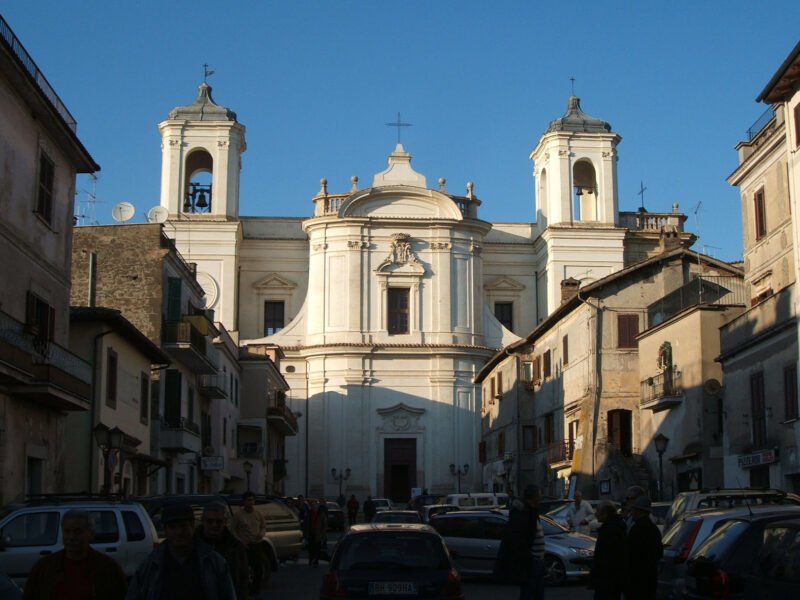
Lake Albano fills a volcanic crater, and on its western rim stretches Castel Gandolfo with the Papal Palace overlooking the water. Below the town, at the foot of the wooded wall, runs Via dei Pescatori, the road that follows the shore. About a kilometer and a half from its start, the Park indicates, there is a square entrance door in peperino, the gray stone of the Castelli. It is the access to the emissary.
The Municipality of Castel Gandolfo, in its itinerary dedicated to the lake, describes the control chamber as the room from which the outflow of the waters was regulated, closed by a metal door. From the outside you see the stone structure, not the tunnel. Anyone arriving expecting a black opening in the rock instead finds a sober facade, at shore level, that you recognize only if you know what to look for.
Behind the door, according to the description published by Sotterranei di Roma, there is a large chamber with sluice gates to regulate the water. From there starts the channel proper, dug in the rock, which crosses the hill and comes out on the other side, in the countryside toward Albano. The Hypogea survey reported by the local press gives the tunnel a height of 2.50 meters and a width of 1.30. Measurements of a narrow corridor, not of a monumental gallery.
The other end is at Le Mole, and here the sources do not agree on the name of the municipality: the Park writes Mole di Albano, the Egeria group speaks of the Mole di Castel Gandolfo. The Park adds that the water then continued toward the Tiber, reached at Tor di Valle, while Sotterranei di Roma gives the Fosso dell'Acqua Acetosa as the last stretch. These are two descriptions of the downstream course, outside the tunnel.
On any given day, then, you see the lake, the road along the shore, the stone door and, a little farther on, the Roman nymphaea that the Municipality points out on the same route. The tunnel stays invisible. A free visit is a walk with a stop in front of a closed entrance, and it works only if you arrive knowing what is behind that door and why it was built.
To understand why the work came about you have to look at the shape of the place. The lake fills the bottom of a closed crater, with no river leaving it. Water comes in with rain and springs, goes out only by evaporation and seepage, and in certain periods the level can rise. For those who farmed the fields around and lived on the shores, a growing lake was a concrete threat, not an abstraction.
A curiosity about the Lake Albano Emissary
A work almost 2,400 years old still has no length that everyone agrees on. The Hypogea survey reported by Castelli Notizie in 2023 gives 1,420 meters. The Municipality of Castel Gandolfo writes 1,450. The Roma Sotterranea page on visits says a kilometer and a half, Sotterranei di Roma 1,800 meters, and the Regional Park stays vague with «several kilometers».
The reason is simple and unromantic. According to Roma Sotterranea, in the explorations of the 1900s the channel was never walked in its entirety, and not even the most recent campaigns have crossed it from one end to the other. According to the same 2023 article, about 36 meters had been explored from the Castel Gandolfo side, about 950 from the Le Mole side, and about 400 meters remained unexplored because of water and mud. The differing figures come from partial surveys and estimates.
The figures that exceed two kilometers, which also circulate in the local press, do not match the survey of the gallery. The Park, for example, describes a course of the water that continues well beyond the hill, as far as the Tiber at Tor di Valle. That is something other than the tunnel dug in the rock, and keeping the two stretches distinct avoids attributing to the Roman work measurements it does not have.
For the reader the practical conclusion is just one. When you read that the emissary is two and a half kilometers long, or that you walk for kilometers underground, it is an approximation. The most solid figure available today is that of the speleological survey, around a kilometer and a half, and in 2023 a stretch of about 400 meters had not yet been explored.
One thing nobody tells you about the Lake Albano Emissary
The best-known part of the emissary is not the one you see from the lake. It is the opposite end. According to the Hypogea survey, from the Le Mole side speleologists have covered about 950 meters, from the Castel Gandolfo side about 36. The peperino door you photograph on the shore is therefore the entrance to the least-known stretch, and what is known about the tunnel comes almost all from the other side of the hill, where speleologists have been able to work longer.
Then there is the water. Sotterranei di Roma writes that the channel still works and irrigates the fields downstream. The Egeria group observes that the flow has dropped a great deal since the 1980s. The two things go together: the channel is not dead, but carries less water than before, and anyone who imagines a work abandoned for centuries has the wrong perspective.
Third detail, the most curious. The Municipality recalls that the water coming out of the emissary fed the water basins where local women washed laundry, and that this use went on until the spread of household appliances. A hydraulic work of republican Rome therefore served a domestic need until times very close to ours, far from the prophecies and sieges of the ancient tale.
Finally the concretions. Inside the gallery the water has deposited limestone for centuries, and Roma Sotterranea speaks of massive deposits that make passage difficult. In 2023 the research group declared the goal of making about 700 meters visitable, up to a stretch with stalactite-like formations. As of the verification date, a publication of this route does not appear to be confirmed by an official source.
The outlet also has a little-told story of its own. At Le Mole, according to Sotterranei di Roma, the water coming out of the hill gave rise to a small settlement with channels, fountains and mills, and a tower still marks its center. The very name of the locality recalls the mole, that is, the millstones of the mills. Anyone looking for the emissary thinks of the lake, but in the daily life of the inhabitants, for centuries, what mattered most was the water that came out downstream.
What does Livy tell and what do the documents say?
It helps to separate three levels. The first is the material document: a gallery dug in the rock, with a control chamber and a system of closures, which researchers date to around 400 BC. The Park dates it between 398 and 396, Sotterranei di Roma between 398 and 397. There is no doubt about the function: to lower and stabilize the level of a closed lake.
The second level is the literary tradition. Livy, in the fifth book of his history of Rome, ties the digging to the war against Veii, the Etruscan city Rome had been besieging for years. According to the account, the lake rose abnormally and the Romans sent to consult the oracle of Delphi. The answer linked the capture of Veii to the waters of Lake Albano and to the way of making them flow out.
The Park summarizes the prophecy this way: victory would come only when the waters of Lake Albano reached the sea. The article published in Archeologia Viva in 2016 lists the ancient authors who mention it: Livy, Dionysius of Halicarnassus, Cicero, Valerius Maximus, Plutarch and Diodorus Siculus. That so many writers take up the episode says how famous it was, not that it happened exactly that way.
The third level is that of modern hypotheses. The Park proposes a concrete one: an exceptional flood of the lake could have caused part of the crater to collapse toward Rome, with flooding and damage across the countryside, and the work would have been built to keep it from happening again. Sotterranei di Roma adds that the 4th-century works may have built on an older hydraulic intervention, from the 6th century BC.
The most reasonable reading holds the three levels together. A closed lake that rises and threatens the fields is a real problem, and digging a channel is the technical answer. The war with Veii and the oracle of Delphi are the way Rome told the story of that undertaking, giving it a religious and political meaning. Livy's account should be presented as a tale, not as a construction-site log.
It remains to explain why a lake south of Rome is tied to an Etruscan city that lay to the north, beyond the Tiber. In the ancient tale the link is religious: the prodigy of the lake is a sign from the gods, and only by respecting the response can Rome end the war. Veii did really fall in those years, and the emissary became in Roman memory the work that had opened the way to victory.
What is the tunnel under the hill like?
The channel is dug by hand in the volcanic rock. The Park and Roma Sotterranea define it as among the oldest documented examples of Roman tunnel works, second only to the Cloaca Maxima, the great sewer that drained the valley of the Roman Forum. That means narrow, long galleries, dug with hand tools, in which the slope had to be right to let the water flow without stagnation.
The most elaborate part is at the entrance. The Egeria group describes filtering stone barriers, that is, elements that held back debris and floating material before it entered the channel. Sotterranei di Roma speaks of a large control chamber with sluice gates to regulate the water. The Municipality adds that the outflow was governed from here. It is the technical heart of the work, and it is also the only part reached by the private visits.
Along the route, again according to Sotterranei di Roma, vertical shafts open up that served to ventilate the excavation and to carry out the material. It is a typical solution of ancient tunnels: work was done from several points at once, and the shafts allowed workers to breathe, to bring the earth out and to check the direction. The position and number of the shafts are not published.
Today the tunnel is almost completely flooded. Roma Sotterranea explains that exploring it takes speleological and cave-diving techniques, that is, dives in an underground environment. The Egeria group reports the numbers of the Albanus Project between 2013 and 2020: 680 working days, 20 speleologists and 5 cave divers. These are figures that by themselves explain why a visit open to anyone, along the channel, is not realistic.
The dimensions reported by the survey, 2.50 meters high by 1.30 wide, suggest a corridor you can walk through upright. The reality described by the speleologists is different: water, mud, limestone deposits that narrow the passage. The channel was designed for water, not for people, and whoever enters it today does so with equipment and authorizations, in conditions that have nothing of the tourist visit.
The choice of a tunnel is not random. The volcanic rocks of the Colli Albani can be dug with hand tools, and the territory around Rome is full of ancient hydraulic galleries, for drainage and for water collection. The Alban emissary is the most famous of these works because it has a date, a story and a function that is understood at a glance: to let the water out of a closed lake.
The advice I give you for visiting the Lake Albano Emissary
The advice is to treat it as one stop on a walk along the lake, not as a destination in itself. Start from Castel Gandolfo, go down to the shore and follow Via dei Pescatori, taking into account the closures flagged by the Park. Factor in the Ninfeo Dorico and the Ninfeo Bergantino, which the Municipality indicates on the same itinerary, and stop in front of the incile already knowing what is behind it.
If you want to see the inside of the control chamber, call the Associazione Culturale Roma Sotterranea well in advance. Their page says there is no visit on the calendar and invites you to arrange a private one. Ask right away what it includes, how long it lasts, how much it costs, what shoes are needed and if there are age limits. None of this information is published, and it is best to have it in writing before setting the date.
Before going, it is worth reading something. The article by Carla Galeazzi, Carlo Germani and Mario Mazzoli in Archeologia Viva, issue 178 of 2016, tells the exploration from the inside. The blog of the Egeria group publishes surveys and photographs of the Albanus Project. They are short reads, and they turn a closed door into something you understand.
One last thing: choose a dry day. The path along the lake, according to the Park, has stretches closed because of landslides and has no water points or information centers. Bring something to drink, walking shoes and a map downloaded on your phone. The lake is beautiful even under a gray sky, but after days of rain the dirt stretches become slippery and some are closed anyway.
If you have only one day, it is best to organize it in this order: morning on the lake, with the walk and the stop at the incile, then back up to Castel Gandolfo for the Papal Palace, whose opening days and hours must be checked on the official channels. The afternoon can go down toward Albano and Le Mole. Whoever has the private visit to the incile should schedule it in the morning, when there is more margin for any delays.
Can you go in and how much does it cost?
You do not enter the tunnel. The only part reachable with a visit is the incile area, with the grates and sluice gates, and only by agreement with an association. There is no ticket at a public rate, no schedule, and the Regional Park does not indicate its own service of visits to the emissary. Anyone who finds an open date online must check that it is confirmed by the organizer.
The official channel to request a visit is the visits page of the Associazione Culturale Roma Sotterranea, which gives the number 334 7401467 and a contact form. Sotterranei di Roma also lists the site among those with private visits, with details reserved for registered users. We do not point to tickets from resellers: the site has no paid entrance.
The association's page carries a free-entry formula without reservation, with time slots from 10 to 13 and from 14 to 18, but in the same text it states that there is no visit on the calendar. The two pieces of information must be read together: without a date on the calendar, those time slots do not count as hours to show up at the shore. The cost of a private visit must be asked when you make contact.
For access for study purposes the route is different. The Egeria group writes that entry is limited and goes through an authorization via the Hypogea Federation, which brings together Roma Sotterranea, the Asso underwater speleology group and Egeria Centro Ricerche Sotterranee. For general information on the territory the reference remains the Regional Park, by phone at 06 9479931 or by email at protocollo@parcocastelliromani.it.
When you call, remember that visits to underground environments depend on conditions that no one fully controls: the water level, the rain of previous days, the availability of the organizers. A date can fall through even at the last moment. For this reason it is best to keep the rest of the day flexible and have an alternative plan, for example one of the other stops in the Castelli, if the visit to the incile is postponed.
Another well-known fact that is rarely mentioned
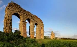
It is known that Rome is the city of aqueducts. It is remembered less that before the aqueducts there were tunnels. The FAI's page on the emissary says it plainly: the work presumably dates to the 4th century BC and precedes by a century the construction of the Roman aqueducts. The arches you see at the Aqueducts Park come after.
The comparison with the Cloaca Maxima, which the Park and Roma Sotterranea recall, helps in understanding. The Cloaca drained the valley between the hills and discharged into the Tiber near the Forum Boarium. The emissary did something similar on a different scale: it took water from a closed lake and sent it toward the river. They are two drainage jobs, before they are monumental engineering.
The FAI defines it as the best known and most important of Italy's artificial emissaries. The site has taken part several times in the I Luoghi del Cuore census, in the 2016, 2018, 2020 and 2022 editions, and the page hopes for an enhancement that would give the work back to the community and the scientific community. The fame is there, in short. What is still missing is a stable way to show it to the public.
There is also an aspect of protection that is forgotten. The Egeria group recalls that the emissary has been protected since 1909 by a ministerial decree. It means it is a listed asset, and that any access to the interior, for study or for a visit, goes through authorizations. The closed door on the shore is not a sign of neglect: it is the result of a choice of protection, in a fragile place that is dangerous for anyone who is not equipped.
The right photo to take at the Lake Albano Emissary
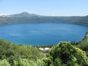
The photo to take is the one that puts together the peperino door and the water of the lake. On its own, the facade of the incile is a stone wall with a closed opening, hard to read. With the lake in the frame the logic of the work is clear at once: water on one side, rock on the other, and in between the point where people decided where to let it out.
The second photo is from below looking up. From the western shore you see the rim of the crater and, above, the houses of Castel Gandolfo with the Papal Palace. It is the image that explains the geography: a lake closed in a basin, with the town on the edge. Without this view the emissary looks like a hydraulic detail, with this view it becomes the answer to an evident problem.
For those who manage to take part in a visit to the incile, the right photo is that of the control chamber, with the sluice gates. Here it is best to ask the association beforehand if photography is allowed and if flash is permitted. In underground environments artificial light can be a nuisance and, with the humidity, reflect on wet surfaces more than you would expect.
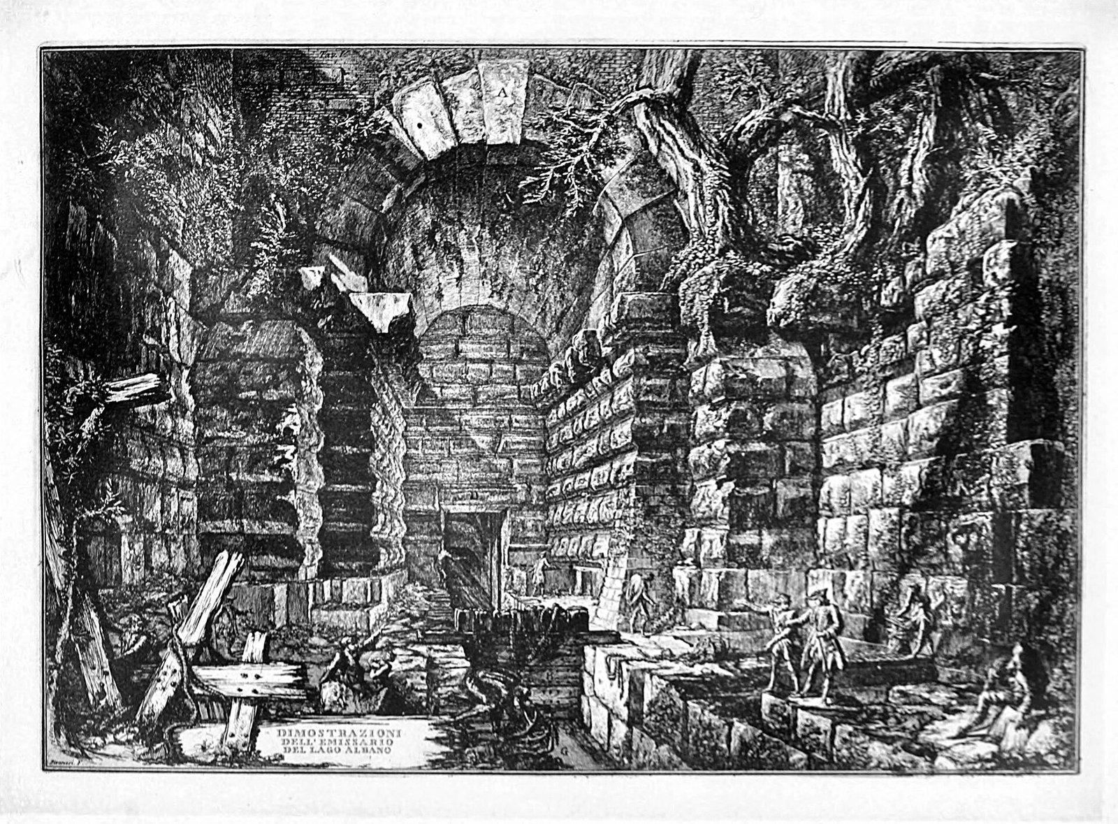
A good idea, before shooting, is to look at the plates that Giovanni Battista Piranesi devoted to the emissary in 1764, in the work Antichità d'Albano e di Castel Gandolfo. Comparing those engravings with what you see on the shore helps in recognizing the pieces. Never force gates or fences for a closer photo.
Anyone with time can also look for the other end, at Le Mole, where the water comes out of the hill. Here the photo is different: less lake, more countryside and more traces of the life the water brought, like the channels and the tower Sotterranei di Roma talks about. Shoot from the road and from public spaces, without entering private land, and respect the fences you find along the route.
How do you get there from central Rome?
The simplest way is the train. The regional line that the railways renamed Castelli Romani Line, the old FL4, leaves from Termini Station and has a branch toward Albano with a stop at Castel Gandolfo. Times and frequencies change with the seasons and should be checked on the Trenitalia website before leaving.
From the station you go down toward the lake. The Park gives as the starting point of CAI trail 510, the circuit of Lake Albano, the area near the disused Castel Gandolfo cable car station, which can also be reached from several car parks along the shore. From there you follow the western bank toward Via dei Pescatori. The descent from the town to the lake is steep and has to be considered for the return as well.
By car you reach the lakefront car parks that the Park indicates. On fine-weather weekends the shore can fill up, and it is best to arrive early. Anyone who prefers the bus can consult the Cotral website for connections with Castel Gandolfo and Albano. Lines and times are not given here because they change often and must be checked at the company's source.
An interesting alternative for those who like walking is to come up from Albano Laziale, which is reached by the same railway line, and combine the lake side with the Le Mole side. It is a longer and less signposted loop. It is best to prepare it on the map, because the Park's trail sheet covers the circuit of the lake and does not reach the outlet at Le Mole.
Some important events that happened here in history
Between 398 and 396 BC, according to the Park, the Romans dig the emissary to regulate the level of the lake. Tradition ties the project to the war against Veii, which falls in those very years. In the following decades Rome also builds the tuff-block wall known as the Servian Walls: it is a city taking on great public works.
In the following centuries the channel keeps working. The Archeologia Viva article of 2016 writes that the work operated for centuries in antiquity and at least until the Middle Ages. Meanwhile building goes on along the lake shores: the Municipality recalls the Ninfeo Dorico, part of the villa of the tribune Publius Clodius Pulcher and renovated in the Domitianic age, and the port of Domitian's villa, of which the quays along Via dei Pescatori remain.
In the 1600s the lake is a place of leisure for the popes as well. The Municipality relates that Pope Alexander VII used the Ninfeo Bergantino, the grotto turned by Domitian into a place of delights, for his brigantine. In 1764 Giovanni Battista Piranesi publishes the Antichità d'Albano e di Castel Gandolfo, with plates devoted to the emissary, which the local press still cites among the historical documentation of the work.
The 1900s bring protection and explorations. The Egeria group gives 1909 as the year of the ministerial protection decree. In 1955 Circolo Speleologico Romano carries out the first systematic exploration, in 1958 further research follows, and in 1978 Vittorio Castellani and colleagues produce the first complete survey. From the 1980s, again according to Egeria, the water flow drops noticeably.
In the new century come the coordinated projects. The Albanus Project of the Hypogea Federation formally starts in 2009, according to Castelli Notizie, with the authorizations of the Soprintendenza, the Park and the municipalities obtained in 2014. Roma Sotterranea launches a three-year study program from August 31, 2015. On June 17 and 18, 2023 the emissary opens on an extraordinary basis, with the announcement of a visit route that does not appear to be active yet.
Who has passed through the Lake Albano Emissary
First are the diggers, whose names we do not know. They worked in narrow galleries, in the rock, carrying the earth out through the service shafts. After them, for centuries, came those who operated the closures at the incile, and at Le Mole the millers and washerwomen who used the water coming out of the hill, as the Municipality and Sotterranei di Roma recall.
Then came the writers, at least with the pen. Livy, Dionysius of Halicarnassus, Cicero, Valerius Maximus, Plutarch and Diodorus Siculus tell the episode, according to the list published by Archeologia Viva. None of them describes the tunnel as an engineer. All use it to talk about Veii, the gods and the destiny of Rome, and that is why the tale has come down to us.
In the 1700s came Giovanni Battista Piranesi, who studied and engraved the work in the Antichità d'Albano e di Castel Gandolfo. In the 1900s came the speleologists. The Roma Sotterranea page cites the explorations of 1955 and 1958, with the names of Dolci, Chimenti and Consolini, and the survey by Vittorio Castellani of 1978. The Egeria group adds the names of Cardinale and Vignati alongside Castellani.
In recent years the most present name is that of Carla Galeazzi, president of the Hypogea Federation according to Castelli Notizie, who coordinated the Albanus Project. With Carlo Germani and Mario Mazzoli she signed the 2016 article in Archeologia Viva. Alongside them, in seven years of work, 20 speleologists and 5 cave divers took turns, going by the numbers published by Egeria.
Alongside the specialists are ordinary visitors. Those of the extraordinary openings of June 17 and 18, 2023, announced by the local press, and those of the private visits arranged with the associations have passed by the incile. And in a certain sense the citizens who flagged the emissary in the FAI's I Luoghi del Cuore census in four editions have passed through too, asking that the work be given back to the public on a stable basis.
What do people usually get wrong about the emissary?
Our opinion is firm: as a standalone destination the emissary is overrated by those who do not know what to expect. Anyone who reads «Roman gallery a kilometer and a half long» imagines an underground visit like the catacombs, and arrives in front of a closed door. The disappointment does not depend on the monument, it depends on the wrong expectation. Without an arrangement with an association, all you see of the emissary is the facade, and that's it.
Second frequent mistake: taking Livy's account as chronicle. The oracle of Delphi, the prophecy about Veii, the lake rising for no reason are traditional material, told by authors who wrote centuries later. The serious modern sources, from the Park to Sotterranei di Roma, set beside the myth a technical explanation: controlling a lake with no outlet that threatened the surrounding lands.
Third mistake, subtler: confusing the emissary with the nymphaea found on the same shore. The Ninfeo Dorico and the Ninfeo Bergantino belong to villas of the late Republican and imperial age, centuries after the digging of the channel. They are close by, they are visited on the same walk, but they tell another story, that of the lake as a place of luxury and not as a hydraulic problem.
Fourth mistake: thinking the work is idle. The channel still carries water, even if less than it once did, and some sources describe it as working for irrigation. This is, in our judgment, the underrated aspect: an infrastructure of the 4th century BC that in part still does its job. It deserves more attention than the door everyone photographs.
One last misunderstanding concerns the open dates found online. Association pages, event calendars and old articles report times and free entries that refer to single past openings. Before setting out to see the interior, ask the organizer for direct confirmation. Showing up on the shore with a time read on an out-of-date page almost always ends in front of the closed door.
The emissary within the lake system: nymphaea, port and villas
Lake Albano has to be read as a single system, and the emissary is its oldest piece. On the same shore the Municipality of Castel Gandolfo points out the Ninfeo Dorico, the Ninfeo Bergantino and the remains of the quays of the port of Domitian's villa. Above, on the edge of the crater, is the town with the Papal Palace. Every era has left something on the same basin of water.
The Ninfeo Dorico, according to the Municipality, was part of the villa of the tribune Publius Clodius Pulcher and was renovated in the Domitianic age. The Ninfeo Bergantino, also called Bagni di Diana, is a natural grotto turned by Domitian into a place of delights. The Park, on CAI trail 510, cites both together with the emissary and the remains of the ancient port. For archaeological visits the Municipality recommends booking through the Park, at the number 06 9495253.
Lake Nemi, a little to the south-east, has its own emissary dug in the rock, which the Lazio parks portal indicates as similar to the Alban one. Anyone who gets passionate about these works can line up the two lakes, Lake Nemi and that of Castel Gandolfo, to understand how the Romans governed the craters of the Colli Albani.
The whole area is part of the Castelli Romani Park, which publishes trail sheets and warnings about closed stretches. On the shore there are also CONI sports facilities, which the Park uses as a reference for finding the Ninfeo Bergantino. It is a lived-in place, not an open-air museum, and the emissary sits in the middle of this daily life.
From the lake you go up toward the towns of the Castelli, each with its own reason to stop. Albano Laziale is beyond Le Mole, Ariccia a little farther, Marino a little north of the lake, Rocca di Papa higher up. The lake is the center of a system of villages that can be visited well in a day or two.
From the landscape point of view, the lake is what remains of ancient volcanic activity, and in Rocca di Papa the INGV Geophysical Museum is devoted precisely to geophysics, a good starting point for anyone who wants to understand the territory of the Colli Albani. Seen this way, the emissary is the intervention with which people took possession of a landscape born of fire: a cut in the rock to decide where to send the water.
When is it closed and what should you not expect?
The interior of the emissary is always closed, except for arranged private visits and the rare extraordinary openings. Do not expect a custodian, a sign with hours or a ticket office on the shore. The door of the control chamber stays barred, and rightly so: the space is damp, largely flooded, and without the presence of someone who knows it, it should not be approached beyond the facade.
The path along the lake also has its closures. The Park, on the page for CAI trail 510, writes that access is allowed only on the paved portion because of landslides in progress, and cites a municipal ordinance, number 12 of 2008, closing the dirt stretch in the woods, in particular along Via dei Pescatori and Via Spiaggia del Lago. Before leaving, it is best to ask the Municipality if there are updates.
The Park gives that trail a length of 4.5 kilometers, an elevation change of about 100 meters and a duration of an hour and 40 minutes, with tourist-level difficulty. It adds that there are no water points, equipped rest areas or information centers. Bring what you need, especially in summer, and do not count on drinking fountains along the way.
Do not expect to find someone explaining the site on the spot either. Anyone who wants a competent reading finds it in the visits organized by the speleological associations or by local archaeologists, when they are on the calendar. On days of heavy rain and right after, the shore and the dirt stretches are to be avoided: mud, unstable rocks and landslides are the very reason for the closures.
The seasons matter too. In summer the shore is busy, it is hot and shade in the woods is precious. In winter the days are short and, at the bottom of the crater, the light fades early. Spring and autumn are the most comfortable times for the walk, provided you avoid the days right after rain, when the dirt stretches become slippery and the landslide closures make more sense than ever.
Eating in the area
On the lake shore and in the center of Castel Gandolfo there is no shortage of places, and on weekends they fill up. The traps are those of any tourist place: the laminated photo menu in four languages, the barker who stops you on the sidewalk, items with no price, places open nonstop without a break in the kitchen. Romans who come to the lake spot them at a glance and keep walking.
Be wary too of places with the best view that adjust the bill to whoever sits down, and of those where the menu outside doesn't match what you get at the table. The lady making fresh pasta in the window is often scenery more than cooking. It is not snobbery: these are signs of a place that bets on passing trade and not on the customer who comes back.
In the Castelli you eat well when you pick a place frequented by people who live in the area, with a short menu that changes with the seasons and written prices. Instead of searching at random on the shore, it is best to start from a selection already made: the list of addresses on Google Maps gathers addresses between Rome and the Castelli chosen with these criteria.
What to combine in the same day
The most natural pairing is Castel Gandolfo itself. After the walk on the lake you go up to the town for the Papal Palace and the square. Then you go down to Albano Laziale, along the ancient Appian Way, and continue toward Ariccia and its Palazzo Chigi. They are three close stops, linked by the road.
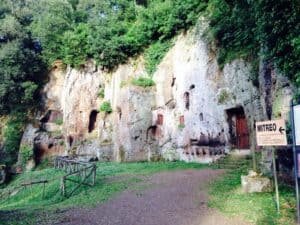
Anyone interested in the underground archaeology of the Castelli has within reach the Mithraeum of Marino, a sanctuary dug in the rock and frescoed, in a town, Marino, that overlooks the same crater. It is the ideal complement to the emissary: another underground space of the Colli Albani, tied however to religion and not to water. Opening days and visit arrangements must be checked at the operator's source before leaving.
For a longer day you can turn south: Genzano di Roma with Palazzo Sforza Cesarini, then Nemi and its lake, where you find again the theme of craters and their emissaries. Or north, to Frascati, with Villa Aldobrandini and the archaeological area of Tusculum.
Walkers can add Rocca di Papa with the Geophysical Museum, devoted to geophysics, or the Salita Discesa between Ariccia and Rocca di Papa. On the way back to Rome along the Appian Way you pass the Appian Way Park and the Villa of the Quintilii, other stops of the same Rome that dug the emissary.
On the northern side of the Castelli you can build a second loop. Grottaferrata is a few kilometers away, and from there you climb to Monte Porzio Catone, with Villa Mondragone and the Observatory Museum. Farther on is Monte Compatri. These are stops with calendar openings, to be checked on the operators' sites before setting out on the road.
Frequently asked questions
Can the Lake Albano Emissary be visited?
The tunnel cannot be visited. The Castelli Romani Regional Park lists it as inaccessible because of the difficulty of passage and the water level. From the outside you see the incile, the peperino door along Via dei Pescatori in Castel Gandolfo. The incile area, with grates and sluice gates, can be seen only with a private visit arranged with the Associazione Culturale Roma Sotterranea, at the number 334 7401467.
How long is the emissary?
The sources do not agree. The survey by the Hypogea Federation reported by Castelli Notizie gives 1,420 meters, the Municipality of Castel Gandolfo 1,450, Roma Sotterranea about a kilometer and a half, Sotterranei di Roma 1,800 meters. The higher figures do not match the speleological survey. The gallery dug in the rock is in any case around a kilometer and a half, with a section of 2.50 by 1.30 meters.
Who built it and when?
The Romans, in the 4th century BC. The Park gives the years between 398 and 396, Sotterranei di Roma between 398 and 397. The tradition reported by Livy ties the digging to the siege of Veii and to a response of the oracle of Delphi. Modern hypotheses speak of a lake with no outlet to be kept under control, perhaps after a disastrous flood, and of a possible older intervention.
What can you see without an organized visit?
You see the facade of the incile, a square peperino door on the western shore, about a kilometer and a half from the start of Via dei Pescatori according to the Park. Along the same shore you meet the Ninfeo Dorico, the Ninfeo Bergantino and the remains of the quays of the port of Domitian's villa. The gallery stays invisible, and the value of the stop depends on how much you know beforehand.
How is a private visit arranged?
You contact the Associazione Culturale Roma Sotterranea through its visits page or at the number 334 7401467, asking to arrange a date. Sotterranei di Roma also lists the site among private visits, with details reserved for registered users. Price, duration, equipment and age limits are not published: it is best to ask for them in writing when booking.
Is the trail along the lake open?
In part. The Castelli Romani Park, in the sheet for CAI trail 510, writes that access is allowed only on the paved stretches because of landslides in progress, and cites a municipal ordinance of 2008 closing the dirt stretch in the woods along Via dei Pescatori and Via Spiaggia del Lago. Before leaving it is best to ask the Municipality of Castel Gandolfo if the situation has changed.
How do you get there without a car?
By the regional train of the Castelli Romani Line, the old FL4, from Roma Termini to Castel Gandolfo station, on the branch to Albano. From the station you walk down toward the lake, with a steep descent to consider for the return as well. Times and frequencies must be checked on Trenitalia. For buses the reference is the Cotral website, which publishes updated lines and times.
Is it a suitable visit for children?
The walk along the lake, on the open stretches, is suitable for families too, with due care on the shore and on the steep descent from the town. For the visit to the incile the requirements are not published: minimum age, footwear and conditions must be asked of the organizing association. The interior of the tunnel, flooded and passable only with speleological techniques, remains off limits for all visitors.
Why is it called an emissary?
Emissary is the name of the watercourse that leaves a lake and carries its water away. It is usually a natural river. Lake Albano, closed in a crater, did not have one, and the Romans dug it artificially in the rock. That is why we speak of an artificial emissary, and the FAI considers it the best known and most important of Italy's artificial emissaries.
Who wrote this and from what sources
The text comes from the editorial team of Tour Leader Pro, the Rome-based organization that designs itineraries, visits and cultural events between Rome and Lazio. Fares, hours and booking arrangements given here result from the official sources cited in the text as of the date indicated at the opening: the pages of the Castelli Romani Regional Park, of the Municipality of Castel Gandolfo, of the Associazione Culturale Roma Sotterranea and of the speleological groups. Tell us what you find changed.
Anyone organizing an outing to the lake for an association, a school or a group of friends must start from one fact: the emissary has no visits on the calendar and the incile opens only by arrangement, with limited numbers. You need time, written confirmations and an alternative plan for rainy days. To set up a day like that, Tour Leader Pro is a useful resource for those who organize group trips.
The emissary fits well into a wider trip in Lazio, among the Castelli Romani, the Appian Way and the underground Rome told in our guide to the city's underground sites, from the Underground Basilica of Porta Maggiore to the catacombs. Anyone putting together volcanic lakes, papal villas and archaeological sites has to organize transport and timing carefully. A useful resource for putting together a multi-day itinerary is Italy Planner.
Contact Information
Nearby
 Albano Laziale (RM)900 m
- Lake Albano (RM)900 m
- Castel Gandolfo (RM)1.2 km
- Pontifical Palace of Castel Gandolfo1.2 km


Upcoming events nearby
- Le quattro stagioni, a Journey Through Vivaldi’s Cimento at Palazzo Savelli: Saturday, November 7, 20261.1 km
- Liszt Festival in Albano Laziale, 40th edition1.1 km
- Festival del Gusto in Albano Laziale, November 6 to 8, 20261.3 km