Appian Way Park
In short. The Appia Antica Regional Park occupies the strip of countryside that wedges into Rome from the southeast, between the Aurelian Walls and the Alban Hills: about 4,580 hectares across the municipalities of Rome, Ciampino and Marino,…
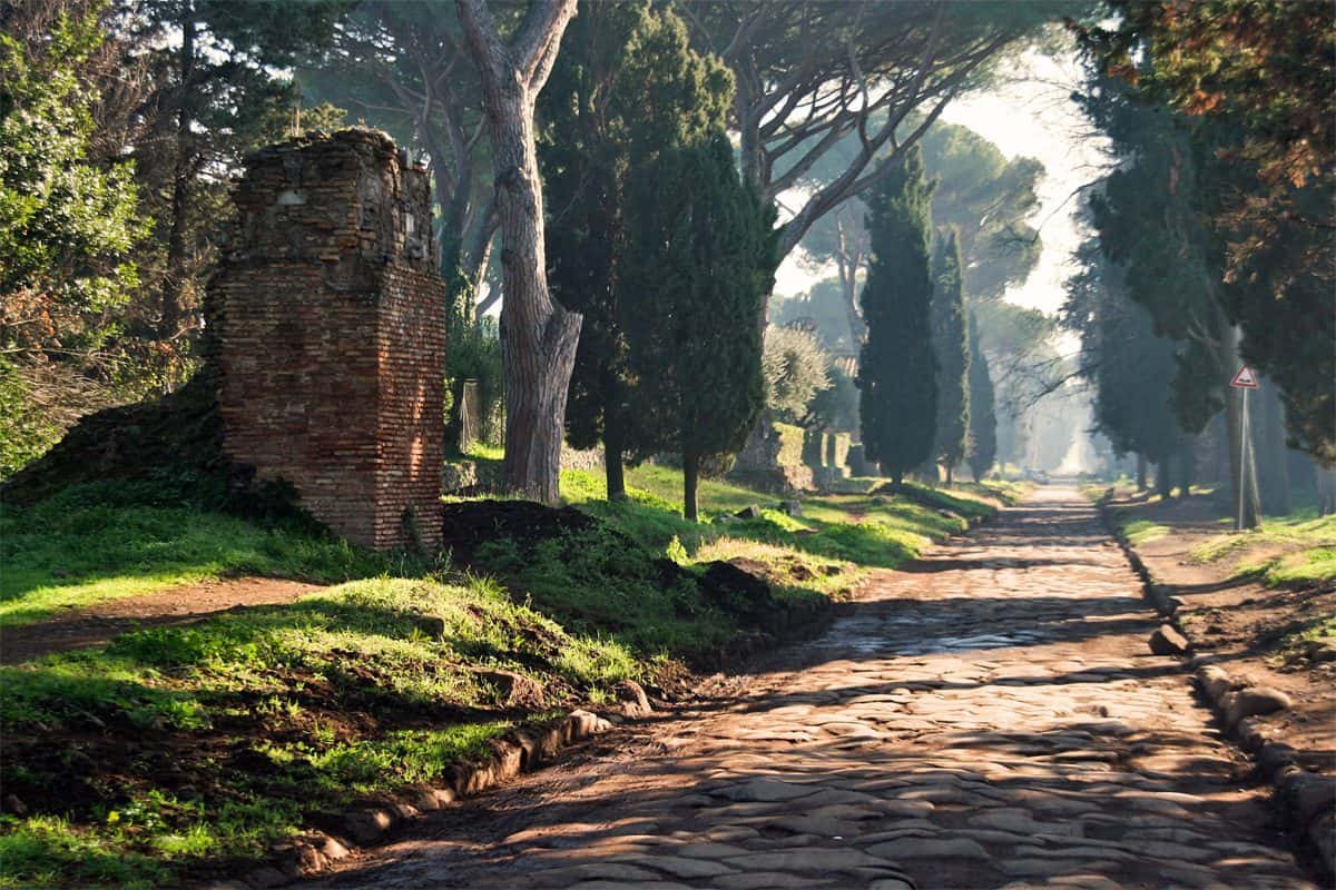
The Appia Antica Regional Park occupies the strip of countryside that wedges into Rome from the southeast, between the Aurelian Walls and the Alban Hills: about 4,580 hectares across the municipalities of Rome, Ciampino and Marino, established as a regional protected natural area in 1988 by Regional Law of Lazio number 66 of November 10. The regional agency's office is at via Appia Antica 42, phone 06 5126314, email info@parcoappiaantica.it. The visitor information point, which also rents bicycles, is a little further along at via Appia Antica 58/60, phone 06 5135316, email puntoappia@parcoappiaantica.it. The agency's official website is parcoappiaantica.it. Walking in the park costs nothing: meadows, paths, basolato, the Caffarella and the Aqueducts are free and open every day. You only pay to enter the fenced archaeological sites that belong to the State, and for those the math is simple: €12 for the single ticket to the Parco archeologico, valid seven days for all sites, €8 for the ticket covering the Mausoleo di Cecilia Metella and Capo di Bove, €8 for the Villa dei Quintili with Santa Maria Nova, €6 for the minor sites, €2 for the reduced ticket, €25 for the annual card. You can reach it by metro line A, stopping at Colli Albani, Arco di Travertino or Anagnina and continuing by bus, or by line 118 from the Circus Maximus and line 218 from San Giovanni. On Sundays the central stretch of the consular road is closed to private traffic and becomes a walk kilometers long. If you want to get the overall picture of the rest of the city before heading down here, the general orientation is on the page for tourist attractions in Rome.

What the Parco dell'Appia Antica is: two bodies, one territory
The first thing to clear up, because it confuses almost everyone who comes here for the first time, is that two different administrations with two different mandates operate here. The Parco regionale dell'Appia Antica is an agency of the Lazio Region founded in 1988: it protects the landscape, the countryside, the watercourses and the fauna, regulates building, and manages the paths and the information points. The Parco archeologico dell'Appia Antica, on the other hand, is an institute of the Ministry of Culture, with special autonomy restored in February 2020: it manages the state-owned monuments, the excavations, the museums, the ticket offices and the stretch of the consular road that is publicly owned.
The practical result for visitors is this: the same walk continuously crosses the two jurisdictions without any sign making it obvious. The meadow where you sit down to eat belongs to the Region, the fence around the mausoleum in front of you belongs to the State, and the basolato that separates them is state property. Neither ticket is needed to walk: the open territory is free and always free of charge.
The Parco regionale dell'Appia Antica
The regional agency manages about 4,580 hectares spread across three municipalities, Rome, Ciampino and Marino, and includes the first 11 miles of the consular road, the Caffarella valley, the Aqueducts area, Tor Fiscale, and the estates of Tor Marancia and Farnesiana. It is the largest urban park in Europe, and that claim is not brochure boasting: no other European capital keeps a cultivated countryside of this size inside its administrative boundaries, with sheep grazing eight kilometers from the Colosseum.
The services the agency offers are guided tours, hiking and cycling itineraries, information points, bicycle rental, and environmental education activities. The agency's official page also points out the presence of partner restaurants and accommodation along the perimeter. Since 2013 the presidency of the agency has been entrusted to geologist Mario Tozzi, a television science communicator and a member of the scientific council of the WWF.
Il Parco archeologico dell'Appia Antica
The state institute manages 18 sites, some famous and others almost unknown even to Romans: the Claudian, Marcian and Anio Novus aqueducts, the Aqueduct of the Quintilii, the Antiquarium of Lucrezia Romana, the Cederna Archive, the basilica of San Cesareo de Appia, the Casino di Caccia alla Volpe, the Capo di Bove complex, the Mausoleum of Cecilia Metella with the Castrum Caetani and the church of San Nicola, the Mausoleum of Campo Barbarico, the tombs of via Latina, Tor Marancia, the Torre del Fiscale, the Caffarella valley, the Appian Way, the Villa of the Quintilii with Santa Maria Nova, the Villa dei Tritoni, the Villa di Sette Bassi and Villa Grandi Franchetti, formerly Massenzia.
The institute also has a virtual museum, muviappia.it, which has proved more useful than expected: when a site closes for work, its spaces remain navigable online. This is the case, in these weeks, of the tombs of via Latina.
Land ownership in the Parco dell'Appia Antica
Here is the figure that explains almost all of the park's contradictions: the land has remained about 95 percent in private hands. 40 percent still belongs to the ancient estates of the Roman aristocracy, 25 percent to companies, 21 percent to small owners, and 10 percent to religious bodies. The public share shrinks to 2 percent municipal public land, another 2 percent historic and artistic public land, and 1 percent military public land.
Keep this proportion in mind as you walk: the closed gates, the walls that line the paving stones for kilometers, the vineyards, the dogs barking behind the hedges, and the villas glimpsed at the end of the cypress-lined avenues are not a management failure. They are the historic fabric of a countryside that was never expropriated. The State has bought what it could, one piece at a time, often late and at a high price.
The boundaries of the Parco dell'Appia Antica
To the north the boundary is the Aurelian Walls, with the Porta San Sebastiano serving as a monumental threshold between city and countryside. To the west the boundary runs along via Ardeatina and the Roma Cassino Napoli railway line. To the east the park borders the Appio Latino and Appio Claudio neighborhoods and via Appia Nuova. To the south it reaches the modern towns of Frattocchie and Santa Maria delle Mole, in the municipality of Marino.
Within this perimeter the park includes the via Appia Antica and its surrounding areas for 16 kilometers, the Caffarella valley with about 190 hectares of meadows and monuments, the Aqueducts archaeological area with about 240 hectares, Tor Fiscale and the tombs of via Latina, the Tor Marancia estate with about 220 hectares, and that of Farnesiana with about 180.
A practical warning that is worth more than many descriptions: the park has no main entrance. You can enter from dozens of points, often through an anonymous gate at the end of a residential street. Anyone who arrives without having decided beforehand where to enter risks losing an hour driving around in a car along boundary walls.
The Appian Way, the road that gave rise to the Parco dell'Appia Antica
In 312 BC the censor Appius Claudius Caecus had the road that bears his name laid out. It was not the first Roman road, but it was the first conceived as an infrastructure of power: straight, paved, drained, and designed to move legions south at a speed never seen before. The original route reached Capua. By 190 BC it had been extended to Benevento and then to Brindisi, the port from which ships sailed for Greece and the East. In its full length the road exceeds 800 kilometers.
The poet Publius Papinius Statius called it Regina viarum, and the nickname has stuck to it for 20 centuries. The queen of roads, however, began right here, at the gates of Rome, and it is here that it preserves the stretch where you can still walk on foot over the original paving stones.
How the Appian Way was built
The Roman construction technique proceeded in superimposed layers. At the bottom, the statumen: large rubble laid on leveled ground to provide drainage. Above it, the rudus, a layer of finer material bound with mortar. Then the nucleus, compacted gravel that received the thrust of the final surface. On top, the basoli, polygonal blocks of volcanic flint squared and fitted together dry, with a precision that still puzzles surveyors today.
Along the sides ran the crepidines, raised sidewalks, and the stopping stones for mounting horses. The roadway was slightly convex so that water would run off to the edges. The result is a surface that has held up 22 centuries of carts, armies, pilgrims and, more recently, cars. Walking on it today is uncomfortable: the flint is smooth, uneven, and often slick with rain. Wear shoes with a grooved sole and leave any idea of a light stroller at home.
The tombs along the Appian Way
The Law of the 12 Tables banned burials inside the pomerium, the sacred boundary of the city. Roman families therefore began building their funerary monuments along the consular roads, where everyone passed. The result, on the Appian Way, was a gallery several kilometers long of mausoleums, aedicules, columbaria, towers, altars and relief portraits, designed to be read by those entering and leaving Rome. A showcase, in the literal sense: those who had money wanted to be seen at the entrance to the capital of the world.
What you see today is a layered mosaic. Some tombs are preserved intact, others reduced to the core of Roman concrete, stripped of their marble or travertine cladding during centuries of illegal quarrying. Many of the reliefs set into the wall along the road were reassembled in the 19th century, and I say this without sarcasm: without that openly theatrical restoration, today we would have nothing to look at.
Spartacus and the 6,000 Crucified
In 71 BC, after defeating the slave revolt led by Spartacus, Marcus Licinius Crassus had the surviving prisoners crucified along Via Appia, in a line, as a visible warning to anyone marching toward Rome. The Archaeological Park lists the episode among the events that belong to this road. The ancient source indicates 6,000 crosses between Capua and Rome. There is no sign, no marker, no plaque: you carry that stretch of history with you mentally, and it changes the color of the landscape.

From Pius IX's Outdoor Museum to Antonio Cederna
The Appian Way has been discovered twice. The first came in the 19th century, when Pope Pius IX wanted to turn the suburban stretch into an outdoor museum: they excavated, they consolidated, they set the collapsed tombs upright again and lined the recovered fragments up along the edges. The works were directed by architect and archaeologist Luigi Canina, who chose an openly evocative restoration approach, rebuilding the brick bases in exposed brick and setting the ancient reliefs into them. Many of the images we associate with the Appian Way today are actually Canina's compositions.
The second discovery dates to the 20th century and bears the name of Antonio Cederna, the journalist and urban planner whom the Archaeological Park calls the father of Italian environmentalism, and who fought for decades against the land subdivision of the Roman countryside. His battle over the Appian Way was long, bitter, and fought with a steady stream of articles and timely complaints. Cederna's archive and library are kept at Capo di Bove, inside the park he helped save: a location worth more than any commemorative monument.
Among the protagonists of the road's modern story, the Archaeological Park also names urban planner Italo Insolera and writer Paolo Rumiz, who made the Appian Way into both a journey and a story.
The Appian Way UNESCO World Heritage Site Since 2024
In 2024, the Appian Way was inscribed on the UNESCO World Heritage List under the official name Via Appia. Regina Viarum, inscribed under criteria three, four, and six. The recognized property is not just the Roman stretch: it comprises 19 components spread along the more than 800 kilometers of the route, from the gates of Rome to Brindisi, and includes works of engineering, arches, baths, amphitheaters, basilicas, aqueducts, canals, bridges, and public fountains.
It was the first Italian nomination proposed directly by the Ministry of Culture. For visitors, little changes right away, but a lot changes in the medium term: the recognition binds how the site is managed, requires agreed protection plans and, historically, brings resources. The first visible effect can already be seen in the restoration worksites open along the road.
The First Section of the Parco dell'Appia Antica: From Porta San Sebastiano to Quo Vadis
The state-owned stretch of the road is about 12 kilometers long, from number 195 to Frattocchie, in the municipality of Marino. Before that point, for about four kilometers, the ancient paving is not visible: you walk along Viale delle Terme di Caracalla and Via di Porta San Sebastiano, reaching the monuments along modern roads laid over the ancient route. The well-preserved stretch begins at the intersection with Via Ardeatina, next to the church of Domine Quo Vadis.
The Church of Domine Quo Vadis
At the fork between the Appia Antica and Via Ardeatina, in the Appio Latino neighborhood, stands the little church of Santa Maria in Palmis, which everyone calls Domine Quo Vadis. The present building is the 17th-century rebuilding of a chapel erected in the 9th century. The adjoining convent is also 17th-century. Tradition, going back to the apocryphal Acts of Peter, holds that here the apostle Peter, fleeing Rome, met Christ and asked him: Domine, quo vadis? The answer, Eo Romam iterum crucifigi, convinced him to turn back and face martyrdom.
In the center of the nave you see a slab with two footprints, 27.5 centimeters long, corresponding to a shoe size 44 or 45. It is a copy: the original is kept in the nearby basilica of San Sebastiano fuori le mura. Scholars interpret it as a pagan ex voto dedicated to the god Rediculus, reread in a Christian key in a later age. John Paul II visited the church on March 22, 1982. Those who want to go deeper will find the dedicated page on the church of Domine Quo Vadis.
The Tomb of Priscilla
Opposite the church, by the river Almone, is one of the most neglected and most moving monuments of the road: the tomb of Priscilla, of the Domitianic age, second half of the 1st century AD. Priscilla was the wife of Titus Flavius Abascantus, freedman of the emperor Domitian and imperial secretary for correspondence, owner of land and bath facilities in this area. It was he who had the mausoleum built for his wife, who died prematurely.
On the quadrangular travertine base rose two cylindrical drums in opus reticulatum. The upper one had 13 niches for statues. Inside, a funerary chamber covered by a barrel vault, faced in travertine, with three niches for the sarcophagi. Statius dedicated to Priscilla's funeral the fifth book of the Silvae, specifying that the woman was embalmed instead of cremated, against current Roman custom. Plundered over the centuries and reused in the Middle Ages as a fortification, the tomb has been restored and is opened only on particular occasions.
The First Mile and the Other Tombs
Between the Quo Vadis and the Maxentius complex the road crosses a stretch where the countryside begins in earnest: dry-stone walls, umbrella pines, and on the left the descent toward the Caffarella. Here you meet the columbarium of Casal Rotondo from the lower levels, the so-called anonymous tombs aligned by Canina, the medieval tower that exploits an ancient core. Better not to try to identify everything: the philological reading of this stretch requires a guide or a whole day with the archaeological map in hand. On your first pass, look at the rhythm. That is the monument.
The Catacombs of the Appia Antica Park
Under the meadows runs a parallel city. The Christian catacombs were born here because here was the right terrain: the granular tufa of the Roman countryside is easily dug and holds without supports. The Christian communities bought land along the consular road and organized communal cemeteries on several levels. They were never hiding places, whatever the 19th-century novelistic vulgate says: they were legal cemeteries, known, and their entrances were marked.
The Catacombs of San Callisto
At Via Appia Antica 110, the Catacombs of San Callisto are the most extensive complex in the area: almost 20 kilometers of galleries on several levels, down to over 20 meters of depth, under 15 hectares of surface. Buried here, according to the estimate of the body that manages them, were about half a million Christians, among them dozens of martyrs and 16 pontiffs. The name comes from the deacon Callixtus, future pope, who at the beginning of the 3rd century had their administration on behalf of the Church of Rome.
The most famous point is the Crypt of the Popes, which the custodians themselves call the little Vatican: nine pontiffs of the 3rd century were laid here. Next to it, the crypt of Santa Cecilia, where according to tradition the martyr was buried before the translation to Trastevere. A little farther, the cubicula of the Sacraments, with the early Christian paintings that gave the room its name.
Hours and fares: open from 9 to 12 and from 14 to 17, weekly closing on Wednesday, ticket office closing at 16:50. Visits are only in an accompanied group, with a minimum of two people, leave every 30 minutes and last about 40 minutes. Full ticket €10, reduced €7 for young people between 7 and 16, school groups, students of archaeology, architecture and art history up to 25 and certified religious personnel. Free up to 6 years old, for people with disabilities above 74 percent and for authorized tour guides. Online booking is required. The complex also observes a prolonged annual closure in winter: check the exact dates on the official website before leaving.
The Catacombs of San Sebastiano
At Via Appia Antica 134, the Catacombs of San Sebastiano have a lexical distinction: the term catacomb was born right here. The locality was called ad catacumbas, near the hollows, because of the pozzolana quarries that marked the depression in the ground, and from that place name the word came to designate all the underground Christian cemeteries in the world.
The visit includes the 4th-century basilica, the crypt of San Sebastiano and, above all, the small plaza with three pagan mausolea of the 2nd century preserved with intact facades, painted plaster and inscriptions: a piece of Roman necropolis that stayed sealed under the floor of the church. In the basilica is kept the marble bust of the Savior, the last work of Gian Lorenzo Bernini. Current hours and fares are published on the sanctuary's official website.
The Mausoleum of the Fosse Ardeatine
Not far away, along Via Ardeatina, the Mausoleum of the Fosse Ardeatine commemorates the 300 35 men killed by the Germans on March 24, 1944 inside the pozzolana quarries. It is not a tourist monument and should not be treated as a stop like any other. If you have an hour, go there before the catacombs and not after: the silence of the shrine changes the way you look at the whole rest of the countryside.
The Maxentius Complex in the Appia Antica Park
At number 153 of Via Appia Antica, between the second and third mile, extends the monumental complex that the emperor Maxentius had built between 306 and 312 AD as a suburban residence and as a dynastic manifesto. Three elements designed together: the palace, the circus and the family mausoleum. Maxentius did not have time to enjoy it: he was defeated by Constantine at Ponte Milvio in 312 and died there.
The circus is the reason the detour is worthwhile. It's the best preserved racing building of the Roman world: you can still read the carceres from which the quadrigas sprang, the central spina, the towers, the steps of the cavea. On the axis of the spina was raised the obelisk that today crowns the Fountain of the Four Rivers in Piazza Navona, carried off by Innocent X in the 17th century. The dynastic mausoleum, called the tomb of Romulus from the name of the emperor's son who died very young, is a circular drum inside a vast quadriporticus, incorporated into the 19th-century Torlonia farmhouse.
The complex belongs to the Capitoline Superintendency and has its own ticket office and calendar, different from those of the state Archaeological Park: the Park's single ticket is not valid here. Updated hours and fares can be found on the website villadimassenzio.it and at the single number 060608. The dedicated page is the one on the Villa of Maxentius.
The Mausoleum of Cecilia Metella, the Symbol Monument of the Appia Antica Park
Via Appia Antica 161, third mile. The cylindrical drum faced in travertine that you see from half a kilometer away was built between 30 and 10 BC for Cecilia Metella, matron of a very powerful family, daughter of Quintus Caecilius Metellus Creticus and tied by marriage to the house of Marcus Licinius Crassus, the triumvir. A frieze with ox heads, the bucrania, runs under the cornice: from there comes the place name Capo di Bove that designates the whole area.
Inside, the burial chamber is conical and opens at the top in an oculus. The square base is preserved mostly in its concrete core, stripped of its facing. At the beginning of the 14th century the Caetani, the family of Pope Boniface VIII, built around the mausoleum a castrum with a tower, a palace and the church of San Nicola, turning the tomb into the keep of a toll post that controlled traffic on the consular road. The church of San Nicola, today roofless, is one of the rare Gothic buildings in Rome.
The rooms of the castrum house the Museum of the Appia, with statues, sarcophagi, inscriptions and reliefs from the road's funerary monuments, and a display that integrates holographic projections and three-dimensional experiences. Hours: Tuesday to Sunday, from 9 to 19:15 from April 1 to September 30, from 9 to 18:30 in March and October, from 9 to 16:30 from November 1 to the end of February. Last entry 30 minutes before closing. Ticket €8 full, €2 reduced, also valid for Capo di Bove.
A personal judgment: it is the most photographed monument in the park and also the one that best withstands the disappointment of expectations. There's little inside, and that little is didactic. The real impact comes from outside, going up 30 meters along the road toward the south and turning back with the afternoon light.
Capo di Bove and the Cederna Archive
500 meters farther on, at Via Appia Antica 222, at the fourth mile, extend the 8,600 square meters of the Capo di Bove complex: a private bath facility from the mid 2nd century AD, with phases of life reaching into the 4th, dozens of rooms, mosaic and colored marble floors, pools, marble facings and painted plaster. The property was bought by the state and opened to the public after a long season of negotiations. The main building, on three levels, houses offices, a conference room, exhibition spaces and the Antonio Cederna Archive and Library.
The baths most probably belong to the vast property of Herodes Atticus and Annia Regilla, the same one that stretched from the Caffarella all the way here. Since June 22, 2026 the complex has been closed to the public for restoration and enhancement works concerning the reception area, the gardens and the bath area. The reopening date will be announced by the Archaeological Park. Anyone who finds the gate closed hasn't got the wrong address: it's best to check before leaving home. The ticket, when the site reopens, is the joint one with Cecilia Metella, €8.

The Villa dei Quintili: The Fifth Mile of the Appia Antica Park
Two entrances, Via Appia Nuova 1092 and Via Appia Antica 251. It is the largest residential complex in the Roman suburbs, and its story is a small novel of power. The owners were the brothers Sextus Quintilius Condianus and Sextus Quintilius Valerius Maximus, consuls together in 151 AD, cultured, very rich, authors of a treatise on agriculture. The attribution is not conjectural: a lead fistula, a lead pipe, bears their names stamped on it.
In 182 or 183 AD the emperor Commodus had them killed on a charge of conspiracy and took the property into the imperial estate. The villa became the emperor's residence, who retreated here to train with weapons. Anyone who saw Ridley Scott's first Gladiator has also seen this story, romanticized.
What You Visit at the Villa dei Quintili
The bath sector is the one that strikes most: the frigidarium and the caldarium preserve floors and wall panels in colored marbles of imperial quality, with big windows that looked toward the Colli Albani. On Via Appia faced a monumental nymphaeum, which served as the complex's representative facade. The large hippodrome-shaped garden organized the green spaces. The excavations of recent years have brought back a theater, a circus for horse races, a wine production facility with its warehouse: a productive estate, as well as a luxury residence.
The antiquarium collects sculptures, architectural fragments and recompositions of polychrome marble inlays. Take your time in front of those panels: they make you understand better than any digital reconstruction what the color of Roman architecture was.
Santa Maria Nova
The villa ticket also includes Santa Maria Nova, three hectares not far away with medieval remains and a 20th-century farmhouse that incorporates a Roman tower and cistern, today used as a visitor reception center. Two perfectly preserved black-and-white mosaic floors have been brought to light there: one depicts a retiarius gladiator named Montanus, the other four horses alluding to the circus factions. They are among the freshest and most beautiful mosaics in the whole park, and almost nobody knows them.
Hours, Tickets and How to Get to the Villa dei Quintili
Open Tuesday to Sunday, from 9 to 19.15 between April and September, from 9 to 18.30 in March and October, and from 9 to 16.30 between November and February. Last entry is 75 minutes before closing. Tickets cost 8 euros full price and 2 euros reduced, including Santa Maria Nova. Take Metro line A to Colli Albani, then bus 664 or 663, or take line 118 from the center. There is a small parking lot at the entrance on Via Appia Nuova, and that makes a difference: it is the only site in the park where arriving by car is not a problem.
The Caffarella Valley
The Caffarella Park is the part of the Parco dell’Appia Antica that Romans really use: about 190 hectares of meadows, reed beds, flocks and monuments between the Aurelian Walls, Via Latina and Via dell’Almone. There are many entrances, all free. The main ones are on Via della Caffarella, Via Latina and Largo Tacchi Venturi. Take Metro line A to Colli Albani, or line 118.
The valley was carved by the Almone, the small river sacred to the Romans, in which the statue of the goddess Cybele was washed every year. The valley floor remains damp, the landscape resembles the Roman countryside of two centuries ago, and the archaeological finds date back to the sixth century BC.
The Monuments of the Caffarella
The Nymphaeum of Egeria is a large exedra with a barrel vault, originally clad in marble and mosaics, with a reclining statue of a river deity in the niche at the back. Antiquarian tradition identified it as the source of the nymph Egeria, adviser to King Numa Pompilius. The identification is a learned suggestion, not an archaeological fact, and the building in fact belonged to the estate of Herodes Atticus.
The Temple of the God Redicolus is in fact the tomb of Annia Regilla, a funerary building in two-tone brick of extraordinary refinement, with facing of yellow and red bricks laid out like inlay. The antiquarian name derives from the deity who was said to have turned Hannibal back.
The church of Sant’Urbano alla Caffarella was originally a small tetrastyle temple dedicated to Ceres and Faustina, and according to the prevailing reading, to the cult of the deified Annia Regilla. Converted into a church, it preserves medieval frescoes of great importance. It is visited by reservation.
Completing the picture are the heroon of Herodes Atticus, the Cisternone, the Colombario Costantiniano, and the Vaccareccia farmhouse, built around the 16th century and still standing inside the park, with its stables still in use.
The Valche and the Pozzolana Quarries
Along the Almone, the valche survive, tower mills of medieval origin, documented from the 11th century, used for fulling cloth. Beneath the meadows, Roman pozzolana quarries run for kilometers. They were exploited for centuries to extract building material and were converted in the modern era into mushroom farms. The Parco archeologico organizes visits to the quarries on weekends and public holidays, by reservation. It is the least touristy and most memorable experience you can have inside the park.
History of the Caffarella in the Parco dell’Appia Antica
Historical sources indicate that in Roman times the estate belonged to Herodes Atticus, an Athenian orator and politician who lived in Rome in the 2nd century AD, and who came into it through his wife, Annia Regilla, who brought the estate as a dowry. The property stretched between the second and third milestones of the Appian Way. Herodes had a huge villa built there, whose foundations have emerged inside private property, along with pools and bathing rooms, mosaics and statues.
Annia Regilla died around 160, while pregnant, and her brother accused Herodes of having her beaten to death. He was acquitted. He dedicated the property to the gods of the underworld in memory of his wife, giving the estate the name Pago Triopio, in memory of the Triopion of Cnidus. The inscription that was placed at the entrance to the estate is preserved at the Capitoline Museums, with the text in Latin and Greek: Annia Regilla, wife of Herodes Atticus, light of the house, to whom these possessions belonged.
The Triopio complex includes the Nymphaeum of Egeria, the Temple of the God Redicolus, and the temple of Ceres and Faustina that became the church of Sant’Urbano. Anyone walking through the Caffarella therefore crosses, without knowing it, the private funerary park of a woman who died in childbirth and violence 18 centuries ago.
From the Caffarelli to the Cessati Spiriti
The valley's current name comes from the Caffarelli family, owners of the estate roughly from the 16th century to the 19th, when the estate passed to the Pallavicini. Many changes of ownership and subdivisions followed, around 1930, along Via Latina, Via Mondaini, Via di Vigna Fabbri and Via dei Cessati Spiriti.
In the 16th century the whole surrounding area was called "delli Spiriti" (of the Spirits), because of noises and night thefts whose authors no one could identify: the blame was put on the spirits that haunted the valley. The legend survived until the 19th century, when a small statue of the Virgin was placed on the facade of a building that housed an inn in order to drive them away. The thefts stopped, people said the spirits had ceased, the inn took the name Osteria dei Cessati Spiriti, and from there the place name passed to the street.
The Borghetto of Via Latina
The recent history of the valley is less picturesque. Those who were left homeless in Rome by the demolitions of the Fascist era, when new streets were being opened in the historic center, built shacks here. In 1946 the city formally gave the name Borghetto di via Latina to the whole of the shacks and small houses that had sprung up without permits. Between 1960 and 1970 the settlement grew further and it was demolished in 1981. Almost nothing of that world is left on the ground, and it's worth remembering as you look at a meadow that seems untouched forever.

The Aqueducts Park Inside the Appia Antica Park
The Aqueducts Park covers about 240 hectares between the Appio Claudio neighborhood, Via delle Capannelle and the Rome-Cassino-Naples railway line, in a sector bounded by Via Appia Nuova and Via Tuscolana, on the edges of Cinecittà, Quadraro and Quarto Miglio. The reference address is Via Lemonia, 00174 Rome. Entry is free and open every day.
The name comes from the remains of six of the 11 aqueducts that supplied ancient Rome: the Anio Vetus, which runs underground, the Aqua Marcia, the Tepula and the Julia, the Aqua Claudia and the Anio Novus, the last two stacked on the same arches. To these is added the Felice aqueduct, built in the Renaissance by the papacy over the course of the Julia and still used today for irrigation. In the past the area was known as Roma Vecchia, from the farmhouse of the same name.
The Aqueducts That Cross the Park
The Aqua Marcia was built between 144 and 140 BC on the initiative of the praetor Quintus Marcius Rex. At 91 kilometers it is the longest of the Roman aqueducts. Pliny the Elder called it clarissima aquarum omnium, the clearest of all waters. Restored in 1870, it is still in operation: the water that comes out of the taps of half of Rome still passes through there.
The Aqua Claudia was begun by Caligula in 38 and finished by Claudius in 52 AD. It is 68 kilometers long and runs on arches of tufa blocks that in the park reach 28 meters in height: these are the ones you see in photographs and films. The Anio Novus, of the same age and built by the same emperors, was made of brick and usually carried turbid water taken from the Aniene. Its best preserved stretch runs above the Claudia.
The picture is not complete without the Felice aqueduct, ordered by Pope Sixtus V between 1585 and 1590, which in being built destroyed part of the Marcia aqueduct, of which only a few stretches remain today. The Renaissance arches can be told apart with the naked eye: lower, more regular, with plastered masonry.
The Archaeological Remains of the Aqueducts Park
Besides the arches, the area preserves a dense archaeological repertoire that almost none of the neighborhood's residents know in full.
- Acquedotti Claudio e Anio Novus, on superimposed arches, both begun by Caligula in 38 and completed by Claudius in 52.
- Acquedotto Felice, built by Pope Sixtus V between 1585 and 1590, destroying part of the Acquedotto Marcio.
- Campo Barbarico, the land between the double intersection of the Claudio and Marcio aqueducts, used in 539 by the Gothic king Vitiges during the siege of Rome: the arches, closed with improvised walls, formed a natural fortified enclosure.
- Casale del Sellaretto, an old road-keeper's house along the Rome-Ceprano railway line from 1862.
- Casale di Roma Vecchia, datable to the 13th century.
- Marrana dell'Acqua Mariana, an artificial ditch built by Pope Callixtus II in 1122 to bring water to the city's mills.
- Tomba dei Cento Scalini, a chamber tomb along the route of Via Latina.
- Tor Fiscale, a medieval tower that makes use of the intersection between the arches of the Claudio and Marcio aqueducts.
- Via Latina, which crossed the area, and of which a stretch of paving stones remains.
- Villa dei Sette Bassi, the second largest in the Roman suburbs, traditionally attributed by scholars to a consul or prefect named Settimio Basso.
- Villa delle Vignacce, attributed to Quinto Servilio Pudente, with the large cistern attached.
The little lake, the waterfall and life in the park
Water from the Acquedotto Felice flows into a small lake, a stream and a little waterfall that follow the line of the ancient Marrana dell'Acqua Mariana. The tree cover is dominated by stone pines, arranged in rows that recreate the Roman countryside of 18th-century views.
The view from the Parco degli Acquedotti stretches toward the Castelli Romani and the nearby neighborhoods, with a detail nobody mentions: the low-flying planes coming in to land at Ciampino, which cross the sky above the arches every few minutes. The park is very popular with runners and cyclists, has long dirt trails, and hosts private sports facilities for soccer, five-a-side soccer, tennis, rugby and golf. Farming and livestock activities still take place there, and the parish church of San Policarpo stands there.
The other areas of the Appian Way Park
The Torre del Fiscale
At Via dell'Acquedotto Felice 120, the Torre del Fiscale rises just under 30 meters. It was built between the 12th and 13th centuries at the point where four water conduits cross: the Claudio and Marcio aqueducts, and at right angles the Tepula and Iulia channels. The Acquedotto Felice later passed through it, and it is in excellent condition.
The name only dates back to the 17th century, when the tower passed to Monsignor Filippo Foppi, papal treasurer, the fiscale. A document from 1277 records it together with a mill and vineyards: it was not a watchtower for the city, as has long been repeated, but the stronghold of a farm estate. Between 2003 and 2010 it was monitored, consolidated and restored, today it is lit at night, and the park around it is free to enter.
The Parco delle Tombe di via Latina
Via dell'Arco di Travertino 151, 400 meters from the Arco di Travertino stop on Metro A. A stretch of the Roman-era Via Latina with tombs from the 1st and 2nd centuries, with vaults covered in painted plaster and stucco: the two-floor Sepolcro Barberini, the Tomba dei Valerii with white stucco medallions, the Tomba dei Pancrazi with mosaics, frescoes and a marble sarcophagus, and the 5th-century early Christian basilica of Santo Stefano.
The park is free to enter, while admission to the tombs costs money, €6 full and €2 reduced, and must be booked in advance. From June 22, 2026, the site is closed for the works involving the new visitor pavilion, Tomba Fortunati 25 and the underground rooms of the Tomba dei Pancrazi. The rooms can still be explored on the virtual museum muviappia.it. Site contact: 333 6180565.
The Villa di Sette Bassi
Via Tuscolana 1700, between the fifth and sixth miles of Via Latina, reachable from the Anagnina stop on Metro A with a one-kilometer walk. It is one of the largest Roman suburban villas, second in size only to the Villa dei Quintili, which is still partly being excavated. The complex is organized around a large hippodrome-shaped garden, with residential areas, farming areas, a temple building, an aqueduct and cisterns. Visits are guided and must be booked through the ministry portal. Tickets are €6 full and €2 reduced.
Tor Marancia and the Farnesiana
The two estates cover roughly 220 and 180 hectares respectively in the western part of the park, toward Via Ardeatina. They are the farming heart of the Appian Way Park: cropland, pastures, farmhouses, and practically no tourist traffic. Tor Marancia is among the sites managed by the Parco archeologico, and it contains remains of a Roman villa and a necropolis. Anyone looking for complete silence within the municipal boundaries of Rome will find it here.
How to get to the Appian Way Park
The park is large, and its entrances have no single point of reference. Here are the combinations that really work.
By Metro and Bus
The 118 is the historic line of the Appian Way. It departs from the Circus Maximus area, passes through Porta San Sebastiano and follows the first stretch of the consular road, serving Quo Vadis, the catacombs and Cecilia Metella, and continues toward the Villa dei Quintili. The 218 comes down from Piazza San Giovanni in Laterano along Via Ardeatina and serves the Fosse Ardeatine and the catacomb area. The 660 links Arco di Travertino Metro A station with Capo di Bove and Cecilia Metella. Lines 663 and 664 connect Colli Albani station with the Villa dei Quintili. Line 503 serves the Antiquarium di Lucrezia Romana da Subaugusta.
For the Parco degli Acquedotti, the right Metro A stop is Giulio Agricola or Lucio Sestio, with a 10-minute walk toward Via Lemonia. For the Caffarella, get off at Colli Albani. Routes and timetables should be checked on the Atac website, which runs the service.
By Archeobus and Tourist Services
The Archeobus is the fixed-route tourist link that has served the Appian Way for years with a multi-stop formula. The service has changed operator, route and seasonal schedule several times, so the practical rule is one: before counting on it, check the current calendar on the official public transport channels. In any case, anyone traveling on their own can reach the same points on the 118 for the price of a regular city ticket.
By Car
Not recommended, and not out of moralism. Via Appia Antica is narrow, has no sidewalks, and is bounded by walls. On weekdays, local traffic uses it at unsuitable speeds, and parking is very scarce. The Parco archeologico reports limited parking near Capo di Bove and Cecilia Metella. The only site with its own parking, though small, is the Villa dei Quintili on Via Appia Nuova side.
Sundays Without Cars
On Sundays the central stretch of the consular road is closed to private traffic, and the road returns to what it was built for: a walking route. It is the day when the Parco dell’Appia Antica is at its best, and also the day when you will find the most people. The best compromise is to arrive by nine in the morning and leave the road around one in the afternoon. After lunch, the crowds along the first stretch become annoying.
By Bike in the Parco dell’Appia Antica
The bike is the right way to grasp the distances in this area: 16 kilometers of consular road cannot be covered on foot in a single day, and by bike you can comfortably cover the round trip with all the stops. The information point of the regional park at Via Appia Antica 58/60 runs bike rental. The service can be booked online, and the contact number is 06 5135316, email puntoappia@parcoappiaantica.it.
Two warnings from people who have taken all the tumbles. First, the ancient paving cannot be ridden. Loose cobblestones jar your wrists and put the wheel rims at risk. On paved stretches, it is better to use the unpaved shoulder where there is one, or to get off and push. Second, after rain the Caffarella floor turns into heavy mud that locks up the wheels. With wet ground, it is better to divert to the Acquedotti, where the dirt paths drain better.
The park has a network of bike paths and nature trails, and a bike and pedestrian link built in recent years toward the Tor Fiscale area. The most beautiful combination for a full day: start at Porta San Sebastiano, descend into the Caffarella, climb back up to the Appia at the height of Cecilia Metella, continue to the Quintili, and return via the Acquedotti.
Tickets, Hours and Costs in the Parco dell’Appia Antica
Walking, running, cycling, spreading a blanket on the grass: all of this in the Parco dell’Appia Antica is free and always accessible. Money is needed only for the state archaeological enclosures and for the sites run by other bodies.
The Parco archeologico reorganized its ticketing starting July 1, 2026. The park ticket costs 12 euros full price, 10 euros in the discounted formula reserved for members, and 2 euros reduced. It is a single pass valid for seven days for all sites, with reservations required through the official Ministry app. Individual site tickets cost 8 euros for the Mausoleum of Cecilia Metella with Capo di Bove, 8 euros for the Villa dei Quintili with Santa Maria Nova, 6 euros for the Antiquarium di Lucrezia Romana, 6 euros for the Villa di Sette Bassi, and 6 euros for the Tombs of Via Latina. They do not require a reservation and are valid for one entry per day.
There is also La Mia Appia Card, an annual pass for 25 euros that gives unlimited access to all sites in the park. For people who live in Rome, it is the obvious choice: it pays for itself by the third visit. It can be bought on the website and in the Musei Italiani app, or at the terminals installed at the sites, which accept electronic cards only. Entry is free for EU minors under 18, for ICOM members and for the categories covered by accessibility regulations.
The catacombs have their own ticket prices: San Callisto €10 full price and €7 reduced, San Sebastiano applies its own price list, published by the sanctuary. The Villa di Massenzio is run by the Capitoline Superintendency and has a separate ticket office.
When to visit the Parco dell’Appia Antica
April, May, and October are the right months. In spring the meadows of the Caffarella are covered in flowers, the morning light cuts across the arches of the aqueducts in a way no summer photograph can capture, and the temperatures let you walk for hours. In October the color turns bronze and the tour groups thin out.
July and August are tough: on the consular road there is little shade, the walls give back heat, and the drinking fountains are less frequent than you'd think. If you go in summer, head out at seven in the morning and be back by 11. In winter the park is still beautiful and empty, with the mud factor, and the opening hours of the state sites shorten to 16.30.
A professional tip on the day of the week: the state sites close on Mondays, and the Catacombe di San Callisto on Wednesdays. A Tuesday or Thursday in May is the ideal window for those who want to see everything without crowds. Sunday is for those who want the pedestrian road and accept the company of half of Rome.
The Parco dell’Appia Antica with children
It works, as long as you choose well. The Caffarella is the best place for the youngest kids: open meadows, sheep, horses, the river, manageable distances, no traffic. The Parco degli Acquedotti has the same advantage plus the view of the arches, which kids love because it's measurable: 28 meters, you can count the floors of a house.
I wouldn't recommend Via Appia Antica on a weekday with small children: the road is narrow, there are cars, and no sidewalk. On Sunday, when it's pedestrian, everything changes. The catacombs are fine for kids from eight years old up, with the warning that they are dark, cool, and crowded: if your child is afraid of enclosed spaces, you don't have to go down.
A stroller on the basalt paving is impossible. Better a baby carrier backpack, or plan the day around the meadows. Bring water: the park has drinking fountains, but they're far apart.
Accessibility in the Parco dell’Appia Antica
The situation is uneven, and it's good to know that in advance. The flat dirt paths of the Parco degli Acquedotti and the main avenues of the Caffarella can be used with an accompanied wheelchair, with a few rough stretches. The Roman paving of the consular road, however, is impossible to navigate alone: the stones are uneven and the joints are wide.
The state sites have accessible routes of varying length, and the areas under construction keep changing the accessible paths. The practical advice is to call the site you want to visit a few days beforehand and ask which entrance is best. The catacombs, by their very nature, have very limited accessibility, and San Callisto offers free admission to people with a disability of more than 74 percent.
Nature, flora, and fauna of the Parco dell’Appia Antica
The park protects a real piece of the Agro Romano, with cropland, pastures, rows of stone pines, isolated oaks, reeds along the Almone, and bramble thickets that host a surprising number of birds. Sheep and horses graze on the meadows of the Caffarella, in the Parco degli Acquedotti, farming and livestock raising still take place.
If you look up, you'll see kestrels hunting over the meadows, buzzards flying high, gray crows everywhere, and in spring the swifts darting between the arches. In the wetlands of the Caffarella, amphibians and small fish survive, with all the limits of a waterway that runs through a metropolis. The ecological value of this green wedge lies mostly in its continuity: it's a corridor that runs from the Alban Hills all the way to the Aurelian Walls, and every break weakens it.

Frequently asked questions about the Parco dell’Appia Antica
How much does it cost to enter the Parco dell’Appia Antica?
Walking, running, cycling or spreading a blanket on the grass in the Parco dell'Appia Antica is free and always accessible, because the consular road, the Caffarella, the Parco degli Acquedotti and the trails are free to enter every day. You only pay for the state archaeological sites, with a single full-price ticket of €12 valid for seven days or with single tickets of €6 and €8.
How do you get to the Parco dell'Appia Antica by public transport?
You get to the Parco dell'Appia Antica on bus line 118, the historic bus of Via Appia, which leaves from the Circo Massimo area, passes Porta San Sebastiano and serves the Quo Vadis, the catacombs and Cecilia Metella, continuing toward the Villa dei Quintili. The Caffarella can also be reached by metro line A, Colli Albani stop, or by bus line 118.
How big is the Parco dell'Appia Antica?
The Parco dell'Appia Antica covers about 4,580 hectares, with 16 kilometers of consular road, spread between Rome and the neighboring municipalities. The area includes, besides Via Appia itself, areas such as the Caffarella, the Parco degli Acquedotti and several archaeological complexes, and it is 95 percent privately owned.
Is the Parco dell'Appia Antica suitable for a visit with children?
Yes, but it's worth choosing the area carefully. The Caffarella is the best spot for the little ones, with open meadows, sheep, horses and no traffic, the Parco degli Acquedotti adds the view of the arches, which children like because they are measurable. Via Appia Antica on a weekday, with small children, requires more attention instead.
Is the Parco dell'Appia Antica wheelchair accessible?
The situation is uneven. The flat dirt paths of the Parco degli Acquedotti and the main avenues of the Caffarella can be covered with an accompanied wheelchair, with a few loose stretches. The Roman paving of the consular Via Appia, on the other hand, cannot be navigated on your own, because the paving stones are uneven and the joints are wide.
Can you visit the Parco dell'Appia Antica by bike?
Yes, the bicycle is the recommended way to get a sense of the Parco dell'Appia Antica's distances, because the 16 kilometers of consular road can't be comfortably covered on foot in a single day. The information point of the Parco regionale, at Via Appia Antica 58/60, runs bike rental, which can be booked online or by phone.
When is the best time to visit the Parco dell'Appia Antica?
April, May and October are the recommended months to visit the Parco dell'Appia Antica. In spring the meadows of the Caffarella are covered in flowers and the morning light enhances the arches of the aqueducts, while in October the color turns bronze and the tour groups thin out. July and August, on the other hand, are hard, because there is little shade along the consular road.
Is the Parco dell'Appia Antica a UNESCO World Heritage Site?
Yes, Via Appia has been a UNESCO World Heritage Site since 2024, as a serial site titled Via Appia, Regina Viarum, made up of 19 components spread along more than 800 kilometers, from the gate of Rome to Brindisi, across several Italian regions.
Contacts and services of the Parco dell'Appia Antica
For general information, services and events, the address of the regional agency is info@parcoappiaantica.it, the visitor information point replies at puntoappia@parcoappiaantica.it. The phone number of the head office is 06 5126314, and that of the PuntoInfo at Via Appia Antica 58/60 is 06 5135316. The official website is parcoappiaantica.it, and the agency is on social media with the page facebook.com/parcoappiaantica and with the profile twitter.com/parcoappia.
The services available within the park's boundaries include bike rental, the network of cycle paths, restaurants along the consular road and marked nature trails. For the state sites, the reference is the Parco archeologico dell'Appia Antica, with its ticket offices and the ministerial booking portal.
Those who want to visit with a professional can turn to the network of guides and tour escorts of TourLeaderPro a Roma, which works with groups and private clients in this part of the city, or to the professional tour escort service for multi-day itineraries. Those planning their trip in English will find a general overview in the guide to the best things to do in Rome and a ready-made three-day plan in the Rome itinerary in three days.
A curiosity about the Parco dell'Appia Antica
The funniest curiosity concerns a pair of marble feet. In the small church of Domine Quo Vadis, at the junction with Via Ardeatina, the floor at the center holds a slab with two human footprints 27.5 centimeters long, that is, a size 44 or 45. Popular devotion attributes them to Christ, who appeared to Peter as he fled Rome, according to the account in the apocryphal Acts of Peter. Scholars read them differently: they are most likely a pagan votive offering, dedicated to the god Redicolo, the deity who, according to tradition, turned Hannibal back from the gates of Rome. A Roman pilgrim left the imprint of his feet to give thanks for a safe return from a journey, and there's no practice better suited to a road that led to Brindisi and the East.
The coincidence is the kind that would make novelists turn pale: both the pagan god and the Christian apostle are tied to the idea of returning, of turning back instead of moving on. When the cult changed, the object remained and the name of its recipient changed. And there's a second joke: the slab you see in the church is a copy. The original is kept in the nearby basilica of San Sebastiano fuori le mura, a few hundred meters away, and almost none of the visitors who are moved by the copy know they have the original 10 minutes' walk away.
Anyone who knows the Parco dell'Appia Antica quickly gets used to this kind of layering. Nothing here was built just once: the temple becomes a church, the tomb becomes a tower, the tower becomes a farmhouse, the quarry becomes a mushroom farm, and the mushroom farm becomes a guided tour. The slab of feet is the perfect symbol of this land, where every object has been reread at least three times and where the most recent reading is almost never the original one.
Something nobody tells you about the Parco dell'Appia Antica
That 95 percent of the park is not public. The land of the Parco dell'Appia Antica has remained largely privately owned: 40 percent belongs to the old estates of the Roman aristocracy, 25 percent to companies, 21 percent to small owners, and 10 percent to religious institutions. The public part is reduced to 2 percent municipal public land, another 2 percent historic and artistic public land, and 1 percent military public land.
This explains almost everything that baffles the first-time visitor. It explains the walls that run alongside the basolato for whole kilometers, the locked gates in front of monuments that are visible but inaccessible, the private villas that occupy archaeological areas, the vineyards behind the hedges, and the private property signs 50 meters from a state-owned mausoleum. It also explains why the State took decades to acquire, one piece at a time, complexes such as Capo di Bove: you buy what the owner decides to sell, when he decides to sell it, at whatever price he can get.
And it explains why Antonio Cederna's battle was so long and so bitter. It wasn't about protecting a state park from neglect, but about preventing a countryside in private hands from being turned into building developments, one lot at a time, with zoning plans as the tool. The fact that today you can walk inside it isn't a given of nature: it's the result of a political dispute won with difficulty, and won only in part. Walk along the basolato looking at the walls with this awareness: every meadow you see open was the subject of a decision, and none of those decisions was a foregone conclusion.
The advice I give you for visiting the Parco dell'Appia Antica
The advice is simple, and it goes against the logic of the tourist who wants to optimize: don't try to see the Parco dell'Appia Antica in a single day. It's a territory of 4,580 hectares with 16 kilometers of the ancient consular road, and anyone who tries to squeeze it into one afternoon ends up taking a row of photographs without understanding anything.
The recommended split is three separate outings. First outing, the road: from Quo Vadis to Cecilia Metella and then on to the Villa dei Quintili, with only one paid visit, the Quintili, which is the site that repays the ticket best. Second outing, the underground and the sacred: one of the two catacombs, San Callisto or San Sebastiano, never both on the same day, because the second erases the first from memory, and the Fosse Ardeatine. Third outing, the greenery: Caffarella in the morning and Acquedotti in the afternoon, without tickets, with a packed lunch.
If you have to choose just one day, choose a Sunday morning early, when the consular road is closed to cars, arrive at nine and plan on four hours. And do something almost nobody does: book ahead. The tombs on Via Latina, the Villa di Sette Bassi, the pozzolana quarries of the Caffarella and the catacombs all work by reservation, and the visitor who shows up without booking spends the day looking at closed gates. The annual pass for €25, for people who live in Rome, is the best cultural purchase in the city: it pays for itself in three visits and removes the anxiety of having to see everything at once.
Another well-known fact, yet rarely mentioned
That Via Appia has been a UNESCO World Heritage Site since 2024 is something every newspaper has reported. What gets mentioned much less is the form of that recognition, which is the interesting part. The listed site is called Via Appia. Regina Viarum and is a serial site made up of 19 components spread along more than 800 kilometers, from the gate of Rome all the way to Brindisi, across several Italian regions. The criteria recognized are the third, fourth and sixth, and the perimeter includes not only the road surface but also the engineering works that accompanied it: arches, baths, amphitheaters, basilicas, aqueducts, canals, bridges and public fountains.
This changes the meaning of what you see when you walk in the Parco dell’Appia Antica. The Roman stretch is not the monument: it is the head of a monument as long as half of Italy. The arches of the aqueducts, which to a distracted eye look like a separate topic, belong to the same engineering logic as the road, and their presence inside the protected perimeter says so explicitly.
The second rarely mentioned element is that this was the first Italian candidacy proposed directly by the Ministry of Culture, without the usual path that starts from a local authority. It's a choice that signals a change of scale in management: Via Appia is treated as a national infrastructure, not as an archaeological emergency of a single municipality. For visitors, the practical effect will arrive over time, in the form of construction sites, restorations and equipped itineraries. The first ones are already visible along the road, with sites temporarily closed for work. It's an inconvenience worth accepting.
The right photo to take at the Parco dell’Appia Antica
The photo everyone tries to take in the Parco dell’Appia Antica is the paving stones in perspective with pines on either side, toward Cecilia Metella. It's a beautiful image and it's also the most overused in the area: you recognize it before you even take it. If you want to do it properly, the right light is that of late afternoon in April or October, when the low sun enters the road from the west and the joints between the stones fill with shadow, giving the paving the texture that disappears at noon.
The photo I recommend instead is a different one, and it's to be found in the Parco degli Acquedotti. Stand under the arches of the Aqua Claudia, where the piers rise over 28 meters, and wait for dawn on a damp day: the low fog gets caught between the arches and reduces them to a sequence of soft layers that become lighter as they recede. With a telephoto lens you compress the perspective and get an effect no wide-angle lens can give. Add a runner in silhouette and you have the photo Romans recognize as their own.
A third shot, less obvious, is found in the Caffarella at sunset, with the tomb of Annia Regilla backlit: the brickwork in yellow and red, laid out like an inlay, lights up with a color that midday photos never capture. One last practical note: a considerable number of planes fly low over the park heading to Ciampino. If they get in the way of your frame, wait 30 seconds and it will pass. But if you wait for them, a plane over the Roman arches makes a photo that tells this city better than many postcards.
Some important events that happened here in history
The first event is the construction of the road itself, in 312 BC, by order of the censor Appius Claudius Caecus. It was not an ordinary public work: it was a contested political decision, made by a magistrate who stayed in office beyond his term and who, with that road, shifted the axis of Roman expansion toward Campania. Within a little over a century the route reached Benevento and Brindisi, the port for the East.
The second is grim and dates to 71 BC. After the revolt of Spartacus was crushed, Marcus Licinius Crassus had the surviving prisoners crucified along Via Appia, lined up along the route between Capua and Rome. Ancient sources speak of 6,000 crosses. On the Roman Appian Way there is no sign commemorating it.
The third dates to 539 AD, during the Gothic War. The Gothic king Vitiges, who was besieging Rome, occupied the land between the double intersection of the Claudian and Marcian aqueducts, in the area now called Parco degli Acquedotti, and turned it into a fortified camp by walling up the arches. The area has kept the name Campo Barbarico from that episode.
The fourth is 312 AD, when Maxentius, who had built a palace, circus and dynastic mausoleum on the Appia, was defeated and died at the Milvian Bridge. His complex remained incomplete in use and intact in structure: precisely because no one reused it extensively, it is today the best-preserved Roman circus in the world.
The fifth is 1122, when Pope Callixtus II had the Marrana dell’Acqua Mariana dug, the artificial ditch that carried water from the Aqueducts to the city’s mills: a medieval work that kept shaping the Caffarella landscape for eight centuries.
The sixth dates to March 24, 1944, when 335 men were killed by the Germans in the pozzolana quarries along Via Ardeatina. The Mausoleo delle Fosse Ardeatine preserves the memory of it within the park’s perimeter.
The seventh is 2024, the year Via Appia was inscribed on the UNESCO World Heritage List. It is the latest chapter, for now, of a story 23 centuries long.

Who has passed through the Parco dell'Appia Antica
The first name is that of Appius Claudius Caecus, the censor who wanted the road in 312 BC and gave it his own name. The second is that of Marcus Licinius Crassus, the richest man in Rome, who in 71 BC made Via Appia the stage for the suppression of Spartacus. His family was linked to Caecilia Metella, who is buried at the third milestone.
In the 2nd century AD the area belonged to Herodes Atticus, an orator from Athens, tutor of emperors and one of the wealthiest men in the Roman world, and to his wife Annia Regilla, who brought the estate between the second and third milestones as her dowry. Annia's death, around 160, and the charge of uxoricide brought against Herodes by her brother are among the most debated trials of the 2nd century. Acquitted, Herodes dedicated the estate to his wife's memory under the name Pagus Triopius.
Also in the 2nd century, the brothers Sextus Quintilius Condianus and Sextus Quintilius Valerius Maximus passed through here. They were consuls in 151 and owned the villa at the fifth milestone. Emperor Commodus had them killed in 182 or 183 and took their house for himself. A century and a half later, Maxentius chose the second and third milestones for his palace, his circus and the mausoleum of his son Romulus.
In Christian tradition, the figure who dominates this stretch is the apostle Peter, the protagonist of the Domine Quo Vadis episode recounted in the apocryphal Acts of Peter. Beneath the meadows rest, according to the sources of the body that manages the Catacombs of San Callisto, 16 popes and dozens of martyrs, including Cecilia, whose crypt can be visited on the second level of the cemetery.
In modern times the decisive name is that of the poet Publius Papinius Statius, who in the fifth book of the Silvae described the funeral of Priscilla near the Almo. Then comes Pope Pius IX, who in the mid-19th century turned the road into an open-air museum, and the architect and archaeologist Luigi Canina, who directed its restorations and gave the landscape the form we still see today. In the 20th century the protagonist is Antonio Cederna, the journalist and urban planner whom the Archaeological Park calls the father of Italian environmentalism and whose archive is kept at Capo di Bove. Alongside him are the urban planner Italo Insolera and the writer Paolo Rumiz, who walked the entire Appia and wrote about it. Among the contemporary names linked to the management of the Parco dell'Appia Antica, the geologist Mario Tozzi, president of the regional body since 2013, deserves a mention.
Quick questions about the Parco dell'Appia Antica
How much does it cost to enter the Parco dell'Appia Antica?
Walking in the park costs nothing: the consular road, the Caffarella, the Aqueducts and the trails are free and open every day. You only pay for the fenced archaeological sites, with a single ticket for 12 euros valid for seven days, or with single tickets for 6 and 8 euros.
How big is the Parco dell'Appia Antica?
About 4,580 hectares, spread across the municipalities of Rome, Ciampino and Marino. It is the largest urban park in Europe and includes 16 kilometers of Via Appia Antica and its surroundings.
When was the Parco dell'Appia Antica established?
In 1988, with Lazio Region law number 66 of November 10. The State Archaeological Park, which manages the state-owned monuments, gained special autonomy in February 2020.
Is the Parco dell'Appia Antica open every day?
The green areas are, always and free of charge. The state archaeological sites open from Tuesday to Sunday and close on Monday. The Catacombs of San Callisto close on Wednesday.
What are the opening hours of the sites in Parco dell'Appia Antica?
From 9:00 to 19:15 from April 1 to September 30, from 9:00 to 18:30 in March and October, from 9:00 to 16:30 from November 1 to the end of February. The last entry is 30 minutes before closing at Cecilia Metella and 75 minutes before closing at the Villa dei Quintili.
How do you get to Parco dell'Appia Antica by public transport?
Line 118 runs along the consular road, starting from the Circo Massimo area. The 218 comes down from San Giovanni along Via Ardeatina. The 660 connects Arco di Travertino to Cecilia Metella. Lines 663 and 664 connect Colli Albani to the Villa dei Quintili. For the Caffarella, get off at Colli Albani. For the Acquedotti, get off at Giulio Agricola or Lucio Sestio.
Is Via Appia Antica closed to traffic on Sundays?
Yes, the central stretch of the consular road is closed to private vehicles on Sundays and becomes passable on foot and by bike. It's the best day to walk there and also the busiest.
Can you ride a bike in Parco dell'Appia Antica?
Yes, and it's worth it. The park has bike paths and trails, and the PuntoInfo at Via Appia Antica 58/60 handles rentals, which can also be booked online. On the ancient paving stones, though, it's better to use the side verge or get off and push.
How much time do you need to visit Parco dell'Appia Antica?
A morning is enough for the stretch from Quo Vadis to Cecilia Metella. To see the road, the catacombs, the Villa dei Quintili, the Caffarella and the Acquedotti, you realistically need three separate visits of about four hours each.
What is the most important monument in Parco dell'Appia Antica?
The Mausoleum of Cecilia Metella, at the third mile, is the recognized symbol. In terms of quality of visit, however, the Villa dei Quintili is the site that best repays the price of the ticket.
Do you need to book to visit the sites in Parco dell'Appia Antica?
The single park ticket requires a reservation through the official Ministry app. Individual site tickets do not. The catacombs, the Tombs of Via Latina, the Villa di Sette Bassi and the pozzolana quarries of the Caffarella operate by reservation.
Does the Parco dell'Appia Antica ticket also cover the catacombs?
No. The catacombs are managed by the Pontifical Commission of Sacred Archaeology and by religious congregations, and they have their own tickets. The Villa di Massenzio, which falls under the Capitoline Superintendency, also has a separate ticket office.
How much do the Catacombs of San Callisto cost?
10 euros for a full ticket and seven euros for a reduced one, with free admission for children up to six years old, for people with a disability above 74 percent, and for licensed tour guides. The visit is always guided and lasts about 40 minutes.
What is the difference between the Catacombs of San Callisto and those of San Sebastiano?
San Callisto is the most extensive complex, with almost 20 kilometers of galleries and the Crypt of the Popes. San Sebastiano is more compact and preserves the 4th-century basilica with Bernini's bust of the Savior and three 2nd-century pagan mausoleums, perfectly preserved. Visiting both on the same day is a waste. You'll only remember one of them.
What is the difference between Priscilla's tomb on the Appian Way and the Catacombs of Priscilla?
They are two different and distant places. The tomb of Priscilla, wife of Titus Flavius Abascantus, dates from the Domitianic period and stands on the Appian Way opposite Quo Vadis. The Catacombs of Priscilla are a Christian cemetery on Via Salaria, on the other side of the city.
Is Parco dell'Appia Antica suitable for children?
The Caffarella and the Acquedotti, yes, very much: open meadows, animals, manageable distances, no traffic. The consular road on a weekday, no, because it's narrow and has no sidewalks. A stroller on the Roman paving stones is impractical.
Is Parco dell'Appia Antica accessible by wheelchair?
Partly. The unpaved trails of the Acquedotti and the main avenues of the Caffarella can be used with assistance. The ancient paving stones cannot. For individual sites, it's best to call ahead and ask them to point out the equipped entrance.
Can you bring dogs into Parco dell'Appia Antica?
In the open green areas, yes, under the usual leash and waste-pickup rules. In fenced archaeological sites and in the catacombs, the rules of each individual site apply, and they should be checked on site.
Can you take photos in Parco dell'Appia Antica?
Outdoors, no problem. At state sites, photography for personal use is allowed. In the catacombs, photos are forbidden, and the reason is both conservation and respect for a burial place.
Where can you eat in Parco dell'Appia Antica?
Along the consular road there are historic eateries and farm stays, listed among the services of the regional authority. The practical advice remains a packed lunch on the meadows of the Caffarella or the Acquedotti. It costs nothing, and the landscape is worth it.
Is Capo di Bove open?
From June 22, 2026, the complex is closed for restoration work covering the visitor reception, the gardens and the thermal area. The reopening will be announced by the Archaeological Park. The Parco delle Tombe di via Latina is also closed for works from the same date.
Is the annual pass worth it for the Parco dell'Appia Antica?
The Mia Appia Card costs €25 and gives unlimited access for one year to all state-run sites. Anyone who lives in Rome pays it off by the third visit. For people who visit the park often, it's the most sensible purchase.
What's the best time to visit the Parco dell'Appia Antica?
April, May and October. Summer is hard, with no shade on the consular road. Winter is beautiful and empty, with mud in the green areas and reduced hours at the sites.
Is the Parco degli Acquedotti part of the Parco dell'Appia Antica?
Yes. The Acquedotti area, about 240 hectares, was included in the perimeter of the regional park in 1988, after a citizens' committee founded in 1986 mobilized against decay and the risk of building speculation.
Why is the Appian Way a UNESCO heritage site?
Because it represents a model of ancient infrastructure of exceptional historical significance. The 2024 inscription, under the name Via Appia. Regina Viarum, covers 19 components along more than 800 kilometers and recognizes criteria three, four and six.
The final advice on the Parco dell'Appia Antica
For first-timers, it's better to walk more slowly than they had planned. The Parco dell'Appia Antica doesn't give anything away to those who cross it with a checklist in hand. Its best monuments often have no sign, half hidden behind a wall, and its quality depends on how long you walk, not on the number of stops. If I had to give a single image to a friend arriving in Rome for the first time, it wouldn't be the Colosseum. It would be the paving stones climbing toward the Castelli on an April morning, with sheep in the Caffarella and the arches of the Claudio in the background. Take your time, book what needs booking, bring water and proper shoes, and come back a second time.
Article written by the editorial team at TourLeaderPro, contact them for Private/Corporate/V.I.P. Tours and Experiences.
Planning a trip to Rome? English-language guides to visiting the city are on ItalyPlanner.com.