Centocelle
In short. Centocelle is visited without a ticket. The Centocelle Archaeological Park, along Via Casilina between Via di Centocelle and Viale Palmiro Togliatti, is a public park with free entry: you walk on the lawns of the former airport, but the…
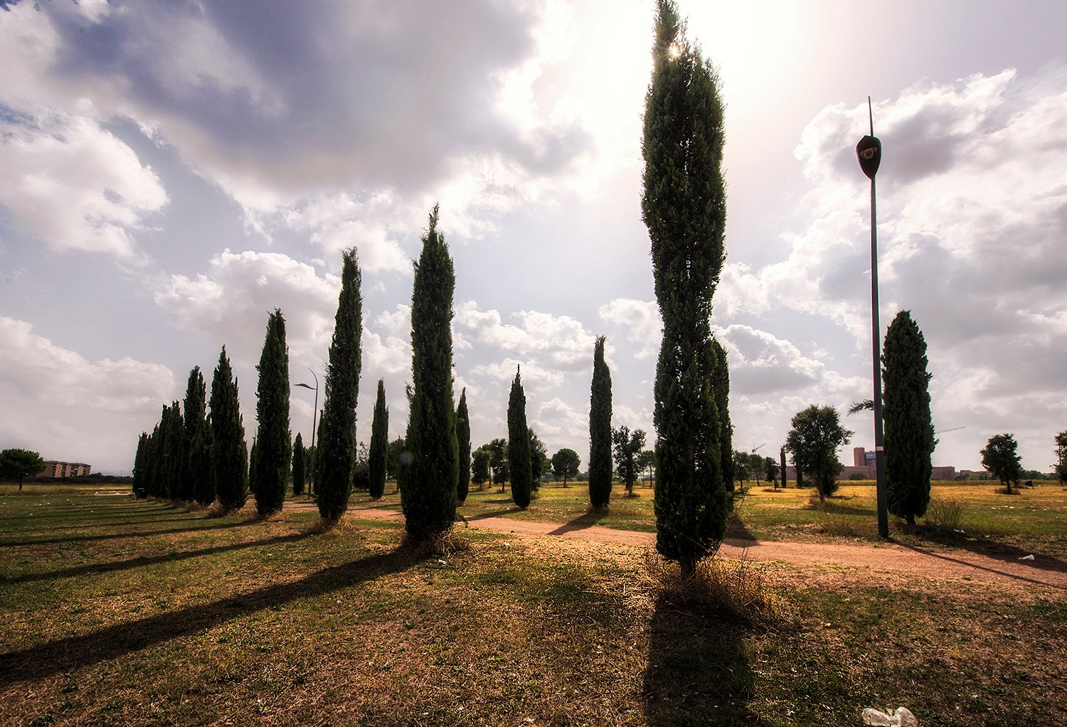
Centocelle is visited without a ticket. The Centocelle Archaeological Park, along Via Casilina between Via di Centocelle and Viale Palmiro Togliatti, is a public park with free entry: you walk on the lawns of the former airport, but the three Roman villas excavated in the 1990s are in fenced areas and have no visiting route open to the public. Piazza dei Mirti, the streets of the neighborhood and the mural in Piazza San Felice da Cantalice are viewed from the public street.
The neighborhood is in Municipio V, east of Torpignattara and the Pigneto, between Via Prenestina to the north and Via Casilina to the south. Forte Prenestino, on Via Federico Delpino, is a social center occupied since May 1, 1986: you enter when it's open for its public activities, not as you would a monument. Villa dei Gordiani, on the Prenestina, is a municipal archaeological park with remains from the imperial era and a medieval tower.
Data checked on September 29, 2026 on the pages of the Capitoline Superintendency and of the Rome Capital tourism portal dedicated to the park, on the Ecomuseo Casilino ad Duas Lauros sheet, on the Roma Servizi per la Mobilità site for transport and on Forte Prenestino site. The Termini-Centocelle railway, which carried the name of the neighborhood, has been stopped since March 4, 2026 and will not return to service. For the archaeological areas the institutional reference is the Capitoline Superintendency, at Piazza Lovatelli 35.
In brief: address, hours, ticket
- Where: Centocelle neighborhood, Municipio V. The Archaeological Park opens onto Via Casilina, between Via di Centocelle, Viale Palmiro Togliatti and Via Papiria. The Ecomuseo Casilino gives the address as Via Casilina 700.
- Operator: Roma Capitale. The three Roman villas fall under the Capitoline Superintendency, Piazza Lovatelli 35, 00186 Rome.
- How to enter: park with free entry from the access points on Via Casilina. Archaeological areas fenced, with no visits published on a calendar.
- Price: free for the park, the streets, Piazza dei Mirti and the murals. Forte Prenestino according to the activities announced by the social center.
- Park hours: the Ecomuseo Casilino indicates 7:00-20:00 every day. The Superintendency does not publish hours.
- How to get there: Metro C, stops Parco di Centocelle and Mirti. On the Casilina the 105 bus and the 105L shuttle. Termini-Centocelle railway suspended since March 4, 2026.
- Accessibility: the operator does not publish any indications. The park is mostly lawn, with uneven ground.
Where it is and what you really see
Centocelle is urban zone 7A of Municipio V. It borders Torpignattara and the Casilino to the west, the Gordiani to the northwest, the Alessandrino to the east and, beyond the Casilina, the Centro Direzionale Centocelle area. The name, for someone arriving from outside, indicates two different things: the inhabited neighborhood, north of the Casilina, and the large archaeological park that stretches south of the consular road, on the grounds of the former airport.
The neighborhood is made of small apartment buildings and low houses, with streets named after plants and flowers: Via dei Castani, Via dei Glicini, Piazza dei Mirti, Via delle Gardenie. In the 1940s the center was Piazza dei Mirti, with Via dei Castani as the main axis flanked by low houses. Today that structure can still be read: the square is the meeting point, Via dei Castani the street of the shops.
The park is something else. It's an expanse of lawns, scattered trees and packed-earth tracks, with some traces of the old landing strip. The sources don't agree on the size: the Italian Wikipedia speaks of about 120 hectares, the Ecomuseo Casilino of 136, the citizens' committee PAC Libero of 126. All the sources agree, however, on one point: the part landscaped and open to the public measures about 33 hectares, a fraction of the total.
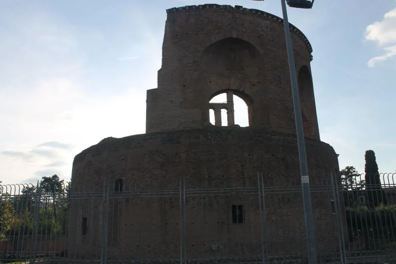
Under those lawns lie three Roman villas. The Capitoline Superintendency calls them villa ad duas lauros, Villa della Piscina and Villa delle Terme. They were investigated with the excavations of the 1990s, which documented an occupation of the area from the 6th century BC to the 6th century AD. Whoever enters the park, though, doesn't see an equipped archaeological area: the villas are in fenced zones and no visiting route is published.
The third element is Forte Prenestino, a late 19th-century fortification on Via Prenestina, today a self-managed social center with a cinema, a people's gym, a library, workshops and a busy calendar of concerts and festivals. The fourth is Villa dei Gordiani, a little farther west, with a large octagonal hall from the 3rd century and the medieval tower called Tor de' Schiavi. They are the four fixed points of a visit, to be linked on foot or with Metro C.
What you really see, above all, is a lived-in neighborhood. Schools, parishes, neighborhood markets, kids sitting on the benches of Piazza dei Mirti, families in the park on Sunday. Centocelle has no postcard monuments and no marked tourist route. Whoever arrives with these expectations finds what they're looking for: the east Rome of the 20th century, with its ancient history underfoot and its recent history written on the walls and in the plaques.
A curiosity about Centocelle
The neighborhood's name comes from a Roman villa. According to the Italian Wikipedia and the park's page, the large imperial estate that stood here was identified with the residence of Helena, mother of Constantine, and was called Centum Cellae because of the extent of its ruins. The place name Centocelle, according to the same source, is attested from 1523. The 100 cells would therefore be the rooms of a complex so large that it remained recognizable for centuries after its abandonment.
It's best to keep the levels of the story distinct. Documented is the use of the name Centocelle from the 16th century and the presence of a late-antique imperial villa, excavated and described by the Superintendency. Tradition is the direct link between the place name and the ruins of the villa, reported consistently by local sources. More uncertain is the interpretation of the cellae: rooms, storehouses or stables. On this point no official source proposes a definitive answer.
There is then a thread that links Centocelle to Torpignattara. The villa in the park is called ad duas lauros, at the two laurels, the same Latin place name as the catacombs of Saints Marcellinus and Peter and of the Mausoleum of Saint Helena, on the Casilina. According to the Ecomuseo Casilino, the villa belonged to Flavia Julia Helena Augusta, mother of Constantine. Helena's tomb and her residence were therefore on the same large imperial estate, today divided between two neighborhoods.
Another curiosity is ecclesiastical. The Italian Wikipedia recalls that in this area the Church established the suburbicarian diocese of Subaugusta, a name that recalls the presence of the imperial court. The bishopric has disappeared for centuries. It's one of those details that explain how important this countryside between the Casilina and the Prenestina was in the 4th century, well before it became periphery.
Finally the street names. The neighborhood has place names that are largely botanical: myrtles, chestnuts, wisterias, gardenias. The Metro C stations inherited two of them, Mirti and Gardenie. Whoever finds their bearings in Centocelle for the first time soon discovers that plant names are the quickest way to understand which part of the neighborhood you are in, and that Via dei Castani is the backbone.
One thing nobody tells you about Centocelle
The Centocelle Archaeological Park is often presented as one of Rome's great archaeological parks, on a par with the Appia or the aqueducts. In our judgment it's a promise the park, for now, doesn't keep. Whoever arrives expecting columns, mosaics or Roman walls to look at finds lawns, young trees, running tracks and some fencing. The villas are there, but you can't see them. The park's name describes what is underneath, not what you visit.
It's not a judgment on the park, which matters enormously to the neighborhood. It's a warning for whoever arrives from outside with the idea of an archaeological area. The PAC Libero committee, which gathers citizens and associations, recalls on its site that the park should have existed since 2006 and documents years of battles over cleanups, car wreckers and fires. The park you see today is the result of those battles, still halfway there.
A second misunderstanding concerns the boundaries. According to the Italian Wikipedia, the archaeological park lies outside the urban zone of Centocelle, separated from the neighborhood by Via Casilina. The Ecomuseo Casilino adds that the green area extends between Municipio V and Municipio VII. Whoever looks for the park by walking from Piazza dei Mirti must therefore go down to the Casilina and cross it: it's not a neighborhood garden, it's an area of its own, as big as a small municipality.
Finally there is a practical mistake. Many maps and many guides still indicate the little Casilina train, the Termini-Centocelle railway, as the simplest way to arrive. The service has been stopped since March 4, 2026, after the contact between two trains, and Roma Servizi per la Mobilità announced in April that the line will not return to service. Whoever doesn't know risks waiting at a closed stop. Metro C remains the most convenient solution.
Whoever wants to understand what the park is today should come on a Sunday. The PAC Libero committee describes on its site an influx of athletes, families, cyclists, groups of musicians playing outdoors, picnics, children's parties and dogs out for a walk, and points out an area of about 350 meters dedicated to sport, the park's playground. This is the area's real function, for now: a large open neighborhood space, more than a place for an archaeological visit.
What remains of the park's three Roman villas?
The best-known villa is the one called ad duas lauros. According to the Capitoline Superintendency it's a late-antique complex of about two hectares, with a garden decorated with sculptures and a funerary structure built in the first decades of the 3rd century. The Ecomuseo Casilino adds that the villa was identified already in the 1920s, during the construction of the airport, and that it was inhabited from the Republican age to the 5th and 6th century AD.
Villa della Piscina is about 400 meters farther west, according to the Ecomuseo. It owes its name to a large basin from the end of the 1st century or the beginning of the 2nd, which the Superintendency calls spectacular. The Ecomuseo estimates that it could hold half a million liters of water and that it was also used as a fishpond. It's a piece of data that says a lot about the owners' standard of living and the amount of water that reached this part of the Roman countryside.
Villa delle Terme is toward Viale Palmiro Togliatti. The Superintendency describes it as well preserved even in elevation, that is with walls rising above the floor level, despite the damage caused by modern pozzolana quarries. It preserves bath rooms, remains of floors and a mosaic with the depiction of a robin. The Ecomuseo also recalls luxury burials in the villa's area, tied to the latest phase of the complex.
None of the three villas has an ordinary opening today. The Ecomuseo Casilino indicates the archaeological areas as fenced, and the Superintendency does not publish hours, prices or visiting arrangements for the park. Whoever wants to know if extraordinary openings are planned can write to the Capitoline Superintendency, at Piazza Lovatelli, or follow the calendars of cultural initiatives of the Municipio and of the local associations, which periodically organize walks and meetings in the park.
Whoever wants to see a Roman villa on the outskirts of Rome with legible remains and an equipped route finds better answers elsewhere: the Villa of the Quintilii on the Appia, the Villa dei Sette Bassi and the Villa of Maxentius. The value of Centocelle is another: to understand, walking on apparently empty lawns, how large the ancient city is that hides beneath the modern periphery.
A detail to remember: the archaeological protection order on the area comes in 1992, and according to the Superintendency it is precisely that order that saved the land from building. In 1995 the city administration designated the site as an urban park, and in the same year, according to the Ecomuseo, the landscape protection order was added. Without those two decisions, in place of the lawns there would probably be apartment buildings, as in the rest of the city's eastern quadrant.
My advice for visiting Centocelle
The advice is to arrive by Metro C at Parco di Centocelle stop, enter the park from Via Casilina access points and walk an hour on the lawns, with an eye on the strip of the former airport and the fences of the archaeological areas. Then you go back up north, cross the Casilina and enter the neighborhood, as far as Piazza dei Mirti. A weekday morning is the quietest moment for the park, Sunday the liveliest.
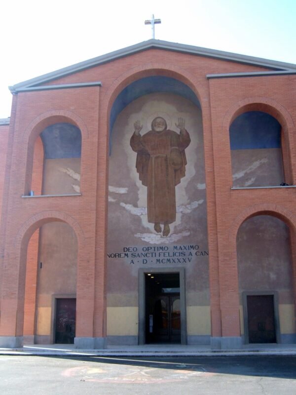
From Piazza dei Mirti it's best to continue on foot along Via dei Castani to Piazza San Felice da Cantalice, where the church of the same name and the mural dedicated to Claudio Baglioni are. It's a neighborhood walk without monuments, but it tells Centocelle better than any information panel. Whoever still has energy can push north to the Prenestina, Forte Prenestino and Villa dei Gordiani, which you reach in about 20 minutes of walking.
Forte Prenestino should be treated separately. It has no museum hours, and access depends on what the social center announces on its site: concerts, festivals, farmers' markets, courses, screenings. Whoever wants to see it inside must choose a date with an activity open to the public and respect the rules of the place. Whoever is content with the outside can look at the moat and the walls from Via Federico Delpino, without entering the areas not open.
Two practical cautions. In summer the park has few shaded areas and the middle hours are heavy: water and a hat are needed more than the camera. The PAC Libero committee recalls that there are no trash cans in the park and that trash must be carried out and disposed of at the entrances. On rainy days the lawns become muddy, and it's best to limit the walk to the main paths or put it off.
A full day in Centocelle, with the park, neighborhood, Forte and Villa dei Gordiani, requires five or six hours on foot. Whoever has less time chooses: park and Piazza dei Mirti in a morning, or neighborhood and Villa dei Gordiani in an afternoon. Whoever arrives in the evening for an event at the Forte can first combine a walk in Piazza dei Mirti, when the benches fill up and the neighborhood shows its most social side.
Do you pay anything and how do you get into the park?
You pay nothing. The Centocelle Archaeological Park is a public park of Roma Capitale, and entry is free. According to the PAC Libero committee the access points have gone over the years from just one to 12, five of them on Via Casilina, with a sixth planned. The Ecomuseo Casilino gives as address Via Casilina 700 and hours from 7:00 to 20:00 every day, with the archaeological areas fenced.
There is no ticket sales channel, because there is nothing to buy. There are also no official visits to the villas with booking, published by the Superintendency. For institutional information the reference remains the Capitoline Superintendency page on the park, while the Roma Capitale tourism portal points to the same page and to the committee's site. Whoever offers tickets for the park online should be ignored.
The rest of the neighborhood is free too. Piazza dei Mirti, Via dei Castani, Piazza San Felice da Cantalice and Maupal's mural are viewed from the street, at any hour. Villa dei Gordiani is a public park run by the Capitoline Superintendency, with the ruins visible from the paths. The neighborhood's churches follow parish hours, to be checked on their respective sites or on the notice board at the entrance before going in outside services.
Forte Prenestino works differently. The social center's site declares it open to the public and publishes a calendar of events: for late September 2026 it announced a public assembly on the 16th, a punk concert on the 25th and the ninth chili pepper festival on the 27th. Access arrangements and any contribution change from event to event and should be read on the Forte's site before leaving.
Another well-known fact, yet rarely cited
Under the park runs a tunnel that could have changed the history of Roman transport. The Ecomuseo Casilino recalls that in the 1930s a tunnel was dug, conceived as a first attempt at a subway, between Porta Maggiore and Torre Spaccata. The work stopped with the war and the project was never completed. In the postwar period the tunnel was used as a mushroom farm, and today it is not part of any published visiting route.
The fact is known to those who deal with the history of the eastern quadrant, and almost never appears in the pages on the park. Yet it explains a lot. 80 years later, Metro C followed a similar line, between the Casilina and the center, with Parco di Centocelle and Mirti stops inaugurated between 2014 and 2015. The dream of an underground line toward the east, left half done in the 1930s, came true only in the new century.
A second little-cited fact concerns the war. On November 22, 2017 the Centocelle neighborhood received the gold medal for civil merit. The citation, published by the Presidency of the Republic, recalls that after the armistice the local community distinguished itself by its extraordinary commitment, alongside the Italian soldiers, in the strenuous defense of the local military airport. Few Roman neighborhoods have received a collective recognition of this kind.
The right photo to take at Centocelle
The most successful photo is that of the park at sunset, from the side of the old strip. The flat ground, low lawns and wide sky are a rarity in Rome, and at sunset the raking light draws the undulations of the ground, where you can make out the traces of buried structures. A wide frame, with the apartment buildings of the surrounding neighborhoods in the background, tells well the relationship between the modern city and the ancient countryside that survives in the middle.
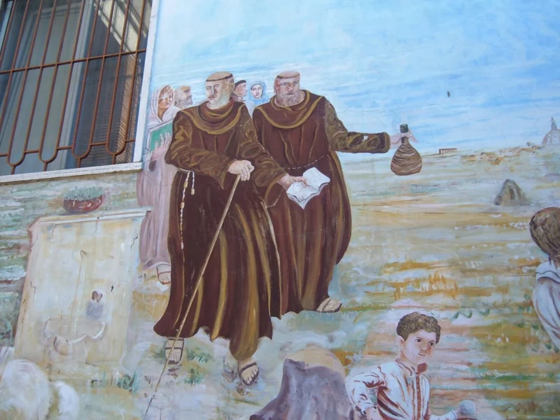
The second is the mural of Claudio Baglioni at Piazza San Felice da Cantalice 20, on the wall of Casa San Felice. According to Leggo, which told the story on May 16, 2021, it's the work of Mauro Palotta, known as Maupal, and shows a close-up of the singer-songwriter as a young man with notes and words from one of his songs of 1981. It should be photographed from the opposite sidewalk: the building is a family home, and the people who live there are not part of the frame.
The third is the octagonal hall of Villa dei Gordiani, with the circular openings of the dome that let the light through. Whoever wants a detail can look in the vault for the amphorae inserted to lighten the structure, the same technique as the Mausoleum of Saint Helena. Photos are taken from the park paths, without climbing the fences around the ruins and without stepping on the masonry, which is fragile and protected.
Where was Italy's first airport?
Right here. On April 15, 1909 Wilbur Wright arrived at Centocelle for a series of demonstration flights with his airplane, and according to the Ecomuseo Casilino that date marks the birth of Italy's first airport. The Italian Wikipedia gives the same date as the official entry into service of the field. The airfield soon became an aeronautics school and, according to the Ecomuseo, was opened to civil traffic in 1926.
The airport was named after the aviator Francesco Baracca, ace of the First World War. During the Second World War, according to the Italian Wikipedia, it became the target of many violent bombings. After the armistice of September 8, 1943, as the citation of the gold medal for civil merit recalls, the population of Centocelle stood alongside the Italian soldiers in the defense of the field against the German troops.
In today's park a part of the strip is still visible, according to the Italian Wikipedia. There are no panels that mark it systematically, and it takes a little attention to recognize it among the lawns. It's the easiest detail to read for a visitor: a straight line in the green, long, that has nothing to do with the Roman countryside and everything to do with the first years of aviation.
Whoever is interested in the history of flight finds here a symbolic place, more than a museum. There are no visitable hangars or aircraft on display in the park, and the memory of the airport comes mostly through names, through period photographs collected by local associations and through the shape of the ground. It's a rare case of a historic place that is better understood from a map than from a visit, and it's best to arrive knowing that.
How do you get there from the center of Rome?
The simplest solution is Metro C. According to the Italian Wikipedia, the stretch between Pantano and Parco di Centocelle opened on November 9, 2014, the one toward Lodi, with the Mirti stop, on June 29, 2015. Whoever starts from Line A changes at San Giovanni and takes the C toward Pantano. Parco di Centocelle serves the archaeological park, Mirti the square and the commercial heart of the neighborhood.
On the Casilina, along the north side of the park, runs the 105 bus. Roma Servizi per la Mobilità, in the article of April 8, 2026, announced the strengthening of the line and a 105L shuttle at peak hours, to compensate for the closure of the railway. The exact stops and detours for roadwork must be checked on the ATAC site on the day of the visit, because on the consular road the worksites change often.
The Termini-Centocelle railway, the narrow-gauge little train that for decades served the Casilina, has been stopped since March 4, 2026, after two trains in opposite directions came into contact on the single-track stretch between Ponte Casilino and Piazzale Labicano. The mobility department has announced that the line will not reopen and will be turned into a Termini-Tor Vergata tramway, with a 252 million euro tender that also includes a new depot at Centocelle.
By car the neighborhood is reached from the Casilina, from the Prenestina or from Viale Palmiro Togliatti, but parking on the inner streets is hard, especially around Piazza dei Mirti. On foot, from Torpignattara, you arrive following the Casilina east or, better, going through the inner streets. By bicycle the park is pleasant, with its packed-earth tracks, while the big avenues around are busy and poorly protected.
Some important events that happened here in history
The excavations of the 1990s, according to the Ecomuseo Casilino, documented an occupation of the area from the 6th century BC to the 6th century AD. Between the end of the 1st and the beginning of the 2nd century the large pool of the villa of the same name was built. In the first decades of the 3rd century the funerary structure of the villa ad duas lauros arose. In the 4th century the imperial estate is tied to Helena, mother of Constantine, buried not far away in the mausoleum on the Casilina.
The name Centocelle, according to the Italian Wikipedia, is attested from 1523. For centuries the area remains countryside. On April 15, 1909 Wilbur Wright flies over the lawns and Italy's first airport is born. In 1926 the airfield opens to civil traffic. In the 1930s the never-completed subway tunnel is dug. Meanwhile north of the Casilina the neighborhood grows, with Piazza dei Mirti as its center already in the 1940s.
Between September 1943 and June 1944 Centocelle lives under German occupation. The population stands alongside the Italian soldiers in the defense of the airport after the armistice, and the neighborhood takes part in the Roman Resistance. On January 31, 1944 the partisan Paolo Renzi, arrested on Via Valmontone, is shot at Forte Bravetta. The Italian Wikipedia recalls that in the first months of 1944 Centocelle became in effect a liberated zone.
In the postwar period the area of the former airport becomes, according to the Ecomuseo, a large urban void, with spontaneous settlements between the 1960s and the 1980s, including the camps Casilino 700, cleared in 2000, and Casilino 900, cleared in 2010. In 1992 the archaeological protection order arrives, in 1995 the landscape one. The park opens to the public in 2006, closes for safety from September 2008 to January 2010, then reopens. In 2017 the neighborhood receives the gold medal for civil merit.
The most recent years have brought Metro C, with the stops opened in 2014 and 2015, and the closure of the Termini-Centocelle railway in March 2026. The PAC Libero committee documents on its site a series of fires of toxic materials in the summer of 2018 and the long dispute over the relocation of the car wreckers from the protected areas. These are still open matters, which decide what the park will become in the coming years.
Who has passed through Centocelle
The first presence tied to the place is that of Helena, mother of Constantine, to whom the Ecomuseo Casilino attributes the villa ad duas lauros. With her, ideally, is the Constantinian court that owned these lands. Much later, on April 15, 1909, Wilbur Wright arrived, one of the two brothers who had flown the first motorized airplane. His demonstration flights over the lawns of Centocelle mark the beginning of aviation in Italy.
In the 20th century the neighborhood was crossed by the Resistance. Paolo Renzi, a partisan arrested on Via Valmontone and shot at Forte Bravetta on January 31, 1944, was decorated in 1975 with the silver medal for military valor, and according to the Italian Wikipedia a stumbling stone preserves his memory. For a broader route on the places of the Roman Resistance there is the page on the places of memory in Rome.
In April 1951, according to the Italian Wikipedia, the future Queen Elizabeth II visited the Borgo Ragazzi Don Bosco, the Salesian work on Via Prenestina born in the postwar period to take in kids in difficulty. Pier Paolo Pasolini cited Via Tor de' Schiavi in Ragazzi di vita and shot in Piazza San Felice da Cantalice a scene of Accattone, with the protagonist and Stella. For other places of Roman cinema there is the page on Rome in the Movies.
Claudio Baglioni spent his adolescence in Centocelle. According to Leggo, Maupal's mural dedicated to his 70th birthday is on the wall of Casa San Felice, the place where the singer-songwriter says he first got onstage. The Italian Wikipedia also recalls an improvised concert that Baglioni gave on April 23, 2007 from a friend's balcony, in the neighborhood where he grew up.
What do you see between Piazza dei Mirti and San Felice da Cantalice?
Piazza dei Mirti has been the center of the neighborhood for 80 years. The Metro C stop gave the square a new role as a hub, and the streets around, Via dei Castani first of all, gather shops, bars, bakeries and small neighborhood markets. There are no monuments to visit: the square is worth it for what happens there, especially in the evening and on weekends, when it fills up with families, kids and elderly people who use it as a living room.
Via dei Castani is the street to walk to understand the neighborhood. The low houses of the first Centocelle alternate with more recent apartment buildings, and the neighborhood shops tell of a neighborhood that has kept a life of its own, without depending on the center. Whoever walks attentively notices how the shop windows change from block to block, among historic shops, new businesses and services for those who live in the area.
Farther north, Piazza San Felice da Cantalice hosts the church of the same name and, at number 20, Casa San Felice, with Maupal's mural dedicated to Claudio Baglioni. It's the neighborhood's street art work documented most precisely: author, date and commissioning appear from a Leggo article of May 2021. The square is also the site of a scene from Accattone, according to the Italian Wikipedia, and thus joins two popular memories of east Rome.
For the rest, Centocelle's street art has no official catalog comparable to those of Torpignattara, the Quadraro or Tor Marancia. There are murals on school walls, overpasses and blank facades, but authors, dates and state of preservation are not gathered by any institutional source. Whoever looks for a structured route of documented works finds better answers in Torpignattara, at the ex Porto Fluviale and on the streets of the Ostiense.
The neighborhood is inhabited, and the rules are those of any residential area. You look from the street, you don't enter courtyards or doorways to frame a mural, you don't insistently photograph people sitting on the benches or leaning out of balconies. Casa San Felice, in particular, is a family home: the mural belongs to the street, the life of those who live there does not.
What is Forte Prenestino and how do you get in?
Forte Prenestino is a fortification built between 1880 and 1884, at the fourth kilometer of Via Prenestina, according to the Italian Wikipedia. It was part of the entrenched camp of Rome, the 15 forts built between 1877 and 1891 to defend the capital of the new Kingdom. Like the other forts, it's a low, sunken structure, surrounded by a moat, designed to withstand artillery and not to be seen from afar.
In 1977 the City of Rome took possession of it, then leaving it abandoned. Since May 1, 1986 the fort has been occupied by the self-managed social center CSOA Forte Prenestino. In 40 years the social center has turned the casemates into concert halls, a cinema, a library with infoshop, a people's gym with dozens of courses, workshops for music, screen printing and bicycle repair, a farmers' market and several refreshment spaces.
The Forte's site declares it open to the public and publishes a calendar of activities that in September 2026 included a public assembly, a punk concert and a festival dedicated to the chili pepper. Among the series hosted or promoted the site lists Crack!, Babel, Electrode, Weird, Interiora and Occhi Rossi. Whoever wants to visit it chooses one of these occasions, checks hours and entry arrangements on the site and arrives knowing they are entering a self-managed space, with its own rules.
Forte Prenestino is an occupation, and its legal status is not that of a monument opened to the public by an authority. It has no ticket office, no institutional visits, no fixed museum hours. It shouldn't be described as a tourist attraction, or as a place to avoid. It's a social center active for 40 years, with a history of interest to those who study the city, and the visit makes sense only by taking part in what the center itself offers.
From the outside, along Via Federico Delpino, you see the moat and the walls of the fort. You don't climb fences, you don't enter closed spaces and you don't go down into the moat. For whoever wants to explore Rome's system of forts, the other 14 are scattered along the consular roads, each with a different history and use. The Prenestino can be seen inside only on the social center's terms.
When is it closed and what shouldn't you expect?
The neighborhood never closes: Piazza dei Mirti, Via dei Castani and Piazza San Felice da Cantalice can be crossed at any hour. The park follows the hours indicated by the Ecomuseo Casilino, from 7:00 to 20:00, a figure the Superintendency does not publish. The archaeological areas of the villas stay closed to the public, except for extraordinary initiatives announced from time to time. Forte Prenestino opens according to its calendar, and outside events it's normal to find it closed.
Don't expect an equipped archaeological park. There are no ticket offices, marked visiting routes to the villas, systematic information panels or services like those of the big parks of the Appia. Don't expect a visitor center, widespread public restrooms or refreshment points inside the park either: whoever spends a few hours on the lawns brings water and whatever is needed, and carries the trash back out, as the PAC Libero committee asks.
Don't expect, finally, a tourist neighborhood. Centocelle has no information offices, no marked itineraries, no souvenir shops. It has a life of its own, made of schools, markets, parishes and associations, and whoever arrives from outside is a guest among those who live there. That is exactly its interest: seeing a part of Rome where the visitor conditions nothing and the city works for those who live in it.
On accessibility the park's operator does not publish any indications. The lawns and packed-earth tracks are flat but irregular, and after rain they become muddy. The PAC Libero committee points out pedestrian crossings with traffic lights on Viale Palmiro Togliatti and on Viale Primavera and an underpass that is cleaned periodically. For those who move in a wheelchair or with a stroller, the advice is to stay on the main paths near Via Casilina access points.
Eating in the area
Centocelle doesn't have the typical traps of the historic center. There are no touts in front of monuments, because there are no monuments with crowds of tourists, nor photo menus translated into five languages. Around Piazza dei Mirti and along Via dei Castani there are many trattorias, pizzerias, bakeries and gelaterias, and in the evening the neighborhood draws people who live elsewhere too. The real risk, here, is fashion.
When a neighborhood becomes trendy, some places raise prices without raising quality, and others bet on decor more than on cooking. The rules of common sense apply in Centocelle too: be wary of places with no prices displayed, of menus that differ between inside and outside, of kitchens open continuously with no break between lunch and dinner. Romans choose where, at lunch on weekdays, people from the neighborhood eat.
Whoever comes for the park on Sunday can also do as many residents do: a packed lunch on the lawns, with what you buy at the bakeries and groceries of the neighborhood before going in. It's a way to use the park the way those who live here use it, and to remember to carry back out everything you bring in. For a few selected addresses in the city there is the list of addresses on Google Maps.
What to combine in a day
The closest pairing is Villa dei Gordiani, at the third mile of Via Prenestina, a public park run by the Capitoline Superintendency. Inside are a large octagonal hall from the 3rd century, with the dome lightened by amphorae, on which in the 13th century the tower called Tor de' Schiavi was built, a two-story cistern from the 2nd century and a columbarium discovered in 1958, dated between the 1st century BC and the 1st AD.
The villa is older than the imperial Gordian family, from which it takes its name. The Historia Augusta, cited by the Italian Wikipedia, attributes to it a portico of 200 columns of different marbles. In 1347 the Colonna troops camped in the area, and the same family bought the tower in 1422. The park was planned in the 1931 master plan and laid out in the 1960s. You reach it from the bus stops on Via Prenestina.
Heading west, on foot or by metro line C, you get to Torpignattara, with the Mausoleum of Saint Helena and the documented murals, and then to Pigneto, with the Nuovo Cinema Aquila to end the day with a screening. Closer to the walls are Porta Maggiore and the Underground Basilica, from which the never-finished tunnel to Torre Spaccata started.
If you follow the thread of the water, you can continue toward Alessandrino, where the arches of the Alexander Severus aqueduct run, and then south to the Aqueducts Park, on Via Tuscolana, with the big arches in the greenery. The comparison with Centocelle is useful: two large green areas of the eastern outskirts, one where the ancient world is easy to see, the other where it hides under the lawns. Farther south is the Appia Antica Park.
Heading east, along Via Casilina, you reach the Castelletto di Torre Angela. Along Via Prenestina, outside the city, are the archaeological area of Gabii, the Castello di Lunghezza and, farther out, Colonna, Zagarolo and Palestrina. These are trips that need a car or the intercity buses, and they should be planned by checking the timetables.
If you prefer to stay in the city, there are other 20th-century neighborhoods to explore on foot: San Lorenzo, with the Verano, Garbatella and Esquiline Hill. For those traveling with children, the Centocelle park, with its lawns, pairs well with the suggestions on the page about Rome with kids, and for outings that cost nothing there is Free Rome.
If you follow the thread of wartime memory, you can link Centocelle to other places of the Resistance and the occupation: the Ardeatine Caves Mausoleum, Porta San Paolo, where fighting against the German troops took place in September 1943, and the Shoah Museum. The Casa della Memoria e della Storia collects archives and initiatives about the period.
Frequently Asked Questions
Is the Centocelle Archaeological Park open?
Yes, as a public park with free entry. You enter from the gates on Via Casilina, and the Ecomuseo Casilino gives hours from 7 to 20 every day. The three Roman villas, however, are in fenced areas and have no regular visits. For institutional information the contact is the Sovrintendenza Capitolina, Piazza Lovatelli 35, which does not publish hours or visiting arrangements for the archaeological areas.
Can you see the Roman villas in the park?
No, not on a regular visit. The villa ad duas lauros, Villa della Piscina and Villa delle Terme were excavated in the 1990s and described by the Sovrintendenza Capitolina, but they are in fenced zones. If you are looking for readable Roman remains on an equipped route, you will find better answers at Villa dei Quintili or Villa dei Gordiani, which is not far away on Via Prenestina.
Why is it called Centocelle?
The name comes from the large imperial estate that stood here, called Centum Cellae for the extent of its ruins and identified with the residence of Helena, mother of Constantine. According to the Italian Wikipedia the place name Centocelle is attested from 1523. The precise meaning of the cellae remains uncertain, and the sources do not offer a definitive reading: rooms, storerooms or other spaces of the villa.
Is it true that Centocelle had Italy's first airport?
Yes. On April 15, 1909 Wilbur Wright arrived on the Centocelle fields for a series of demonstration flights, and that date is given by the Ecomuseo Casilino as the birth of Italy's first airport. The airfield, named after Francesco Baracca, became an aeronautics school and from 1926 opened to civil traffic. In the park part of the runway can still be seen.
How do you get to Centocelle by public transport?
By metro line C, stops Parco di Centocelle for the park and Mirti for the square, reachable from line A by changing at San Giovanni. On Via Casilina runs bus 105, reinforced at peak hours by the 105L shuttle according to Roma Servizi per la Mobilità. The Termini-Centocelle railway has been out of service since March 4, 2026 and will not return to service.
Can you enter Forte Prenestino?
Yes, but only when the social center opens for its activities. The Forte, on Via Federico Delpino, has been occupied since May 1, 1986 by the CSOA Forte Prenestino, which publishes concerts, festivals, courses and markets on its website. There are no museum hours and no ticket office: access arrangements and any contribution change from event to event and should be checked before you leave.
Where is the Claudio Baglioni mural?
In Piazza San Felice da Cantalice 20, on the wall of Casa San Felice. According to Leggo, which reported it on May 16, 2021, it is the work of Mauro Palotta, known as Maupal, and was made for the 70th birthday of the singer-songwriter, who grew up in the neighborhood. You look at it from the opposite sidewalk, without entering the building, which is a family home that people live in.
How much time do you need to see Centocelle?
A morning is enough for the park and Piazza dei Mirti. A full day lets you add Via dei Castani, Piazza San Felice da Cantalice, Forte Prenestino from the outside and Villa dei Gordiani, with five or six hours of walking in total. If you want to enter the Forte, you need to pick a date with an activity open to the public, often in the evening or on the weekend.
Who Wrote This and On Which Sources
The text comes from the editorial team of Tour Leader Pro, the Rome-based company that designs itineraries, visits and cultural events across Rome and Lazio. Fares, hours and access arrangements given here come from the sources named in the text as of the date indicated at the start: the Sovrintendenza Capitolina, the Rome tourism portal of Roma Capitale, the Ecomuseo Casilino, Roma Servizi per la Mobilità, the Presidency of the Republic and Forte Prenestino website. Tell us what you find changed.
Organizing a visit to Centocelle, for yourself or for a group, means above all choosing the right day for the park, knowing that the villas cannot be visited, using metro line C instead of the closed little train and, for the Forte, checking the social center's calendar. For those who organize group trips to Rome with itineraries on the lesser-traveled neighborhoods and their history, a useful resource is Tour Leader Pro.
The eastern quadrant of Rome, between Porta Maggiore, Pigneto, Torpignattara and Centocelle, is a part of the city that travelers discover late, often after seeing the historic center several times. Here you find buried imperial villas, Italy's first airport, late 19th-century forts and working-class neighborhoods, and from here Via Casilina and Via Prenestina head toward the Castelli and the Sacco valley. To put together a multi-day trip between Rome and Lazio, a useful resource for building an itinerary is Italy Planner.
Contact Information
Nearby
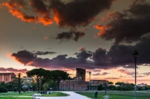
 Church of San Felice da Cantalice600 m
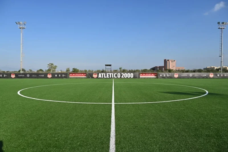
- Atletico 2000 Sports Center800 m
- Casa della Cultura di Villa De Sanctis1.0 km
- Circolo Sportivo Villa De Sanctis1.2 km
- Torpignattara1.2 km
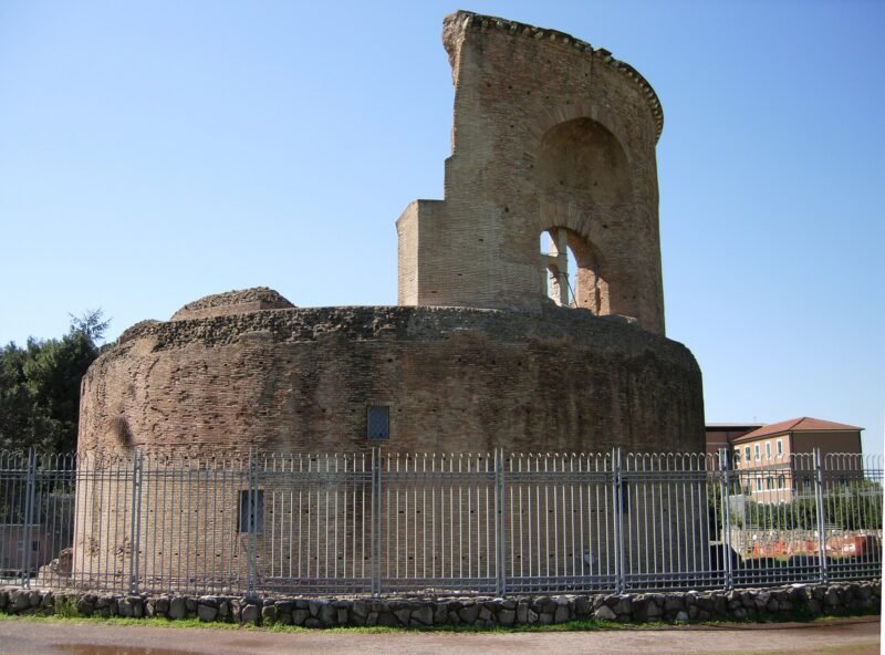
- Mausoleum of Saint Helena and Catacombs of Saints Marcellinus and Peter1.2 km
Upcoming events nearby
- Itinerario narrativo diffuso, walks to the churches of Rome’s outskirts, October 11 to November 29, 2026600 m
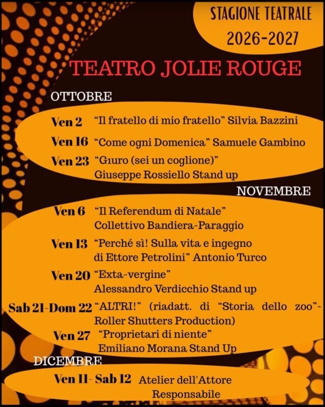
- Il Referendum di Natale, Collettivo Bandiera-Paraggio at Teatro Jolie Rouge, November 6, 2026800 m
- Perché sì! On the life and wit of Ettore Petrolini, by Antonio Turco at Teatro Jolie Rouge, November 13, 2026800 m
- Exta-vergine, stand up by Alessandro Verdicchio at Teatro Jolie Rouge, November 20, 2026800 m