Castelletto Torre Angela
In short. There are places in Rome you visit and places in Rome you read.
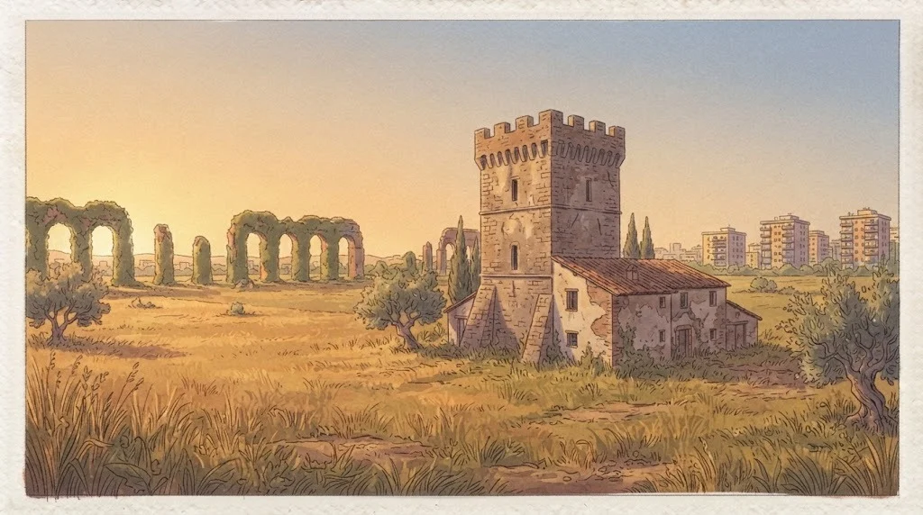
There are places in Rome you visit and places in Rome you read. The Castelletto di Torre Angela belongs to the second category: it has no ticket office, no bookshop, no custodian to explain things to you. What it has is a compact mass of masonry planted along Via di Torrenova, a name the whole neighborhood knows and almost no tourist guide has ever printed, and a function that no contemporary architect would know how to design anymore: standing in the middle of the countryside and watching over it.
In Rome the historic center is the easy part. The hard part, and for me much more interesting, begins where the postcards end: here, to the east, beyond the Grande Raccordo Anulare, where the city ate up the Agro Romano within two generations and left standing, like bones inside flesh, the towers and farmhouses that used to govern that Agro. The Castelletto di Torre Angela is one of those bones.
This entry is not a piece of news reporting. Torre Angela is told almost exclusively through its problems, and those who live there know it better than anyone. Here we do the opposite: we tell the stratigraphy. Who built here, why, with which stones, to defend against whom, and how it went from wheat to apartment blocks in 50 years. It is not an exercise in kindness: it is simply the correct way to look at a piece of city that has thousands of years of history under its feet and 50 years of history above its head.
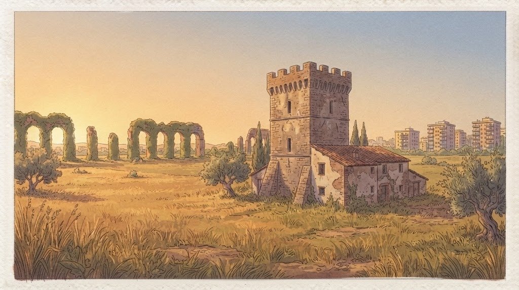
Where exactly Castelletto Torre Angela is
The reference address is Via di Torrenova, number 700, in the eastern sector of Roma Capitale. We are in Municipio VI, the one everyone calls the Municipio delle Torri, a name it has earned honestly: Torre Angela, Torre Maura, Torre Spaccata, Torre Gaia, Torrenova, Tor Bella Monaca, Tor Sapienza, Torraccia, Tor Vergata. It is not a place-name affectation: it is an inventory of medieval infrastructure that survived the city that came after.
Administratively, Torre Angela is zone Z. XIII of the Agro Romano of Roma Capitale and corresponds to urban planning zone 8F of Municipio VI. It borders to the north the Acqua Vergine zone, to the east and southeast Borghesiana, to the south Torrenova and Torre Gaia, to the west Torre Spaccata. Translated for those who don't handle Roman place-names: we are outside the Raccordo, in the middle of the bundle of roads that goes from Porta Maggiore toward the Prenestini mountains and toward the Castelli, wedged between Via Casilina to the south and Via Prenestina to the north.
The geography that matters for understanding Castelletto Torre Angela
If you look at an altimetric map instead of a road map, the position stops looking random. This whole quadrant is a plateau of volcanic tuffs deposited by the Colli Albani district, cut by ditches that run down toward the Aniene to the north and toward the Tiber to the west. The ditches, in Roman dialect, are called marrane, and for centuries they were the only reliable water lines of the countryside: where there is a marrana there is a ford, where there is a ford there is a mandatory crossing, and where there is a mandatory crossing sooner or later someone builds something tall and thick to control it.
The Castelletto di Torre Angela sits exactly inside this logic. It is not on a panoramic postcard summit: it is on a modest rise that, before the apartment buildings raised the artificial horizon to 20 meters, dominated a stretch of countryside sufficient to see someone coming half an hour ahead. Half an hour, in the Middle Ages, was the difference between closing the gates and losing the harvest.
The Castelletto Torre Angela area in one sentence
In short: we are in the last belt of Rome where the countryside survives in patches between the neighborhoods, above a subsoil full of Roman villas and paved roads, inside an urban fabric built largely between the 1960s and the 1980s, served today by a metro line and flanked by one of the largest university campuses in Europe. All this within a radius of four kilometers.
What Castelletto Torre Angela really is
Let me clear up right away a misunderstanding that I see arise every time I say the word castelletto in front of a group. Nobody here ever built a castle in the Disney sense of the term: no moat, no drawbridge, no cylindrical towers with little flags. In the Agro Romano the term castelletto indicates a much more prosaic and much more interesting organism: a fortified rural nucleus, that is, a complex of farm buildings gathered around a tower or a sturdy main building, closed toward the outside and open onto an inner courtyard.
It was, in substance, a farm endowed with the capacity to withstand a surprise attack. Not a siege with war machines: an armed band, a raid, a group of brigands or a baronial militia that passed by to plunder livestock. The difference between a farmhouse and a castelletto is all there: the farmhouse produces, the castelletto produces and defends itself.
The typical elements of a nucleus like Castelletto Torre Angela
When I observe a structure of this type I always look for the same five things, and I suggest them to you too. The first is the tallest and most compact body, which as a rule is the oldest part: it is the tower, or what remains of it after the centuries have shortened it and the owners have absorbed it into later buildings. The second is the masonry: if you see courses of squared tuff, flakes of flint embedded in mortar and blocks of reused material that are clearly Roman, you have in front of you a chronology that starts in the Middle Ages and arrives in the modern age.
The third thing is the height of the openings. In control structures the low windows are almost always late: originally you entered high up, with removable ladders, and on the ground floor there were only arrow slits or blind storerooms. The fourth is the courtyard: look for the enclosure, even if today it is a low wall with wire mesh on top. The fifth is the relationship with the road: a castelletto never looks elsewhere, it looks at the road. If it seems to you that the building is crooked relative to the asphalt, almost always it is the asphalt that has moved.
Visiting: the part I have to tell you plainly
The Castelletto di Torre Angela is not a monument open to the public. It has no hours, no tickets, no visitor routes, and the documentation accessible on it is scarce and fragmentary, as happens for the great majority of the fortified rural nuclei of the Agro Romano that ended up inside the modern urban fabric. Many of these complexes are private property, others are in agricultural or residential use, still others are in conditions that make approaching them inadvisable.
So the correct way to come here is only one: you look from the public road, you respect private property, you climb over nothing and you enter no courtyard. It is not a limitation, it is the normal good manners you use when you stroll inside someone else's home. I assure you that from the road you understand a great deal: the mass, the materials, the position relative to the road, the relationship with the apartment blocks that grew up around it. And the relationship with the apartment blocks is the most eloquent thing of all.
The name: why it's called Castelletto Torre Angela
The place-name is read in two stages. Castelletto is the common name of the building type, as just explained. Torre Angela is the name of the place, and it is a name with a documented and rather elegant history.
The attested ancient form is Turris Aegidi Angeli, that is, the tower of Egidio Angeli. The estate of Tor Angela appears to have belonged, in the 14th century, to Angelo Del Bufalo. The passage from Turris Aegidi Angeli to Torre Angela is a very ordinary phonetic erosion: the Latin genitive falls apart, the masculine proper name becomes feminine by attraction to the word torre, and within a few centuries a medieval owner becomes an imaginary lady. Rome is full of these metamorphoses, and almost always those who live there hold on to them, convinced that they tell a legend, when they tell a deed of sale.
Why the detail of the name is not a detail
I like this etymology because it dismantles the romantic idea that the place-names of the Agro arise from the landscape. They do not arise from the landscape: they arise from the land registry. Every tower of the Agro Romano carries, engraved in its name, the identity of whoever owned it or worked there. Torre Angela says Angeli. Tor Bella Monaca refers to a tradition tied to a nun. Torre Spaccata declares its own state of preservation. Torrenova warns that at some point someone built a new one, and that therefore there was an old one.
It is a place-name system that works like a property register in the open air. When you walk between Torre Angela and Torrenova you are not crossing neighborhoods: you are crossing the boundaries of ancient estates, and the roads you travel follow in large part the service roads that connected one farmhouse to another. Via di Torrenova, which is the street of our Castelletto, belongs to this family of routes: it was not born as an urban street, it became an urban street.
The Del Bufalo and the trade of owning the countryside
The Del Bufalo are a Roman family of long-standing presence in the city, and their appearance in this corner of the Agro in the 1300s is perfectly consistent with the social mechanics of the time. The countryside around Rome, in the late Middle Ages, was not populated by farmers who owned their land: it was divided among great city houses, ecclesiastical bodies, monasteries, chapters of basilicas and hospitals. Ownership was an income, not a trade.
The owner lived in the city, inside the walls, in a palace with its own fine family tower. In the countryside he kept a steward, a farmhouse, a few families of workers and, when needed, an armed garrison. The tower in the middle of the fields was at once a storehouse, a guard post, a visual signal and a statement of ownership: a road sign 15 meters tall that told anyone passing that from there on you paid him.
The towers of the Agro Romano: the system Castelletto Torre Angela belongs to
To really understand the Castelletto you have to stop looking at it as an isolated object and start looking at it as a node. Between the 11th and the 14th century the Roman countryside fills up with towers: hundreds of them, scattered along the consular roads, on ridges, at fords, on top of the ruins of imperial villas. They are not built by a single authority following a unified plan, and this is the point that usually surprises those who arrive with the model of frontier castles in their heads.
They are built by the Roman barons, the abbeys, the basilicas, the hospitals, the rural communes. Each fortifies its own piece. The result, however, ends up working as a network: from one tower you can see two or three others, and on a clear day a smoke signal or a bell could cross the Agro much faster than a horse. It was not an alarm system designed at a desk, it was an emergent system. The best networks often arise this way.
Defending against whom, exactly
The most frequent question is: but who were they defending against? The honest answer is: above all, each other. Rome in the 13th and 14th centuries is a city where the great families fight over control of revenues, offices and crossings. Add the raids that now and then come up from the sea or down from the mountains, the mercenary companies of the 14th century, the endemic brigandage that will accompany the Agro until the 19th century, and you have the picture.
Then there is a less spectacular but more constant enemy: livestock theft. In an economy where wealth walks on four legs, a solid enclosure and a tower from which to see far are worth more than any contract. The Castelletto di Torre Angela is born in this world, and its compact plan tells exactly this concern.
Why so many are left
One of the most interesting paradoxes of the Agro Romano is that its economic backwardness worked as a preservative. Where agriculture industrializes early, the old farmhouses are demolished because they get in the way. Where agriculture remains extensive, cereal-growing and pastoral, the old farmhouse keeps serving and so stays standing. The Agro around Rome lived for centuries on wheat, pasture and latifundia, with a very low stable population. Result: the towers lost their battlements, gained lean-to roofs, became barns and stables, but were not pulled down.
Then, in the 1950s and 1960s, the city arrived, and in 30 years it did more damage than seven centuries. Many towers vanished under the foundations of apartment buildings, others survived by the skin of their teeth, wedged between a parking lot and a supermarket. That the Castelletto di Torre Angela is still there, recognizable, is already news in itself.
The roads that explain Castelletto Torre Angela: Casilina and Prenestina
No tower of the Agro can be understood without the road it watched over. Here there are two roads, and both are very ancient.
Via Casilina, or the Labicana in disguise
The modern Via Casilina follows, for a good part of its urban and extra-urban course, the ancient Via Labicana, which left Rome toward the Latin town of Labicum and then continued southeast, joining Via Latina and heading in the direction of Campania. The modern name derives from Casilinum, the ancient town near Capua: the road, in short, changed its name but did not change its job. It has always been the main line toward the South.
For our quadrant the Casilina is the backbone. Running alongside it are the former licensed Rome-Fiuggi railway, of which the current metro is in part the heir on the outer stretch, and an uninterrupted sequence of borgate grown like a comb on both sides. If you want to understand how eastern Rome is made, travel the Casilina from Porta Maggiore toward the Castelli and observe how the fabric changes every two kilometers: first the 19th-century one, then the Fascist one, then the 1950s public housing, then the illegal building of the 1960s, then the piano di zona of the 1980s.
Via Prenestina and the world of Gabii
To the north runs instead Via Prenestina, which is the road to Praeneste, today's Palestrina, and is perhaps the most underrated consular road of Rome. Along the Prenestina you meet the park of Villa dei Gordiani with its great round mausoleum known as Tor de' Schiavi, the archaeological area of Gabii and the Ponte di Nona, which owes its name to the ninth mile of the road.
Gabii deserves a parenthesis, because it is one of those sites that explain the whole landscape. It was a very ancient Latin city, powerful before Rome and then absorbed by Rome. Its sanctuary dedicated to Juno Gabina is one of the most important republican sacred complexes in Lazio, and for some decades the area has been the subject of systematic excavation campaigns carried out in collaboration with foreign universities. But above all Gabii is the geological reason for half of Rome: from here was extracted the lapis gabinus, the gray peperino used in the city for thresholds, door jambs and structures that had to withstand fire.
When you look at the tuff of the Castelletto di Torre Angela, then, you are looking at the same geological history that supplied the materials to the center of Rome. The Lazio volcano built the city twice: once by making the ground and once by supplying the stones.
The antiquity beneath Castelletto Torre Angela
This is the part people don't expect. The Torre Angela quadrant is not at all virgin from the archaeological point of view: on the contrary, it is one of the richest suburban areas in Roman remains, simply because two consular roads passed through it and because the countryside was densely occupied by rustic villas.
Villas, tombs and paved roads
In the territory of the zone, structures of great interest are known: a villa along the ancient Via Gabina, of which very early phases are recognizable, stretches of paving of the ancient route toward Gabii, tombs of the imperial age lined up by the book on the sides of the road, and the already mentioned Ponte di Nona, which is a work of the republican age in ashlar masonry, one of the best-preserved Roman bridges of the suburbium.
The Roman settlement logic in this sector was simple: the road, on its sides the tombs, behind the tombs the rustic villas with their production facilities, and around them the fields. When in the Middle Ages the towers are built, very often they are planted on top of or next to these ancient structures, because the foundations are already there, the building material is within reach and the position had been well chosen 2,000 years earlier by someone who knew his business.
Reuse as a method
In the Agro Romano reuse is not an exception, it is the norm. Travertine blocks from a tomb end up in the corners of a tower. Fragments of marble become thresholds. A column drum serves as a bollard. There was no intention of preserving the ancient or even of destroying it: there was the good sense of someone who has a quarry already dug 200 meters from home.
I advise you, when you observe masonry like that of the Castelletto di Torre Angela, to look for anomalies: a block that is too big, too regular, with a molded profile that has nothing to do with the rest. They are the involuntary signatures of an earlier building, and they are the most direct way to touch with your eyes 2,000 years of continuity of land use.
The Middle Ages of the estates around Castelletto Torre Angela
Between the 10th and the 12th century the Roman countryside goes through a deep transformation. The late antique model of the productive villa has long since collapsed. In its place a landscape of domuscultae takes hold, that is, large papal farms organized to supply Rome, and then, from the high Middle Ages, a landscape of lay and ecclesiastical estates identified by a farmhouse and a tower.
The key word is casale. In the Roman documentary lexicon the casale is not a country house: it is a landholding unit, a piece of territory with boundaries, water rights, grazing rights, and at the center a building complex that is its head. The estate of Tor Angela is exactly this, and our Castelletto is, in all probability, the head of one of these organisms.
Who worked here
Agricultural work in the Agro Romano was for centuries seasonal and migrant work, not settled. Wheat requires hands concentrated in a few weeks, at harvest. The rest of the year the countryside is almost empty. Teams arrived from the Sabina, from Ciociaria, from the Abruzzi, from the Marche, and left again. The stable population was reduced to a few families per estate: the steward, the vergaro, a few guards, the butteri for the livestock.
This explains something that at first sight seems absurd: why a few kilometers from one of the most populous cities in Europe there was, until a little over a century ago, a semi-deserted countryside. It was not abandonment, it was an economic model. And the Castelletto di Torre Angela, with its courtyard and its rooms, was the house of that model.
Income, pasture, wheat
The owner collected rents in money or in kind, the tenant risked the harvest, the shepherds paid for the right to graze their flocks on the fallow fields. A system as stable as it was rigid, which held out almost unchanged from the 1300s to the 1800s and which left Rome the most discussed feature of its territory: the concentration of land ownership in a few hands, which in the 20th century would become the raw material of building speculation.
The old maps that tell about Castelletto Torre Angela
If you want to understand what this piece of countryside looked like before the city, you have to go through the maps. And here Rome's luck is enormous, because its Agro is one of the best-mapped territories in Europe in the modern age.
The Catasto Alessandrino
The document I love most is the Catasto Alessandrino, the great cartographic survey of the Agro Romano promoted under Alexander VII in the second half of the 1600s and today kept in the State Archive of Rome. It consists of hundreds of watercolor plans, drawn by surveyors who walked the estates on foot and on horseback, with boundaries, ditches, roads, farmhouses and towers represented with surprising precision and a pictorial taste that today we would call naive.
Leafing through those maps means seeing the Agro as a mosaic of irregular polygons, each with its name and its owner. The towers are drawn as small parallelepipeds with a roof, almost toys, but their position is reliable. They are, in fact, the first information infrastructure of the Roman territory.
Nibby, Tomassetti, Ashby
Then comes the 19th century and with it scientific topography. Antonio Nibby published in 1837 his historical-topographical analysis of the surroundings of Rome, estate by estate, and it is still the starting point today for anyone who wants to know what was at a given point of the Agro. Then comes Giuseppe Tomassetti, who dedicated a whole life to the Campagna Romana antica, medioevale e moderna: the work began to appear in 1910 and was completed by his son, and it is still the reference repertory for estates, farmhouses and towers, consular road by consular road.
Finally there is Thomas Ashby, the British archaeologist who between the end of the 19th and the early 20th century traveled the Agro Romano photographing it systematically, and whose images, kept in Rome at the British research institution he directed, are the last visual testimony of the countryside before its urbanization. Anyone who looks at those plates understands in an instant what we have lost and why the surviving towers, like the Castelletto di Torre Angela, are worth much more than their state of preservation lets one guess.
The 19th century around Castelletto Torre Angela: malaria, butteri, latifundia
There is an image that in the 19th-century Europe becomes a pictorial genre of its own: the Roman Campagna. Ruins, broken aqueducts, herds, shepherds in cloaks, very low horizons and enormous skies. Corot worked on it as a young man, generations of foreign landscape painters built a career on it, and in the early 20th century a group of Roman painters even gathered in a society dedicated to the Roman Campagna to go and paint it from life before it disappeared.
That landscape, however, was also a health sentence. The Agro Romano was malarial, severely and chronically. The wet zones, the marshy ditches, the absence of a stable population and the seasonality of work created the perfect conditions for transmission. People died, and died a lot, above all among the seasonal laborers who arrived from the mountains and had no acquired resistance.
The land reclamation laws
After 1870 the Italian State tackled the problem with a series of measures for the reclamation of the Agro Romano, which between the end of the 1870s and the 1880s imposed on owners works of sanitation, drainage, construction of farmhouses and wells. In the early 20th century the public distribution of quinine was added, which is perhaps the first great mass health intervention of unified Italy.
The result is slow but real: the countryside begins to fill with people, the first modern tenant farmhouses appear, the estates are broken up. The landscape of medieval towers is enriched with a second layer: the two-story farmhouses with porch and stable, which can still be recognized here and there among the apartment buildings of the quadrant.
The butteri, or on the dignity of a trade
It is worth spending a few words on the butteri, the mounted herders of the Agro Romano and the Maremma, because they are the human figure that best represents this countryside. They worked semi-wild cattle, used a long stick called uncino instead of the lasso, rode with a characteristic saddle and had a ritual festival of their own, the merca, the branding of the colts.
In 1890 Buffalo Bill's circus arrived in Rome with its Wild West show, and a challenge that remained famous was born from it: the American cowboys against the butteri of the Agro Romano, led by Augusto Imperiali. The chronicle of the time recounted that the butteri did very well, taming horses that the Americans had declared untameable. Take it for what it is, an episode of journalistic folklore, but with a very serious background: those were people who lived with animals, and in the countryside where the Castelletto di Torre Angela stands they worked exactly like that.
The agricultural 20th century that precedes the urban Castelletto Torre Angela
Between the two wars the Agro Romano is hit by a very aggressive agrarian policy. Rural borgate are built, estates are broken up, service centers are founded, there is digging, there is drainage. At the same time Rome expands, and begins to expel toward the outside the populations cleared from the central neighborhoods to make room for the demolitions.
The so-called official borgate are born this way, as social dumps disguised as housing policy: a block is demolished in the center, the inhabitants are taken 10 kilometers away, into little houses without sewers, without schools and without transport, and all this is called renewal. Eastern Rome, with its cheap countryside and its consular roads, is the natural destination of this movement.
The postwar period and the explosion
But the real earthquake comes after 1945. Rome goes from a little over 1.5 million inhabitants to over 2.5 million within 20 years, and the immigration comes above all from inland Lazio, from Abruzzo, from Molise, from Campania, from Puglia. Housing is needed, lots of it and right away, and the official market can't deliver.
The response is what urban planners call spontaneous building and everyone else calls illegal building out of necessity: you buy an agricultural lot from an owner who subdivides it without title, you build on weekends with the help of relatives, first one floor, then the second, then the third. No master plan, no utilities, no sewers. Torre Angela is born largely this way, and this must be said without reticence and without moralism: it was the way thousands of families solved a problem that nobody was solving for them.
How Torre Angela became a neighborhood around Castelletto Torre Angela
The mechanism of Roman spontaneous building is almost always the same, and it is fascinating to reconstruct because it is still readable today in the layout of the streets. The owner of an agricultural plot lays out a penetration road, often following an old cart track, and along that road sells narrow, deep lots. The lots become houses, the road becomes the axis of the neighborhood.
When you walk through Torre Angela and find very long, slightly winding streets branching off from Via di Torrenova or from the Casilina, you are not looking at an urban plan: you are looking at the boundaries of the agricultural land parcels of the last century. The geometry of the neighborhood is the geometry of the fields. It is the same reason why certain blocks have shapes that no architect would ever have drawn.
The renewal of the borgate
From the 1970s on begins the long and laborious work of recovery. The City of Rome draws the perimeters of the building nuclei that arose outside the plan and starts them on urban renewal plans, with the aim of bringing them roads, sewers, lighting, schools, green space. The national amnesties of the 1980s complete the picture on the legal side. It is a slow process, never truly concluded, but it is the reason why today Torre Angela has services that in the 1960s were unthinkable.
The Castelletto goes through all this standing still. It is the only thing within a radius of a kilometer that has not moved a centimeter from the 1950s to today, while everything around it changed. I find that this, more than its stones, is its rarest quality: it is the fixed point that lets you measure how much the rest has changed.
Tor Bella Monaca and the planned city
At the far edge of the territory of Torre Angela is born, in the early 1980s, Tor Bella Monaca, which is the exact opposite of spontaneous building: an entirely designed piano di zona, with slab and tower buildings, designed green spaces, services planned from the start. The neighborhood takes its name from a 13th-century medieval tower, which is still there and which is one of the historical reference points of the quadrant.
The later history of Tor Bella Monaca is well known and I don't need to repeat it. I say only one thing as someone who deals with architecture: the social failure of that neighborhood was not caused by its architecture, which was ambitious and in certain places remarkable, but by the concentration of social fragility in a single place and by the absence for years of the services that had been planned on paper. The urban project is a vase, it is not the water.
The other towers that form a crown around Castelletto Torre Angela
Municipio VI, as already said, is called the Municipio delle Torri. It is worth reviewing them, because each adds a piece to the understanding of our Castelletto.
Torrenova
Torrenova is the zone immediately to the south, between the Casilina and the Tuscolana. Its name declares a chronological succession: there was a tower, a new one was made. The most significant complex is the 16th-century castle overlooking the Casilina, with its church dedicated to Saint Clement: a beautiful example of how, in the modern age, the medieval fortified nucleus evolves into a noble country residence, keeping its defensive look as pure display. In the territory there are also an 18th-century farmhouse, a 19th-century toll farmhouse and significant Roman remains, including baths of the imperial age in the Tor Vergata area.
The relationship between the Castelletto di Torre Angela and Torrenova is direct even in the literal sense: the road that connects the two places is the one the Castelletto faces onto. It is not a coincidence, it is the survival of a link between estates.
Torre Maura, Torre Spaccata, Torre Gaia
Going toward the city you meet Torre Maura, whose place-name refers in all probability to the dark color of the masonry or to an owner. Then Torre Spaccata, which has the most honest name of all: the tower was split, and whoever saw it described it that way. Torre Gaia, farther south, closes the quadrant toward the Castelli.
Observing the distribution of these towers on the map you notice that they are all in the band between the fifth and the 12th mile from the gates of Rome. It is exactly the distance at which the countryside stopped being peri-urban and became land to be garrisoned: close enough to be profitable, far enough not to be protected by the walls.
Tor Sapienza, Tor Tre Teste, Torraccia
To the north, toward the Prenestina, the sequence continues: Tor Sapienza, which owes its name to a holding of the Studium Urbis, that is, of the University of Rome. Tor Tre Teste, where today stands one of the best-known contemporary religious buildings in Europe, the church designed by Richard Meier and consecrated in 2003, with its three great sails of white concrete. And the Torraccia, whose pejorative augmentative tells of a ruin that nobody has bothered to rename.
If you have half a day and feel like driving, I suggest you make the round of these towers in sequence. It is an itinerary you won't find in any guidebook, lasts about three hours and makes you understand the deep structure of eastern Rome better than any book.
The materials and techniques of Castelletto Torre Angela
Let's move on to the technical part, which is the one that turns a walk into a lesson. The masonry of the Agro Romano is an open book, provided you know the alphabet.
Tuff
The dominant material is tuff, a pyroclastic rock produced by the eruptions of the Colli Albani volcanic district and, for certain varieties, of the Sabatini district to the north. It is light, it is cut with a saw, it hardens in the air and it is very poor if exposed to driving rain without plaster. The medieval towers of the Agro are almost all in squared tuff blocks, laid in regular courses, with abundant mortar joints.
Look at the size of the little blocks: in Roman-age facings the blocks tend to be large and perfectly squared, while in the Middle Ages they work with small modules, on the order of 20 to 30 centimeters in length, because the building site is poorer and the labor less specialized. It is a rough chronological indicator but surprisingly reliable.
Flint and fragments
Alongside tuff there often appears flint, the very hard lava stone with which the Romans paved roads. In the Agro it is found everywhere, because every dismembered paved road became a quarry. Flint is used in flakes, embedded in mortar, in wall fillings and in the less visible parts.
Then there are the bricks: reused Roman bricks, recognizable because thinner and wider than modern bricks, often used to reinforce corners and to form relieving arches above openings. When you see an arch made of ancient bricks in a wall of medieval tuff, you are looking at two empires superimposed in the same square meter.
Later transformations
No structure of this type has come down to us as it was built. On top of the medieval nucleus, over the centuries, were added lean-to roofs, low volumes, stables, barns, new openings, infills of old openings, and in the last century cement plasters, metal window frames, brick-and-concrete roofs. A restorer would say it is a palimpsest. Better to say it is a building that kept on working, and buildings that work get dirty.
The task of the person looking is not to imagine how it would be if it were clean, but to read the layers in order. It is far more fun, and it requires no scaffolding.
The residual agricultural landscape around Castelletto Torre Angela
One thing that throws off those who come here for the first time is that the countryside is not finished. It is in patches, it is fragmented, in certain spots it is reduced to a handkerchief between two roads, but it is there. Rome has an enormous municipal area, with a share of agricultural land that makes it, in terms of cultivated land within municipal borders, an almost unique case among the great European capitals.
In the eastern quadrant this residual countryside can be recognized from the window: plots of wheat or fodder wedged between the neighborhoods, rows of eucalyptus planted in the 20th century along farm roads, reed beds in the ditches, a flock grazing with an air of total indifference toward the buildings behind it.
Why it matters
This interstitial countryside is not a passive remnant. It is the only thing that still lets you understand why the Castelletto di Torre Angela stands where it stands. Take away the fields and the tower becomes a strange building among the houses. Leave the fields, even a few, and suddenly the logic returns: the tower looks at that, controls that, defends that.
For this reason, around here, it is worth looking for the viewpoint where the frame holds together the ancient structure and at least a strip of cultivated land. That is where the image explains itself.
Seasonality
The landscape changes radically with the seasons, much more than in the historic center. Between March and May the wheat is green and the grass on the margins explodes. In June the wheat turns yellow and the countryside takes on that blond color that the painters of the 19th century made famous. In July and August it is all stubble and dust. In autumn the plowing lays the dark soil bare again. In winter the tramontana mornings give an air so transparent that you can see the Prenestini mountains and the Castelli with an almost unreal clarity.
Public green space and parks near Castelletto Torre Angela
The quadrant has a provision of equipped green space that has grown a great deal in recent decades, almost always as an outcome of the renewal plans for the borgate and of the piani di zona.
Tor Bella Monaca park
The largest is the green area that accompanies the Tor Bella Monaca neighborhood, with lawns, trees and sports facilities. It is not a historic garden and does not pretend to be one: it is an urban neighborhood park, and as such it should be judged. On spring days it is one of the best observation points for understanding the social life of this part of Rome.
Villa dei Gordiani, a little farther north
On the Prenestina, in the direction of the city, the park of Villa dei Gordiani offers a different experience: monumental ruins of the imperial age inside a heavily frequented public park, with the great circular-plan mausoleum known as Tor de' Schiavi and other brick buildings. The attribution of the villa to the imperial family of the Gordiani comes from a late source and has to be taken with a grain of salt, but the monumentality of the complex is not in question.
I recommend combining it with the visit to the quadrant, because it shows what the suburban properties of the Roman aristocracy were and therefore what came before the medieval estates.
The agricultural green of Tor Vergata
To the south, the large university complex of Tor Vergata keeps wide free surfaces, partly agricultural, partly fallow, with known archaeological presences. It is an unusual landscape: university sheds, fields, Roman remains and, in the background, the horizon of the Castelli. It isn't postcard material, but it is real, and it has a harsh beauty of its own that I appreciate a lot.
The churches of the neighborhood around Castelletto Torre Angela
The religious history of Torre Angela tells the growth of the neighborhood better than any statistic, because parishes are erected when the population passes certain thresholds and their buildings date the growth with notarial precision.
The parish of Santi Simone e Giuda Taddeo was erected on April 4, 1961, and is the sign that at the end of the 1950s there was already a stable community here large enough to require it. Next comes Santa Rita a Torre Angela, also 20th century. Then comes Santa Maria Madre del Redentore, built between 1985 and 1987, which corresponds to the phase of the piano di zona and the massive arrival of new residents.
In the new century the neighborhood keeps growing and two more churches appear: the one dedicated to Saint Edith Stein, built between 2005 and 2009, and the one dedicated to Saint Maximilian Kolbe, between 2007 and 2009. Five parishes in 50 years is an impressive demographic indicator.
How to read suburban religious architecture
The Roman churches of the second half of the 20th century are a chapter of architectural history that deserves more attention than it receives. They are almost always the only public building designed with some formal ambition in neighborhoods built in a hurry, and often they are also the only covered space available for collective activities.
When I look at one I look for three things: how natural light is handled, because that is where all the quality of the space is decided. How the churchyard is treated, that is, if the building talks to the street or turns its back on it. And which material dominates, because it tells the budget and the era. It is an exercise that can be done in 10 minutes and that changes the way you look at a whole neighborhood.
How to get to Castelletto Torre Angela
This is one of the few historic Roman suburbs that can be reached comfortably without a car, and for me that is good news, because it means it can be visited in half a day starting from the center.
The metro
Line C of the Rome metro serves the quadrant directly with a station that carries the name of the neighborhood, Torre Angela, and with the nearby stations of Torrenova, Torre Gaia and Grotte Celoni. The first section of the line, the outer one connecting the Pantano area to Parco di Centocelle, entered service in November 2014. In the following years the line was extended toward the center, first to Lodi and then to San Giovanni, where it connects with line A.
The practical advice is banal but effective: get off at Torre Angela and walk. The distances in the quadrant are wide and the sidewalks not always generous, but the urban fabric can only be read on foot. By car you see the facades, on foot you see the courtyards.
The little train that was there before
The prehistory of metro C deserves to be told, because it is a perfect Roman story. Until a few years ago along this corridor ran the old narrow-gauge railway that went from Rome to Fiuggi and Ciociaria, inaugurated in the 1910s and progressively reduced in the following decades until surviving only on the urban stretch toward Pantano and the one toward Giardinetti.
It was a slow little train, with green cars and a charm that today we would call vintage and that at the time we simply called old age. It carried commuters, peasants with baskets, students for generations. Metro C inherited its right-of-way for the most part, and whoever knew the little train, even today, boarding line C, knows exactly where it used to run. It is the rare case in which a modern infrastructure does not erase the previous one but follows its track.
Roads and car
Those arriving by car have as reference points Via Casilina, Via Prenestina and the corresponding exit of the Grande Raccordo Anulare. Via di Torrenova is a connecting road between the Casilina and the university complex, so it has heavy traffic at rush hour. Parking in the area is possible but disorderly: don't expect convenient spaces, expect to circle around.
If I may make an observation as a professional: this is a quadrant where the car loses time instead of saving it. The metro plus your legs is the winning combination.
Tor Vergata, the cumbersome neighbor of Castelletto Torre Angela
A few kilometers south of the Castelletto stretches the campus of the University of Rome Tor Vergata, established in 1982 as the capital's second state university. The complex is enormous, one of the largest in Europe by area, and includes scientific faculties, a university hospital, research centers and areas still free.
The name, in this case too, comes from a tower: tor vergata, that is, striped tower, probably because of the alternation of materials in the masonry. Even the university, in short, is a child of the place-names of the Agro Romano, and once again the common thread is the same: here everything takes its name from a structure for controlling the territory.
The unfinished Vela
Inside the complex stands what is perhaps the most famous unfinished building in Italy: the structure designed by Santiago Calatrava for the university sports hub, begun in the second half of the 2000s in view of the swimming world championships hosted in Rome in 2009 and never completed. Its great white arches can be seen from very far away and have become, in spite of themselves, an involuntary monument.
I mention it because it is instructive. Five kilometers apart we have two structures that cannot be visited: a medieval tower that cannot be visited because it is private and has stopped being a public monument, and a contemporary work that cannot be visited because it was never finished. The first worked for 700 years, the second never worked a day. Drawing a moral from it is too easy, but the symmetry is striking.
What it means to have a university next door
The presence of the university has changed the social structure of south-eastern Rome: it has brought students renting rooms, services, daily mobility, research. It has not solved the quadrant's problems, and it would be naive to expect that, but it has created a second economic engine alongside the residential one. On weekday mornings, on metro C toward Grotte Celoni, you can recognize very well the two flows that coexist.
Neighborhood life around Castelletto Torre Angela
A place is not just stones. If you come here you have to bear in mind that you are entering a lived-in residential neighborhood, not a monumental area, and this changes the way you move.
The neighborhood markets
Eastern Rome has a dense network of neighborhood markets, covered and on the street, which are the places where the social life of the neighborhood is most visible. They are also the place where the geography of Italian internal migration can be read in the accents and the products: the deli that betrays Abruzzo origins, the stall that sells vegetables from the Agro Pontino, the fishmonger who arrives from the coast.
A Roman neighborhood market in the morning is a first-rate anthropological experience, and it costs nothing. If you have an hour and want to understand a neighborhood, go before 11:00.
The Tor Bella Monaca theater
The quadrant hosts a public theater that has a stable program and that over the years has become a cultural reference point for all of eastern Rome. It is one of those outposts you notice little from the outside and that count enormously from the inside: a place where the neighborhood sees itself represented and where the rest of the city, now and then, comes to sit.
In our judgment the quality of a suburb is not measured by its monuments, but by the number of places where a person can enter free or almost free and stay a couple of hours without having to consume. Libraries, theaters, parks, senior centers, oratories, little playing fields. From this point of view the Torre Angela quadrant is much better equipped than its reputation lets one imagine.
Associations and memory
Then there is an associative fabric that in eastern Rome is particularly lively: groups that deal with after-school programs, popular sport, urban gardens, reclaiming spaces, local memory. It is above all thanks to these groups that pieces of the quadrant's history, including the stories of the towers and farmhouses, have been documented, photographed and told when nobody else was taking care of it.
When I speak of the Castelletto di Torre Angela and its stories, I know well that a good part of what is known of it locally has passed through this volunteer work. It is not academic historiography, but it is memory gathered seriously, and in the absence of anything else it is worth a great deal.
A walking itinerary starting from Castelletto Torre Angela
Here is a route calibrated to two or three hours of easy walking, with no claim to completeness and with the sole ambition of getting you to read the territory.
First stop: the structure and the road
You start from the point where Via di Torrenova runs alongside the complex. Devote a good 10 minutes to observing it standing still, from the opposite sidewalk if traffic allows. Look for the five things described above: the tallest body, the masonry, the height of the openings, the enclosure, the orientation relative to the road. Then move away 100 meters and look again: from far away you understand the mass, up close you understand the technique, and you need both.
Second stop: the spontaneous fabric
From there slip into one of the residential side streets. Walk for 10 minutes looking at the houses: you will notice that almost none is the same as another, that the floors are often added at different times, that outside staircases are frequent, that the lots are narrow and deep. You are reading the self-built housing of the 1960s and 1970s, an urban phenomenon that in Rome produced hundreds of hectares of city and that would deserve serious study far more than the thousandth guide to the Colosseum.
Third stop: the piano di zona
Then head toward the area of the large public buildings, that is, toward the planned neighborhood. The change of scale is brutal and instructive: you go from six-meter facades to 60-meter facades, from neighborhood streets to boulevards, from pitched roofs to flat roofs. Two opposite ways of making a city 500 meters apart.
Fourth stop: the agricultural edge
Finish by looking for the edge, that is, the point where the built-up area stops and the field begins. It is the most photogenic and most meaningful place of the whole itinerary. At that point you see simultaneously the three Romes that overlapped here: the agricultural one, the spontaneous one and the planned one. If you manage to hold all three in the same frame, you have understood the quadrant.
Rules of common sense
No drama and no paranoia: it is a residential neighborhood like many, and tens of thousands of people live here who go to work, take their children to school and do the shopping. The normal urban precautions apply: don't enter private property, don't photograph people without permission, don't leave objects in view in the car, move with discretion. Respect is the best letter of introduction, here as everywhere.
What to eat and drink around Castelletto Torre Angela
You won't find gastronomic-guide dining here, and honestly it is not what I look for when I come. You will find instead the Roman neighborhood dining in its most authentic form, which has precise rules and excellent results if you know what to order.
The rule of the bakery
The first address of every Roman suburb is the bakery. White pizza cut into pieces, red pizza, the loaf, the sour cherry tart. A bakery that bakes in several batches during the day and has a line at 11:00 in the morning is almost always a good bakery. It costs very little and gives you the exact picture of the average quality of the neighborhood.
Neighborhood Roman cooking
In the local restaurants the menu is predictable and that's perfectly fine: cacio e pepe, gricia, amatriciana, carbonara, coda alla vaccinara, tripe on Saturday, abbacchio on special occasions, and the traditional side dishes, sautéed chicory, puntarelle in season, broccoletti. Roman cooking is a cooking of poor ingredients treated with precision: pecorino romano, guanciale, pepper, pasta kept aggressively al dente.
An observation for foreign visitors: carbonara has no cream, gricia is amatriciana without tomato, and the historical order of appearance is probably the opposite of what they imagine. Gricia comes first, the tomato comes later.
Coffee and the ritual
In suburban bars coffee is drunk at the counter in 30 seconds, often standing next to someone commenting on the match. It is a social ritual before it is a beverage. If you want to pass for a person of the world, order a coffee and nothing else, drink it at the counter and pay at the register if the bar is of the old-fashioned kind. And don't ask for a cappuccino after lunch, not because it is forbidden, but because they will look at you with that particular tenderness that Romans reserve for outsiders.
When to come to see Castelletto Torre Angela
The quadrant has no opening hours, so the right question is not when it is open but when it is legible.
The seasons
Spring, between the end of March and the first half of May, is the best moment by far: the fields are green, the light is long, the temperatures allow you to walk for hours. Autumn, between October and November, is the second best moment, with fresh plowing and very clean skies after the first rains.
The Roman summer in the suburbs is hard: the quadrant is open, ventilated but completely exposed, and between 11:00 and 16:00 the sun is punishing. If you come in July or August, come early in the morning. Winter gives tramontana days with a spectacular clarity of the air, ideal for long-distance photography toward the Castelli and the Prenestini.
The hours
The first hour after dawn and the last before sunset are the only ones in which a tuff masonry really tells its story: the raking light brings out the courses, the infills, the seams between the building phases, the putlog holes. At noon the tuff becomes a flat, beige surface and says nothing anymore.
The days
On Saturday morning the neighborhood is at the peak of its activity, with the markets and families out and about. Sunday afternoon is quieter and better suited to walking calmly. Weekdays are the best for understanding mobility: a crowded metro in the morning, congested roads at rush hour, and that commuter movement toward the university which is by now a structural feature of the quadrant.
Castelletto Torre Angela and the wrong way of telling the suburbs
I have to address the question, because ignoring it would be hypocritical. Torre Angela and the neighboring districts appear in the national media almost only when something bad happens. The result is that those who have never set foot there have built an idea of the place made exclusively of crime reports, and those who live there carry a brand they did not choose.
The problems should not be denied: they exist, they are documented, and the people who live here know them better than anyone. But telling a territory only through its crimes is like describing a hospital by listing the deaths. Everything else is missing: the people who work, the schools that function, the volunteers, the shopkeepers, the kids who study, the elderly who built these houses with their own hands on the weekends of 1968.
The suburb as a lazy category
Then there is a problem of vocabulary. The word suburb is used as if it indicated a moral condition instead of a geographic position. In Rome there are very rich suburbs and degraded historic centers. There are outer neighborhoods with excellent services and semi-central zones without a public garden. The distance from the Campidoglio explains almost nothing.
What explains something is the story of how a place was built: if it was born with a plan or without, if it had services right away or after 30 years, if it was conceived as a city or as a warehouse. Torre Angela was born largely without a plan and was equipped afterward, laboriously, and this explains a great deal of its current characteristics, much more than any judgment on its inhabitants.
The role of a tower in all this
And this is where the Castelletto di Torre Angela stops being an antiquarian curiosity and becomes something useful. A neighborhood that knows it has 700 years of history under its feet tells itself differently from a neighborhood that believes it was born in 1965. The tower solves no social problem, let's be clear. But it changes the sentence with which the neighborhood begins its own autobiography, and opening sentences matter.
What to read to go deeper on Castelletto Torre Angela
Anyone who wishes to go beyond these lines has available a solid bibliography, which is worth consulting.
The reference works on the Agro
The obligatory starting point remains Giuseppe Tomassetti with La Campagna Romana antica, medioevale e moderna, published beginning in 1910 and completed by his son. It is organized by consular roads and reviews estate by estate, with the documentary sources cited. Before him, the Analisi storico-topografico-antiquaria della carta de' dintorni di Roma by Antonio Nibby, from 1837, remains a mine of information.
For the landscape and its photographic transformation, the campaigns of Thomas Ashby are irreplaceable. For historical cartography, the Catasto Alessandrino kept at the State Archive of Rome is the principal document, and it is partly consultable in reproduction.
Institutional sources
For the current state of the properties, the references are the Sovrintendenza Capitolina ai Beni Culturali of Roma Capitale, responsible for municipally owned properties and for the carta della qualità, and the state Soprintendenza responsible for the territory, as well as the Ministry of Culture. Administrative information on the municipi, the urban planning zones and the renewal plans can be found on the institutional portals of Roma Capitale.
Local sources
Finally there are the publications and documentation work produced by associations, committees and neighborhood groups of eastern Rome. They are uneven materials, sometimes lacking critical apparatus, but they often contain photographs, oral testimonies and details that no academic source has ever collected. They should be used with a critical spirit, not snubbed.
Preserving Castelletto Torre Angela: the problem and the possibilities
The fate of the fortified rural nuclei absorbed into the city is one of the least resolved chapters of Roman conservation. They are too many to be turned into museums, too few for their loss to be irrelevant, almost always private and almost never profitable. The consequence is that they survive through inertia as long as someone keeps using them, and begin to crumble on the day they stop serving any purpose.
Why reuse is the only realistic protection
A historic building is preserved if it has a function. The best experiences, in Italy and elsewhere, are those in which farmhouses and towers have become seats of associations, documentation centers, educational farms, libraries, spaces for the neighborhood. It is not rhetoric: it is maintenance. A leaking roof gets repaired only if there is someone underneath.
The difficulty, in the case of private complexes, is that the initiative depends on the owner, and no rule can oblige someone to open their own home. What the administration can do is facilitate, impose restrictions, monitor structural conditions and, when possible, acquire. What we can do is much simpler: to know these places, to name them correctly, to remember that they exist. A property that nobody talks about is a property already half lost.
The carta della qualità and the restrictions
Rome has planning instruments that survey and classify the widespread historic building heritage, towers and farmhouses of the Agro included, with the aim of subjecting them to specific intervention rules. Not all surveyed properties have the same degree of protection, and the distance between formal protection and real maintenance can be considerable. But the survey is the precondition of everything: you do not protect what you have never counted.
Frequently asked questions about Castelletto Torre Angela
Can you go inside?
No. It is not a site open to the public and no ordinary visitor routes are listed. It is observed from public space, without crossing fences or gates.
How much time does it take?
For observing the structure alone, 20 minutes. For a sensible walk in the quadrant, which is the right way to come here, allow two or three hours. If you add Villa dei Gordiani on the Prenestina or the Gabii area, you have filled a whole day.
Is it suitable for children?
Yes, with the warning that it is an urban walk on busy streets, not a fenced archaeological park. Children, in my experience, love the hunt for reused blocks and ancient bricks inside the masonry: it turns a walk into an observation game.
Does it cost anything?
Nothing. It is a zero-cost itinerary, apart from the metro ticket and the coffee at the bar.
What weather is best for coming?
With a clear or slightly cloudy sky, preferably in the early morning hours or in the late afternoon, avoiding the middle hours of summer. In the rain the quadrant loses a lot, because it is a landscape that lives on long horizons.
Is it safe?
The rules of any residential neighborhood in a large European city apply: ordinary attention, discretion, common sense. There are no reasons to avoid the area during the day, and there are no reasons to behave differently from how you would behave in any other inhabited neighborhood.
A curiosity about Castelletto Torre Angela
The most beautiful curiosity concerns the name, and concerns a change of sex that came about through pure linguistic wear. The ancient form of the place-name is Turris Aegidi Angeli: the tower of Egidio Angeli. In the 1300s the estate appears as belonging to Angelo Del Bufalo. In both cases we are facing a man, a surname, a landholding perfectly masculine and perfectly notarial.
Then happens what always happens to words when they stop being written and start to be only pronounced. The Latin genitive Angeli loses its grammatical function, is reread as a proper name, and the attraction of the feminine word torre that precedes it does the rest. Angeli becomes Angela. Within a few generations a medieval owner has turned into a lady who never existed, and nobody noticed.
I find it one of the most Roman things that can be told. This city has an impressive capacity for producing imaginary characters out of transcription errors: a split tower becomes an adjective, a hypothetical nun gives her name to a neighborhood of 30,000 inhabitants, and a certain Egidio Angeli, of whom we know practically nothing, has been traveling for 700 years under female disguise on road signs, at metro stops and on the identity documents of those born here. If this is not immortality, it resembles it quite a bit.
Something nobody tells you about Castelletto Torre Angela
The thing nobody tells you is that the plan of the neighborhood is still the plan of the agricultural estate, and that therefore walking through Torre Angela you are literally walking inside a 17th-century land register, lightly asphalted.
It works like this. When in the 1950s and 1960s the large estates are broken up and sold in lots, the seller doesn't design a neighborhood: he uses the boundaries he already has. The old farm roads become penetration roads. The limits between one field and another become limits between blocks. The ditches, covered over or not, become axes or barriers. The result is that the irregularity of the neighborhood, which to a distracted eye looks like chaos, is in reality ancient order misread. Every unexplained curve had an agrarian reason.
The second thing nobody tells you is more uncomfortable. For the great majority of the towers and farmhouses of the Agro Romano there is no monographic study. They are cited in 19th-century lists, they appear in historical maps, they are surveyed in planning instruments, but almost nobody has ever done for them what is routinely done for a palace in the center: survey, stratigraphic analysis of the masonry, systematic archive research, dating of the phases. We know more about the decoration of a ceiling on Via Giulia than about the entire building history of 20 towers of the Agro put together.
It is nobody's fault in particular: it is the consequence of a cultural hierarchy that for decades considered the suburb a zone without history. The paradox is evident: precisely here, where visible history is scarcest, every single surviving historic building would have an enormous documentary value. The Castelletto di Torre Angela is one of those archives in masonry that nobody has yet opened properly.
The advice I give you for visiting Castelletto Torre Angela
The operational advice is simple: come by metro, come at the end of the day and come with the idea of walking, not of looking at a monument. Line C leaves you in the neighborhood, and the 20 minutes on foot from the station are part of the visit, not an annoyance to put up with. It is in those 20 minutes that you read the urban fabric, the added floors, the workshops on the ground floor, the courtyards, the murals, the little markets.
The second piece of advice concerns the hour. Arrive so as to have the last hour and a half of light available. Tuff is a stone that only lights up with raking sun: at noon it is an inert surface, half an hour before sunset it reveals the courses, the seams, the infills, the putlog holes, the point where one building phase ends and another begins. In practice, the light does for free the work that would otherwise require an archaeologist of architecture.
The third piece of advice is about method, and it is the one I care about most. Don't come here alone if you can avoid it, and above all don't come with the attitude of the urban explorer documenting decay. This is a neighborhood where tens of thousands of people live: say hello, ask if you may pass, don't point the lens toward windows, don't enter private courtyards, don't publish photos of people without their consent. If you stop at the bar and ask the barista where the Castelletto is, nine times out of 10 he will answer you precisely and will even tell you something more. Courtesy, in the suburbs, opens more doors than any guidebook.
The fourth and last: combine. On its own the Castelletto is a 20-minute stop. Inserted in a day that includes the park of Villa dei Gordiani on the Prenestina, the archaeological area of Gabii, the Ponte di Nona and perhaps the contemporary church of Tor Tre Teste, it becomes a piece of a story that goes from the republican age to the 21st century without a break. It is one of the smartest Roman days one can organize, and you won't meet a single tourist group.
Another well-known fact, yet seldom cited
The fact is this: Rome is, by extent of agricultural surface included within municipal borders, one of the most agricultural municipalities in Europe. It is not a joke and it is not a quiz paradox: the territory of Roma Capitale is vast, and a very significant portion of it is still cultivated or at any rate not built on. There are active farms, arable land, olive groves, vineyards, livestock, inside the perimeter of the city.
Everyone knows it, in the sense that anyone who has looked at a map has noticed, and yet almost nobody mentions it when talking about Rome, because it clashes with the mental image of the monumental capital. And instead it is the key to reading neighborhoods like Torre Angela: here the city did not replace the countryside, it rested on top of it, leaving shreds of it alive. The Castelletto is not a relic that happened by chance in the middle of the apartment buildings. It is a piece of a productive system that in part still works, a few hundred meters away.
The second well-known and seldom-cited fact concerns the numbers of the towers. The medieval fortified structures surveyed in the Roman countryside number in the hundreds: not dozens, hundreds. It is a density that no other Italian metropolitan area possesses, and it is the material residue of the longest conflict over control of an agricultural territory that Italy has known, that between the Roman baronial families, the papacy and the ecclesiastical bodies, which dragged on for five centuries.
The honest answer is that Roman tourism has a limited capacity for absorption and has chosen, understandably, to concentrate on three square kilometers of center. But anyone who has already seen those three square kilometers two or three times would do well to know that outside there is an entire territorial system, legible, free and empty of visitors.
The right photo to take at Castelletto Torre Angela
The right photo is not the close-up of the masonry, even though the temptation is strong. The right photo is the one of contrast in scale: the historic structure in the foreground or middle ground, and behind it the modern apartment building, the balcony with laundry hung out, the satellite dish, the streetlight. It is the image that tells 700 years of land-use history in one stroke, and it needs no caption to be understood.
Technically: use a medium-long focal length, from 70 to 130 millimeters equivalent, and put yourself as far away as possible compatibly with road safety. The telephoto compresses the planes and makes the modern building seem right up against the ancient structure, which is exactly the narrative effect you are after. With the wide angle, on the contrary, everything moves away and the comparison deflates.
On light, as already said: raking sun, first or last hour. I add that tuff has a warm dominant and that in the middle hours it tends to burn out. If you shoot digitally, underexpose slightly and recover the shadows in post-production, because highlights on light tuff are lost quickly. The sky, if it is a full blue, can be saturated a little: the contrast between the beige of the stone and the blue always works.
The second photo to bring home is the one of the edge: the point where the last apartment building ends and the field begins. Frame it horizontally, with the dividing line between built and cultivated cutting across the frame, and wait for someone to pass to give the scale. It is the most honest photograph one can make in this quadrant, because it shows the moving boundary on which all the recent history of eastern Rome was played out.
A recommendation that counts double here: don't photograph the windows of houses, don't photograph children, don't photograph identifiable people without asking. It seems obvious, but the quantity of reportage on the suburbs made without ever speaking to those who live there is the reason why in certain neighborhoods a camera is looked at with mistrust. It is not paranoia, it is memory.
Some important events that took place here in history
The chronology of this piece of the Agro Romano is read in big thresholds, and each threshold has left a mark still visible.
The first threshold is ancient. Between the 4th and the 2nd century BC the territory is organized by the consular roads, the Labicana and the Prenestina, and dotted with rustic villas and tombs. The Ponte di Nona, which carries Via Prenestina across the ditch at the ninth mile, is of the republican age, and from this phase comes the dense network of agricultural settlements whose remains survive throughout the zone, including the villa along the ancient Via Gabina. In the meantime, a little farther east, Gabii goes from an autonomous Latin city to a satellite of Rome, and its peperino quarries become one of the sources of building material for the capital.
The second threshold is medieval and is the one that interests us most. Between the 11th and the 14th century the countryside is reorganized in estates with a farmhouse and a tower at the center. In this framework the Turris Aegidi Angeli is born, and in the 1300s the estate of Tor Angela appears in the hands of Angelo Del Bufalo. It is the moment when the place-name is fixed and when the structure we now call the Castelletto takes on its function as a garrison.
The third threshold is modern. In the second half of the 1600s the surveyors appointed under Alexander VII travel the Agro and draw up the maps that make up the Catasto Alessandrino, fixing for the first time with precision the boundaries, roads and buildings of the estates. From that moment the territory is documented, and every later transformation becomes measurable.
The fourth threshold is 19th-century and sanitary: after 1870 the laws for the reclamation of the Agro Romano impose works of sanitation and the construction of tenant farmhouses, and at the beginning of the 20th century the public distribution of quinine drastically reduces malaria mortality. The countryside begins to be stably populated.
The fifth threshold is that of the second postwar period, and it is the most violent of all. Between the 1950s and the early 1970s the quadrant fills with spontaneous building: thousands of families buy lots and build without title, giving shape to the neighborhood we see today. In 1961, on April 4, the parish of Santi Simone e Giuda Taddeo is erected, the first institutional recognition of the fact that a community now lives here.
The sixth threshold is planning: in the 1970s and 1980s the City starts the urban renewal of the borgate, and in the early 1980s the large piano di zona of Tor Bella Monaca is built. In 1982 the University of Rome Tor Vergata is born, bringing a few kilometers away a university hub destined to become one of the largest in Europe. Between 1985 and 1987 the church of Santa Maria Madre del Redentore rises.
The seventh and last threshold is very recent: in November 2014 the first section of metro line C enters service, with the Torre Angela station, and for the first time in its history the neighborhood is connected to the center by modern rail public transport. Seven thresholds, 2,300 years, and a tuff structure that went through almost all of them while staying where it was.
Who has passed through Castelletto Torre Angela
First the people whose names are known. Angelo Del Bufalo, the 14th-century owner of the estate of Tor Angela, belongs to a long-established Roman family, and with him pass through here stewards, vergari, castaldi and families of workers of whom we will never know anything but who inhabited these walls much longer than he did. Even earlier, the mysterious Egidio Angeli, who gave the tower its name and place-names their luckiest misunderstanding.
Then there are those who passed through by trade. The papal surveyors of the second half of the 1600s, who traveled these estates with the plane table and the cord to draw up the maps of the Catasto Alessandrino, are perhaps the first technicians to have looked at this piece of countryside with a systematic eye. A century and a half later Antonio Nibby did the same work with antiquarian erudition. Then Giuseppe Tomassetti, who dedicated decades of surveys and archive research to the Roman Campagna. Then the British archaeologist Thomas Ashby, who between the end of the 19th century and the first decades of the 20th crossed the Agro photographing it before it disappeared.
No documents link these to this specific complex, but the method with which they worked involved passing through, looking and taking notes estate by estate, and this was one of the estates. It is reasonable to imagine them along this road, notebook in hand.
The butteri passed through, the mounted herders of the Agro Romano, who drove semi-wild cattle here and who in 1890 gave Buffalo Bill's circus, visiting Rome, the riding lesson that the chronicles of the time recounted with enormous amusement. The best known of them, Augusto Imperiali, remained in popular memory as the man who tamed the horses the Americans had declared untameable. The shepherds of the transhumance passed through, who came down from the Abruzzi to winter in the Lazio plains along sheep tracks in use for millennia. The teams of seasonal reapers passed through, who arrived in June and left in July, and who paid for their wages in fevers.
The painters passed through. In the 19th century the Roman Campagna becomes a required subject for anyone studying in Rome, and generations of Italian and foreign landscape painters go out through the city gates with easel and parasol to paint towers, aqueducts and herds. In 1904 a group of Roman artists founds a society explicitly dedicated to the Roman Campagna, with the idea of going to paint it from life while it is still standing. They were right to be in a hurry.
And then, above all, those without a name passed through and stayed: the tens of thousands of people who between 1950 and 1980 arrived here from Ciociaria, Abruzzo, Molise, Puglia, Calabria and Sicily, bought a lot, put up one floor, then another, had children who put up the third. They are the ones who built the neighborhood that surrounds the Castelletto di Torre Angela, with their own hands and on their own weekends, and if a medieval structure can still be looked at from an asphalted and lit road it is because they asked for that road, demanded it and sometimes paid for it.
Of the tower, the name of a 14th-century owner is remembered. Of the neighborhood almost no name is remembered. I find it worth saying, before leaving.
Article written by the editorial team of TourLeaderPro, contact them for Private/Corporate/V.I.P. Tours and Experiences.
Planning a trip to Rome? The English guides to visiting the city are on ItalyPlanner.com.
Contact Information
Via di Torrenova , 700
Roma Roma Città, Roma Città