Castel d’Asso
In short. Castel d’Asso is the easiest Etruscan rock-cut necropolis to reach in the whole Tuscia: nine kilometers from Viterbo, a paved road up to a dirt parking area, free entrance, no gate and no hours.
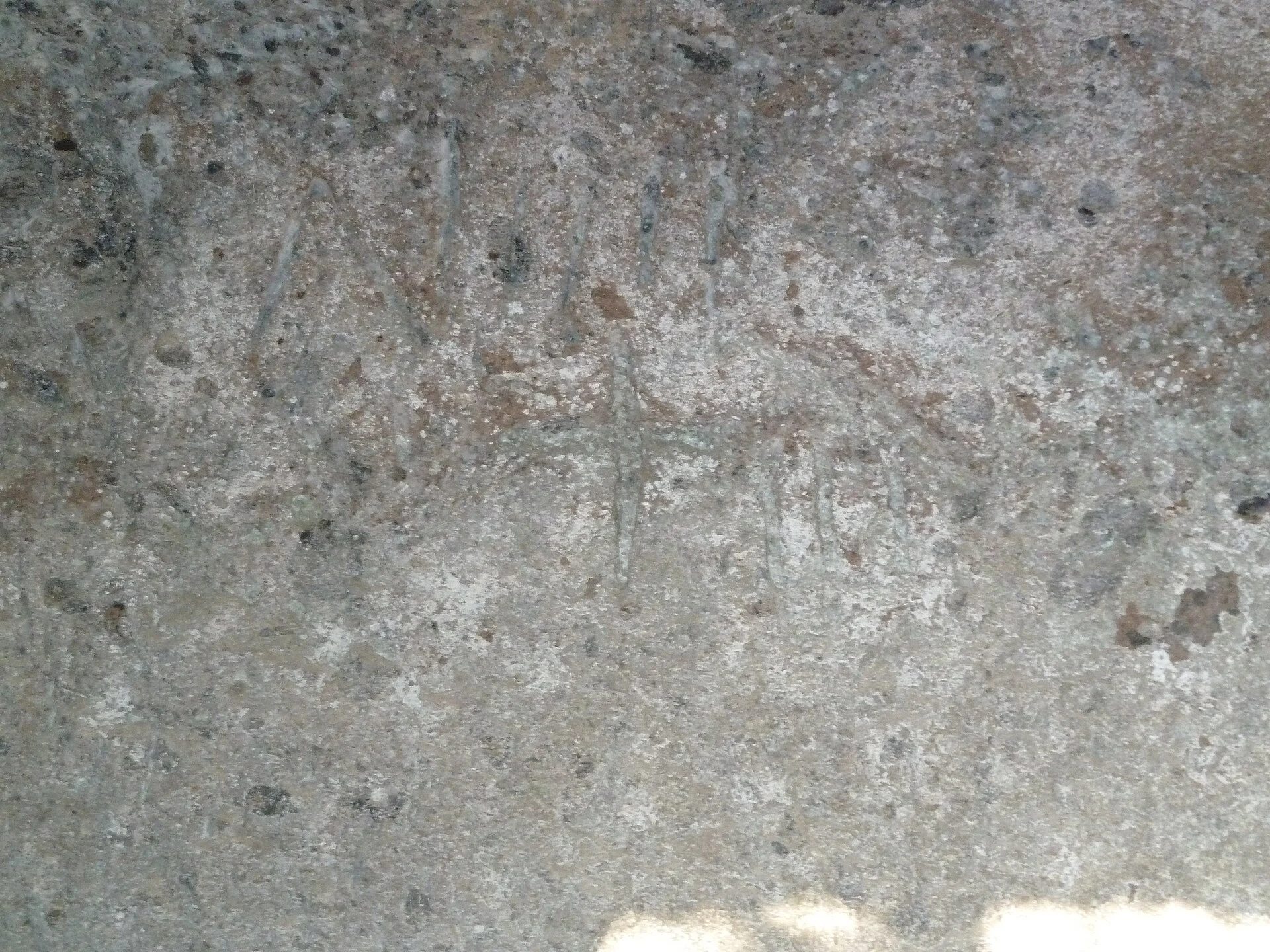
Castel d’Asso is the easiest Etruscan rock-cut necropolis to reach in the whole Tuscia: nine kilometers from Viterbo, a paved road up to a dirt parking area, free entrance, no gate and no hours. The cube-shaped facades carved in the tuff can be seen from the edge of the parking area, without walking. If you have half a day and a car, you arrive, look, go down into the gorge and come back up in two hours.
The comparison with the other rock-cut necropolises in the area is merciless from a practical point of view. At Norchia you walk quite a lot before seeing anything. At San Giuliano and at Blera the paths demand legs and a sense of direction. Here the ridge with the tombs starts a few steps from the parking area and the topography reads at a glance: plateau of the living on one side, cliff of the dead on the other, the stream in between.
The plateau in front of the tombs preserves the ruins of a medieval castle and, beneath, the remains of the Etruscan-Roman town that almost everyone calls Axia. That name needs some care, and further on in this page we explain why. Meanwhile the rule of the place applies: you arrive by car, you watch where you put your feet and you bring water, because on the cliff there is nothing.
Where Castel d’Asso is and how to get there
The archaeological area is reached from Via del Procoio, in the territory of the municipality of Viterbo, southwest of the historic center. The Ministry of Culture's listing of places indicates access from the Tuscanese provincial road with postal code 01010. From Piazza del Plebiscito it's about 20 minutes of driving, almost all outside the built-up area, with the last two kilometers on a narrow two-way road with no shoulder.
The most convenient reference for those driving with a navigator is the Terme dei Papi area, on the Strada dei Bagni. From there you continue along Strada Montarone and Via del Procoio. There is also the route via provincial road 15, called Strada Ponte del Diavolo. Both work, both end at a dirt parking area where cars are parked in no particular order. No lines, no numbered spaces: a clearing and that's it.
From Rome: train, bus and the missing piece
From Rome you reach Viterbo in two public ways. The regional train on line FL3 leaves from Roma Ostiense, Trastevere, San Pietro and Valle Aurelia and arrives at Viterbo Porta Fiorentina in about two hours, with a change sometimes needed. The Roma Nord railway, run by Cotral, leaves from Piazzale Flaminio and arrives at Viterbo Porta Romana with similar times and a less frequent service on holidays.
The problem starts after that. From Viterbo to the necropolis no public transport line, urban or intercity, appears to be published that goes to the parking area or to a walkable distance. The nine kilometers of countryside have to be covered by car, by taxi or by bicycle. Let's say it plainly: for Castel d’Asso you need a car, your own or rented, or a ride.
If you arrive by train and don't want to rent, there are two honest options. One is a taxi from the station, round trip agreed in advance, because nothing passes up there and the phone gets poor reception in some points of the gorge. The other is to combine the necropolis with a driving tour of the province, placing it between two stops: it works well fitted between Villa Lante at Bagnaia and Tuscania.
By bike, on foot and with groups
The bicycle is a real option for those with trained legs. From Viterbo it's nine kilometers with a modest but constant climb, on asphalt with low traffic outside rush hours. The final stretch has blind curves: keep your light on even during the day. In summer the route is exposed almost its whole length and at midday becomes an endurance test, not an outing.
With groups the real constraint is the bus. The parking area and the access road aren't sized for a 50-seat vehicle: the turning maneuver is complicated and in some conditions impossible. It's best to bring large groups here only with minibuses, warning the driver before leaving. Whoever organizes must check the vehicle, not take it for granted.
A curiosity about Castel d’Asso
The facades you see from the bottom of the ditch aren't entrances. They are false doors: a molded frame carved in the tuff, topped by a cornice, that imitates the front of a house and leads nowhere. The real burial chamber is below, carved lower down, and you entered it from a side corridor or from a stair cut into the rock, almost always invisible from afar.
The architectural game is deliberate. The Etruscan walking along the bottom of the ditch saw a row of stone houses lined up on the wall, with the door closed, and above the cornice the owner's name. The tomb became an address. On the lintel of the false door you can still read, in some cases after 25 centuries, the names of the families that had them carved.
The practical consequence for visitors is immediate: looking for the door where you see the door is a mistake. The real openings are the low holes, often clogged with earth and brambles, on the side of the block or at the base. In many tombs they are buried or closed by landslides, and this explains why an honest visit to Castel d’Asso is almost entirely external, not underground.
Why they're called cube tombs
The term describes the shape: a tuff parallelepiped isolated on three sides by the cutting of the rock, which stays attached to the wall only at the back. Seen from the front it's a cube, a die in fact, with the false door incised on the main face and a projecting cornice at the top. The type is characteristic of inland rock-cut Etruria and doesn't appear on the coast.
Next to the full cube there is the half-cube, where the block emerges only halfway, and the vestibule type, where in front of the facade a small carved space opens. The difference isn't only aesthetic: it changes the amount of rock removed, and therefore the cost. A necropolis like this can also be read as a ranking of expense sculpted in tuff, and the accounts almost always add up.
What you really see on the cliff
The most cited count speaks of about 60 monumental rock-cut tombs spread over three sectors of the ridge. The typological breakdown reported by the Treccani Enciclopedia dell'Arte Antica distinguishes 21 cube tombs, 28 cube tombs with a lower facade and 10 with a vestibule or with the lower facade only. Not all are equally readable: some have collapsed, others are covered by vegetation for much of the year.
The accepted chronology places the monumental phase between the fourth and the second century BC, with an occupation of the site going back at least to the sixth and sporadic reuse of the chambers until the middle of the first century AD. It means that the landscape you look at from the bottom of the ditch formed over about 200 years, not in a single moment, and that the oldest tombs live alongside the more recent ones.
The Tomba Grande
The Tomba Grande occupies the third sector and is the piece everybody photographs. Local sources date it to the third century BC and describe a tripartite interior that would have held at least 40 sarcophagi. Seen from outside it's a wide block with a double cornice and two false doors side by side, which gives the idea of a palace facade more than of a single house.
The judgment on the Tomba Grande, here, is less enthusiastic than what you read around. It's imposing, yes, but the truly instructive part of the necropolis is the medium-sized tombs of the first sector, where the cornice, the inscription and the access stair can all be read together in a few square meters. The Grande impresses and explains little. One photo and move on.
The Tomba Orioli and the tombs with a name
The Tomba Orioli is in the first sector and bears the name of the Viterbo scholar who surveyed the necropolis in the 19th century. The available descriptions speak of a chamber about 17 meters long with a very high number of burials, above 60. A figure like that describes a tomb used for a long time, by a large family group, not an individual burial.
On the lintels of other tombs you can read Etruscan family names: the Ceise, with a burial attributed to an Arnth Ceise, the Tetnie, a family also known at Vulci, and the Urinate Salvie. The inscription isn't always visible without raking light: some are reduced to traces, and if you arrive at midday with the sun high you risk walking past them without noticing.
The plateau and the castle
On the plateau facing the cliff, where the ancient settlement stood, the ruins of a medieval castle remain: stretches of wall, the base of a tower and the body of the keep. On the dating the sources diverge. Some local listings speak of a 12th-century structure occupied by Viterbo troops in 1187, others of a 15th-century building raised over the ruins of the Etruscan-Roman settlement.
When two sources diverge and neither is an excavation report, the honest thing is to say they diverge. The castle is probably the result of different overlapping phases, like almost all the castles of the Tuscia, and without an archaeological publication at hand you can't choose. If you're looking for a readable and well-preserved medieval layout, you'll find it better at Vitorchiano.
Something nobody tells you about Castel d’Asso
The signage on site is scarce and in some places absent. There is no mandatory route, no panels at each tomb, no ticket office where you can ask for a map. Whoever arrives without having read anything sees a ditch full of brambles with squared blocks in it, spends five minutes taking photos and leaves convinced it's not much. It happens often.
The second thing nobody writes is that the vegetation sets the timing. The area is looked after by volunteers, not by a paid crew: between one cleaning and the next, bramble and cane retake the ridge quickly, especially on the north-facing side. In late spring and in summer some facades are physically hidden by a green wall two meters high.
The third concerns the chambers. Entering the underground tombs isn't forbidden by a sign, but it's not a good idea: the dromoi are narrow, the tuff crumbles, and the floor in several places is covered by fill earth that hides steps and pits. Without a real flashlight and without someone who knows where to put their feet, the interior visit is done from outside.
The phone and the water
At the bottom of the ditch phone coverage drops and in some stretches disappears. Whoever goes alone must know this before, not after. On the parking area there are no drinking fountains, restrooms, bars, fuel pumps or trash bins. Water is brought from Viterbo and garbage is brought back. It seems obvious and yet the parking area after fine-weather weekends tells another story.
The ECA SUTHI inscriptions and the question of Axia
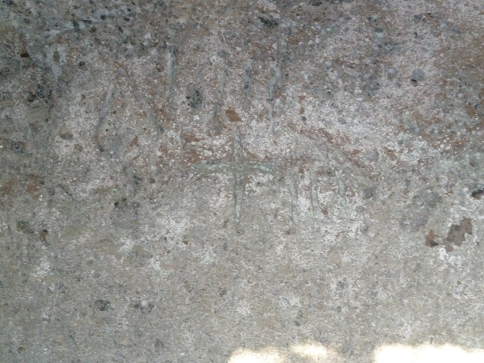
The inscriptions are the reason Castel d’Asso counts in Etruscological literature, not only in local tourism. According to the picture reported by Treccani, about one fifth of the tombs bear an inscription with the founder's name or the funerary formula, or both. A quarter of the tombs also bear numerals, with values in a range between 13 and 41.
The formula that appears is eca suthi, often followed by a third term that editions write nesl. On the first part there is wide agreement: suthi in Etruscan indicates the tomb, the sepulcher, and eca is a demonstrative. The current translation of the pair is therefore something like this tomb, this sepulcher. Up to here the ground is solid and the grammars agree.
On the third term the situation changes. The Treccani entry interprets it with explicit caution, proposing a meaning close to hereditary and noting that this is a probable reading, not an established fact. Other readings have been put forward in the Etruscological bibliography. Whoever guides a group here should put it this way: the formula almost certainly means this is the tomb, the rest is debated.
Why the numbers on the tombs
The numerals carved next to the formulas have received different explanations. The most discussed links them to the capacity or the number of places planned in the chamber, others read them as indications of measure or of the level of the cut in the rock. None of these hypotheses is definitively proven, and a popular listing that picked one and presented it as settled would do the reader a disservice.
Axia: what can be said and what can't
Cicero, in the oration Pro Caecina of 69 or 68 BC, cites a castellum called Axia in the territory of Tarquinia, tied to the landholding interests of the Cesennii family of Tarquinia. The identification of that castellum with the settlement on the Castel d’Asso plateau is widely accepted in the literature and the Ministry of Culture's listing presents it as established.
The delicate point is how it was reached. The name Axia was applied to this site by the Dominican Annio da Viterbo, who lived between 1432 and 1502, author of a series of epigraphic and historical forgeries that polluted the antiquarian studies of the Tuscia for centuries. That a proposal comes from Annio doesn't automatically make it false, but it requires checking on what independent grounds it rests.
Independent grounds exist and are of a topographic and onomastic type: the position compatible with the territory of Tarquinia, the presence of a fortified settlement of adequate rank, the continuity of the place name in the medieval form. What so far doesn't appear is an inscription found on site that writes the city's name. Without that, the identification remains very probable and not certified.
Whoever writes or tells about this site therefore has two correct options and one wrong one. Correct: say that the site is identified with Cicero's Axia according to a hypothesis accepted by most studies, or say that it's called Castel d’Asso and that the ancient name is almost surely Axia. Wrong: say that the Etruscans here called themselves that, period.
The advice I give you for visiting Castel d’Asso
Arrive early in the morning, between 8:00 and 10:00, from October to April. The low morning light enters the ditch from the east and brings out the cornices and the inscriptions on the tuff, which at midday flatten out and disappear. Between May and September the same time slot serves another purpose: avoiding the heat on a cliff with no shade and no water.
Allow two hours and not 40 minutes. The necropolis extends over a few hundred linear meters, but the three sectors are reached with ups and downs on packed earth and the useful part of the visit is the close reading of the facades. Whoever rushes sees six blocks of tuff. Whoever stops sees a sculpted social hierarchy, with the big tombs at the top and the small ones stepping down.
The right order of stops
Start from the parking area, go down into the ditch right away and walk it uphill keeping the cliff on your right. Go up to the plateau and the castle only at the end, when you've already understood what the inhabitants of the settlement were looking at from above. Done the other way around, the tour loses its sense: the castle becomes an ordinary ruin and the tombs a row of rocks.
If you have a whole day, do well to combine. The combination that works best, for distances and for contrast, is the necropolis in the morning and free hot springs in the afternoon. Alternatively you can go up to San Martino al Cimino for the 17th-century village, or head toward Lake Vico for the late afternoon.
What to bring
Closed shoes with a lugged sole, always. A hand flashlight or headlamp even if you don't go in anywhere, because it serves to light the inscriptions under the cornices from the side. Water, at least one liter per person in summer. Long pants from April onward, for the brambles and for the ticks, which in this countryside really exist and are not a textbook detail.
A light pair of binoculars changes the visit more than it seems. Many facades are looked at from below at 20 or 30 meters' distance and the moldings, the ledges, the traces of letters are lost to the naked eye. A pair of binoculars passed from hand to hand keeps people awake better than 10 minutes of explanation.
Hours, entrance, management: how access works
Entrance to the archaeological area is free and there is no ticket office. The site is open, without a continuous perimeter fence and accessible at any time, with the obvious limit of daylight hours. Local sources and the municipal tourism portal state it openly: the visit is free. No institutional booking portal manages this place, and you shouldn't invent one.
Care of the area has been entrusted since December 2011 to the Archeotuscia association, a volunteer organization based in Viterbo in the former church of the Almadiani, at Piazza dei Caduti. The volunteers handle maintenance, clearing of vegetation and visits by appointment, and the same group looks after the Ferento area. The contacts published on the association's website are the numbers 339 2716872 and 328 7750233 and the mailbox archeotuscia@gmail.com.
Archaeological protection falls to the Soprintendenza Archeologia, Belle Arti e Paesaggio per la provincia di Viterbo e per l’Etruria meridionale. On the ministry's portal of cultural sites the site's listing gives the access address from the Tuscanese provincial road and publishes no opening hours, consistent with the fact that there are none.
What free means, here
Free means nobody sells a ticket, not that the place maintains itself. The difference between a decent visit and an excursion through brambles depends on when the last crew of volunteers with brush cutters came through. Anyone who cares about the necropolis and goes often can join the association or take part in the cleaning days, which are announced from time to time.
For an accompanied visit there is only one way: contact in advance the association that looks after the area, or a licensed tour guide for the province. There is no welcome service on site, no office to show up at the same morning. Anyone expecting the model of a fenced archaeological park with a bookshop is in the wrong place, and disappointment is guaranteed.
Accessibility
The area is not accessible to people using a wheelchair and not even to those who walk with difficulty. The parking area is dirt, the descent into the ditch is on earth and rock with irregular natural steps, the paths have no handrails or stabilized surface. Institutional sources declare no accessible route and on site there appears to be no dedicated equipment.
A part of the necropolis, however, can be seen from above. From the edge of the parking area and from the rim of the plateau you see several facades of the central sector without going down, and with binoculars the view is decent. For those who can't tackle the ditch this is an honest partial solution, which is better said beforehand than discovered on arrival.
Another well-known fact, yet rarely cited
Everybody knows that the objects found in the tombs are no longer here. Less known is where they ended up. The excavations carried out in the necropolis in the 1960s, accompanied by surface surveys, produced materials that were scattered along several paths, and a collection of finds from this site made its way to the Royal Ontario Museum in Toronto.
The dispersal didn't begin in the 1960s. It began in the 19th century, when the necropolises of the Tuscia were opened with antiquarian criteria and the grave goods took the road to the market and to private European collections. It's the same story that concerns much of inland Etruria, and anyone who wants to see the context put back together finds it at the National Etruscan Museum of Villa Giulia.
The consequence for the visit is structural. At Castel d’Asso you see the architecture and not the grave goods: no sarcophagus in place, no urn, no vase. Anyone who wants to close the circle has to add a stop at a museum, in town or in Rome. The Museum of Etruscan and Italic Antiquities of Sapienza is the less-visited Roman alternative.
The relationship with Norchia and the other rock-cut necropolises
Castel d’Asso belongs to a compact group of rock-cut necropolises of inland Etruria that includes Norchia, San Giuliano in the territory of Barbarano Romano, the tombs of Blera and the complexes of the Parco Marturanum. The architectural language is shared, the differences are in scale, state of preservation and above all in the effort of getting there.
The ranking, in our judgment, is this. For pure monumentality Norchia wins. For readability and convenience Castel d’Asso wins, without discussion. For landscape and silence San Giuliano wins. Anyone with one day only who isn't used to walking on uneven ground should come here, and not be talked out of it by those who downplay it.
The Bagnaccio and the free hot springs a few minutes away
The pairing that makes the day is the one with the thermal waters that gush out in the countryside north of Viterbo. The Bagnaccio is along the route of Via Francigena, on private property, and is run by the social promotion association that bears the same name as the place. From the necropolis you cross the city or skirt around it: it's about 20 minutes by car.
The information published by the association on its website indicates five pools fed by sulfurous water, with the spring at around 60 degrees and the pools at decreasing temperatures. One pool is cold water. Access to some pools is reserved for those over 14, with a single pool also open to younger children, and the rule is posted on site.
Hours and contributions
The summer schedule, from April 1 to October 31, is from 10:00 to 22:00 every day. The winter schedule, from November 1 to March 31, is from 10:00 to 20:00 Monday through Thursday and from 10:00 to 21:00 Friday through Sunday. The association's site is bagnaccio.it and publishes seasonal updates.
On admission the formula is particular and needs to be understood. For the occasional visitor access is free, with a voluntary contribution left at one's discretion. Regulars take out an annual membership card, listed at €45 from age 6 up, with a declared exemption for people with 100 percent disability who have documentation. The camper parking area requires a reservation.
The zero-cost alternative
Anyone who wants no card and no contribution has the other historic option in the area, the Piscine Carletti, free and without association management. The comparison is clear-cut: at the Bagnaccio you find order, declared daily cleaning and rules, at the Carletti you find absolute freedom with everything that comes with it, including night hours and a very mixed crowd.
The practical suggestion, if you come from Rome for the day, is hot springs after and not before. After two hours among the ruins and the tuff, hot water makes sense. Before, it loosens your legs and takes away the will to walk. Bring an old towel and flip-flops: sulfurous water permanently stains light fabrics and the smell stays on you for hours.
The right photo to take at Castel d’Asso
The photograph that tells this place isn't the close-up of the facade. It's the framing from the bottom of the ditch, with the lens pointed upward along the ridge, which holds three or four tombs lined up and above them the rim of the plateau. It serves to show the thing that matters: a rock wall turned into a street of houses.
The right time is the first hour of a winter morning, when the low sun enters the ditch from the side. The side light sculpts the cornices, brings out the moldings and makes legible the letters on the lintels, which with the sun at its zenith become invisible. In summer the same condition is found only in the last half hour before sunset, with the problem of having to climb back up in the dark.
The two framings almost everybody gets wrong
The first is the wide angle from the parking area that takes everything in. It doesn't work: the cliff flattens, the tombs become blotches and the result looks like an abandoned quarry. Better a normal lens or a short telephoto, getting closer and choosing three subjects instead of 20. Tuff looks good only when you can see the grain of the stone.
The second is the photo of the frontal false door, centered and symmetrical. It gives back a flat surface and removes the architectural information, that is, the fact that the block is detached from the wall on three sides. Moving 40 degrees to the side you see the edge, the cut flank and the depth: the same tomb becomes understandable to anyone looking at the photo afterward.
The detail not to miss
The detail worth the photographic trip is the inscription on the lintel, shot with raking light and without flash. Frontal flash flattens the incisions and erases them. With a flashlight held to the side by a companion, even a recent phone gives back legible letters. It's the cheapest way to take home something you won't find on postcards.
Anyone looking for the wide landscape finds it by going back up onto the plateau toward the castle, looking back toward the cliff with the Viterbo countryside in the background. On clear January days you can see the Cimini hills. The same exercise works on other heights in the province, from the cone of Soriano nel Cimino to the ridges above Ronciglione.
Some important events that happened here in history
The first documentable event isn't an episode but a process: the building of the monumental necropolis between the fourth and the second century BC. In that period the families of the settlement on the plateau decided to spend on carved funerary architecture, with a language common to the whole of inland rock-cut Etruria, and the ditch took the shape you see today.
The second is the Ciceronian citation. In the trial in defense of Aulus Caecina, held in Rome toward the end of the 60s BC, the castellum of Axia appears in the territory of Tarquinia, tied to the landholdings of the Cesennii family. It's the moment when this strip of countryside enters a Roman judicial oration, as the backdrop to a dispute over a property.
The Middle Ages and the Viterbo contest
On the plateau a castle rose in the medieval period, now reduced to ruins. Local sources link the site to the military events of the Viterbo territory and report an occupation by the city's troops in 1187. On the dating of the structure, as we said, the available listings don't agree, and in the absence of a published excavation report it's best to record the uncertainty.
The story isn't isolated. Between the 12th and the 14th century Viterbo extended control over the castles of its surrounding territory with a series of submissions and destructions that left emptied villages throughout the province. Anyone who wants to see what remains of a truly abandoned settlement can go to Celleno or to Chia.
1817 and the rediscovery
In 1817 the Viterbo scholar Francesco Orioli surveyed and described the necropolis, starting the modern knowledge of the site. Orioli himself is tied to the rediscovery of Norchia. His name remains attached to the tomb of the first sector, and that date marks the passage of the place from the condition of countryside with squared stones to that of a monument recognized by scholarship.
From there begins the 19th century of antiquarian excavations, with the grave goods taking the road to collections. In the 20th century the systematic campaigns arrive: in the 1960s surface surveys and wide excavations in the necropolis, and in 1970 the monograph by Emiliozzi Colonna Di Paolo and Giovanni Colonna, followed in 1978 by the second volume, which remains the reference on this site.
Later studies
The bibliography cited by the Treccani encyclopedia entry includes, besides the two volumes by Colonna Di Paolo and Colonna, Stephan Steingräber's 1981 work on rock-cut funerary architecture and John Peter Oleson's 1982 study of Etruscan sepulchral architecture. These are reference titles, not beach books, but anyone who wants to check the claims of this page knows where to look.
Who has passed through Castel d’Asso
The most cited illustrious visitor is George Dennis, the Englishman who traveled through Etruria in the mid-19th century and wrote the account that is still read today. In front of these facades he used a comparison that has stuck: the Egyptian pyramids. It's a Victorian hyperbole, and those who arrive expecting Giza are left puzzled, but it says how much the site impressed an eye used to classical antiquities.
Before him had come Annio da Viterbo, the Dominican who lived in the 15th century and who gave ancient names to this territory with a generosity that later studies have had to take apart piece by piece. The name Axia applied to this place comes from him. His shadow over the historiography of the Tuscia is long and reaches the captions of today's tourist sites.
The archaeologists
Francesco Orioli in 1817 is the first modern surveyor. Luigi Canina, an architect and topographer active in the first half of the 19th century, included the rock-cut necropolises of inland Etruria in his documentation work. In the 20th century the names that matter are Emiliozzi Colonna Di Paolo and Giovanni Colonna, authors of the two-volume monograph that remains the basis of any serious discussion of this necropolis.
Then there are those with no name on the covers. The volunteers who since 2011 have kept this place open and walkable are the only reason a visitor today can walk in the ditch instead of looking at it from afar. They almost never appear in tourist listings. In a page that claims to be useful, though, they deserve a line.
Today's passersby
On the route of Via Francigena, which comes down toward Viterbo and continues toward Rome, thousands of walkers pass every year. The necropolis lies a few kilometers off the official route and almost nobody detours. Anyone walking the Lazio stages of the Francigena and has a rest day in Viterbo has here the best possible detour.
Season, footwear and safety
The good season runs from October to April. There are three reasons: the low vegetation that lets you see the facades, the raking light that lasts all day, the absence of heat on a cliff with no shade. The very best months are November, February and March, with the reservation of rainy days, when the bottom of the ditch becomes slippery mud and wet tuff is treacherous.
Summer is the worst season and not by a small margin. Between June and September bramble and cane cover part of the ridge, the sun beats down from 10:00 to 18:00 without a single useful tree, and the vipers in the Viterbo countryside are not a legend. Anyone going in August at midday sees less, sweats more and takes needless risks.
Footwear
Low or high trekking shoes, with a lugged sole. Not smooth sneakers, not sandals, not city shoes with a leather sole. The ground alternates packed earth, outcropping rock polished by passage, roots and natural steps of irregular height. Dry tuff grips well, damp tuff is like soap and falls almost always happen going down.
Anyone who arrives with the wrong shoes has only one sensible strategy: stay up high, on the parking area and the rim of the plateau, and look at the tombs from the edge with binoculars. It's a halved visit but a safe one. Attempting the descent with smooth soles in a gorge without full phone coverage is the classic way to turn an outing into an evening in the emergency room.
Real safety, not bureaucratic
There are no railings on the rim of the plateau and in some places the drop is several meters. With children you need a held hand, no discussion. The underground chambers, where open, have unstable ceilings and floors covered with earth that hides pits and steps: the rule is that nobody goes in, and the explanation is given from outside.
Last point, the car. The parking area is isolated and unattended. Bags, backpacks and photo gear left in view are an invitation. Take them with you or put them in the trunk before arriving, not in front of the spot. It applies here as in all the open archaeological areas of Lazio, from Cerveteri to Sutri.
The contrarian position: leave it as it is
Every time Castel d’Asso comes up, the refrain of enhancement starts: fence, ticket office, panels, equipped route, maybe a walkway. The position here is the opposite, even if in the minority among those who work in tourism. This place is worth exactly what it is, an open archaeological site where you enter at your own risk and look without mediation.
The fenced park model works where the numbers justify it and where there is material to protect on site. Here the grave goods have been gone for 150 years, the facades are living rock that keeps better ventilated than caged, and the visitors on a winter weekday can be counted on the fingers. A ticket office would cost more than it would bring in.
Then there is a reason of experience. Walking alone at the bottom of a ditch, with the facades appearing among the brambles and nobody around, is the one thing this site offers that the Banditaccia or the Monterozzi can no longer offer. Putting turnstiles and a mandatory route there means switching off the only thing that works.
What is needed instead is regular, funded maintenance: brush clearing three times a year, consolidation of the stretches of wall at risk, minimal signage at the start of the road and a well-made downloadable map. It costs a fraction of an equipped park and solves 90 percent of the real problems. Whoever asks for the fence usually has never gone down into the ditch.
The second unpopular opinion
Castel d’Asso is not a stop for everyone and shouldn't be sold as one. People traveling with small children, people with mobility problems, people looking for the packaged experience with an audio guide and a coffee at the exit won't find anything here and do well to go elsewhere: Palazzo Farnese in Caprarola or the Monster Park of Bomarzo give that public much more satisfaction.
What to put around the necropolis
A well-built day puts Castel d’Asso in the morning and a second substantial thing in the afternoon. The choice depends on the season and the group. In winter it's best to end indoors, so the historic center of Viterbo with the medieval San Pellegrino quarter. In summer it's best to end in the water, so free hot springs or a beach on Lake Bolsena.
Anyone with two days has the whole province at their disposal. On the lake axis, Bolsena works for the basilica and the castle, Montefiascone for the fortress and the panorama, Marta for the harbor and Capodimonte for the promontory. Distances are short, half an hour by car between one point and the next.
Toward the west the theme stays archaeological and the landscape changes. The Tuscania nature reserve and the Romanesque churches of the town make a full half day. Those who want to continue along the Etruscan thread go down to Bagni di Sant’Agostino, where the free hot springs sit next to an archaeological setting, with water less organized than the Viterbo kind.
Toward the north the province becomes harsher. Farnese and Valentano open onto the Selva del Lamone and the upper Tuscia, with slow roads and few services. Civita di Bagnoregio is the exact opposite of Castel d’Asso for crowding and for ticket, and you need to know that before putting it on the same day.
Toward Rome the return trip can become a stop. On the Cassia axis you meet Sutri with its amphitheater carved in the tuff and Nepi with its gorges. On the Flaminia axis you pass through Civita Castellana, Calcata and, farther north, Orte.
A note on the calendar. The first weekend of September Viterbo is another city because of the transport of the Macchina di Santa Rosa: hotels full, streets closed, impossible traffic. For a quiet trip to the necropolis that weekend should be avoided, or you accept that the day revolves around the festival and not around the Etruscans.
Eating in the area
On the road to the necropolis there is nowhere to eat. No restaurants, kiosks, fuel pumps or fountains: you go back toward Viterbo or bring lunch from home and eat it on the plateau, carrying your trash back. The sandwich bought in town before leaving remains the most sensible solution for those visiting early in the morning.
When you're back in town it's worth knowing how to recognize the places that live off passing trade. The first sign is the menu with photographs of the dishes displayed on the sidewalk, often translated into five languages: no kitchen worth its name needs to show the picture of a carbonara to sell it. The second sign is the person at the door inviting you to sit.
The third sign is the lady rolling out the pasta sheet behind the glass or on the sidewalk. It's scenery, not a guarantee: in many cases the displayed pasta and the served pasta have no relation, and the display serves to stop passersby. The fourth is the kitchen open from morning to night without a break, which is the simplest way of saying that the dishes aren't cooked to order.
The fifth concerns the price and is found above all in front of monuments and in the most trodden squares, in Viterbo as elsewhere. Items with no price on the menu, quantities decided by eye, different price lists between the outdoor table and the dining room: these are the mechanisms by which the bill adjusts to who is paying. The cover charge and the service charge should be read before sitting down, not after.
On the repeated signs found in historic centers the discussion is different and without snobbery. Those chains work like attractions: you go in because you know the name, you pay a predictable sum, you eat a predictable thing. There is nothing scandalous. Simply, residents don't go there, and anyone traveling to eat well has little to gain from them.
The criterion is only one and requires no apps or reviews. You look at who is sitting and in what language they order. If at two in the afternoon inside there are local people talking to each other in Italian and ordering without looking at the menu, you go in. If there are only passing tables, you walk another 200 meters.
For those who want an already filtered starting point, the selection of addresses I keep updated can be consulted here: the list on Google Maps. It remains a starting point, not an oracle: managements change, cooks move around and a place that was good three years ago can today have become a trap.
Frequently asked questions
Do you pay a ticket to enter Castel d’Asso?
No. Entrance to the archaeological area is free and there is no ticket office. The site isn't continuously fenced and is freely accessed from the dirt parking area at the end of Via del Procoio. No institutional booking portal manages this place, so anyone who finds a ticket for sale online is buying an accompaniment service, not access.
What are the opening hours?
There are no published hours, because there is no opening and closing. The listing on the ministry's portal of cultural sites reports no hours. The real limit is daylight: in the ditch darkness arrives earlier than on the plateau, and in winter from 16:00 on the visit becomes pointless because the facades can no longer be read.
Do you absolutely need a car?
Yes, or an equivalent vehicle. From Viterbo to the necropolis no useful public transport line appears to be published, and the nine kilometers of countryside have to be covered by car, taxi or bicycle. Anyone arriving by train at Viterbo Porta Fiorentina or Porta Romana must arrange the last stretch in advance, because on site nothing passes.
Who runs the area and who do you contact for a guided visit?
Care of the area has been entrusted since December 2011 to the volunteer association Archeotuscia, based in Viterbo in the former church of the Almadiani at Piazza dei Caduti, which also looks after Ferento. The contacts published on the association's website are the numbers 339 2716872 and 328 7750233 and the mailbox archeotuscia@gmail.com. Protection falls to the Soprintendenza for the province of Viterbo and southern Etruria.
Can you go inside the tombs?
Physically in some cases yes, but it's discouraged. The access corridors are narrow and partly buried, the tuff crumbles, the floor of the chambers is covered by fill earth that hides steps and pits. With groups the rule is that nobody goes in. Anyone going alone should consider that in the ditch the phone has no signal in several spots.
How much time does the visit need?
Two hours for a real visit, including the descent into the ditch, the walk along the three sectors of the ridge, the climb back to the plateau and the tour of the castle ruins. In 40 minutes you see four facades and leave without having understood the topography of the site, which is the thing that makes this place instructive.
Can you really see the inscriptions?
Some yes, others are reduced to traces. Light makes the difference: with the raking sun of early morning or late afternoon the letters carved on the lintels emerge, with the sun high they vanish. A flashlight held to the side helps a lot. Names like Ceise and Tetnie are among those reported by descriptions of the site.
Is it suitable for children?
It depends on age and on who is accompanying. There are no railings on the rim of the plateau and the drops are several meters, so with little ones you need a constantly held hand. For kids from 10 years up, with the right explanation of the false doors and the inscriptions, it works better than many museums, because you walk and discover.
Is it worth combining with the Bagnaccio hot springs?
Yes, and it's the pairing I recommend most often. The Bagnaccio is in the countryside north of Viterbo, on private property, run by the association of the same name, with a summer schedule from 10:00 to 22:00 from April 1 to October 31 and a reduced winter schedule. For the occasional visitor access is free with a voluntary contribution, while those who go often take out the annual membership card.
Who wrote this page
The information published here comes from the team at Tour Leader Pro, the Rome-based organization that designs itineraries, visits and cultural events in Rome and Lazio. Hours, contributions and access conditions reported on this page were checked on September 28, 2026 against the institutional and association sources cited in the text. It's worth rechecking them before you go, because in the province they change without notice.
Building a day outside Rome means making things fit that don't naturally go together: regional trains with low frequencies, archaeological sites without staff, volunteer associations that answer the phone at variable hours, country roads that navigators underestimate and distances that look short on paper. Anyone planning for themselves or for a group finds working tools and materials at Tour Leader Pro.
For the general picture on rail and road connections, car rentals, airports and destinations in Lazio outside central Rome, from the Tuscia to the lakes to the Tyrrhenian coast, a useful resource in the planning phase is Italy Planner, which treats Italy from the point of view of someone who has to get around and not only of someone who has to read.