Barbarano Romano (VT)
In short. You reach Barbarano Romano (VT) by car along Via Cassia and then on the provincial roads of the lower Tuscia, or by Cotral buses, which connect the town with Rome, with Viterbo and with Civitavecchia: schedules change with the season…
You reach Barbarano Romano (VT) by car along Via Cassia and then on the provincial roads of the lower Tuscia, or by Cotral buses, which connect the town with Rome, with Viterbo and with Civitavecchia: schedules change with the season and should be checked on the carrier's official website or at the toll-free number 800 174 471. The provincial capital, Viterbo, is about 30 kilometers away. The visitor center of the Marturanum Regional Park and the Francesco Spallone Natural History Museum are at Viale IV Novembre 46-48, open Monday to Friday and on Saturday and Sunday from 9:00 to 13:00, outside those hours you enter by reservation, and admission is free. The numbers are 0761 414507 and 324 8679585, the email is parcomarturanum@regione.lazio.it. The Civic Archaeological Museum of the Rock-Cut Necropolises is at Via Sant'Angelo 2, phone 0761 414531. The Etruscan necropolis of San Giuliano, inside the park, has no ticket office: you enter from the trails, with the right shoes. Anyone arriving for the day parks outside the walls and walks: the village is a few hundred meters long and can only be toured on foot.
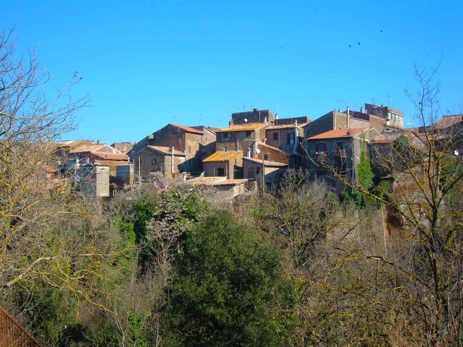
The town stands on a wedge-shaped tuff shelf, bounded by the confluence of two short tributaries of the Biedano stream. Below the houses the reddish tuff drops for tens of meters into the gorges, and that difference in level decided everything: where they built, where they dug, where the Etruscans' dead ended up. Fewer than a thousand residents today, 985 in the 2024 count, in a municipality whose territory coincides almost entirely with a regional protected area. Anyone looking for a Lazio village left off the mass routes, with one of the most extraordinary Etruscan necropolises in existence inside it, has found the right address.
The network of trails and archaeological sites in this area is also described on the page of Marturanum Park, which is the natural container within which Barbarano Romano (VT) lives.

Where Barbarano Romano (VT) is and how to get there
Geography counts for more than bureaucracy here. Barbarano Romano (VT) has belonged to the province of Viterbo since 1927, but until that year it was in the province of Rome, and the name itself remembers it: the town was simply called Barbarano and added the adjective Romano in 1872. On a map you find it in the strip of land between the Cimino-Vico volcanic district, to the northeast, and the Tolfa Mountains, to the southwest: a middle land, of tuff and pastures, which the classic Tuscia itineraries cross without stopping.
By car to Barbarano Romano (VT)
The main road link is provincial road 42, which points toward Monte Romano. Coming from the south you go up along the Cassia route and leave the main road fairly early: the last kilometers are narrow provincial roads, with bends, low walls and tractors. It's not a defect, it's the reason the landscape is still what it is. A practical tip: don't trust the navigator blindly for the necropolis access points, because some directions lead onto dirt tracks that a low car can't handle. Better to aim for the town, park, and from there choose the entrance on foot.
By bus to Barbarano Romano (VT)
The service is run by Cotral, which declares connections with Rome, Viterbo, Civitavecchia and other places in the area. Runs are few and differ between weekdays, Saturdays and holidays: anyone without a car has to build the day around the bus schedule, not the other way around. Timetable searches are done from the dedicated section of the Cotral website, entering departure and arrival stops. For routes with a transfer there is a dedicated function. The toll-free number is 800 174 471.
The railway that no longer exists
In the municipal territory there were two stations on the Orte-Capranica-Civitavecchia line. The line has been closed since 1961. It's one of those scars that explain more than one chapter of local history: within a few years a town connected to the sea and the hinterland by a track found itself dependent on the car. Anyone who gets around by public transport still feels it today. Those who love walking, on the other hand, have gained something: the old railway bed and the dirt roads of the area have become hiking terrain, and the town has reorganized around the trails.
The walled village of Barbarano Romano (VT)
Barbarano is an open-air manual of medieval urban planning, the kind you read by walking. The town consists of a first core probably dating to the 10th century, to which buildings were added from the 13th to the 17th century. The layout is the herringbone one: a main street in the center, two secondary parallel ones on the sides, and the transverse alleys that descend toward the walls. The settlement is stretched out on the tuff wedge between the two gorges and closed, in the only stretch not defended by nature, by the walls. The result is a compact, clean, quiet historic center, without the traffic that ruins so many neighboring villages.
Porta Romana and the tower with the clock
The monumental entrance is Porta Romana, from the 15th century, once equipped with a drawbridge. The tower that supports it has housed a clock since 1863, which is the detail everyone photographs without knowing how old it is. From Porta Romana the descent toward the Biedano gorge also begins: you pass through the gate and in a few minutes you're inside a tuff canyon with dense vegetation, walls tens of meters high and small waterfalls. The passage from the paving to the shade of the gorge is abrupt, and for a visitor arriving from Rome it's the best surprise of the day.
The two circuits of walls of Barbarano Romano (VT)
Over the centuries Barbarano has had two distinct circuits of walls. Few traces remain of the older one, mostly because of the collapses of the 1930s, which led to the disappearance of the battlemented Ognissanti gate and the tower known as the tower of King Desiderius. Of the outer circuit, on the other hand, important stretches remain: square towers open at the back, datable to the 14th century, lined toward the end of the 15th century by a second curtain wall with the addition of round towers. The sequence is readable with the naked eye, and it's a lesson in military history: the square towers served against missile weapons, the round ones against gunpowder artillery, which in the 15th century had changed the rules of sieges.
The Castello, the town hall and the tower of King Desiderius
The oldest part of the town bears the name Castello. It was defended by a circuit of walls, the oldest of those of Barbarano, on whose remains the town hall is partly built, which was the Palazzo dei Priori. Above the complex stood a tower with a pentagonal plan, almost at the end of the main street, Via Vittorio Emanuele. Local tradition links it to Desiderius, last king of the Lombards, who around 771 was fortifying Viterbo and the neighboring villages against the Franks of Charlemagne. In 1930 the tower collapsed disastrously, and with it part of the walls and of the priors' palace. It's the fact that explains why the silhouette of Barbarano today is low and lacks a real vertical sign: a piece is missing, and it fell less than a century ago.
The three parallel streets and the outer staircases
Walking along the three parallel streets you notice something that repeats in the Tuscia and is particularly consistent here: the traditional homes have the outer staircase, the so-called profferlo, built of the same reddish tuff as the walls. It served to separate the ground floor, which was stable or storeroom, from the dwelling proper on the upper floor. The alleys are often decorated with flowers and with arte povera installations of rural taste: you like it or you don't, but it's the sign of a lived-in town, not a stage set. Anyone looking for the clean shot finds it at dawn, when the streets are empty and the light comes in low from the east.
Palazzo Mastini
A short distance from the center stands Palazzo Mastini, a work of the 16th-17th century, restored in recent times and now municipally owned. It's the building that says better than any other how Barbarano, in the modern age, was not a village of shepherds but a center with families of rank, statutes, offices. Its use changes over time and public openings follow the calendar of municipal initiatives: anyone who wants to visit it should ask at the town hall or at the park visitor center before heading up.

The churches of Barbarano Romano (VT)
Four religious buildings tell four different phases of the town's life, and it's worth seeing them in chronological rather than geographic order. Opening times don't follow a museum schedule: the parish church is the one most easily found open, the others depend on services and local initiatives. Anyone who wants to get into all of them should ask at the parish or at the park visitor center.
The collegiate church of Santa Maria Assunta
It's the parish church, already existing at the end of the 11th century, rebuilt and reworked several times, above all during the 18th century. At the entrance an original marble plaque of 1280 indicates that the church was built in that year: the date falls during a vacancy of the papacy, the one that followed the death of Nicholas III Orsini, and this says how capable the community of Barbarano was of deciding for itself even in the absence of a pontiff. The interior is layered: beneath the 18th-century forms older works remain, and the most cited is the 14th-century fresco of the Madonna nursing the Child Jesus with Saints John and Anthony Abbot. The Madonna of the Milk is a theme that recurs often in the Tuscia and that the Council of Trent would later view with suspicion: finding a survivor, in a village collegiate church, is a small stroke of luck for anyone who travels with open eyes. The blunt advice: go in with a phone flashlight and look at the margins of the fresco, not just the central figure.
The church of the Crocifisso
Built probably between the 12th and 13th centuries, it is documented for the first time in 1573. The plan is a single nave with two side chapels, and inside is kept a notable wooden crucifix from the 16th century. The correct name is Crocifisso, and it's worth remembering because different spellings circulate in the signage and the guides. It stands among the decorated alleys of the village, and its scale of values is the right one for understanding Barbarano: no declared masterpiece, a lot of continuity of use, a wooden artifact that has crossed five centuries in the same setting for which it was made.
The Sant'Angelo complex
An old block that originally also included a cemetery. The church, now deconsecrated, arose at the end of the 13th century and is flanked by the former rectory, the parish priest's residence, whose facade forms a single whole with that of the church. In some rooms of the complex the Civic Archaeological Museum of the Rock-Cut Necropolises is now housed. The overlap is perfect and almost nobody notices it: a medieval church built over a tuff hill dug out by the Etruscans now houses the grave goods pulled out of those tombs. The whole history of the place fits into a single block.
The church of Santa Maria del Piano
An old church of the 13th century, rebuilt in the second half of the 16th. During restorations in recent decades many frescoes were brought to light. The place name says the rest: del Piano, that is, outside the cliff, on the good ground. The churches of the plain, in this territory, are often older than those inside the walls, because the population perched itself up only when the plain became unsafe. Looking at Santa Maria del Piano with this reversed chronology in mind makes the walk much more interesting.
The Civic Archaeological Museum of the Rock-Cut Necropolises
Everyone says it's a small museum, and it is: two rooms in the Sant'Angelo complex, at Via Sant'Angelo 2. But it's also the place without which the San Giuliano necropolis remains a nice wood full of holes in the tuff. The museum is run by the Barbarano Cultura association, which also looks after a small attached library. The phone number is 0761 414531. Hours vary with the season and the availability of the volunteers: anyone who arrives without calling first risks finding it closed, and it's the most common mistake among Sunday visitors.
The two sections of the Barbarano Romano (VT) museum
The layout is clear and in two parts. The first section displays the finds from the excavation campaigns carried out in the territory around the village, in particular in the rock-cut necropolises of San Giuliano. The second widens the view and documents the phenomenon of rock-cut necropolises across the whole province of Viterbo, with their historical and architectural context. It's an approach worth double: you leave knowing not only what is at Barbarano, but why across this whole strip of inland Etruria the dead were buried in facades carved into the tuff instead of under a mound of earth.
The grave goods of the Cima tomb
The highlight is the Attic black-figure vases of Greek provenance from the grave goods of the Cima tomb. It's worth stopping: those vases came here from Attica in the 6th century BC, through the Tyrrhenian ports and the roads of the interior, to end up inside the tomb of a family of a center that today doesn't appear in any school textbook. It's the material proof that Marturanum was inside the Mediterranean trade circuit, not on its margins. If I had to point to a single object to look at carefully in the whole town, I would point to these.

The Marturanum Regional Park
The Marturanum Regional Natural Park was established by regional law no. 41 of July 17, 1984 and protects 1,240 hectares lying entirely within the municipal territory of Barbarano Romano. Management is entrusted to the municipality itself. The contacts of the body are the number 0761 414507 and the address parcomarturanum@regione.lazio.it. This is an administrative detail with concrete consequences for the visitor: the park is not a facility with a ticket office and turnstiles, but an open territory, with marked trails and a visitor center. You enter for free and behave accordingly.
What the Marturanum really protects
The formula that best describes this area is that of a set of gorges carved by watercourses into flat tuff plateaus, surrounded by rolling hills covered with woods and pastures. The park sits between the Cimino-Vico volcanic district and the Tolfa Mountains, and the dominant rock is banks of reddish tuff with the typical dark scoriae. This geology explains why the Etruscans chose precisely this place: tuff is dug with simple tools, holds its shape, and lets you carve architectural facades in negative. No other material in Lazio allows the same work.
The gorges of the Biedano and the Vesca
The northern sector of the park, that of the valleys, is the most spectacular part. The Biedano and the Vesca have cut the plateau to create deep, damp, shady gorges, where the summer temperature drops by several degrees compared with the plateau above. It's a microclimate, not a figure of speech: beech trees grow in the gorges between 200 and 300 meters of elevation, a botanical anomaly that elsewhere in Italy is seen only in particular conditions. Anyone who descends from Porta Romana toward the bottom of the valley notices it after 50 meters of elevation drop, when the air changes.
The Quarto, the pastures and the Maremma cattle
The southern sector, called the Quarto, is another world. Rolling hills on sedimentary flysch rocks, clay soils poorly suited to cultivation, open pastures and thorny scrub. Maremma cattle graze here in the wild. It's worth saying clearly: they are animals with long horns and territorial behavior, and they must be kept at a distance, especially in the presence of calves. The landscape is what the English of the Grand Tour would have called pastoral, and at Barbarano Romano (VT) it's not a tourist reconstruction, it's agricultural economy in progress.
The flora of the Barbarano Romano (VT) park
The woods are dominated by oaks, with Turkey oak and downy oak as the reference species. Along the water appear black alder, elm, white and black poplar and several species of willow, and in the water water hemp, water celery and brooklime. The botanical census of the area counts about 960 plant species, with rare orchids and meadow blooms that in April and May transform the Quarto. 960 species on 1,200 hectares is a high number: it depends precisely on the coexistence of opposite environments, the damp, shady gorge and the dry, sunny pasture, a few hundred meters from each other.
The fauna of the park
In the waters live demanding organisms such as the freshwater crayfish and the freshwater crab, which survive only where water quality holds up. Among the amphibians appears the spectacled salamander, an Italian endemic species. The documented mammals include fox, wild boar, badger, porcupine and wildcat. The sky is the most generous part: peregrine falcon, kestrel, hobby, short-toed snake eagle, plus woodpeckers and warblers in the wood, and along the water kingfisher, Cetti's warbler and the cited presence of the black stork, a very rare and shy species. Among invertebrates mayflies, dragonflies and protected beetles are reported. A professional tip: the good time for sightings is the first hour after dawn, not the noon of the school trips.
The Francesco Spallone Natural History Museum and the visitor center
The natural history museum named for Francesco Spallone also works as the park visitor center, and is at Viale IV Novembre 46-48. It displays animals, plants and natural environments characteristic of the Viterbo Tuscia, with geological and archaeological sections as complement. Next to it, the visitor center hands out publications on the flora and fauna of the park, materials on the Etruscan necropolises and above all trail maps. Admission is free, access is possible with a wheelchair and with a stroller, hours are from 9:00 to 13:00 Monday to Friday and on weekends, with the possibility of opening by reservation outside those hours. For closing days the reference is 324 8679585. Stop by before you walk, not after: the map picked up at the start changes the day.

The Etruscan necropolis of San Giuliano
Here is where the real game is played. According to archaeologists, no known Etruscan necropolis presents a variety and richness of burial types like San Giuliano. It's not promotional hyperbole: it's the reason this site appears in the specialist literature on Etruscan funerary architecture. There are pit and trench tombs, large tumuli, the imposing dado tombs typical of rock-cut necropolises and the portico tombs, which in the Etruscan world are unique. The complex develops along the flanks of a tuff cliff already occupied by a stable settlement during the Bronze Age, and the monumental phase covers the 7th and 6th centuries BC.
Marturanum, the city that came first
In the 6th century BC the center of Marturanum knew its greatest splendor. The position was naturally fortified and controlled the road that led from Cerveteri toward Orvieto, to the point of making this place the outpost of powerful Tarquinia toward Rome. Anyone who has seen the Banditaccia Necropolis and the painted tombs of Tarquinia finds here the third term of comparison, the rock-cut one: the same patrons, the same culture, a completely different architectural solution dictated by vertical tuff.
The three entrances to the San Giuliano necropolis
There are three main accesses: Chiusa-Cima, San Simone-San Giuliano and Caiolo. Caiolo is the most used and the best suited to first-time visitors, because from its parking lot you quickly reach the first tombs open to visitors. Anyone who has already walked here once should change entrance the second time: from the Chiusa-Cima side the character of the site is different, less tamed. The minor necropolises of the area bear the names Caiolo, Chiusa-Cima, Valle Cappellana and San Simone: they are four distinct nuclei, not a single cemetery.
From Caiolo: the tumulus, the Tombs of the Chariots and the Beds
From the Caiolo parking lot you reach in a few minutes the Caiolo Tumulus and the so-called Tombs of the Chariots and the Beds. The names aren't decorative: they derive from the elements sculpted in the tuff inside the chambers, the funerary beds carved along the walls and the references to the chariot, a sign of rank. The interior architecture reproduces that of the house of the living, with a gabled roof, beams and ridge carved from the rock. Looking at the ceiling, and not only the facade, is the right way to visit an Etruscan tomb: it's there that the domestic architecture of the 7th century BC, built in wood and lost everywhere, survives in negative.
The Palazzine tombs
Following the trail that descends into the valley you meet the other burials one after another, starting with the tombs called Palazzine. The route crosses the ditch, among ferns and under the tree canopy, and it's a solitary environment even on summer weekends. The dado facades emerge from the wall like miniature palaces, with cornices, moldings and false doors: hence the nickname. Don't expect signs every 50 meters: the signage exists but is discreet, and anyone who hasn't picked up the map at the visitor center will walk past half the tombs without seeing them.
The Queen's Tomb
A sign marks the most monumental burial of the complex, the Queen's Tomb, with a facade 10 meters high. 10 meters of wall worked in the tuff: it's the measure that gives an idea of the spending power of the patrons and the quality of the craftsmen. The name is modern and conventional, like almost all the names of Etruscan tombs, and shouldn't be taken literally: no document indicates who was buried there. What remains is the architectural fact, which is what counts. If you have only one hour inside the park, spend it getting here.
The Stag Tomb
Not far from the Queen's Tomb, the Stag Tomb presents above a side staircase a singular bas-relief sculpture that depicts the fight between a stag and a wolf. The image has become the stylized logo of the protected area, and this says how much the park itself considers it its own symbol. The predation scene belongs to an Orientalizing repertoire widespread in the archaic Mediterranean. Finding it carved outdoors, on a tuff wall exposed to the weather for 25 centuries, is a stroke of luck that doesn't repeat often. Go with side light, otherwise the relief flattens and you can't read anything.
The church of San Giuliano on the rock
A wooden bridge leads to the tuff rock of San Giuliano, where the small medieval church of the same name stands, also in tuff. Beyond it you reach a viewpoint overlooking the valley below. It's the moment when the chronology of the place closes in a circle: on the same cliff that the Etruscans used as an acropolis and whose flanks they filled with tombs, the Middle Ages built a church and a settlement. The settlement of Marturanum probably arose precisely on the San Giuliano headland in the early Middle Ages, before the population moved to the plateau where the town now stands.
Two centuries of excavations at San Giuliano
The first excavations date to the middle of the 19th century, in the full season of antiquarian research, when Etruscan necropolises were opened more for the market in grave goods than for knowledge. At the beginning of the 20th century Luigi Rossi Danielli worked there. In the 1930s Gino Rosi and Augusto Gargana were active. The leap in method is recent: the area has been systematically investigated only since 2016, with campaigns that tackled the site as a whole, settlement included, and not only the showiest tombs. Anyone who returns to San Giuliano every few years notices it: the reading of the site has changed.

The trails of Marturanum Park and the sunken roads
The hiking network is laid out by the Viterbo section of the Italian Alpine Club (CAI), and the park documents 16 routes among trails, itineraries in the necropolises and connections with neighboring territories, practicable on foot, on horseback and by bicycle. The designations are the CAI ones and should be read carefully, because the E classification indicates a hiking route and the EE classification a route for experienced hikers: the difference here isn't theoretical, given that you descend and climb back inside damp gorges with slippery rock.
The long trails
CAI 103 links Civitella Cesi to Barbarano Romano (VT) in about two hours, classified EE, and continues on the stretch that leads from Barbarano to Cura di Vetralla in about three hours, again EE. CAI 105 comes from Vejano to Barbarano in two and a half hours, EE, and in the opposite direction it's the trail that descends from Barbarano to Blera along the Biedano gorge, also in about two and a half hours and classified EE. This last one is the route that local tradition calls the Cammino degli Etruschi, and it crosses the Biedano canyon to another decisive center for the Etruscology of the area. If I had to pick just one for a fit walker, I'd pick this one, in spring, with high water and the ferns still tender.
The short routes suited to everyone
Not everything requires the legs of an experienced hiker. CAI 138b goes from Civitella Cesi to the Quarto of Barbarano in about an hour and 20 minutes and is classified E. CAI 138c links Poggio delle Quercete to the second mill in about 50 minutes, again E, and CAI 138d goes from Val di Propizio to the Tirintera drinking trough in another 50 minutes, E. Shortest of all is CAI 138a, half an hour from Sarignano to the second mill on the Biedano, which however is classified EE: length says nothing about difficulty, and anyone who confuses the two ends up in trouble. The mills cited in the names are the old water mills on the stream, and the fact that they still give the trails their names says how important that economy was.
The routes inside the necropolises
Besides the CAI trails the park publishes five tracks dedicated to the necropolises: an overview of the complex and then three routes corresponding to the three entrances, Chiusa-Cima, San Simone and San Giuliano, Caiolo. They are short, but must be approached with the same seriousness: uneven ground, steps dug into the tuff, exposed stretches. Hiking shoes, water, a hat in summer. The flip-flops you occasionally see in the Caiolo parking lot are the reason mountain rescue exists.

The sunken roads and Via Clodia
The territory preserves sunken roads cut into the tuff, in particular those of Sarignano and San Giuliano: deep trenches, as wide as a cart, with walls rising above your head. They are Etruscan works, later reused for centuries as ordinary roadways. Via Clodia also passed through Barbarano, the Roman road that ran up through inland Etruria: its routes were brought to light in the 1980s. In the Quarto area traces remain of the Piro bridge, of Roman date. Walking a sunken road is the most physical experience this territory offers: you walk inside the rock, on a road that is 2,500 years old and still works.

The history of Barbarano Romano (VT)
The historical sequence of this municipality is longer and more continuous than that of many famous centers of Lazio, and has the merit of being readable on the ground almost without interruption.
Before the Etruscans
Human presence goes back to remote epochs: in the Quarto area Paleolithic stone artifacts have been found, and for the Neolithic pottery fragments and stone tools are reported. The volcanic hill on which the modern settlement stands was probably the site, in the early Bronze Age, of a village, as attested by the many artifacts identified at the foot of the promontory. For the Bronze Age two settlements are documented, at Pontone and on the hill of San Giuliano, with pottery fragments of the Middle Bronze Age and material of the Proto-Villanovan culture of the Late Bronze Age. 3,000 years of continuous occupation of the same plateau are no accident: there is water, there is natural defense, there is stone to work.
Etruscan Marturanum
In antiquity the place was called Marturano, or Marturanum, and the name survives today in the name of the park. The 6th century BC was the period of greatest splendor: outpost of Tarquinia toward the territory that would become Roman, junction of the road between Cerveteri and Orvieto, a center able to import Attic pottery. Then the Roman conquest, Via Clodia, the Piro bridge, and a long period in which this part of inland Etruria became rearguard countryside. Local tradition attributes the change of name from Marturano to Barbarano to the Lombard king Desiderius: it's a tradition, not a documented fact, and should be taken for what it is.
The Middle Ages and the parchment of 1188
News of a stable settlement comes with the Middle Ages. The first mention of the castle of Barbarano appears in a parchment of 1188, which is the date from which the town's documentary history is counted. In the early Middle Ages the settlement probably arose on the San Giuliano headland, before the move to the present plateau. The town was also a bishop's see: there is news of bishops styled marturanenses. Barbarano was part of the Lombard Duchy of Rome which, after the donation of Liutprand of 728, had become possession of the Church in the course of the 8th century. In the 14th century the town gave itself a municipal statute, and between the 14th and 19th centuries it alternated between the control of Viterbo and that of Rome: two poles, a community in between, with everything that implies in terms of tolls, exemptions and boundary disputes.
Anguillara, Orsini, Borgia
In the 14th century Barbarano was a fief of the Anguillara, the baronial family who from Lake Bracciano controlled a sizable slice of northern Lazio. It then passed to the Orsini and finally, in the 15th century, to the Borgia. Three surnames that alone sum up the history of the Lazio baronage between the 1300s and 1400s, with its switches of side, papal confiscations and reassignments. The outer circuit of walls with round towers, from the late 15th century, is materially the product of this season: they fortified because power changed hands and nobody trusted anyone.
From 1872 to 1961: three modern dates
In 1872 the municipality took the present name of Barbarano Romano. In 1927, with the administrative reorganization that created the province of Viterbo, the town passed from the province of Rome to that of Viterbo: hence the abbreviation VT that goes with the name. In 1930 the pentagonal tower, part of the walls and of the priors' palace collapsed. In 1961 the Orte-Capranica-Civitavecchia railway closed. In 1984, with the regional law of July 17, the park was born. Five dates that explain the town today better than any description of the landscape.
Festivals and traditions of Barbarano Romano (VT)
The festival calendar is dense and largely religious, as in all the agricultural centers of the Tuscia. Exact dates and programs change from year to year and should be checked with the municipality before setting out.
Saint Barbara, the patron saint
The patron saint of the town is Saint Barbara and her feast falls in December, with a concert and fireworks. Devotion to Saint Barbara in the tuff towns has a concrete reason: she is the protector invoked against lightning and against explosions, and in a territory of quarries and stone working the choice is no accident. Going to Barbarano in December means finding a cold town, with few people in the streets and lit up in the evening: anyone looking for the winter atmosphere of the Tuscia without crowds has their chance here.
Saint Anthony Abbot and Carnival
On January 17 Saint Anthony Abbot is celebrated, protector of animals, with the blessing of the beasts, which in a municipality of livestock breeders still makes full sense. Carnival follows, with its repertoire of floats and village masquerades. They are the two festivals that best preserve the link with the agricultural cycle: in the same week in which the animals are blessed, people begin preparing the land.
Corpus Domini and the infiorata
For Corpus Domini the town's streets are covered with carpets of petals: the infiorata runs through all the streets of the built-up area. It's the moment when the village shows itself at its best, because the floral design follows the herringbone layout of the three parallel streets and highlights the urban structure. Anyone photographing should do it from above, from the steps or from the outer staircases of the houses: from the ground you lose half the design.
September: the Nativity and the sagra della lumaca
The September festivities are dedicated to the Nativity of the Madonna, on the 6th, and usually last several days, with concerts, sports competitions and shows. In the same period the sagra della lumaca is held, the local signature dish. On September 10 Saint Nicholas of Tolentino is celebrated. The September week is the moment when the town doubles its population between returning emigrants and visitors from the surrounding area: anyone who wants silence should choose another period, anyone who wants the real festival should choose this one.
The Attozzata, the Sagra del Pizzicotto and the others
The local calendar also includes the Sagra del Pizzicotto, dedicated to the typical leavened-dough gnocco, and above all the Attozzata, held near the Etruscan necropolis: shepherds make ricotta in cauldrons over an open fire and serve it on chunks of durum wheat bread. This last one deserves an extra word, because it is one of the few Lazio sagre in which the food is made in front of those who eat it, with the equipment of work and not that of the fairground kitchen. One last celebration closes the year: the living nativity scene at Christmas, which uses the alleys of the village as a natural set.
What you eat and what is produced at Barbarano Romano (VT)
The municipality's economy is agricultural and small-scale: in 2015, 55 businesses with 133 employees were active. The main agricultural products are grapes and olives, and there is cattle breeding whose organic products are sold locally. In the municipal territory you see olive groves, orchards, vineyards, hazelnut groves and small vegetable plots. This land used to be famous for growing hemp, a crop that has now vanished from the Italian landscape and that here, until a few generations ago, gave work and income. At the table this translates into simple, right things: the snail of the sagra, the pizzicotto, the ricotta of the Attozzata, the cattle raised in the wild in the Quarto. The professional tip: buy olive oil directly from local producers and not in the shops of the neighboring cities, the difference in price and quality is evident.
A curiosity about Barbarano Romano (VT)
The real curiosity of this place is a botany matter, and almost nobody tells it to visitors. Inside the Marturanum gorges, beech trees grow between 200 and 300 meters of elevation. The beech, in central Italy, is a mountain tree: you normally meet it above 1,000 meters, in the Apennines, and in the low-elevation beech woods of Lazio it constitutes an exception studied by botanists. Here it descends almost to sea level because the gorge works as a cold-air trap: the humidity stagnates, the sun gets in a few hours a day, the temperature stays low even in July. The result is that walking along the Biedano you cross in half an hour a vegetation gradient that in normal conditions would require 800 meters of elevation. You start among oaks and Mediterranean scrub on the plateau, descend among black alders, elms, poplars and willows along the water, and in certain shady stretches find yourself under beech canopies.
The botanical census of the area has counted about 960 plant species on 1,240 hectares, rare orchids included. To give the measure: it's a floristic density that many far larger parks do not reach, and it depends precisely on this coexistence of opposite environments a few hundred meters apart, the dry pasture of the Quarto and the damp gorge of the valleys. The Etruscans, who knew nothing of this in scientific terms, had understood the substance perfectly: they dug the tombs in the vertical tuff of the gorges and kept the settlement up high, dry and safe. Anyone who visits Barbarano Romano (VT) thinking of going just to see ancient stones comes home having crossed one of the most interesting ecological anomalies of Lazio, without having noticed.
Something nobody tells you about Barbarano Romano (VT)
That the park has no ticket office, no opening and closing hours for the gates, no custodians at the entrances. It sounds like a bureaucratic detail, and yet it changes the whole organization of the day. The Marturanum is run directly by the Municipality of Barbarano Romano, which is the managing body of the protected area: this means that the San Giuliano necropolis doesn't work as a fenced archaeological area, but as a territory crossed by trails. You enter freely, for free, whenever you want. And you take responsibility for what you do.
The practical consequences are three. The first: there is nobody to tell you where to go, so the trail map picked up at the visitor center on Viale IV Novembre is not a souvenir, it's equipment. The second: there is no lighting, there are no parapets on all the exposed stretches, and wet tuff is as slippery as ice. After rain certain passages are to be avoided, period. The third, the most underestimated: in the Quarto Maremma cattle graze in the wild, large animals with long horns, and they must be kept at a respectful distance, particularly when there are calves.
There is then a fourth consequence, concerning the museum. The Civic Archaeological Museum of the Rock-Cut Necropolises is run by a local association, Barbarano Cultura, and its hours depend on the availability of volunteers. The number 0761 414531 exists for this reason: you call beforehand. The number of people who arrive at Barbarano Romano (VT) on Sunday afternoon, find the museum closed and leave disappointed is the reason this information has to be written large and not at the bottom of the page.
My advice for visiting Barbarano Romano (VT)
Do the day the opposite way from how everyone does it. Most visitors arrive mid-morning, tour the village, have lunch and in the early afternoon go down to the necropolis with the sun at its zenith. It's the worst possible order, for three reasons: in the gorge the heat of a summer early afternoon is oppressive, the vertical light flattens the carved reliefs and the dado facades become illegible, and the tiredness from the walk arrives when the museum is still open and you'd need lucidity to understand it.
The right order is this. Arrive early, park, breakfast at the town bar. Immediate descent to the necropolis from the Caiolo entrance, with the first hours of low light: the bas-relief of the Stag Tomb can only be read like that, and the 10-meter facade of the Queen's Tomb photographed at 8:00 in the morning is something else compared with the same wall at noon. Climb back up around 11:00, stop at the Francesco Spallone Natural History Museum or at the archaeological museum. Lunch. And the village in the afternoon, when the three parallel streets are in shade and the reddish tuff takes on that warm color that the noon sun erases.
Second part of the advice: allow two days, not one. Barbarano Romano (VT) alone is exhausted in half a day. Barbarano plus one of the long trails, CAI 105 toward Blera along the Biedano gorge for example, is a full day, and that leaves another for the village, the museums and the churches. Anyone with only one day who has to choose: necropolis in the morning, village in the afternoon, and give up the long walk without regrets. Anyone coming by public transport should organize everything around the Cotral schedule: here the bus rules, and missing the return run means being stranded on foot.
Another well-known fact, yet rarely mentioned
That at Barbarano Romano (VT) the portico tomb exists, and that it is a practically unique type in the Etruscan world. You read it in the site descriptions, but it always takes second place to the spectacular numbers, the 10 meters of facade of the Queen's Tomb or the overall variety of the complex. Yet it is the architecturally most significant fact of all San Giuliano.
The rock-cut necropolises of inland Etruria have a recognizable grammar: the dado tomb, that is, a cubic block isolated from the tuff wall by vertical cuts, with the false door carved on the front and the burial chamber below, the tumulus, of older tradition, the pit and trench tombs of the Villanovan and Orientalizing periods. San Giuliano has them all, which would already be enough to make it a case study. But here the portico solution also appears, with a colonnade carved in negative in front of the chamber, and this is not found elsewhere in the same form. Archaeologists consider it the element that makes the complex exceptional.
It's worth understanding why. In a rock-cut necropolis the architect works in negative: he doesn't build, he removes material. Carving a portico means designing a covered, articulated space without being able to assemble it, foreseeing everything before the first blow, with no possibility of correction. A miscalculation can't be fixed, you abandon the tomb. The craftsmen who did this work at San Giuliano in the 7th and 6th centuries BC knew their business, and worked for patrons who could pay them. Marturanum wasn't a village: it was a center with a class able to import Attic vases and finance experimental funerary architecture.
The right photo to take at Barbarano Romano (VT)
The photograph worth the trip isn't the one of the village from above and isn't the one of the gate with the clock, however guaranteed both are. It's the facade of the Queen's Tomb with a person in front, for scale. 10 meters of wall carved in tuff, without a human reference in the frame, becomes in a photograph just any wall: the brain has no way to estimate the dimensions, and the power of the work is lost. Put someone at the base, even from behind, and the photograph finally tells what you saw.
The right light is that of early morning or evening, never noon. In the gorges the sun gets in a few hours a day, and low light is the only one that brings out the moldings, cornices and false doors of the dado tombs. For the bas-relief of the Stag Tomb the point is even sharper: in flat light the fight between the stag and the wolf flattens until it disappears, in side light it can be read. Anyone who arrives at noon and finds the relief disappointing hasn't seen a disappointing work, they have chosen the wrong hour.
The other two framings I recommend. The first: the wooden bridge that leads to the rock of San Giuliano, shot from below, with the little medieval tuff church in the background. It's the image that sums up the layering of the site, Etruscans below and Middle Ages above, and no caption is needed to understand it. The second: the outer staircases of the village houses, in reddish tuff, photographed at an angle in late afternoon, when the shadow of the railing draws on the wall. Photographs of the village from outside everyone takes. Those of the construction detail almost nobody does, and they are the only ones that last.
A few important events that happened here in history
The first event is an act of writing: the parchment of 1188 in which the mention of the castle of Barbarano appears for the first time. Before that date the town exists materially but not legally. From then it enters the documentation and its administrative history begins. In the 14th century the community gives itself a municipal statute, which means councils, magistracies, written rules: a leap in autonomy that materialized in the Palazzo dei Priori, now the town hall.
The second is carved in stone: the original marble plaque of 1280 at the entrance of the church of Santa Maria Assunta, which indicates the year of construction. The date falls in the vacancy that followed the death of Nicholas III Orsini, a gap at the head of the Church that lasted months. A community that builds its own collegiate church just while the papacy has no holder says something about the strength of local institutions at the time.
The third is a collapse. In 1930 the pentagonal tower that dominated the town, together with part of the walls and the priors' palace, came crashing down. With that collapse the battlemented Ognissanti gate also disappeared. It's the event that most visibly changed the silhouette of Barbarano Romano (VT): the town we see today is an amputated town, and anyone who looks at earlier photographs struggles to recognize it.
The fourth is a closure: in 1961 service ends on the Orte-Capranica-Civitavecchia railway, which had two stations in the municipal territory. A town linked by rail to the Tyrrhenian and the hinterland goes back to depending on the road, and the depopulation of the second half of the 20th century has in this date one of its material causes.
The fifth is an administrative rebirth: regional law no. 41 of July 17, 1984 establishes the Marturanum Regional Natural Park, 1,240 hectares entrusted to the management of the municipality. From that moment the town's identity is built on the pairing of archaeology and nature. The sixth and last is recent and concerns research: only since 2016 has the San Giuliano area been systematically investigated, after a century and a half of episodic excavations. The two dates, 1984 and 2016, explain why Barbarano Romano (VT) today is a place whose reputation is growing and not a declining village.
Who has passed through Barbarano Romano (VT)
The first name is that of a tradition more than of a document: Desiderius, last king of the Lombards, to whom local memory attributes both the town's change of name from Marturano to Barbarano and the pentagonal tower that dominated Via Vittorio Emanuele until 1930. Around 771 Desiderius was fortifying Viterbo and the neighboring villages to counter the advance of the Franks of Charlemagne, and in that framework the attribution has a certain historical plausibility. It remains, however, a tradition, and as such it must be reported.
Well documented, instead, are the families that held the fief. The Anguillara in the 14th century, lords of Lake Bracciano and among the most aggressive barons of northern Lazio. The Orsini then, the dynasty that crossed the whole history of the Papal States and that at the end of the 13th century had given the Church that Nicholas III whose death leaves the papacy vacant in the year of the Santa Maria Assunta plaque. And finally the Borgia, in the 15th century, the most cumbersome name in the papal history of the Renaissance. Barbarano Romano (VT) was never at the center of their strategies, but it was part of the estate that those strategies put at stake.
Then there are those who passed through with a shovel in hand. The first excavations at San Giuliano date to the middle of the 19th century, in the season when Etruria was the hunting ground of antiquarians from half of Europe. At the beginning of the 20th century Luigi Rossi Danielli worked there, a central figure of Viterbo archaeology. In the 1930s Gino Rosi and Augusto Gargana were active, the latter tied to the season of research in the Tuscia of that decade. Since 2016 the systematic campaigns have arrived, conducted with methods their predecessors did not have.
One name remains written at the entrance of the visitor center: Francesco Spallone, after whom the park's Natural History Museum is named. And one last collective passage deserves mention: the members of the Viterbo section of the Italian Alpine Club, who laid out and maintain the network of trails with which anyone can cross the gorges today. Without that volunteer work, the San Giuliano necropolis would be reachable only by those who know the territory by heart.
What to see around Barbarano Romano (VT)
The position is excellent for building a multi-day itinerary in the Tuscia. A short distance away is Blera, another fundamental center for Etruscology, reachable on foot along the Biedano gorge. To the north you reach Vetralla and then the provincial capital, Viterbo, with its medieval San Pellegrino quarter. To the west, toward the sea, are Tuscania with its Romanesque basilicas and Tarquinia with its painted tombs, which completes the picture of Etruscan funerary art begun at San Giuliano.
To the south you meet Sutri, with the amphitheater carved in the tuff and the Mithraeum, which is the most immediate term of comparison for understanding how rock was worked in this territory. A little further on Lake Vico closes the volcanic quadrant. On the coastal Etruscan side, Cerveteri and its Banditaccia Necropolis show the tumulus variant of the same civilization, while the ancient road led toward Orvieto.
For those who prefer gardens and Renaissance oddities, within an hour's drive are Villa Lante at Bagnaia, the Park of the Monsters at Bomarzo, the Palazzo Farnese at Caprarola and the villages of Soriano nel Cimino, San Martino al Cimino and Chia. Further north you reach Civita di Bagnoregio, and in the Treja valley there is Calcata. The rule: two stops a day, not three. These towns are to be walked, not ticked off a list.
When to go to Barbarano Romano (VT)
Spring is the best season, no question. Between April and May the meadow blooms in the Quarto are at their peak, wild orchids can be seen, water in the gorges is abundant and the temperature is right for walking. Autumn is the second good period: forest colors, few people, mushrooms and chestnuts in the neighboring towns. Summer has to be managed: on the plateau the heat is strong, but in the gorges the temperature drops quite a bit, so you schedule the walk early in the morning and the village in the late afternoon. Winter is for those who love silence: short days, empty town, tuff dark with rain and slippery trails, to be tackled only with suitable equipment.
A warning about rain, worth more than any seasonal advice: wet tuff is treacherous. After days of rain the downhill stretches toward the bottom of the gorges become dangerous and the fords may be impassable. It's not pessimism, it's the reason the shortest trails are classified EE.
Barbarano Romano (VT) with children
It works well, as long as you choose the right route. The Francesco Spallone Natural History Museum is free, accessible with a stroller and designed also for a non-specialist public: animals, plants and environments of the Viterbo Tuscia explained directly. It's the right place to start, because it gives children the keys to recognize what they'll then see in the woods. The village can be toured in an hour, without traffic, with the flowered alleys that kids always like.
For the necropolis the picture changes. The Caiolo entrance is the most suitable, because the first tombs are reached in a few minutes from the parking lot and there's no need to tackle the full descent into the valley. The dado tombs with the carved false doors have an immediate effect on children, who read them as houses. The descent into the gorge, on the other hand, with uneven ground and steps in the tuff, is suitable from age 10 up and with real shoes. And the Maremma cattle of the Quarto must be explained beforehand: they are free animals, not those of an educational farm enclosure.
Accessibility at Barbarano Romano (VT)
The picture has to be told honestly. The Francesco Spallone Natural History Museum and the visitor center are accessible with a wheelchair and with a stroller, and admission is free. The historic center is a medieval village on a tuff plateau, with uneven paving, slopes and outer staircases: passable with difficulty and with assistance, not independently. The San Giuliano necropolis is not accessible to people with reduced mobility: these are hiking trails with differences in level, steps in the tuff and exposed stretches, with no flat alternatives. Anyone with specific needs should call the park first, at 0761 414507, and organize the day around the village and the museums.
Frequently asked questions about Barbarano Romano (VT)
Do you pay to visit Barbarano Romano and the San Giuliano necropolis?
No, visiting Barbarano Romano and the trails of Marturanum Park is free, as is access to the San Giuliano necropolis area. The Francesco Spallone Natural History Museum also has free admission, while for the Civic Archaeological Museum of the Rock-Cut Necropolises it's best to ask the association that runs it directly about conditions.
What are the hours of Marturanum Park at Barbarano Romano?
Marturanum Park at Barbarano Romano has no ticket office, no opening or closing hours for gates and no custodians at the entrances, because it is run directly by the municipality as a freely walkable territory, not as a fenced archaeological area. It's still best to get information on site or at the visitor center about trail conditions.
Is Barbarano Romano wheelchair accessible?
At Barbarano Romano the Francesco Spallone Natural History Museum and the visitor center are accessible with a wheelchair and with a stroller. The historic center, a medieval village on a tuff plateau with uneven paving and outer staircases, can instead be toured only with difficulty and with assistance, while the San Giuliano necropolis is not accessible to people with reduced mobility.
Is Barbarano Romano suitable for children?
Barbarano Romano works well with children if you choose the right route, starting from the Francesco Spallone Natural History Museum, free and accessible with a stroller, which gives the keys to recognize what you then see in the woods. The village can be toured in about an hour, without traffic.
When is the best time to visit Barbarano Romano?
Spring is without question the best season for Barbarano Romano, with meadow blooms at their peak between April and May, wild orchids visible and abundant water in the gorges. Autumn is the second recommended period, with forest colors and fewer people.
What is the San Giuliano necropolis at Barbarano Romano?
The San Giuliano necropolis at Barbarano Romano is, according to archaeologists, the Etruscan site with the greatest variety and richness of burial types among those known, with pit and trench tombs, large tumuli and imposing dado tombs. It also includes the portico tomb, a type practically unique in the Etruscan world.
What to see near Barbarano Romano?
Near Barbarano Romano, Blera can be reached on foot along the Biedano gorge and is another fundamental center for Etruscology. To the north you reach Vetralla and the provincial capital Viterbo with its medieval San Pellegrino quarter, while toward the sea there are Tuscania and Tarquinia with its painted tombs.
Guided visits and accompaniment at Barbarano Romano (VT)
A rock-cut site without someone to explain it remains a wood full of cuts in the rock: the difference between seeing and understanding, at San Giuliano, is made by the person walking ahead. Anyone organizing groups, corporate trips or private outings in northern Lazio can rely on the tour leader professionals of TourLeaderPro, who work on Rome and on all the Italian regions. For itineraries departing from the capital the reference is the page of services in Rome. Foreign visitors preparing a trip to Italy need English-language guides instead: the regional overview is on the page dedicated to Lazio, and for those building the vacation around day excursions there is the collection of day trips.
Quick questions about Barbarano Romano (VT)
How much does it cost to visit Barbarano Romano (VT)?
The village and the trails of Marturanum Park are free. The Francesco Spallone Natural History Museum has free admission. For the Civic Archaeological Museum of the Rock-Cut Necropolises it's best to ask directly at 0761 414531, because conditions and openings depend on the association that runs it.
Do you pay to enter the San Giuliano necropolis?
No. The archaeological area is inside the park and is reached by the trails, with no ticket office and no gates. This also means there is no supervising staff: you move with caution and with suitable equipment.
How much time do you need to visit Barbarano Romano (VT)?
Half a day for the village and the museums. A full day if you add the necropolis from the Caiolo entrance. Two days if you also want to walk one of the long trails, for example the link with Blera along the Biedano gorge.
How do you get to Barbarano Romano (VT) from Rome?
By car along the Cassia route and then on the provincial roads of the lower Tuscia, with the last stretch on provincial road 42. By bus with Cotral, which declares connections with Rome, Viterbo and Civitavecchia. Schedules and routes are checked on the carrier's website or at the toll-free number 800 174 471.
Can you get to Barbarano Romano (VT) by train?
No. The two stations in the municipal territory were on the Orte-Capranica-Civitavecchia railway, closed since 1961. Today public connection is by road only.
Where do you park at Barbarano Romano (VT)?
The historic center is toured on foot: you leave the car outside the walls and enter through the gate. For the necropolis the most-used reference is the Caiolo parking lot, at the entrance of the same name to the archaeological area.
What are the entrances to the San Giuliano necropolis?
Three: Chiusa-Cima, San Simone-San Giuliano and Caiolo. Caiolo is the best for a first visit, because the first tombs are reached in a few minutes from the parking lot.
How tall is the Queen's Tomb?
The facade is 10 meters high and is the most monumental burial of the San Giuliano complex. A sign marks it along the route.
What is the Stag Tomb?
A tomb that presents, above a side staircase, a bas-relief with the fight between a stag and a wolf. The scene was chosen as the stylized logo of Marturanum Park.
How big is Marturanum Park?
1,240 hectares, all within the municipal territory of Barbarano Romano. The protected area was established by regional law no. 41 of July 17, 1984 and is run by the municipality.
How many trails are there in Marturanum Park?
The park documents 16 routes among CAI trails, itineraries in the necropolises and connections with neighboring municipalities, practicable on foot, on horseback and by bicycle. The network is laid out by the Viterbo section of the Italian Alpine Club.
Are the trails of Barbarano Romano (VT) difficult?
It depends on the route. Some are classified E, that is, hiking, others EE, for experienced hikers. Even short routes can be EE: duration doesn't measure difficulty. You need hiking shoes and caution on wet tuff.
Can you ride horses or bicycles in the park?
Yes, the park indicates routes practicable on horseback and by bicycle as well as on foot. The conditions of individual tracks should be checked at the visitor center before setting out.
Is the Civic Archaeological Museum of the Rock-Cut Necropolises always open?
No, and this is the visitors' most frequent mistake. The museum is at Via Sant'Angelo 2 and is run by the Barbarano Cultura association: it's best to call 0761 414531 before planning the visit.
What can you see in the archaeological museum of Barbarano Romano (VT)?
Two sections: the first with the finds from the excavations in the territory, in particular from the rock-cut necropolises of San Giuliano, including the Attic black-figure vases from the grave goods of the Cima tomb. The second is dedicated to the documentation of the rock-cut necropolises of the whole province of Viterbo.
Is Barbarano Romano (VT) suitable for children?
Yes, with a few precautions. The Francesco Spallone Natural History Museum is free and accessible even with a stroller, the village can be toured without traffic, and the first tombs from the Caiolo entrance are near the parking lot. The full descent into the gorge is suited to older kids.
Is the historic center wheelchair accessible?
The visitor center and the Natural History Museum are accessible with a wheelchair and stroller. The medieval village, with uneven paving and slopes, can be toured only with assistance. The necropolis, on hiking trails, is not accessible.
Can you take photographs at Barbarano Romano (VT)?
Outdoors yes, village and necropolis included. For the interiors of the museums and churches you follow the indications of the staff and the parish. The best light for the carved tombs is that of early morning or evening.
When are the festivals of Barbarano Romano (VT) held?
Saint Anthony Abbot on January 17, Carnival following, Corpus Domini with the infiorata in spring, the festivities of the Nativity of the Madonna and the sagra della lumaca in September, Saint Nicholas of Tolentino on September 10, Saint Barbara patron saint in December and the living nativity scene at Christmas. Programs and exact dates change every year and must be confirmed with the municipality.
What do you eat at Barbarano Romano (VT)?
The signature dishes are snail, star of the September sagra, the pizzicotto, a leavened-dough gnocco, and the ricotta made over an open fire during the Attozzata. The territory produces grapes, olives and beef from free-range farming.
What is the difference between San Giuliano and the other Etruscan necropolises of Lazio?
The variety. Cerveteri is the kingdom of tumuli, Tarquinia that of painted tombs. San Giuliano brings together pit and trench tombs, tumuli, dado tombs and portico tombs, the latter practically unique in the Etruscan world. It's a rock-cut necropolis, that is, dug vertically into the tuff walls.
When is the best time to visit Barbarano Romano (VT)?
Spring, between April and May, for the blooms, water in the gorges and right temperatures. Autumn is the second choice. In summer you walk early in the morning. In winter you weigh the wet ground of the trails carefully.
Is Barbarano Romano (VT) in the province of Rome or Viterbo?
Viterbo, since 1927. Before that year it belonged to the province of Rome, and the municipality's name became Barbarano Romano in 1872, so in a period when it was still Roman administratively too.
Is it worth venturing all the way out here? Our opinion: Barbarano Romano (VT) is not a postcard village and doesn't try to be. Anyone looking for shops, bars and bustle will be disappointed, and would do better to stop at Viterbo. But whoever has walked once along the bottom of the Biedano gorge, has seen the 10-meter facade of the Queen's Tomb emerge from the tuff wall and then climbed back up to the rock of San Giuliano as far as the little medieval church, has understood something no museum teaches: that the Etruscans did not live in museums, they lived in this landscape. Bring serious shoes, set out early, call the museum beforehand. And take the time to sit in silence at the viewpoint above the valley, which is the best place in all the Tuscia to understand why a civilization chose to bury its dead inside a rock wall.
Article written by the editorial team of TourLeaderPro, contact them for Private/Corporate/V.I.P. Tours and Experiences.
Planning a trip to Rome? The English-language guides for visiting the city are on ItalyPlanner.com.