Blera (VT)
In short. Blera is a town in the province of Viterbo with about 2,900 inhabitants, at 260 meters above sea level, lying on a tuff spur a kilometer and a half long between the Biedano stream and the Rio Canale, 75 kilometers northwest of Rome and 25 southwest of Viterbo.
Blera is a town in the province of Viterbo with about 2,900 inhabitants, at 260 meters above sea level, lying on a tuff spur a kilometer and a half long between the Biedano stream and the Rio Canale, 75 kilometers northwest of Rome and 25 southwest of Viterbo. By car from Rome you choose between Via Cassia (SS2) as far as Vetralla and then the provincial road SP41 Blerana, or Via Aurelia (SS1) and the SS1 bis to Monte Romano, then the SP42 Barbaranese. Either way you arrive in about an hour and a quarter. If you're coming from Bracciano, take the former SS493 Claudia Braccianese, which is the modern heir of Via Clodia. Without a car: Cotral buses from Viterbo (Piazzale Gramsci) and from Vetralla, with runs also from Tarquinia, Civitavecchia and Bracciano and a reduced number of direct connections with Rome (Saxa Rubra and Cornelia). The schedules change with the school year and should be checked on the Cotral site before you leave. The Blera railway station, on the Orte-Capranica-Civitavecchia line, has been closed since 1961 and the line has been decommissioned since 2011: the nearest train is the one to Capranica-Sutri or to Viterbo, from where you continue by bus. You park for free along the access roads to the historic center and in Piazza Papa Giovanni XXIII, from which the path to the Devil's Bridge starts. The historic center, the Roman bridges, the Cava Buia, the columbarium and all the rock-cut necropolises (Pian del Vescovo, Casetta, Terrone, Cimiterio), as well as the archaeological areas of San Giovenale and Luni sul Mignone, are free to enter, with no ticket office, no guards and no lighting. The only paid site is the Museo Civico Gustavo VI Adolfo di Svezia, at Via Umberto I 54 (telephone 0761 470093, the town's culture office): hours and fee are not stably published online, so you phone first. The church of Santa Maria Assunta e San Vivenzio, on the square of the same name, is open during service hours. A full day is needed for the town, a bridge, a necropolis and a stretch of gorge, and two days to add Barbarano Romano and the Marturanum Park. The other destinations of the Tuscia with which to build the itinerary are in the tourist attractions section of this site.

How to get to Blera (VT) from Rome, from Viterbo and from Tarquinia
The first thing to know about Blera is that this town is not found by chance. You don't pass in front of it on your way somewhere else, you don't catch it getting off the expressway for gas, it doesn't appear on the billboards of the big Tuscia destinations. You reach Blera because you decided to reach it, and that is already half of its beauty. We are in the province of Viterbo, in that strip of territory that the ancients called Etruria and that today we call the Tuscia, 75 kilometers from Rome and about 25 from Viterbo. On paper these numbers seem like little, and in reality they tell of a small journey through a landscape that changes gradually, ripples, gets carved out, and in the end delivers a village resting on a tuff spur between two gorges.
Via Aurelia: the sea, the Tolfa Mountains, then the tuff
Let's start from Rome, which is the most frequent starting point. There are two main roads and neither is wrong: the character of the trip changes. The first is Via Aurelia, the SS1 state road, which you take leaving the capital to the north along the coast. You proceed toward Civitavecchia, with the sea on your left and the profile of the Tolfa Mountains on your right, and at a certain point you leave the coast to climb toward the interior. From Civitavecchia you take the SS1 bis toward Monte Romano and from there the provincial Barbaranese road, which enters Blera from the west, or else you go further north toward Tarquinia and then turn east. Either way the landscape changes sharply: you leave the sea light, wide and a bit dazzling, and enter a world of cultivated hills, pastures, Mediterranean scrub that gradually becomes woodland. It is the passage I prefer, because it prepares you for what you will find. Blera is not a seaside town, it is not a mountain town: it is a tuff town, and tuff has to be approached slowly. Anyone who wants to add half an hour can stop at the village of Tolfa, which on its mountains keeps another Etruria, the mining one of alum and iron.
Via Cassia: Sutri, Capranica, Vetralla and the Blerana
The second road is Via Cassia, the SS2, which you take from northern Rome through La Storta, Campagnano, Monterosi and then Sutri and Capranica. From here you continue toward Vetralla, which is the natural hub for those arriving from this side, and from Vetralla you go down southwest along the SP41 Blerana, 12 kilometers of volcanic plateau dotted with farmhouses, isolated oaks and dry-stone walls. This route is more direct if you start from the northern districts of Rome or if you come from Viterbo, and it allows a stop at the amphitheater of Sutri or at Capranica, two places that deserve a detour even of only half an hour. Anyone with time can extend the trip to Ronciglione and Lake Vico, but at that point you are already building a two-day itinerary, which is not a bad idea at all: Lake Vico is the crater of the volcano that made the tuff of Blera, and seeing them in the same weekend closes the circle.
From Viterbo, from Tarquinia, from Bracciano
From Viterbo it's simple: 25 kilometers to the southwest, with the option of going through Vetralla or taking the minor roads that go down toward Barbarano and Blera. They are 25 kilometers you cover in a little over half an hour if you're in no hurry, and it's best not to tackle them in a hurry, because the road crosses Turkey oak woods and stretches of countryside that are worth the time spent on their own. From Tarquinia you go up inland in about 30 kilometers, and this is the smartest combination for those who want to truly understand the Etruscan world: first the painted tombs of Tarquinia, then the rock-cut necropolises of Blera. Two faces of the same civilization, two different ways of treating death and rock. From Bracciano, finally, you go up along the former state road 493 Claudia Braccianese through Manziana, Oriolo Romano and Vejano: it is the road that most faithfully follows the ancient Via Clodia, and arriving at Blera from the south, as the Romans did, has its own logic. Along the way the beech forest of Oriolo Romano deserves a stop, and Lake Bracciano is the right place for a swim on the way back, in summer.
Buses, trains and the railway that is no more
The way to get here, let's say it right away, is the car. I don't say it out of laziness but out of honesty. The Cotral connections link Blera to Viterbo, Vetralla, Tarquinia, Civitavecchia and Bracciano, and a few runs come directly from Roma Saxa Rubra and Roma Cornelia. They are perfectly usable by those who have time and flexibility, but the structure of the territory, with necropolises scattered in the valleys, paths that start from points far from the town and Roman bridges that you reach by secondary roads, makes the car the natural tool for the visit. Those who arrive by train get off at Viterbo (line FL3 from Roma Ostiense and Roma San Pietro) or at Capranica-Sutri on the same line and continue by bus, finding out in advance about the schedules, which thin out quite a lot on holidays. There is a melancholy note to add: Blera had a station. The Orte-Capranica-Civitavecchia railway, with four stops in the municipal territory (Blera, Civitella Cesi, Le Pozze and Monte Romano), closed the section to Civitavecchia in 1961, kept Blera as the terminus for two years and then closed altogether. The line has been formally decommissioned since 2011. The old passenger building still gives its name to one of the zones of the southern necropolis, the Stazione, and whoever walks along the Biedano meets the remains of the railway bed that the wild boars have adopted as a track. Anyone traveling in a group or wanting to rely on an escort will find in the TourLeaderPro tour escort service a way to structure a day in the Tuscia without wasting time on transfers.
Parking, shoes and what you really need at Blera (VT)
Parking at Blera is not a problem, and this is one of the small graces of towns that have not suffered tourist pressure. There are spaces along the access roads to the historic center, in the flat areas at the edge of the town and in Piazza Papa Giovanni XXIII, which is also the starting point of the most frequented hiking loop. The center proper, the one gathered on the spur, is covered on foot, and covered quickly: it is small, it is compact, it is made of lanes that suddenly open onto overlooks toward the void. I recommend closed shoes with a lugged sole, not so much for the town as for everything else: the necropolises are reached by paths, the Roman bridges are viewed from positions that require a few steps on packed earth, and the bottom of the gorges becomes slippery after rain. A headlamp is needed for the columbarium and for the tomb chambers, where there is no artificial lighting. A map downloaded beforehand is useful because phone coverage works in town and becomes capricious inside the gorges.
When to come to Blera (VT)
As to when to come, the advice is precise. Spring and autumn are the right seasons. In spring, between April and the first half of June, the gorges are very green, the water in the ditches still runs with some energy, the vegetation has that luminous quality that lasts a few weeks and the meadows fill with wildflowers. In autumn, from late September to November, the Turkey oak woods change color slowly and the low afternoon light enters the burial chambers cut in the tuff in a way that never happens in summer. On the second Sunday of September there is the festival of the Madonna della Selva, with the image of the Virgin carried in procession along the route of Via Clodia to the hermitage, and in November, for San Martino, the cellar festival opens the caves of the historic center. Summer has its appeal but must be managed: the middle hours are hot and the exposed paths become tiring, so it is better to concentrate the walks in the early morning or late afternoon, and to use the gorges, where the temperature drops by quite a few degrees, for the middle of the day. In compensation, July brings Cavalli in Piazza and August the festival of mutton gnocchi and truffle fettuccine. Winter gives absolute silence and a clarity of air that makes very distant ridges visible, but you have to allow for short days and mud. On December 11, for San Vivenzio, the town gathers in the crypt of the patron saint.
How much time you need and in what order to visit Blera (VT)
A full day lets you see the historic center, the Devil's Bridge, the Pian del Vescovo necropolis and a stretch of gorge. Two days let you do things properly and add Barbarano Romano, which shares with Blera the system of the Biedano gorges and completes the picture almost didactically. Those with three days can build a complete Etruscan itinerary by going down toward Tuscania and then back up toward Norchia, or by pushing on to Vulci and its princely tombs. For those arriving from abroad who want to frame Etruscan civilization before leaving, the English guide to the Etruscans by ItalyPlanner lines up the major sites and explains why it is worth seeking out the minor ones too.
Blera is a small town, with a fabric of services sized for its residents. Bars, grocery stores, a few trattorias: there is what you need, but not the abundance of tourist places. It's best to set out with enough water if you plan to walk, and not to take for granted that everything is open all day without a break. It is a detail that Romans used to Sunday outings out of town may overlook, and that makes the difference between a successful day and a day spent looking for a sandwich. On the order of the visit: if you arrive in the morning, start from below, go down toward the Devil's Bridge and the Biedano valley while the air is still cool and the light enters the gorges at an angle. Go up into town toward noon, when the sun is high and the lanes offer shade, and visit the church and the museum. Save the late afternoon for Pian del Vescovo and the panoramic points, because that is where the raking light brings out the relief of the tuff and draws the facades of the rock-cut tombs as no other hour of the day can. It is a tested sequence, which turns an ordinary outing into a day you remember.

Blera (VT) before Blera: the tuff, the Etruscans, Via Clodia
A landscape made by a volcano and carved by water
To understand Blera you have to start from geology, not from history. It sounds like a textbook statement, and yet it is the key to everything. This corner of the Tuscia was born from the eruptions of the Vico volcanic complex, the one whose crater is now occupied by Lake Vico, and of the Vulsini and Sabatini complexes, which over hundreds of thousands of years poured layer upon layer of pyroclastic material onto the territory. About 155,000 years ago an ignimbrite flow deposited the so-called red tuff with black scoriae, the warm, mottled rock you see in the houses of the town and in the walls of the gorges. That material, as it compacted, became a soft stone, workable with simple tools, able to bear the weight of a settlement and at the same time to let itself be carved. Then the waters arrived. The Biedano, the Rio Canale and the Martarello cut into the plateau patiently, creating those narrow, deep gorges that are called forre here. The result is a vertical checkerboard landscape: wide, airy plateaus separated by sudden cuts, tens of meters deep, in which water runs and very dense vegetation grows.
Blera stands exactly there, on a narrow, winding promontory about 1,500 meters long, bounded by the Biedano and the Rio Canale and interrupted by three transverse ditches. It is not a position chosen for the view, although the view is there: it is a position chosen for defense. A settlement with two sides protected by natural precipices and only one front to guard is, in ancient military terms, an excellent bargain. The Etruscans understood this early, and on this spur arose the city that Pliny the Elder lists among the minor centers of Etruria and that Strabo and Ptolemy remember by the name of Blera. On the Etruscan name we have no certainty: the proposals of scholars oscillate between a form Phlera and a Plaise-ra, city of Plaise, deduced from epigraphic evidence. Another hypothesis, more fanciful, brings in the Greek blerai, a kind of nettle. The Latin Blera turned into the medieval Bieda, which remained the official name of the town until 1952, when the administration took up the ancient form again. This passage of the name, from Latin to vernacular and back, tells of a continuity of settlement that very few centers can claim with equal clarity: Blera and Tuscania are, in the province of Viterbo, the only Etruscan settlements that have never changed site.
Etruscan Blera: a city in the middle
Blera was not a metropolis. It did not have the power of Tarquinia or the wealth of Vulci, it did not mint a political history that the ancient chroniclers felt obliged to record. It was something different and, in some ways, more interesting: a medium-sized center, firmly set in the network of trade between the Tyrrhenian coast and the interior, first in the orbit of Cerveteri in the archaic age and then, from the 5th century, in that of Tarquinia, with a stable and prosperous community that for centuries carved its tombs in the tuff walls of the surrounding valleys. It is in these tombs that we read its history, because the city of the living was continually rebuilt on top of itself, while the city of the dead stayed where it was. Anyone who visits the Tuscia with even a minimally trained eye soon learns this rule: necropolises preserve what settlements erase.
The chronological horizon is wide. The first significant evidence dates to the Iron Age, with the settlement taking shape between the 8th and 7th century BC, while a few kilometers away, at San Giovenale and Luni sul Mignone, the Swedish excavations have documented Bronze Age villages as early as the 16th century BC. It is between the 7th and 6th century that the community reaches a first maturity, attested by the circular tumuli on the plateau of Pian del Vescovo, by the house tombs with a pitched roof and then by the tombs cut into the rock wall. During the 6th and 5th century funerary production becomes more articulated, with the emergence of that extraordinary type which is the cube tomb: a cubic block obtained by subtraction from the tuff wall, with the smooth facade turned toward the valley, often decorated with cornices and moldings that imitate the architecture of the houses of the living. It is funerary architecture, but it is first of all architecture: someone designed those volumes, calculated the proportions, decided where the shadow would fall. Between the 4th and 2nd century, in the Hellenistic age, the tombs simplify into underground chambers with a dromos, and inscriptions appear: from Pian del Vescovo comes a tomb with the name Fel Usuie, from the Pariano sector the sarcophagus of Marce Spurina, today in the National Museum of Tarquinia.
Via Clodia: the forgotten road that made Blera (VT)
Then Rome arrives, and it arrives in a way that at Blera can still be read today in the ground. During the 4th and 3rd century BC, Roman expansion to the north progressively absorbs the Etruscan centers of the interior. Blera is not destroyed: it is incorporated, Romanized, reorganized. It keeps its function as a territorial node and gains a new role thanks to a road. That road is Via Clodia, and for Blera it is everything. Via Clodia is one of the great forgotten roads of the Roman road system. Everyone knows the Appia, the Aurelia, the Cassia, the Flaminia. Almost no one can say precisely where the Clodia ran. And yet it was a fundamental artery: it branched off the Cassia just outside Rome, skirted Lake Bracciano, went up the interior of the Tuscia touching Blera, Norchia, Tuscania and continued north to Cosa and the Tuscan Maremma. It was neither a coastal road nor a mountain-ridge road: it was a road of the middle, which served the agricultural and mining interior of Etruria. It passed through Blera because Blera was an obligatory point, and by passing through Blera it left the town the most spectacular legacy it possesses: the bridges.
The Devil's Bridge and the Ponte della Rocca are two works of Roman road engineering that span the gorges and that, incredibly, are still standing. They are not ruins to be imagined: they are readable structures, with arches resting directly on the living rock and facings in peperino blocks, the hardest volcanic stone, which the builders preferred to tuff for the load-bearing parts. The Devil's Bridge, dated to the 1st century BC, spans the Biedano with three arches, a central one 7.80 meters high and two smaller lateral ones, and it strikes you by the disproportion between the modesty of the watercourse and the monumentality of the work. But that disproportion is only apparent: whoever built a consular road did not think of the stream dried up in August, he thought of the February flood and he thought of letting heavy carts pass in any season, and in fact the roadway measured over four meters. The Ponte della Rocca, slightly older (2nd century BC), on the route of the Clodia toward Pian del Vescovo, was built with blocks quarried from the necropolis itself, and completes the system: it lets you understand how the settlement was connected in both directions.
The popular name of the first, Devil's Bridge, belongs to a family of place names that is very widespread throughout Europe. Every time a medieval community found itself in front of an ancient work too bold to be explained with the means of its own time, it attributed it to the devil. It is a cultural reflex that says a great deal: it means that in the Middle Ages those bridges were already perceived as enigmas, as artifacts of a lost world. Walking today under those arches means lining up with generations of people who looked at them with the same astonishment, changing only the explanation.
Bieda: the diocese, the Lombards, the popes and the barons
With the end of the empire and the turbulence of the early Middle Ages, Blera follows the fate of much of the inland Tuscia, but with a peculiarity that distinguishes it: it is a very ancient episcopal see. The diocese of Blera had its own bishops from 457 to 1093, and the first, Vivenzio, is still the patron saint today, buried in the crypt of the main church. In 1093 the see was united to Toscanella, today's Tuscania, and in 1192 to Viterbo. In 739 the town was occupied by the Lombards of King Liutprand, in 772 it was destroyed by King Desiderius, in 1247 it was put to fire and sword by the army of Frederick II. Between the 13th and 15th century it belonged to the Prefects of Vico, the family that dominated the Tuscia from the castle of Vico and that at San Giovenale built a fortress above the Etruscan walls. In 1400 Pope Boniface IX granted the fief to the counts Francesco and Nicola Anguillara. In 1465, after the disputes between the Anguillara and Paul II, Bieda returned to the Holy See, in 1516 Leo X entrusted it to Lorenzo Anguillara of Ceri, and from 1572 it remained under the direct government of the Apostolic Chamber until 1870. The palace that the people of Blera still call Palazzaccio is that of the Anguillara. It is the kind of history that does not produce great monuments but that structures the life of a community: a few changes of hands, a few fortifications, a few epidemics, a lot of agriculture.
The 20th century: the name, the province, the park, the museum
The 20th century brings four important facts. In 1927 Bieda passes from the province of Rome to the newly established province of Viterbo. In 1952 the town takes back the ancient name of Blera, reconnecting to the Etruscan and Latin root. In 1984, with regional law number 41, the Marturanum Regional Natural Park is born, 1,240 hectares entirely within the municipality of Barbarano Romano, which places under protection the stretch of the Biedano gorges immediately upstream of Blera with the necropolis of San Giuliano: a decisive step, because it transforms a widespread and vulnerable heritage into a managed system, with paths marked by the CAI of Viterbo and a logic of use that has also spread to the Blera side. In 1994, finally, the Museo Civico is born, named for the archaeologist king Gustavus VI Adolf of Sweden, who in the 1950s and 1960s had dug in person at San Giovenale and Luni sul Mignone, and in the 1990s the project of the open-air museum takes shape, a museum spread along the suburban routes built in the footsteps of the Etruscans. Those who want to deepen the overall picture of southern Etruria and understand how the individual sites fit together start from the Villa Giulia Etruscan Museum in Rome, where a large part of what was excavated in the Tuscia is kept.
The landscape that results today is, in our judgment, one of the most intact in Lazio. From the plateaus you see cultivated fields, rows, patches of woods and the distant profile of the Monti Cimini. From the edges of the gorges you look down into a different world, damp and shady, where the Turkey oak and the hornbeam form a continuous vault and where you hear the water before you see it. In the middle, everywhere, the tuff: in the cut walls, in the facades of the town's houses, in the field walls, in the tombs. It is a warm, reddish monochrome, which in summer bleaches and in winter darkens with humidity. Whoever arrives here looking for the postcards of the Lazio villages will be thrown off, because Blera is not a postcard village. It is a place to be read.
Place by place: visiting Blera (VT) from the town to the necropolises
Blera is visited on three levels: the town on the spur, the bridges and the Cava Buia at the bottom of the Biedano, the necropolises halfway up the opposite walls. Here I go through them in the recommended order, starting from the top.
The historic center of Blera (VT): Via Roma, Porta Marina, the profferli
The settlement developed in the Middle Ages along a single axis, Via Roma, which runs the length of the spur, with transverse lanes that go down toward the edges and end in overlooks onto the void. Originally it was entered through two gates, Porta Romana and Porta Marina. The second is the one still standing, and it helps you understand how the defense worked for a town that on its long sides didn't need walls, because the gorges did the job. The houses are of red tuff, often plastered in part and left exposed in part, and they preserve in great number the profferli, the external stone stairs that lead to the living floor, leaving the ground floor to cellars and stables: it is the most characteristic building type of the Tuscia, and at Blera there are many more of them than in more famous centers. Look at the worn thresholds, the reused portals, the ancient blocks incorporated in the walls. In a town with 25 centuries of continuous settlement, the building material is almost always salvaged material, and every wall contains fragments of vanished buildings. The cellars dug under the houses, which open for the festival on San Martino, are the domestic continuation of the same gesture with which the Etruscans dug the tombs.
The church of Santa Maria Assunta e San Vivenzio: the former cathedral of Blera (VT)
On Piazza Santa Maria stands the main church, which for over six centuries was the cathedral of the diocese of Blera and which today is the parish church. Of the original Romanesque construction there remain the crypt of the 11th-12th century and little else, because the facade and most of the building were rebuilt in the second half of the 18th century. The marble portal dates from 1507. The interior has three naves, divided by pillars that encase the original columns, with side chapels and a presbytery raised conspicuously above the crypt. The piece to look at is the high altar, which rests on a Roman marble sarcophagus of the imperial age decorated on three sides with a bas-relief of Adonis' boar hunt: a pagan object that for centuries has held up the Christian altar table, with the ease with which everything is reused in the Tuscia. Among the canvases, the Assumption of Mary by Vincenzo Milione (1789), an Assumed Virgin by Antonio da Bassano from the late 16th century, a Madonna of the Tears by an unknown artist and a 16th-century Flagellation that the catalogs place close to the manner of Annibale Carracci. In the crypt rests the body of Saint Vivenzio, the first bishop, with the skull and an arm in silver cases. The liturgical feast falls on January 13, but the people of Blera celebrate him on December 11, and twice a year, on Easter Monday and the second Sunday of May, they set out on foot for Norchia, 28 kilometers round trip, to reach the cave where according to tradition the saint lived as a hermit.
The palaces of Blera (VT): Lattanzi, Pretoriale, Tornaforte, Palazzaccio
The civic heritage is modest but has to be sought out. Palazzo Lattanzi, also called Tornaforte, dominates Piazza della Rocca and preserves neoclassical frescoes. It is the most elegant house in town. The 16th-century Palazzo Pretoriale, on Via Giorgina, housed the civic magistrates until the early 1900s and today holds a depository of cultural assets and part of the town archive: the finds from the 19th- and 20th-century excavations that are not displayed at the museum are here, and can be seen only with ministerial authorization. Palazzo Chiodi has been the seat of the town hall since 2015. The Palazzina del Governatore recalls the centuries when Bieda was governed directly by the Apostolic Chamber. The Palazzo del Barone, which everyone calls Palazzaccio, is the residence of the Anguillara, the feudal lords of the 15th and early 16th century: the pejorative nickname says a lot about how the people of Blera remembered their lords. None of these buildings can be visited inside at regular hours. They are looked at from outside, and that is enough.
The Museo Civico Gustavo VI Adolfo di Svezia: the horse and man
At Via Umberto I 54, in a converted building, the Museo Civico of Blera was born in 1994 and opened its first section in 2002 with a title that wrong-foots anyone expecting the usual display cases of bucchero: Il cavallo e l'uomo (The Horse and Man). It is the result of the joint work of archaeologists and cultural anthropologists and documents the historical relationship between men and horses in the Lazio Maremma. The prehistoric and protohistoric section starts from the ancestors of the equids in the Plio-Pleistocene, goes through the Paleolithic cultures and arrives at the domestication of the horse and its use as a transport animal. The ethno-anthropological section, on the lower floor, tells of the territory, the work of the butteri and the horse in popular festivals, with about 600 objects of peasant life. Dioramas, audiovisuals and ambient sounds make it a museum that works with children much better than many archaeological museums. The dedication to Gustavus VI Adolf is not a courtesy tribute: the king of Sweden, an archaeologist by training, dug in person at San Giovenale and Luni sul Mignone between the late 1950s and 1963 with the Swedish Institute of Classical Studies in Rome. Telephone 0761 470093. Hours and ticket price are asked of the town hall because they are not stably published.
The Devil's Bridge: three arches over the Biedano
From the center you go down Via Umberto I toward the Biedano valley and in a quarter of an hour you are under the Devil's Bridge. It is a work of the 1st century BC that carried Via Clodia over the stream: three arches in peperino blocks, the central one 7.80 meters high, the two lateral ones about 2.85, for an original width of 4.70 meters and a roadway of 4.10, enough for two carts to pass. It was restored in 1916 and since then it has been an object of study more than of use, because the modern road passes elsewhere: the drivable bridge of 1937 spans it from above, and the view from the bottom, with the ancient arch below and the 20th-century span above, is a lesson in the history of engineering in a single glance. The technical detail I invite you to observe concerns the supports: the arches do not rest on piers built in the streambed, they rest directly on the tuff, which the builders shaped to receive the weight. It is a solution that reduces the material needed and that exploits geology instead of fighting it. Look at the point where masonry meets natural wall: in some stretches it is hard to tell where the work of man ends and where the mountain begins.
The Cava Buia and the Roman columbarium
Beyond the bridge the Clodia continued inside an Etruscan cutting, the Cava Buia: a corridor dug into the tuff for about 400 meters, with high walls and a vault of vegetation that justifies the name. It is a sunken road like the more famous ones of Pitigliano and Sovana, and like them it has a disputed origin: road, stone quarry, drainage work, probably all three at different times. In some periods it has been closed because of landslides, so it should be checked beforehand. If it is open, it should be walked with a flashlight and suitable shoes. In the same area a Roman columbarium, dug into the wall and reachable by a metal ladder, preserves the rows of niches that held the cinerary urns: the interior is completely dark and without a flashlight you see nothing. It is the kind of monument that explains better than any book the change in mentality between the Etruscan tomb, which is a house, and the Roman tomb of the imperial age, which is an archive.
The Ponte della Rocca and the cube tombs
The second Roman bridge, the Ponte della Rocca, from the 2nd century BC, accompanies the access to the Pian del Vescovo archaeological zone. It was built, say the sheets of the distributed museum, with stone quarried from the nearby necropolis: the blocks that hold it up today were, literally, a piece of the city of the dead. Around its abutments are concentrated some of the most readable cube tombs in the territory, and it is the right place to understand the type before climbing to the necropolis proper. The Ponte della Rocca remained for centuries the practical access to the settlement from one of the two directions, and has been crossed by carts, mules, peasants, pilgrims in an almost unbroken chain that starts in the 2nd century BC and reaches the memory of the living. There are not many artifacts in the world that can say as much.
The Pian del Vescovo necropolis and the Tomb of the Sphinx
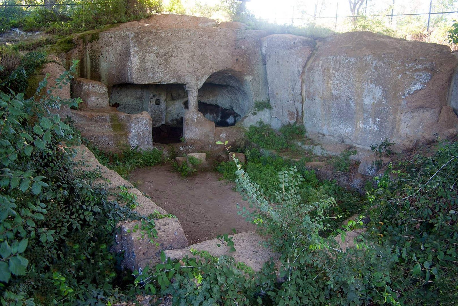
Pian del Vescovo, about two kilometers from the town on the right bank of the Biedano, is the northwestern sector of the great burial area of Blera and the one with the greatest concentration of tombs: one of the largest rock-cut necropolises of Etruria. On the plateau you see the circular tumuli of the Orientalizing period, 7th century. On the western slope the rock monuments are arranged in parallel superimposed orders, like the floors of an apartment building, connected by carved stairways. There is a notable archaic house tomb with a pitched roof, there are the cube tombs near the bridge, there is the Hellenistic tomb with the inscription Fel Usuie. The most famous burial is the Tomb of the Sphinx, with a double chamber, which yielded the sculpture it takes its name from, now in the National Archaeological Museum of Viterbo at Rocca Albornoz together with three peperino lions from the same area. In 1915 the archaeologists of the German Institute in Rome documented the whole necropolis with surveys and photographs that remain the basis of every later study. An area called Campane di Roma preserves burial niches dug into the tuff. Here there is no ticket office, no fence, no guard: you walk, you search, you look up.
Casetta and Grotta Penta: the painted chambers of Blera (VT)
On the opposite side, on a platform halfway up the cliff, the Casetta necropolis repeats the arrangement in parallel orders connected by stairways, but adds a detail that Pian del Vescovo lacks: plastered and painted chambers. The best known is the Grotta Penta, a chamber tomb with a central pillar that ends in a sort of capital and with traces of paint still visible on the walls. It is not Tarquinia, let that be clear: the colors are shadows of colors, and anyone who arrives expecting banquets and dancers will be disappointed. But it is one of the few testimonies of rock-cut funerary painting in the interior, and seeing it in the half-light, with the flashlight bringing out the color fields, is an experience worth the walk. The western necropolises of Terrone and Ponton Graziolo are harder to reach and largely overgrown with vegetation: I would leave them to those who come back a second time with a local guide.
The Cimiterio, the Borsello, the Stazione: the southern necropolis
On the southern slopes of the settlement the sector called Cimiterio gathers the zones of Borsello, Molella, Fornicello, Pontone del Paino, Cava Buia and Stazione. Here archaic cube tombs of the 6th-5th century live alongside simple chamber tombs of the late Etruscan period, between the 4th and 2nd century, when wealth had moved elsewhere and the families of Blera made do with sober spaces. It is the part closest to town and easiest to fit into a short walk, and for this reason I recommend it to those with little time or small children. Upstream, toward Barbarano, the nuclei of Madonna della Selva and Santa Barbara have tombs from the 8th to the 4th century. Pariano and Petrolo, with their cubes of the 6th-5th century, and La Lega and Palombara, with tombs of the 4th-2nd century and a recently discovered sacred area, complete a ring of cities of the dead that literally surrounds the city of the living.
San Giovenale: the Etruscan village dug by a king
Along the municipal road Blera-Civitella Cesi, on an isolated plateau, San Giovenale is one of the most important abandoned settlements of inland Etruria. The excavations of the Swedish Institute of Classical Studies in Rome, conducted between the late 1950s and the early 1960s with the active presence of King Gustavus VI Adolf, documented continuity of settlement throughout the Bronze Age, from the 16th century BC, and then an Etruscan settlement of the archaic age, 7th-6th century, with houses built of tuff blocks and covered with terracotta tiles: one of the very rare occasions in Etruria when you see the house of the living and not only that of the dead. Two sectors of the excavation are protected by coverings. Above the Etruscan walls, in the 13th century, the Prefects of Vico built a castle, and to the west you see the ruins of the church of San Giovenale, dedicated to the bishop of Narni, built in the 9th century and restored in the 13th. The necropolis around it runs from the 8th to the 2nd century BC. Entry is free, with no services: you leave the car along the road and continue on foot.
Luni sul Mignone: the Bronze Age on the bank of the Mignone
Even more isolated, on the plateau at the confluence of the Vesca and Canino streams into the Mignone, at about a hundred meters above sea level, Luni sul Mignone is the most important prehistoric site of northern Lazio. The Swedish campaigns of 1960-1963, again with the king, brought to light the Apennine houses of the Middle Bronze Age (16th-15th century BC), long semi-underground buildings dug into the tuff, a Proto-Villanovan hut of the Late Bronze Age (11th-10th century), a small cave tomb, then the Etruscan phase of the 7th-6th and 4th century with a semi-underground house and fortification walls, an early medieval rock-cut church with an adjoining cemetery (7th-8th century) and remains of buildings of the 11th-12th century, before the definitive depopulation in the 14th. For Italian archaeology Luni has been a milestone, because it fixed the chronology of the Bronze Age cultures of central Italy. For the visitor it is a walk in an almost uninhabited landscape, where what you see are cuts in the tuff, hut floors, stretches of wall. What matters is knowing what you are looking at. It is worth reading up beforehand, or going with someone who can explain.
Civitella Cesi and the Torlonia castle
The hamlet of Civitella Cesi, connected to Blera by local public transport, is a tiny village gathered around the castle that today bears the name of the Torlonia, founded in the first half of the 11th century on the remains of an Etruscan fortification. A short way off, the Antiquitates Center of Experimental Archaeology has rebuilt a full-scale prehistoric village and offers workshops: it is the right stop for families with children, who at San Giovenale and Luni would struggle to imagine what the traces in the tuff tell.
The Madonna della Selva and the road to Norchia
Along the route of Via Clodia to the north, in the middle of the woods, the church of the Madonna della Selva is the destination of the procession of the second Sunday of September, when the effigy of the Virgin is carried from the town to the hermitage along the Roman road. Farther on, at 14 kilometers, the Clodia reaches Norchia, which belongs to the municipality of Vetralla and where Etruscan funerary architecture reaches a monumentality that at Blera is only hinted at: cube facades more than 10 meters high, temple tombs with sculpted pediments. Seeing Blera first and then Norchia means understanding a crescendo. The Blera-Norchia stretch of the Clodia is also the route of the two annual pilgrimages to Saint Vivenzio, and can be walked in a day.

A curiosity about Blera (VT)
The curiosities of Blera are not tour-guide anecdotes. They are things you can see, and that no one tells because the town has never had anyone who took the trouble to tell them aloud. Here are several, ordered below for those who want to arrive prepared and look at the right things. Some concern the stone, others the names, others still the way the inhabitants have gone on using for 2,500 years the same cavities dug by their ancestors. They are all, one way or another, curiosities about tuff.
The name that went back in time
Almost all Italian towns have changed name over the centuries, but almost always in the direction of modernity: from an ancient form to a vernacular form, then to a standardized form. Blera went the reverse way, and this is a rarity worth noting. The Latin Blera, that of Pliny, Strabo and Ptolemy, turns into the medieval Bieda, and Bieda remains the official name of the town until 1952, when the administration decides to take up the ancient form again. A conscious return to the origins, matured in the decade in which the Swedish excavations at San Giovenale and Luni sul Mignone were about to bring the territory back to the center of European archaeology. It is not only a bureaucratic matter. Changing name means changing narrative identity, and Blera chose to declare who it was: not just any village of the Patrimony of Saint Peter, but a center with 2,600 years of continuity. Whoever strolls through the historic center today still finds, in the memories of the elderly and in the Vocabolario del dialetto di Blera published in 2010, the old Bieda. It is a double name that coexists, as the two souls of the town coexist.
There's more. On the etymology scholars do not agree. One proposal links the name to the Greek blerai, a kind of nettle, which would make Blera the town of nettles. Another, more solid because it rests on epigraphic evidence, reconstructs an Etruscan Plaise-ra, city of Plaise, a family name. The forms Bleras or Phlera that circulate in some guides are modern reconstructions, not attestations. There are no definitive certainties, because Etruscan remains a language whose grammar we understand better than its vocabulary. The nicest hypothesis is that the town carries in its name a man of whom we know nothing, and that the nettles, which in fact grow very dense along the Biedano, are the contribution of the 19th-century philologists to local imagination.
Roman bridges that no one has ever stopped using
The most underrated curiosity of Blera is that its Roman bridges are not monuments in the strict sense. They are infrastructure that has kept working. The Ponte della Rocca, in particular, remained for centuries the practical access to the settlement from one of the two directions, and has been crossed by carts, mules, peasants, pilgrims in a chain that starts in the 2nd century BC and reaches the memory of the living. The Devil's Bridge stopped carrying traffic only when, in 1937, the modern bridge was built over it, and in 1916 the State had restored it not as a find but as a work still useful. This radically changes the way you have to look at them. A ruined temple is a dead object that we reanimate with imagination. A bridge you can still walk is a living object: its original function coincides with its current function, and the act we perform crossing it is identical to that of a Romanized Etruscan merchant of the 1st century. It is a temporal short circuit that is almost never found in traditional archaeological sites, where everything is fenced off and observed from a distance. Here you walk inside history, literally.
I add a note on the devilish name. In Italy there are dozens of Devil's Bridges, from Bobbio to Borgo a Mozzano, and the recurring legend tells of a pact: the devil builds the bridge in a night and in exchange demands the soul of the first to cross it, and the inhabitants trick him by sending an animal across. The Blera version is less codified, and whoever relates it limits himself to saying that the work seemed impossible to the medieval people who inherited it. But the mental structure is the same. You find yourself in front of a work that seems impossible, and you attribute the impossible to the one who does the impossible for a living. It is folklore, of course, but it is also a form of popular architectural criticism: the bridge was judged extraordinary by those who lived beside it.
Cube tombs, or houses for the dead
The funerary type that makes Blera and its territory unique in the Etruscan panorama is the rock-cut cube tomb. The principle is simple and ingenious: instead of building a monument by piling up stones, you make the monument by subtracting material from the wall. A block of tuff is isolated on three sides, the facade is smoothed, it is decorated with cornices and moldings, the burial chamber is dug below or behind, and the result is a cube that juts out of the rock as if it had been set against it. From afar, along the walls of the gorges, they look like houses: and that is exactly what they were meant to look like. The Etruscans conceived the tomb as a dwelling of the afterlife, and this conception is visible throughout Etruria: at Cerveteri, in the Banditaccia necropolis, the tumulus tombs reproduce inside rooms, beds, ceiling beams. At Tarquinia the frescoes populate the chambers with banquets and dances. At Blera and in the nearby rock-cut necropolises, where the rock outcrops vertically along the gorges, the same idea takes an outward form: you don't furnish the interior, you build the facade. The tombs become an urban front carved in the wall, a quarter of the dead facing the valley, ordered by rows and levels like a real settlement, and at Pian del Vescovo and Casetta the rows are connected by stairs dug like the ramps of a palace.
Anyone approaching one of these necropolises for the first time almost always makes the same perceptual mistake: looking for the monumental entrance, the museum layout, the equipped route. It isn't there. The tombs are where they were, often overgrown with vegetation, sometimes marked by centuries of reuse as animal shelters or farm depots. It is a condition that some dislike and that I like very much, because it preserves the only honest relationship possible between us and those artifacts: we meet them walking, as anyone passing there 2,000 years ago met them. A detail to look for, for those with patience: the traces of the tools. On the tuff, on many facades, you can still read the parallel marks left by the point chisel or the chisel. They are grooves a few millimeters wide, oriented diagonally, that tell the gesture of a hand. In the raking light of late afternoon they become very evident, and at that moment the tomb stops being a find and goes back to being a building site.
A regional park born to protect emptiness
The Marturanum Regional Natural Park has a peculiarity that distinguishes it from most Italian protected areas: it was not born to protect a species, a wood or a peak, but to protect a mixed system in which the archaeological element and the natural element are inseparable. The necropolises are inside the gorges, the gorges are habitats, the habitats protect the necropolises from agricultural and building aggression. You can't save one without the other, and whoever wrote regional law 41 of July 17, 1984 understood it with a lucidity that was not at all a given at the time. The name derives from the locality Marturanum, one of those very ancient rural place names that survive in cadastral maps much longer than any monument. The park covers 1,240 hectares in the municipality of Barbarano Romano alone, with its seat at Viale IV Novembre 44 (telephone 0761 414507), and is managed by the town. The territory of Blera remains outside it, but the Biedano that crosses the San Giuliano necropolis is the same that flows under the Devil's Bridge, and CAI trails 103 and 138 connect the two sides without a break. Inside it, environments live side by side that, a few hundred meters apart, are completely different: arid grasslands on the plateaus, Turkey oak woods on the slopes, alders, elms, poplars and willows at the bottom of the gorges, vertical walls with ferns and rock vegetation, even mineral springs rich in iron.
This variety translates into surprising fauna for a territory 70 kilometers from Rome. In the gorges nest the lanner falcon, the short-toed eagle, the red kite, the kestrel and the peregrine falcon. Along the water the kingfisher and, passing through, the black stork. Porcupines, badgers, polecats and wildcats move about, and the wild boar is by now a dominant presence as in all of inland Lazio. But the real wealth is the less showy kind: the spectacled salamander, an amphibian found only in Italy, the invertebrates of damp environments, lichens and mosses on the walls where direct sun never reaches. They are fragile ecosystems that depend on a specific microclimate, and that the gorges protect naturally because their shape keeps humidity and temperature relatively constant. There is also an aspect I find fascinating and that is rarely highlighted. The walls dug by the Etruscans have multiplied the available ecological niches. Burial chambers, corridors, cavities reused for farming have become refuges for bats and for other species that seek dark, stable environments. Put differently: a human activity of 25 centuries ago has produced, as a pure side effect, an increase in biodiversity that protection now safeguards. It is a short circuit between archaeology and ecology of which the territory of Blera is a textbook case.
The endless reuse of cavities
The last curiosity is perhaps the most human. The Etruscan tombs of the Blera territory were not abandoned after antiquity: they were reused practically without interruption. In the Middle Ages and in the modern age those chambers, dry, cool in summer and warm in winter, became stables, barns, cellars, shelters for shepherds, tool depots. Some still preserve mangers carved in the rock, rings for tying animals, dry-stone closing walls built in front of the entrance. At Luni sul Mignone the reuse took the form of an early medieval rock-cut church with its cemetery, made where a thousand years earlier there were Bronze Age huts. For the purist archaeologist it is a disaster, because reuse has erased stratigraphies and contexts. For those who look at the landscape as a document it is instead a stroke of luck, because it tells a story of continuity that no museum can give back. Those cavities were useful for 25 centuries, changing function every time the world around them changed. The tuff, which is soft and generous, allowed each generation to adapt them without destroying them.
Walking along the gorges you meet cavities of every kind, and telling an Etruscan tomb from a 19th-century cellar cut into the same wall takes a trained eye. Some clues help: the geometric regularity of the chamber, the presence of side benches for the deposition, the cornices on the facade, the relationship between the height of the entrance and the current walking level. But often the two layers overlap, and the honest answer is that the cavity is both. Those who visit the territory with an expert escort read these overlaps much more easily. For groups that want a tailor-made itinerary among Blera, Barbarano and Norchia, the group travel organization service of TourLeaderPro is the place to start. The reuse, after all, has not ended. Even today some cavity serves as shelter for farm tools, another houses stacked firewood, and on San Martino the town's cellars open for the festival. There is nothing scandalous in it: there is the natural continuation of a relationship between community and rock that at Blera has never been interrupted. And this, in the end, is exactly what makes the town different from an archaeological site. Here you don't visit a past preserved under glass: you cross a present that the past has never stopped inhabiting.

One thing nobody tells you about Blera (VT)
Here is the most interesting part, the one with the things guides don't say. Not because they hide them, but because a guide has to be reassuring and certain truths about places are not. Blera is a magnificent and underrated town, and precisely for this reason it has to be told without rhetoric. There are five things that those who arrive here discover only on the spot, almost always too late to be able to organize differently. I put them here, in order of importance.
The most important heritage can't be visited the way you expect
The thing nobody really tells you is that the rock-cut necropolises of the Blera territory are not archaeological sites in the common sense of the term. There's no ticket office, no museum route, no guard to explain what you are looking at, no lighting. There are tuff walls inside wooded valleys, reachable by paths of varying difficulty, some very readable and others largely covered by vegetation. The signage in some stretches is impeccable and in others disappears, and the Cava Buia can be closed because of landslides. Those who arrive with the expectation of Cerveteri or Tarquinia, where the site is fenced, equipped and narrated, are thrown off and sometimes disappointed. You have to turn the expectation upside down, and then everything changes. Here you don't visit a site: you explore a territory. The difference is not semantic. Visiting a site means following a route laid out by someone else, who has already decided what is important. Exploring a territory means walking, searching, going the wrong way, raising your eyes and realizing that what looked like a rock wall is actually a row of carved facades. The second experience is infinitely more intense than the first, but it requires a mental readiness that has to be prepared.
There is a practical consequence to take into account. Some tombs are on private land, or in places where access is made difficult by landslides, vegetation or unstable ground. Not everything that appears on archaeological maps can actually be reached, and insisting can be both improper and dangerous. The rule is simple: if an access is not signposted and there is no obvious path, you don't go. The territory is rich enough to offer a great deal while staying on legitimate routes, and the rush to see that particular tomb is worth neither a broken foot nor an argument with an owner. I add a consideration about conservation. The fragility of these places is real. The tuff flakes, facades degrade by runoff, repeated trampling at sensitive points accelerates erosion. Walking on top of a tomb, climbing a facade to photograph it better, moving stones to see what's underneath are gestures that seem harmless and that multiplied by thousands of visitors become destructive. In a territory without constant surveillance, conservation depends almost entirely on the behavior of those who go there. It is a responsibility that those who come here should feel, and that almost no one explains to them.
The tourism that is missing is both a stroke of luck and a problem
The second thing nobody says concerns the flip side of authenticity. Everyone likes discovering the non-touristy town, the real one, the one without tour groups. Blera is exactly that, and those who go appreciate it. But a town without tourism is also a town without tourist infrastructure, and the two things are the same thing seen from two sides. Concretely it means: few beds, opening hours that follow the needs of residents and not those of visitors, a civic museum that doesn't publish a stable schedule, information on the territory that is fragmentary and left to the initiative of individuals. It means that if you arrive on a Monday off season you may find little open. It means that an expert escort of the territory can't be found at the last minute in the square, but must be sought in advance. It is not a defect of the town: it is the mathematical consequence of low tourist demand, in a municipality that in 2015 counted 179 active businesses with fewer than two employees each.
Those who come prepared turn this limit into an enormous advantage. Booking in advance, getting informed beforehand, arriving with a plan and with supplies means having for yourself a first-rate archaeological heritage in a condition of silence that at Tarquinia or Cerveteri is simply unthinkable. In these valleys you can spend whole afternoons without meeting anyone. No one. In a region that receives tens of millions of visitors a year, this is a luxury condition that can't be bought. There is, however, a broader point worth making, because it concerns the future. The towns of the Viterbo interior have lived for decades a dynamic of slow depopulation. Young people move toward Viterbo, toward Rome, toward the coast. The heritage remains, but the community that guards it thins out. An intelligent, right-sized, respectful tourism is not a risk for places like Blera: it is probably the only way to keep alive the services, the paths, the activities. The rhetoric of the unspoiled place not to be shown to anyone is a convenient rhetoric for the visitor and a disastrous one for those who live there. The right way to visit, then, is also the right way to contribute: stop to eat, buy a local product, sleep a night instead of going back and forth in a day, turn to those who accompany people in the territory.
The gorges change everything, even the climate
The third thing nobody says is that at Blera there are two different climates in the same municipality, separated by a few tens of meters of elevation difference. On the plateau the climate is the continental one of the inland Tuscia: hot, dry summers, cold winters with frequent night frosts, marked temperature swings. At the bottom of the gorges the climate is another: constant humidity, lower temperatures in summer and milder in winter, reduced ventilation, filtered light. It is an inversion microclimate, which lets typically mountain or northern species survive at low elevations and Mediterranean latitudes: the ferns of the valley floor and the black alder along the Biedano are there for this reason. This has immediate practical consequences for the visit. In summer, going down into a gorge means gaining several degrees and finding continuous shade: it is the right strategy for the middle hours. In winter it means entering a damp environment where the ground stays wet for days after rain and where the cold is felt more than the thermometer says. In the shoulder seasons it means passing, within 20 minutes of walking, from a sunny meadow to an almost twilight undergrowth. Dressing in layers is not generic advice: here it is an operational necessity.
It also has consequences for how the landscape is perceived, and they are the most interesting. The gorges are not just valleys: they are ecological corridors that cross the territory connecting different environments. Fauna uses them as routes of movement, seeds spread through them, water concentrates in them. Inside a gorge you walk in a world that works by its own rules, and the feeling of having entered elsewhere is a measurable environmental fact. The jump in temperature is felt on the skin, the acoustics change, sound is dampened against the damp walls and the vegetation. Whoever goes down for the first time always notices it, and almost always lowers their voice without realizing it. Then there is the theme of water, which in the tourist narrative of Blera is almost absent and which is instead central. The Biedano is not an imposing river, but it is the agent that built this entire landscape. Digging for tens of thousands of years it created the vertical walls that the Etruscans then used as a support for their tombs. Without that erosion there would be no rock-cut facades, and without rock-cut facades Blera would be a town like many others. The rock-cut civilization of the Tuscia is, ultimately, the product of an encounter between a workable rock and a patient water.
The town above is worth as much as the ruins below
The fourth thing nobody says, and which is perhaps the most unfair, is that the historic center of Blera is systematically neglected. Everyone goes down toward the bridges and the necropolises, and the town stays a parking lot to leave from and return to. It is a mistake, because the settlement preserves an urban structure of great interest and a material quality that can be read in every wall. The historic center occupies the spur with an elongated layout, conditioned by the shape of the relief: Via Roma runs along the length and the transverse lanes go down toward the edges, often ending in overlooks onto the void. It is a herringbone structure found in many rock settlements of the Tuscia and that arises from a single logic: exploiting all the available space on a limited and defensible surface. Walking in it you physically understand what it means to build within a rigid geographic constraint. The houses are of red tuff, with the profferli, arcades and external stairs that tell of reworkings layered over the centuries. It is not monumental architecture, it is minor architecture, and that is why it is worth it: because it is the most direct document of how people lived here.
Then there are the overlooks, which are the real surprise. At several points on the edge, often at the end of a lane that seems blind, the view onto the gorge suddenly opens: below is the green, opposite is the tuff wall, and at certain points you glimpse the facades of the tombs. It is an overlook that puts the city of the living and the city of the dead in direct relation, exactly as it must have been in antiquity. No museum can reconstruct this relation. A village lane is enough. Finally I recommend devoting half an hour to the church of Santa Maria Assunta and its crypt, and a glance at the minor churches: San Nicola di Bari, deconsecrated, the Madonna del Suffragio, the chapel of San Senzia, the Madonna delle Lacrime at the cemetery. Don't expect famous masterpieces: expect stratification. Ancient layouts reworked, bell towers grafted onto earlier structures, a Roman sarcophagus under the altar. It is the same principle as the walls of the houses, applied to the scale of public architecture. Those who have already seen the great Romanesque churches of Tuscania will find here a minor and domestic version of the same language, and the comparison is instructive precisely for the difference in scale.
The truth about the time needed for Blera (VT)
What remains is the thing that, all things considered, nobody ever says explicitly: Blera takes more time than anyone budgets. Guides indicate half a day, travel sites slot it in as a stop between two major destinations, and the result is that 90 percent of visitors leave convinced they have seen it and having seen almost nothing. The realistic calculation is this. For the historic center, unhurried and with the overlooks, you need an hour and a half. For the Devil's Bridge, the Cava Buia and the columbarium, counting the approach on foot and the time needed to go down into the gorge, you need at least an hour and a half. For Pian del Vescovo, counting the access path and the observation time needed for the facades to emerge from the green, you need another good hour and a half, and the full loop that links them measures nine kilometers with 200 meters of elevation change and takes a good three hours. For San Giovenale or Luni sul Mignone you need two hours each, transfers included. We are already past six hours without counting the stop to eat and the time that is inevitably lost looking for an access.
From this comes the conclusion, which is also an invitation. Blera is not a stop: it is a full day, and if you can, a day and a half with a night nearby. Those who can afford two days should do two days, adding Barbarano Romano and perhaps a side trip toward Viterbo or Capranica to balance the rock-cut with the medieval. Those who have only half a day should choose one thing only and do it well: a bridge and a necropolis, or the town and a path. Better two complete experiences than six hurried glances. And then there is one thing time can't buy: the willingness to stay still. The rock-cut landscape of the Tuscia doesn't give itself to those who run. It has a slowness of its own, made of shifting light, emerging details, layering silences. Whoever sits on a boulder at the edge of a gorge and stays there 20 minutes doing nothing takes Blera home. Whoever passes, photographs and leaves takes home a file.
The advice I give you for visiting Blera (VT)
The main advice is one and I say it right away, without preamble: don't treat Blera as a stop. Treat it as a destination. It sounds obvious, but it is exactly the mistake I see made most often by those who arrive here. The Tuscia is generous with beautiful towns and the temptation to squeeze four or five into a Sunday is strong. The result, though, is that of Blera you see the square, photograph a lane, say it's cute and leave. And you have missed everything, because everything that counts at Blera is outside the built-up center, down below, inside the valleys, along the paths.
First: three levels, six hours
The operational proposal is this: give Blera at least six full hours, and organize them on three altitude levels. The high level is the town, with its medieval layout on the spur, the tuff houses, the church with the crypt, the museum, the overlooks onto the gorges. The middle level is the strip of the edges, where the roads and the panoramic paths run from which you observe the carved walls from above. The low level is the valley floor, where the Roman bridges, the Cava Buia, the columbarium, the course of the Biedano and the most accessible necropolises are. Anyone who does only the first level has seen a town. Anyone who does all three has understood a territory.
Second: the raking light
Start early. Not to do more things, but to do things in the right light. Tuff is a rock that needs raking light to reveal itself. At noon, with the sun overhead, the tomb facades flatten, the moldings disappear, the tool marks vanish and everything becomes an indistinct wall. Early morning and late afternoon are the two windows in which the relief exists again. If you have to choose, choose late afternoon for the western slope of Pian del Vescovo, which faces west, and the morning for the walls exposed to the east: it sounds like a photographers' detail, and it is instead a detail for anyone who wants to see anything.
Third: shoes and flashlight
I repeat it because it is the number one cause of failed visits. The surface of the paths in the gorges is made of tuff polished by water, decomposing leaves and stretches of exposed rock. With a smooth sole you slip, and slipping here almost always means getting hurt, because the slopes are steep and the walls close. You need ankle boots or at least light trekking shoes with a lugged tread, and long pants for the brambles. Nothing technical, nothing expensive: just not urban sneakers. If it has rained in the previous two days, allow for real mud, the kind that sticks and doesn't leave. And bring a flashlight: the columbarium and the Grotta Penta without light are two black holes.
Fourth: the offline map
Bring a map downloaded before leaving, or the track of the nine-kilometer loop. In the gorges the phone signal regularly drops, and the paths, though signposted, intertwine in a way that on paper seems obvious and on the spot is not at all. There is no danger of getting lost in a dramatic sense, the territory is small and surrounded by roads, but you can easily lose an hour redoing a stretch already covered. An hour, in a day of visiting, is a lot.
Fifth: just one necropolis, 40 minutes
Here I get more personal. Don't try to see all the necropolises. There are at least eight in the area, some spectacular, others more modest, and the collector's temptation leads you to run from one to the next accumulating photographs and not memories. Pick one, Pian del Vescovo for the first time, reach it unhurried, and stay there at least 40 minutes. Sit down. Look at the wall opposite until you begin to distinguish the individual facades, the alignments, the levels. The rock-cut landscape doesn't give itself at first glance: it needs time to emerge from the green. It is the same dynamic as looking at a starry sky after leaving a lit room. At first you see almost nothing, after 20 minutes you see everything.
Sixth: Blera (VT) plus just one other place
Pair Blera with just one other place, not with three. The combinations that work best are two. The first is Barbarano Romano with the San Giuliano necropolis, inside the Marturanum Park, which lets you complete the reading of the rock-cut system with a coherent day, without long transfers. The second is Norchia, where Etruscan funerary architecture reaches a monumentality that at Blera is only hinted at: seeing Blera first and then Norchia means understanding a crescendo. If instead you want a strong contrast, pairing with Tuscania works very well, where the Etruscan world is joined by the great Romanesque architecture of San Pietro and Santa Maria Maggiore. Those who organize an itinerary for a corporate group or for demanding guests, and want someone to take care of the transfers, the stops and a lunch that isn't a sandwich, will find in the private experiences for small groups by TourLeaderPro a formula designed for those who have no time to lose.
Seventh: the packed lunch
Blera has a few addresses where you eat well, honest Viterbo cooking, but it is a small town and on weekdays off season it isn't certain that everything is open. If you plan a long walk, bring something to eat. A packed lunch eaten on a plateau overlooking the gorge, with the sound of water below and the woods around, is frankly worth more than any table. And there is also a reason of rhythm: sitting down in a restaurant at noon means losing the best moment to resume walking in the early afternoon. Dinner, instead, book it: mutton gnocchi and truffle fettuccine deserve a chair.
Eighth: find out about the routes
The gorges are dynamic environments. A flood can move boulders, a fallen tree can block a path, the Cava Buia can be closed because of landslides, a stretch can be temporarily off limits because of safety work. It's not an expedition situation, but it is the normality of an untamed territory. A phone call to the town's culture office or to the Marturanum Park office in Barbarano avoids surprises, and the pages on the Marturanum Park and on Barbarano Romano on this site help you build the second day.
Ninth: talk to the people of Blera (VT)
The last piece of advice is more an invitation. Talk to people. Blera is a town where people answer, tell stories, point the way. Ask at the bar where the old road goes, ask someone who works the land where the cavities are that visitors don't find, ask an elderly person what was said about the Devil's Bridge when he was a boy and what the town was called when he was born. You will get information that appears in no guide, and above all you will get the thing that makes traveling different from going around: a relationship. In a town of fewer than 3,000 inhabitants that receives few visitors, arriving with sincere curiosity is a key that opens practically everything.
Another well-known fact, and yet not often cited
Anyone who has read a line about Blera knows it was an episcopal see. Almost no one stops to do the math: the diocese of Blera had its own bishops from 457 to 1093, that is for 636 years, a span longer than the one that separates us from the discovery of America. For six centuries a town that today has fewer than 3,000 inhabitants was an ecclesiastical capital with a cathedral, a chapter, a territory to administer, and its bishop sat in the Roman councils next to those of much larger cities. The suppression of 1093, with the union to Toscanella, and then the passage to Viterbo in 1192, were not a punishment: they were the consequence of the shift of weights in the Tuscia, with Viterbo growing and the centers of the Clodia shrinking. But the fact remains, and it explains why the church of Santa Maria Assunta is out of proportion to the town, with its three naves and raised presbytery: it is a cathedral that lost its title, not a parish church that grew too big.
The second well-known and rarely cited fact is that a pope comes from Blera. The Liber Pontificalis says that Sabinian, elected in 604 on the death of Gregory the Great and dead in 606, was Tuscan, born in the city of Blera. It was a short and unpopular pontificate: tradition remembers him for selling the grain during a famine instead of distributing it as his predecessor had done, and for a legend according to which Gregory appeared to him in a dream to reproach him. It is an ungenerous portrait, built by those who wanted to exalt Gregory, but it is the portrait the people of Blera inherited: a pope the town almost never brags about, and who would deserve at least a plaque. I add the third fact: the civic museum bears the name of a foreign king, Gustavus VI Adolf of Sweden, because that king, an archaeologist by training and president of the Swedish Institute of Classical Studies in Rome, came to dig in person at San Giovenale and at Luni sul Mignone between the late 1950s and 1963. A reigning monarch digging in a field of the Tuscia: it is an image the town has rightly returned with the dedication of the museum.
The right photo to take at Blera (VT)
If I had to name a single shot, the one that brings Blera home and explains it without need for captions, I would have no doubt: the Devil's Bridge shot from below, from the bottom of the gorge, with the three arches spanning the void, the span of the modern bridge passing above and the vegetation closing the sides of the image. It is the right photo for a precise reason: it contains all the elements of the story. There is the tuff, there is the water that carved the valley, there is Roman engineering, there is the 20th-century kind, there is the woodland that has retaken possession of everything. Five layers of history in a single frame.
The time of day, the vantage point, the human figure
To do it well a few precautions are needed. The first concerns the time. The bottom of the gorge receives direct light for a limited window, and in the middle hours the contrast between the lit upper part and the shadowed lower part is so violent that no sensor can handle it without sacrificing something. The best moment is relatively early morning, when the light comes in at an angle and lights the underside of the arch with an indirect reflection, or a day of veiled sky, which flattens the contrast and gives back all the details of the peperino blocks. Overhead sun is the enemy: to be avoided. The second precaution concerns the vantage point. The temptation is to stand squarely under the central arch, but that framing, though symmetrical and reassuring, flattens the depth. Much better to move sideways a few meters and shoot the bridge at three-quarter view, so that the thickness of the structure and its relationship with the rock wall it rests on can be read. Putting a foreground element in the bottom corner, a boulder, a trunk, a stretch of watercourse, gives scale and keeps the image from going flat. The third precaution concerns the human figure. A bridge photographed without size references can be six meters high or 25, and the viewer has no way of knowing. A person at the base, even small in the frame, multiplies the force of the image tenfold: the central arch is 7.80 meters high, and a human figure says so better than any number.
The other three photos of Blera (VT) worth the trip
That said, the Devil's Bridge photo is not the only one worth the trip. The first alternative is the wall of Pian del Vescovo shot from a medium distance, from the opposite side of the Biedano, with the raking light of late afternoon, so that the facades of the cube tombs emerge from the green like a front of multi-story houses. It is a photo that requires patience and that works only in certain conditions, but when it works it tells the Etruscan idea of the city of the dead better than any text. Use a medium-long focal length to compress the planes. The second is the detail: a portion of carved facade, shot up close, with the tool marks visible on the tuff. It needs side light, it needs standing a meter or two from the surface, and it needs resisting the temptation to straighten everything: the irregularity of the rock is the subject. These archaeological macros are the photographs that age best, because they depend neither on the season nor on the sky and give back the tactile dimension of the place. The third is the overall landscape from the plateaus, or from the viewpoint at the end of one of the town's lanes: wait for the moment when the sun lowers and the gorges fill with blue shadow while the plateaus stay golden, and shoot the succession of planes all the way to the Monti Cimini in the background. It is the image that explains the geography: the territory is neither a plain nor a mountain, it is a cut plateau. To pull it off you need a clear sky and you need to arrive on site 20 minutes early, because the good window lasts a short time.
Tripod, condensation, phone
I add two technical notes. The first: here the tripod really is needed. In the gorges the light is scarce and high ISO eats exactly the surface detail you came looking for. In the columbarium and the Grotta Penta, moreover, without a tripod and without a flashlight you bring home nothing. The second: watch out for humidity. Going from a warm plateau to the cool bottom of a gorge makes the lens fog, and it takes a few minutes before it is usable again. If you go down, take out the equipment as soon as you arrive and let it acclimatize while you look around. One last consideration for those who shoot with a phone and have no intention of carrying a bag of lenses. Modern phones handle the contrast of the gorges very well thanks to automatic processing, and for the bridge framing they are often more than enough. Where they struggle is in the close detail of the tuff and in the compression of planes for distant walls. The advice, in that case, is to give up the digital zoom and physically get closer. Walking 20 more meters always produces a better photo than any software enlargement. And, please, do not climb on the facades for the shot: the tuff gives way, and the tomb too.

Some important events that happened here in history
Blera has no pitched battle with its name, and this has kept it out of the textbooks. It does have, however, a sequence of dates that, lined up, tell the whole Tuscia. I list them distinguishing what is documented from what is tradition.
457: the first bishop, Vivenzio
Tradition has the diocese of Blera begin with Vivenzio, bishop from 457 to 484, who died on January 13 of that year. No contemporary document tells his life. Local tradition makes him a hermit who withdrew to a cave near Norchia, on which a small church was later built. His body rests in the crypt of the main church, and his figure in pontifical robes, with the crosier in his right hand and a church in his left, is the coat of arms of the town, recognized by decrees of 1958 and 1959. The diocese remains autonomous until 1093: it is the most important fact of the town's medieval history, and it does not have a single precise day.
604: a man from Blera on the throne of Peter
In 604 Pope Sabinian is consecrated, whom the Liber Pontificalis says was born in Blera. He reigns until February 606, in years of famine and Lombard pressure on Rome, and the memory that remains of him is the unflattering one of the pope who sold the grain. He is nonetheless the only man from Blera to have led the Church, and the town cites him less than it should.
739 and 772: Liutprand and Desiderius
In 739 the Lombard king Liutprand, at war with the Roman duchy and with the pope, occupies Bieda together with other castles of the Tuscia. In 772 King Desiderius, in the last Lombard offensive before Charlemagne's descent, destroys it. These are the two episodes that explain why the town withdrew onto the most defensible spur and why the settlement we see is medieval in layout, even if Etruscan in site.
1247: the army of Frederick II
In 1247, during the long war between the emperor Frederick II and the papacy for control of the Patrimony of Saint Peter in Tuscia, the imperial army destroys Bieda. It is the second documented destruction, and it coincides with the years in which the Tuscia was the battlefield between the Guelph cities and the imperial vicars. The reconstruction takes place under the Prefects of Vico, who dominate the town between the 13th and 15th century and who at San Giovenale build the fortress above the Etruscan walls.
1400, 1465, 1516, 1572: the Anguillara and the Apostolic Chamber
In 1400 Boniface IX grants Bieda in fief to the counts Francesco and Nicola Anguillara. In 1465, after the clash between the family and Paul II, who dismantled the Anguillara dominion in the Tuscia, the town returns to the Holy See. In 1516 Leo X entrusts it to Lorenzo Anguillara of Ceri, and in 1572 Bieda returns definitively under the Apostolic Chamber, which governs it until 1870 through a governor: the Palazzina del Governatore in town and the Palazzaccio of the Anguillara are the two stone witnesses of this alternation.
1915: the German Institute at Pian del Vescovo
In 1915, while Europe was at war, the archaeologists of the German Archaeological Institute in Rome documented the Pian del Vescovo necropolis with surveys, drawings and photographs that remain the basis of every later study. Many of the tombs recorded then are today less legible than they were in those images, and the comparison is both a lesson in method and a reminder of the fragility of tuff.
1916 and 1937: two bridges over the Biedano
In 1916 the Devil's Bridge is restored. In 1937 the modern road spans the gorge with a new bridge, about 60 meters high, which passes over the Roman work. Since then the ancient bridge has carried no traffic and has become what it is today: the most photographed monument of Blera.
1927 and 1952: the province and the name
In 1927 Bieda passes from the province of Rome to the newborn province of Viterbo. In 1952 the town takes back the ancient name of Blera. In 1958 and 1959 the decrees arrive that recognize the coat of arms and banner with the image of Saint Vivenzio. In between, two world wars cost the town 36 soldiers and 44 civilians, the latter killed in reprisals and bombings: a heavy toll for a municipality of a few thousand souls.
1956-1963: the king of Sweden digs at San Giovenale and Luni
Between the late 1950s and 1963 the Swedish Institute of Classical Studies in Rome, with the active presence of King Gustavus VI Adolf, digs San Giovenale and then, from 1960 to 1963, Luni sul Mignone. These are the campaigns that fixed the chronology of the Bronze Age in central Italy and that brought to light the Etruscan houses of San Giovenale, one of the few Etruscan settlements excavated over a wide area. In that same 1961 the Blera station on the Orte-Civitavecchia railway closes: the town loses the train in the year it gains a place in the history of archaeology.
1984 and 1994: the park and the museum
On July 17, 1984 the Lazio Region establishes with law 41 the Marturanum suburban park in the municipality of Barbarano Romano, which protects the Biedano gorges upstream of Blera. In 1994 the Museo Civico of Blera is born, named for Gustavus VI Adolf, and in 2002 the section Il cavallo e l'uomo opens. These are the two dates of protection, the ones that turned a scattered heritage into a system.
Who has passed through Blera (VT)
The question of who has passed through Blera deserves an honest answer, and the honest answer is that almost anyone who crossed inland Etruria for 25 centuries has passed through Blera, but few stopped to sign the register. It is not a town of big names. It is a town of transits, with a few real names in between. And it is precisely in the quality of these transits that its history is read.
The Etruscans without a name, and the two with a name
The first passage is collective and anonymous: the Etruscan communities that between the 8th and 6th century BC structure the settlement on the spur and begin to dig the walls of the gorges. We know almost none of them by name, and this is the normal condition of the Etruscan world outside the great aristocracies of Tarquinia, Vulci and Cerveteri. We do know their work, however, and the work says a great deal: it speaks of a society with remarkable technical skills, with a clientele able to order monumental tombs, with a codified relationship between funerary architecture and status. Two names, though, we do have, carved in stone: Fel Usuie, buried in a Hellenistic tomb at Pian del Vescovo, and Marce Spurina, whose sarcophagus with the inscription ta muthna Marces Spurinas, this is the tomb of Marce Spurina, comes from the Pariano sector and is in the National Museum of Tarquinia. The Spurinnas were one of the great Tarquinian families, and finding one buried at Blera says how tied the town was to the larger city.
The Romans of Via Clodia: Pliny, Strabo, Ptolemy
The second passage is the Roman one, and it has a name that is both individual and institutional: Via Clodia. Roman roads took their name from the magistrate who had promoted their construction, and on the precise identification of the Clodius in question scholars debate without having reached a unanimous conclusion. What is certain is that the opening of this artery transformed Blera from a peripheral Etruscan center into a station on a state route. From then on, anyone traveling the inland itinerary between Rome and northern Etruria passed through here: magistrates, soldiers, merchants, couriers, tax officials, pilgrims in the late period, a continuous flow of people who crossed the gorges on the bridges we photograph today. And Blera enters the books: Pliny the Elder lists it among the minor cities of Etruria, Strabo and Ptolemy record it in their geographies. None of the three, in all probability, set foot there. But they wrote it, and for a tuff town being written about by Pliny is already a way of passing into history.
Vivenzio, Senzia, Sabinian: the saints and the pope
The third passage is ecclesiastical. Vivenzio, bishop from 457, a hermit in the cave of Norchia according to tradition, is the first Christian name of Blera and is still its patron saint. Senzia, a martyr of the 4th-5th century, is co-patron and has a chapel in town and a festival on the second Sunday of June. Saint Hermes is the third co-patron, celebrated in August. Sabinian, born at Blera, was pope from 604 to 606. For six centuries, then, bishops, papal legates, collectors of the Patrimony of Saint Peter walked these roads, and the archive documentation preserves deeds, territorial disputes, confirmations of possessions: the kind of history that does not produce monuments but that structures the life of a community far more deeply than any resounding event.
Liutprand, Desiderius, Frederick II, the Anguillara
The fourth passage is that of the armies. Liutprand in 739, Desiderius in 772, the troops of Frederick II in 1247: three times in five centuries Bieda was taken or destroyed by those who came down or up along the Clodia, because a road that brings merchants also brings soldiers. Then the Prefects of Vico, lords of the Tuscia from their castle and builders of the fortress of San Giovenale, and the Anguillara, feudal lords from 1400 and again from 1516, whose dominion in the Tuscia Paul II dismantled in 1465. The Palazzaccio is their mark, and the name the town gave it is the historical judgment of the people of Blera on their barons.
George Dennis and the 19th-century travelers
The fifth passage is that of modern travelers, and here the discussion gets more interesting. Between the 18th and 19th century cultured Europe discovers Etruria. Scholars, draftsmen, British, German and French antiquarians travel the Tuscia with notebooks and surveying instruments, looking for tombs, inscriptions, ceramics. The most famous is George Dennis, the English consul who in 1848 published The Cities and Cemeteries of Etruria, the book that introduced the Etruscans to the Anglo-Saxon world: Dennis came to Bieda, described the bridges and the necropolises, and his pages are still today the most beautiful reading to carry along on the path. It is the season that leads to the rediscovery of the rock-cut necropolises of the Biedano valley, of Norchia, of Castel d'Asso, and that produces that extraordinary travel literature in which archaeological enthusiasm mixes with the romantic taste for ruins immersed in the woods. Not all those travelers were benefactors. The season of discoveries was also the season of undocumented digs, of private collections built without criteria, of exports. Many materials from the Blera territory took the road to European museums and private collections, forever losing the link with the context of discovery, and to the 19th-century digs was added in the 20th century the phenomenon of clandestine digs.
Gustavus VI Adolf and the archaeologists of the 20th century
The sixth passage is that of the archaeologists of the 20th century, and here the story turns positive. In 1915 the German Institute surveys Pian del Vescovo. Between the late 1950s and 1963 the Swedish Institute, with King Gustavus VI Adolf digging in person, brings San Giovenale and Luni sul Mignone back to light. In 1976 Stefania Quilici Gigli publishes the ancient topography of the city and territory, in 2005 Ceci and Schiappelli the volume on Blera and its necropolises, in 2014 Foddai the study of the tunnels and pre-Roman hydraulic systems. The work is not finished and probably never will be, because the territory is vast and the vegetation still hides a great deal. But whoever walks the paths today does so thanks to decades of patient surveys carried out by people who combed these gorges meter by meter. For those who read English, the ItalyPlanner guide to the small towns of Lazio is the way to place Blera next to Viterbo, Bomarzo and Civita di Bagnoregio before choosing where to sleep.
Shepherds, charcoal burners, butteri
There is finally a last set of people who passed through Blera that appears in no chronicle and that I consider the most important: the shepherds, the charcoal burners, the farmers, the mounted butteri who for centuries have worked these valleys and to whom the civic museum has dedicated a whole floor. It is they who reused the tombs as stables, who kept the paths open, who handed down the names of places, Pian del Vescovo, the Borsello, the Molella, the Campane di Roma. Without their daily passage, repeated for generations, this territory would today be an impenetrable wood in which no necropolis would be reachable anymore. The conservation of the Blera archaeological landscape, even before the protection institutes, is owed to those who lived inside it.

Blera (VT) with children and accessibility
With children Blera works as long as you choose well. The historic center, small and traffic-free, can be done with a stroller only in part, because the lanes have steps and the profferli are made of stairs. A sling or a child-carrier backpack solves it. The Museo Civico, with its dioramas on the horse, the ambient sounds and the audiovisuals, is designed precisely for the little ones and is the stop to put in the middle of the day, when it is hot outside. The Devil's Bridge is reached from Piazza Papa Giovanni XXIII with a quarter of an hour of descent on a path: from age six up, with closed shoes, it is a small adventure they remember. The columbarium with the metal ladder and the flashlight is the moment kids between eight and 12 like most. Pian del Vescovo, with the nine-kilometer loop, is for those with hiking legs. The Antiquitates Center at Civitella Cesi, with the rebuilt prehistoric village and the workshops, is the right alternative for a family that wants to understand San Giovenale without walking in the tuff. As for wheelchair accessibility: the town has flat stretches along Via Roma and the church is reachable, while the bridges, Cava Buia, columbarium and necropolises are dirt and rock paths and remain out of reach. No archaeological site in the municipality has restrooms, water or lighting: you set out equipped from town.
What to eat in Blera (VT)
The cooking of Blera is that of the inland Lazio Maremma, peasant and pastoral, and the two dishes the town claims are gnocchi with mutton, with the mutton meat sauce that is slowly cooked here and that has a festival in August, and fettuccine with truffle, because the Turkey oak woods around the gorges yield black truffle. The dessert is the rocciata, a roll of pastry filled with Tonda Gentile Romana hazelnuts, the variety that made the fortune of the Monti Cimini and that at Blera goes into everything sweet. Then oil, pecorino cheeses, homemade cured meats, wine from the hills. It is not a cuisine of starred restaurants and it doesn't need to be: it is a cuisine of trattorias and festivals, where the dish arrives as it is and costs what is fair. The advice, already given, is to book dinner and keep lunch light, so as not to lose the early afternoon in the gorges. If you happen to be here in November, for San Martino, the cellar festival opens the caves dug under the houses of the center: new wine, chestnuts, and the rare chance to enter those cavities that are the domestic flip side of the Etruscan tombs.
What to see around Blera (VT)
Within half an hour's drive the territory offers more than a weekend can hold. 10 minutes away, Barbarano Romano and the San Giuliano necropolis inside the Marturanum Park, with the cube tombs and the Queen's Tomb. A quarter of an hour away, Vetralla and, in its municipality, Norchia, the most monumental of the rock-cut necropolises. 20 minutes away, Sutri with the amphitheater dug into the tuff and the mithraeum, and Capranica. 25 minutes away, Viterbo with the medieval San Pellegrino quarter and the National Archaeological Museum at Rocca Albornoz, where the sphinx of Pian del Vescovo ended up. Half an hour away, Tuscania, with San Pietro and Santa Maria Maggiore, and Tarquinia with the painted tombs and the museum of Palazzo Vitelleschi. To the south, Lake Bracciano and the beech forest of Oriolo Romano, along the old Clodia. To the east, Lake Vico and Caprarola with Palazzo Farnese. Anyone planning the trip from abroad and wanting an overview of the possible outings from Rome will find in the ItalyPlanner English guide to day trips from Rome the distances and times with which to measure a day in the Tuscia too.
Quick questions about Blera (VT)
How much does it cost to visit Blera (VT)?
Nothing. The historic center, church, Devil's Bridge, Ponte della Rocca, Cava Buia, columbarium, the necropolises of Pian del Vescovo, Casetta, Terrone and Cimiterio, San Giovenale and Luni sul Mignone are all free to enter, with no ticket office. The only possible cost is the Museo Civico ticket, which you ask the town hall about (0761 470093).
How far is Blera from Rome and how long does it take?
About 75 kilometers. By car, via the Cassia and Vetralla or via the Aurelia and Monte Romano, an hour and a quarter without traffic. By public transport you need half a day between the train to Viterbo or Capranica and the Cotral bus, or one of the few direct Cotral runs from Saxa Rubra or Cornelia.
Can you get to Blera (VT) by train?
Not directly: the Blera station has been closed since 1961 and the Orte-Civitavecchia railway is decommissioned. The train goes to Viterbo or Capranica-Sutri (line FL3 from Rome), then you continue by Cotral bus.
How long does it take to visit Blera (VT)?
A full day for the town, Devil's Bridge, Cava Buia, columbarium and Pian del Vescovo. Half a day is enough only if you choose one thing: the town and a bridge, or a necropolis. Two days to add San Giovenale, Luni sul Mignone or Barbarano Romano.
How long is the Blera hiking loop?
The most popular loop starts from Piazza Papa Giovanni XXIII, goes down to the Devil's Bridge, passes the Cava Buia and the columbarium, climbs to Pian del Vescovo and returns to town: about 9 kilometers, 200 meters of elevation change, three hours, hiking difficulty.
Are the Etruscan tombs of Blera (VT) fenced or guarded?
No. They are in the open, inside the gorges, without guards, without lighting and without services. You visit them by walking on the paths, with a flashlight for the chambers. Some are on private land or in landslide-prone zones: you stay on the signposted routes.
What is a cube tomb?
An Etruscan tomb made by subtraction from the tuff wall: a cubic block isolated on three sides, with the facade decorated by cornices that imitates a house, and the burial chamber dug below or behind. At Blera you see them at Pian del Vescovo, near the Ponte della Rocca, at Petrolo and in the Cimiterio, dated to the 6th-5th century BC.
Where is the Tomb of the Sphinx of Blera?
In the Pian del Vescovo necropolis, about two kilometers from town on the right bank of the Biedano. It is a double-chamber tomb. The sphinx that gives it its name is in the National Archaeological Museum of Viterbo.
How old is the Devil's Bridge of Blera (VT)?
It is Roman, from the 1st century BC, built to carry Via Clodia over the Biedano: three peperino arches, the central one 7.80 meters high. The Ponte della Rocca is slightly older, from the 2nd century BC. The modern bridge that passes over the Devil's Bridge is from 1937.
What was Via Clodia?
A Roman consular road that branched off the Cassia outside Rome, skirted Lake Bracciano and crossed the inland Tuscia touching Blera, Norchia and Tuscania as far as Cosa, in the Maremma. At Blera its two bridges and the cutting of the Cava Buia remain. Its route is still today the path of the Madonna della Selva procession and of the pilgrimages to Norchia.
Why was Blera called Bieda?
Bieda is the medieval vernacular form of the Latin Blera, the name by which Pliny, Strabo and Ptolemy cite the city. It remained the official name of the town until 1952, when it went back to Blera.
What's in the Museo Civico of Blera (VT)?
A permanent exhibition titled Il cavallo e l'uomo: a prehistoric section on the evolution of the equids and domestication, and an ethno-anthropological section on the butteri, on work in the fields and on the horse in the festivals of the Lazio Maremma, with about 600 objects, dioramas and audiovisuals. It is at Via Umberto I 54.
Who is Saint Vivenzio and when is he celebrated?
The first bishop of Blera, from 457 to 484, patron saint of the town, buried in the crypt of the church of Santa Maria Assunta. The main feast is December 11. Two pilgrimages on foot to his cave at Norchia are held on Easter Monday and the second Sunday of May.
Is Blera (VT) suitable for children?
Yes, from age six, for the museum, the descent to the Devil's Bridge and the columbarium with a flashlight. The Antiquitates Center at Civitella Cesi has a rebuilt prehistoric village with workshops. The necropolises are real hikes and require walking legs.
Is Blera wheelchair accessible?
The town partly, along Via Roma and up to the church. Bridges, Cava Buia, columbarium and necropolises are dirt and rock paths with elevation changes and are not accessible.
Where do you park in Blera (VT)?
For free along the access roads to the historic center and in Piazza Papa Giovanni XXIII, from which the path to the Devil's Bridge starts. For San Giovenale and Luni sul Mignone you leave the car along the municipal road to Civitella Cesi.
What is the difference between Blera and Barbarano Romano?
They are 10 minutes from each other on the same Biedano. Barbarano has the San Giuliano necropolis inside the Marturanum Park, with better-signposted paths and protected-area management. Blera has the two Roman bridges, the Cava Buia, the columbarium, more scattered necropolises and two prehistoric sites, but all outside a park. They complement each other: one day each.
What is the difference between Blera and Norchia?
Norchia, in the municipality of Vetralla 14 kilometers along the Clodia, has the most monumental rock-cut facades in Etruria, with temple tombs. Blera has more diffuse and less scenic necropolises, but it has the bridges, the living town and the museum. Seeing Blera first and then Norchia is the right order.
When is the best time to go to Blera (VT)?
Spring (April-June) and autumn (late September-November) for the gorges and the light. Festivals: second Sunday of June San Senzia, July Cavalli in Piazza, August food festival and Saint Hermes, second Sunday of September Madonna della Selva, November cellar festival, December 11 San Vivenzio.
What do you eat in Blera?
Mutton gnocchi, truffle fettuccine, the rocciata with Tonda Gentile Romana hazelnuts, pecorino, cured meats, local oil and wine.
Can you take photos in the tombs and in the church?
In the necropolises yes, without limits, but without climbing on the facades. In church yes, outside services and without flash on the canvases. In the museum, ask the staff.
Is there a tourist office in Blera (VT)?
Not an office with the hours of a tourist town. The reference is the town hall's culture office at the museum number, 0761 470093. For the park side, the Marturanum office in Barbarano Romano, 0761 414507.
Why Blera (VT) is worth the detour
Tarquinia and Cerveteri remain the places where the Etruscans can be understood in an afternoon. But to feel them, rather than to understand them, the answer is Blera. Not for the town, which is beautiful but no more so than others. Not for the bridges, which are extraordinary but can be seen in an hour. For the condition. At Pian del Vescovo, in the late afternoon of a weekday in October, with the light coming in at an angle and the facades emerging from the green one after another, you are alone with a city of the dead that no one has put under glass. It is an experience that is becoming rarer in the Tuscia and that here, for now, holds out. Go before someone decides to put a ticket office there. And when you get there, sit down and wait for the tuff to speak.
Article written by the editorial team of TourLeaderPro, contact them for Private/Corporate/V.I.P. Tours and Experiences.
Planning a trip to Rome? The English guides to visiting the city are on ItalyPlanner.com.