Ponte Cestio
In short. Ponte Cestio is the bridge that links the Tiber Island to the right bank of the Tiber, the one of Trastevere.
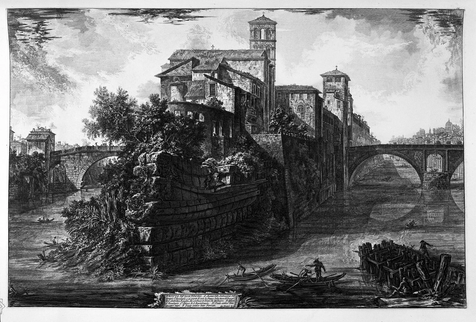
Ponte Cestio is the bridge that links the Tiber Island to the right bank of the Tiber, the one of Trastevere. On the other flank of the island Ponte Fabricio does the same job, leading toward the Ghetto. The two bridges together form the only continuous crossing of the river that rests on a natural support, and they have been in use for more than 2,000 years. The first Ponte Cestio dates to the 1st century BC, and in the 4th century AD it was rebuilt almost from scratch by the emperors Valentinian, Valens and Gratian, who for the occasion took travertine blocks from the nearby Theater of Marcellus, by then out of use. Here the tourist story usually stops, and here the problem begins: between 1888 and 1892 the bridge was dismantled and rebuilt almost entirely during the works on the Tiber embankments. What you cross today is twice as wide as the original, has two modern side arches and preserves only in part, and reassembled, the ancient central arch. Saying so takes nothing away from the monument: it only changes what you are looking at. The lines that follow explain what is ancient and what is not, which facts are established and which remain disputed, and how to visit the bridge today, which is free, always open and pedestrian.
Where Ponte Cestio is and how to get there
Ponte Cestio crosses the right arm of the Tiber between the Tiber Island and Piazza in Piscinula, at the mouth of Trastevere: access is free, 24 hours a day, with no ticket or gates. The island side opens onto Piazza San Bartolomeo all'Isola, in front of the basilica of San Bartolomeo. The Trastevere side comes out onto Lungotevere degli Anguillara, a step from Piazza Gioacchino Belli and Viale Trastevere. Whoever arrives from the other side of the island passes over Ponte Fabricio, which descends toward Lungotevere de' Cenci and the Ghetto.
On foot, starting from the center
From the Capitoline Hill and Piazza Venezia you go down Via del Teatro di Marcello, skirt the Portico d'Ottavia and in barely a quarter of an hour you are on the island. From Campo de' Fiori the most direct route is Via dei Giubbonari, Via Arenula and then Lungotevere de' Cenci: 20 minutes at a normal pace. From Largo Argentina it's about 10 minutes downhill. Those coming from the Aventine Hill or the Circus Maximus arrive from the Forum Boarium passing in front of the Arch of Janus and Santa Maria in Cosmedin, then take Ponte Palatino or go down onto the embankment.
The route we recommend to those who have time is another: you arrive from Ponte Palatino, look at the Ponte Rotto isolated in the middle of the current, go up the embankment upstream and climb onto Ponte Cestio from the Trastevere side. This way you see in order a Roman bridge reduced to a single arch, a Roman bridge rebuilt in the 19th century and a Roman bridge left almost intact, that is, Ponte Fabricio. Three different fates within 300 meters.
By public transportation
The most convenient is tram 8, which leaves from Piazza Venezia and stops at Piazza Gioacchino Belli, a little over 100 meters from the Trastevere end of the bridge. On the Lungotevere run the buses linking Testaccio to the Vatican area, with stops near Lungotevere degli Anguillara and Lungotevere de' Cenci. The nearest subway stop is Circo Massimo, on line B: from there you need 15 minutes on foot passing through the Forum Boarium. From Termini the best is line H or tram 8 taken after a first stretch by subway or bus, but the solution changes often depending on the building sites underway on the Lungotevere: before leaving it's worth checking the updated route on the Rome transit company's website, because detours on the Lungotevere are frequent.
By car, by bike and who it's really for
Bringing a car here makes no sense. The island and the two bridges are in a restricted traffic zone and transit over Ponte Cestio is reserved for authorized vehicles, starting with the ambulances of the Fatebenefratelli hospital, which occupies almost half the island. Private traffic goes over Ponte Garibaldi, a little farther upstream, or over Ponte Palatino downstream. Whoever arrives from outside Rome saves time by leaving the car at a park-and-ride on subway line B and finishing by subway. By bicycle, on the other hand, the place works well: the bike path on the Tiber embankments reaches right under the island and you climb back up by the ramps, although the surface of the embankments is uneven and after floods mud stays for weeks.
Accessibility
Ponte Cestio can be crossed in a wheelchair: the roadway is continuous and the connections with the two banks have no steps. The problem begins afterward. The descent to the embankments is by 19th-century ramps and stairways, some steep and without a continuous handrail, and the paving of Trastevere just past the bridge is sampietrini, awkward for small wheels. Whoever accompanies a person with mobility difficulties finds the route easier staying at the level of the Lungotevere and crossing the island and the bridges without going down to river level.
What you see today crossing Ponte Cestio
The bridge you cross today has three arches, is a little under 80 meters long and is about twice as wide as the Roman bridge that preceded it: these are the proportions that came out of the building site of 1888-1892, not the ancient ones. Walking over it takes a minute. Looking at it with understanding takes a few minutes more, and is done from below, not from above.
The three arches and how to tell them apart
The central arch is the one that repeats, and in part reuses, the ancient bridge: it is narrower and steeper than the other two, with large irregular travertine blocks, wide joints, surfaces hollowed by the water. The two side arches are an addition of the 19th-century reconstruction, made necessary by the widening of the riverbed: the blocks are more regular, the joints thin, the curve wider and lower. Once noticed, the difference leaps to the eye even for someone who has never looked at a bridge in their life. The point from which it is best seen is the embankment on the left going downstream, about 30 meters from the bridge.
The parapets, the inscriptions and the slabs
Set into the parapets are the slabs with the imperial inscriptions of the 4th century, or their copies: the text celebrates the rebuilding ordered by Valentinian, Valens and Gratian. The slabs you see today were repositioned during the 19th-century reconstruction, and on the question of which are the originals and which the reproductions the popular sources do not agree. We preferred to report the doubt rather than choose one: whoever wants the exact answer will find it in the epigraphic collections, where the texts of these inscriptions have been catalogued for over a century.
The materials: travertine, tuff, Roman concrete
The visible facing is largely travertine, the limestone of Tivoli that in Rome stands up well to water and frost. Underneath and inside, in the ancient part, is the core in Roman concrete, the mix of lime and pozzolana that allowed ancient builders vaults that without that mix would not have been possible. The 19th-century parts use modern masonry faced with new travertine: up close the difference in grain can be seen, from afar it can't, and that is exactly the effect the designers of 1888 were after.
The abutments and the relationship with the embankment walls
The two ends of the bridge fit into the muraglioni, the retaining walls over 10 meters high built starting in the 1870s to stop the floods that regularly inundated the center. It is a hard joint, without mediation: the ancient bridge was born on low, crumbling banks, today it dies against a vertical wall of travertine. Whoever wonders why the Tiber Island seems sunken compared with the city has the answer here: the island did not go down, the banks went up.
The reconstruction of 1888-1892: the fact almost nobody writes
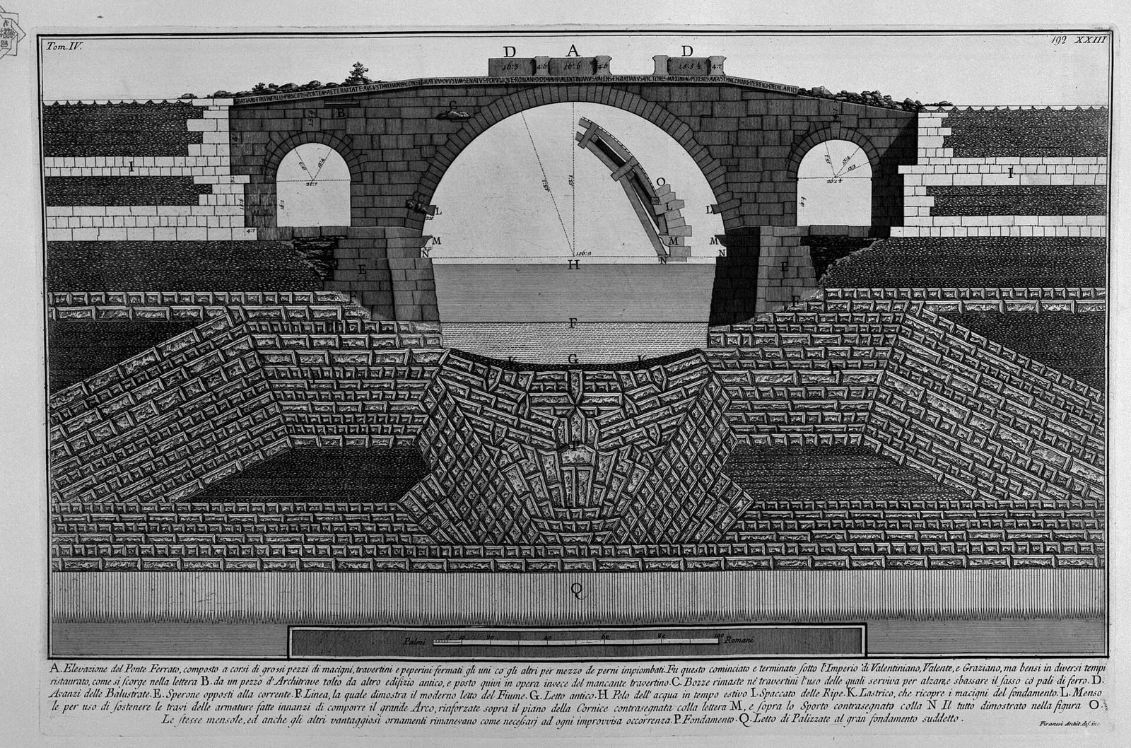
Between 1888 and 1892 Ponte Cestio was dismantled and rebuilt almost entirely. Not restored, not consolidated: dismantled stone by stone and reassembled longer and wider, with two new arches at the sides and the ancient central arch reassembled using in part the original blocks. This is the fact missing from almost all captions, signs and the spoken accounts you hear on the bridge, where the monument is presented as a Roman bridge of the 1st century BC that has come down to us. That is not how it went, and the thing is documented in the minutes of the Tiber works and in the writings of the archaeologists who watched the building site.
Why the bridge had to be rebuilt
The reason is hydraulic, not aesthetic. After the flood of December 1870, which inundated half of Rome a few weeks after the breach of Porta Pia, the new State decided to solve the problem of floods once and for all by channeling the river between two continuous embankment walls, with a regular section much wider than the natural one. The project led to the widening of the riverbed: where the river ran narrow between irregular banks, they dug and set back, so that the flood discharge would pass without overtopping the banks. The right arm of the Tiber, the one between the island and Trastevere, ended up widened to such an extent that the old bridge was no longer enough to span it. A bridge that doesn't reach the other bank serves nobody.
There was also a second reason, less told: the narrow section of the old bridge acted as a plug. The narrow piers and arches slowed the current in flood and made the level rise upstream, which is exactly the defect the embankment walls were meant to eliminate. The same reasoning cost the life of the surviving arches of the Pons Aemilius, today known as the Ponte Rotto, demolished in those same years down to the single arch still seen today, isolated in the middle of the river.
How it was done, in practice
The building site worked by subtraction and reassembly. The structures were surveyed and dismantled, the blocks numbered, the foundation redone with modern criteria on the newly dug riverbed, and finally the bridge was reassembled on a different geometry: longer, to span the widened arm, and wider, to bear the traffic of a growing city. For the two new arches new material was needed. For the central one the recovered ancient blocks were reused, but not all of them: some were too degraded, some were replaced, some ended up elsewhere. How many exactly are the ancient stones reassembled is one of the questions on which the sources diverge, and whoever writes a flat figure does so without being able to prove it.
How ancient is what we see
The honest answer is: in part, and above all at the center. The central arch preserves Roman material and repeats the ancient geometry. The two side ones are 19th-century work. The roadway, the parapets and the connections with the embankment walls are 19th-century. Whoever looks in Rome for a Roman bridge that has remained essentially as it was must cross the island and climb onto Ponte Fabricio, which is the other half of this same crossing and which the embankment building site spared because the left arm of the river did not require widening of the same extent.
The discordant voices, and why it's worth repeating
On the extent of the 19th-century intervention the popular literature swings between two extremes. Some speak of a simple conservative widening and others of total reconstruction with reuse of spolia. The documented truth is in between and leans toward the second extreme: new structure, new geometry, material in part ancient. Repeating it is not meant to belittle the monument. It is meant to understand what you are looking at, and not to attribute to the 1st century BC a curve drawn by an engineer of the Kingdom of Italy. A bridge that has been rebuilt three times in 2,000 years tells a more interesting story than an imaginary bridge that has stood still.
A comparison that helps
Whoever has seen Ponte Sisto has already met the same mechanism: there too the 19th century put its hand again to the 15th-century bridge to adapt it to the new riverbed, changing its proportions. And whoever knows Milvian Bridge knows that the ancient central arches coexist with rebuildings from very different periods, from the 15th century to Pius VII. In Rome bridges are almost always palimpsests. Ponte Cestio is the case in which the palimpsest is told least.
The Roman bridge: when it was born, who wanted it, how it was made
The first Ponte Cestio was built in the 1st century BC, at a time when Rome was arranging the crossing of the island in a stable and monumental way. Ponte Fabricio, on the opposite arm, bears carved the name of the magistrate who had it built and a date that the inscriptions fix at 62 BC. For Ponte Cestio there is no original inscription as clear, and the dating is derived by comparison and indirectly, within the second half of the century.
Who the Cestius was who gives it its name
On the figure who gives the bridge its name the uncertainty is real and must be declared. The most recurrent proposals in the literature are two: a Lucius Cestius active in Rome in the Caesarian age, who would have promoted the work in the years immediately after Caesar's death, and a member of the same family linked to Gaius Cestius Epulo, the one of the pyramid near Porta San Paolo. Neither hypothesis rests on a decisive proof. There is not, for Ponte Cestio, the document that for Ponte Fabricio says in clear letters who did what. All that can be stated without forcing is that the name is a gentilicium, that it points to a family active in Rome in the 1st century BC, and that the precise identification remains debated among scholars.
How a stone bridge was built in Rome
The technique is the same that is found in all surviving Roman bridges. The stretch of river concerned was diverted or isolated with cofferdams of wooden piles driven into the bed, the water was emptied out, the foundation of the pier was laid on a bed of piles and rubble, then the piers were raised in squared blocks of tuff and travertine joined dry with metal clamps. On the piers wooden centering was built, on which the blocks of the arch were laid from the springing to the keystone. Once the centering was removed, the arch held up by itself through compression. The fill above the vaults was in concrete, and above that ran the paving.
Two details distinguish Roman bridges from later imitations. The first are the cutwaters, that is, the wedge-shaped profiles of the piers facing upstream, designed to cut the water and to deflect the logs the Tiber carries in flood. The second are the occhi di scarico, the circular or arched openings made above the piers to let water through when the level exceeds the springing of the arches, reducing the thrust on the structure. Whoever looks at Ponte Fabricio recognizes them immediately. On Ponte Cestio, because of the rebuildings, the reading is less immediate.
The 4th-century rebuilding and the stones of the Theater of Marcellus
The second decisive moment in the life of Ponte Cestio is the late antique rebuilding ordered by the emperors Valentinian I, Valens and Gratian, which the inscriptions place around 370 AD. From that intervention the bridge also took a second name, Pons Gratiani, Gratian's bridge, which remained in use for centuries alongside the ancient one.
What the inscriptions say
The text of the slabs celebrates the three emperors as restorers of the work and mentions the rebuilding of the bridge. The inscriptions have been known to epigraphic collections since the 19th century and were copied many times even before: Humanists and Renaissance antiquarians transcribed them because they were among the few legible imperial epigraphs in the open air in the city. On their present location, as said, caution is advisable: the slabs were removed and repositioned during the 19th-century building site.
The travertine of the Theater of Marcellus
The detail that strikes most is the origin of the material. To rebuild the bridge in the 4th century, travertine blocks were taken from the Theater of Marcellus, which at that chronological point had long since stopped functioning as a theater and had become, in effect, a stone quarry 200 meters away. The reuse of material from disused buildings, what archaeologists call spolia, was not a late antique exception: it was the normal way of building when transporting new stone from the quarries cost more than recovering it on the spot. The same logic explains half of medieval Rome.
Here, though, the detail has an added value. The Theater of Marcellus, inaugurated by Augustus and dedicated to his nephew who died young, was one of the most imposing public buildings of the lower city. Seeing it become a quarry for a bridge less than four centuries after its inauguration says a lot about the Rome of the 4th century: a city that no longer built on an Augustan scale and that held its heritage together by dismantling one part to save another. Whoever looks today at the mass of the theater wedged beneath Palazzo Orsini is looking at the other face of the same story.
From the Middle Ages to the 19th century: the many names of the bridge
In the Middle Ages Ponte Cestio loses its ancient name and takes others, tied to what surrounds it: the most reliable way to understand how a place really worked is to look at what the people who passed through it every day called it.
Ponte San Bartolomeo
The most widespread name in medieval documents is Ponte San Bartolomeo, from the basilica of San Bartolomeo all'Isola founded at the end of the 10th century by the emperor Otto III on the site where the sanctuary of Aesculapius stood. The basilica preserves the memory of Adalbert of Prague and, according to tradition, the relics of the apostle Bartholomew: from the Middle Ages onward the island becomes a pilgrimage destination and the bridge takes the name of the church it leads to. The well that can be seen on the step of the high altar, made according to popular tradition over a spring tied to the ancient medical cult, is one of the most cited pieces of the continuity between the pagan sanctuary and the Christian church: as with all traditions, the story counts as a story and not as archaeological proof.
Ponte Ferrato
A second recurring name in the sources is Ponte Ferrato. The most accredited origin is technical: the clamps and metal reinforcements applied to the structure in the rebuildings, visible on the blocks, would have given the nickname. An alternative explanation tied to a railing also circulates, but it is not documented with the same strength. We report it as an attested name whose etymology remains debated.
The views that tell us what it was like
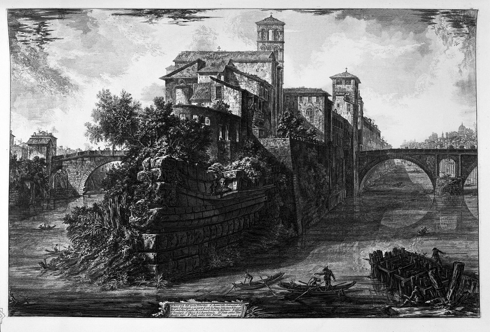
The best way to get an idea of the bridge before 1888 is to look at the images made by those who saw it. The 18th-century views by Giuseppe Vasi and the engravings by Giovan Battista Piranesi give back the island with its low banks, the boats, the vegetation on the shores. The watercolors of Ettore Roesler Franz, painted precisely in the years when the embankment walls were erasing that landscape, are the most direct testimony: a substantial part of that series is kept at the Museo di Roma in Trastevere, five minutes from the bridge, and it is the visit we recommend to anyone who wants to understand what the Tiber building site took away from the city. The exhibition rooms change over time and not the whole series is always on display: it's worth checking the museum's website before going specially.
A curiosity about Ponte Cestio
The soundest curiosity about Ponte Cestio is that part of its stones had already lived at least two lives before becoming a bridge: they were blocks of the Theater of Marcellus in the 4th century, became the ancient bridge, were dismantled in the 19th century and reassembled in the position where they are now. Few stones in Rome have such a documentable résumé.
The pedestrian bridge that is also a hospital road
Ponte Cestio is pedestrian for the public, but it is not a closed bridge: it remains the access route for authorized vehicles to the Fatebenefratelli hospital, which has occupied a good part of the island since the 16th century. It is one of the very few Roman monuments of this age that still performs an active health function 24 hours a day. Whoever stops for 10 minutes in the middle of the bridge sees a stretcher go by. It is a workplace, not just a relic, and this changes how it's best to stay there: without tripods planted in the middle of the roadway and without groups standing in front of the emergency room entrance.
The tip of the island that looks like a ship
At the downstream end of the island, toward the Ponte Rotto, a fragment of travertine facing shaped like a ship's prow is preserved, with traces of the ancient decoration. Tradition links it to the story of the arrival of Aesculapius's serpent in Rome, carried by ship from Epidaurus in 291 BC: it is precisely a tradition, not an archaeological fact, while the ship-shaped facing is real and visible from the embankment. You get there by going down the ramps below Ponte Cestio and walking along the embankment downstream, with an eye on the river level.
Ponte Cestio and Ponte Fabricio: two very different halves
The two bridges of the island are almost always cited together, but they tell opposite stories: Ponte Fabricio is the best-preserved Roman bridge in the city, Ponte Cestio is the most rebuilt Roman bridge. They are almost equally long and are less than 200 meters apart. Crossing one after the other, in the same quarter of an hour, is the quickest way to understand two centuries of urban history.
What to look at on Ponte Fabricio
On the bridge toward the Ghetto you see the two large ancient arches with the occhi di scarico above the central pier, the repeated inscriptions naming Lucius Fabricius, curator of the roads, and the two four-faced herms set into the parapet, from which the popular name Ponte dei Quattro Capi comes. The paving is irregular, the curve of the roadway is the ancient one, the parapet is low. These are all clues that are missing on Ponte Cestio, and it is precisely their absence that says how much the 19th-century building site weighed.
Something nobody tells you about Ponte Cestio
The thing almost never said is that Ponte Cestio, as we cross it, is a 19th-century monument that quotes an ancient monument. The sign doesn't say it, the spoken guides skip it, and the photograph that circulates presents it as Roman with no adjectives. Knowing how things went doesn't ruin the visit: it makes it readable.
The practical consequence: where to look and where not
From above, the bridge says little. The roadway, the parapets, the balustrade and the lampposts are 19th-century or later, and whoever stays on the bridge looking for the ancient won't find it. The ancient is read from below and from the side: from the embankment, looking at the springing of the central arch and the texture of the blocks near the waterline. If we had to name a single point, it would be the Trastevere embankment about 30 meters downstream of the bridge, with the sun at your back. The rest is panorama.
The second unsaid thing: the island has changed as much as the bridge
The Tiber Island too was redrawn by the Tiber building site. The profile of the shores, the embankments, the ramps, the stairs and the retaining wall that surrounds it almost everywhere are works of the last 150 years. The level at which we walk on the island is the ancient one: the river around it has been sunk and moved away. In the Middle Ages you went down to the water by a few steps and the gardens reached to the shore. Today you go down by a wide ramp, between vertical walls. It is no small detail: it explains why the island, which in old views seems to float, today seems sunken.
The advice I give you for visiting Ponte Cestio
The operational advice is only one and is worth more than any other: don't visit Ponte Cestio from above, visit it from below, going down onto the embankment, and do it in the first hour of light or the last. Access is free and always open, so the only cost is getting up early.
The time that changes everything
From 7 to 9 in the morning, in any season, there is almost nobody on the bridge and on the embankments. The light comes from the east, so it illuminates the end toward the Ghetto and leaves the one toward Trastevere in shadow: whoever wants the travertine in full light arrives in the morning and stands on the downstream side. In the late afternoon the situation reverses and the sun hits the Trastevere face from the side, with the Janiculum lighting up behind. In between, from 11 to 16, the light is flat and the island is full of groups in transit.
The route we recommend, 90 minutes
Start at Piazza Gioacchino Belli, climb onto Ponte Cestio, pause in the middle to look at the river upstream, go down onto the Trastevere embankment to see the central arch from below, climb back up onto the island, a full circuit of the island on the upper level with a stop at the downstream tip, entrance to the basilica of San Bartolomeo, crossing of Ponte Fabricio, 10 minutes in the Ghetto as far as the Portico d'Ottavia, and back. 90 minutes at a calm pace, without tickets. Whoever wants to extend it continues toward the Synagogue and the Jewish Museum, which instead have their own tickets and hours to check beforehand.
How much time you really need
For the bridge alone 10 minutes are enough, 20 if you go down to the embankment. Whoever slots it into a tour of Trastevere or the Ghetto crosses it without noticing and does wrong, because it is one of the few points in Rome from which you understand the shape of the river. Our judgment: half an hour well spent here is worth more than two hours in line elsewhere, and the ratio of time spent to things understood is among the best in the historic center.
Another well-known fact, yet rarely cited
The well-known fact that almost nobody links to Ponte Cestio is that the Tiber Island is, in all probability, the reason Rome exists where it exists. Here the river splits into two narrower and shallower arms, and for centuries this was the easiest point to cross the Tiber in the urban stretch. A practicable ford near defensible hills and a salt road that came from the coast: geography explains the city better than any founding legend.
The right photo to take of Ponte Cestio
The right photo at Ponte Cestio is not taken from the bridge: it is taken from the Trastevere embankment, about 30 meters downstream, framing the central arch at three-quarters with the tip of the Tiber Island and the Ponte Rotto in the background. It is the only position from which, in a single image, the bridge, the island and the river all fit.
Time and light
Two windows work. The first is early morning, when the raking light from the east draws the travertine joints and the water is still: it is the best hour for the texture of the stone. The second is the blue hour just after sunset, when the lampposts on the bridge and the hospital windows light up and the sky is still readable: it is the only hour when the exposure between sky and stone fits in the same image without compromise. At noon the contrast is harsh and the stone turns white without detail.
The other three framings that work
From the island embankment, under the bridge, with the arch framing the profile of Trastevere and the bell tower of Santa Maria in Trastevere in the background. From Ponte Garibaldi, looking downstream, to have bridge and island on axis with the Janiculum and the Acqua Paola Fountain high up. From Ponte Palatino, looking upstream, for the direct comparison between the Ponte Rotto in the foreground and Ponte Cestio behind: it is the photograph that best tells the difference in fate between the two.
Equipment and common-sense rules
You don't need much: a moderately wide-angle lens covers everything. A tripod is useful only at blue hour and must be set up on the embankment, never on the bridge, where it would block the passage of emergency vehicles. Photographing the outside of monuments is allowed. For church interiors, each church's own rules apply, and they often ban flash and tripods. In the hospital area, people's privacy applies: don't photograph patients, stretchers or the emergency room entrances.
Some Important Events That Happened Here in History
Ponte Cestio is not the stage of great battles or famous ceremonies. It is infrastructure, and its history coincides with the history of the crossing. The episodes that follow are the documented ones that concern the bridge directly or the island it leads to.
291 BC: the sanctuary of Aesculapius
Literary tradition says that during a plague the Romans sent an embassy to Epidaurus and brought the cult of Asclepius, Latinized as Aesculapius, back to Rome in the form of a sacred snake that was said to have stopped on the island. The story is tradition. The historical fact is the founding of the sanctuary on the island in 291 BC and its operation for centuries as a healing center. It is from this cult that the island's healthcare vocation descends, unbroken up to today's hospital.
The 1st century BC: building the two bridges
Within a few decades Rome gave the island two masonry bridges: Ponte Fabricio, dated by its inscriptions to 62 BC, and Ponte Cestio, built in the second half of the same century. The crossing became permanent and monumental, and Trastevere entered fully into the urban fabric.
Around 370 AD: the imperial rebuilding
Valentinian I, Valens and Gratian had the bridge rebuilt using travertine from the Theater of Marcellus. This is the work that gave the monument its second name, Pons Gratiani, and produced the inscriptions still linked to the bridge today.
998: Otto III and the basilica
Emperor Otto III had the Basilica of San Bartolomeo built on the island, in memory of Adalbert of Prague. From then on the bridge changed name in common use and became Ponte San Bartolomeo, following the church it leads to.
1584: the arrival of the Fatebenefratelli
The Hospitaller Order of Saint John of God settled on the island and opened a hospital there, which has never closed since. The continuity between the sanctuary of Aesculapius and today's hospital is one of the best-documented cases of a function persisting in one place in a European city.
1849: the Roman Republic
During the French siege of the Roman Republic the fighting was concentrated on the Janiculum, which overlooks Trastevere. The wounded came down toward the river and the hospitals of the lower city, and the crossing of the island was one of the routes used. The story is told at length at the Museum of the Roman Republic and Garibaldian Memory, on the Janiculum, which is the right visit for anyone who wants to learn more about 1849.
1870: the flood that decided everything
On December 28, 1870, the Tiber overflowed and flooded the center of Rome just a few weeks after the annexation to the Kingdom of Italy. The decision to build the embankment walls came from there, and with it the fate of Ponte Cestio.
1888-1892: the reconstruction
The bridge was taken apart and reassembled wider and longer, with two new arches. In the same years the remaining arches of Ponte Emilio were demolished, Ponte Garibaldi was built, and the Roman river landscape took the form it has today.
1943-1944: the hospital during the occupation
During the German occupation of Rome the island's hospital took in and hid wanted people, among them Jews who had escaped the roundup of the Ghetto on October 16, 1943, registering them as suffering from a nonexistent, contagious disease to discourage checks. The story is documented and acknowledged, and the island's bridges were the route by which those people arrived. Anyone who wants the context will find it at the Jewish Museum of Rome and in the page dedicated to the Ghetto.
Who Has Crossed Ponte Cestio
Over 2,000 years, Ponte Cestio has been crossed mostly by ordinary people: the sick heading to the sanctuary and later to the hospital, millers, pilgrims, Trastevere residents going to market. The well-known names that follow are those whose presence on this stretch of the river is documented or attested by their own works.
Giovan Battista Piranesi and Giuseppe Vasi
The two great engravers of eighteenth-century Rome both depicted the island and its bridges. Their plates are today the most precise record of how the bridge looked before the nineteenth-century works, with low banks and buildings right up against the water. A substantial part of Rome's engraving heritage is held at the Istituto Centrale per la Grafica, which exhibits on a rotating basis.
Ettore Roesler Franz
A Roman painter of German origin, between the 1870s and the 1890s he painted the watercolor series known as Roma sparita (Vanished Rome), created precisely to record what the embankment walls were about to erase. His views of the Tiber at the island are the closest visual testimony of the bridge before its reconstruction. A large part of the series is at the Museo di Roma in Trastevere.
The people of Trastevere, every day
It is worth closing the list with those who left no name. For centuries Ponte Cestio was the daily shortcut between Trastevere and the rest of the city, the only way to cross the river on foot without a detour. It still is. At dawn, before the tourists, nurses coming off the night shift and kids going to school cross it. It is the traffic the bridge was built for.
What to See Around Ponte Cestio
Ponte Cestio sits at the center of an area that, in half an hour of walking, brings together a medieval district, an ancient neighborhood and three centuries of archaeology. Within a kilometer there are more monuments you can visit for free than in any other part of the historic center.
On the island and just beyond
The Basilica of San Bartolomeo all'Isola, with the well on the altar and the reused columns. Ponte Fabricio toward the Ghetto. The Ponte Rotto, visible from both banks. On the Trastevere side, the small Church of Sant'Agata and, a little higher up, Santa Cecilia in the Ripa Grande district.
Toward the Ghetto and the Foro Boario
Crossing Ponte Fabricio, in a few minutes you reach the Portico d'Ottavia, the Theater of Marcellus (the source of the stones for the late antique rebuilding), and the Synagogue. Heading up toward the Capitoline Hill you come to the Crypta Balbi, the right museum for understanding how Rome transformed between antiquity and the Middle Ages. Going down along the river you enter the Foro Boario, with the Arch of Janus, the two Republican temples and the Mouth of Truth.
Toward upper Trastevere and the Janiculum
From the Trastevere end of the bridge you climb toward Santa Maria in Trastevere, Santa Maria della Scala and the Museo di Roma in Trastevere. Higher up are the Villa Farnesina, the Botanical Garden, the Galleria Corsini, the Tempietto del Bramante inside the San Pietro in Montorio complex, and the Fontana dell'Acqua Paola. If you have half a day, you'll find the complete picture in the page on Trastevere.
The other bridges, if the theme interests you
Anyone who comes to Rome for the bridges has a day already written: Ponte Sisto upstream, Ponte Sant'Angelo with Bernini's statues in front of Castel Sant'Angelo, Ponte Milvio at the northern end, and the Ponte della Musica for the contrast with the contemporary. They can all be reached with a combination of tram 2, riverside buses and the metro.
When to Go: Seasons and Tiber Floods
Ponte Cestio is accessible all year and free of charge, but the embankments under the bridge are not. They are closed during floods and in the days after, and the closure can last weeks. It is the only seasonal variable that really matters if you want to see the bridge from below.
Autumn and winter
Between November and March the river is high and the embankments are often impassable. On the other hand, the city is empty, the low light is the best of the year, and the island at 8 in the morning is deserted. If you come in this season, prepare a plan B from street level: from Ponte Garibaldi and Ponte Palatino you can see the bridge well even with the embankments closed.
Spring
April and May are the months when the balance of climate, light and crowds is most favorable. The embankments are usually open, the greenery on the banks is thick, and the days are long. It is also the period when organized groups start crossing the island nonstop between 10:00 and 16:00.
Summer
In summer the Lungotevere changes face: the river's summer festival sets up on the embankments, with stalls, bars and shows, and the island has hosted open-air film screenings for years. If you want the bridge in silence, avoid the evenings of July and August. If you want summer Rome on the river, here is one of its main concentrations. Dates and programs change every year, so check them on the festivals' official pages. We keep the updated picture in the page on Lungo il Tevere Roma, which covers the stretch between Ponte Sublicio and Ponte Sisto and so does not duplicate this page.
Sundays and markets
On Sunday mornings Trastevere is taken over by the flow toward Porta Portese, the biggest flea market in the city. If you arrive in those hours, you'll find Viale Trastevere and the Lungotevere much busier than usual. The bridge stays quiet, but public transport doesn't.
Eating in the Area Without Falling Into a Trap
Ponte Cestio opens onto one of the areas with the highest density of tourist restaurants in Rome, between the entrance to Trastevere and the Portico d'Ottavia. Here the difference in quality between two signs 50 meters apart can be huge, and you can't tell from the menu on display. That's why we don't name places: restaurants change management within a few months, and a list goes out of date before the next season. We prefer to give the criteria.
The signs that argue against a restaurant
They are always the same and you can spot them from the street. The lady rolling out fresh pasta in the window or right on the sidewalk is an advertising lure, not a sign of good cooking. A menu with photos of the dishes, often translated into 5 languages, points to a place built on customers who don't come back. The barker who invites you to sit down as you walk by is doing the same job. A place open from morning to late at night with no kitchen break isn't cooking, it's reheating. And tables set in front of a famous monument, with items not priced on the list or different prices between the dining room and the outdoor seating, are the oldest trap in the city.
The chain places of the center
In this area there are several signs that repeat identically in many spots of the center, with the same menu and the queue with a ticket number. They are a commercial phenomenon, not a gastronomic one: they live on tourist flow and brand recognition. Romans don't go there, and that is the only fact you need to know.
The criterion that always works
Look at who is sitting and in what language they order. If the tables hold locals speaking Italian with a Roman accent, the place holds up. If there are only big tables of passers-by with cameras around their necks, it's worth walking another 5 minutes toward the inside of the district, where prices go down and the cooking goes up. For a broader picture on the subject we have a dedicated page: where to eat in Rome without falling into the tourist trap. If you want already selected recommendations, you can consult Daniele Dezi's personal list on Google Maps, curated and not sponsored.
Frequently Asked Questions About Ponte Cestio
How much does it cost to visit Ponte Cestio?
Visiting Ponte Cestio is free: it is a public bridge, with no ticket office, turnstiles or opening hours. Access is free 24 hours a day, as with all the bridges of Rome. The descent to the Tiber embankments, when they are open, is also free, as is the visit to the Basilica of San Bartolomeo all'Isola, which however has its own hours tied to religious services and closes in the middle of the day.
Is Ponte Cestio the original Roman bridge?
Ponte Cestio is not the original Roman bridge in its entirety: it was taken apart and rebuilt almost completely between 1888 and 1892, during the works on the Tiber embankment walls, and the work made it wider and longer. The central arch repeats the ancient geometry and partly reuses the original blocks. The two side arches are nineteenth-century. Anyone looking for a Roman bridge that has remained substantially intact has to cross the island and go up onto Ponte Fabricio.
How do you get to Ponte Cestio by public transport?
You can reach Ponte Cestio by tram 8, which from Piazza Venezia stops at Piazza Gioacchino Belli, a little over 100 meters from the entrance to the bridge on the Trastevere side. The buses connecting Testaccio to the Vatican area run along the Lungotevere. The nearest metro stop is Circo Massimo, on line B, a quarter of an hour on foot. Detours on the Lungotevere are frequent, so it's best to check the updated route before leaving.
How much time do you need to see Ponte Cestio?
To cross Ponte Cestio and look at it carefully, 20 minutes is enough, including the descent to the embankment to see the central arch from below. If you include it in the full tour of Tiber Island, with the Basilica of San Bartolomeo, Ponte Fabricio and the downstream tip shaped like a ship, allow between 1 hour and 90 minutes. Adding the Ghetto or the first stretch of Trastevere comfortably makes it half a day.
Is Ponte Cestio accessible with strollers and wheelchairs?
Ponte Cestio is accessible by wheelchair and with a stroller: the roadway is continuous, without steps, and the connections with the two banks are level. The difficulties begin off the bridge, because the descent to the embankments is by steep ramps and nineteenth-century stairways, and the paving in Trastevere is sampietrini. Staying at the level of the Lungotevere, you can cross the island and the bridges without obstacles.
Can you photograph Ponte Cestio?
Photographing Ponte Cestio is allowed, since it is an outdoor public space, and no permit is needed for personal photos. The tripod must be set up on the embankment and not on the roadway, because the bridge remains the access route for emergency vehicles to the island's hospital. For church interiors, each church's rules apply, and they often ban flash and tripods. Patients' privacy and the hospital areas must be respected.
Can you cross Ponte Cestio by car?
Ponte Cestio cannot be crossed by private car: passage is reserved for authorized vehicles, in particular ambulances and service vehicles of the Fatebenefratelli hospital. Ordinary traffic goes over Ponte Garibaldi, a little upstream, and Ponte Palatino, downstream. For those arriving from outside the city, the quickest solution is still to leave the car in a park-and-ride on metro line B and finish the trip by public transport.
Is Ponte Cestio suitable for children?
Ponte Cestio is suitable for children: it is pedestrian, short, with no tickets and no queues, and Tiber Island, which it leads to, can be walked in 20 minutes. The parapets meet code and traffic is limited to authorized vehicles. The descent to the embankments should be judged case by case, because the ramps are steep and the surface stays slippery after floods. The tip of the island shaped like a ship's prow works well as a story for the little ones.
What is the difference between Ponte Cestio and Ponte Fabricio?
Ponte Cestio connects Tiber Island to Trastevere, Ponte Fabricio connects it to the Ghetto bank: they are the two halves of the same crossing. The substantial difference is the state of preservation. Ponte Fabricio, dated by its inscriptions to 62 BC, is the best-preserved Roman bridge in the city. Ponte Cestio was remade in the 4th century and rebuilt almost entirely between 1888 and 1892.
Who Wrote This Page
This page is curated by the editorial team of Tour Leader Pro, the Rome-based project office that designs and coordinates visits, itineraries and cultural events in Rome and Lazio. The hours, fares and access conditions given here were checked against the official sources named in the text as of the publication date. It's worth rechecking them before you leave, because they change often. If you find outdated information, let us know.
If you want to approach Tiber Island, the bridges and the Ghetto with a guide who can read the stones, on tourleaderpro.com you will find the private visits and tailor-made routes curated by our team, including walking itineraries along the Tiber and packages for corporate and school groups. The same team handles escort services and logistics for those organizing cultural events in the city, and answers quote requests with a written program and a clear price.
If you are coming from abroad and preparing a wider trip in Italy, on italyplanner.com you will find guides in English, day-by-day itineraries, day trips and practical information on trains, travel times and seasons, with the same criterion we follow here: verified data, no lists of restaurant signs, and an explicit judgment on what is worth the time you have.