Rione Borgo
In short. The rione Borgo is the 14th rione of Rome and occupies the strip of city between Castel Sant’Angelo and Piazza San Pietro, on the right bank of the Tiber.
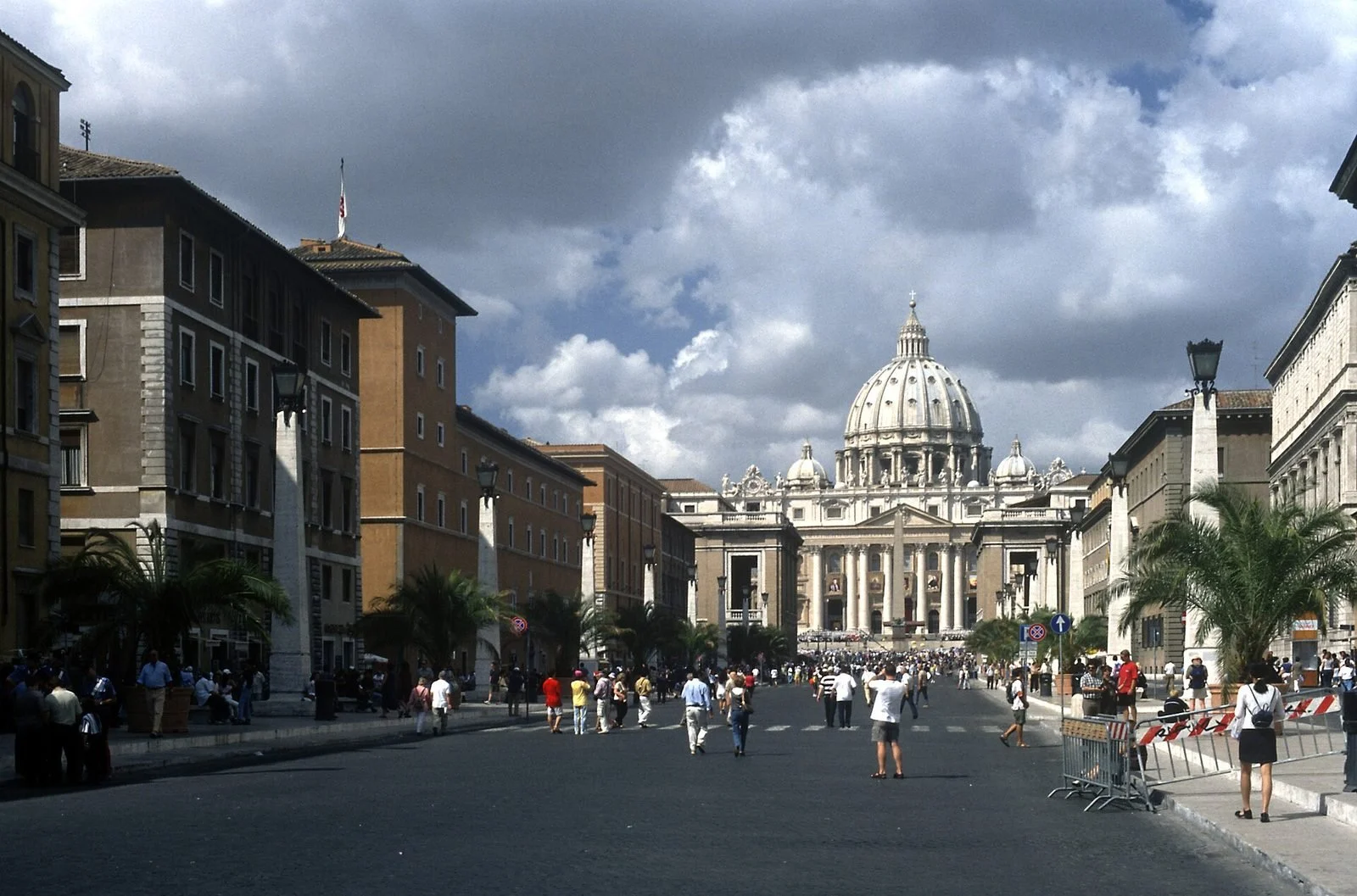
The rione Borgo is the 14th rione of Rome and occupies the strip of city between Castel Sant'Angelo and Piazza San Pietro, on the right bank of the Tiber. It is a narrow strip, a little over a kilometer from east to west, that almost everyone crosses without knowing they have crossed it: you step off Ponte Sant’Angelo, walk 10 minutes and find yourself in front of Bernini's colonnade. In between is Borgo, with a history of its own, older than the Vatican as a State and different from that of the rest of Rome. It began as a settlement of foreign pilgrims around the tomb of Peter, was walled in by Pope Leo IV in the 9th century, became the neighborhood of hotels and moneychangers serving the jubilees, and in the 20th century lost its backbone: two entire streets, demolished between 1936 and 1950 to open Via della Conciliazione. Here we tell what Borgo was, what remains of it, what was destroyed and how to visit it today.
Where the rione Borgo is and what its boundaries are
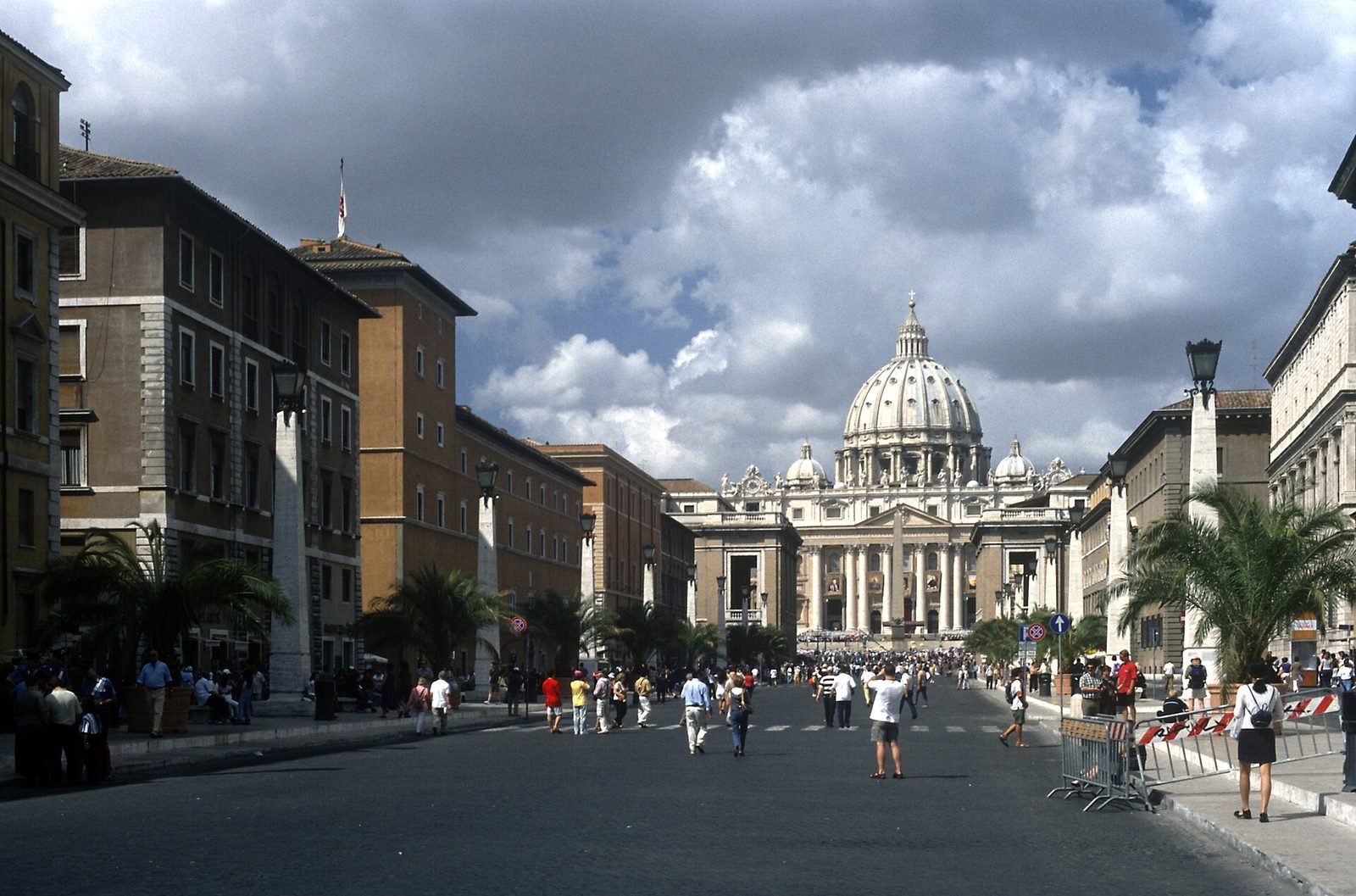
The rione Borgo borders the Tiber to the east at the height of Castel Sant’Angelo, the State of Vatican City to the west, the Prati neighborhood to the north and the Janiculum hill to the south. Its two extremes are Piazza Pia, in front of the castle, and Piazza San Pietro: between the two runs Via della Conciliazione, which is today the main axis of the rione and which until 90 years ago did not exist.
The current boundaries, changed in 1929
The boundaries of the rione are no longer the historic ones. With the Lateran Pacts of February 11, 1929 a substantial part of Borgo, the one around the basilica and the apostolic palaces, passed to the new State of Vatican City: the Italian rione stops where Vatican territory begins, which in the square is marked by a band of light travertine on the paving, at the opening of the colonnade. From that day the rione XIV has been administratively smaller than it was in the 19th century, while remaining one of the largest in Rome on paper because of the buffer areas toward the Janiculum.
How to get there by public transport
The nearest metro stop is Ottaviano on Line A, from which you walk about 10 minutes along Via Ottaviano to Piazza del Risorgimento and from there to Borgo Pio. The alternative is Lepanto, also on Line A. From the historic center the buses going up Corso Vittorio Emanuele II reach Piazza Pia and Largo Giovanni XXIII in a few minutes. The lines change often because of construction work and closures tied to events in Piazza San Pietro: it's best to check the updated route on the Atac app, because a detour can lengthen the trip by 20 minutes. On tickets and connections we have a page devoted to how to get around Rome.
On foot, which is almost always the best solution
From Piazza Navona to Piazza San Pietro it's just under 25 minutes on foot via Ponte Sant’Angelo, from the Pantheon add five more. From Campo de’ Fiori the most direct route goes by Via dei Banchi Nuovi and Via del Banco di Santo Spirito, which is the old pilgrims' road and preserves the name of the ancient papal bank. From Trastevere you go up along the river from Ponte Sisto in about 20 minutes. If you arrive by bicycle you find the lungotevere bike path almost to Piazza Pia: the page on Rome by bike explains where you can really ride.
Why it's called Borgo: the northern pilgrims and the word burgus
The name Borgo derives from the Germanic burg, through medieval Latin burgus, and originally indicated the settlement that arose outside the walls of Rome around St. Peter's. It is not an Italian name: it was brought by the pilgrims who came from northern Europe and who settled here in national groups, each with its own neighborhood, its own church and its own hospice.
The scholae peregrinorum
Between the 8th and 9th centuries the area adjoining the tomb of Peter organized itself into four stable foreign communities, called scholae: the Schola Saxonum of the Saxons, the Schola Francorum of the Franks, the Schola Frisonum of the Frisians and the Schola Longobardorum of the Lombards. They were not schools in the modern sense of the term. They were associations of fellow countrymen serving as hospice, church, cemetery and mutual aid, with their own head and their own militia, and they served to give assistance to those who arrived in Rome after months of travel along Via Francigena. Each schola had its sector of houses and gardens, and from this fabric of foreign quarters, not from a unified plan, the urban fabric of Borgo was born.
The Saxons and the place name Sassia
The Schola Saxonum is the one that left the most lasting mark on the place names. Tradition traces it back to King Ine of Wessex, who around 727 is said to have founded in Rome a hospice for the pilgrims of his kingdom, and the Latin name Saxia, meaning land of the Saxons, has stayed attached to the place for 1,300 years. Today you can still read it on the facade of the church of Santo Spirito in Sassia, on the lungotevere that bears the same name and in the name of the hospital. It is one of the few cases in Rome in which an Anglo-Saxon place name survived intact through Latin, Italian and dialect.
The Leonine City: the walls of Leo IV and the sack of 846
The Leonine walls were built between 848 and 852 by order of Pope Leo IV and enclosed for the first time in a fortified circuit the Vatican hill, the basilica of St. Peter and the pilgrims' borgo, creating the so-called Civitas Leonina. It was a direct response to a disaster that had happened two years earlier.
The Saracen raid of 846
In August 846 a Saracen fleet sailed up the Tiber and plundered the two great basilicas that stood outside the Aurelian wall: St. Peter's in the Vatican and St. Paul Outside the Walls. Rome within the walls held, because Aurelian's walls held. The basilicas did not: they were defenseless by definition, having been built outside the city over the tombs of the two apostles. The raiders carried off the silverware, the cladding, the offerings accumulated over five centuries of pilgrimages, and desecrated the tombs. The blow to the credibility of the papacy was enormous, because it made evident that the center of Western Christendom was unable to defend its founding relic.
The construction of the walls, 848-852
Leo IV started the work immediately afterward, financing it with contributions from the cities of the papal patrimony and with the economic help of the Carolingian emperor Lothair I. The circuit was a little under three kilometers long, in brick, reinforced by about 40 towers, and ran down from the Vatican to the river, incorporating Castel Sant’Angelo as the eastern stronghold. The sources report that the settlers of the domuscultae, the Church's great farms in Lazio, called up in turns, also worked on the construction. In 852 the pope consecrated the walls with a procession that went along their entire perimeter. From that moment Borgo was a city within the city, with its gates, its guards and its closing hours.
The Borghi: the streets that give the rione its name
The rione is called Borgo in the singular, but the streets that make it up are all called Borgo in the plural: Borgo Santo Spirito, Borgo Sant’Angelo, Borgo Pio, Borgo Vittorio, Borgo Angelico. They are parallel or nearly parallel streets, laid out like a comb between the river and the Vatican, and their history can be read in the name of whoever opened them.
Borgo Santo Spirito
It is the southernmost and the oldest in layout, and runs from the Santo Spirito hospital to the start of Piazza San Pietro, passing under the flank of the church of Santo Spirito in Sassia. On this street face the monumental entrance of the hospital complex, the general headquarters of the Society of Jesus and a row of remodeled 16th- and 17th-century palaces. It is also the street that preserves the most austere character of the rione: little commerce, many institutions, and a light that in the morning arrives raking from the east.
Borgo Pio, Borgo Vittorio, Borgo Angelico
These three parallel streets are the result of a 16th-century urban operation. Pius IV, pope from 1559 to 1565, had the fortifications extended to the north by building a new stretch of walls and opening Porta Angelica, and within the land thus gained had a regular grid of streets laid out, meant for the Vatican's service buildings. Borgo Pio bears his name. The other two were added in the same plan or soon after, and on the exact origin of their names the local sources do not fully agree: different explanations circulate, none of which rests on a document we were able to check, and we prefer to say so rather than choose the most pleasing version.
Borgo Pio today is the pedestrian street with the little tables, and we talk about it further on because it deserves a precise warning. Borgo Vittorio and Borgo Angelico, a few yards away, have stayed much more residential: same houses, same width of roadway, a tenth of the tourists. Anyone who wants to understand how people lived here before the rione became a corridor of passage should walk those two, not the first.
Borgo Vecchio and Borgo Nuovo, the two streets that no longer exist
The two most important streets of Borgo are no longer on the map. Borgo Vecchio was the medieval route that led from the bridge to the basilica, the pilgrims' street par excellence, lined with hotels, moneychangers, sellers of medals and food. Borgo Nuovo was opened by Alexander VI for the jubilee of 1500 and was long called Via Alessandrina: it was the street of display, wider and more regular, the one for papal processions and solemn entrances. The two streets ran almost parallel and between them was an elongated wedge-shaped block. That block was called the Spina.
The Spina di Borgo and its demolition, 1936-1950
The Spina di Borgo was the block of houses between Borgo Vecchio and Borgo Nuovo, demolished starting October 29, 1936 to open Via della Conciliazione, inaugurated in 1950 for the Holy Year. It is the central episode of the rione's modern history, and it has to be told in full, because the street everyone walks today exists in the place of something.
What the Spina was
It was a building block about 300 meters long and a few dozen meters wide, narrowing toward the river like the prow of a ship. Inside were working-class houses, shops, pilgrims' hotels, two squares (Piazza Scossacavalli and Piazza Rusticucci), the church of San Giacomo Scossacavalli, the Palazzo dei Convertendi and a quantity of smaller buildings layered from the 15th to the 19th century. Several thousand people lived there, and the current estimates range from 800 to over a thousand families. It was a lived-in neighborhood, dense, noisy, with laundry hung out and shops on the ground floor, as Trastevere or the Jewish Ghetto of Rome were then.
Why it was torn down
The idea of opening a straight street toward St. Peter's is old and recurs in the projects of architects from the 16th century onward, but it stays on paper for four centuries. It becomes executive after the signing of the Lateran Pacts of 1929, when the Fascist regime and the Holy See both have an interest in materializing the reconciliation in a visible work. The project is entrusted to Marcello Piacentini and Attilio Spaccarelli. On October 29, 1936 Mussolini strikes the first blow of the pickax in front of the cameras of the Istituto Luce. The work continues with a war in the middle and the street is completed in time for the jubilee of 1950, with the final arrangement of the head toward the colonnade.
What was lost
An entire medieval street was lost, Borgo Vecchio, with its continuous front of houses from the 15th to the 19th century. Piazza Scossacavalli was lost, which was the real square of the rione, the one of the market and neighborhood life. The church of San Giacomo Scossacavalli was lost, demolished in 1937 after being deconsecrated: it was a church of ancient foundation, rebuilt in the 16th century, and of it there remain photographs, surveys and a few scattered furnishings. The houses of an entire Roman working-class population were lost, transferred by official order to the outlying borgate then under construction. And what was lost, forever, was a relationship between narrow space and wide space that had been conceived by whoever had designed the square.
The destroyed effect of surprise
This is the point we advise keeping in mind more than any other. Gian Lorenzo Bernini designs the colonnade between 1656 and 1667 knowing very well how one arrived there: through the narrow streets of Borgo, that is through a compressed, dark fabric, a few meters wide. Anyone coming out of Borgo Nuovo found the square upon them all at once, without warning, and the ellipse of 284 columns opened in front of them like something that couldn't be there. That effect was the design. Via della Conciliazione erased it: today the dome is seen from 700 meters away, shrunk by perspective, and when you reach the square the surprise has already been used up by a quarter of an hour of walking in a straight line. The paradox is that the street conceived to exalt St. Peter's took away from the basilica its best entrance. It is not an isolated opinion: it is the criticism that architectural historiography has repeated since the 1950s, from Bruno Zevi onward, and it is the reason why the demolition of the Spina is still cited in textbooks as an example of what happens when a perspective axis is mistaken for an urban solution.
Where the pieces went
Some fragments of the Spina were not destroyed but moved, and can still be seen. The fountain that stood in the center of Piazza Scossacavalli, tied to Carlo Maderno's work at St. Peter's, was dismantled and repositioned in front of the church of Sant’Andrea della Valle on Corso Vittorio Emanuele II: anyone passing there is looking at a fountain from Borgo without knowing it. The Palazzo dei Convertendi was rebuilt set back, on the north side of the new street, with some of the original elements. Photographs of the Spina before the demolition exist in quantity, because the demolition was documented both by preservation campaigns and by propaganda: they are the main source for understanding what was there.
A judgment, since one is needed
Via della Conciliazione is not an ugly street in itself. It is wide, orderly, well proportioned in its 1930s language, and the row of obelisk-shaped lampposts has a dignity of its own. The problem is the price. To obtain a perspective that nobody had asked for, a living neighborhood was erased and Bernini's urban masterpiece was spoiled. Anyone visiting Rome can perfectly well walk it, but knowing they are walking inside the void left by something else. It is the difference between seeing a street and reading it.
Via della Conciliazione today
Via della Conciliazione is about 500 meters long and connects Piazza Pia to Piazza San Pietro, with a central roadway and two very wide sidewalks marked out by travertine lampposts in the shape of obelisks. It is the only street in Rome built to be walked looking straight ahead, and it is also the least Roman in the historic center: anyone walking it for the first time senses it immediately, without being able to say why.
What is really along the street
On Via della Conciliazione face ancient buildings reassembled and new buildings built in imitation. Palazzo Torlonia, at number 30, is an authentic Renaissance palace of the early 16th century, which stayed in place because it stood outside the Spina. The Palazzo dei Penitenzieri is 15th-century and keeps inside a cycle of frescoes by Pinturicchio in the so-called Sala dei Semidei, which can be visited only on special occasions and with access regulated by the owner. The Palazzo dei Convertendi, as noted, is a reassembly. The other fronts are mostly constructions of the 1930s and 1940s in travertine and brick, designed not to clash.
The underpass at Piazza Pia
At the head toward the river the situation has recently changed. In view of the jubilee of 2025 the lungotevere was routed through a tunnel under Piazza Pia, turned into a continuous pedestrian square between Castel Sant’Angelo and the start of Via della Conciliazione. The work opened at the end of 2024 after a long and contested construction site, which involved archaeological excavation of the area. The practical result is that today you go from the castle to the street without crossing a fast-moving roadway. It's still best to verify the pedestrian layout before going, because the final arrangements were completed in successive lots.
The Passetto di Borgo, the corridor of the popes
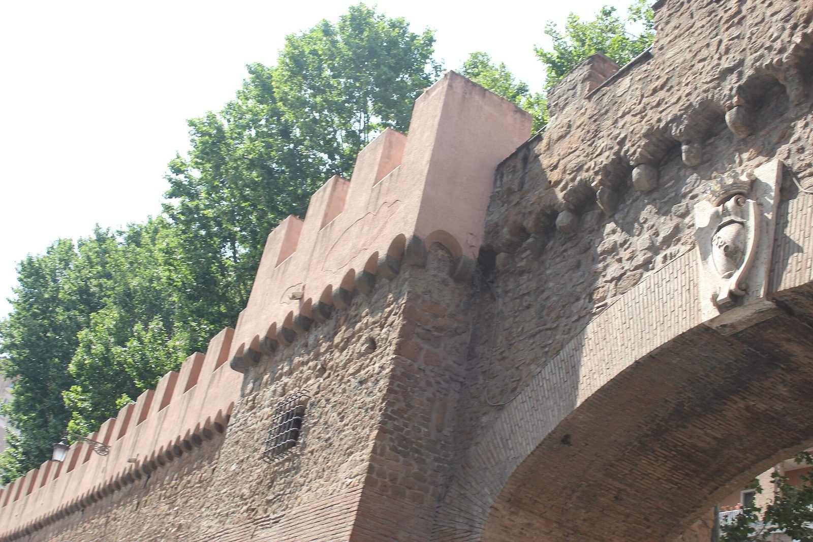
The Passetto di Borgo is an elevated walkway about 800 meters long that connects the Vatican palaces to Castel Sant’Angelo, running over a stretch of the Leonine walls between Borgo Sant’Angelo and Via dei Corridori. It is the popes' escape route, and on at least two occasions it worked exactly for that.
Who built it
The wall on which the Passetto runs dates from the 9th century, to the walls of Leo IV. The corridor proper, that is the covered walkway usable at height, is attributed to Nicholas III, pope from 1277 to 1280, as part of the works that permanently moved the papal residence from the Lateran to the Vatican. The structure seen today is however largely the result of the intervention of Alexander VI Borgia, between 1492 and 1503, who had it reinforced, crenellated and equipped militarily: for this reason it is also called the corridor of Alexander VI. Further reworkings are due to Urban VIII in the 17th century, on the occasion of the reorganization of the castle's defenses.
1494 and 1527, the two times it was needed
In 1494 Charles VIII of France came down into Italy and entered Rome with his army. Alexander VI, who was in no position to oppose him militarily, withdrew to Castel Sant’Angelo through the corridor and negotiated from there: the affair ended with an agreement and no damage to the city, but the pope had used the Passetto for what it was, that is an umbilical cord between the palace and the fortress.
On May 6, 1527 it went much worse. The imperial troops of Charles V, made up of Spaniards and German landsknechts largely Lutheran, left without pay and without command after the death of the Constable of Bourbon under the walls, broke through precisely on the side of Borgo and the Janiculum. Clement VII was celebrating in St. Peter's when he was told that the front had fallen. He ran the Passetto to Castel Sant’Angelo while beneath him the soldiers were entering the rione. The chronicles agree that the Swiss Guard covered the retreat fighting in front of the basilica and that most of its men died there: the figure traditionally reported is 147 dead out of 189 men, and it is remembered every year on May 6 in the oath ceremony of the recruits. The Sack of Rome lasted months, devastated Borgo more than any other rione because it was the first to be hit, and effectively closed the season of the Roman Renaissance.
Can you visit it?
The Passetto is not open continuously. In recent years it has been made accessible in limited periods, with guided visits organized by the body that runs Castel Sant’Angelo, often concentrated in the summer season or on special occasions, with limited places and mandatory reservation. We give neither hours nor fares here because they change from year to year and publishing an old figure is worse than not publishing it: the only reliable source is the official website of the Castel Sant’Angelo museum, where the openings are announced one at a time. Anyone who cares should check a few weeks ahead, because when they open the places go fast.
A useful clarification, because it generates confusion: the Passetto di Borgo has nothing to do with the passetto del Biscione, which is a different place, on the other side of the river, near Campo de’ Fiori. Same common name, two different things.
Santo Spirito in Sassia, the hospital and the wheel
The complex of Santo Spirito in Sassia, in Borgo Santo Spirito, brings together a 16th-century church and a hospital of medieval foundation that operated continuously for more than 700 years. It is the place in Borgo that preserves the most memory of what the rione really was, that is a machine of welcome and care built around the flow of pilgrims.
The church
The present church was rebuilt in the 16th century to a design by Antonio da Sangallo the Younger, at the wish of Paul III, on the site of the old church of the Schola Saxonum. The travertine facade, in two orders, was completed in the second half of the century and is attributed to Ottaviano Mascarino. The interior has a single nave with side chapels and a coffered ceiling. You enter free of charge during the hours of opening for worship, which in Roman churches of this kind are normally concentrated in the early morning and late afternoon, with closure in the middle hours: it's best to check on site or telephone, because the hours vary and we did not find a stable official schedule. Since 1994 the church has also been the seat of the cult of Divine Mercy, which on certain dates brings an influx of the faithful far above normal.
The hospital and the Sistine ward
The hospital of Santo Spirito was founded by Innocent III at the beginning of the 13th century, entrusted to the hospitaller order of Santo Spirito and originally intended for the poor sick, pilgrims and abandoned children. The architecturally most important part is the Sistine ward, built under Sixtus IV in the 1470s: a very long space, divided into two arms by a central octagonal tiburio, decorated with a cycle of frescoes telling the story of the hospital's foundation and the deeds of the pope. It is one of the largest 15th-century spaces preserved in Rome, and it already served then as a hospital ward with beds lined up along the walls.
The Sistine ward has no free entrance: it is part of the monumental complex managed by the health authority and is opened for guided visits and events, with access to be arranged in advance and irregular availability. In the same complex are the Lancisiana library, founded at the beginning of the 18th century by the physician Giovanni Maria Lancisi, and the national historical museum of the Art of Health, also with limited openings to be verified before showing up at the door.
The foundling wheel
On the hospital's front toward the river the foundling wheel is preserved, the rotating device that allowed an infant to be left without being seen. It was a wooden cylinder set into the wall, open toward the street: you placed the child, turned the wheel, rang a bell and left. On the other side a nun collected the infant, who was registered and entrusted to wet nurses. The institution of the wheel at Santo Spirito is traditionally traced back precisely to Innocent III and to the wish to avoid infanticides and drownings in the Tiber: the tradition should be taken for what it is, that is a founding story handed down by the order's chronicles, but the device is real and remained in operation until well into the 19th century.
Anyone looking at that wooden cylinder understands Borgo better than by walking Via della Conciliazione. Thousands of children entered the city from there, with a note, a broken medal or a piece of cloth on them so that one day they could be recognized. Almost none was recognized.
What you see on a tour of Borgo
A complete tour of the rione Borgo, without going into the Vatican Museums and without climbing the dome, takes between two and three hours and includes about 10 stops. We list those that hold up, with the difference between what you always see and what depends on openings.
The two ends: castle and basilica
At the two tips of the rione are the two monuments that have their own pages on this site, and we do not repeat them here: Castel Sant'Angelo, which was Hadrian's mausoleum, fortress, prison and is today a national museum, and the basilica of St. Peter with its dome. For hours, tickets and lines we refer to those entries and to their respective official sources, because these are data that change often and it makes no sense to duplicate them. The same goes for the Vatican Museums, whose entrance, by the way, is not on this side but on Viale Vaticano, on the north side, about 15 minutes on foot from Borgo Pio.
Santa Maria in Traspontina
It is the Carmelite church on Via della Conciliazione, built starting in 1566 to replace an older church that stood closer to the castle and was demolished because it got in the way of artillery fire. It has a low dome, wanted for the same defensive reason, and a Baroque interior with chapels entrusted to several confraternities. Inside are kept two columns that popular tradition indicates as the ones to which Peter and Paul were supposedly tied before martyrdom: it is a devotion, not an archaeological fact, and has to be presented as such. Entry is free during hours of worship.
A curiosity about the Rione Borgo
The curiosity concerns the Romans, not the monuments: for centuries those who lived in Borgo were not considered Roman by other Romans. The rione depended on papal jurisdiction and not on that of the Capitoline, its inhabitants had different statutes and privileges, and in popular speech there was a sharp distinction between Rome and Borgo. Crossing Ponte Sant’Angelo meant changing administrative worlds. The Roman saying that sets the borghigiani against the Romans, and that oral tradition links to brawls and neighborhood challenges, is documented in 19th-century dialect literature and still survives as a joke among those who grew up here.
Something nobody tells you about the Rione Borgo
What you don't read in the guides is that the pavement of Piazza San Pietro and of Via della Conciliazione tells the border of a State, and almost nobody looks at it. On the paving of the square runs a band of light travertine that marks the limit of the territory of Vatican City: on one side you are in Italy, on the other you are not. There is no barrier, no check, no conspicuous sign. There is a line of stone that most visitors step over while looking up.
The other thing nobody says: Borgo is lived in
Behind the scenes of the jubilee traffic, Borgo remains a residential rione with a few thousand inhabitants, a school, a parish and the rows of hung laundry you see by raising your eyes on Borgo Vittorio. Those who live here coexist with a flow that in certain weeks exceeds the population by 20 times, and this determines shop hours, the difficulty of finding a real grocery store, the cost of rents and the progressive replacement of neighborhood shops with businesses aimed at passersby. A neighborhood Rome still exists here, but it is found 50 meters from the main axis, not on top of it.
Eating in Borgo: how to recognize a trap
Borgo Pio and Via della Conciliazione are among the areas of Rome with the highest concentration of places designed for people who pass once and don't come back. We do not name signs, either for good or bad: a list of names goes stale in a few months and teaches nothing. We give instead the criteria, which remain valid even when places change management.
The five signals that put you on guard
The first signal is the lady rolling out fresh pasta in the window or directly on the sidewalk. It is a staged lure designed for those who take photos, not a sign of cooking: in a place that really works, pasta is made in the kitchen, not in front of the door. The second is the menu with photographs of the dishes, often laminated and translated into six languages. A place with regular customers doesn't need to show what a carbonara looks like. The third is the barker at the door, the person who invites you to sit as you walk by: whoever has a full place sends nobody out into the street. The fourth is continuous hours from morning to night, with no break between lunch and dinner. A real kitchen closes in the afternoon, because it has to clean and set up again. The fifth is the location: places located immediately in front of a famous monument apply, with a frequency we have found several times, a price calibrated on the tourist in front of them, with unpriced items on the menu, inflated cover charges and different price lists between the outdoor seating and the inside room.
The simplest criterion of all
Before sitting down, look at who is sitting and in what language they order. If at the tables there are people speaking Italian with the local accent, and if someone greets the server by name, the place has returning customers. If at the tables there isn't a single local customer in any time slot, that place lives on passing trade and has no economic reason to keep quality high. It applies at noon and it applies in the evening, and in Borgo it works particularly well because the rione is lived in: the employees of the Vatican offices, the hospital staff and the residents eat lunch somewhere, and it is not where the photos are taken.
The chains of the center
In recent years, in the areas with the most foot traffic, places with a repeated sign have multiplied, with the same menu at several points in the city, the same graphics and the line with the numbered ticket. We do not name them because there is no need. The observation of fact is enough: Romans don't go there, and they don't go for the most banal reason, that for the same spending they eat better elsewhere. A format that works on the volume of passersby doesn't need regular customers and adjusts accordingly.
Where to move
The practical advice is to move away by a few hundred meters. To the north, beyond Borgo Angelico, you enter Prati, a residential neighborhood of the early 20th century with a much higher density of neighborhood places and more reasonable prices. Alternatively you go back across the river: the area behind Piazza Navona toward Via dei Coronari, or Trastevere in the inner streets. A general picture is on the page about where to eat in Rome, which reasons by criteria and not by rankings.
Anyone who prefers to start from already selected addresses can consult Daniele Dezi's personal list on Google Maps: it is a curated collection, updated over time, and contains no paid listings or commercial agreements of any kind. None of the places that appear in it pays to be there.
The advice I give you for visiting the Rione Borgo
My advice is to enter Piazza San Pietro from the wrong street, that is not from Via della Conciliazione. You arrive from Borgo Pio or Borgo Sant’Angelo, continue to the side entrance, and come out onto the square from the side instead of from the front. It doesn't give back the original effect, because that was erased by the demolition of the Spina, but it comes much closer: you walk between walls a few meters apart and then the space opens all at once. It is the most honest way to understand what Bernini had in mind.
The time
For the rione itself, early morning. Between 07:00 and 09:00 Borgo is a normal neighborhood: deliveries, bars with customers standing, school, hospital. From 10:00 on it becomes a corridor. Anyone who wants to take photos or simply walk without being pushed has to get up early, and in exchange also finds the best light on the eastern front of the colonnade. Late evening works just as well, after 21:00, when the groups have gone back: Rome at night in this area is surprisingly quiet.
The day
Avoid Wednesday morning, when the general audience is held and the whole quadrant goes haywire with barriers, lines and closures. Avoid Sundays and holidays of the major liturgical calendar, for the same reason. Tuesday and Thursday are the days with the least pressure. Anyone with few days who has to fit everything in can look at our page on Rome in one day to understand how to fit Borgo into an itinerary that doesn't become a forced march.
Another well-known fact, yet rarely cited
That Via della Conciliazione was born from the demolition of a neighborhood is known by many. That the idea was not an invention of the 20th century is known by few. The idea of a straight axis between the river and St. Peter's recurs in Roman architectural culture from the 16th century and resurfaces in the following centuries with different solutions: gutting the Spina, doubling one of the two existing streets, or closing the square with the missing arm of the colonnade.
The third arm never built
Bernini's original project in fact provided for a third arm, a porticoed body that would have closed the square on the side toward Borgo leaving only two side openings. It was the decisive element: you saw the square only after getting past the diaphragm. It was never built, for reasons of cost and because of the death of the patrons, and the square stayed open toward Borgo. You could say that Piazza San Pietro remained unfinished for three centuries and then was completed in reverse, that is by throwing it wide open instead of closing it.
The same logic elsewhere in the city
The gutting operations of the 1930s did not concern Borgo alone. The same season produced Via dei Fori Imperiali over the archaeological area between the Colosseum and Piazza Venezia, the isolation of the Mausoleum of Augustus with the destruction of the block surrounding it, and a long series of smaller demolitions throughout the center. The criterion was always the same: isolate the monument, erase the fabric around it, open a perspective. Anyone who wants to see the result of that logic applied to an entire neighborhood need not go far, because rione Monti was cut in two precisely then.
The right photo to take at the Rione Borgo
The right photo in Borgo is not the dome at the end of Via della Conciliazione, which is the most repeated framing in Rome and flattens everything. It is the view from the end of Borgo Sant’Angelo or Borgo Pio, where the narrow facades frame a fragment of dome in the distance: that is the image that gives back the original measure of the rione, with the relationship between the narrow alley and the mass that closes it at the end.
The light and the hour
The streets of Borgo are oriented roughly east-west, so the sun runs along them lengthwise. In the early morning the light enters from behind, from the castle side, and lights the facades without burning them. In the late afternoon it arrives from the front, from the Vatican, and backlights anyone in the street: it's the worst condition for a portrait and the best for a silhouette. In the square, the facade of the basilica faces east and gets sun only in the morning: after 13:00 it is in shade and the dome is lit only on its flank.
What doesn't work
The colonnade photographed from the center of the square with a wide angle doesn't work: the curve distorts and the embrace effect disappears. Better to look for the two points marked on the paving between the obelisk and each of the fountains, from which the four rows of columns visually line up into one: they are the so-called centers of the foci of the ellipse, they are marked by two stone disks, and the result is an image that explains the geometry of the design better than any caption. Photographing the little tables of Borgo Pio as an authentic corner doesn't work either: it is the most staged part of the rione.
Some important events that happened here in history
For 12 centuries Borgo has been the point where Church history and military history physically crossed, because whoever wanted to reach the pope had to pass through here. The medieval events, from the raid of 846 to the walls of Leo IV and the corridor of Nicholas III, have already been told above: here we pick up the chronology from the 16th century, with the dates on which the sources agree.
May 6, 1527, the Sack of Rome
The imperial troops break through on the side of Borgo. Clement VII flees along the Passetto while the Swiss Guard covers the retreat in front of the basilica: tradition reports 147 dead out of 189 men, a figure remembered every year in the oath ceremony. The rione is devastated first and the sacking of the city continues for months.
1586, the obelisk and the rione
Sixtus V has the Vatican obelisk moved from the flank of the basilica to the center of the square, with a construction site directed by Domenico Fontana that remained famous for its organization. In the same period the pope reorganizes the rioni of Rome and Borgo is recognized as the 14th.
1849, the Roman Republic
During the French siege Borgo lies immediately behind the front of the Janiculum, where fighting goes on for weeks. The story is told in the collections of the Museum of the Roman Republic on the Janiculum.
1929, the Lateran Pacts
On February 11 the agreement establishing the State of Vatican City is signed. Part of the rione passes under Vatican sovereignty and the border is drawn on the paving of the square.
1936-1950, the Spina and Via della Conciliazione
On October 29, 1936 the demolition begins. The street is inaugurated in 1950 for the Holy Year, with the completion of the head toward the colonnade.
1943-1944, the occupation
During the nine months of German occupation Borgo and the extraterritorial Vatican area were one of the points through which the network of assistance to those sought and persecuted passed, with hiding places in the rione's religious institutes. Those months are documented in the collections of the Historical Museum of the Liberation on Via Tasso.
Who has passed through the Rione Borgo
Through Borgo passed nearly everyone who counted in European history, because for a thousand years whoever wanted to speak with the pope had no other way. Here we report only documented presences, distinguishing facts from traditional attributions.
Raphael
Raphael Sanzio lived in Borgo in the last years of his life, in a palace built by Bramante on Borgo Nuovo that he had bought, and died there on April 6, 1520 at the age of 37. The building has disappeared: it was demolished and the memory of the place was scattered in the transformations of the Spina. The body was taken to the Pantheon, where it still lies.
Bramante, Sangallo, Michelangelo
The construction site of St. Peter's kept in Borgo, for decades and in succession, the greatest architects of the Renaissance. Donato Bramante worked there from 1506, Antonio da Sangallo the Younger directed it for more than 20 years and also signed the reconstruction of Santo Spirito in Sassia, Michelangelo took over the fabbrica in 1546 and redesigned its dome. For all of them the rione was the place where you slept, ate and argued about the construction site.
Gian Lorenzo Bernini
The colonnade, the Scala Regia and the baldachin are his work, and the construction site of Piazza San Pietro kept him busy for more than a decade. Anyone who wants to follow his work in the city can start from our page on Bernini in Rome, which lines up the works by area. For his rival there is the page on Borromini in Rome.
The pilgrims, who are the real protagonists
Millions of nameless people slept in the hospices of Borgo, changed coins from the bankers of Borgo Vecchio, bought medals and devotional images, and left again. Via Francigena ended here, and anyone arriving after three months of walking from northern Europe found this: narrow streets, hotels, moneychangers, and at the end the basilica. The rione was built by them far more than by the popes.
Frequently asked questions about the rione Borgo
What is the rione Borgo of Rome?
The rione Borgo is the 14th rione of Rome and includes the strip of city between Castel Sant’Angelo and Piazza San Pietro, on the right bank of the Tiber. It was born in the early Middle Ages as a settlement of foreign pilgrims around the tomb of Peter and was walled in by Pope Leo IV between 848 and 852, taking the name Civitas Leonina.
Why is it called Borgo?
The name of the rione Borgo comes from the Germanic burg, through medieval Latin burgus, and was brought to Rome by the pilgrims from northern Europe who settled here between the 8th and 9th centuries. The Saxons of the Schola Saxonum also left the place name Sassia, which survives in the name of the church and hospital of Santo Spirito in Sassia and in the lungotevere of the same name.
What was the Spina di Borgo and when was it demolished?
The Spina di Borgo was the block of houses between the two streets of Borgo Vecchio and Borgo Nuovo, demolished starting October 29, 1936 to open Via della Conciliazione, inaugurated in 1950. The project was by Marcello Piacentini and Attilio Spaccarelli and followed the Lateran Pacts of 1929. Two streets, two squares and the church of San Giacomo Scossacavalli were lost.
Can you visit the Passetto di Borgo?
The Passetto di Borgo can be visited only in limited periods of the year, with guided visits with limited places organized by the management of Castel Sant’Angelo. There is no continuous opening and the dates are announced one at a time: hours and fares should be checked on the museum's official website a few weeks ahead, because places sell out quickly.
How do you get to the rione Borgo by public transport?
The rione Borgo is reached by Metro Line A, Ottaviano stop, from which you walk about 10 minutes to Borgo Pio via Piazza del Risorgimento. The alternative is the Lepanto stop, also on Line A. Several buses arrive at Piazza Pia and Largo Giovanni XXIII: the routes change often because of construction work and celebrations, so it's best to check them on the Atac app before leaving.
How much time do you need to visit the rione Borgo?
For a tour of the rione Borgo you need between two and three hours, including stops at the churches and the walk along the Passetto, excluding the basilica of St. Peter, the dome and the Vatican Museums. Adding Castel Sant’Angelo you easily reach half a day. Anyone who also wants to enter the basilica and climb the dome should allow a full day, lines included.
Is Borgo Pio worth it?
Borgo Pio preserves the 16th-century layout wanted by Pius IV and is walked in 10 minutes, but it is today the most touristy street of the rione, with a very high concentration of places aimed only at passing trade. The walk makes sense for the scale of the street and for the facades. For eating or for understanding how people live here it's best to move to Borgo Vittorio and Borgo Angelico, 50 meters away.
Is the rione Borgo accessible to people with mobility difficulties?
The rione Borgo is largely flat and Via della Conciliazione has very wide sidewalks, so the main route between Castel Sant’Angelo and Piazza San Pietro is among the easiest in the center of Rome. The difficulties concern the sampietrini paving of some inner streets and the access staircases of some minor churches. We have a dedicated page on Accessible Rome.
Who wrote this page
This page is edited by the editors of Tour Leader Pro, the Roman project office that designs and coordinates visits, itineraries and cultural events in Rome and Lazio. Hours, fares and access conditions reported here are verified at the publication date against the official sources indicated in the text: it's best to recheck them before leaving, because they change often. If you find an outdated piece of data, let us know.
Anyone building a Roman itinerary that holds together Borgo, the lungotevere and the historic center, crossing this stop with Ponte Sant’Angelo, Piazza Navona and the other nearby stops, will find planning tools and operational support at Tour Leader Pro, which works on Rome and Lazio with its own guides and coordinators.
For a broader picture, including connections from the airports of Rome, travel between Italian cities and destinations outside Lazio, a good resource is Italy Planner, which covers trip planning in Italy on a national scale.