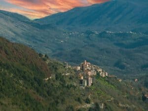
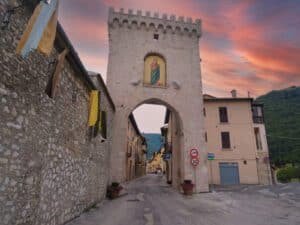
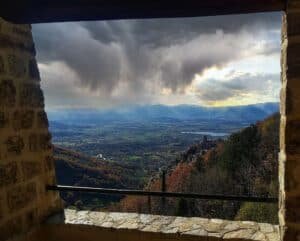
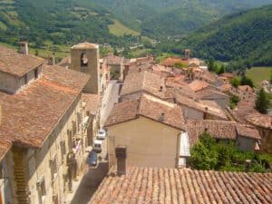
For mountains near Rome, the two names that come up most are Monte Livata, about ninety kilometers and a little under two hours away, and Terminillo, about two hours away. This guide covers 25 of them, grouped by area: Monti Simbruini, Reatino, Ciociaria and surroundings, and Abruzzo. For each one you get the altitude, travel time from Rome and a note on access. Full details are on the individual pages linked in each section. For more ideas, see our day trips near Rome hub.
Mountains Near Rome: Monti Simbruini and the Aniene Valley
Monte Livata
This is the mountain of Subiaco: the summit is at 1,429 meters, in the Monti Simbruini range. From Rome, take the A24 to Vicovaro-Mandela, then the SS5 Sublacense. From Subiaco, a provincial road of about 19 kilometers climbs at an average grade of around 6 percent: it takes thirty-five to forty minutes by car, and cyclists from Rome know it as a classic climb. Without a car: Cotral from Ponte Mammolo to Subiaco, then the local bus from piazza Falcone. Check the schedules.
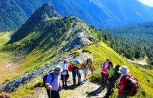
Monti Simbruini Regional Nature Park
It’s a little over an hour from Rome by car, using the same Vicovaro-Mandela exit and the Sublacense. Entry is free in every season. You pay for services: ski lifts in winter, snowshoe rentals, hiking guides, and parking on some plateaus on high-season weekends. The park authority has its offices in Jenne.
Filettino (FR)
This is the highest municipality in Lazio: the town center sits at 1,063 meters, on the border with Abruzzo. It has a little over five hundred residents. You can walk around the town for free. By car, take provincial road 28 from Trevi nel Lazio. In winter, carry snow chains.
Cervara di Roma (RM)
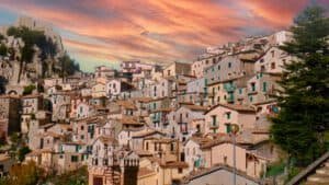
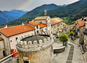
The town is at 1,053 meters and is the highest municipality in the Metropolitan City of Rome. From Rome it takes about an hour and a quarter without traffic, on the A24 and the provincial roads from Subiaco or Arsoli. There are no tickets or opening hours: the town itself is the sight. Leave the car along the road and walk up.
Vallepietra (RM)
The village has a little over two hundred residents and sits at 825 meters. The draw is the Santissima Trinità sanctuary, set into the rock face of Monte Autore at over 1,300 meters, fourteen kilometers by paved road from the village. The season runs from May 1 to the end of October, with hours that change from month to month: check the official website.
Canterano (RM)
A town of a little over three hundred fifty residents, at 602 meters in the Monti Ruffi, in the upper Aniene valley. It is about sixty kilometers from Rome: A24, Vicovaro-Mandela exit, Tiburtina Valeria toward Subiaco, then a provincial road. With traffic, allow a full hour. By public transport, start with Cotral, but check local bus times on the official website.
Terminillo, Reatino and Sabina
Terminillo (RI)
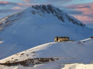
At 2,217 meters, it is the highest peak of the Monti Reatini. From Rome it takes about two hours: Salaria to Rieti, then SS4 bis Terminillese, twenty kilometers of wide switchbacks up to Pian de’ Valli, at 1,620-1,640 meters. From Rieti it is under thirty minutes in good conditions. Without a car, take the Rieti city bus from Rieti station: few runs, so read the schedule on the operator’s website.
Leonessa (RI)
It stands at about 1,013 meters on the plateau that separates Lazio from Umbria. There is no train station: from Rome you drive, about 110 kilometers and an hour and forty minutes, on the A24 to Borgorose and then the SS578. It has held the Touring Club Italiano Orange Flag since 2003, and in 2021 it received the Borgo del Respiro (“village of breath”) recognition.
Poggio Bustone Sanctuary and San Giacomo Convent
The complex is on Monte Rosato, above the village, which sits at 756 meters. From Rome it is about a hundred kilometers, roughly an hour and a half, taking Salaria to Rieti. From the convent, a steep half-hour walk uphill leads to the Sacro Speco, the upper hermitage. The complex is run by the Friars Minor.
Accumoli (RI)
The village is at 855 meters, on Salaria. Since August 24, 2016, the historic center has been a red zone, fenced off and closed to visitors: you can only see the town from outside. The hamlets and the trails of the Monti della Laga remain open. From Rome it is about 150 kilometers, on the A1 to Fiano Romano and then Salaria. The town hall is the point of contact for up-to-date information.
Monte Soratte (RM)
It rises on its own in the middle Tiber valley, in the municipality of Sant’Oreste, about 45 kilometers north of Rome. On Flaminia it takes a little under an hour. The reserve is free to enter, including the trails and the hermitage of San Silvestro. The trails start from the center of the village.
Ciociaria, Monti Lepini and Monti della Tolfa
Guarcino (FR)
It sits on a ridge of the Monti Ernici, at about 625 meters according to the town’s website. From Rome it is about ninety kilometers and a little over an hour and a quarter on a weekday, taking the A1 to Anagni-Fiuggi. The tourist information point is at via Alfonso Milani 1.
Collepardo (FR)
It is at 674 meters in the Monti Ernici, about 100 kilometers from Rome: an hour and twenty minutes in normal traffic, Valmontone exit on the A1. There is no station and local buses are infrequent. Parking is free. It has held the Orange Flag since 2003. Check opening hours at Certosa di Trisulti.
Pico (FR)
The village is at 192 meters, on a limestone spur at the foot of Monte Pota, inside the Monti Aurunci Natural Park. From Rome it is about 110 kilometers, a good hour and a half from Rome’s ring road, with the Ceprano or Pontecorvo exit on the A1. Park for free in the lower part and walk up.
Montelanico (RM)
A town of a little over two thousand residents on the northern slope of the Monti Lepini. From Rome it takes a little over an hour: A1 to Colleferro, then regional road 609 Carpinetana. Visiting is free at any hour and starts from the town hall square. By train, the nearest station is Colleferro-Segni-Paliano.
Allumiere (RM)
It stands at 522 meters in the Monti della Tolfa. The town hall, the chiesa camerale and the civic museum all face Piazza della Repubblica. From the motorway toll booth it is a little under twenty kilometers of mountain road, about half an hour without traffic. By train, go to Civitavecchia and continue with Cotral: check the schedules.
Campoli Appennino (FR)
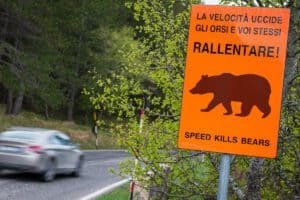
The village is at 650 meters on the edge of a karst sinkhole, inside Abruzzo, Lazio and Molise National Park, a little over 120 kilometers from Rome. The historic center is free to visit. The Marsican brown bear wildlife area, by contrast, runs on set shifts with guided visits: information and bookings go through the infopoint.
Cassino (FR)
A city of about 35,000 residents at the foot of the mountain that holds Montecassino abbey. From Rome it is 135-140 kilometers: a good hour and a half on the A1, Cassino exit, then eight kilometers uphill to the abbey. By train there is a regional service from Roma Termini, about an hour and a half. A local line goes up to the abbey with a few runs a day.
Campo Soriano (LT)
A natural monument in a karst basin at about 360 meters, between Terracina and Sonnino, in the Monti Ausoni. Entry is free, with no gates. A paved road crosses the area, with pull-offs and trails that start at the edge of the roadway.
Abruzzo Mountains Near Rome
Pescasseroli (AQ)
This is the main town of Abruzzo, Lazio and Molise National Park, at 1,167 meters. From Rome it takes about two and a half hours: A25, Pescina or Celano exit, then SS83 Marsicana. Buses leave from Tiburtina station, but on off-season weekdays there are few runs.
Abruzzo, Lazio and Molise National Park
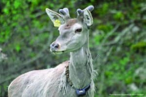
The park itself has no entry fee. You pay for the Pescasseroli Visitor Center, with its museum, wildlife park and Apennine garden, and for parking at Camosciara and in Val Fondillo. At Camosciara, a paid shuttle train shortens the climb. Check rates and summer trail rules on the park authority’s website.
Scanno (AQ)
A village at 1,050 meters in the upper Sagittario valley. From Rome it is about one hundred sixty kilometers and a little over two hours: A24/A25 to Cocullo, then regional road 479 Sannite. There is no entry fee for the village. By train, go to Sulmona and continue by TUA bus.
Campo Imperatore (AQ)
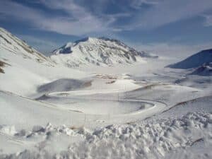
The plaza is at 2,130 meters. From Rome, leave the A24 at Assergi after about an hour and fifty minutes. The Gran Sasso cable car starts from Fonte Cerreto, at 1,115 meters. SS17 bis is open in summer and closes on and off from November to April because of snow. Check rates and hours on the operator’s website.
Santo Stefano di Sessanio
A village of a little over one hundred residents at 1,251 meters, in Gran Sasso and Monti della Laga National Park. From Rome it takes an hour and fifty minutes to two hours: A24 to L’Aquila Est, then SS17. Entry is free. Leave the car outside the walls and walk up.
Grotta di Luppa Regional Reserve | Sante Marie (AQ)
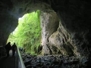
The reserve covers about 435 hectares in the Monti Carseolani, close to the border with Lazio. Access to the trails is free. The descent into the sinkhole is only possible with caving guides, by reservation. Leave the A24 at Tagliacozzo or Carsoli. Contacts are on grottediluppa.com.
How to Choose Among the Mountains Near Rome
- Short on time: Canterano, Montelanico, Allumiere and Monte Soratte are among the closest, half an hour to an hour and a quarter by road.
- High altitude: Terminillo (2,217 meters) and Campo Imperatore (plaza at 2,130 meters).
- No car: Monte Livata, Terminillo, Cassino and Scanno have public transport, but schedules change by season.
- Free to visit: Filettino, Cervara di Roma, Santo Stefano di Sessanio and Monti Simbruini park have no entry fee.
- Winter: check snow and road conditions before you leave, especially for Filettino and Campo Imperatore.
For a comparison with other trips, read Hill Towns in Lazio: Where They Are and How to Get There. For water, see the guide to Lakes Near Rome for Swimming. If you want a day of culture, read Tivoli Day Trip from Rome: Hot Springs, Villa d’Este and Hadrian’s Villa.
FAQ: Mountains Near Rome
What is the highest of the mountains near Rome?
Among the destinations in this guide, Terminillo reaches 2,217 meters and is about two hours from Rome.
How do you get to Monte Livata without a car?
Take Cotral from Ponte Mammolo to Subiaco, then the local bus from piazza Falcone. Schedules change between winter and summer, so check the operator’s website. More details on the Monte Livata page.
Which places are free to visit?
Monti Simbruini park has free entry, as do Filettino and Cervara di Roma. You pay for services such as parking and lifts.
Which Abruzzo mountains can you reach by motorway?
For Scanno, take the A24/A25 to Cocullo, about two hours from Rome. For Campo Imperatore, leave the A24 at Assergi, in about an hour and fifty minutes.
Can you visit the center of Accumoli?
No. Since August 24, 2016, the historic center of Accumoli has been a red zone and is closed to visitors. You can visit the hamlets and the trails of the Monti della Laga.
All the places in this guide (25)
 Monte LivataSubiaco (RM)Monte Livata - Viale dei Boschi, 00028 Subiaco RM, Italy
- Terminillo (RI)TerminilloTerminillo (2217 meters) is the highest peak of the Reatini Mountains and closes the Rieti basin to the east, the basin of Rieti. You reach it from…
- Monti Simbruini Regional Nature ParkNear RomeThe Monti Simbruini Regional Nature Park (from the Latin sub imbribus, "under the rains", also called the Roman Alps) is the treasure chest that ho…
- Filettino (FR)Filettino (FR)Filettino (FR) is the highest municipality in Lazio: the town center is at 1,063 meters above sea level, in the province of Frosinone, at the easte…
- Cervara di Roma (RM)Cervara di Roma (RM)Cervara di Roma (RM) is the highest town in the Metropolitan City of Rome Capital: the built-up center sits at 1,053 meters above sea level, and th…
- Vallepietra (RM)Vallepietra (RM)Vallepietra (RM) -
- Canterano (RM)Canterano (RM)Canterano (RM) is a municipality of just over 350 inhabitants in the upper Aniene valley, in the province of Rome, set at 602 meters above sea leve…
- Leonessa (RI)Leonessa (RI)Leonessa rises on the Apennine plateau that separates Lazio from Umbria, at about 1,013 meters above sea level, in the province of Rieti. The munic…
- Poggio Bustone Sanctuary and San Giacomo ConventPoggio Bustone (RI)The Sanctuary of Poggio Bustone is in Poggio Bustone, in the province of Rieti, just above the town, on the flank of Monte Rosato, at the northeast…
- Accumoli (RI)Accumoli (RI)You reach Accumoli from State Road 4 Salaria, at around kilometer 142, at an elevation of 855 meters, in the province of Rieti. The town hall is at…
- Monte Soratte (RM)Sant'Oreste (RM)Monte Soratte is the Sacred Mountain sung by Pliny, Virgil and Horace: “Vides ut alta stet nive candidum/ Soracte, nec iam sustineant onus/ siluae…
- Guarcino (FR)Guarcino (FR)Guarcino (FR) is a town of about 1,500 inhabitants in the province of Frosinone, resting on a ridge of the Ernici Mountains at a little over 600 me…
- Collepardo (FR)Collepardo (FR)Collepardo is in Frosinone Province, in southern Lazio, at 674 meters of altitude on the slopes of the Ernici Mountains. The distance from Rome is…
- Pico (FR)Pico (FR)Pico is a town of about 2,600 inhabitants in the province of Frosinone, at 192 meters above sea level, perched on a limestone spur right up against…
- Montelanico (RM)Montelanico (RM)Montelanico (RM) is a municipality of just over 2,000 inhabitants in the Metropolitan City of Rome Capital, lying on the northern slope of the Lepi…
- Allumiere (RM)Allumiere (RM)Allumiere sits at 522 meters above sea level in the Monti della Tolfa, in the province of Rome, and its administrative center and its tourist cente…
- Campoli Appennino (FR)Campoli Appennino (FR)Campoli Appennino is a municipality of about 1,600 inhabitants in the province of Frosinone, at 650 meters above sea level, resting on the edge of…
- Cassino (FR)Cassino (FR)Cassino (FR) -
- Campo Soriano (LT)Campo Soriano (LT) -
- Pescasseroli (AQ)Pescasseroli (AQ)Pescasseroli (AQ) is the main center of the Abruzzo, Lazio and Molise National Park and sits at 1,167 meters above sea level, in a basin at the mou…
- Abruzzo, Lazio and Molise National ParkMountains Near RomeThe Abruzzo, Lazio and Molise National Park has its seat in Pescasseroli (AQ), where the Authority's administration is located. The Visitor Center…
- Scanno (AQ)Scanno (AQ)Scanno (AQ) is a mountain village in the upper Sagittario valley, in the province of L'Aquila, at 1050 meters of altitude among the Marsican mounta…
- Campo Imperatore (AQ)Campo ImperatoreCampo Imperatore (AQ) has no street number: it has a road, the SS 17 bis del Gran Sasso, which branches off state road 17 above Assergi (a hamlet o…
- Santo Stefano di SessanioSanto Stefano di Sessanio (AQ)Santo Stefano di Sessanio - Santo Stefano di Sessanio, 67020 AQ
- Grotta di Luppa Regional Reserve | Sante Marie (AQ)Sante Marie (AQ)Within the territory of the Grotte di Luppa nature reserve lies the large Val di Luppa sinkhole which, set among the chestnut woods that are abunda…