Monti Simbruini Regional Nature Park
In short. The Monti Simbruini Regional Nature Park can be reached from Rome in a little over an hour by car: the main access is the A24 Rome-L'Aquila motorway to the Vicovaro-Mandela exit, then State Road 5 Sublacense toward Subiaco, from where…
The Monti Simbruini Regional Nature Park can be reached from Rome in a little over an hour by car: the main access is the A24 Rome-L'Aquila motorway to the Vicovaro-Mandela exit, then State Road 5 Sublacense toward Subiaco, from where the climbs start toward Monte Livata, Jenne, Vallepietra and Cervara di Roma. The seat of the managing body, the Ente Parco Appennino Monti Simbruini, is in Jenne at Via dei Prati 5, telephone 0774 827221, email monti.simbruini@simbruini.it. Entry to the park is free, in every season and at every hour: there is no ticket office, there is no gate, no reservation is needed. What you may pay for are services, which are a different matter: the ski lifts in winter, snowshoe rental, the hiking guide, parking on some plateaus on high-season weekends, admission to the Subiaco monasteries when a contribution is requested. Rates change from year to year and should be checked on the park's official website or on that of the individual operator before setting out. The territory covers 29,990 hectares between the provinces of Rome and Frosinone and is the largest terrestrial protected area in Lazio.
Anyone arriving without a car has to allow for a change: the regional train on the Rome-Avezzano-Sulmona line goes to Mandela-Sambuci or to Roviano, and from there Cotral buses go up the Aniene valley toward Subiaco, the de facto terminus of public transport in the upper valley. From Subiaco there are runs to Jenne, Vallepietra, Cervara and Monte Livata, but with frequencies designed for residents and not for hikers: check the schedule on the Cotral website the day before, and in winter the run to Livata is not guaranteed in case of snow. The practical truth is that without a car the park can only be visited well from Subiaco.
To place this mountain within the rest of what Lazio offers, keep an eye on the page of tourist attractions in Lazio, where the regional parks are lined up side by side.

What the Monti Simbruini Regional Nature Park Is
The Monti Simbruini range occupies the northeastern corner of Lazio, on the watershed that divides the region from Abruzzo. It is a compact limestone massif, with few roads and many high-altitude meadows, and it has one characteristic that sets it apart from all the other mountains near Rome: water. It rains here like nowhere else in the central Apennines, and that water disappears underground to reappear lower down as perennial springs. The very name of the range comes from this weather condition, and not from a legend.
The Regional Law That Established the Monti Simbruini Regional Nature Park
The park was born with Lazio regional law number 8 of January 29, 1983, published in the Region's official bulletin on February 28 of the same year. It is a date worth remembering, because it places the Simbruini among the first great regional parks in Italy, at a time when the national framework law on protected areas was still seven years away. Two later laws have amended the 1983 text, number 7 of July 14, 2014 and number 15 of November 16, 2015, which touched up the boundaries and the structure of the body. Anyone looking for the law will find it in the acts of the Lazio Region: it is not a bureaucratic detail, because the 1983 boundary and the current one do not coincide, and the difference explains why certain old maps show borders that no longer exist today.
How Big the Monti Simbruini Regional Nature Park Is
The official area given by the Lazio Region is 29,990 hectares, almost 300 square kilometers. To give an idea: it is an area comparable to the municipal territory of Rome divided by almost five, and it is the largest terrestrial protected area in Lazio. Many publications round it to 30,000 hectares, and it is an honest rounding, but the exact number is the one on the regional sheet. Within this boundary live side by side meadows above 1,800 meters, beech forests that come down to 800, river gorges, inhabited villages, paved roads, ski lifts, monasteries from the sixth century and at least one sanctuary that draws tens of thousands of pilgrims in a single day. The park is not an uninhabited strict reserve: it is a living territory, with more than 5,000 permanent residents, and this radically changes the way you visit it.
The Municipalities of the Monti Simbruini Regional Nature Park
Tradition speaks of seven municipalities, and they are the seven that every hiker learns by heart: Camerata Nuova, Cervara di Roma, Filettino, Jenne, Subiaco, Trevi nel Lazio and Vallepietra. The Region's official sheet now lists eight, adding Arsoli, which overlooks the Aniene valley at the northern entrance of the massif. Five belong to the Metropolitan City of Rome Capital, two to the province of Frosinone: Filettino and Trevi nel Lazio. This double administrative membership explains quite a few things, from the fragmentation of transport services to the historical difficulty of building a unified tourist promotion. The visitor perceives it in a banal way: the Roman side looks to Subiaco, the Ciociaria side looks to Fiuggi and the Sacco valley, and the two worlds touch only at altitude.
The Managing Body and the Seat in Jenne
The body that administers the territory is called Ente Parco Appennino Monti Simbruini and is based in Jenne, at Via dei Prati 5, a village of a few hundred residents perched above the Aniene gorge. The choice was as political as it was geographic: putting the seat in one of the smallest municipalities rather than in Subiaco, which is the largest center, meant declaring that the park belongs to the mountain and not to the valley floor. The Region also entrusted the same body with the management of the Natura 2000 network sites located on the massif. The contacts: telephone 0774 827221, fax 0774 827183, certified email parcomontisimbruini@pec.regione.lazio.it. The institutional website is parcomontisimbruini.it, and it remains the reference for calendars, ordinances, temporary trail closures and calls for tenders.
Why They Are Called Simbruini: The Mountains Under the Rain
The place name comes from the Latin sub imbribus, literally under the rains. It is not a scholarly flourish: it is a weather description that the Romans drew from experience, because the water the city drank came from these mountains. The humid currents rising from the Tyrrhenian cross the Pontine plain and the Latin valley without meeting obstacles, then crash against the first serious barrier of the central Apennines, which is exactly this one. The result is precipitation that exceeds 2,000 millimeters a year, values from the western Alps measured an hour from Rome, where 600 fall.
That rain does not run on the surface. The limestone drinks it, carries it along fractures and underground channels, and gives it back at lower elevations through springs of enormous flow and excellent quality. This is why the summit meadows of the Simbruini, although they receive double the water of Rome, have very few visible streams: the real hydrography is underground. Anyone walking the plateaus in summer faces a landscape that looks arid and is not at all.
A second name, less fortunate but recurring in 20th-century publicity, is Roman Alps. It is a brochure definition, born to sell the capital's snow, and it holds up badly under comparison: the forms are Apennine, rounded, grassy, with no spires or glaciers. But it contains a core of climatic truth, because in winter the amount of snow that falls on Campo Staffi and Campo dell'Osso has no equal in the rest of Lazio.

The Geography of the Monti Simbruini Regional Nature Park
Anyone looking at a map understands at once that the Simbruini are not one mountain but a system of ridges oriented from northwest to southeast, parallel to the general direction of the Apennines, cut by transverse valleys that break them up. The geographic boundaries are clear: to the north the Monti Carseolani, to the east the Roveto Valley and Abruzzo, to the south the Monti Cantari and then the Ernici, to the west the Monti Affilani and the Latin Valley. The Aniene valley cuts the northwestern flank and works as an access corridor.
From Fosso Fiojo to the Main Ridge
The point where the Carseolani end and the Simbruini begin is Fosso Fiojo, on the border between Lazio and Abruzzo. From there the range rises toward the southeast along the watershed between the Aniene basin and the Turano basin, at first with gentle slopes that generate the crown of karst plateaus in the northern part of the park: Campaegli, Campo Buffone, Campo dell'Osso, Campo della Pietra, Camposecco. Then the relief becomes more decisive and culminates in Monte Autore, which dominates the valley of the same name and offers the most complete panorama of the whole massif.
The Simbrivio Valley, the Fracture That Splits the Monti Simbruini in Two
At this point an element comes in that no small-scale map renders well: the deep depression of the Simbrivio Valley, which wedges in perpendicular to the direction of the range and cuts it almost into two halves. It is a narrow, shaded valley, run through by a stream that swells quickly in winter, and it has determined the history of settlement: Vallepietra is perched on one of its flanks, and the Sanctuary of the Santissima Trinità leans against the wall that closes it at its head. Anyone who wants to pass from one sector of the park to the other on foot has to descend and climb back almost 1,000 meters, or take the long way around.
The Southern Sector and the Monti Cantari
Beyond Colle della Tagliata, at whose base the rocky amphitheater of the sanctuary opens, the watershed gains elevation again with Monte Tarinello and Monte Tarino, descends to the Monna della Forcina pass, climbs again to Campo Staffi and culminates in Monte Cotento. South of the Serra Sant'Antonio pass begins the group of the Monti Cantari, which geographically is a massif in its own right but administratively falls within the boundary of the regional park. The southern boundary follows the crest of Monte Viglio to Trevi nel Lazio, and from there descends along the course of the Aniene to Subiaco. On the Abruzzo side the small Renga range breaks off instead, closing the panorama toward the east.
The Peaks of the Monti Simbruini Regional Nature Park
The summits of the Simbruini do not impress with verticality, and they impress quite a lot with extent. They are grassy, wide mountains, climbed on trails without ever using your hands, and for this very reason they have claimed victims among the careless: fog at altitude erases the landmarks in 10 minutes and a treeless plateau, with visibility at 20 meters, becomes a labyrinth.
Monte Autore, the Capital's Mountain
Monte Autore stands just over 1,850 meters and is the highest peak in the Metropolitan City of Rome Capital. The official sheets of the regional trails give elevations between 1,850 and 1,862 meters depending on the measuring point on the summit, which is broad and barely rolling. The classic ascent starts from Campo dell'Osso, at 1,590 meters, and along the marked trail 673d through Valle Maiura, Cannavacciari and the Valle di Monte Autore it covers 7.5 kilometers with 540 meters of elevation gain and about 2 hours 40 minutes of walking, difficulty E. It is the route I recommend to anyone coming for the first time: pastures, beech forests, no exposed passages, and at the top a cross with a view that by itself justifies the trip.
The Vedute of Monte Autore
The viewpoint called Le Vedute opens the view over the whole southern part of the range and the Cantari: Assalonne, Tarinello, Tarino, the Faito plateau, the Cotento, the Viglio, the Crepacuore, with Campocatino in the background. On clear winter days, when the air is dry and the snow has cleaned the atmosphere, you can make out the Gran Sasso to the north and sense the sea to the west. It is the spot where you understand the architecture of the massif better than on any map.
Monte Cotento, the Only Peak Above 2,000 Meters
At 2,015 meters Monte Cotento is the highest summit of the Simbruini proper and the only one in the group to exceed the 2,000-meter threshold. You climb it from Campo Staffi, above Filettino, and it is an honest climb, steep in the final stretch, over high-altitude grassland. In winter it becomes terrain for ski mountaineering and snowshoeing, with the warning that the north face accumulates wind-blown snow and needs careful assessment.
Monte Viglio, the Giant of the Southern Boundary
Monte Viglio, on the border between Lazio and Abruzzo above Filettino, is the highest mountain within the boundary of the regional park and it also exceeds 2,000 meters. The official routes that climb it are three, all rated EE: the 694b from Filettino by Colli Albaneti and the Pratone, 3 hours 40 minutes. The 696b from Valle Granara by Valle Fura, two and a half hours, the most direct route. The 696a, a loop of 5 hours 10 minutes that passes through Fonte della Moscosa and Monte Piano. The summit ridge is long and completely exposed to the wind: in uncertain weather it is the wrong place to be.
Monte Tarino and Monte Tarinello
The Tarino comes close to 2,000 meters and closes the central sector to the north, separated from the Autore group by the Simbrivio fracture. It is perhaps the wildest peak in the park, the one where you meet the fewest people even in August, and its eastern face drops toward the Roveto Valley with considerable elevation differences. The Tarinello precedes it on the ridge and works as a foreland peak. Anyone who wants a long and solitary day finds the right terrain here.
The Karst Plateaus of the Monti Simbruini Regional Nature Park
If there is a landscape that identifies the Simbruini, it is not the peaks: it is the plateaus. Closed, grassy basins, with no outlets, a few hundred meters or a few kilometers wide, surrounded by rounded ridges and beech forests. They form because rainwater, instead of carving valleys, dissolves the limestone and sinks. The technical term is karst, from the name of the Trieste Karst where the phenomenon was first studied: rainwater loaded with carbon dioxide becomes carbonic acid, attacks the calcium carbonate of the rock, turns it into soluble bicarbonate and carries it away. On the surface, sinkholes and swallow holes remain. Below, a network of caves where the carbonate precipitates again into stalactites and stalagmites.
Campo dell'Osso and Campo della Pietra
Campo dell'Osso, at 1,590 meters above Monte Livata, is the most visited plateau and the starting point for half the park. In summer it is an immense meadow with horses and cows grazing free-range. In winter it becomes the heart of the Livata ski area, with downhill runs and cross-country loops. Campo della Pietra is close to it and keeps a more severe look, with rock outcrops sticking out of the grass that justify the name.
Camposecco, the Plateau That Looks Like Ireland
Camposecco, above Camerata Nuova, is the plateau that strikes most people who don't know it: a vast basin at about 1,400 meters, with dry-stone walls, herds and an almost absolute silence. The name says it all, because water never stays there: after thunderstorms ephemeral pools form and vanish within a few hours into the swallow holes. It can be reached by car from Camerata Nuova on a dirt road, partly paved, with parking nearby. The trail 664c from Camerata Nuova goes up through Camposecco and continues through the Valle di Monte Autore to the summit, five hours of walking with difficulty EE.
Campaegli, the Gateway of Cervara
Campaegli is about eight kilometers from Cervara di Roma and is a small tourist settlement at 1,430 meters from which, through a little valley, you reach a wide karst plateau between Livata and Cervara, near Monte Calvo. In the middle of the village the park has opened an information point. It is a convenient base for families: flat meadows, equipped picnic areas, short trails, the possibility of horseback rides. In the surroundings is the Grotta Stoccolma, a swallow hole that the park rangers cleaned out after years in which it had been filled with materials of every kind, work that is worth more than 10 educational signs.
Campo Buffone and the Minor Plateaus
Campo Buffone completes the northern crown together with smaller basins that have local names on the maps and on the ground are grassy clearings surrounded by beech. They are the places where in summer you walk at dawn to see the deer return to the forest, and where in winter snow accumulates out of proportion to the elevation, because the wind dumps it into the basins. A practical warning: on the plateaus the night frost is much more intense than on the ridges, because of temperature inversion. On a January night at Camposecco you reach temperatures that are not recorded 200 meters higher up.
The Water of the Monti Simbruini Regional Nature Park
This is the reason Rome has drunk for 2,000 years. The combination of abundant rain and permeable carbonate rock generates an underground reservoir of enormous size, which gives back water from foothill springs of constant flow and excellent quality. The presence in the same territory of a regional protected area, a Special Area of Conservation and a Special Protection Area is not a regulatory whim: it protects a strategic water reserve.
The Aniene Begins Here
The Aniene, the river that crosses Rome's eastern outskirts and flows into the Tiber at Ponte Salario, rises in the territory of Filettino, on the slope of Monte Tarino, at about 1,200 meters of elevation. The springs are a place worth the detour, also because they contradict every expectation: not a trickle, but an already substantial jet coming out of the rock. From there the river descends toward Trevi nel Lazio, enters the gorges below Jenne, forms waterfalls and small lakes in the territory of Subiaco and then opens the valley that leads to Tivoli. The Latin name Anio is that of two of the four Roman aqueducts fed by these waters.
The Simbrivio
The Simbrivio is the stream that gives its name to the valley of the same name and descends from Vallepietra toward the Aniene. Its springs feed a modern aqueduct that serves dozens of municipalities in southern Lazio, and its flow tells better than any statistic how much it rains on these mountains. The valley-floor road that runs alongside it, now paved, is the first stretch of the 683a trail from Vallepietra to the sanctuary and then to Monte Autore.
The Liri and the Watershed
From the southern slope of the massif the Liri also rises, and it takes an entirely different direction: it descends toward the Sora valley, receives the Fibreno, becomes the Garigliano and flows into the Tyrrhenian Sea at the border with Campania. Three major rivers from a single mountain group, with basins that end at different points of the sea: it is one of the reasons geographers consider the Simbruini a first-rate hydrographic hub of the central Apennines.
The Four Roman Aqueducts
Four Roman-era aqueducts started from these mountains: the Anio Vetus, the Aqua Marcia, the Aqua Claudia and the Anio Novus. The Anio Vetus is the second aqueduct in the history of Rome, the Aqua Marcia was considered by the ancients the best for water quality, and the Claudia and the Anio Novus are the ones that reached the city on the monumental arches you can still walk through today at the Aqueducts Park. The system stayed in operation, with interruptions and restorations, for centuries. Today the Simbruini springs, through modern pipelines, supply the southern part of Rome and the Castelli Romani, serving about a million users. Drinking tap water across half the province means drinking rain that fell on the Simbruini a few years earlier.
The Aniene Lakes at Subiaco
In the territory of Subiaco the Aniene forms waterfalls and pools with a very ancient history. Here Nero had a villa built with three artificial lakes by damming the river, and from those lakes the place took the name Sublaqueum, meaning under the lakes, hence Subiaco. One of the dams collapsed in 1305 and the landscape changed forever. Today what remains is San Benedetto Lake, with its green, icy water, a very popular summer destination and a very underrated one from a historical point of view.

The Beech Forests of the Monti Simbruini Regional Nature Park
The dominant forest is beech, and on the Simbruini it reaches an extent that has no equal in Lazio. The regional fact sheet notes the high natural value of these woods, due to the great age of the trees and the plant associations present. It's not a polite formula, because in forest ecology great age means century-old trees, dead wood on the ground, cavities, fungi and wood-boring insects, that is, a complete and rare ecosystem.
The Beech That Grows Too Low
The botanical peculiarity most cited by specialists concerns elevation: on the Simbruini the beech grows much lower than latitude would lead you to expect, down to 800 meters and in some gullies even lower. The cause is atmospheric humidity and the temperature inversion of the narrow valleys, which create cool conditions at mixed-forest elevations. The result is that you walk inside cathedral beech forests a few hundred meters above the valley floor, something that elsewhere requires climbing twice as high.
The Monumental Trees
In the territory of Monte Livata there is one of the largest beech forests in Europe, and in several sectors of the park clusters of trees of remarkable size survive, spared from the logging of the 20th century because they were too awkward to reach. Walking among those trunks in October, when the leaves turn copper and the light comes in low, is the best aesthetic experience the park offers. A professional's warning: many visitors go up in August, and in the beech forest in August there is almost nothing to see, because the canopy is closed and the undergrowth is dead. The forest should be visited in April and in October.
The Undergrowth and the Blooms
In spring, before the beech puts out its leaves, the ground is covered with geophytes: anemones, squills, toothworts, snowdrops in the coolest spots. On the summit meadows, between June and July, the high-altitude blooms burst out, with gentians, wild orchids and endemic Apennine species. The park has dedicated a specific publication to orchids, a sign that the local orchid heritage is considerable. Wild orchids are photographed and not picked: they are all protected and many take years to bloom for the first time.
The Wildlife of the Monti Simbruini Regional Nature Park
The massif works as an ecological corridor between the Abruzzo, Lazio and Molise National Park and the mountains that look toward Rome. It's a strategic position: animals moving from the heart of the Apennines westward pass through here.
The Apennine Wolf
The wolf is permanently present. It's not a brochure presence: it is documented by years of monitoring and by constant reports from shepherds and park rangers. Seeing one is rare and spotting one by day is rarer still, but finding tracks in the fresh snow of the plateaus is anything but unlikely. The wolf is not a danger to hikers. It is an economic problem for local livestock farming, and coexistence rests on compensation payments and prevention systems such as electric fences and guard dogs. If you meet a Maremma sheepdog out grazing, move away from the flock without running and keep your dog on a leash.
The Deer and the Wildlife Area of Camerata Nuova
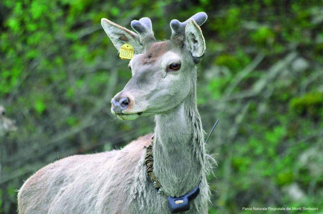
The deer has returned to the Simbruini and is now one of the most visible presences in the park. At Camerata Nuova the park authority runs a dedicated wildlife area, which lets you observe the animals in large enclosures and serves above all as a teaching tool for school groups. In the wild, the best moment for an encounter is the autumn bellowing of the stags, between mid-September and early October, when the males challenge each other vocally at dawn and dusk on the plateaus. Guided outings to the bellowing are organized every year. You book them and you do them in silence, without flashlights and without getting closer.
Birds of Prey and the Special Protection Area
The ZPS (Special Protection Area) Monti Simbruini e Ernici, Natura 2000 code IT6050008, covers 52,098.6 hectares between the provinces of Rome and Frosinone, so much more than the regional park alone, and it was established to protect birdlife. Diurnal birds of prey nest on the cliffs and the high-altitude meadows. On the open ridges you can see species on migration that use these crests as a route. The ZPS conservation measures date from regional decree 612 of December 16, 2011, and management has been entrusted to the park authority since 2019.
The Water Dwellers
Cold streams and perennial springs host amphibians and invertebrates that are very sensitive to water quality, which is the reason certain stretches of river have strict regulations. The spectacled salamander, an Italian endemic, frequents the shady streams of the beech forests. Newts and Apennine frogs populate the temporary pools of the plateaus. These are animals you look at by crouching down and that you never touch with dry hands.
Natura 2000 in the Monti Simbruini Regional Nature Park
Several sites of the European Natura 2000 network lie on the park's territory, managed by the Appennino Monti Simbruini Park Authority. The Special Area of Conservation (ZSC) Monte Autore e Monti Simbruini centrali, code IT6030040, covers 6,684.8 hectares between the provinces of Rome and Frosinone. Its conservation measures were approved by regional executive resolution 159 of April 14, 2016, and the appointment of the managing body dates from resolution 305 of June 19, 2018. The ZPS Monti Simbruini e Ernici, already mentioned, is by far larger and also takes in territory outside the park.
What changes for people who walk? Very little in practical terms, because the conservation measures mainly concern economic activities, logging, grazing and building works. The legal framework does change, though: inside a ZSC or a ZPS, going off the trail, collecting, free camping and flying drones have stricter rules, and the penalties are not symbolic. Before planning aerial shots or a bivouac, it's worth writing to the park authority.
The Trails of the Monti Simbruini Regional Nature Park
The hiking network is extensive and numbered according to the Italian Alpine Club tradition, with hundreds of kilometers marked. The official Lazio Region fact sheets list dozens of routes on foot and by mountain bike with difficulty, times and length. The scale is worth remembering: T means tourist, on obvious roads and mule tracks. E means hiking, on a marked trail, with some steep stretches. EE is for experienced hikers, with passages on treacherous ground or barely visible tracks. EEA requires via ferrata equipment. On the Simbruini almost everything is E or EE.
Route 673d, from Campo dell'Osso to Monte Autore
Start at Campo dell'Osso at 1,590 meters in the municipality of Subiaco, finish at the summit of Monte Autore, 7.5 kilometers, 540 meters of elevation gain and 230 of loss, lowest point 1,509 meters, two hours and 40 minutes, difficulty E. It crosses Valle Maiura, Cannavacciari and the Valle di Monte Autore, alternating grassy pastures and beech forests. It is the best-balanced route in the park and the right one for anyone going up for the first time.
Route 683a, from Vallepietra to the Shrine and the Summit
The most demanding of the classics: start at Vallepietra at 818 meters, finish on Monte Autore at around 1,850, 9.1 kilometers, more than 1,400 meters of elevation gain, three hours and 20 minutes up and two and a half for the return, difficulty EE. You first follow the valley-floor road that runs alongside the Simbrivio stream, pass the cemetery and the Rimessa shrine, and arrive at the Shrine of the Most Holy Trinity. Then the trail becomes steep in the beech forest, touches the Fonte della Fossaiola and the Passo Procoio, and climbs by mule track to the summit cross. 1,400 meters of elevation gain is a real day: bring water and food and start early.
Route 664c, from Camerata Nuova via Camposecco
Five hours, difficulty EE, from Camerata Nuova to Camposecco and then through the Valle di Monte Autore to the top. It is the access from the north, the least trodden, and it gives you the complete crossing of the Camposecco plateau. Do it with good visibility: on the open meadows the track gets lost in places.
Route 673c, the Campominio Loop
Four hours, difficulty EE, a loop that from Campo dell'Osso reaches Campominio, the Sella di Monte Autore, the Valle di Monte Autore and Camposecco before heading back. It is the right choice for anyone who wants to see two different plateaus in a single day without retracing the same route.
The Climbs to Monte Viglio
Three official routes, all EE: the 694b from Filettino via Colli Albaneti and the Pratone, three hours and 40 minutes. The 696b from Valle Granara via Valle Fura, two hours and 30 minutes, the shortest route. And the 696a, a loop from Valle Granara via Fonte della Moscosa and Monte Piano, five hours and 10 minutes. The final ridge is long, scenic and wind-beaten.
Mountain Biking in the Monti Simbruini Regional Nature Park
There are plenty of marked cycling routes and they range from tourist level to demanding. MTB route 9 links Monte Livata, Campo dell'Osso, Campo della Pietra, the Rifugio Ceraso and Campo Staffi, difficulty EE, and is the high-altitude traverse par excellence. MTB 10 joins Filettino, Trevi nel Lazio, Ponte Anali, the Arco di Trevi and Pratiglio Sant'Onofrio. MTB 13 descends from Subiaco to Comunacque and Trevi nel Lazio with difficulty E. MTB 16 is the loop Camerata Nuova, Camposecco, Piana di Campaegli. MTB 17, from Ponte Sant'Antonio to Ponte Minnone, is rated T and is also suitable for anyone riding with children. The Classica Livata, number 30, remains the most popular ride in the park.
Practical Rules on the Trails of the Monti Simbruini
Dogs must be kept on a leash, fires are forbidden outside equipped areas, free camping is not allowed, and trash is carried back down to the valley, tissues included. Going off the trail on the plateaus seems harmless and it isn't: you trample blooms and disturb wildlife. One last point, the one Romans underestimate most: here the phone almost never works. Coverage is patchy on the ridges and absent in the valleys. Download the track before leaving and tell someone where you're going.
Frequently Asked Questions About the Monti Simbruini Regional Nature Park
How much does it cost to enter the Monti Simbruini Regional Nature Park?
Access to the territory of the Monti Simbruini Regional Nature Park is free, with no ticket and no opening hours. You only pay for services, such as ski lifts, rentals, guides, some parking lots in high season and any contributions requested by the monasteries of Subiaco.
How big is the Monti Simbruini Regional Nature Park?
The Monti Simbruini Regional Nature Park covers an official area of 29,990 hectares, which makes it the largest protected area in Lazio. The limestone massif occupies the northeastern corner of the region, on the watershed with Abruzzo, and is crossed by ridges, karst plateaus and wide beech forests.
Why are the Monti Simbruini called that?
The name of the Monti Simbruini Regional Nature Park comes from the Latin sub imbribus, meaning under the rains: a meteorological description the Romans drew from experience, because the water that fed the city's aqueducts came from these mountains. It is the area of the central Apennines where it rains the most.
Is the Monti Simbruini Park suitable for children?
Yes, it is one of the few mountain areas near Rome that really works with small children, because the plateaus are flat and walking on them isn't tiring. Campaegli has equipped picnic areas, Campo dell'Osso offers the learning area in winter, and the deer wildlife area at Camerata Nuova lets you see the animals without covering kilometers.
Can you see wolves in the Monti Simbruini Park?
The Apennine wolf is permanently present in the Monti Simbruini Regional Nature Park, as years of monitoring and constant reports from shepherds and park rangers document, because the massif works as an ecological corridor between the Abruzzo, Lazio and Molise National Park and the mountains that look toward Rome. Seeing one is still a rare and chance event.
When is the best time to go to the Monti Simbruini?
April and May are the best months by far for the forest of the Monti Simbruini Regional Nature Park, when the beech puts out its leaves and the undergrowth blooms. Snow can remain at altitude until mid-May on the northern slopes, while July and August offer a temperature advantage over the heat of Rome.
Is the Monti Simbruini Park accessible for people with mobility difficulties?
Partly. The mountain is not an easy environment for people with mobility difficulties, but the plateaus reachable by car, such as Campo dell'Osso, Campaegli and Camposecco, let you enjoy the landscape a few meters from the parking lot on compact grassy ground. The Santa Scolastica Monastery in Subiaco is more accessible than the Sacro Speco, which is all stairs cut into the rock.
The Visitor Centers of the Monti Simbruini Regional Nature Park
The park authority manages a network of facilities spread across the park's municipalities: information points and visitor centers at Cervara di Roma, Filettino, Jenne, Monte Livata, Subiaco, Trevi nel Lazio and Vallepietra, as well as the administrative headquarters. They are small outposts, with variable hours, often tied to the season and to holidays. Call before counting on them, because out of season quite a few open only on weekends. Where they are open you'll find maps, up-to-date information on trail conditions, educational material and the chance to book a guided visit. The information point at Campaegli, at 1,430 meters in the middle of the village, is the most convenient for anyone arriving from the Cervara side.
Anyone organizing a group outing, a school trip or a company activity in the mountains can rely on qualified professionals. TourLeaderPro's tour guiding service regularly works on Lazio destinations and handles the logistics, which in an area with narrow roads and limited parking is half the problem.

Skiing in the Monti Simbruini Regional Nature Park
The snow of the Simbruini is the reason generations of Romans learned to ski without crossing the Apennines. The resorts are small, the elevation is modest by Alpine standards, and snow cover is irregular from year to year. Anyone who arrives expecting the Dolomites is disappointed, and anyone who arrives knowing what the mountains of Lazio are has a lot of fun.
Monte Livata and Campo dell'Osso
The Monte Livata plateau, about 15 kilometers from Subiaco, extends over more than 3,000 hectares and is home to the ski resort of the same name. Its history is instructive: greatest success between the 1970s and the 1980s, then a long decline that ended with closure in the first half of the 2000s. Thanks to the intervention of local entrepreneurs and the allocation of European funds, the new resort reopened in 2013. Today Livata is called the capital's mountain, for its closeness to Rome and because Monte Autore, which it leans against, is the highest peak in the province of Rome. Next to the downhill runs of Campo dell'Osso there are cross-country loops and snowshoe routes, which in recent years have overtaken downhill skiing in number of participants.
Campo Staffi
On the Ciociaria side, above Filettino, on the border with the Monti Cantari, Campo Staffi is the park's other historic resort, with lifts that climb toward Monte Cotento. It is the area that gets the most snow of all and the one where the season lasts longest. Outside the lifts, the open slopes above the basin are classic ski mountaineering and snowshoeing terrain.
Campaegli and the Abruzzo Side
Campaegli, above Cervara di Roma, has a more family-oriented vocation: learning area, cross-country skiing, sledding. On the Abruzzo side, just beyond the watershed, the Camporotondo resort operates. Always keep in mind that above 1,400 meters road access requires chains on board or winter tires by order of a local ordinance. On weekends with fresh snow the road to Livata is regulated and anyone who arrives unprepared is turned back.

The Villages of the Monti Simbruini Regional Nature Park
The park is not uninhabited, and its towns are worth at least as much as the peaks. They are all hilltop settlements, born for defense in the medieval period, depopulated by 20th-century emigration and today partly repopulated by returning tourism.
Subiaco, the Gateway to the Park
Subiaco is the largest town and the natural entrance. The town of the Rocca Abbaziale, of the Benedictine monasteries, of the Ponte di San Francesco, it is also the place where in 1465 two German clerics, Corrado Sweynheym and Arnoldo Pannartz, set up the first movable-type printing press in Italy, inside the Santa Scolastica Monastery. In 2025 Subiaco was Italian Capital of the Book, a recognition that descends directly from that primacy. Anyone going up into the mountains passes through here and is wrong not to stop.
Jenne
Jenne, seat of the park authority, is perched above the Aniene gorge at just under 800 meters. From here you go down to Comunacque, where the river receives the Simbrivio, and you reach the Grotta Mora Cavorso, one of the most important prehistoric sites in Lazio. The town gave the Church Pope Alexander IV, from the family of the counts of Jenne, elected in 1254.
Cervara di Roma, the Artists' Town
Cervara di Roma, at 1,053 meters, is the highest municipality in the Metropolitan City and one of the most photogenic villages in all of Lazio. Since the 19th century it has been a destination for landscape painters. The Artists' Staircase, cut into the rock and sculpted with contemporary works, tells this vocation, and above the town the Mountain of Europe dedicated to World Peace gathers outdoor sculptures. From Cervara you reach Campaegli in a few minutes by car.
Camerata Nuova and the Ruins of Camerata Vecchia
Camerata Nuova is the town rebuilt after the fire of 1859, when the original settlement was destroyed. The ruins of Camerata Vecchia, clinging to a rocky spur above the valley, are one of the most impressive places in the park: roofless walls, arches and alleys, overrun by the forest. The road to Camposecco and the deer wildlife area starts from the new town.
Vallepietra
Vallepietra, at 825 meters, lives in symbiosis with its shrine. It preserves the Caetani Tower, a remnant of the defensive system of the family that dominated this part of the Apennines between the 13th and 14th centuries, and it keeps very ancient musical and devotional traditions, starting with the pilgrims' singing.
Trevi nel Lazio
Trevi nel Lazio, in the province of Frosinone, is dominated by the Caetani Castle, one of the best-preserved fortifications in the area. In August 2006, in the municipal territory, cave explorers discovered a system of active caves, with running water, more than a kilometer long. The discovery confirmed how little is still known about the Simbruini underground.
Filettino, the Highest Municipality in Lazio
Filettino, at 1,062 meters, is the highest municipality in Lazio. It preserves the so-called Saracen Walls and the viewpoint that opens onto the range, and above all the territory where the Aniene rises and the road to Campo Staffi climbs. It is the ideal base for the southern sector of the park.
Arsoli and the Northern Threshold
Arsoli, at the mouth of the valley, with its Massimo Castle and compact historic center, works as a hinge between the Aniene valley and the Carseolano plateau. Not far away, already outside the park but in the same landscape, Anticoli Corrado, another town of models and painters, and the Pietrasecca caves, which show the karst of these mountains seen from the inside, deserve a detour.

The Monasteries of Subiaco Inside the Monti Simbruini Regional Nature Park
No visit to this massif is complete without the two Benedictine monasteries of Subiaco, which occupy the rocky flank above the Aniene gorge. They are the reason this mountain carries weight in European history and not only local history.
The Santa Scolastica Monastery
Santa Scolastica is the only one of the 13 monasteries founded, according to tradition, by Benedict in the Subiaco valley to have survived without interruption. It has three cloisters from different eras, one of them Cosmatesque, a Romanesque bell tower from the 11th century and a library that is among the oldest in Italy. Here, in 1465, the first books printed in Italy came out. The visiting hours given by the monks are 9:30-12:15 and 15:30-17:15 in winter, 9:30-12:15 and 15:30-18:15 in summer. The phone number is 0774 82421. Groups book ahead.
The Santa Scolastica Monastery deserves at least an hour and a half, and it is not a place to rush through between one ski lift and another.
The Sacro Speco, San Benedetto Monastery
The San Benedetto Monastery, known as the Sacro Speco, is built up against the vertical wall above the cave where, according to tradition, Benedict of Nursia lived for three years as a hermit at the beginning of the sixth century. The building has no floor plan. It adapts to the rock, stacking churches, stairs and chapels on several levels. The frescoes cover three centuries of painting, from the 13th to the 15th, with Umbrian, Sienese and Roman masters. In the Chapel of San Gregorio there is the portrait of Saint Francis of Assisi that scholars consider the oldest surviving one, painted when the saint was still alive or a very few years after, without a halo and without stigmata. It's a detail that alone justifies the climb. Group visits must be booked in advance, by contacting the monastic community.
How to Organize the Visit to the Monasteries
The two monasteries are connected by a narrow road and a trail in the woods. The Sacro Speco parking lot is limited and on weekends it fills up by 10:00. It's best to drive up to Santa Scolastica, leave the car there and continue on foot for 20 minutes along the mule track. You arrive more rested and without having fought anyone over a parking space. Dress appropriately, keep silent in church, and no flash photography on the frescoes.
The Shrine of the Most Holy Trinity at Vallepietra
Set against the base of a rock wall at about 1,337 meters of elevation, below the Colle della Tagliata, the Shrine of the Most Holy Trinity is the most visited place of worship in the whole massif and one of the oldest mountain shrines in central Italy. The devotional center is a fresco depicting the Trinity as three identical seated figures, an archaic and very rare iconography, which scholars place between the 12th and 13th centuries and which local tradition attributes to a miraculous intervention.
The great pilgrimage falls on Pentecost Sunday and gathers thousands of people who arrive on foot from all over Lazio and Abruzzo, in groups organized by town, with songs handed down orally. The groups climb at night, sing in front of the fresco at dawn and come back down the same day. Anyone who wants to understand what Apennine popular religiosity is has its open-air laboratory here. The shrine can be reached by car from Vallepietra along a road that becomes narrow and steep for the last kilometers, or on foot along route 683a. On festival days the road is closed and you go up with shuttles. Find out beforehand, because the traffic arrangements change every year.
An important note: the shrine is not a scenic viewpoint, it is a living place of worship. On pilgrimage days you enter on tiptoe and you don't photograph people at prayer.
Archaeology and Prehistory in the Monti Simbruini Regional Nature Park
These mountains were inhabited long before the Romans. The Grotta Mora Cavorso, in the territory of Jenne, yielded finds from the Early Neolithic and burials that changed the chronology of the prehistoric settlement of inland Lazio. It is one of the sites Roman universities have been working on for years, and the material that comes out of it is displayed in museum and scientific settings. It is not a tourist cave: you visit it as part of organized initiatives.
From the protohistoric and historic periods, what remains instead are the transhumance routes, which connected the high-altitude pastures to the Roman countryside and to Ciociaria. They are the same lines that many marked trails follow today. When you walk on a paved mule track on the plateaus, you are walking on an economic infrastructure that has worked for two millennia. The system of Roman aqueducts, mentioned above, is the other great work this territory generated. For anyone who wants to see what the Romans built just outside the park, at Arcinazzo there is the Villa of Trajan, a hilltop imperial residence excavated on the plateau, a few minutes from the edge of the park and from the village of Arcinazzo Romano.
When to Go to the Monti Simbruini Regional Nature Park
Spring
April and May are the best months by far for the forest. The beech puts out its leaves, the undergrowth blooms before the canopy closes, and water runs everywhere. At altitude there can still be snow until mid-May on the northern slopes, and the plateaus are muddy. Bring waterproof boots and gaiters.
Summer
July and August offer the temperature advantage. While Rome hits 38 degrees, Campo dell'Osso records 10 fewer, and in the shade of the beech forest you walk without suffering. The downside is the afternoon thunderstorms, which form here with a speed that surprises anyone coming from the coast. A simple rule: you get up high by 13:00 and by 15:00 you're already down. Ferragosto on the plateaus accessible by car is a circle of hell. If you're looking for silence, choose Camposecco or the Tarino and not Campo dell'Osso.
Autumn
October is the season I recommend to anyone who has only one day. The foliage of the Simbruini beech forests holds its own against any Apennine forest, the air is clear, the plateaus empty out, and between mid-September and early October you hear the stags bellowing. The days get shorter fast. Plan your return with at least an hour of daylight to spare.
Winter
From December to March the park changes jobs and becomes snow terrain. Downhill skiing at Livata and Campo Staffi, cross-country at Campo dell'Osso and Campaegli, snowshoes everywhere. Anyone moving off-piste must be aware of the avalanche risk, which very much exists here despite the modest elevation, and carry self-rescue equipment. The roads require chains or winter tires by ordinance.
The Monti Simbruini Regional Nature Park with Children
It is one of the few mountain areas near Rome that really works with small children, because the plateaus are flat and you don't get tired. Campaegli has equipped picnic areas and short trails. Campo dell'Osso in winter has the learning area and the sleds. The deer wildlife area at Camerata Nuova lets you see the animals without kilometers of walking. San Benedetto Lake at Subiaco is an easy walk along the water. A few warnings that save the day: at altitude the sun beats down even in winter and sunscreen is needed, drinking water on the trail is not guaranteed and has to be brought, and restrooms exist only in the villages and in the mountain huts. Snowshoes for children can be rented at Livata and Campaegli from local operators. A stroller is useless on the trails: you need a baby carrier backpack.
Anyone traveling from abroad who wants to build an itinerary combining Rome and the mountains of Lazio will find material in English in the regional guides of ItalyPlanner on Lazio and in the section dedicated to mountains and nature in Italy.
Accessibility and Services in the Monti Simbruini Regional Nature Park
The mountain is not an easy environment for people with mobility difficulties, but some things can be done. The plateaus reachable by car, Campo dell'Osso, Campaegli and Camposecco, let you enjoy the landscape a few meters from the parking lot, on compact, flat grassy ground. The Santa Scolastica Monastery is more accessible than the Sacro Speco, which by its very shape is all stairs cut into the rock. The Shrine of the Most Holy Trinity can be reached by car as far as the square, with a short uphill stretch at the entrance. For precise information on adapted routes and services, it's best to write to the park authority, which has projects underway on trail accessibility.
On services, the truth has to be told: the park is served unevenly. In the villages you find bars, grocery stores and restaurants. At altitude, outside the mountain huts and the centers of the ski resorts, there is nothing. Fuel is bought at Subiaco or Fiuggi, not at Vallepietra. ATMs are few and in high season they run out of cash. Bringing water, a sandwich and a windbreaker even on clear days is good practice, not pessimism.
What to Eat in the Monti Simbruini Regional Nature Park
The cooking is the pastoral cuisine of the Lazio Apennines, without concessions: pecorino, ricotta, lamb, grilled mutton, hand-pulled fettuccine, sagne e fagioli, polenta in the higher villages. Subiaco has a tradition of bread and convent sweets. Filettino and Trevi nel Lazio work with truffles. At Vallepietra the festival brings with it a pilgrimage cuisine, essential and nourishing. The goat and sheep cheeses from these pastures have a character that derives directly from the high-altitude blooms, and they are better bought from producers than in souvenir shops. A blunt piece of advice: the trout in the restaurants along the Aniene is often farmed even when the menu suggests otherwise, while the lamb and the cheeses here are truly local. Order accordingly.
A Curiosity About the Monti Simbruini Regional Nature Park
The best curiosity concerns the name, and almost nobody tells it in full. Sub imbribus, under the rains, is not a poetic label invented by a 19th-century geographer. It is a technical observation by the Romans, who knew the water regime of these mountains better than the shepherds who lived there did. The hydraulic engineering of the ancient capital depended on one precise meteorological fact, namely that the first mountain barrier met by the humid currents coming from the Tyrrhenian Sea releases here more than 2,000 millimeters of rain a year, three and a half times what falls on Rome. When the censors Marcius Rex and later Claudius ordered the springs of the upper Aniene valley to be tapped, they were not choosing just any place. They were choosing the point where the sky delivers more water than anywhere else in Lazio.
The second part of the curiosity concerns where that rain ends up. Not in the streams. The limestone swallows almost all of it through sinkholes and swallow holes, carries it for tens of kilometers along underground channels that no one has yet mapped in full, and gives it back downstream from the foothill springs, filtered and at constant temperature. Cave explorers have been working for decades to understand where each vein goes in and where it comes out. The 2006 discovery at Trevi nel Lazio, more than a kilometer of active caves with running water, showed that the Simbruini underground is still largely unknown. And here is the paradox: on the rainiest massif of the central Apennines, in summer, at altitude, you can walk for hours without meeting a drop of surface water. The Monti Simbruini Regional Nature Park is a gigantic sponge that holds everything inside, and what looks like an arid plateau is actually the reservoir of a million people.
Something Nobody Tells You About the Monti Simbruini Regional Nature Park
That the park has no entrance. It seems obvious written like that, and yet it is the source of 90 percent of the planning mistakes I see people make. Anyone who arrives convinced they'll find a gate, a ticket office, a visitor center open every day with a map in hand, ends up on a mountain road with three forks and no useful signs. The Monti Simbruini Regional Nature Park is a territory of almost 30,000 hectares with eight independent road entrances that don't connect with each other except by going all the way around the massif, and the visitor centers are small outposts, scattered through the villages, with seasonal hours. Nobody tells you because nobody has an interest in telling you.
The practical consequence is that a day on the Simbruini is decided at home, not on the spot. You have to choose the sector first: north, from Camerata Nuova and Camposecco. Center, from Subiaco and Livata. East, from Cervara and Campaegli. South, from Filettino, Trevi and Campo Staffi. The Simbrivio, from Vallepietra. Going from one to another in a day means an hour and a half of hairpin turns. Some people leave Rome at 8:00 for Campo Staffi, take the Sublacense toward Subiaco because it's the one they know, and arrive at their destination at 13:00 after going through the whole upper valley. The second thing nobody tells you is that the phone inside the park often doesn't work: coverage on the ridges is patchy and in the carved valleys it is absent. The offline map has to be downloaded before leaving the valley floor, not when you need it.
My Advice for Visiting the Monti Simbruini Regional Nature Park
Choose just one piece of it, and take it slowly. The Monti Simbruini Regional Nature Park is the largest protected area in Lazio and can't be seen in a day. Anyone who tries goes home with four parking lots and no memories. The itinerary I recommend for a first visit is this: leave Rome early, A24 to Vicovaro-Mandela, the Sublacense to Subiaco, up to Monte Livata and park at Campo dell'Osso by 9:30. From there, route 673d to Monte Autore, two hours and 40 minutes of walking, a long stop at the Vedute, back the same way or by the 673c loop if you have the legs and the time. Back to Subiaco in the afternoon, visit Santa Scolastica before the afternoon closing, dinner in town and back to Rome after dark. It's a full and honest day, and it gives a correct idea of what these mountains are.
The most unpopular advice concerns the season: avoid July and August if you can. Not because of the heat, which isn't here, but because the plateaus accessible by car turn into parking lots and the afternoon thunderstorms force rigid schedules. Go in mid-October. The forest is at its peak, the stags are bellowing, the plateaus are empty, the air is crisp and the low light does justice to a landscape that looks flat in high summer. Bring an extra layer: at 17:00 in October, at 1,800 meters, the temperature plunges. And a headlamp, because darkness arrives sooner than a Roman's head expects.
Another Well-Known Fact, Yet Rarely Mentioned
That these mountains served as a set for the Italian western. Between 1970 and 1971, scenes from They Call Me Trinity and its sequel Trinity Is Still My Name were shot on the Simbruini, the two films that made the Terence Hill and Bud Spencer duo famous and that remain among the greatest commercial successes of Italian cinema of all time. The fact is well known among enthusiasts and in the villages, where people who were kids back then remember the crews and the extras recruited locally, but it almost never appears in the area's tourist communication.
The reason for the choice is technical and interesting: the karst plateaus of the Simbruini, wide, grassy, free of trees and with no modern buildings on the horizon, look enough like the American prairies to hold up on camera, and they are an hour and a half from Cinecittà. They cost a fraction of Spain. The same reasoning had already brought other productions to the area in the 1960s. Anyone who walks at Camposecco or Campo della Pietra with this information in mind recognizes the backdrops, and the walk gains an extra level. I'll add a footnote for film buffs: the geography of the films is reassembled in editing, so don't look for the set, because there is no set here. Look for the landscape, which has remained identical because the park restrictions prevented anyone from building on it.
The Right Photo to Take at the Monti Simbruini Regional Nature Park
The right photo is not the summit. It is the plateau with livestock grazing and the beech forest closing it off behind, photographed in summer at dawn or in autumn in the late afternoon, when the low light draws the undulations of the karst ground and makes the sinkholes readable. Camposecco, above Camerata Nuova, offers the best composition in the Monti Simbruini Regional Nature Park: an immense meadow, dry-stone walls, herds, no buildings in the frame. With a moderately long lens, around 80 to 100 millimeters equivalent, the planes compress and the basin gains depth. With a wide angle, instead, the plateau flattens and becomes just any meadow. It's the most frequent mistake I see people make.
The second photo to take home is from the Vedute of Monte Autore, and it's a winter photo: the snowy southern range, the Cotento and the Viglio in sequence, Campocatino in the background. You need a day of tramontana wind after a snowfall, which is when the air in Lazio is cleanest. The third, less obvious, is the Sacro Speco seen from the trail that climbs from Santa Scolastica: the building glued to the wall, with the rock crushing it from above, tells the very idea of eremitic monasticism better than any interior. For photos inside churches, no flash and no tripod without permission. And drones: inside the Natura 2000 network zones the rules are restrictive, so you ask the park authority before and not after.
Some Important Events That Happened Here in History
The first event is from the imperial age: the construction of Nero's villa at Subiaco, with the three artificial lakes obtained by damming the Aniene. From those lakes the place took the Latin name Sublaqueum and then Subiaco. One of the dams held for more than 1,200 years and collapsed in 1305, changing the morphology of the valley forever: a hydraulic event that is both Roman history and medieval history.
The second is the choice of Benedict of Nursia, at the beginning of the sixth century, to withdraw into the cave above the valley. From that individual act, according to tradition, 13 monasteries were born, and from that experience came the Rule that would organize monastic life across the whole West. To claim that monastic Europe begins in a cave in the Monti Simbruini is not rhetoric: it is the historiographical fact.
The third is from 1465, and it is the most underrated. Two German clerics, Corrado Sweynheym and Arnoldo Pannartz, set up in the Santa Scolastica Monastery the first movable-type printing press active in Italy, printing among others Cicero's De oratore and Lactantius. Italian printing was born in the mountains, not in a city. In 2025 Subiaco was proclaimed Italian Capital of the Book precisely because of this primacy.
The fourth is the tragedy of Camerata Vecchia, destroyed by a fire in 1859. The population rebuilt the settlement farther down the valley, giving rise to Camerata Nuova, and the ruins of the old town remained clinging to the rocky spur, overrun by the forest, as they are today.
The fifth is from the 20th century and concerns the Second World War: the Gustav Line ran farther south, but the upper Aniene valley experienced occupation, roundups and partisan activity, and the park's towns paid their price in lives and destruction. The sixth, finally, is administrative and changed the fate of the territory: Regional Law number 8 of January 29, 1983, which by establishing the Monti Simbruini Regional Nature Park prevented the paving over of the plateaus in a decade when half of Italy's mountains were being parceled out into building lots. Anyone who photographs Camposecco today with no second homes in the frame owes it to that law.
Who Has Passed Through the Monti Simbruini Regional Nature Park
Benedict of Nursia, first of all. A young student come from Umbria to Rome, according to tradition he left the city disgusted by its customs and went up the Aniene until he found the cave above Subiaco, where he lived in solitude before founding the communities of the valley. His stay at Subiaco predates Montecassino and is the founding moment of Western monasticism.
Nero passed through as emperor and as patron, having the villa and the lakes built. Pope Alexander IV, elected in 1254, was from the family of the counts of Jenne and came from this town. The Caetani dominated the area between the 13th and 14th centuries and left the castle of Trevi nel Lazio and the tower of Vallepietra. The family gave the Church Boniface VIII. Sweynheym and Pannartz, the two German first printers, arrived at Santa Scolastica in 1465 and from there printing came down to Rome.
From the 19th century the artists begin. Cervara di Roma became a destination for landscape painters, mostly foreign, who from the Grand Tour had picked up the habit of climbing from the Roman countryside toward the mountains in search of light and models. The same happened at Anticoli Corrado, a little farther down the valley, which made a trade out of that season. The Artists' Staircase of Cervara preserves the memory of this presence.
In the 20th century came cinema and sport. Terence Hill and Bud Spencer shot part of the two Trinity films here between 1970 and 1971. The Livata and Campo Staffi resorts saw generations of Roman skiers pass through in the boom years, and on these plateaus Lazio's Nordic skiing athletes were trained. And then there have been, and still are, the pilgrims: tens of thousands every year toward the Shrine of the Most Holy Trinity, in village groups that sing as they climb. They, more than any illustrious figure, are the true continuous history of this mountain.
Quick Questions About the Monti Simbruini Regional Nature Park
How much does it cost to enter the Monti Simbruini Regional Nature Park?
Nothing. Access to the park's territory is free, with no ticket and no opening hours. You only pay for services: ski lifts, rentals, guides, some parking lots in high season, any contributions requested by the monasteries.
How big is the Monti Simbruini Regional Nature Park?
The official area is 29,990 hectares, that is, almost 300 square kilometers, between the provinces of Rome and Frosinone. It is the largest land protected area in Lazio.
When was the Monti Simbruini Regional Nature Park established?
By Lazio Regional Law number 8 of January 29, 1983. Regional Law 7 of July 14, 2014 and Law 15 of November 16, 2015 followed later.
What are the municipalities of the Monti Simbruini Regional Nature Park?
The seven municipalities historically cited are Camerata Nuova, Cervara di Roma, Filettino, Jenne, Subiaco, Trevi nel Lazio and Vallepietra. The regional fact sheet now also adds Arsoli. Filettino and Trevi nel Lazio belong to the province of Frosinone, the others to the Metropolitan City of Rome Capital.
Why are they called the Monti Simbruini?
From the Latin sub imbribus, under the rains. It is the rainiest zone of the central Apennines, with precipitation exceeding 2,000 millimeters a year.
What is the highest mountain in the Monti Simbruini Regional Nature Park?
Within the park's perimeter the highest peak is Monte Viglio, over 2,000 meters, on the border with Abruzzo above Filettino. Among the Simbruini proper the highest summit is Monte Cotento, 2,015 meters, the only one in the group to exceed 2,000.
How tall is Monte Autore?
Just over 1,850 meters. The regional route fact sheets give elevations between 1,850 and 1,862 depending on the point of the summit. It is the highest relief in the Metropolitan City of Rome Capital.
How do you get from Rome to the Monti Simbruini Regional Nature Park?
By car, A24 to Vicovaro-Mandela and then State Road 5 Sublacense toward Subiaco: from an hour and a quarter to an hour and a half depending on the destination. By train, the regional line to Avezzano as far as Mandela-Sambuci or Roviano, then a Cotral bus to Subiaco and from there toward the park's villages.
Can you reach the Monti Simbruini Regional Nature Park without a car?
Yes, but with serious limits. Public transport serves only Subiaco well. The runs to Livata, Jenne, Vallepietra and Cervara are few and scheduled around residents, and in winter they can be canceled because of snow. Check the schedules the day before.
How long does a visit to the Monti Simbruini Regional Nature Park take?
A day is enough for one sector only: one hike plus one village, or the monasteries of Subiaco plus one plateau. To see north, center and south you need at least three days, better with an overnight stay in the area.
Do you need to book to visit the Monti Simbruini Regional Nature Park?
Not for the territory. You do book the guided visits, the outings to the stags' bellowing, the activities in the wildlife area and the group visits to the monasteries of Subiaco.
Is the Monti Simbruini Regional Nature Park suitable for children?
Very. The plateaus are flat and wide, Campaegli and Campo dell'Osso have equipped areas, the deer wildlife area at Camerata Nuova works well with the youngest, and San Benedetto Lake at Subiaco offers an easy walk. A stroller is unusable on the trails: you need a baby carrier backpack.
Can you bring a dog to the Monti Simbruini Regional Nature Park?
Yes, on a leash. Watch out for the flock guard dogs, which defend their territory: give them a wide berth, without running and without shouting, and keep your own dog close.
Where can you ski in the Monti Simbruini Regional Nature Park?
At Monte Livata and Campo dell'Osso above Subiaco, at Campo Staffi above Filettino, at Campaegli above Cervara di Roma for cross-country and the learning area. On the Abruzzo side Camporotondo operates. Snow cover varies a lot from year to year.
Are there caves you can visit in the Monti Simbruini Regional Nature Park?
The underground is very rich, but there are no developed tourist caves like elsewhere. The Grotta Mora Cavorso at Jenne is an archaeological site visited as part of organized initiatives. In 2006 at Trevi nel Lazio more than 1,000 meters of active caves were discovered. For a developed cave not far away, you go to Pietrasecca, near Carsoli.
What animals can you see in the Monti Simbruini Regional Nature Park?
Deer, wild boar, foxes, roe deer, diurnal birds of prey, and the Apennine wolf, permanently present but rarely seen. Rare amphibians such as the spectacled salamander live in the streams.
What is the best time to visit the Monti Simbruini Regional Nature Park?
Mid-October for the forest, the bellowing and the light. April and May for the blooms. Winter for the snow. July and August give relief from the heat but bring crowds on the plateaus reachable by car and afternoon thunderstorms.
Does the phone work in the Monti Simbruini Regional Nature Park?
Little and badly. Coverage is patchy on the ridges and often absent in the valleys. Download maps and tracks before leaving and tell someone your itinerary.
Which trails do you recommend for first-timers?
Route 673d from Campo dell'Osso to Monte Autore: 7.5 kilometers, 540 meters of elevation gain, about two hours and 40 minutes, difficulty E. For those who want less effort, the crossing of the Camposecco plateau from Camerata Nuova, staying on the flat.
How much elevation gain is there from Vallepietra to Monte Autore?
More than 1,400 meters of climbing over 9.1 kilometers, difficulty EE, about three hours and 20 minutes up and two and a half down. You pass the Sanctuary of the Santissima Trinità.
How much does it cost to visit the monasteries of Subiaco?
The visiting rules and any contributions are set by the monastic community: Santa Scolastica opens in morning and afternoon time slots, while the Sacro Speco requires a reservation for groups. Check the official website of the Benedictine monasteries before you head up.
Where is the Sanctuary of the Santissima Trinità?
In the municipality of Vallepietra, at about 1,337 meters, at the foot of the rock wall below Colle della Tagliata. You get there by car from Vallepietra or on foot by trail 683a. On the days of the Pentecost pilgrimage, traffic is managed with shuttles.
Can you mountain bike in the Monti Simbruini Regional Nature Park?
Yes, there is a network of marked routes with difficulty from T to EEA. The easiest of the classics is number 17 from Ponte Sant'Antonio to Ponte Minnone. The most demanding is the number 9 crossing from Livata to Campo Staffi.
Can you camp or light a fire in the Monti Simbruini Regional Nature Park?
No. Free camping is not allowed and fires are banned outside the equipped areas. Drones also face severe limits in the Natura 2000 network zones: you ask the park authority for permission.
What is the difference between the Monti Simbruini Regional Nature Park and the Abruzzo National Park?
They are two distinct protected areas that border each other from a distance. The first is regional, established in 1983, almost 30,000 hectares on the Lazio watershed. The Abruzzo, Lazio and Molise National Park is national, much older and larger, with the Marsican brown bear as its symbol species. The Simbruini work as an ecological corridor to the west.
Where do you eat well in the Monti Simbruini Regional Nature Park?
In the towns, not up high. The cooking is pastoral: pecorino, ricotta, lamb, mutton, handmade fettuccine, sagne and beans. The cheeses and the lamb are truly local. For the trout, it's best to ask where it comes from.
Is the Monti Simbruini Regional Nature Park accessible for people with limited mobility?
Partially. The plateaus you can reach by car let you enjoy the landscape on flat ground a few meters from the parking lot. Santa Scolastica is more manageable than the Sacro Speco, which is all stairs in the rock. For adapted routes, it's best to contact the park authority.
Where is the headquarters of the Monti Simbruini Regional Nature Park?
In Jenne, at Via dei Prati 5, telephone 0774 827221. The managing body is called Ente Parco Appennino Monti Simbruini and it also manages the Natura 2000 sites of the massif.
One Last Recommendation for These Mountains
The Monti Simbruini Regional Nature Park has always paid the price of being close to Rome: it's treated as the place you go to get some air on Sunday, park on the first meadow, eat and head back. That's a shame, because this is a limestone massif that fed the aqueducts of an imperial capital, the cave where the monastic rule of the West came from, the first Italian printing press, the most visited mountain sanctuary in Lazio and 30,000 hectares of beech forests and grasslands that nobody has paved over. Give it a whole day and a precise goal, not a fallback afternoon. If you're planning a broader trip and want to fit the Lazio mountains between Rome and the rest of the country, you'll find practical tips in the guides on day trips in Italy, while for a day built to measure, with transport and accompaniment, the reference is the services of TourLeaderPro in Rome.
If I have to leave you with just one piece of advice, it's this: go up to Camposecco on an October dawn, turn off your phone, sit on a dry-stone wall and wait 20 minutes without doing anything. You'll hear the cowbells before you see the herds, and maybe a distant bellowing. It's worth all the museums you have planned.
Article written by the editorial team of TourLeaderPro, contact them for Private/Corporate/V.I.P. Tours and Experiences.
Planning a trip to Rome? The English-language guides to visiting the city are on ItalyPlanner.com.