Monte Livata
In short. Monte Livata is the mountain of Subiaco: summit at 1,429 meters above sea level, Monti Simbruini range, Metropolitan City of Rome Capital.
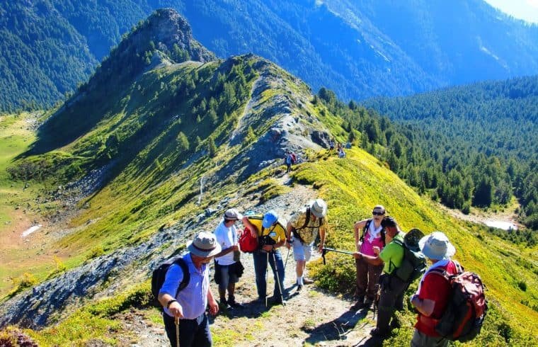
Monte Livata is the mountain of Subiaco: summit at 1,429 meters above sea level, Monti Simbruini range, Metropolitan City of Rome Capital. You reach it from Piazza di Subiaco by a provincial road of about 19 kilometers that climbs a total elevation gain of about 1,200 meters, with average gradients around 6 percent. By car it's 35 or 40 minutes of curves. By bike it's a climb that Roman amateur cyclists know by heart. From Rome, take the A24 motorway to the Vicovaro-Mandela exit, then the state road 5 Sublacense: just under two hours of driving, about 90 kilometers. Without a car, you can reach Subiaco on Cotral buses from the terminus of Metro line B at Ponte Mammolo, and from there take the bus that goes up to Livata, departing from piazza Falcone. Schedules and connections change between winter and summer and should be checked on the Cotral website or at the toll-free number 800 174 471. There's no entrance ticket: Monte Livata is open land, inside the perimeter of the Monti Simbruini Regional Nature Park, and the only things you pay for are parking where it's regulated, the chairlift when it's running, and equipment rental. The high-altitude road stays open in winter but may require chains or winter tires. Above 1,400 meters, when snow arrives, it really arrives.
Other mountain and nature destinations a few hours from Rome are collected on the page of tourist attractions in Lazio.

Where Monte Livata is and which municipalities it belongs to
The territory of Monte Livata belongs to the municipality of Subiaco and borders those of Camerata Nuova, Cervara di Roma, Jenne and Vallepietra. It's an administrative detail with practical consequences: anyone walking here crosses from one municipality to another without noticing, and the border with Abruzzo, toward Camporotondo and Cappadocia, is just a few kilometers along the ridge. The official name of the mountain refers to the summit, but in common usage Livata refers to the entire plateau that opens northeast of Subiaco, 3,000 hectares of meadows, sinkholes and beech woods that Roman tourism has been visiting for 70 years.
Anyone arriving for the first time is thrown off by the geography. There's no village, no square, no historic center. There are three separate clusters, a few kilometers of road apart, each with its own elevation, its own vegetation, and its own degree of built-up area. Understanding this layout is the key to not wasting time: whoever is looking for the school camp for children and whoever is looking for the trail to Monte Autore won't be going to the same place.
Useful distances from Monte Livata
From Livata to Subiaco it's 15 kilometers of provincial road, measured from the locality Anello. About 5 kilometers away, on the Cervara di Roma side, is Campaegli, another mountain tourist locality at 1,430 meters elevation. The town of Subiaco is 12 kilometers from Anello and is home to the Benedictine monasteries, open every day of the year. Toward the southeast, the trails descend to Vallepietra and the Sanctuary of the Santissima Trinità. Toward the east, they cross into Abruzzo along the route through Camporotondo, Cappadocia, Tagliacozzo. Anyone planning a single day should factor in these distances, since mountain roads aren't covered at the average speed of a state road.
The Monti Simbruini, the range Monte Livata belongs to
The name of the range comes from the Latin sub imbribus, literally "under the rains." It is not a poetic metaphor. The Simbruini receive more than 2,000 millimeters of precipitation a year, compared with barely 800 in Rome, because they are the first to intercept the humid western currents rising from the Tyrrhenian Sea. That water is the reason Rome has been drinking for 20 centuries. From the Simbruini slopes rise the Aniene, which runs 98.5 kilometers before flowing into the Tiber at Ponte Salario, the Liri, and the Simbrivio stream. Roman engineers tapped the springs of this area for the Anio Vetus, the Aqua Marcia, the Aqua Claudia and the Anio Novus. The Marcia still supplies the capital's water network today. Anyone walking the meadows of Monte Livata is walking over the city's reservoir.
The highest peaks of the range exceed 2,000 meters. Monte Cotento reaches 2,015 meters, Monte Tarino 1,960, Monte Tarinello 1,844, and Monte Viperella 1,834. Monte Viglio, at 2,156 meters, is usually assigned to the nearby Monti Càntari. Monte Autore, at 1,854.8 meters, is the third highest peak of the Simbruini and the highest in the entire Rome Metropolitan City. Monte Calvo, at 1,591 meters, closes off the horizon from Livata to the north. On paper these are modest Apennine elevations, but on the ground they are severe, because the weather changes quickly and fog rises from the Abruzzo side within half an hour.
The karst that shapes Monte Livata
The ground of all three districts of Monte Livata is karst, and this explains almost the entire landscape. Rainwater, slightly acidic, dissolves the limestone and carves from within. Sinkholes form, closed basins with flat bottoms where the grass stays green longer, and swallow-holes that swallow the streams and give them back kilometers downhill as foothill springs. Grotta Stoccolma is one of the known swallow-holes of the massif. The phenomenon has one consequence visitors notice right away: there are no surface watercourses worth the name on the plateau. There is water, plenty of it, but it runs under your feet. This is also why the plains of Campo dell'Osso and Fossa dell'Acero have that bowl shape, with beeches climbing the edges and leaving the center to the grass.
The Monti Simbruini Regional Nature Park
Since 1983, the Monte Livata area has been part of the Monti Simbruini Regional Nature Park, established by regional law of January 29 of that year. At about 30,000 hectares, it is the largest protected area in Lazio, and it includes the territories of Camerata Nuova, Cervara di Roma, Filettino, Jenne, Subiaco, Trevi nel Lazio and Vallepietra. The park authority's office is in Jenne, at Via dei Prati 5, with phone numbers 0774 827219 and 827221 and an email address listed on the park's official website. The authority runs thematic visitor centers spread across the towns, a system of marked trails, environmental education activities and guided tours.
The beech forest of the Simbruini is considered one of the largest in Europe. In autumn, between the second half of October and the first half of November, it produces a range of colors on the slopes of Monte Livata, from straw yellow to rust red. This is when the mountain is at its best and when tourist traffic is lowest: if you can choose, pick October.
The park regime, however, has another side, one at the center of 40 years of local controversy. Environmental restrictions introduced in 1983 have blocked the expansion of ski lifts and ski areas, and with them the development projects for the Monna dell'Orso and Campominio areas that the company running the lifts presented several times. People who live in Subiaco describe it as an injustice. People who come from Rome to walk among the beeches see a mountain that has not been built up with concrete. The two views have coexisted for decades, and neither one is entirely wrong.
The three districts of Monte Livata
Monte Livata, or simply Livata as everyone in Subiaco calls it, is divided into three districts. They share the karst nature of the ground and are distinguished from one another by altitude, vegetation and level of human development. It is worth getting to know them one by one, because the experience each one offers is different.
La Bandita, the lower part of Monte Livata
La Bandita occupies the lower band of the plateau, between roughly 1,350 and 1,425 meters, and includes the two areas of the Anello and the Valletta. It is the most built-up and best-served district: shops, restaurants, bars, residences, hotels, and rental of sports and recreation equipment. The non-ski sports facilities are concentrated here, and they are what keep the resort alive 11 months a year: a riding stable, tennis courts, a bike park with a trial area, and a recently built rail alpine slide, the attraction kids ask for first as soon as they get out of the car.
The Anello is also the finish line of the Speata, the running race that starts in Subiaco and climbs to Livata, organized by the local walkers' group. It is a pure uphill race, with the same elevation gain as the road, and every year it draws onto the forecourt a crowd out of proportion to the size of the place. La Bandita is served by the Cotral bus departing from Subiaco, Piazza Falcone, 15 kilometers away.
The verdict on La Bandita is clear: it's the least beautiful district and the most useful. You don't come for the scenery, which here has already been eaten into by the building of the sixties and seventies, but because it's the only place where you find everything: a bathroom, a sandwich, a pair of snowshoes for rent, a big parking lot. If you have small children or a mixed group, make your base here and use the other two districts as excursions.
Campo dell'Osso, the middle district of Monte Livata
Campo dell'Osso occupies the middle position, at around 1,560 meters, and includes the Fossa dell'Acero area. Viale dei Boschi runs through it, the artery that connects Livata to the Monna dell'Orso lifts: a straight stretch among the beech trees that in winter, when the snow holds, becomes one of the most photographed walks in Lazio.
The settlement structure is made up mostly of private residences, those villas and chalets that Roman families built starting in the sixties. Next to the houses there are a hiking refuge, a residence, a hotel that has seen long periods of closure, two restaurants, a bar, a pizzeria, a sports equipment rental and a church. The traces of the boom are still visible: the soccer field called I Miceti, a tennis court and several ski lifts that have been idle for years, waiting for a modernization announced several times.
In recent years the Campo dell'Osso slopes have been reactivated in reduced form with a moving carpet that works as a lift for the beginners' area. In the 2012 and 2013 season a 10-kilometer cross-country ski track was opened, running in the direction of Vallepietra, inside the beech forest. In summer the same tracks become trails and lead to the Sanctuary of the Santissima Trinità, a pilgrimage destination especially on the Sunday after Pentecost, and continue toward Abruzzo along the Camporotondo, Cappadocia, Tagliacozzo route. Campo dell'Osso is also the classic starting point of the snowshoe hike to the SAIFAR refuge.
If I had to name a single spot on Monte Livata for someone with half a day, I'd name this one. Campo dell'Osso has the right altitude, the woods within reach of your boots, and enough services not to turn the trip into an expedition.
Monna dell'Orso, the upper part of Monte Livata
Monna dell'Orso, which everyone simply calls La Monna, occupies the summit zone between 1,618 and 1,758 meters. It's the district where the real lifts are concentrated. In 2013, thanks to a joint effort by public and private parties, the Monna dell'Orso four-seat chairlift was inaugurated, carrying skiers, hikers and simple day-trippers from 1,618 meters to 1,758 meters.
On the square at the departure station there are buildings of different eras and workmanship: a chalet that works as a cafe, bistro and restaurant, with an attached solarium, a recently built refreshment point equipped with picnic tables, the ski and snowboard school, a sports equipment rental, a forest ranger post, a technical room, the control cabin and ticket office of the chairlift, a large shed for tracked vehicles and equipment. The natural catchment area is the lower province of Rome, in competition with the nearby Campo Staffi and Campocatino in the province of Frosinone.
From here the hikes into the woods start toward Monte Calvo and Monte Autore. The opening of the chairlift depends on the season and the snow conditions, and the operating days and hours should be checked with the operator before setting out: climbing 1,200 meters of elevation to find the lift closed is a mistake that is made at Livata more often than you'd think.

Monte Livata in winter: skiing, snowshoes and sledding
Let's clear up a misunderstanding right away that concerns almost all Romans under 40. Monte Livata is no longer the ski resort their parents went to. The structured alpine area, with the network of ski lifts that covered the hills of Cesone, Fascia, Rotoli, Valletta, Fossa dell'Acero and Monna dell'Orso, no longer exists in the form it had in the seventies and eighties. What remains is a snowy mountain with a chairlift, a beginners' area, a cross-country loop and kilometers of trails you can walk with snowshoes. Anyone who arrives with this expectation isn't disappointed, anyone who arrives thinking they'll find Roccaraso an hour from Rome is.
The Monte Livata four-seat chairlift
The Monna quad chairlift, opened on December 22, 2013 with equipment supplied by a South Tyrolean manufacturer, replaced the historic skilift and reopened mechanized access to the upper section. The vertical rise it covers is modest, 140 meters, but it opens up the fan of summit slopes and also serves those who want to reach the starting point of the trails at altitude in summer without wearing out their legs on the road. Ticket prices and opening hours are set by the operator season by season and should be checked before setting out.
The five historic runs of Monna dell'Orso
Until 2008 the Monna dell'Orso skilift ran, serving five alpine ski runs whose names are still in everyday use in Subiaco: Del Sole, Dell'Orso, Delle Signore, Nordica and Topolino. The closure came when the concession expired. It had been extended several times and was finally not renewed, and it made way for the chairlift project. Along with the lifts, the local alpine ski schools also shut down, and the last generation of Sublacense instructors ended up working in Abruzzo or in the Alps, in Cortina d'Ampezzo and Madonna di Campiglio. It is a professional diaspora that says more than many statistics about the state of skiing in Lazio.
Cross-country skiing and snowshoeing at Monte Livata
Cross-country skiing is today the discipline that holds up best. The loop opened in the 2012 and 2013 season offers 10 kilometers of track running through the beech forest toward Vallepietra, with gentle gradients and a surface that holds up well even with modest snow cover. Snowshoeing is the other resource: from Campo dell'Osso, half-day routes leave for the SAIFAR refuge and toward the inner plateaus, and the powdery snow of the Simbruini lends itself well to this slow pace. Be careful with fog, though: on the plateau, with reduced visibility, landmarks disappear and the sinkholes become traps. Snowshoe with a GPS track or with a guide, always.
Sledding and the ski school area at Monte Livata
For families with children under 10, the useful part of Monte Livata is all at La Bandita and Campo dell'Osso: the rail sled ride, which also works without snow, the gentle slopes of the ski school area served by the magic carpet, and rental of toboggans and small snowshoes. A practical tip that no official website mentions: bring a complete change of dry clothes for the children and leave it in the car. There are no changing rooms on the plateau, and an afternoon in the snow always ends with someone soaked up to the knees.
Monte Livata in summer: meadows, beech forests and trails
Summer at Monte Livata is the most underrated season and, in our view, the best. In July and August, while Rome reaches 35 degrees, the plateau stays between 20 and 25 degrees, and at dawn you still need a sweatshirt and long pants. The meadows are roamed by horses and herds of cattle grazing freely, which move around and cross the road without looking. Drive slowly and don't feed the animals.
Monte Autore, the highest peak above Monte Livata
Monte Autore, at 1,854.8 meters, is the hiking destination par excellence for anyone setting out from Monte Livata. It is the third-highest peak in the Simbruini and the highest point in the Metropolitan City of Rome, and on the summit there is a cross that can be seen from far away on clear days. The summit falls within the territory of Camerata Nuova and Vallepietra, and it is reached on foot from Monte Livata, from the Vallepietra side, and from Camporotondo on the Abruzzo side. On the southwest flank, at about 1,337 meters below the cliff of Colle della Tagliata, stands the Sanctuary of the Santissima Trinità, one of the oldest and most intense pilgrimage sites in the central Apennines.
The climb presents no technical difficulties, but it is long and almost entirely exposed in its final part, above the tree line. Bring enough water and a hat, and start early: on summer afternoons, heat thunderstorms arrive right on time, and a ridge with no shelter is not where you want to be.
Monte Calvo and the Fossa dell'Acero
Monte Calvo, at 1,591 meters, offers a shorter hike that also suits those who don't walk much. The route crosses the beech forest and emerges onto summit pastures with a view over the entire plateau. The Fossa dell'Acero, behind Campo dell'Osso, is one of the most elegant karst basins in the massif: flat bottom, beeches encircling it like an amphitheater, and almost total silence on weekdays. It's the place to take someone who has never seen a sinkhole and wants to understand what one is in two minutes.
Campaegli, Viale dei Boschi and the other routes from Monte Livata
About 5 kilometers away, in the territory of Cervara di Roma, is Campaegli, at 1,430 meters, another mountain locality with its lifts and meadows. The connection between the two is convenient and lets you combine the day. Viale dei Boschi, which links Livata to Monna dell'Orso, can be walked or biked, and it's the right stroll for a summer evening. Heading north, the trails lead to the area of the ruins of Camerata Vecchia, the village abandoned after the fire of 1859, which remains one of the most memorable hikes on the whole slope.
Animals and pastoral life on the meadows
Free-range grazing is not tourist folklore: it is the economy that kept this mountain going for centuries before the skiers arrived, and it still shapes its landscape. It is the animals' teeth that keep the plateaus open: without grazing, the beech trees would reclaim the meadows of Livata in about 30 years, and the plateau that visitors photograph would disappear. The herds go up in late spring and come down in autumn, following a short transhumance calendar that the Simbruini have practiced for as long as anyone can remember along the routes toward Abruzzo.
Common-sense rules, which are broken every weekend at Livata. Dogs must be kept on a leash: guard dogs protecting the flocks do not play, and an Abruzzo shepherd who gets between the flock and a loose dog is simply doing his job. Do not walk through a group of cattle, go around it. Do not leave food on the meadows. Do not pick mushrooms without the permit required by regional rules and the park's regulations.
The history of Monte Livata, from donkeys to the chairlift
The tourist history of Monte Livata is one of the best-documented stories of the Lazio mountains, and it is worth telling in full because it explains everything you see on the plateau today, including the ruins.
Before 1956: you went up on foot or by donkey
Until 1956, Monte Livata was reached on foot or by donkey. Even so, the mountain already had its visitors: the Subiaco skiers group, founded in 1927, went up regularly to practice cross-country skiing, alpine skiing and ski jumping. They were athletes who carried their skis on their shoulders for hours and skied down slopes without packed runs or signs. Whenever someone complains about the current state of the lifts, it is worth keeping in mind that this mountain had 30 years of skiing before it had a road.
1956 and 1957: the road and the first ski lifts
The road for vehicles was opened in 1956, promoted by the Subiaco municipal government and by the then head of the Forestale. The following year, in 1957, the first cable lifts were built on the Bandita and Fascia hills. Two years, and Monte Livata went from the Middle Ages of mules to the modernity of ski lifts: it is a compression of time that explains well the enthusiasm with which the town welcomed the following season.
1959: the Hotel Italia and the pioneers of Monte Livata
In 1959 the first hotel, the Hotel Italia, was opened, built by Giacomo Orlandi, a pioneer of mountain tourism in Livata, whom everyone in Subiaco called Giacomino ju Ricciu. The same family still runs the business today, in its fourth generation, together with the Pensione Genziana: two establishments that came through the boom, the decline and the long stagnation unscathed. In the following years other operators opened commercial and tourist businesses, and many affluent Roman families began to visit Livata, building the first chalets on the Livata plain and on the Campo dell'Osso plain.
1965 and 1968: the Livata ski club and the instructors from Cortina
In 1965 the Livata ski club was founded, whose first president was Filippo Morini, co-owner of the first cable lifts built on the Cesone, Fascia, Rotoli, Valletta, Fossa dell'Acero and Monna dell'Orso hills. That same year the provveditorato agli studi di Roma began organizing winter stays at the Hotel Italia for middle school students, who learned to ski alongside their lessons under the guidance of teachers trained at ISEF. It was the origin of a mass phenomenon: for two generations, the ski week of Roman kids has been called Livata.
In 1968, at the same hotel, the first alpine ski school was founded. Thanks to the will and generosity of Giacomo Orlandi and the pro loco, instructors from Cortina d'Ampezzo were hired, who formed the school affiliated with the Federazione Italiana Sport Invernali. The following year, two instructors from Predazzo joined the three Cortina instructors, and they later became the founders and owners of the scuola italiana sci di Monte Livata dei fratelli Guadagnini. In the same period, some people from Subiaco set up a second local school, called Cimon della Pala. In 1975 the Subiaco alpine ski school was founded, made up of federation instructors. In just a few years, on a mountain in Lazio, a core of technical instruction took shape that launched alpine skiing in central and southern Italy.
1976 and 1977: Livata 2001 and the start of summer tourism
The industrial turning point came with the company Livata 2001, which from 1976 began building new ski lifts, replacing those of the previous operators in the Livata, Campo dell'Osso and Monna dell'Orso ski areas. In 1977 the same company built the Anello sports center on the plain: this is the conventional birth date of summer tourism at Monte Livata, which until then had been a purely winter destination. In the following years, ski clubs held a great many alpine skiing races here.
From the 1980s to 2008: the decline of Monte Livata
From the start of the 1980s until the end of the millennium, the Subiaco mountain, like the other Lazio ski resorts, went through a slow and steady decline. There are three reasons, and none of them is enough on its own. The first is competition from the Abruzzo ski areas, Campo Felice, Ovindoli and Roccaraso, which are just as easy to reach from Rome and have more modern runs and lifts. The second is poor long-term management of services, with infrastructure gaps that lasted for decades, starting with drinking water and sewer connections. The third is the set of restrictions that followed the establishment of the park in 1983, which blocked any expansion of the skiable area. In 2008, the closure of the Monna ski lift, the last cable installation still running, took away the draw that generated certain cash flows.
From 2013 to today: a partial restart
2013 marked a turning point. At a public meeting on July 14 of that year, attended by the mayor, business owners and apartment owners, the arrival of materials to complete the chairlift was announced. The delivery was honored, work resumed at the end of August, and the lift was inaugurated on December 22, 2013, operating from the 2013 and 2014 winter season. At the same time, work started on the sewer collectors, and funds were found at the Lazio Region to complete the aqueduct, a construction project that was started, interrupted and resumed several times. The progress of these works should be checked with the Subiaco town hall: it's a matter that changes from year to year, and public sources are not always up to date.

A curiosity about Monte Livata
The biggest curiosity about Monte Livata isn't on the mountain: it's in the name of the range it belongs to. Simbruini comes from the Latin sub imbribus, meaning under the rains. It's not an erudite whim: it's a hydrographic observation the Romans made before anyone else, because more than 2,000 millimeters of water fall on these slopes every year, two and a half times what falls on Rome. Everything else grows out of that climatic anomaly. The piedmont springs of the Simbruini fed the Anio Vetus, the Aqua Marcia, the Aqua Claudia and the Anio Novus, that is, a decisive part of the water system that allowed a city of a million inhabitants to exist in antiquity. The Aqua Marcia, captured in this area, still supplies Rome's water network: when a Roman turns on the tap, there's a very good chance they're drinking water that fell as rain on the pastures of Monte Livata and the surrounding slopes.
There is a second side to the same curiosity, and it's the one that explains the landscape. With all that water, you'd expect to find streams, waterfalls and small lakes at Livata. There's almost none of that, because the limestone is permeable and the water disappears underground a few meters after falling, carving out sinkholes and swallow holes and resurfacing only at the base of the massif. Monte Livata is a soaked mountain that looks dry. Anyone hiking here in summer has to bring their own water: they'll only find it at the fountains in the inhabited areas, not along the trails. It's the most elegant hydraulic paradox in the Lazio Apennines, and nobody tells visitors about it when they arrive.
Something nobody tells you about Monte Livata
For two generations, this mountain was the ski training ground of the Rome public school system. In 1965, the Rome school board began organizing winter stays at the Hotel Italia for middle school students: they studied in the morning and learned to ski in the afternoon, with teachers who had graduated from the ISEF acting as instructors. It was not a niche initiative. For years, Rome's schools organized winter school trips to the hotels of Livata, and thousands of Romans, now in their fifties and sixties, first put on skis on these slopes, not in the Alps.
This detail has a consequence you can still see on the ground today. The housing stock of Campo dell'Osso and the Livata plain, all those small villas that seem out of scale to today's visitor compared with the available services, is the material leftover of that mass phenomenon. The families who had discovered Livata through their children and their school bought and built here between the 1960s and 1970s, when it seemed the mountain would grow forever. Then alpine skiing moved off to Abruzzo and the houses stayed, many of them closed 11 months a year.
The professional fallout is even more bitter, and nobody writes about it. When the lifts closed, the ski schools closed too, and the last generation of ski instructors from Subiaco had to move away. Today they work in Abruzzo, in the Alps, in Cortina d'Ampezzo, and in Madonna di Campiglio. They were born and raised on a mountain that taught half of Rome to ski, and now they teach somewhere else. Anyone who drives up to Monte Livata and sees only meadows and beech trees doesn't imagine the failed industrial story underneath.
The advice I give you for visiting Monte Livata
Don't come to Monte Livata on a Sunday in January right after the first heavy snowfall. That's exactly what everyone does, and it's the best way to take home the worst memory. The provincial road that climbs from Subiaco has two lanes, tight switchbacks, and no chance to pass. When tens of thousands of Romans decide on the same weekend that they want to see snow, the climb grinds to a halt, the parking lots fill up by nine in the morning, and anyone who arrives at 11 parks miles away along the side of the road, where they block the passage of snowplows.
My practical advice has two parts. First: if you want snow, come on a Friday or a Monday, and leave Rome by seven. On this road, the difference between eight and 10 in the morning is an hour and a half of driving. Second, and more important: seriously consider coming to Monte Livata when there's no snow. October, with the beech forest turning red, and June, when the meadows are in bloom and the herds have just come up, are the two moments when this mountain shows its best side and when you practically have it to yourself. Anyone who has only visited Livata in winter has never really seen it.
I'll add three practical notes that apply in any season. Always check with the operator if the chairlift is running before you go up, because the lift runs on a seasonal schedule, not every day. Bring enough water, because you won't find any on the karst trails. And keep chains in the car from November to March, even if the sky is clear when you leave: it's 15 degrees in Rome, and at 1,600 meters there can be ice in the shade.
Another well-known fact, yet rarely mentioned
Monte Livata was a stage finish in an international professional cycling race. In 1975 it hosted the finish of the second half-stage of the second stage of the Tirreno-Adriatico, which started from Frascati, and was won by Italo Zilioli. The fact is known to enthusiasts and ignored by everyone else, yet it says something precise about this climb: 19 kilometers, 1,200 meters of total elevation gain, and an average gradient of around 6 percent. These are the numbers of a major Alpine climb of moderate difficulty, with the peculiarity of being an hour and a half from Rome.
This explains why, on any weekend from March to November, the provincial road is used by groups of cyclists. The climb from Subiaco to Livata is, together with a few others, the classic testing ground for Rome's amateur cycling. It has a steady rhythm, without the double-digit ramps that break your legs, and this makes it readable: you can climb at a constant pace and measure yourself against the clock. At the top, moreover, there's a bar and a parking area where you can wait for the rest of the group, which is not a given on Lazio's climbs.
Then there's the Speata, a running race organized by the Simbruini walkers' group, which goes up on foot along the same route and reaches the top of the plateau. Anyone who has never seen it can't imagine the scene: hundreds of runners cresting the summit at the Anello, with Rome 90 kilometers below and beech trees all around. The date and rules change from edition to edition and should be checked with the organizers.
The right photo to take at Monte Livata
The photo everyone tries to take here is the meadow with grazing horses and the beech forest in the background. It almost always turns out badly, for a specific technical reason: at noon, with the sun high, the high-altitude meadows are a uniform surface with no volume, the light flattens the green, and the horses become dark blobs with no detail. The same scene at seven in the morning at the end of June, or in the last hour before sunset, is something else: low, raking light draws the undulations of the dolines, the trunks of the beeches at the edge of the forest cast long, parallel shadows, and the animals' coats catch light along their outlines.
The spot I recommend is the northern edge of the Fossa dell'Acero, behind Campo dell'Osso, with the hollow in the foreground and the crown of beeches closing the frame. You need a moderately long lens, between 85 and 135 millimeters equivalent, to compress the planes and bring out the bowl shape of the doline, which is completely lost with a wide-angle. In autumn, the same framing holds up on its own with the beech forest in color.
The second image, less obvious, is Viale dei Boschi with fresh snow on the branches: a central, straight perspective, with the forest closing in over the road. It works in the early morning, before passing cars dirty the snow. Then there is the photo from above: from the top station of the chairlift, at 1,758 meters, on days with tramontana wind the horizon opens up to the Abruzzo hills on one side and the Aniene valley on the other. One warning, which applies as a rule of behavior as well as composition: don't chase a grazing animal to get closer. Use a telephoto lens and stay still.
Some important events that happened here in history
The first event worth remembering did not happen on Monte Livata but below it, and it changed the history of Europe. In the early 6th century, Benedict of Norcia withdrew to a cave above Subiaco and stayed there for three years. 13 monasteries grew up around that hermitage, and today the monastery of Santa Scolastica survives from them, holding the title of protocenobium of the Subiaco Benedictine congregation. The Benedictine Rule, which spread from these slopes throughout the West, was written a few hundred meters above sea level below the Livata pastures.
The second event took place in 1465. Two German printers, Conrad Sweynheym and Arnold Pannartz, set up what is considered the first printing workshop in Italy in the abbey of Subiaco. The first book printed on the peninsula therefore came into being at the foot of this mountain, and not in a capital city. This fact led to Subiaco being named Italian Capital of the Book in 2025. The town, which has a little over 8,000 inhabitants, received city status by decree on July 27, 2021.
The third event concerns the plateau in the strict sense and is the year 1956, when the drivable road opened. Until then, you got to Monte Livata on foot or on the back of a donkey. Within 24 months the drivable road and the first cable lifts arrived. No other event has changed this mountain so profoundly.
The fourth is 1975, the stage finish of the Tirreno-Adriatico won by Italo Zilioli, which put the Subiaco mountain in the national sports news for one day. The fifth is January 29, 1983, when the regional law establishing the Parco Naturale Regionale dei Monti Simbruini set a protection regime over 30,000 hectares that would guide, and limit, every later decision. The sixth is 2008, the closing of the Monna dell'Orso ski lift. The seventh is December 22, 2013, the opening of the four-person chairlift: the first good infrastructure news in 30 years.
Who passed through Monte Livata
The figure who left the deepest mark on this territory is Nero. The emperor had a monumental villa built in the Aniene valley below Subiaco, with three artificial lakes created by damming the river, the Simbruina Stagna of the Latin sources, from which the name Subiaco itself derives, sub lacu, under the lakes. Excavations have uncovered the remains of buildings arranged on different levels. Of the marble bridge that crossed the river, only traces of the foundations remain. Nero never climbed the pastures of Livata, but the landscape that made the place valuable, that is, the water of the Simbruini, is the reason he chose this valley.
Then Benedict of Norcia, who lived his hermit experience in the cave above Subiaco in the early 6th century, and his sister Scholastica, to whom the two monasteries are dedicated. And Francis of Assisi, who passed through the Sacro Speco around 1223 and 1224. The fresco that depicts him without stigmata and without a halo is dedicated to him, and it is considered his earliest and most faithful depiction. Anyone who goes up to Monte Livata and doesn't go down to see that face makes a planning mistake.
In the 20th century, the pioneers of Lazio skiing passed through here. Giacomo Orlandi, whom people in Subiaco called Giacomino ju Ricciu, built the Hotel Italia in 1959 and started hotel hospitality at altitude. Filippo Morini founded the Sci Club Livata in 1965 and was co-owner of the first cable lifts. The instructors from Cortina d'Ampezzo hired in 1968, and the two instructors from Predazzo who arrived the following year, the Guadagnini brothers, brought an alpine-level technical ski school here and launched skiing in central and southern Italy.
And then there are the sporting passages. Italo Zilioli, a top-level professional who finished second in the Giro d'Italia for three consecutive years, won the half-stage of the Tirreno-Adriatico here in 1975. Along with him, on the same road, the entire cycling pack of those years passed through. Finally, the anonymous ones passed through, and still do: the tens of thousands of Roman students who learned to ski on these slopes between the 1960s and 1980s during the winter weeks organized by their schools. They left no plaques, but they left the houses, the hotels and the collective memory that still keeps the name of Monte Livata alive in the city's memory.
Subiaco and the monasteries below Monte Livata
No day trip to Monte Livata is complete without the descent to Subiaco, 12 kilometers further down. The town has just over 8,000 residents, stretches along the Aniene and is dominated by the Rocca Abbaziale. In 2025 it was recognized with the title of Italian Capital of the Book, thanks to the printing press set up here in 1465.
The Monastery of Santa Scolastica
The Monastery of Santa Scolastica is the only survivor of the 13 monasteries founded around the Benedictine hermitage, and it keeps the title of protocenobio of the Sublacense congregation. The complex is laid out across three cloisters from different eras, from the 12th to the 16th century, which are worth the visit on their own. The passage from Romanesque to Cosmatesque and then to Renaissance can be read as you walk through. Visits take place at times set by the monastic community, roughly 9.30 and 12.15 in the morning and 15.30 and 17.15 in winter, with closing pushed back to 18.15 in summer. It's best to confirm by phone before you leave, because the liturgy takes precedence over visits. A sung Mass in Gregorian chant is celebrated in the church.
The Sacro Speco, the Monastery of San Benedetto
The Monastery of San Benedetto, which everyone calls the Sacro Speco, is built against the rock face of Monte Taleo and rests on nine tall arches, some of them Gothic. Inside, the frescoes cover several centuries: elements of Byzantine ancestry, the 13th-century cycles of Magister Conxolus, and works by the Sienese and Umbro-Marchigiana schools between the 14th and 15th centuries. The dominant themes are the Passion of Christ, the life of the Madonna and the life of Benedict of Norcia. The statue of the saint in the grotto is the work of Antonio Raggi, carved in 1657. The portrait of Francis of Assisi, dating to 1223 and 1224, has no stigmata and no halo, and for this reason it is considered a portrait from life. For groups, the visit is arranged in advance with the monastic community.
What to See Around Monte Livata
Those with more than one day can plan an itinerary through the valley and the heights. In Vallepietra you can visit the Sanctuary of the Santissima Trinità, set beneath the cliff of Colle della Tagliata at about 1,337 meters. The pilgrimage on the Sunday after Pentecost is one of the oldest popular religious events in Lazio. In Vallepietra and Cervara di Roma, the highest town in the province with its carved staircases, you touch on the stone architecture of the upper Aniene valley. The ruins of Camerata Vecchia instead tell a story of abandonment that is worth an afternoon.
Heading down toward Rome along the Valeria and the Tiburtina, you reach Tivoli, with Hadrian's Villa and its waters, which ideally closes the story of the Aniene that began at Livata. Those looking for other Lazio mountains with the same spirit should look at the Monti Lucretili, the Duchessa mountains, and the Monte Navegna and Monte Cervia nature reserve above Lake Turano. Or you can cross into Abruzzo toward the Abruzzo, Lazio and Molise National Park, which borders the Simbruini on the eastern ridge.
Frequently Asked Questions About Monte Livata
How far is Monte Livata from Rome and how do you get there?
Monte Livata is about 90 kilometers from Rome, reachable in one hour and 40 minutes or two hours depending on traffic on the A24. The reference exit is Vicovaro Mandela. Then follow the statale 5 Sublacense to Subiaco, and from there take the provincial road that climbs to higher elevation.
What is the altitude of Monte Livata?
The summit of Monte Livata reaches 1,429 meters above sea level. The territory belongs to the municipality of Subiaco and borders Camerata Nuova, Cervara di Roma, Jenne and Vallepietra, with the Abruzzo border a few kilometers away along the ridge.
Can you still ski at Monte Livata?
At Monte Livata, the old ski area with ski lifts on hills such as Cesone, Fascia and Valletta no longer exists in the form it had in the 1970s and 1980s. It remains a mountain where you can walk in the snow and ride the rail sled run at the Bandita even without snow cover.
What can you do at Monte Livata in summer?
In summer Monte Livata offers meadows, beech woods and trails, with temperatures of 20 or 25 degrees while Rome hits 35. The meadows are crossed by horses and herds grazing freely, which have shaped the landscape of the plateau for centuries.
Is Monte Livata suitable for young children?
Monte Livata is one of the few mountains in Lazio that works well with small children, because you can park practically on the meadow without any approach walk or cable car. At La Bandita, the rail slide gives half an hour of fun even without snow, and the riding stable offers the first saddle experience.
Is Monte Livata accessible to people with reduced mobility or pushing a stroller?
The flat areas of La Bandita and the parking areas of Monna dell'Orso at Monte Livata can be reached by car and crossed without significant elevation changes on paved or compacted surfaces. The trails, on the other hand, remain mountain terrain with scree, roots and uneven ground, and without equipped routes.
When is the best time to visit Monte Livata?
June, when the pastures are in bloom, is according to many visitors the best month to visit Monte Livata. From December to March the mountain is winter, with frequent snow above 1,500 meters, while July and August offer temperatures 20 degrees lower than Rome's.
When should you avoid Monte Livata?
Avoid Monte Livata on the Sunday after a heavy snowfall in January, because it's when the most visitors arrive together. The provincial road that climbs from Subiaco has two narrow lanes and hairpin bends with no room to pass, and on the busiest weekends the climb gets blocked easily.
For those who want to tackle this area with a professional, licensed tour guides and tour escorts from the TourLeaderPro a Roma network regularly work in the upper Aniene valley, and organized groups rely on the accompagnamento turistico service for day-trip logistics.

Monte Livata with children
It is one of the few mountains in Lazio that really works with small children, and the reason is obvious: you park practically on the meadow. You don't need an approach walk, you don't need a cable car, and you don't need baby carriers. You get out of the car and you're already on the grass or the snow. At La Bandita, the rail slide gives half an hour of fun even without snow. The riding stable offers the first saddle experience. The bike park with trial area works for kids from age eight and up. In winter, the training slope served by the magic carpet allows the first descents without tackling a ski lift.
Two warnings. The first concerns altitude: 1,400 meters is not the Alps, but the sun's radiation on snow is still strong, and children get sunburned on their faces in two hours. Use a high-protection sunscreen and sunglasses, even when the sky is overcast. The second concerns restrooms: on the plateau, they exist only in bars and restaurants, and on peak days the lines are long. Plan the stop accordingly.
Accessibility and safety at Monte Livata
The flat areas of La Bandita and the parking areas of Monna dell'Orso are reachable by car and can be crossed without significant elevation changes, which makes part of Monte Livata usable even for people with reduced mobility or pushing a stroller, at least on paved or compacted surfaces. The trails, on the contrary, are mountain terrain: scree, roots, uneven ground, no barriers. There are no equipped routes for wheelchairs on the hiking trails.
On safety, there is a reminder that comes up every winter with unpleasant results. The plateau is wide, not very well defined and, with fog or driving snow, has no visual landmarks: you can lose your orientation in a few minutes, even a few hundred meters from the road. Anyone leaving the marked trails should bring a GPS track, a charged battery and suitable clothing. The single emergency number is 112. Phone coverage on the plateau is spotty. And, simply, let someone know where you're going and when you plan to be back.
When to go to Monte Livata
From December to March the mountain is wintry, with snow not guaranteed but frequent above 1,500 meters. The weekends right after snowfalls are to be avoided because of traffic. April and May are transition months, with the meadows coming free and the trails still muddy at altitude. June is the month of pasture flowering and the absolute best time of year. July and August offer 20 degrees more relief than Rome and are the months of hotel life. On Ferragosto weekends, however, the plateau fills up. September is quiet and stable. October and the first half of November are the time of the beech forest foliage, and they give the best images of the whole year.
Those organizing a trip from abroad who think in English will find Italian mountain itineraries collected in the guide Mountains and Nature in Italy by ItalyPlanner. Day trips from the capital are listed in the day trips section, and things to see in the city are in the guide Best Things to Do in Rome.
Quick questions about Monte Livata
How far is Monte Livata from Rome?
About 90 kilometers, a trip of one hour and 40 minutes or two hours depending on traffic on the A24. The reference motorway exit is Vicovaro-Mandela. Then you follow the statale 5 Sublacense to Subiaco, and from there the provincial road that climbs to altitude.
At what altitude is Monte Livata?
The summit of Monte Livata reaches 1,429 meters above sea level. The inhabited hamlets are spread between 1,350 meters at La Bandita and 1,758 meters at the arrival station of the Monna dell'Orso chairlift.
Do you have to pay a ticket to access Monte Livata?
No. Access to the plateau is free. You pay for the chairlift when it is running, for equipment rental, for sports facilities and for parking where it is regulated.
How do you get to Monte Livata without a car?
Take the Cotral bus from Rome to Subiaco, departing from the terminus of metro line B at Ponte Mammolo, and then the bus that goes up to Livata from piazza Falcone. Services at altitude are few and change between seasons. Check cotralspa.it or call the toll-free number 800 174 471.
Is there snow at Monte Livata?
In the cold season, yes, though frequency and amount vary from year to year. Above 1,500 meters the snow cover is more reliable. No official website guarantees snow in advance. Check the forecasts and the condition of the slopes before setting out.
Is the Monte Livata chairlift open?
The four-seater Monna dell'Orso, opened on December 22, 2013, runs on a seasonal schedule set by the operator. Days, times and fares should be checked before going up.
Can you ski at Monte Livata?
Structured alpine skiing from the 1970s and 1980s no longer exists. What remains is the ski school area served by a magic carpet at Campo dell'Osso, the slopes served by the chairlift, and the 10-kilometer cross-country ski loop toward Vallepietra. Those looking for a complete alpine resort should look to the Abruzzo resorts.
Can you use snowshoes at Monte Livata?
Yes, and it is today the winter activity that works best. The classic routes start from Campo dell'Osso, including the one toward the SAIFAR refuge. In fog or fresh snow, it is advisable to go with a guide or with a GPS track.
Do you need chains to drive up to Monte Livata?
From November to March it is prudent to keep them in the car, together with winter tires or as an alternative to them. The seasonal ordinances on mandatory equipment are the responsibility of the road management body and should be checked.
Is Monte Livata suitable for children?
Very much so. You park right next to the meadows, and there is the rail toboggan run (slittinovia su rotaia), the riding stable, the bike park and the ski school area. High-factor sunscreen is needed even in winter, along with a spare dry change of clothes.
Are there restaurants and bars at Monte Livata?
Yes. La Bandita holds most of the services, with restaurants, bars, hotels and residences. Campo dell'Osso has two restaurants, a bar, a pizzeria and a refuge. At the Monna dell'Orso square there is a chalet with a restaurant and a snack bar with picnic tables. Opening times follow the season.
Is there water along the trails of Monte Livata?
Almost never. The karst ground quickly absorbs rainfall and returns it to the foothill springs, much further down. Fill up water at the fountains of the inhabited areas before setting out.
Can you bring a dog to Monte Livata?
Yes, on a leash. Cattle and horses graze free on the plateau, and guard dogs work to protect the flocks. A loose dog creates dangerous situations for itself and for its owner.
What is the difference between Monte Livata and Campaegli?
Campaegli, at 1,430 meters, falls within the municipality of Cervara di Roma and is about five kilometers from Livata. It is a smaller and less served locality, and many visitors combine the two in the same day.
How long does it take to climb to Monte Autore from Monte Livata?
Monte Autore, at 1,854.8 meters, is a hike of a good half day for a trained hiker, with no technical difficulties but with an exposed final stretch. Actual times depend on the starting point you choose and on conditions. Anyone who doesn't know the route should rely on the park's trail markings or a guide.
Is Monte Livata inside a protected park?
Yes, since 1983 it has been part of the Parco Naturale Regionale dei Monti Simbruini, established by regional law on January 29, 1983. The park covers about 30,000 hectares and is the largest protected area in Lazio.
Can you pick mushrooms at Monte Livata?
Only in compliance with regional regulations and the park's rules, which require a permit and set quantity limits. Up-to-date rules should be requested from the park authority, based in Jenne at via dei Prati 5.
What is the best time to visit Monte Livata?
June for the flowering of the pastures and October for the color of the beech forest. These are the two times when the mountain is at its most beautiful and least crowded. Winter is crowded only on the weekends following snowfall.
Is there cell phone coverage at Monte Livata?
Coverage is patchy and varies a lot between the three hamlets and the wooded sectors. Don't rely on your phone as your only tool for navigation or rescue.
What is there to see in Subiaco after Monte Livata?
The two Benedictine monasteries, Santa Scolastica and the Sacro Speco, open every day of the year with seasonal hours, the Rocca Abbaziale, and the historic center. It's 12 kilometers from the Anello, a 20-minute descent.
Why are they called the Monti Simbruini?
From the Latin sub imbribus, under the rains. The range receives over 2,000 millimeters of precipitation a year and feeds the Aniene, the Liri and the Simbrivio, as well as the springs that supplied the Roman aqueducts and still supply Rome today.
If I had to say in one line what Monte Livata is today, I'd say it's a mountain that has stopped chasing what it can no longer be and hasn't yet figured out what it might become. Mass alpine skiing ended here 20 years ago and won't come back. But 90 kilometers from Rome, 3,000 hectares of meadows and beech forests at 1,500 meters, a chairlift, a cross-country loop, a network of trails, and two of the most important monasteries in Europe 20 minutes downhill are an asset few Alpine resorts can claim in this combination. It's worth coming in October, leaving the car at the Anello, and walking to the Fossa dell'Acero without hurrying. Then head down to Subiaco and look the portrait of Francis in the face. A day like this is worth 10 weekends on the snow in traffic jams.
Article written by the editorial team at TourLeaderPro, contact them for Tours and Private/Corporate/V.I.P. Experiences.
Planning a trip to Rome? English-language guides for visiting the city are available at ItalyPlanner.com.