Monti Lucretili Regional Nature Park
In short. The park authority's headquarters is at Viale Adriano Petrocchi 11, in Palombara Sabina (RM), postal code 00018, with telephone 0774 637027 and email address info@parcolucretili.it: from here they manage more than 18,000 hectares of…

The park authority's headquarters is at Viale Adriano Petrocchi 11, in Palombara Sabina (RM), postal code 00018, with telephone 0774 637027 and email address info@parcolucretili.it: from here they manage more than 18,000 hectares of Apennine mountain overlooking the Tyrrhenian plain. The offices of the Monti Lucretili Regional Nature Park are open to visitors Monday and Wednesday from 8:00 to 17:30, Tuesday, Thursday and Friday from 8:00 to 14:00, and are closed Saturday and Sunday. The calendar of guided hikes and any trail closures for fire risk or bad weather can be checked on the official website parcolucretili.it before you leave. The park has no entrance ticket or turnstile: you enter freely from the towns around it, and the real expense is transport and a guide, if you want one. By car from Rome you take Via Salaria or Via Tiburtina and head up toward Palombara Sabina, Marcellina, San Polo dei Cavalieri or Percile depending on the side you're interested in. By public transport the most convenient gateway is the Palombara-Marcellina railway station on the Rome-Orte line, from which local buses reach the towns. Those who come to hike almost always start from one of the road passes above the towns, where the asphalt ends and the numbered CAI trails begin.
To place the area among the other quick day trips northeast of Rome, it's worth keeping an eye on the guide to proposals in Rome and its surroundings, which collects the other protected areas reachable in a day from the capital.
Where It Is and What the Monti Lucretili Regional Nature Park Is
The Monti Lucretili Regional Nature Park occupies the southernmost sector of the Monti Sabini, where the backbone of the Apennines drops and opens onto the Roman countryside. Established in 1989, it protects an area of about 18,204 hectares straddling the province of Rome and that of Rieti, a band of mountain that begins a few dozen kilometers from the Grande Raccordo Anulare and that, despite modest elevations and the closeness to the metropolis, keeps a surprisingly wild character. The highest mountain is Monte Pellecchia, 1,368 meters, which overlooks the valley of the Licenza stream. A little farther south rises Monte Gennaro, 1,271 meters, the symbol peak of the Lucretili, the one you can recognize with the naked eye from Rome looking northeast on clear days.
The landscape of the Monti Lucretili Park reads in overlapping layers: dense beech and holm oak woods, wide karst plateaus dotted with sinkholes, small recessed lakes, and a ring of towns with houses packed at the foot of castles and towers. It's not a spectacular mountain in the Alpine sense of the term, there are no 1,000-meter vertical walls or glaciers. It's a middle mountain, a human one, where pasture, olive grove and woodland have alternated for centuries and where karst has shaped plateaus, swallow holes and springs. Since 2016 the same authority also manages the nearby Inviolata Regional Nature Park, near Guidonia, under Regional Law no. 12 of August 10, 2016.
The Karst Geology of the Monti Lucretili
Under the woods there's rock, and the rock here is almost all limestone. The Monti Lucretili are built of limestones, marly limestones and marls deposited in the seas of the Mesozoic and the Cenozoic, then lifted by the thrusts that built the Apennines. Limestone dissolves slowly in slightly acidic rainwater, and this explains the most curious features of the landscape: the sinkholes, closed funnel-shaped basins where water disappears underground, the swallow holes, which swallow streams, and the karren fields, slabs of bare rock cut by grooves. The phenomenon is most evident on the large high-altitude plateaus, like the Pratone di Monte Gennaro and the Colle di Mezzo area, where water doesn't pool on the surface but runs underground and re-emerges lower down at the springs. Anyone who walks the Lucretili soon learns not to look for fountains on the plateaus: the water is there, but it's hidden in the belly of the mountain.
The Municipalities of the Monti Lucretili Park
The Monti Lucretili Regional Nature Park spreads over the territories of 13 municipalities: Licenza, Marcellina, Monteflavio, Montorio Romano, Moricone, Orvinio, Palombara Sabina, Percile, Poggio Moiano, Roccagiovine, San Polo dei Cavalieri, Scandriglia and Vicovaro. They are towns very different from one another in exposure and spirit. Those on the southern side, toward Rome, like Marcellina, Palombara Sabina and Moricone, feel the closeness to the capital and partly take on its rhythm. The innermost villages, on the other hand, like Orvinio, Roccagiovine, Licenza and Percile, keep landscapes and atmospheres of other times, with the Sabine countryside of silvery olive groves climbing up to meet the woods. Palombara Sabina, where the authority is based, is the largest town and the most convenient logistical base. From San Polo dei Cavalieri and from Marcellina start the classic trails to the Gennaro. From Percile you reach the famous Lagustelli.
Monte Gennaro, the Symbol Peak of the Monti Lucretili
If the Monti Lucretili have a face, that face is Monte Gennaro. At 1,271 meters it is not the highest summit of the group, a record that belongs to Monte Pellecchia, but it is the most seen, the most climbed and the most loved, because it closes off the northeast horizon of Rome and has become the home mountain for generations of Roman hikers. The classic ascent starts from Prato Favale, above Marcellina, at an elevation of about 830 meters, where the road ends and CAI trail number 303 begins. The elevation gain to the summit is about 500 meters and is covered in two and a half hours of walking, at difficulty E, that is, hiking: no exposed passages, but a real mountain route that requires boots, water and trained legs.
CAI Trail 303 to Monte Gennaro
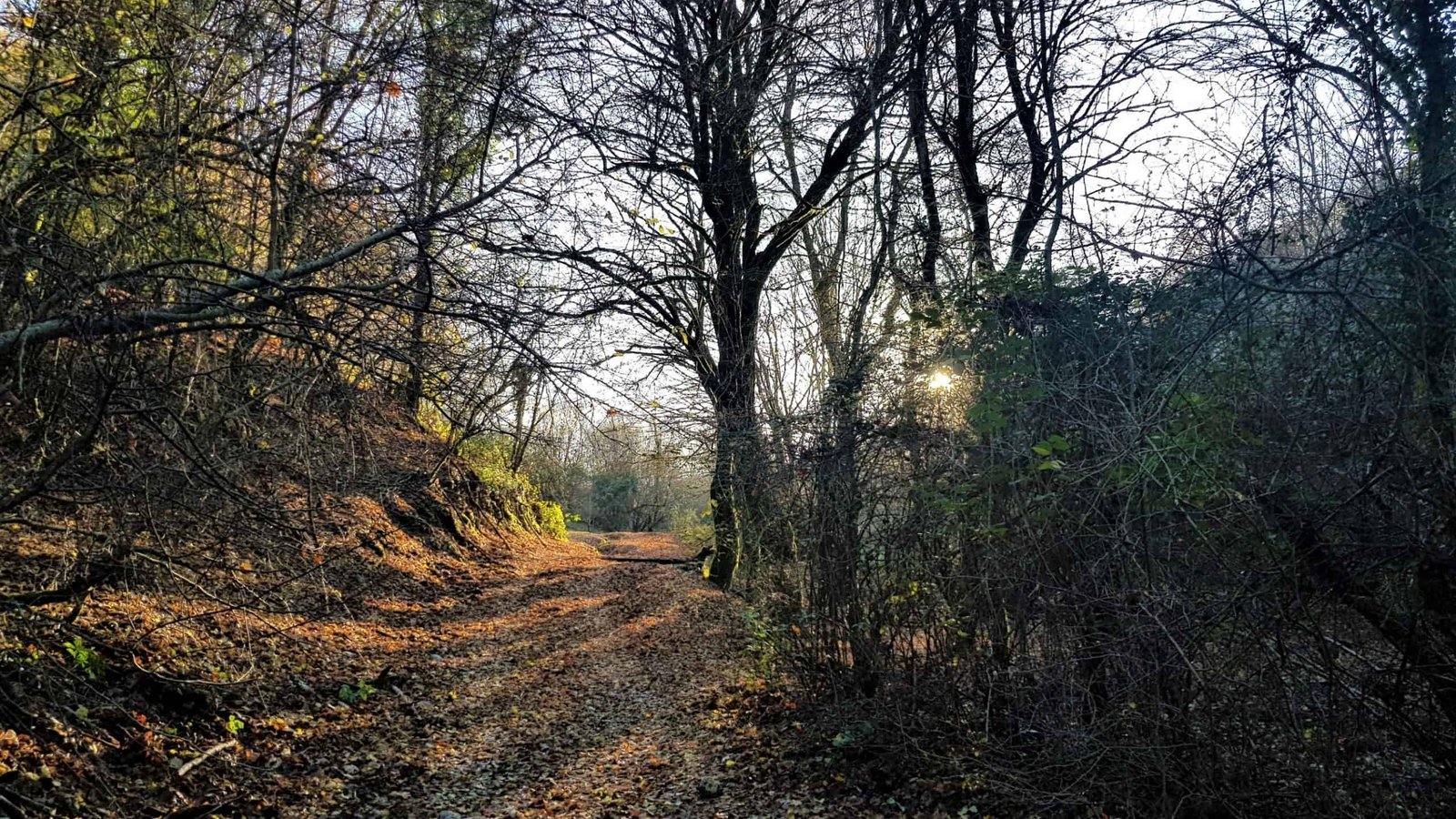
The 303 is one of the most beautiful trails of the Monti Lucretili Park precisely because it changes character at every stretch. From Prato Favale you climb through sparse groves and stony meadows toward Monte Andrea, then enter the Valle Cavalera, and this is where the route gives its best: enormous twisted beeches, clinging among the rocks, form an ancient beech forest where old hollies also grow. Past the valley you emerge on the Pratone, the large karst plateau before the summit, with a ruined chapel as a landmark. The last stretch crosses the Pratone and climbs on less marked tracks to the cross and the concrete block that mark the top. There is also a variant starting from San Polo dei Cavalieri, still with number 303: from there you first follow a road toward Monte Morra up to an elevation of 900 meters, then a scenic trail over the Aniene valley that crosses the singular campo di anime, an outcrop of karst rocks, and reaches the Pratone after about eight kilometers and two and a half hours of walking.
The Pratone di Monte Gennaro
The Pratone deserves a chapter of its own. It's a vast high-altitude grassland, a karst plateau riddled with sinkholes and swallow holes, which in summer is covered with blooms and in winter, when it snows, becomes a white expanse a step from Rome. It's the place where people stop to eat, where children roll in the grass and where grazing horses suddenly appear beyond a rise. Its breadth deceives: it seems flat, but it hides hollows that take away your landmarks, and in fog finding your way becomes hard. The advice is simple: on the Pratone you don't cut by eye toward the summit when the haze comes down, you go back to the marked tracks. The beauty of the place must not make you forget that it is still mountain.
The View from the Summit of the Gennaro
From the top of Monte Gennaro, on crisp tramontana days, the gaze runs very far: you can make out the Abruzzo ridges, the Monti Simbruini, the Monti Lepini, and toward the sea even the Pontine Islands. To the west the isolated shape of Soratte and, beyond, the profile of Amiata in Tuscany. At your feet, the Roman countryside and the city. The only flaw, it must be said honestly, is the radio installations that occupy the summit and partly spoil the view: the mountain is very beautiful, but man has put antennas on it. It's still worth the climb, and worth choosing a clear winter or early-spring morning, when the air is more transparent and the view really reaches the sea.
Monte Pellecchia, the Roof of the Monti Lucretili
The height record in the Lucretili belongs to Monte Pellecchia: 1,368 meters, by some measures just under 1,370. It's a more secluded and less frequented mountain than the Gennaro, and for that very reason wilder. It overlooks the valley of the Licenza stream and its southeast walls are the kingdom of the golden eagle, which here finds the quiet cliffs it needs to nest. Those who want to climb it find longer and lonelier routes, often starting from the Licenza side or from the inner passes. It's a destination for those seeking silence more than a crowded panorama. Around the Pellecchia and the Gennaro are arranged the minor peaks of the group: the Serrapopolo, around 1,180 meters, and the Cima Cesarone, just under 1,200 meters, which complete the main ridge of the Monti Lucretili.
The Laghetti di Percile, the Lagustelli of the Monti Lucretili Park
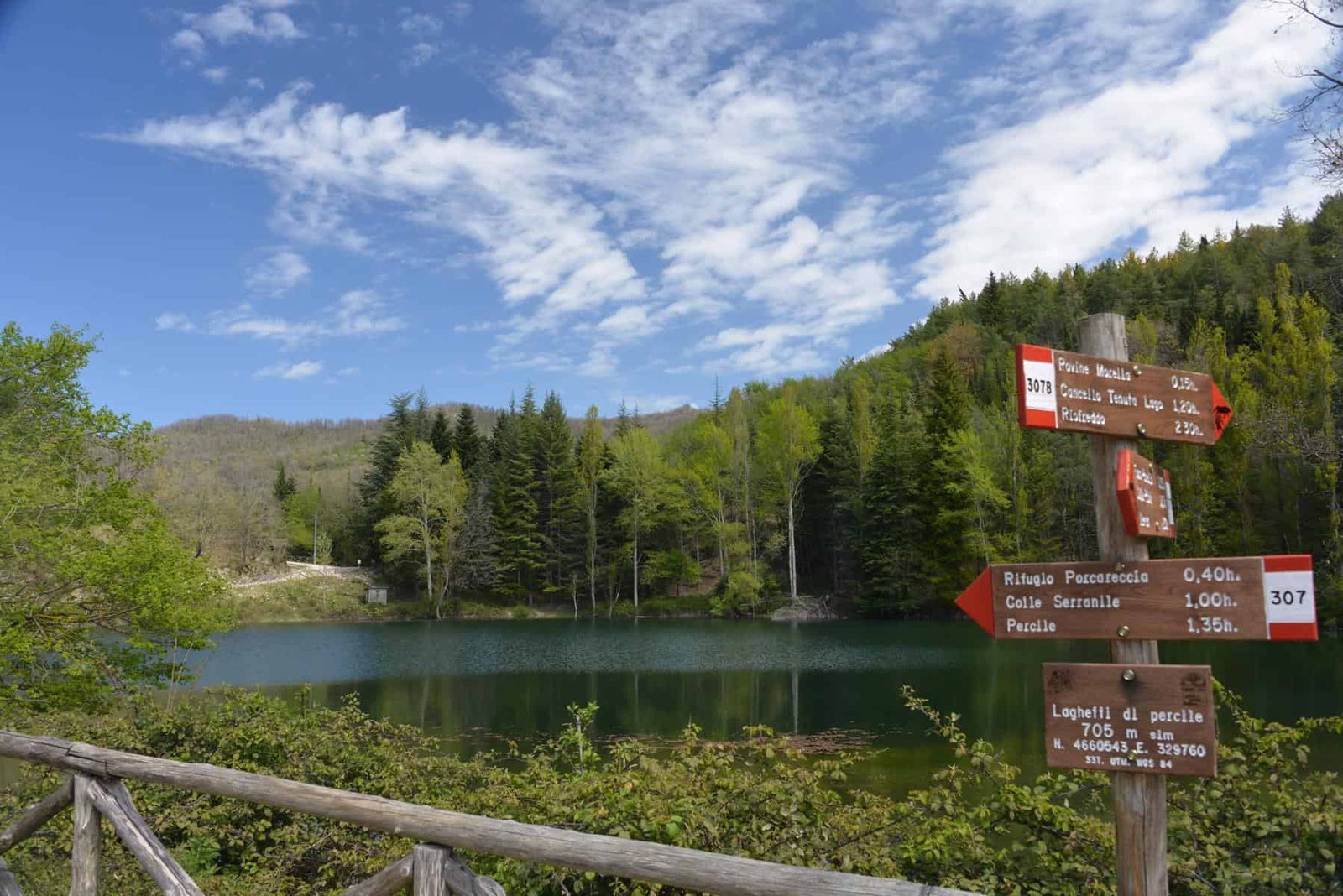
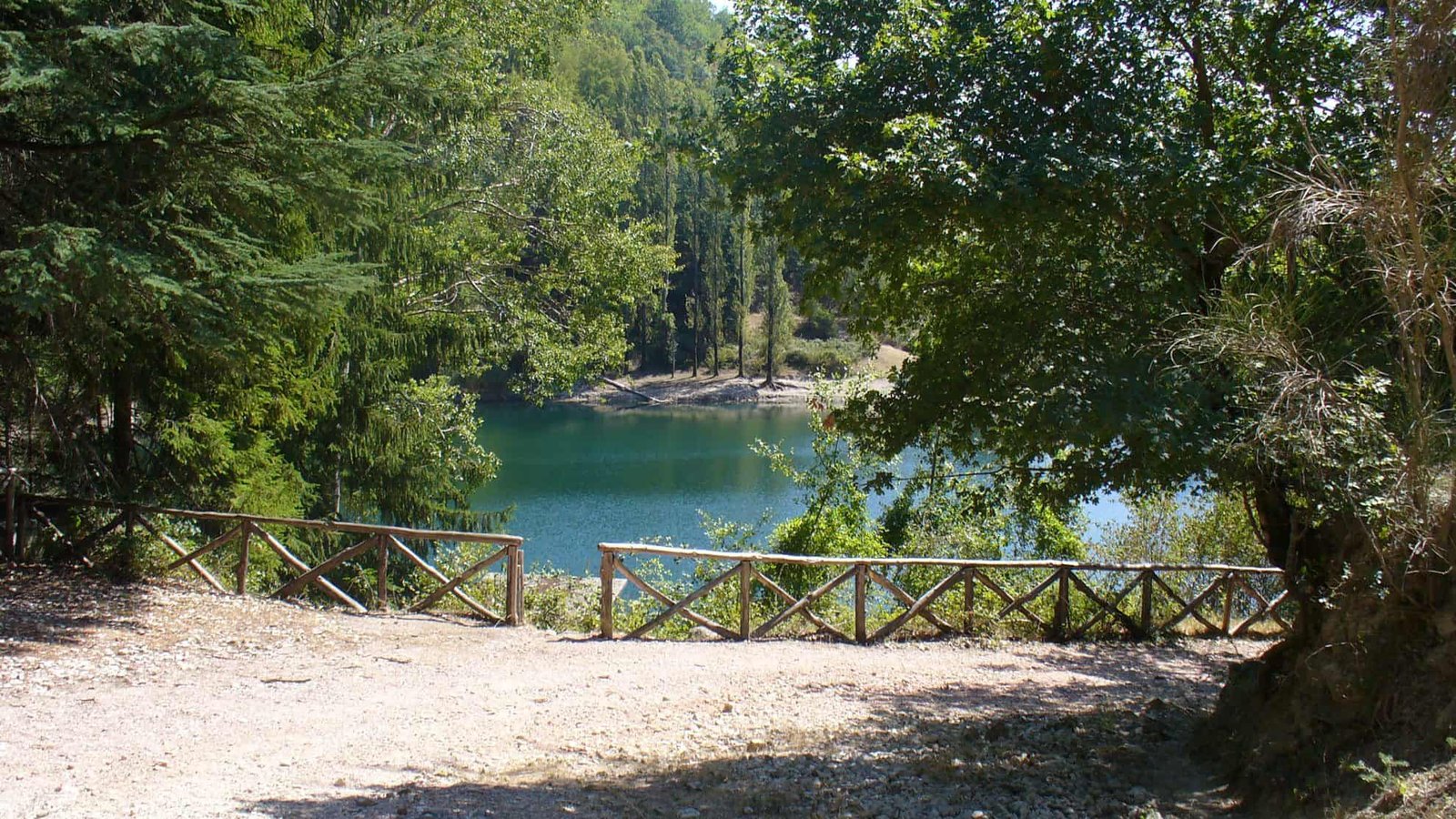
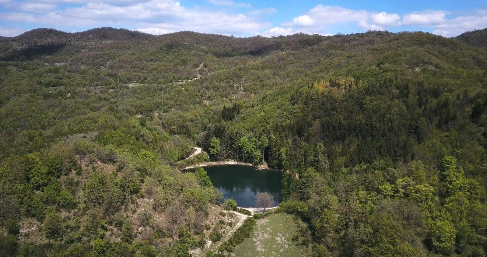
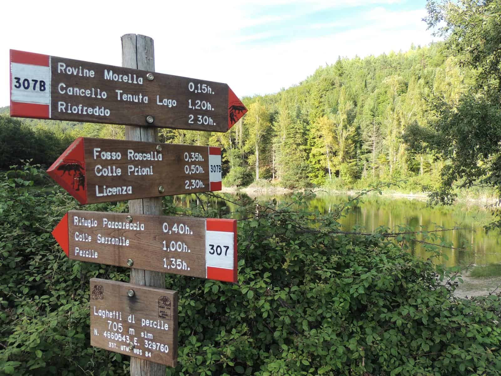
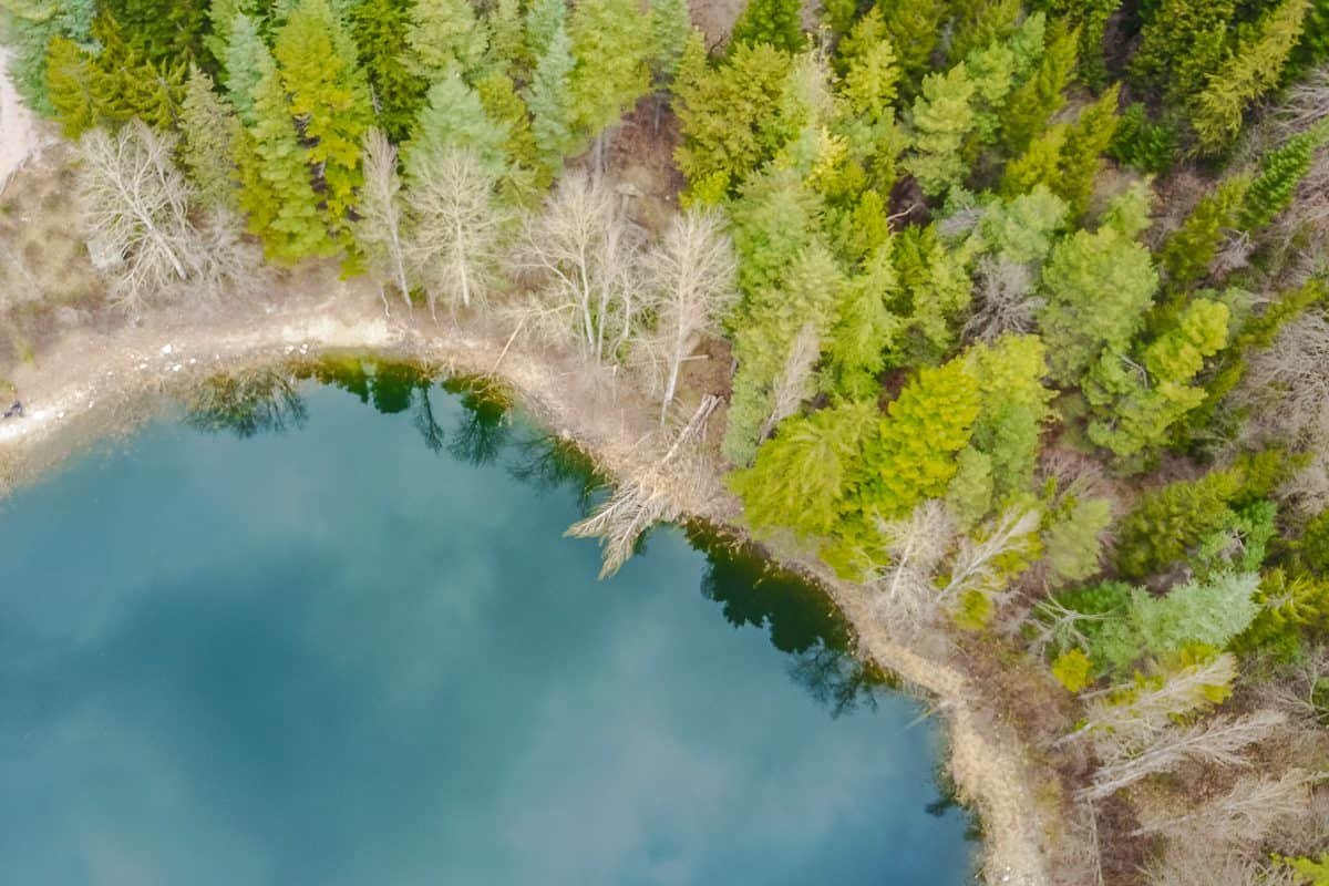
From the village of Percile an easy trail leads to the two bodies of water the locals call Lagustelli, the small lakes of Percile. There are two, of karst origin: Lago Marraone and Lago Fraturno, set in a wooded, silent basin. They are not lakes fed by a river, but karst basins where water surfaces and pools, a rare thing in these mountains where water usually disappears underground. The environment is so delicate and precious that the area is recognized as a wetland of international importance under the Ramsar Convention, the treaty that protects the planet's wetlands. They are, without exaggeration, one of the most beautiful places in the whole Monti Lucretili Regional Nature Park.
How to Visit the Lagustelli di Percile
The walk to the Laghetti di Percile is within reach of almost everyone: you start from Percile and in a short time you reach the two basins, with no demanding elevation gain. Precisely because it is easy and beautiful, in the good season the destination gets crowded on weekends. The advice is to go on a weekday or in the early morning hours, with the utmost respect for the environment: no swimming where it's not allowed, no noise, no trash left on the grass. The Lagustelli are not an outdoor swimming pool, they are a protected habitat, and their survival also depends on how visitors treat them. For more on the two bodies of water there is the dedicated page on the Percile Lakes, which is worth reading before going, as is the one on the village of Percile where the trail starts.
The Wildlife of the Monti Lucretili Park
The highest merit of the Monti Lucretili, the one that earned them protection, is faunal. The park hosts a pair of golden eagles nesting on the southeast walls of Monte Pellecchia, in the Valle Ustica area, to which a hiking route is also dedicated. Seeing it in flight, with a wingspan of over two meters, is one of those moments that repay hours of walking: it climbs in a spiral on the warm currents and dominates the valley without a wingbeat. It's not common, and it doesn't appear on command, but those who frequent the park know where to look up and know to bring binoculars.
The Wolf and the Mammals of the Monti Lucretili
The wolf has returned, as across a large part of the Apennines, and its presence here is considered to be growing: very hard to spot, it leaves traces more than appearances, but it's there, and its presence is a sign that the ecosystem works. Alongside it the park hosts a rich mammal fauna: the pine marten, elegant and shy, the squirrel, the porcupine, which roams at night in its cloak of quills, and the badger, which digs deep dens in the woods. They are animals that move mostly at dawn and dusk, and that the daytime walker senses more from tracks, fallen quills and signs on the ground than from direct sight.
The Rare Amphibians of the Waters
Where there is clean water, in the Lucretili, there are amphibians that have disappeared elsewhere. The pools and streams host the spectacled salamander, a small amphibian with an unmistakable livery that lives only in Italy, and the yellow-bellied toad, a little toad that when in danger arches its back showing its belly blotched with yellow to warn predators. They are fragile species, tied to uncontaminated ponds and streams, and their survival is one of the reasons the Lagustelli and the park's wetlands must be protected with care. Finding them is a privilege of those who walk slowly and watch where they put their feet.
The Flora and Woods of the Monti Lucretili
The botanical values of the Monti Lucretili are notable and have been studied for centuries: as early as the 17th century the naturalist Federico Cesi, founder of the Accademia dei Lincei, worked on the flora of these mountains. As you gain elevation the woods change dress. Low down and on the warm slopes Mediterranean scrub dominates, with mock privet, rockrose and myrtle. The Judas tree appears, which in spring covers itself in pink flowers before the leaves, and the oriental hornbeam, a species of Balkan-Eastern origin that bears witness to the ancient floristic ties between this peninsula and the East. Going higher you enter the holm oak woods and finally the great beech forests, like the one in the Valle Cavalera, where the twisted beeches draw an almost fairy-tale forest. In spring the plateaus and clearings light up with wild orchids, which here include several species.
The Garden of the Five Senses
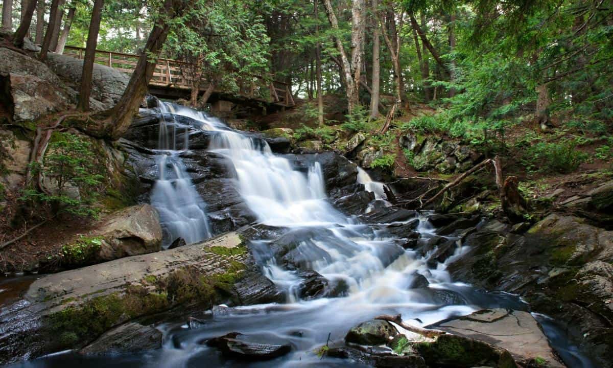
Among the park's initiatives designed for those who aren't expert hikers is the Garden of the Five Senses, an educational and sensory trail run within the Monti Lucretili Park, where you get to know plants by touching them, smelling them, listening to the wind among the leaves. It's the right place for children and school groups, a way to get botany into the heads of the little ones without lectures. Those who want to visit will find the opening calendar on parcolucretili.it, which varies with the seasons.
The Villages, Abbeys and Castles of the Monti Lucretili
The Lucretili mountain is not only nature: it's a landscape inhabited since forever, and its towns tell a thousand years of history. There are many medieval remains more or less everywhere, among abbeys, hermitages and castles, often still little known and sometimes set in scenery of great beauty. It's worth choosing a few villages and visiting them slowly, instead of rushing from one summit to another.
Licenza and Horace's Villa
The village of Licenza was the ancient retreat of the great Latin poet Horace. In the countryside below the town are preserved the remains of the villa the poet received as a gift from his rich patron Maecenas: a place that Horace celebrated in his verses as a refuge from the frantic life of Rome, devoted to meditation, philosophy, reading and poetry. The villa, datable to around 32 BC, is one of the rare cases in which an ancient literary text can be laid over stones still visible: reading Horace's epistles and then walking among the walls of his villa is an experience that alone is worth the trip to the Lucretili.
Orvinio, Roccagiovine, Scandriglia
Orvinio, counted among the most beautiful villages in Italy, strikes with its solitude and with the abbey of Santa Maria del Piano, which stands just outside the town. Roccagiovine, perched on a spur, keeps the silent atmosphere of mountain towns where time seems to slow down. Scandriglia captivates with its rural scenery, an intact example of Sabine countryside with silvery olive groves alternating with woods and pastures. They are three faces of the same inner Sabina, the one you barely sense from a car window and that has to be discovered on foot, entering the alleys and talking with the people who live there.
The Medieval Castles
Scattered across the territory are castles and fortresses in different states of preservation. The castle of Castiglione, inhabited between the 13th and 15th centuries, and the castle of Montefalco, from the 13th century and abandoned at the beginning of the 15th, are two examples of that system of fortifications that in the Middle Ages guarded the passes and valleys between the Sabina and the Roman countryside. Many of these remains are ruins immersed in the woods, reachable only on foot along the trails, and precisely for this they have an intact appeal, far from the tourist circuits.
A Curiosity About the Monti Lucretili Regional Nature Park
The finest curiosity of the Monti Lucretili is that one of its peaks gives its name, and perhaps even its fame, to a saying that everyone in Rome knows without knowing where it comes from. Monte Gennaro, with its unmistakable silhouette northeast of the city, has for centuries been the barometer of the Romans: when clouds gather on its summit, the weather is about to change. But the real curiosity concerns the fauna. On the southeast walls of Monte Pellecchia a pair of golden eagles nests, the largest raptor in the park, and a few dozen kilometers from the Colosseum. Few Romans know that, by climbing a couple of hours of trail from a town like Licenza or Marcellina, you enter the hunting territory of an eagle: an animal that in the imagination is associated with the Alps or Abruzzo, and that instead lives permanently here, around the corner from home. The Valle Ustica, where the pair breeds, is so important that a trail is named after it. It's the proof that you don't need to go far to find real nature: just look up at the profile of the Lucretili and know that up there, where the woods end and the cliffs begin, there is a nest that has held out for years a step from the metropolis.
One Thing Nobody Tells You About the Monti Lucretili Regional Nature Park
What the quick guides don't explain is that on the Monti Lucretili water is a deception. The landscape is green, the woods are dense, and whoever arrives for the first time thinks they'll find fountains and streams at every bend. The truth is that this is a karst mountain, and karst carries off the surface water: the sinkholes and swallow holes that pierce the large plateaus, like the Pratone di Monte Gennaro, swallow the rain and make it vanish underground, to give it back much lower down, at the springs at the foot of the towns. On the high-altitude plateaus, where you walk longest, there is no drinking water. This has a practical consequence that those who know the park always apply and that the novice learns the hard way: the water for the day is loaded in town, before climbing, because up there you don't refill your bottle. The second thing nobody says is that the Pratone, so wide and inviting, is also the easiest place to lose your bearings when fog arrives: it's so vast and uniform that landmarks disappear. It's no small detail on a mountain that, though close to Rome, remains a mountain in every respect.
The Advice I Give You for Visiting the Monti Lucretili Regional Nature Park
The advice for tackling the Monti Lucretili the first time is not to start from the summit. Monte Gennaro is the most coveted destination, but throwing yourself straight onto the 303 without knowing the area often means arriving tired and not understanding where you are. Better to start from the Laghetti di Percile or a walk on the low plateaus, get the measure of the mountain, learn to read the white-and-red CAI trail markers, and only then aim for the Gennaro on a clear morning. As for the season, the Lucretili can be walked almost all year, but each has its rule: spring is the best time for blooms and orchids, autumn for the colors of the beech forests, winter for crisp days and maybe snow on the Pratone, while summer must be tackled by starting at dawn to avoid the heat on exposed slopes. One blunt piece of advice: real boots, not sneakers, because the trails are stony and wet limestone is slippery. And a less obvious one: bring binoculars. On this mountain the best sight is almost never at the summit, but in the sky above the cliffs of the Pellecchia, where with a bit of luck and patience you see the eagle.
Another Well-Known Fact, Yet Rarely Mentioned
Everyone knows the Monti Lucretili are close to Rome. Almost no one remembers that they have been studied by science since the 17th century. Federico Cesi, the nobleman founder of the Accademia dei Lincei, the first modern scientific academy in Europe, the one Galileo Galilei also belonged to, worked on the flora of these mountains at a time when botany was taking its first steps as a discipline. That one of the cradles of modern science looked at precisely these mountains says how much their plant richness was recognized even then. The fact is well known among specialists and almost always escapes the visitor, who sees a wood and doesn't imagine walking in a place that four centuries ago drew the attention of the Lincei. It's another way of looking at the Lucretili: not just a gym for hikers, but a living archive of species, some of Balkan-Eastern origin like the oriental hornbeam and the Judas tree, that tell the botanical history of the Mediterranean. Next time you cross the Valle Cavalera among the twisted beeches, remember that you're walking in an open-air laboratory centuries old.
The Right Photo to Take at the Monti Lucretili Regional Nature Park
The postcard everyone looks for in the Lucretili is the Laghetti di Percile seen from above, with the body of water set in the green and the surrounding woods. It's the photo that circulates most, and it's rightly beautiful. But the right photo, the one that truly tells this mountain, is taken elsewhere and at a precise moment. Climb to the Pratone di Monte Gennaro on a clear winter morning, when snow covers the plateau and the sky is crisp, and stand with your back to the summit looking toward Rome: ahead you'll have the white expanse of the Pratone sloping down toward the countryside, and on the horizon, if the air is clean, the silhouette of the city and even the glint of the sea. It's the image that explains in one stroke the paradox of the Lucretili: high-mountain snow and silence half an hour from the capital's traffic. Alternatively, for those who love details more than panoramas, the photo to take home is that of the big twisted beeches of the Valle Cavalera, with morning light filtering through the branches: they look like trees from another age. One practical warning: on the Pratone the full midday light flattens everything, better the low hours, at dawn or in the late afternoon, when long shadows give relief to the karst terrain.
Some Important Events That Happened Here in History
The history of the Monti Lucretili is made more of long durations than of single dates, but a few events deserve to be remembered. The first, and the oldest, is the building of Horace's villa at Licenza, around 32 BC: the poet received it as a gift from Maecenas and made it his refuge from life in Rome, leaving testimony of it in his verses. It's not a minor episode: it's one of the rare cases in which Latin literature anchors itself to a precise place in these mountains, and for centuries the villa was a destination for cultured travelers looking for the Horatian places.
The second great chapter is medieval. Between the 13th and 15th centuries the mountain covers itself with castles and fortresses: the castle of Castiglione, inhabited precisely between the 13th and 15th centuries, and that of Montefalco, which arose in the 13th century and was abandoned at the beginning of the 15th, bear witness to an era in which these passes were contested and garrisoned. In parallel the abbeys flourish, like Santa Maria del Piano near Orvinio, centers of prayer but also of agrarian reclamation and settlement.
The third event is recent and concerns protection: in 1989 the Lazio Region establishes the Monti Lucretili Regional Nature Park, rescuing from speculation and abandonment more than 18,000 hectares of mountain. It's the date that changes the destiny of this territory, turning it from a forgotten margin into a protected area. In 2016, with Regional Law no. 12 of August 10, the same authority is also entrusted with managing the Inviolata Regional Nature Park, a sign of a protection policy that is widening. They are events without fanfare, but they are the ones that allowed the golden eagle to return to nest and the Lagustelli to stay clean.
Who Has Passed Through the Monti Lucretili Regional Nature Park
The most illustrious figure to pass through these mountains is without doubt Horace, Quintus Horatius Flaccus, one of the greatest poets of ancient Rome. In the countryside of Licenza he lived and wrote, in the villa given to him by Maecenas, singing the quiet of the Sabine countryside against the noise of the city: his Epistles and his Odes preserve the memory of these places, and for this the Licenza valley has become, over the centuries, a small literary pilgrimage. Those who know the Horatian verses on country retreat, on otium and on measure walk in these woods with a different eye.
Behind Horace is the figure of Maecenas, the great patron of the arts in the time of Augustus, whose name has become a synonym for someone who funds artists: it was he who gave the poet the villa, and so in a certain sense it's to Maecenas that these mountains owe their literary fortune. In the 17th century it's science that takes an interest in the Lucretili, with Federico Cesi and the Accademia dei Lincei, who studied its flora. Closer to us, these mountains have been and remain the gym of generations of Roman hikers and mountaineers: the Club Alpino Italiano has laid out and maintains the network of numbered trails, and Monte Gennaro has been for over a century the initiation mountain for those who, in Rome, begin to go into the mountains. Not emperors or film directors, then, but poets, patrons, scientists and walkers: a cultured and discreet company, worthy of a mountain that doesn't like fanfare.
How to Get to the Monti Lucretili Park
By car from Rome the most direct route is Via Salaria or Via Tiburtina heading northeast: from Palombara Sabina you reach the southern slopes and the authority's headquarters at Viale Adriano Petrocchi 11. From Marcellina you climb to Prato Favale for the Gennaro. From San Polo dei Cavalieri starts the other route to the Pratone. Toward the interior you continue to Licenza, Percile and Orvinio. By public transport the reference is the Palombara-Marcellina station on the Rome-Orte railway line, served by regional trains, from which local buses connect the towns. It's best to check bus schedules, which thin out on holidays. Those who don't drive and don't want to depend on buses do well to rely on a guide or an organized hiking group, which solves the problem of transport to the trailheads, often far from the stops.
When to Go and When to Avoid the Monti Lucretili
Every season has its moment in the Monti Lucretili. Spring, from April to June, is perhaps the best of all: the beech forests open in tender green, the plateaus fill with blooms and orchids, the days get longer. Autumn gives the warm colors of the woods and ideal temperatures for walking. Winter, on clear days, offers the most transparent air and the longest views, with the possibility of snow on the Pratone. But it must be tackled with proper equipment and attention to ice. Summer is the season to manage with the most caution: on exposed slopes the heat beats down, and it's best to start at dawn and carry a lot of water. To avoid, in every season, are days of thick fog on the plateaus, where finding your way becomes hard, and periods of fire alert, when some trails may be closed: check on the official website before setting out.
The Monti Lucretili with Children
The park lends itself well to a family outing, as long as you pick the right destination. The Laghetti di Percile are the ideal walk with children: short, with no demanding elevation gain, with water as the reward at the end of the trail. The Garden of the Five Senses is designed expressly for the little ones and school groups, with a hands-on approach to nature. The climb to Monte Gennaro, on the other hand, is too long and tiring for small children: keep it for kids already used to walking. In any case, the usual rules apply: water loaded in town, closed shoes, a hat in summer, and the patience to go at the pace of the youngest, stopping to look at the animals and plants instead of aiming only at the goal.
What's Around the Monti Lucretili
The Monti Lucretili are at the center of one of the richest areas for quick day trips in Lazio, and those who come can easily extend the visit. To the south, nearby Tivoli offers two of the most famous sites in Italy, Hadrian's Villa and Villa d'Este, both World Heritage sites, besides the historic center of Tivoli with its waterfalls. Still in the Aniene valley, farther upstream, you reach Subiaco with its Benedictine monasteries. Toward the interior, the Sabina opens other scenes: the village and abbey of Fara in Sabina, the reserve at the confluence of the Tiber and the Farfa at Nazzano, and farther east the waters of Lake Turano. For those looking for more mountain, the Monti Simbruini are the natural Apennine extension to the southeast. It's an area where, within half an hour's drive of the Lucretili, you go from high-altitude woods to imperial villas without a break.
The Name Lucretili and the Deep History of the Mountain
The very name of these mountains carries with it a piece of ancient history. The Monti Lucretili, also called Lucretini, are the southernmost offshoot of the Monti Sabini, and their name goes back to Roman and pre-Roman times, when this was the land of the Sabines, the Italic people that tradition ties to the very origins of Rome. Walking here means crossing a landscape that humans have lived in and shaped for at least 3,000 years: first the Sabine shepherds with transhumance along the tratturi, then the Romans with country villas like Horace's, then the monks with the abbeys that reclaimed the valleys, and finally the farmers who drew the landscape of olive groves and pastures we see today. The karst mountain, with its springs and its alpine pasture plateaus, has always offered water and grass for livestock, and this explains the dense network of towns around it. It isn't virgin nature, it's a cultural landscape, where every dry-stone wall, every drinking trough, every trail tells centuries of human labor within a wild environment that has never been entirely tamed.
Transhumance and the Alpine Pasture Plateaus
The great karst plateaus of the Monti Lucretili, starting with the Pratone di Monte Gennaro, are not only a geological phenomenon: for centuries they were high-altitude pastures, where flocks climbed in summer looking for fresh grass while on the plain the sun burned everything. The much-frequented Pratone of the Gennaro, as the old descriptions call it, owes its fame to this too: it was and in part still is grazing land, and the horses and cows you meet up there are the sign of a tradition that hasn't died out. Anyone walking the plateaus on a summer morning and seeing free-roaming livestock on the horizon is looking at a piece of mountain economy thousands of years old. Transhumance, the seasonal movement of flocks, carved the trails hikers walk today: many of the routes numbered by the CAI follow ancient pastoral paths.
The Slopes of the Monti Lucretili Park, One by One
Anyone who wants to understand the Monti Lucretili must resign themselves to not seeing them all at once: it's a mountain with many faces, and every slope has its gateway town, its character and its destinations. It's worth covering them one at a time, on different trips, instead of fooling yourself into exhausting them in a Sunday.
The Marcellina and Palombara Sabina Slope
It's the southern slope, the one that looks at Rome and feels its closeness. Palombara Sabina, with its Savelli castle dominating the town, is the largest center and the seat of the park authority. Marcellina, not far, is the base of the classic climb to Monte Gennaro via Prato Favale. This is the most frequented slope, the most convenient to reach from Rome, and for that very reason the most crowded on weekends. But it's also the one where the mountain presents itself most immediately, with the silhouette of the Gennaro rising behind the towns. From here open the most classic and best-documented trails of the park.
The San Polo dei Cavalieri Slope and the Aniene Valley
To the southeast the park looks over the Aniene valley, and the gateway town is San Polo dei Cavalieri, perched on a hill with its Orsini-Barberini castle. From San Polo starts the variant of trail 303 that reaches the Pratone di Monte Gennaro through open views over the Aniene valley, with a gaze that sweeps over Marcellina and Palombara Sabina and over the singular field of souls, an outcrop of karst rocks shaped by water. It's a less trodden side than the Marcellina one, and for that reason it's appreciated by those who want a little more solitude while staying on well-marked routes.
The inner side: Licenza, Percile, Roccagiovine
Once past the main ridge you enter the most secluded part of the Lucretili, the one with the inner villages that preserve landscapes and atmospheres of other times. Licenza, with Horace's villa in the countryside below, is the gateway to classical culture. Percile is the base for the Lagustelli and for the climb to the slopes of Monte Pellecchia. Roccagiovine, tiny and silent, is the kind of village where nothing happens and that's exactly why it feels good to be there. This is the wildest and least touristy side, where the solitude of the towns, as the old guidebooks say, amazes the visitor. It's the part of the park to save for those who have already done the classic destinations and want to go deeper.
The side of Orvinio and Scandriglia, toward Rieti
On the Rieti side the park fades into the deepest Sabina. Orvinio, one of the most beautiful villages in Italy, with the abbey of Santa Maria del Piano just outside the town, is the best-known destination. Scandriglia enchants with its rural scenery, the intact Sabine countryside of silvery olive groves alternating with woods and pastures. It's the most agricultural and gentlest side, where the mountain melts into the hills of Sabina olive oil, one of the best in Italy. Those who like to combine a walk with a meal will find the most authentic flavors of the area here.
The eagle trail and the Valle Ustica
Among the themed routes of the Lucretili Mountains Park, the trail dedicated to the golden eagle deserves a separate mention. It runs through the Valle Ustica area, at the foot of the southeastern walls of Monte Pellecchia where the pair nests. It's an itinerary designed to bring the hiker closer to the territory of the great raptor, with the chance, never guaranteed but real, of seeing it fly. Anyone who takes it should keep two golden rules in mind: silence and distance. The golden eagle is an animal sensitive to disturbance, especially during the nesting season, and its presence here is a fragile heritage not to be compromised. Bring binoculars, move slowly, and don't stop under the walls where the nest might be: these are precautions that make the difference between a lucky sighting and a harmful disturbance. The Valle Ustica is one of those places where the mountain asks for respect more than conquest.
Walking safely in the Lucretili Mountains
Near Rome doesn't mean easy. The Lucretili Mountains remain mountains in every respect, and every year rescuers are called out for poorly equipped or disoriented hikers, often right on the Pratone when the fog comes down. The rules are the usual ones and they apply even an hour from the capital. Hiking boots with a lugged sole, because wet limestone is slippery and the trails are stony. Enough water, loaded up in town, because you won't find any on the plateaus. Layered clothing, because at altitude the weather changes fast and a mild day in town can turn cold and windy at the top. A trail map and, even better, a GPS track, because the white-and-red CAI trail markers help but on the big plateaus they may not be enough. An early start, to have some margin of daylight on the way back. And the most important rule: tell someone where you're going and what time you expect to be back. In a mountain emergency the number to dial is 112, the single European emergency number. With these precautions the Lucretili are a generous mountain within reach of many. Without them, even an apparently trivial outing can turn into trouble.
Accessibility and services in the Lucretili Mountains Park
Since it is a mountain park made of trails, a large part of the Lucretili Mountains territory is not accessible to people with mobility difficulties: the high-altitude routes require trained legs and rough terrain. There are, however, gentler destinations, such as some valley-floor walks and the educational activities at the park authority's headquarters, suitable for a wider public. For updated information on accessible routes, guided visits, school activities and availability of services, the reference is always the park office in Palombara Sabina, reachable at 0774 637027 or at info@parcolucretili.it, and the official website parcolucretili.it, where you'll find the hiking calendar and any trail closure notices. In the towns around the park there is no shortage of bars, grocery stores and trattorias where you can stock up before going up and eat on the way back. Ending a walk with a plate of Sabine cooking and a glass of wine from the Castelli or from Sabina is part of the experience.
The Sabine table around the Lucretili Mountains
A trip to the Lucretili Mountains doesn't end at the summit but at the table, and it would be a shame to ignore that. The Sabina that surrounds the park is the land of one of the most awarded extra virgin olive oils in Italy, the Sabina oil with protected designation of origin, produced from the silvery olive groves that climb right up to the woods. In towns like Scandriglia, Palombara Sabina, Licenza and Orvinio the trattorias serve no-frills mountain and country cooking: homemade pasta with meat sauces, pecorino cheeses, cured meats, legumes, mushrooms and truffles in the right season, all washed down with the local wines. Ending a walk with lunch in an inner village, perhaps buying a bottle of oil straight from the producer, is the right way to understand that the Lucretili landscape is not only to be looked at but also to be tasted: the olive groves, pastures and woods you cross on foot show up, shortly after, on the plate. It's worth finding out in advance, because in the smallest villages few places are open and on weekdays it's best to call first. But this very scarcity is part of the charm, because you eat where the locals eat, with products that often come from their own vegetable garden and olive grove. One last suggestion for those planning the day: allow for lunchtime and don't rush off, because Sabine slowness doesn't go well with the hurry of those who want to tick off destinations like a shopping list.
Quick questions about the Lucretili Mountains Regional Nature Park
How much does it cost to enter the Lucretili Mountains Park?
Entry to the park is free: there is no ticket and no gate. The only possible expenses are transportation, a hiking guide if you choose one, and specific activities organized by the park authority, whose costs you can check on the official website.
Where is the Lucretili Mountains Regional Nature Park?
The park occupies the southernmost sector of the Sabine Mountains, northeast of Rome, straddling the provinces of Rome and Rieti. The authority's headquarters is at Viale Adriano Petrocchi 11, in Palombara Sabina (RM).
What is the highest mountain in the Lucretili Mountains?
The highest peak is Monte Pellecchia, 1368 meters, which overlooks the valley of the Licenza stream. More famous, although a little lower, is Monte Gennaro, 1271 meters, the symbol peak of the park.
How do you climb Monte Gennaro?
The classic climb starts from Prato Favale, above Marcellina, at about 830 meters, and follows CAI trail 303: about 500 meters of elevation gain and two and a half hours of walking, hiking difficulty. A variant starts from San Polo dei Cavalieri.
How difficult are the trails in the Lucretili Mountains?
The main routes, like the 303 to Monte Gennaro, are rated E, hiking: no exposed passages, but real mountain walking that requires boots, water and fitness. With snow or ice the difficulty increases.
What are the Percile Lakes?
They are two small lakes of karst origin, Lago Marraone and Lago Fraturno, locally called Lagustelli, set in a wooded hollow near the village of Percile. The area is recognized as a wetland of international importance under the Ramsar Convention.
Can you swim in the Percile Lakes?
They are a protected and delicate habitat, not an outdoor swimming pool. Swimming where it isn't allowed should be avoided. You visit them on foot, with respect for the environment, preferably on weekdays so as not to crowd them.
Can you really see the golden eagle in the Lucretili Mountains Park?
A pair of golden eagles nests on the southeastern walls of Monte Pellecchia, in the Valle Ustica area. Seeing one is not guaranteed, but those who visit the park with binoculars and a little patience have good chances, especially above the cliffs of the Pellecchia.
Are there wolves in the Lucretili Mountains?
Yes, the wolf is present and its presence is considered to be growing, as in much of the Apennines. It is shy and extremely hard to spot: it leaves tracks more than appearances. It poses no danger to hikers.
Are the Lucretili Mountains suitable for children?
Yes, if you choose the right destinations: the Percile Lakes and the Giardino dei Cinque Sensi are perfect for families. The climb to Monte Gennaro, on the other hand, is long and tiring and is best kept for kids already used to walking.
Do you need a guide to visit the Lucretili Mountains?
It isn't mandatory for easy walks, but on long routes like the Gennaro, or for those who don't know the mountains, a guide or an organized hiking group adds safety and solves the problem of getting to the trailheads.
Is there drinking water along the trails?
On the large karst plateaus, like the Pratone di Monte Gennaro, surface water is scarce because the limestone absorbs it. It's always best to load up on water for the day in town, before going up.
How do you get to the Lucretili Mountains by public transportation?
The reference is the Palombara-Marcellina station on the Rome-Orte railway line, from which local buses reach the towns. Bus schedules, especially on holidays, are reduced: it's best to check them in advance.
What is the best season to go?
Spring for the blooms and the orchids, autumn for the colors of the beech woods, winter for the clear days and any snow on the Pratone. Summer should be tackled by starting at dawn to avoid the heat on the exposed slopes.
How long is the walk to the Percile Lakes?
It's a short, easy walk that starts from the village of Percile and reaches the two lakes without any demanding elevation gain, suitable for families too. The exact times depend on the starting point and your pace: check the signs and the official website.
Is there Horace's villa in the Lucretili Mountains?
Yes, in the countryside below Licenza are the remains of the villa that the Latin poet Horace received as a gift from Maecenas, dating to around 32 BC. It is one of the most fascinating places, from a historical point of view, in the whole park.
Can you go by bike or on horseback in the Lucretili Mountains Park?
Several routes, like the stretch of the 303 from San Polo dei Cavalieri, are open to bikes and horses as well as to walkers. Always check which trail allows which activity, respecting the signs and the environment.
What to see near the Lucretili Mountains?
Within half an hour by car there are Tivoli with Villa Adriana and Villa d'Este, Subiaco with the Benedictine monasteries, the Sabina of Fara in Sabina, the Nazzano reserve at the confluence of the Tiber and the Farfa, Lake Turano and the Simbruini Mountains.
The final advice
If I had to sum up the Lucretili Mountains in one sentence, I'd say they are the mountain that Romans have in front of their eyes and barely look at. The Gennaro closes the horizon northeast of the city every day, and yet few people climb it, and even fewer know that an eagle lives up there. Treat this mountain with the seriousness it deserves and with the curiosity that pays off: load up on water in town, put on your boots, pick a clear morning, and climb without hurry. Stop on the Pratone, raise your binoculars toward the cliffs of the Pellecchia, and remember that you're walking where Horace looked for peace and where the Lincei studied plants. It's not the highest or the most famous mountain in Italy, but it's close, and real, and it's yours: all you have to do is go.
Article written by the editorial team of TourLeaderPro, contact them for Private/Corporate/V.I.P. Tours and Experiences.
Planning a trip to Rome? The English-language guides to visiting the city are on ItalyPlanner.com.