Percile Lakes
In short. The Percile Lakes, which everyone in the village calls the lagustelli, are two karst bodies of water in the municipal territory of Percile (RM), inside the Regional Nature Park of the Monti Lucretili.
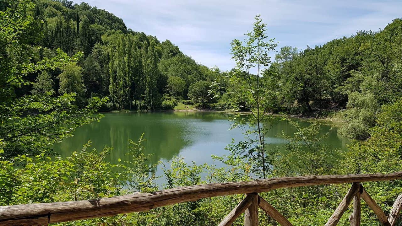
The Percile Lakes, which everyone in the village calls the lagustelli, are two karst bodies of water in the municipal territory of Percile (RM), inside the Regional Nature Park of the Monti Lucretili. They are reached on foot from Piazza Giuseppe Garibaldi in the village, at an altitude of 575 meters, following the CAI 307 marked trail: five and a half kilometers, 130 meters of climbing and 140 meters of descent, one hour and 50 minutes of walking, difficulty T, meaning tourist grade. The first of the two lakes you reach is the Marraone, at 674 meters. The second, the Fraturno, is at 704 meters and is the big one, the only one with a walkable shore. Access is free and open, nothing needs to be booked, and there are no ticket offices, bars, toilets or picnic tables at the lakes. The last drinking water is the two fountains in the village, and cell phone signal is patchy. By car, take the A24 exit at Vicovaro Mandela and climb 12 kilometers of provincial road. By train, you reach Mandela station on the Roma Tiburtina-Avezzano line. The bus connection to Percile is run by Cotral, with runs to check on the carrier's website because there are few of them and they change with the school calendar. If you want to shorten the walk, you can keep driving on the dirt track beyond the village and leave the car at the panoramic pullout before the woods, saving about four kilometers round trip.
The wider natural context, with the other destinations in the area, is covered in the guide to the Monti Lucretili Park.

Where the Percile Lakes are and how to get there
Geography matters more than it seems here. The Percile Lakes are not in true mountains. They sit in the pre-Apennine belt that separates the Aniene Valley from the Turano basin, a limestone terrain that the sea shaped over millions of years and that rainwater keeps carving from below. From Rome you travel east and follow the Aniene Valley upstream, and in a little under an hour you go from the 700 buses of Ponte Mammolo to a road where you sometimes have to brake for a horse.
Driving to the Percile Lakes
The fastest route is the A24 Rome-L'Aquila motorway, exiting at Vicovaro Mandela. From the toll booth, follow the signs for Licenza and then Percile. It's about 12 kilometers of provincial road with narrow switchbacks, but the asphalt is in decent condition, and total travel time from east Rome is around 45 minutes outside rush hour. If you're coming from the Salaria, you can instead head down toward Orvinio and Licenza along state road 314 Licinese, which connects the Tiburtina Valeria to the Salaria itself. It's longer, and much more beautiful. A practical warning that's worth more than three paragraphs of prose: on the last stretch, satellite navigation tends to suggest forest dirt tracks that are not public roads. Head to Percile village, and start from there.
Public transport to the Percile Lakes
It can be done, with patience. The Roma Tiburtina-Avezzano regional railway stops at Mandela, at the foot of the valley. The bus service to Percile is run by Cotral, which connects the village both with the Rome terminus at Ponte Mammolo and with Vicovaro Valle dell'Aniene station. Runs are few and concentrated in school-time slots, so check the carrier's website the day before, not a month before. The advantage, if you can fit the times together, is that Piazza Garibaldi stop is exactly the kilometer zero of trail 307: you get off the bus and start walking, without having to go back to get your car at the end of the hike.
Where to park for the Percile Lakes
Percile has a few dozen parking spaces and in spring it fills up early. The rule is to leave the car along the road right after the turn for the village, where the pullout is wide, and walk up the last 300 meters to the square. That way you avoid getting stuck in the alleys and you pass the first of the two fountains. If you're short of breath or short of time, you can keep driving on the dirt track that leaves the town and stop at the Aquila viewpoint or at the small parking area before the woods, the one with the wooden tables and the bench. From there to the lakes it's less than two kilometers. The parking lot at the Porcareccia forest refuge exists but it's tiny, four or five cars at most, and on Sundays in May it's already full at nine in the morning. Never leave your car in front of the forest gates. They are service passages and must be kept clear.
CAI Trail 307, the Main Route to the Percile Lakes
Trail 307 is a Club Alpino Italiano trail classified T, for tourist, and the classification is honest. There are no exposed sections, you don't need any equipment, and there isn't a meter of rock. You do need closed shoes with a lugged sole, because the surface alternates between asphalt, stony dirt track and packed earth that turns into thick mud after rain. It's five and a half kilometers, 130 meters of elevation gain uphill, 140 downhill, and one hour and 50 minutes of walking according to the park's official sheet. For a mixed group, count on two hours and 20 minutes, because you stop to look.
From the Square in Percile to Colle Serranile
You start from Piazza Garibaldi, leave the old town following the signs for the Lagustelli and climb the Aone gully through scrub vegetation: broom, dog roses, a few junipers. It's the least spectacular stretch and the one where you sweat the most, because the climb is all concentrated in the first 20 minutes. Then the track becomes a drivable road and the view opens up. On the right is the Licenza valley, and at the far end Monte Pellecchia, which at 1,368 meters is the highest peak in the park. From Colle Serranile onward the slope eases and stays that way to the end.
From Porcareccia to Lake Marraone
Once you're past a conifer reforestation, the kind planted in rows in the 1950s and now a bit out of place in a Mediterranean wood, you reach the Porcareccia forest refuge. From here on you walk on a dirt track among pastures and oak groves, with low fences and dark gates that you must always close behind you. These are working pastures, not scenery. After about an hour and a half from the start you reach Lake Marraone, at 674 meters. Watch out, because it's easy to walk past it without seeing it. It sits about 20 meters below the trail, hidden by dense vegetation, and the only clue is a change of color among the foliage.
Arriving at Lake Fraturno
A few more minutes of almost flat walking and the Fraturno opens up, at 704 meters. This one is clearly visible, with a shore you can walk along and a ring of oaks, firs and cypresses reflected in it. This is the moment when groups go quiet, and not for rhetorical effect. The contrast between the Mediterranean scrub you've just crossed and this emerald-green basin with an almost pre-Alpine look is a small jolt. The full loop of the shore takes about 20 minutes and it's best to do it clockwise, because the morning light comes from the east and the reflection of the trees is easier to read from the opposite bank.
The Short Variant and the Percile Lakes Loop
The route works as a loop, and that's why it pays to study it beforehand. At the fork in front of the abandoned shed, turning left takes you straight down to the Marraone and in a few minutes to the Fraturno. Turning right makes it quite a bit longer, you gain elevation and you reach the large lake first, with wider views over the basin. If you have the legs and the time, you can do the long loop on the way out and the short one on the way back. It's the solution I prefer, because it avoids seeing the same landscape twice. If you have small children, on the other hand, do the short one out and back and you won't miss anything essential.
What the Percile Lakes Really Are: Two Water-Filled Dolines
Here it's worth spending a few lines on geology, because it changes how you look at them. The Percile Lakes are not dam lakes, nor artificial basins, nor remnants of a river. They are karst cavities: dolines, meaning funnels opened in the limestone by underground runoff and by the collapse of the vault that followed. The karst that created them is ancient and largely covered, buried under more recent deposits, and precisely for this reason their shape at the surface is so regular that it looks drawn with a compass.
Lake Fraturno, by the Numbers
The larger of the two covers about 9,000 square meters, has an almost circular shape with diameters of 96 meters north-south and 118 east-west, and a maximum depth of around 15 or 16 meters. The seasonal swings in level are surprisingly small. In a survey conducted between March and July the measured difference was 60 centimeters, which suggests a constant groundwater supply and not only rainfall. Translated for walkers: the Fraturno is always there, even in August, even in dry years. That is not at all a given in a karst environment.
Lake Marraone, the Funnel That Empties
The smaller one is the more interesting of the two for a geologist and the more disappointing for a photographer. It has a diameter of about 80 meters and a water surface at around 700 meters of elevation, but its basin goes much lower than its twin's: about 40 meters of total depth. As a result, Marraone works like a huge funnel and in many seasons it is almost completely without water, reduced to a muddy bottom with reed beds. Its banks are steep, slippery and without a safe path. Going down there is not done, less because it's banned than out of common sense and respect for a hollow where amphibians and insects have a fragile balance.
A Climate Archive Buried in the Percile Lakes
The bottom of the Fraturno is a book. In March 2018 a team of researchers from the Institut des Sciences de l'Evolution in Montpellier and the Institute of Plant Sciences of the University of Bern, assisted by the park authority's nature service, took sediment cores from the lake to study its microfossils: pollen, insect remains, organic material deposited layer upon layer. The stated goal of the project was to reconstruct the climatic and environmental changes of the last 20,000 years, in a selection of about 20 Italian lakes chosen for naturalness, adequate depth and little human interference. That the Fraturno made that list says two things: that it is deep enough to preserve a readable stratigraphy, and that nobody has ever really tampered with it. Walking around it knowing that is something else.
The Lago State Estate, the Forest That Protects the Percile Lakes
The two bodies of water fall entirely within the municipal territory of Percile and are part of the state estate called Lago, a forest complex of about 900 hectares made up of oak woods, conifer reforestation, clearings and pastures. It is not a virgin forest and nobody should describe it as one: it is a managed forest, with regulated cutting, service roads and forestry stations, and it is precisely public management that kept the shores from being divided into building lots, as happened elsewhere in Lazio. All of it lies within the Monti Lucretili Regional Nature Park, established by regional law number 41 of June 26, 1989 and later amended in 1994: 18,204 hectares spread over 13 municipalities, from Marcellina and Palombara Sabina to Licenza, Roccagiovine, Vicovaro, Orvinio and, of course, Percile. The authority's headquarters is in Palombara Sabina, on viale Adriano Petrocchi.
One figure that strikes people arriving for the first time: forests cover about 70 percent of the park's surface. On a pre-Apennine massif less than 50 kilometers as the crow flies from the Colosseum, it's a percentage worth some thought about the way Rome has used, and sometimes spared, its own hinterland.
Flora and Fauna of the Percile Lakes
The natural value of the Percile Lakes does not depend on the rarity of a single species, but on the overlap of different environments within a few 100 meters: deciduous woodland, planted conifers, pasture meadow, damp shore with reed bed. Four habitats in 20 minutes of walking is a richness you rarely find in Lazio.
The Trees and Flowers Around the Percile Lakes
On the shore of the Fraturno you can recognize poplars, willows and a reed bed of common reed, with horsetails in the muddiest areas: these are the plants that the damp shore selects on its own. A few meters higher up the oak wood begins, with downy oaks and Turkey oaks, and in the planted areas firs and cypresses that on backlit days give that almost alpine look everyone talks about. The park's flora is a mosaic of Mediterranean, central European and Balkan species. Among the most cited are the storax, which the park authority chose as its symbol, the martagon lily and a remarkable variety of wild orchids. They bloom between April and June, they are small and if you aren't looking for them you won't see them: look at the grassy edges of the path, not the middle.
Amphibians, Reptiles and the River Crayfish
The smaller fauna is the real surprise. In the park the spectacled salamander, the crested newt and the smooth newt are documented, as well as the Apennine toad. The reptiles recorded are 13 species, including the common tortoise and the grass snake, which you can see swimming at the water surface in the small lakes with its head out. The river crayfish survives in the streams, one of the strictest indicators of environmental quality that exist: where it is found, the water is truly good. None of these species is to be touched, collected or moved, and the bucket for tadpoles stays at home.
The Golden Eagle and the Other Birds of Prey
Above the oak grove, and with a bit of luck above the Fraturno, flies the raptor that gives the park its least known record: a nesting pair of golden eagles, the known nest closest to Rome. That's not a brochure detail. It means that an hour's drive from Termini there is a territory large and quiet enough to support a predator that demands dozens of square kilometers of hunting ground. Alongside the eagle, the peregrine falcon, the sparrowhawk and the kestrel nest. Among mammals the park records fox, badger, wild boar, porcupine and at least five species of bats, with occasional presence of the Apennine wolf: occasional, not resident, and anyone who promises guaranteed sightings is selling hot air.
The Free-Roaming Horses of the Percile Lakes
On the dirt track that leads to the lakes you almost always meet horses grazing free-range, often dark, often in small groups with their foals. They're owned animals, not wild, used to people passing by but not tame: you don't pet them, you don't feed them, you don't get between a mare and her foal. The same goes for the cattle herds that go up to the high pastures in summer. A dog off the leash in the middle of a herd of horses is the quickest way to turn a beautiful day into a terrible one.

A Curiosity About Percile Lakes
The best curiosity concerns the lake that is almost not there. Two scholars, Gastone Imbrighi and Neri Scerni, devoted to the Percile Lakes a systematic survey documented in the Bollettino della Società Geografica Italiana, with measurements taken in the field between March and July of 1952. That work gives us the most precise picture we have of the two basins: the larger one, 9,000 square meters of surface and 16 meters of maximum depth, almost circular, with 96 meters of diameter north-south and 118 east-west. The smaller one, 80 meters in diameter, the water level at an elevation of 700 meters and a bed that drops away for about 40 meters. That very anomalous ratio between diameter and depth of the bed makes the Marraone a funnel: a karst shaft more than a lake, and in many seasons you find it dry or almost dry.
The authors' conclusion is the part I like best, because it's phrased with the caution that serious science keeps even when it's right: it's probable that these are karst cavities, sinkholes, but of a covered and ancient karst. No certainty waved around, a solid hypothesis and the reason why it's held. 70 years later, paleoecology cores from the bottom of the Fraturno have confirmed that this bottom preserves sediments undisturbed for millennia. Anyone who arrives at the Percile Lakes expecting a scenic pond finds instead one of the few basins in Lazio where geological time can still be read line by line. It's worth the detour much more than certain photogenic waterfalls of central Italy, about which 10 times more has been written.
Something Nobody Tells You About Percile Lakes
That there's no drinking water at the lakes. It sounds obvious, but it's the cause of 90 percent of the ruined days on this trail. After the last fountain in the village, and there are two, both in the built-up area of Percile a few meters apart, there isn't a single source along the 5.5 kilometers of the 307. No captured springs, no safe water taps, no open refuge: La Porcareccia is a forest ranger station, not a bar. Two liters per person in summer is the minimum, one and a half in spring, and anyone hiking with children should bring more, because children drink poorly and all at once.
The second thing almost nobody mentions concerns facilities. At the Percile Lakes there are no tables, benches, trash cans or toilets. The only equipped area, with a few wooden tables, is earlier on, on the dirt track, at the level of the small rest stop. If your plan for the day is a long lunch on the shore of the Fraturno, bring a blanket and carry every single piece of trash back down to the valley, peels and shells included, because the wildlife of the pastures quickly learns to look for human food and stops behaving like wildlife. Third thing nobody says: phone signal is patchy and in some stretches of the woods it disappears completely. Download the track offline before you leave, and the single emergency number 112 works even with minimal coverage from another carrier, but you need to be able to describe your location out loud. Learning the names of the two lakes and of the La Porcareccia refuge is exactly what this is for.
My advice for visiting Percile Lakes
Go on a Friday, or in any case on a weekday, and set off early. I say this from experience: on May Sundays the square in Percile becomes a double-parked car park and the trail, which is wide and easy, turns into a procession. The paradox of the Percile Lakes is that their reputation as an easy family outing, which is deserved, is also what compromises their best part, which is the silence. At 8 in the morning on an ordinary day the woods are a different place: you can hear the woodpeckers, you see the horses still standing around, and the low light on the Fraturno lasts until 10.
The second piece of advice is technical. Don't trust the altitude: 704 meters seems like nothing, but the Fraturno basin is damp, it traps cold air, and in October in the morning you'll find it eight degrees colder than in Rome. Always pack an extra layer. Third piece of advice, against the current: don't make the trip just for the lakes. The stretch of dirt track between the Serranile hill and La Porcareccia, with the Licenza valley below and Monte Pellecchia opposite, holds its own in terms of scenery against the arrival, and anyone who rushes toward the water without turning around misses it. Fourth: if you're walking with people who aren't very fit, use the car option up to the parking area and turn the day into a two-hour walk plus lunch in the village. A short outing that goes well is better than a long one that goes badly. The rule, in the mountains as in the Preappennino, never changes.
Percile, the village where the Percile Lakes trail starts
It would be a mistake to treat the town as a parking lot with houses around it. Percile has a little over 200 residents, sits at 575 meters above sea level and is part of the Borghi più belli d'Italia club: stone alleys restored with restraint, sudden views over the valley, a silence that in Sabina is still the rule. It takes 40 minutes to see and it's best to do it on the way back, when your legs ask you to slow down.
Palazzo Borghese
The building that dominates the village started out as a castle: the records link it to a fortified complex from the first decades of the 11th century, which was turned into a noble residence over the following centuries. In 1608 the fief passed into the hands of the Borghese family, the dynasty that, with Paul V and Cardinal Scipione, was reshaping the face of Rome, and the castle became a residence. Today it houses the municipal offices, which means you can read its layers very clearly from the outside, while the interiors are not a museum and can't be visited freely.
The churches of Percile
Three buildings deserve a look. Santa Lucia, the 16th-century parish church dedicated to the patron saint, was originally the private chapel of the palazzo and keeps the air of a noble oratory. Sant'Anatolia, in the center of the village, holds 17th-century frescoes. Outside the village, Santa Maria della Vittoria, with the attached hermitage, is the oldest of the three: the structure dates back to the 12th century and shows Gothic elements, while local tradition attributes its construction to Charles of Anjou as a thank-you for the victory of 1268 over Conradin of Swabia. It's worth being precise about this: the battle is a historical fact, the attribution of the church is tradition, not documentation. Anyone who tells you it's certain is oversimplifying.
La Fonte degli Aliucci
Just outside the village rises the Fonte degli Aliucci, a very light oligomineral water that local memory links to a use already in Roman times. Its very low dry residue is why the people of Percile carry it away in demijohns. Anyone coming back from the lakes with empty water bottles will find it on the road, and it's the best way to close the loop on a day spent talking about water.
Another well-known fact, yet rarely mentioned
That the name of this place is almost certainly a Roman family name. Scholars link Percile to the gens Porcia, and an intermediate form is documented: in a text concerning Pope Silvestro I, so from the first third of the 4th century, a fundum Percilianum appears in Sabinensi territory. A farm estate, not a village: the Roman settlement pattern in these valleys was made of scattered rural villas, and the compact village we see today is the result of medieval incastellamento, that is, the concentration of the population around a defensible point between the 10th and 11th centuries. Materials from the imperial age come from the area, including funerary cippi and a marble stele dedicated to a seven-year-old girl: a small detail that is worth, for understanding who lived on these slopes, more than 20 pages of general background.
The decisive step dates to 1011, when Count Ottone di Sabina donated to the abbey of Farfa about 1,500 moggi of arable land in this area. Farfa was then one of the landholding powers of central Italy, and that donation places Percile in an economic and political system that goes well beyond its bell tower. In the following centuries the fief passed among the counts of Sabina, the Frangipane, the Orsini and finally the Borghese, who held it until Italian unification. The reason this well-known fact is rarely cited is simple: those who write about the Percile Lakes talk about hiking, and those who write about Farfa talk about abbeys. The thread connecting the two stories is the same water, and the same arable lands that that water made productive. Anyone who wants to see the other end of the thread will find, a few dozen kilometers away, the Abbazia di Farfa and the Sabine villages of Fara in Sabina and Poggio Mirteto.
The right photo to take at Percile Lakes
The photo that really works here isn't the wide panoramic view of the lake. Fraturno is small, and a wide-angle lens flattens it until it looks like a puddle: the 9,000 square meters that impress in reality become nothing in a 24-millimeter frame. The right photo is the reflection. You stand on the walkable shore, at the height where the oak and cypress woods touch the water, wait for the wind to drop for 20 seconds, and shoot with a normal or short telephoto lens, 50 or 85 millimeters, keeping the shoreline very low in the frame or cutting it out entirely. The result is an image where you can't tell where the tree ends and its double begins: that is the reason people talk about the Alps an hour from Rome.
Timing matters more than equipment. From eight to 10 in the morning the light comes in low from the east, lights up the reeds and leaves the opposite shore in cold shadow, with a color temperature contrast that can't be invented in post-production. Late afternoon works well only in autumn, when the oaks turn rust-colored and the reflection becomes monochrome. A polarizing filter, here, should be used with judgment: turning it all the way removes exactly the reflection, that is, the subject. Turn it halfway and see what happens. As for the Marraone, make peace with it: it's 20 meters below the trail, covered by vegetation, and in dry seasons it's a muddy hollow. Photographing it from above through the branches is an exercise in frustration, and none of the images that circulate do it justice. Its beauty is conceptual, not visual: it's a funnel in the limestone, and it needs to be understood more than captured on camera. Last recommendation, and a serious one: don't go down to the Marraone's shore for a photo. The banks are steep and slippery, and every year someone gets convinced of it too late.

Some important events that took place here in history
The history of this corner of Sabina is measured in centuries of land ownership, with two or three violent shocks. The first certain date is 1011: Count Ottone of Sabina gives the abbey of Farfa about 1,500 moggi of arable land. Around the year 1000, and in any case in the decades immediately after, the defensive castles of the area go up, and the fortified core that will become Palazzo Borghese is tied to the 1030s. The territory is contested for a long time among the counts of Sabina, the Frangipane and the abbey, then passes to the Orsini.
1268 is the year of the Battle of Tagliacozzo, which closes the Swabian chapter in Italy with the defeat of Conradin of Swabia by Charles of Anjou. Local tradition links the founding of the church of Santa Maria della Vittoria to that victory, and the name of the building preserves the memory of the episode even though the document is missing.
In 1608 the fiefdom enters the holdings of the Borghese family, who will keep it until the Unification of Italy, turning the castle into a residence and the private chapel into a parish church.
On November 3, 1867, after the Battle of Mentana, groups of fleeing Garibaldini find refuge in Percile: the town's place names preserve the memory of it. It's the moment when this village of 200 souls enters, for a handful of days, into national history.
The First World War costs the community 27 dead, an enormous figure in relation to the number of inhabitants. During the Second World War the town suffers bombings that damage the built-up area and force the population to evacuate.
In 1989, with regional law number 41 of June 26, the Monti Lucretili Regional Nature Park is born, and the Percile Lakes come under a protection regime that has prevented their exploitation. In March 2018 the bottom of the Fraturno is cored by an international research group to reconstruct 20,000 years of climate. These are two facts that seem minor next to the battles, and yet they have decided the fate of this landscape more than any lordship.
Who has passed through Percile Lakes
The figure worth keeping in mind is Enrico Coleman, a painter born in Rome in 1846 to Charles Coleman, an English landscape painter who had settled in the city, and Fortunata Segatori, a model from Subiaco. Trained in the circle of Nino Costa, he joined the In Arte Libertas movement in 1886 and was one of the 25 members of the Campagna Romana, the group of artists who chose to paint the countryside instead of the drawing rooms. He exhibited at the major Italian and international shows, including all the Venice Biennales up to 1910. But the part that concerns these mountains is a different one: Coleman was an early member of the Club Alpino di Roma and, in April 1881, together with engineer Edoardo Martinori, he traveled and documented the Simbruini and the nearby ridges in one of the first organized hiking explorations of the area. He had an obsessive passion for wild orchids, so much so that his friends nicknamed him the Burmese, and he left an album of 88 detailed reproductions that remains useful material for botanical studies. The botanist Fabrizio Cortesi dedicated a hybrid to him, Orchidea colemanii. The Sentiero Coleman is named after him, a seven-stage route that runs from Subiaco to Tivoli, crossing the Simbruini, the Lucretili and the Monte Catillo reserve, and that passes through the lakes area.
Before him, Federico Cesi, the noble founder of the Accademia dei Lincei who lived between 1585 and 1630, looked at these valleys: his investigation of the flora of this pre-Apennine sector belongs to the period when botany stopped being herbalism and became science. In the autumn of 1867, it was the Garibaldini who had escaped Mentana that crossed Percile looking for shelter. In the 20th century, the geographers arrived: Gastone Imbrighi and Neri Scerni with their 1952 surveys, which gave the lakes the only serious measurements we have. In March 2018 it was the turn of the paleoecologists Walter Finsinger, from Montpellier, and Oliver Heiri with Alexander Bolland and Nina Perret Gentil, from the University of Bern, joined by Anacleto Cerqua and Paolo Ricci of the park authority's nature service. If someone is looking for a famous postcard name, they'll be disappointed: no emperors or popes on vacation ever came through here. What came through were a painter in love with orchids, two geographers with a sounding line, and a team of researchers with a corer. To me, that sounds like a better list.
Hikes That Connect to the Percile Lakes
Trail 307 is not a dead end: it is the central hub of a network of trails that lets you stretch the day or build an entire weekend.
Castel del Lago and Colle Morella
From the shores of the Fraturno, trail 307B branches off and, in about 15 minutes of steep climbing, leads to the ruins of Castel del Lago, on Colle Morella. What remains are masonry walls, traces of the enclosure wall, and a position that explains by itself why they built it there: the panoramic views take in the lake basin and the valley. The ground is uneven, and the steepness changes the tone of the outing, which stops being a stroll: with small children, skip it, with 10-year-olds, you can do it without any trouble.
The Sentiero Coleman
Anyone with bigger ambitions can connect to the Sentiero Coleman, the seven-stage route between Subiaco and Tivoli. It is a stage-based route that requires planning, booked overnight stays and trained legs, and it offers a full crossing of the Simbruini Mountains and the Lucretili all the way to the gates of Tivoli, with Subiaco as the starting point.
The Rioscuro Waterfalls
The large loop that joins the Percile Lakes to the Rioscuro waterfalls is the variant preferred by local hikers: it makes the route considerably longer, adds elevation gain and leads into a completely different gorge environment, with running water and damp rocks. It takes a full half day, proper footwear and caution after rain, when the rocks become slippery.
Toward Lake Turano and the Navegna Reserve
By car, from the lakes you reach Lake Turano in half an hour, along with the towns on its shore, first among them Castel di Tora, with the Nature Reserve Monte Navegna e Monte Cervia behind it. It's the easiest way to turn a day trip into a weekend.
The Percile Lakes with Children
It's one of the few hikes in Lazio that I recommend without reservations to families with children aged five and up, as long as you use your head. The trails leading to the Fraturno and the Marraone are not steep, the total elevation gain is modest and the ground is almost always drivable: you can bring a baby carrier backpack, while a city stroller is ruled out and even hiking models struggle on the last stretches. The smart option for the little ones is going by car to the pull-off or the parking area: that leaves less than two kilometers each way, with horses grazing as a guaranteed attraction and the lake as the final reward.
Two warnings for parents. The first is about the water: on the shore of the Fraturno there are no railings, the bottom drops off quickly and in some stretches the bank is muddy. A six-year-old has to be kept within arm's reach, period. The second is about the Marraone: it's not a place to play at going down, and that needs to be explained beforehand, not in front of the slope. Bring a full change of clothes, because kids in mud always end up covered. Snacks are eaten on the shore and everything is carried back out. It's a rule that kids learn very well by age eight, if you explain it to them.
When to Go to Percile Lakes
Spring is the queen of seasons, from mid-April to mid-June: the woods are in new leaf, wild orchids bloom along the edges of the trail, the Fraturno is at its highest level and even the Marraone can have water. It's also the most crowded period on weekends, and the best compromise is still Friday morning.
Autumn is the best season, between the second half of October and the first half of November: oaks and Turkey oaks turn color, the air is clear, the horses are still out and you can count the visitors on your fingers. Summer only works in the early hours: from noon on, the south-facing dirt track turns into a hot plate, and the lack of water along the route makes itself felt. Winter is beautiful and harsh, with short days, mud, icy stretches in the shade and a real chance of snow above 600 meters. Anyone who goes has to be properly equipped and head back early, because in December at 16:30 it's already evening in the woods. After heavy rain it's worth putting it off for two days: it's not dangerous, just slippery and dirty.
Percile's Festivals: Ramiccia, Sparaci and Chestnuts
The festival calendar is the reason it pays to pick the date of your trip to Percile Lakes with a bit of strategy. The best known is the Sagra della Ramiccia, held on the first Sunday of December. Ramiccia is an egg pasta cut very fine by hand by the women of the village and dressed with a sauce from a local recipe. For the festival about 1,500 eggs are worked into dough by hand, a number that in a village of 200 inhabitants says everything about the level of collective mobilization. Anyone who arrives in December also finds the Christmas markets and a village full of people.
May 1 is the turn of the Festa dei Laghi, which officially opens the hiking season: walks on foot, horseback and mountain bike outings in the state-owned forest, stalls of local products. It's the day when Percile Lakes are most alive and, predictably, most crowded: wonderful if you're looking for a festival, wrong if you're looking for silence. The second Sunday of May is the Sagra degli Sparaci, that is, wild asparagus, which in these valleys is gathered along the low stone walls and the edges of the woods. The last Sunday of October is the turn of the Sagra della Castagna. Outside the festivals, the things to take home are always the same and they're good: amaretti, nociata, ciambelletti, honey, sausages.
Frequently Asked Questions About Percile Lakes
How much does it cost to visit Percile Lakes?
Visiting Percile Lakes costs nothing: access is free and open, there is no ticket office and no check at the entrance. The only expenses are fuel or the public transport ticket and, if you like, lunch in the village of Percile.
Do you need to book for Percile Lakes?
No, you don't need to book to reach Percile Lakes on your own. You only book if you choose a hike with an environmental guide or a tour organized by the park authority.
How long is the trail to Percile Lakes?
CAI trail 307, the main route to Percile Lakes, is classified as tourist and measures five and a half kilometers, with 130 meters of elevation gain uphill and 140 downhill. The surface alternates between asphalt, stony dirt track and packed earth, which turns to mud after rain.
Is there drinking water along the trail to Percile Lakes?
No, after the last fountain in the village of Percile, along the five and a half kilometers of trail 307 you won't come across a single supply point: no tapped springs, no safe drinking troughs, no open refuge. It's best to bring all the water you need before you set out.
Are Percile Lakes suitable for children?
Yes, Percile Lakes are one of the hikes in Lazio recommended without reservation for families with children aged five and up. The trails aren't steep and the elevation gain is modest, although a city stroller is out of the question: you can use a baby carrier backpack.
How do you get to Percile Lakes from Rome?
To get to Percile Lakes from Rome you travel east up the Aniene Valley, in a little under an hour, as far as the village of Percile, the starting point of CAI trail 307. The Lakes are inside the Lago state estate, in the Monti Lucretili Regional Nature Park.
When to go to Percile Lakes?
Spring, from mid-April to mid-June, is the queen of seasons for Percile Lakes, with the woods in new leaf and the water at its highest level, even though it's the most crowded period on weekends. Autumn, between the second half of October and the first half of November, is a quieter alternative.
What are the Percile Lakes really?
The Percile Lakes are not dam lakes or artificial reservoirs. They are karst cavities, sinkholes opened in the limestone by underground erosion and by the collapse of the vault that followed. The largest, Fraturno, has a surface area of about 9,000 square meters.
What's around the Percile Lakes
The area can fill an entire weekend without repeating itself. A few kilometers away, within the same park, San Polo dei Cavalieri offers a castle and a terrace over the Aniene Valley. A little further downstream is the system of gorges and waters of the Aniene Valley Nature Reserve. Heading north, you enter Rieti Province, and the Sabina and its villages begin: Orvinio, Collalto Sabino with its rocca, Torri in Sabina. Heading east, over the watershed, you reach the Grotte di Pietrasecca, where the same karst process that carved the lakes' sinkholes is visible underground. It's the visit I recommend pairing with this one, because it explains the Percile Lakes better than any informational panel. Heading south, Anticoli Corrado adds the chapter of the painters and models who came down from these valleys to pose in Roman studios, and closes the circle opened by Coleman.
For those organizing a full day who want to rely on qualified professionals, the guides and tour escorts in the network of certified tour guiding regularly work in this area. For corporate groups, there are dedicated formats of corporate experiences in Rome that include outings outside the city.
Rules, common sense and safety at the Percile Lakes
The Percile Lakes are inside a regional nature park and inside a state forest estate, so the rules of both apply. No picking plants, flowers or mushrooms without authorization, no lighting fires in any form or at any time, no leaving marked trails, no camping. Dogs must be kept on a leash at all times, not only when you meet horses. Carry your trash back down to the valley, since there are no bins and no waste collection.
On swimming, the answer is practical before it is regulatory. Bathing is not one of the permitted uses in a basin of this kind, the shores are not equipped, there is no supervision of any kind, and the bottom of Fraturno drops to 16 meters a few steps from the shore. Anyone who dives does so at their own risk, in a protected environment where the water is habitat, not a swimming pool. The rules in force can be read on the park authority's website. Going down to the shores of Marraone is ruled out in every season, because of the steepness and the fragility of the hollow.
For safety, the list is short and should be followed: shoes with a lugged sole, two liters of water per person in summer, a GPS track downloaded for offline use, a windproof shell in your backpack even in June, and a return time set before you leave. The number to call in an emergency is 112. One last point concerns hunters. During hunting season, some areas near the park are hunted, and wearing something bright-colored is not vanity.
Quick questions about Percile Lakes
How much does it cost to visit the Percile Lakes?
Nothing. Access to the Percile Lakes is free of charge, with no ticket office or entrance check. The only costs are fuel or the public transport ticket and, possibly, lunch in the village.
Do you need to book for the Percile Lakes?
No. You only book if you choose a hike with a nature guide or a visit organized by the park authority, which periodically offers themed outings.
How long is the hike to the Percile Lakes?
The CAI 307 trail measures five and a half kilometers, with a listed walking time of 1 hour and 50 minutes. With stops and a loop around the Fraturno shore, a full trip from Piazza di Percile and back takes four to five hours.
What is the elevation gain on the trail to the Percile Lakes?
About 130 meters of climbing and 140 meters of descent, with a difficulty rating of T, turistica. You start at 575 meters and reach 704 meters at Lake Fraturno.
Can you drive to the Percile Lakes?
Not all the way to the shore. However, you can shorten the walk considerably by continuing on the dirt track past the village to the panoramic pullout or the small parking area before the woods, where space is limited to a few cars.
How many Percile Lakes are there, and what are they called?
There are two: Fraturno, the larger, at an elevation of 704 meters, and Marraone, the smaller, at 674 meters. Locally they are called lagustelli.
How deep is Lake Fraturno?
About 15 or 16 meters, over a surface of 9,000 square meters. The Marraone has a bed that goes much deeper, around 40 meters, but it often has almost no water.
Can you swim at the Percile Lakes?
The shores are not equipped, there is no lifeguard and the bottom drops off quickly: swimming is not among the intended uses for a protected basin like this one, and the current regulations should be checked on the park authority's website.
Are the Percile Lakes suitable for children?
Yes, from five years old and up, preferably using the short variant with the car as far as the parking area. You need to watch them continuously on the shore, which has no railings.
Can you bring dogs to the Percile Lakes?
Yes, on a leash. Along the route there are horses and cattle grazing free-range: a dog off the leash in the middle of a herd is a serious risk for everyone.
Is the route to the Percile Lakes wheelchair accessible?
No. The surface alternates between a rocky dirt track and packed earth, with uneven stretches: there is no accessible route all the way to the lakes.
Is there drinking water along the trail?
No. The last fountains are in the village of Percile. After the village you won't find any place to refill until you return.
Are there restrooms or cafés at the Percile Lakes?
No. Services are only in the village, where there is a small café on the main square, across from the information point.
Can you have a picnic at the Percile Lakes?
There are no tables on the shore: you eat sitting on a cloth. The only area with wooden tables is earlier, along the dirt track. You carry your trash back down to the valley.
Can you ride a mountain bike at the Percile Lakes?
Yes, the route is largely passable by vehicle and mountain biking is among the activities practiced in the area, especially during the Festa dei Laghi on May 1. You go at walking pace near the pastures and always give way to people on foot.
How do you get to the Percile Lakes from Rome?
By car, take the A24 to Vicovaro Mandela and then 12 kilometers of provincial road toward Licenza and Percile: about 45 minutes from the east side of the city. By train, go to Mandela on the Roma Tiburtina-Avezzano line, then take a Cotral connection to Percile, with schedules to be checked on the carrier's website.
What is the best time for the Percile Lakes?
From mid-April to mid-June for the blooms and the water level, and the second half of October for the colors and the quiet. In summer, only early in the morning.
What is the difference between Lake Fraturno and Lake Marraone?
The Fraturno is bigger, easy to see, with a shore you can walk along. The Marraone is smaller, sunk about 20 meters below the trail, with steep, slippery banks and often little or no water.
What are the ruins you can see above the Percile Lakes?
They are the remains of Castel del Lago, on Morella hill, reachable in about 15 minutes of steep climbing on trail 307B from the shores of the Fraturno.
Can you see wild animals at the Percile Lakes?
With patience and silence you can observe birds of prey, amphibians and reptiles tied to the water, as well as the grazing horses. The park is also home to a nesting pair of golden eagles and occasional presences of the Apennine wolf, but no one can promise sightings.
Is the trail to the Percile Lakes well marked?
Yes, the 307 is marked with the colors of the Italian Alpine Club and the main dirt track is obvious. The spot where people go wrong most often is the fork in front of the abandoned shed: left for the short route, right for the long loop.
How far is Percile from Rome?
About 60 kilometers, which turns into three quarters of an hour by car from the eastern quadrant of the city outside rush hour.
Is Percile one of the Most Beautiful Villages of Italy?
Yes, the village is a member of the Borghi più belli d'Italia club and has just over 200 inhabitants at an elevation of 575 meters.
My verdict on the Percile Lakes
One thing needs to be said: the Percile Lakes can't be judged by the photograph. Anyone who arrives expecting the alpine spectacle promised by the captions is left a bit baffled in front of two basins of water of 9,000 square meters and 80 meters in diameter. Anyone who arrives knowing that beneath that emerald green there is a karst well 16 meters deep, that its twin drops down 40 and almost always stays dry, and that the bottom of the larger one preserves 20,000 years of layered pollen, looks at the same scene and sees something else entirely. The difference between the two days is knowledge, not the landscape. If I have to give a straight recommendation: go on a weekday in late October, do the long loop on the way out, walk around the shore of the Fraturno clockwise, climb up to Castel del Lago if your legs hold up and finish with a plate of ramiccia in the village. It's one of the few Lazio outings that is worth exactly what it promises, as long as you don't expect it to be the Dolomites.
For those planning a wider itinerary in Lazio who plan in English, the regional overview is covered in the ItalyPlanner guide to Lazio, while mountain and nature outings in Italy are collected in the mountains and nature section, and day trips from the big cities are on the page dedicated to day trips.
Article written by the editorial team of TourLeaderPro, contact them for Private/Corporate/V.I.P. Tours and Experiences.
Are you planning a trip to Rome? The English-language guides to visiting the city are on ItalyPlanner.com.