Montagne della Duchessa Regional Nature Reserve (RI)
In short. The Montagne della Duchessa Regional Nature Reserve (RI) has its seat at Via della Boscareccia 2, in Corvaro di Borgorose (RI), postal code 02021, telephone 0746 306493, official website riservaduchessa.it.
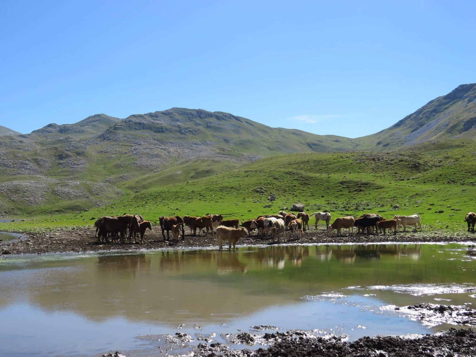
The Montagne della Duchessa Regional Nature Reserve (RI) has its seat at Via della Boscareccia 2, in Corvaro di Borgorose (RI), postal code 02021, telephone 0746 306493, official website riservaduchessa.it. Entry to the protected area is free and open, there are no tickets or opening hours: it is a regional reserve of over 3,540 hectares, established by Lazio regional law No. 70 of June 7, 1990 and managed by the municipality of Borgorose. You get there from the A24 Rome-Teramo motorway, Valle del Salto exit, then continue on State Road 578 Salto Cicolana and on the municipal roads that lead to the two real access points, Cartore and Valle Amara. From Rome it's about 90 kilometers of motorway plus 20 of minor roads, an hour and 40 minutes of driving when the traffic is honest. A car is essential: there is no scheduled service that goes all the way to the trailhead parking areas. The Cartore parking lot is at an elevation of 950 meters, the Valle Amara one just above 1,000. For guided visits, the museum's opening and the state of the trails it's best to phone the reserve's office in advance, because some routes are subject to seasonal closure orders.
Anyone arriving from Rome can combine the day with other destinations in the Rieti area: the Lake Salto is a quarter of an hour by car from the interchange, and the complete list of Lazio destinations is on the tourist attractions page.

Where it is and how to get to the Montagne della Duchessa Regional Nature Reserve
The protected territory occupies the southeastern sector of the province of Rieti, in the geographic area of the Cicolano, right up against the border between Lazio and Abruzzo. Administratively, most of the reserve falls in the municipality of Borgorose, which is also its managing body. Geographically, though, the Duchessa is a piece of the Abruzzo Apennines that ended up on the Lazio side of the watershed: its ridges continue without a break into the Velino massif, and the regional boundary line runs along the edge of the rocks, in some places literally under the feet of the walker.
By car from the A24
The main route is the A24 Rome-Teramo. You exit at Valle del Salto and follow the signs for Borgorose and Corvaro. From here two different roads open up, which never meet again: one leads to Cartore, the other to Valle Amara. It's not a minor detail, because taking the wrong fork means finding yourself an hour of curves away from the trailhead you wanted. Anyone heading for Lago della Duchessa must go to Cartore. Anyone heading for the Fonte la Vena huts and the Monte Morrone side must go to Valle Amara.
From Rieti, L'Aquila and the Cicolano
From Rieti it's best to go down the Salaria and then take the Cicolana. The travel time is similar to that from Rome, because the road is all valley floor and curves. From L'Aquila you arrive in under an hour passing through Magliano de' Marsi, and this is the route nearly all Abruzzo hikers use, since the Duchessa massif is their home mountain seen from the other side. Anyone coming from Antrodoco or from the Terminillo side has a good hour and a half of provincial roads ahead.
Where to leave the car
At Cartore the road ends in a dirt parking area beside the village, at an elevation of 950 meters. It is the only real base point of the protected area: there are the rest area with tables, the little fountain, a few accommodation facilities and the trail sign. Fires are forbidden, and it's not a formal recommendation: in August these beech woods are as dry as tinder. Valle Amara, instead, is reached by a road that is often impassable in winter, and that in summer is the starting point of the horseback itineraries and of the longer climbs toward Morrone. Free camping is not allowed in the reserve: the permitted forms of stay and any authorizations must be requested from the managing body.
What the Montagne della Duchessa Regional Nature Reserve really is
On paper it is a regional protected area of over 3,540 hectares, one of the more modest figures among the Lazio reserves. On the ground it is something else: a limestone massif that goes from the 944 meters of Cartore to the 2,239 meters of the Costone, with an elevation difference of 1,200 meters concentrated in very few kilometers as the crow flies. Anyone who knows the central Apennines knows that this is its signature: vertical walls that look Dolomitic, endless summit pastures, beech woods that climb up to 1,800 meters and then suddenly give up.
The reserve in numbers
The official trail network measures about 57 kilometers and connects Cartore to the border ridges. The peaks that govern the landscape are Murolungo, 2,184 meters, and Monte Morrone, 2,141 meters. A little farther along you see Monte Cava, around 2,000, and Monte Velino, which at 2,486 meters is the silhouette that closes every panorama to the east. The valley floor is at 950 meters, the maximum elevation reachable on foot exceeds 2,200. Woodland formations cover 56 percent of the protected area, the rest is pastures, rocks and scree.
The border with Abruzzo and the nearby protected areas
The Duchessa is not an island. Its eastern and southern edge coincides with the regional boundary and joins the system of Abruzzo protected areas: the Sirente-Velino Regional Nature Park and, a little farther north, the Monte Velino Oriented Nature Reserve, which is the place the griffon vultures and a large part of the deer now seen in the Duchessa come from. Farther south, beyond the Fucino basin, begins the territory of the Abruzzo, Lazio and Molise National Park, the historic reservoir of the Marsican brown bear and the Apennine chamois. The Duchessa is the northern link of this chain: too small to host stable populations of large mammals, well enough preserved to work as a corridor. Anyone who wants to see the Apennine chamois has to go down to the Camosciara, where the species is stable and observable. Here instead you come for the wolf, for the griffon vulture and for the landscape.
On the Lazio side the Duchessa interacts with the other protected areas of the Rieti area: the Lungo and Ripasottile Lakes Reserve in the Rieti plain, the Monte Navegna and Monte Cervia park on the two artificial lakes of Salto and Turano, and farther south the Simbruini Mountains.

The geology of the Montagne della Duchessa
Everything here is limestone, and limestone explains everything: the shape of the valleys, the absence of surface streams, the way the lake fills and empties, even the color of the rock at sunset. The Duchessa Mountains make up one of the most important hydrogeological complexes in Italy: the rain and snow that fall on these ridges do not flow on the surface, they infiltrate and feed the Peschiera spring system, that is, the aqueduct that supplies Rome with water. When you turn on a tap in central Rome, in all likelihood you are drinking water that fell on these mountains.
Karst, valleys, sinkholes
The landscape is organized from north to south in a succession of deep, narrow valleys: Valle Amara, Vallone di Fua, Vallone del Cieco, Vallone di Teve. They are incised gorges, with steep sides and dry floors for much of the year. The feature that strikes most those arriving from the Alps is precisely this: you walk for hours in grandiose valleys without meeting a stream. The water is there, but it runs underneath, in a network of conduits that no one has ever mapped in full. On the surface remain the dolines, the sinkholes, the caves. Along the Bocca di Teve route you see a stalactite-stalagmite column inside a cave, and near Cartore you pass the Cau, a doline with a microclimate all its own, a well of cold air where the vegetation changes within 10 meters.
The traces of the glaciers
Over the karst planes are superimposed the forms left by the last glaciation. The Capo Bove cirque is the most readable case: a spoon-shaped hollow dug by the ice, with its moraine ridges still recognizable. The basin of Lago della Duchessa is of the same type, although the origin of the basin is karstic. It's a combination that repeats elsewhere in the central Apennines, from the Gran Sasso to the Maiella, but here it is concentrated in a small space and therefore understood at a glance. Anyone who wants to read the landscape without a book in hand should take half an hour at the edge of the lake and look at the profile of the ridges: the basin, the thresholds, the glacial steps are all there.
Lago della Duchessa, the heart of the Montagne della Duchessa Regional Nature Reserve
Lago della Duchessa is at 1,788 meters above sea level, in a basin dominated by Murolungo, 2,184 meters, and Monte Morrone, 2,141 meters. It is one of the highest lakes in the Apennines, and one of the very few natural lakes in Lazio that is not of volcanic origin. It covers about four hectares, with a perimeter of a little under 1,000 meters, but the values vary a lot according to the pattern of precipitation: in a dry year the perimeter visibly shrinks and the shore moves away from the marks left the year before.
A karst lake without inflows
The lake has no springs of its own and no river feeding it. It lives on melted snow and rain. On the northwest shore there is a karst sinkhole that in periods of high water drains water toward the subsoil, and in this way regulates the level. The shape is that of an imperfect figure eight, generated by the union of two dolines: you read it very well from above, and it is the reason it's worth climbing at least 100 meters above the shore before taking the photograph. In summer the waters drop and the peripheral band is covered with grasses and buttercups. In spring, when the snow melts, the lake widens and the banks become muddy.
Murolungo and Monte Morrone
Murolungo is the wall that closes the basin to the north. The name says it all: a long, vertical wall of gray limestone, which stays in shadow in the morning and lights up in the afternoon. It is one of the most severe walls of the Lazio Apennines and has a fair mountaineering history. Monte Morrone, on the opposite side, has a rounder profile, with pastures almost to the top, and it is the shepherds' mountain: for centuries its summit meadows have hosted livestock from June to October. Be careful not to confuse it with the other Monte Morrone, the one above Sulmona, where the hermitage of Celestine V stands: they are two different mountains 70 kilometers apart.
The crested newt in the lake
In the water of Lago della Duchessa lives a sizable but isolated population of crested newt. It is the most curious faunal fact of the reserve: an amphibian that at these altitudes, in a basin without inflows and subject to strong level variations, should not do well and instead thrives. If you lean over the shore on a calm June day and stay still for a few minutes, you will see them rise to the surface to breathe. Don't touch them, don't take water, don't let dogs into the lake: the population is closed, and has nowhere to go if something goes wrong.

The trails of the Montagne della Duchessa Regional Nature Reserve
The marked network has been renumbered according to the CAI standard and today counts 19 documented routes among numbered trails and stages of long-distance walks. The old two-digit codes with a letter, those still found in some printed guides, have been replaced: the old 2B became CAI 102, the old 2C is the Valle della Cesa, the old 1A is CAI 103. If you have a map from 15 years ago at home, update it before leaving.
CAI 102, the classic climb to Lago della Duchessa
This is the route people come here for, and it's best to know right away that it's not a stroll. It starts from Cartore at 950 meters and reaches the lake at 1,788: four and a half kilometers of length, 872 meters of elevation gain, two hours and 40 minutes of climbing for a fit walker, difficulty EE, that is, for experienced hikers. The track climbs the Val di Fua and the Vallone del Cieco and passes by the shepherds' huts of Le Caparnie. Just outside Cartore you meet a monumental Turkey oak that alone is worth the stop. Water is found at the Cartore fountain and at Le Caparnie, around 1,725 meters: in between, nothing. The Rifugio Gigi Panei is met at around 1,665 meters, but its availability depends on administrative decisions and must be checked before counting on it as shelter. Four and a half hours for the round trip is a realistic calculation only if you don't stop. With breaks and the loop around the lake you easily get to six.
CAI 101, the low loop of Cartore
The other side of the coin, and the most underrated route in the reserve. It's a loop that starts and ends at the entrance of the Ponte di Curolo: 9.7 kilometers, three hours, barely 318 meters of elevation gain, difficulty E, elevations between 824 and 1,000 meters. It crosses the Cartore valley inside the Duchessa-Velino massif and lines up things you don't see at the lake: the orchid blooms of May, the mixed oak woods, the Arioli necropolis, the Italic-Roman complex of Bocca di Teve, the Cau of Cartore with its microclimate, the Fonte Vecchia of Cartore at 916 meters with the old wash houses. There are two rest areas equipped with tables, at Parentone-Tricagli and at Cartore, and in both lighting fires is forbidden. If you have children or tired legs, do this one and forget the lake.
CAI 602 and the Val di Teve
The Val di Teve is the valley that runs along the regional boundary between Lazio and Abruzzo, and trail CAI 602 follows it for 5.4 kilometers between 1,615 and 980 meters, with 80 meters of ascent and 756 of descent, two hours and 20 minutes, difficulty E. It's a long descent through a plant succession that keeps changing: you start among meadows, pastures and dwarf juniper, pass into mixed beech woods with maple and rowan, and end among holm oaks and thermophilous oak woods at Bocca di Teve. Birch, linden and alpine buckthorn appear in places, and these are presences that in the Apennines are not to be taken for granted. At the end you reach Bocca di Teve, at 980 meters, which is the natural watershed between Lazio and Abruzzo, and the polygonal walls attributed to the Romans after 304 BC, with the base of an Italic temple and the hermitage of San Costanzo carved into a cave. A warning that is worth the trip: the route stays closed from October to May because of the risk of landslides and slumps, by order of the mayor of Magliano de' Marsi.
CAI 103, from the lake to the Rifugio Sebastiani
Anyone who arrives early at the lake and still has energy can continue toward the Rifugio Sebastiani: 4.8 kilometers, 500 meters of ascent and 209 of descent, about two hours, difficulty EE, elevations between 1,788 and 2,246 meters. It is the high traverse that links the Duchessa basin to the Velino side, and it is the most exposed stretch of the whole reserve. It must be said clearly that the track is not yet marked on the ground: the official numbering exists, the paint on the stones does not. Without a GPS track, with fog coming in or residual snow, it is not the place to improvise.
CAI 104 and CAI 105, the Valle Amara side
CAI 104 links the Ponte di Valle Amara to the Fonte la Vena huts: 6.4 kilometers, 792 meters of elevation gain, about two hours and 40 minutes, difficulty T, elevations between 1,015 and 1,750 meters. You walk on gravel roads inside a narrow valley flanked by mixed oak woods and beech woods, climb via the Fossa Conca and arrive at the huts at the foot of Monte Morrone, structures built in the early 1990s that stay open as shelter for a large part of the year and that in summer may be occupied by shepherds. Along the route you see the old dry-stone shelters of the shepherds, and in snowmelt periods you can sense the paths of the underground water. CAI 105 reaches the same huts starting from the Anguizzola locality, on Via Valle Amara near Corvaro: 5.9 kilometers, 1,023 meters of ascent and 176 of descent, three hours and 40 minutes, difficulty EE, elevations between 894 and 1,877 meters. It comes from the merging of the old tracks 2D and 2E, crosses the mixed oak wood of downy oak and ash, enters beech forest early, touches the mature beeches of Prime Prata and the Cardito pastures, and at a rocky passage opens an almost 360-degree panorama over the Valle Amara. If I had to choose a single itinerary to understand how the woods change with elevation, I would choose this one.
The Valle della Cesa
The former CAI 2C starts from the Cartore fountain and climbs for four kilometers to the high pastures: 689 meters of ascent, 85 of descent, two hours, difficulty T, elevations between 1,080 and 1,750 meters, also passable on horseback. It's the old way of the shepherds and the inhabitants of Cartore to reach the Bosco di Cartore and Le Caparnie, with steep slopes and tight switchbacks. It touches the Vallone del Cieco and the Fonte Salomone at 1,836 meters, and crosses pastures used from June to October. It is the most honest way to reach altitude: the same road that was walked here for work, not for leisure.
The Cammino dei Briganti and the Cammino Naturale dei Parchi
Two long-distance walks cross the reserve. The Cammino dei Briganti touches the Duchessa with its third and fourth stages: the third goes from Nesce to Cartore, 17 kilometers, 405 meters of ascent and 305 of descent, difficulty E. The Cammino Naturale dei Parchi enters with the 13th, 14th and 15th stages, which link Pescorocchiano to Corvaro, Corvaro to Castiglione and Castiglione to the Rascino plateau. Anyone who doesn't feel like climbing to the lake but still wants to walk here for two days will find in these stages the best solution, because they pass through villages and low woods and allow you to sleep under cover.
Cartore, the village that opens the Montagne della Duchessa Regional Nature Reserve
Cartore is a small rural settlement of 13th-century origin, and in recent decades it has emptied almost completely. For years the village had a single permanent resident, Eusebio Di Carlo, and his stubborn presence has become part of the history of the place. Then came the restorations: first the mountain community, then the reserve with the support of the Region recovered the houses, and today Cartore works as an equipped base for visiting the protected area. The stones are the old ones, the roofs are new, and the difference compared with 20 years ago is enormous.
The name is the most interesting thing. It derives in all probability from Castoris, that is, from a sanctuary dedicated to the Dioscuri, Castor and Pollux, the sons of Jupiter. Where exactly this sanctuary was is not demonstrated: the hypotheses place it at Bocca di Teve, where the base of an Italic temple really does exist, or inside the village of Cartore itself. It's a textbook case of how a place name outlives the thing it named: the temple is gone, the god is gone, the name is still hanging on the houses.
Corvaro, the tumulus and the Cicolano Archaeological Museum
The reserve's seat is in Corvaro, and Corvaro keeps the most important archaeological feature of the whole area. In 1984, in the Montariolo locality, a tumulus tomb of the 6th century BC was identified, with a diameter of about 50 meters. The excavations yielded hundreds of burials: the official sources of the protected area speak of 254 tombs brought to light, while the Cicolano Archaeological Museum displays materials from a monumental tumulus that yielded 368 of them between pre-Roman and Roman. The oldest are from the 6th-5th century BC and in all probability belong to warriors. At the center of the large tumulus a smaller tumulus of the early Iron Age was identified, between the end of the 9th and the 7th century BC: a monument grown by accumulation, century after century, around an original core of burials.
The Cicolano Archaeological Museum opened in Corvaro in 2016 and is the right place to understand what you walked over during the hike. Opening hours and days should be checked on the museum's website or by phoning, because they are subject to seasonal variations. A similar, smaller necropolis was identified and partially excavated inside the reserve's territory, and in the Cartore valley there is the Arioli necropolis, a tumulus cemetery of the 6th-5th century BC that you meet along the CAI 101 loop.

The Aequi, the castles and the hermitages of the Montagne della Duchessa
The Cicolano was the territory of the Aequi, an Italic people speaking Oscan-Umbrian, whose dominion, originally much wider, was confined to this sector of the central Apennines after the Roman conquest between the end of the 4th and the early 3rd century BC. In Roman times the survivors were called Aequiculi or Aequicoli, and the name has survived in the local place names. The traces of their settlement are in the hilltop oppida: Monte Frontino at 1,167 meters above Santo Stefano, Colle Civita at 951 meters above the Spedino cemetery, Castelluccio at 932 meters above the Ville locality. Romanization left remains in the Colle Pezzuto and Campo di Mezzo localities, inscriptions scattered across the territory and the polygonal walls of Bocca di Teve, later than 304 BC.
In the Middle Ages the landscape changes masters. Benedictine monasticism, backed first by the Lombards and then by the Franks, reorganizes agricultural activities and finds in the sanctuary of Santa Anatolia its most prominent center. The slopes fill with hermitages: the hermitage of San Costanzo at Bocca di Teve, carved inside a cave, and the hermitage of San Leonardo in the Fua valley. From the 9th century Saracen raids trigger castle building, and at the end of the 10th century about 30 castles are counted in the Cicolano. The most significant are those of Torano, Castelmenardo and Corvaro: the latter, built between the 10th and 11th century, preserves ellipsoidal walls, four circular towers and the main entrance of Porta Calata.
Within the reserve's territory there is also the village of Santo Stefano, a few houses gathered around the church, reached by a small paved road and preceded by a scenic terrace over the Cammarone plain, with the Velino in the background. The church began in the 7th century as a rural chapel and later became an abbey center. In the 13th century, with the monastery gone, it appears in a bull of Pope Anastasius IV as Santo Stefano di Cliviano. The present building dates from the end of the 13th century, with a single nave and the bell gable set on the roof, and it follows the Romanesque model of nearby San Martino in Torano. Not far from the Corvaro tumulus, in the Sant'Erasmo locality, there was an active sacred area with a spring whose waters were credited with healing properties.
The flora of the Montagne della Duchessa Regional Nature Reserve
Woodland formations occupy 56 percent of the protected area and are arranged in bands that follow elevation, exposure, the nature of the bedrock and the type of soil. Below 1,200 meters mixed woods of Turkey oak, ash, hornbeam, rowan and maple dominate, with a thermophilous component that in the warmest spots reaches the holm oak. Climbing, you enter the beech woods, first mixed and then pure, which between 1,650 and 1,750 meters become monumental. Above the tree line begin the dwarf juniper shrublands and the primary high-altitude grasslands, with wide rocky surfaces.
How many species there are
The official sources of the managing body indicate about 500 species of vascular plants recorded in the reserve, with at least 66 of particular scientific interest because they are rare or endemic. Other surveys promoted by the reserve raise the count quite a bit, reaching over 1,000 entities distributed in 81 families: the difference depends on the census criteria and on the extent of the area considered. In both cases it is a richness out of scale for a protected area of this size.
The species that matter
Among the notable presences are the wild peony, the bear's ear primrose and the Apennine gentian, and then a list of rarities that would fill a page: Paeonia officinalis subsp. villosa, Matthiola italica, Dryopteris villarii, Saxifraga ascendens subsp. parnassica, Saxifraga exarata subsp. ampullacea, Amelanchier ovalis subsp. cretica, Fritillaria tenella, Nigritella rubra subsp. widderi, Corallorhiza trifida. The orchids are seen mostly in May along the low loop of Cartore, and they are the reason it's worth coming here in a season almost nobody considers.
Allium ducissae, the Duchessa garlic
In 2022, in the scientific journal Plants, a species new to science was described: Allium ducissae Bartolucci, Iocchi and F. Conti. The research, funded at the end of 2020, was conducted by Fabrizio Bartolucci and Fabio Conti of the University of Camerino with Olga De Castro of the University of Naples and with Marco Iocchi, and combined morphological, genetic and chromosomal analyses to clarify the identity of a population of Allium that no one had yet managed to classify. The result is that it is a species endemic to the central Apennines, present in the world only in the Duchessa-Velino massif. A plant that exists here and nowhere else on the planet, described the day before yesterday: it is the most remarkable thing that has happened in this reserve in the last 20 years, and almost nobody knows it.

The fauna of the Montagne della Duchessa Regional Nature Reserve
The first systematic faunal census dates to 1993 and recorded 227 species of insects, nine of amphibians, 10 of reptiles, 97 of birds and 38 of mammals. Of the 97 bird species, 81 are recorded as nesting. These are numbers that today should be read as a vintage photograph, because in the meantime some presences have consolidated and others have appeared.
The wolf, the bear, the ungulates
The Apennine wolf is present permanently all year round, with at least one pack. The Marsican brown bear, an endemic Italian subspecies, visits the reserve with some regularity: since the summer of 2005 traces have been detected with high frequency, and this changes the picture compared with the idea of a purely occasional presence. The fact remains that the limited extent of the protected area is not enough for an adult plantigrade: the Duchessa is ground for transit and feeding along the corridor that links the Velino-Sirente to the rest of the central Apennines. The red deer and the roe deer, extinct for decades, were reintroduced in the 1990s, the former thanks to an intervention by the State Forestry Corps in the neighboring Monte Velino Nature Reserve, the latter through spontaneous expansion of the Abruzzo populations. Today both have spread across the whole territory. The wild boar is everywhere, and is often seen.
The smaller carnivores are represented by the stone marten, the badger, the pine marten, thought to have disappeared and then found again in at least two localities, and the wildcat, which is the hardest species to spot in the whole reserve. Among the small mammals are the squirrel, the weasel, the hazel dormouse, the shrew, the garden dormouse and the water vole. In the high-altitude grasslands lives the snow vole, a glacial relict whose Apennine distribution, from the Sibillini to the Gran Sasso to the Maiella, is explained only by the climatic events of the Quaternary. In the caves of the reserve recent research has established 14 species of bats out of the 36 in Italy: a record, and a fact that says a lot about the state of conservation of the cavities.
The raptors and the griffon vulture
The golden eagle uses the summit grasslands as hunting territory. It nests on the nearby Velino and in the Duchessa it appears in passing flight. Among the diurnal raptors the kestrel, the peregrine falcon, the lanner falcon, the hobby, the buzzard, the goshawk and the sparrowhawk are easily seen. Among the nocturnal ones are the barn owl, the little owl, the tawny owl and the very rare eagle owl.
The absolute protagonist, though, is the griffon vulture. The colony derives from a reintroduction project conducted by the State Forestry Corps at the foot of the Velino, in the Monte Velino Oriented Nature Reserve: between 1994 and 2002, 97 individuals were released. Today the species is permanently present in the Duchessa with many breeding pairs, and for those who climb the high trails the sighting is almost a given. An adult griffon vulture exceeds two and a half meters of wingspan and flies by exploiting the updrafts that form against the walls of Murolungo: if you find yourself on the ridge line in mid-morning, on a sunny day with a light wind, you'll find them below you, not above. It is one of the few nature experiences in Italy that are truly worth the trip.
Amphibians, reptiles and lake birds
The crested newt lives permanently in Lago della Duchessa with a sizable but isolated population. Among the reptiles the species that matters is Orsini's viper, very rare in Italy, which frequents the high-altitude steppe pastures and feeds mainly on orthopterans. There are then the common viper, the western whip snake and the slow worm. Along the lake shores you may come across occasional migratory ducks such as the mallard, the tufted duck and the garganey. In the scrub you see jays and woodpeckers, and at low altitudes in summer the hoopoe. At altitude the rock partridge holds on, having survived the heavy hunting pressure that preceded the establishment of the protected area: its presence is one of the best indicators of how well the reserve has worked.
The climate and the seasons at the Montagne della Duchessa Regional Nature Reserve
The altitude range, from 800 to over 2,200 meters, produces different climates within a few kilometers. Average annual temperatures range between four and seven degrees in the higher bands and rise to 10 to 12 degrees in the valley-floor areas. The average of the warmest month is around 24 degrees, that of the coldest around six. Precipitation, according to data from the Avezzano weather station, follows two overlapping regimes: one of Mediterranean type, with peaks in autumn and secondarily in spring, and one of continental type, with rainfall well distributed between winter and summer. Annual rainfall stands at 1,000 to 1,200 millimeters at high altitudes and about 700 on the valley floor. The summer quarter collects about a third of the annual total, which means that prolonged summer drought does not exist here, and that the afternoon thunderstorms of July and August are the norm, not the exception.
When to come and when to avoid
The good window for the lake runs from late June to mid-October. Before June, snow can still occupy the Vallone del Cieco and the basin, and winter equipment is needed. Snowfalls are regularly recorded in March and April as well. From October to May the Bocca di Teve route is closed due to landslide risk. In July and August the problem isn't the heat, it's the thunderstorm: set out at dawn, be at the lake by 10 and start going down before 2 in the afternoon. The season I truly recommend is the second half of September, when the beech woods change color, the shepherds are still up high, the thunderstorms have thinned and there is no one left on the trails. In winter the Duchessa becomes terrain for ski mountaineering, ski touring and snowshoeing, but it is a severe environment: the avalanche risk in the Vallone del Cieco is real and must not be underestimated.
A curiosity about the Montagne della Duchessa Regional Nature Reserve (RI)
The name of these mountains does not come from a geographic fact, but from a courtly tribute. The local learned tradition traces it back to Francesco De Marchi, a Bolognese military engineer of the 16th century, courtier and alpinist ante litteram, who is said to have christened the massif in honor of Margaret of Austria, natural daughter of Charles V, duchess of Parma and Piacenza and feudal lady of these territories through the holdings of Leonessa and Cittaducale. De Marchi was in Margaret's service and in 1573 made the first documented ascent of the Corno Grande of the Gran Sasso: a man who really knew the mountains of the Apennines, who did not name them from afar. If the tradition tells the truth, the place name would be a piece of Renaissance flattery that has survived five centuries.
The fascinating thing is the short circuit that followed. The duchess's name passed from the mountains to the lake, and from the lake it came back, until it became the label by which the reserve is known even to those who have no idea who Margaret of Austria was. In the meantime the ancient place name, the real one, survives in another form: Aequiculanus, the Aequi, the people who lived here before anyone thought of putting a duchess's name on a ridge. Two layers of names superimposed, one popular and very ancient, the other learned and courtly, and neither erases the other. It is the history of the Apennines in miniature. I add that the exact genealogy of the attribution to De Marchi should be taken for what it is, a well-rooted local tradition and not a notarial document: anyone who wants to verify it must turn to the historical bibliography of the Cicolano, which the reserve's seat keeps.
Something nobody tells you about the Montagne della Duchessa Regional Nature Reserve (RI)
That Lago della Duchessa empties. Not completely and not every year, but the level fluctuates a lot, and the postcard image that circulates on social media is the one from June, with the water at its maximum and the buttercups on the banks. Anyone who arrives at the end of August in a dry year finds a reduced basin, with the peripheral band turned into wet meadow and the sinkhole on the northwest shore in plain view. It's not degradation, it's nobody's fault: it is the normal functioning of a karst lake without inflows, fed only by precipitation and drained by an underground conduit. The stated perimeter, a little under 1,000 meters, and the surface of about four hectares are average values that vary from year to year.
The second thing nobody says concerns drinking water. On the whole climb from Cartore to the lake there are exactly two water points: the village fountain, at 950 meters, and the Le Caparnie spring, around 1,725. Between the two, for 800 meters of elevation, there is nothing. In August you happen to see people arrive in the basin with half a liter each and have to ration it for the descent. Two liters per person is the minimum, three if you continue toward the Rifugio Sebastiani. And the lake water is not to be drunk and not to be touched: it is the habitat of an isolated population of crested newt, and every contamination counts.
The third is phone coverage. In the valleys there is none, and in places not even in the basin. Anyone relying on a cell phone to find their way should download the offline map before leaving the parking area, and tell someone the expected return time. The single emergency number is 112.

The advice I give you for visiting the Montagne della Duchessa Regional Nature Reserve (RI)
My advice is to reverse the order in which almost everyone approaches this reserve. Most people arrive, head straight for the lake on CAI 102, take the photograph, go back down and leave, and have seen a tenth of what there was to see. Better to do two days, or at least two visits in different seasons.
The first day is the low one: the CAI 101 loop from Cartore, three hours, little elevation gain, and inside it there are the orchids, the oak woods, the Cau with its microclimate, the Fonte Vecchia with the wash houses, the Arioli necropolis, the Italic-Roman complex of Bocca di Teve. You finish at the rest area with the tables and go down to Corvaro for the Cicolano Archaeological Museum. It is the day that explains the territory: who lived here, how, for how long.
The second day is the high one, and it has to be approached with the seriousness it deserves. Departure from Cartore no later than 7 in the morning, real boots with high ankle, two liters of water, rain jacket even in August, hat, and the awareness that 872 meters of elevation gain in four and a half kilometers on a trail rated EE is not a Sunday stroll. Once at the lake, don't stop on the shore: climb another 100 meters or so up the Morrone side, because from there you see the figure-eight shape of the basin and understand the geology of the place. Then go back down the same way, without inventing shortcuts: sheep tracks are everywhere and lead where you don't want to go.
One last recommendation: check the state of the routes before leaving, by phoning the reserve. Bocca di Teve is closed from October to May, CAI 103 toward the Rifugio Sebastiani is not yet marked on the ground, and the availability of the Rifugio Gigi Panei depends on administrative acts that change. It is a five-minute phone call that avoids a wasted day.
Another well-known fact, yet rarely cited
That Rome's water originates here too. The limestone complex of the Montagne della Duchessa is one of the most important hydrogeological systems in Italy, and the precipitation that falls on these ridges, finding no surface watercourses, infiltrates the rock and feeds the Peschiera springs, the great aqueduct that supplies the capital. The link between Rome and this remote mountain of the Cicolano is closer than the 4 million people who open a tap in the city every day imagine.
The fact is well known among hydrogeologists and unknown to almost everyone else, and it has practical consequences worth stating. The first is that protecting these mountains is not an environmentalist luxury: it is aqueduct maintenance. Every form of pollution at altitude, from fires to abandoned waste to uncontrolled discharges, enters directly into a system that ends up in Roman taps, because limestone does not filter the way a deep soil would, it transmits. The second is that the flow rates of these aquifers depend on winter snowfall, and the low-snow winters of recent years show up in the springs even before they show in the landscape. The third is that the whole massif is also protected as a Site of Community Importance and Special Protection Area of the Natura 2000 network, and not only by the regional law of 1990: there is a layering of protections that reflects exactly this double value, ecological and hydrological.
Anyone walking here, in short, is walking above the water reserve of a capital. It is worth keeping in mind while deciding where to throw an empty bottle.
The right photo to take at the Montagne della Duchessa Regional Nature Reserve (RI)
The photograph everyone takes is the lake from the shore, horizontal, with Murolungo behind. It always comes out the same and delivers nothing: from the shore the basin looks flat, the wall appears squashed and the hollow gets lost. The right photograph is taken from 50 or 100 meters higher, climbing the Monte Morrone side along the pasture tracks. From up there everything fits: the figure-eight shape generated by the two dolines, the glacial basin, the gray wall of Murolungo closing to the north, and in the background, if the air is clean, the silhouette of the Velino.
The best light is that of early morning, between 8 and 10, when the raking sun draws the steps of the basin and the water is still motionless. In the afternoon Murolungo lights up orange but the lake goes into shadow, and you need a long exposure or a tripod. If you come in late autumn, the combination of red beech wood in the Vallone del Cieco and yellow meadows in the basin gives the strongest colors of the year.
There is then a less obvious and harder photograph, which is that of the griffon vultures. You need patience and a position on the ridge line in mid-morning, when the updrafts begin to work against the walls: from there the birds pass below the lens, and you see the whole silhouette against the dark background of the woods. With a modest telephoto lens, from 200 millimeters up, you bring home images that no other place in Lazio allows. A serious piece of advice: don't chase them, don't use drones, don't whistle to make them turn. Drones in protected areas are subject to restrictions and disturb nestings that cost 20 years of work to those who brought them back here.
At low elevation, finally, the best photograph is that of Cartore backlit at sunset, with the recovered stones and the mountains behind. It tells the truest thing about this reserve: an almost dead village that became useful again because a protected area was built around it.
Some important events that happened here in history
The fact that made Lago della Duchessa a name known all over Italy has nothing to do with the mountain. On April 18, 1978, during the kidnapping of Aldo Moro, a communiqué attributed to the Red Brigades was released, numbered as the seventh, according to which the body of the president of the Christian Democracy lay on the bottom of Lago della Duchessa. It was false. Frantic hours and searches at altitude followed, with snow still on the ground and the lake partly frozen. Aldo Moro was found in Rome on May 9, 1978, in Via Caetani. For a generation of Italians the name of this lake remains tied to that communiqué, and those who climb up here with that memory on their shoulders find a silent place that has nothing to do with the story that happened to it.
Much further back in time, the decisive event is the defeat of the Aequi. Between the end of the 4th and the early 3rd century BC Rome subdued this Italic people and reduced its territory, originally much larger, to this sector of the Apennines: the polygonal walls of Bocca di Teve, later than 304 BC, are the material sign of that passage. Even earlier, and for centuries, the Corvaro tumulus received the burials of the local community: identified in 1984 in the Montariolo locality, with a diameter of about 50 meters, it yielded hundreds of tombs, the oldest from the 6th-5th century BC, and at its center a smaller tumulus dating to the early Iron Age, between the end of the 9th and the 7th century BC.
In the Middle Ages the structural fact is castle building: from the 9th century Saracen raids push communities to fortify themselves, and at the end of the 10th century about 30 castles are counted in the Cicolano, among them that of Corvaro with its ellipsoidal walls and four circular towers. In the 13th century the church of Santo Stefano, its monastery now lost, appears in a bull of Pope Anastasius IV with the name Santo Stefano di Cliviano.
In the 20th century the events are of opposite sign and equally decisive: depopulation, which empties Cartore until only one inhabitant is left, and then regional law No. 70 of June 7, 1990, which establishes the reserve and stops hunting in an area where hunting pressure had almost wiped out the rock partridge. In the 1990s the reintroductions arrive: the red deer, released by the State Forestry Corps in the neighboring Monte Velino Reserve, and above all the griffon vulture, with 97 individuals released between 1994 and 2002 at the foot of the Velino. From the summer of 2005 the Marsican brown bear begins again to leave frequent traces. In 2016 the Cicolano Archaeological Museum opens in Corvaro. In 2022, finally, an international scientific journal describes Allium ducissae, a species new to science and endemic to the massif: in a little over 30 years a mountain that was dying of abandonment has returned to producing news.
Who has passed through the Montagne della Duchessa Regional Nature Reserve (RI)
The first name is that of Francesco De Marchi, a Bolognese military engineer of the 16th century in the service of Margaret of Austria. He is the man to whom local tradition attributes the christening of these mountains, and he is also the protagonist of the first documented ascent of the Corno Grande of the Gran Sasso, in 1573. A fortifications technician who climbed peaks out of curiosity in an age when the mountain was only an obstacle: if the name of this massif comes from him, it comes from the only man of his century who had reason to look at it from above.
Margaret of Austria, natural daughter of Charles V, duchess of Parma and Piacenza, is not recorded as ever having set foot on the ridges that bear her title, but these territories belonged to her as feudal lady through the holdings of Leonessa and Cittaducale. The link between the duchess and the mountain is entirely documentary and feudal, and perhaps that is exactly why the name took root: it was the way of saying to whom a pasture belonged.
Then the shepherds passed through, and they are the true historical population of this place. For centuries the grasslands of Morrone and Cardito have hosted flocks from June to October, and the traces of their passage are everywhere: the dry-stone shelters along the Valle Amara, the huts of Le Caparnie at 1,725 meters, the Fonte Salomone, the Fonte Vecchia of Cartore with the wash houses, the trail of the Valle della Cesa that was born not for tourism but for work. Even today the Fonte la Vena huts, built in the early 1990s, can be occupied by shepherds in summer.
Before that, the monks passed through. The Benedictines, backed by the Lombards and then the Franks, reorganized the economy of the valley around the sanctuary of Santa Anatolia, and the hermitages on the slopes of the Duchessa remain to testify to a more radical choice: the hermitage of San Costanzo at Bocca di Teve, carved inside a cave, and the hermitage of San Leonardo in the Fua valley. Anyone passing Bocca di Teve today walks beside the base of an Italic temple, Roman walls and a Christian hermitage within a radius of a few hundred meters: three religions superimposed on the same watershed.
In 1978 the journalists, the carabinieri and the divers passed through, brought up here by a false communiqué and by a snow that would not melt. In the 1990s and 2000s the men of the State Forestry Corps passed through with the cages of the griffon vultures and the deer. In 2020 the botanists of the University of Camerino and the University of Naples passed through, and from that work came Allium ducissae. And then there is Eusebio Di Carlo, the last inhabitant of Cartore, who did not pass through at all: he stayed, when everyone else had gone away, and the village that today works as the gateway to the reserve is also thanks to him.
The Montagne della Duchessa Regional Nature Reserve with children
Let's say it right away: the climb to Lago della Duchessa is not suitable for small children. An elevation gain of 872 meters on a trail rated EE, with no water for much of the route and with frequent afternoon thunderstorms in summer, is too much for legs under 12 years old, and shoulder child carriers on that stretch are uncomfortable and not very safe.
The reserve, though, has a lot to offer families, provided you choose the low part. The CAI 101 loop around Cartore is almost flat, takes three hours at an easy pace, and contains enough things to keep curiosity awake: the Cau doline with its cold air, the wash houses of the Fonte Vecchia, the tumulus tombs of Arioli, the ancient walls of Bocca di Teve. There are two rest areas with tables, at Cartore and Parentone-Tricagli, where you can eat comfortably. The Cicolano Archaeological Museum in Corvaro completes the day under cover, which is useful if the weather changes. The low stretch of the Valle Amara, on a gravel road, is also passable without difficulty.
Two substantial recommendations. Dogs must be kept on a leash always: there are wolves here, there are flocks with guard dogs, and a loose dog is a problem for all three. And teach the kids that the lake water is not to be touched, because it hosts an isolated population of crested newt that a single prank can compromise.
Accessibility, rules and safety at the Montagne della Duchessa Regional Nature Reserve
The reserve is a wild mountain area and does not offer equipped routes for people with motor disabilities. The gravel road stretches in the Valle Amara and the Cartore parking area are the only flat and regular environments. The rest of the network is on mountain trail, with a stony surface, natural steps and steep slopes. Anyone with specific needs would do well to phone the reserve's seat in advance to understand what is actually practicable.
The basic rules are those of any protected area and here they have concrete reasons. Don't light fires, not even in the equipped rest areas. Don't pick plants: 66 species are rare or endemic and some exist only on this massif. Don't camp freely. For the permitted forms of stay, contact the managing body. Waste is carried back down to the valley, all of it. Dogs on a leash. Drones are subject to restrictions and in any case disturb the nesting of raptors.
On the safety front, there are four critical points. The first is water, which is scarce. The second is the summer thunderstorms, predictable and violent, which require being on the way down early in the afternoon. The third is residual snow, which in the Vallone del Cieco and in the basin can last until late June and makes light crampons and an ice axe necessary. The fourth is orientation on CAI 103 toward the Rifugio Sebastiani, which as of the date of the available official information is not yet marked on the ground. The single emergency number is 112. Phone coverage in the valleys is patchy, so the map must be downloaded offline and the return time communicated to someone before departing.
What to see around the Montagne della Duchessa Regional Nature Reserve
The Cicolano is a land that almost nobody visits, and that is its merit. A few kilometers from the Valle del Salto interchange is Lake Salto, an artificial basin with a jagged outline, and a little farther Lake Turano with villages overlooking the water, both included in the Monte Navegna and Monte Cervia park. Toward Rieti you meet Cittaducale, a city of Angevin foundation with a regular layout, and farther north Leonessa, which shares with the Duchessa the feudal link with Margaret of Austria. Anyone with an extra day can push on to Antrodoco, to the Velino gorges, or to Amatrice.
On the Abruzzo side, less than an hour away, are L'Aquila and the Fucino basin, and farther south the territory of the Abruzzo, Lazio and Molise National Park with the Camosciara and Scanno. Toward the Gran Sasso, Campo Imperatore and Santo Stefano di Sessanio complete the picture of the central Apennines. Anyone instead heading back toward Rome can stop at the Simbruini Mountains or, exiting at Tivoli, at Villa Adriana.
Frequently asked questions about the Montagne della Duchessa Regional Nature Reserve (RI)
How much does it cost to enter the Montagne della Duchessa Regional Nature Reserve?
Entry to the Montagne della Duchessa Regional Nature Reserve is free: access to the protected area is open, there are no tickets or turnstiles. You pay only for parking where applicable and, if you visit it, the ticket for the Cicolano Archaeological Museum in Corvaro.
How do you get to Lago della Duchessa and how long does it take?
You climb to Lago della Duchessa along trail CAI 102, which starts from Cartore at 950 meters elevation. The lake is at 1,788 meters above sea level, in a basin dominated by Murolungo, 2,184 meters, and Monte Morrone, 2,141 meters, with an elevation gain of about 870 meters to tackle.
Is the climb to Lago della Duchessa suitable for children?
No, the climb to Lago della Duchessa is not suitable for small children: it is a route rated EE, with almost 870 meters of elevation gain, no water for much of the way and frequent afternoon thunderstorms in summer. The reserve does offer other proposals better suited to families, such as the low CAI 101 loop from Cartore.
Is the Montagne della Duchessa Regional Nature Reserve wheelchair accessible?
No, the reserve is a wild mountain area and does not offer equipped routes for people with motor disabilities. The only flat and regular stretches are the gravel road in Valle Amara and the Cartore parking area. The rest of the network runs on mountain trails with a stony surface and steep slopes, so it's best to contact the reserve's seat in advance.
Does Lago della Duchessa always have water?
No, the level of Lago della Duchessa fluctuates a lot according to the seasons and the years. The postcard image with the water at its maximum is generally had in June, while anyone arriving at the end of August in a dry year may find a reduced basin, with the peripheral band turned into wet meadow.
What is the best time to visit the Montagne della Duchessa?
The recommended period depends on what you want to see: in May the orchids bloom along the low loop of Cartore, while in June Lago della Duchessa is at its maximum water level. High-altitude hikes must be planned taking into account the afternoon thunderstorms, frequent in summer.
Why the name Montagne della Duchessa?
The name of the Montagne della Duchessa, according to the local learned tradition, would go back to Francesco De Marchi, a Bolognese military engineer of the 16th century, who is said to have christened the massif in honor of Margaret of Austria, natural daughter of Charles V, duchess of Parma and Piacenza and feudal lady of these territories.
What to see in Cartore and Corvaro besides the mountain?
At Cartore, a small rural settlement of 13th-century origin recovered by the reserve with the support of the Region, is the access base for the trails. At Corvaro, the reserve's seat, is instead the Cicolano Archaeological Museum, which holds the finds from the tumulus tomb of the 6th century BC discovered in 1984 in the Montariolo locality, with hundreds of burials brought to light.
On the hospitality front, Cartore has a few accommodation and refreshment facilities, and the towns of Borgorose and Corvaro offer the rest. The cuisine is the pastoral cooking of the Cicolano, with lamb, sheep cheeses, homemade pasta and mountain legumes. Anyone organizing a group outing with a guide can turn to the tourism professionals who work in Rome and the Rieti area: TourLeaderPro handles escort and logistics for groups, while those looking for group travel organization in Italy will find the dedicated service on the same site. For foreign visitors, the English guides on Italian mountains and nature and ItalyPlanner's page on Lazio are the most convenient starting point.
Quick questions about the Montagne della Duchessa Regional Nature Reserve (RI)
How much does it cost to enter the Montagne della Duchessa Regional Nature Reserve?
Nothing. Access to the protected area is open and free, there are no tickets or turnstiles. You pay only for parking where applicable and, if you visit it, the ticket for the Cicolano Archaeological Museum in Corvaro.
How long does it take to climb to Lago della Duchessa?
From trail CAI 102, which starts from Cartore at 950 meters, you need about two hours and 40 minutes of climbing for 4.5 kilometers and 872 meters of elevation gain. With breaks and the return, the day is five or six hours.
Is the trail to Lago della Duchessa difficult?
It is rated EE, that is, for experienced hikers. It has no climbing passages, but it is steep, long and on stony ground. You need fitness, you need boots with high ankle and you need water.
Can you reach Lago della Duchessa by car?
No. The road ends at Cartore, at 950 meters, and from there you go up on foot only. There are no lifts or drivable roads to the basin.
How do you get to the Montagne della Duchessa Regional Nature Reserve from Rome?
By car: A24 Rome-Teramo, Valle del Salto exit, then State Road 578 Salto Cicolana and municipal roads to Cartore or Valle Amara. About an hour and 40 minutes of travel.
Can you reach the Montagne della Duchessa by public transport?
Not as far as the trailheads. Scheduled services serve the towns of the municipality of Borgorose, but not the parking areas of Cartore and Valle Amara. A car is in effect necessary.
When is the best time to visit the Montagne della Duchessa Regional Nature Reserve?
From late June to mid-October for the lake and the high elevations. The second half of September offers the best compromise between colors, temperatures and absence of crowds. May is ideal for the low loop of Cartore because of the orchids.
Is there water along the trail to Lago della Duchessa?
Only two points: the Cartore fountain at 950 meters and the Caparnie spring at around 1,725. In between there is nothing. Bring at least two liters each.
Can you swim in Lago della Duchessa?
No, and it's not a matter of temperature. The lake hosts an isolated population of crested newt and is a protected habitat: you don't enter the water, you don't take samples, you don't let dogs in.
How deep is Lago della Duchessa?
It is classified as a shallow lake. Its dimensions vary with precipitation: the surface is around four hectares and the perimeter a little under 1,000 meters, but the values change from year to year.
Do you see griffon vultures at the Montagne della Duchessa?
Yes, with good probability. The colony derives from the 97 individuals released between 1994 and 2002 at the foot of the Velino and is now permanently present with many breeding pairs. The best chances are in mid-morning along the ridges.
Is there a bear in the Montagne della Duchessa Regional Nature Reserve?
The Marsican brown bear visits the reserve and since the summer of 2005 its traces have been detected with high frequency. It is not, however, a stable presence: the area is too small, and works as a corridor toward the Velino-Sirente.
Are there wolves? Is it dangerous to walk here?
The Apennine wolf is permanently present with at least one pack. It poses no danger to hikers. The problem, if anything, is the dog left loose, which can trigger conflicts with the wolves and with the flocks' guard dogs.
Can you bring a dog to the Montagne della Duchessa?
Yes, on a leash. At altitude you meet flocks with guard dogs, and a loose dog creates serious problems both for them and for wildlife.
Can you camp in the Montagne della Duchessa Regional Nature Reserve?
Free camping is not allowed. The permitted forms of stay and any authorizations must be requested from the managing body, the municipality of Borgorose, through the reserve's offices.
Is the hut on the lake trail open?
The Rifugio Gigi Panei, at around 1,665 meters, has an availability that depends on administrative decisions and must be checked before departure by contacting the reserve. It should not be considered guaranteed shelter.
Why is Lago della Duchessa linked to the Moro case?
Because on April 18, 1978 a false communiqué attributed to the Red Brigades claimed that Aldo Moro's body lay on the bottom of the lake. It was a false lead: Moro was found in Rome on May 9, 1978.
Where does the name Montagne della Duchessa come from?
Local learned tradition traces it back to the Bolognese engineer Francesco De Marchi, in the 16th century, in honor of Margaret of Austria, duchess of Parma and Piacenza and feudal lady of Leonessa and Cittaducale.
How big is the Montagne della Duchessa Regional Nature Reserve?
Over 3,540 hectares, with elevations ranging from the 944 meters of Cartore to the 2,239 meters of the Costone and a trail network of about 57 kilometers.
When was the Montagne della Duchessa Regional Nature Reserve established?
By Lazio regional law No. 70 of June 7, 1990. The managing body is the municipality of Borgorose and the seat is at Via della Boscareccia 2 in Corvaro.
Is the reserve wheelchair accessible?
There are no equipped routes. Only the Cartore parking area and the initial gravel road stretches in Valle Amara are flat. For specific situations it's best to phone the seat in advance.
Can you go horseback riding in the Montagne della Duchessa Regional Nature Reserve?
Yes, on some routes. CAI 104 in Valle Amara and the Valle della Cesa itinerary are also indicated for horseback hiking.
Can you ski at the Montagne della Duchessa?
There are no ski lifts. The area is frequented in winter for ski mountaineering, ski touring and snowshoeing, with all the caution the alpine environment requires, avalanches included.
Is the Bocca di Teve trail always open?
No. The route stays closed from October to May because of the risk of landslides and slumps, by order of the mayor of Magliano de' Marsi.
What is the difference between the Montagne della Duchessa Reserve and the Sirente-Velino Park?
They are two adjoining protected areas in different regions: the Duchessa is a Lazio regional reserve of over 3,540 hectares managed by the municipality of Borgorose, the Sirente-Velino is a much larger Abruzzo regional park. Their boundaries touch on the watershed, and ecologically they form a single system.
Is there a visitor center or a museum?
The reserve's offices are in Corvaro, at Via della Boscareccia 2, and the Cicolano Archaeological Museum, opened in 2016, displays the materials from the Corvaro tumulus. Hours and openings should be checked before the visit.
The final advice
If you have only one day and want to take something home from this mountain, better not to climb to the lake. It often happens to see people arrive in the basin exhausted, take the photograph and leave without having understood where they were. Do the low loop of Cartore instead, take three hours, look at the May orchids, stick your head into the Cau doline, touch the wash houses of the Fonte Vecchia, reach the walls of Bocca di Teve and stay there for five minutes in silence, with Abruzzo on one side and Lazio on the other. Then go down to Corvaro, enter the museum and look at what the tumulus yielded. By then you will have understood the Duchessa, and the lake will become the reason to come back with more time and the right legs. Mountains you understand are visited twice, those you conquer only once.
Article written by the editorial team of TourLeaderPro, contact them for Private/Corporate/V.I.P. Tours and Experiences.
Planning a trip to Rome? The English guides for visiting the city are on ItalyPlanner.com.