Via Francigena
In short. Via Francigena in Lazio is walked in eight stages, from Acquapendente (VT), on the border with Tuscany, to Piazza San Pietro in Rome: about 180 kilometers of dirt tracks, Roman paving stones, Etruscan sunken roads and, on the last day,…
Via Francigena in Lazio is walked in eight stages, from Acquapendente (VT), on the border with Tuscany, to Piazza San Pietro in Rome: about 180 kilometers of dirt tracks, Roman paving stones, Etruscan sunken roads and, on the last day, urban parks, with a total elevation gain of around 2,500 meters. The walk is free and always open. There is no ticket, reservation or schedule, except for those of the individual monuments you come across (the basilica of Santa Cristina in Bolsena, the Rocca dei Papi in Montefiascone, the Palazzo dei Papi in Viterbo, the amphitheater of Sutri). From Rome you reach the stages by the FL3 regional railway (Roma Ostiense, Roma San Pietro, Valle Aurelia, then La Storta, Capranica-Sutri, Viterbo Porta Fiorentina) and by the Cotral buses that connect the capital with the towns of the Tuscia. For Acquapendente the most convenient railway base is Orvieto station on the Rome-Florence line, with a bus connection. The official GPX tracks, the stage-by-stage descriptions and the closure notices are on the website of the European Association of the Vie Francigene, viefrancigene.org, which is also the only place to buy the pilgrim's Credential (suggested price 8 euros). Without it you can't access the religious hostels and you don't get, in Rome, the Testimonium, reserved for those who have walked at least the last 100 kilometers (200 by bicycle). The right time is from April to early June and from September to October. In July and August the Viterbo countryside shows no mercy.
If you're looking for the lake that Via Francigena runs alongside for two days, you'll find the dedicated guide to Lake Bolsena. If you want to fit the walk into a wider trip, start from the index of tourist attractions in Rome and Lazio. If you'd rather walk accompanied, with the logistics of luggage and overnight stays handled by others, a licensed tour guide can be found among the certified professionals that TourLeaderPro puts in a network.

What Via Francigena Really Is
Via Francigena, also called Francisca or Romea, was not a road in the sense that the Aurelia or the Cassia is. It was a bundle of routes, a road system with many alternatives, and anyone who calls it "the pilgrims' road" in the singular does wrong to its nature. From western Europe, and in particular from the land of the Franks, travelers came down toward Rome and then, for those who wished, continued toward Puglia, where the ports of Bari, Brindisi and Otranto shipped pilgrims and crusaders to the Holy Land. The alternative itineraries took the collective name of vie romee, because all of them, one way or another, led to Rome.
The pilgrimage to the tomb of the apostle Peter was in the Middle Ages one of the three peregrinationes maiores, together with Jerusalem and Santiago de Compostela. For this reason the peninsula was traveled ceaselessly by people from every part of Europe. Many stopped in Rome. The others continued down the peninsula to Brindisi and sailed from there. Anyone who doesn't understand that Rome was, for some of the pilgrims, a stage and not a destination, doesn't understand Via Francigena.
The network lived on changing conditions. The pilgrim chose the road according to the season, the political situation of the territories crossed and the relics he wished to venerate: a newly canonized saint shifted the traffic of an entire region. The constant presence of people from different cultures allowed an exceptional passage of signs, emblems, languages and artistic forms of the Christian West, and the traces of that passage deeply structured the settlement patterns and traditions of the places crossed: hospices, rural parish churches, bridges, villages lined up along the road. A saying circulates according to which the conscience of Europe was born on the pilgrimage roads. It is attributed to Goethe, but nobody has ever pointed to the passage where he supposedly wrote it, and it should be taken for what it is, a lucky formula more than a quotation.
The Name Via Francigena: Where It Comes From and Where It Is First Written
"Francigena" means "born from France," and it's the name Italians gave to the road from which the Franks arrived. Pilgrims from the land of the Franks began to cross the Alps in large numbers in the post-Carolingian age. The first archive documents that cite the name date from the 9th century and concern, with a certain paradox, a stretch of road in Tuscany: the Actum Clusio, a parchment from 876 kept in the abbey of San Salvatore on Monte Amiata, names the via Francigena in connection with the countryside of Chiusi, in the province of Siena. South of Rome the name appears for the first time at Troia, on Via Appia Traiana, in the Privilegium Baiulorum Imperialium of 1024. From the 12th century the name becomes common.
The first description of the route, instead, dates to the 10th century: the account that Archbishop Sigeric wrote of his own journey back to Canterbury from Rome, where in 990 he had been received by the pope and had obtained the pallium. That document is the most famous testimony to the network, but it doesn't exhaust it. I tell its stages further on, together with the itineraries of an Icelandic abbot, an English monk and a Norman archbishop, because Via Francigena can only be understood by comparing the diaries of those who walked it in different centuries.
Since 1994 Via Francigena has been a "Cultural Route of the Council of Europe," on a par with the Camino de Santiago, and it has thus acquired a supranational dignity. On April 7, 2001 the European Association of the Vie Francigene was founded, and today it manages the routes, the signage and the Credential.
A Curiosity About Via Francigena
The curiosity concerns a detail of the writing: Sigeric's diary is written backward. The archbishop lists his stops starting from Rome, with the number I assigned to the city of the popes, and works his way up toward the Channel. The stage that for us is the first in Lazio, Acquapendente, for him is one of the last before Tuscany, and Piazza San Pietro is not an arrival but a departure. Anyone who walks to Rome today is reading the manuscript from the last line to the first. Sigeric's Via Francigena is therefore, literally, a road of return: the 79 submansiones (modern scholars reconstruct 80) are the stops of a man who has already obtained what he wanted and is going home.
The manuscript, in Latin, is kept at the British Library in London and is more than a list of places. Before the stages, Sigeric notes the Roman churches he visited in the days spent in the city: San Pietro, Santa Maria in Campo Marzio, San Lorenzo, San Valentino, Sant'Agnese, San Sebastiano, San Paolo, San Pancrazio and others. It is the oldest guide to Rome written by an English pilgrim, and it describes a city in which the devotional destinations were above all the basilicas outside the walls on the consular roads, that is, the tombs of the martyrs. The stages in Lazio bear names that the walker still recognizes: Johannis VIIII (the station at the ninth mile of the Cassia, La Storta), Bacane (Baccano), Suteria (Sutri), Furcari (Forcassi, near Vetralla), Sce Valentine (San Valentino, today Viterbo), Sce Flaviane (San Flaviano in Montefiascone), Sca Cristina (Bolsena), Aquapendente. On the itinerary the archbishop took 79 days for about 1,600 kilometers, mostly on foot, with an average of around 20 kilometers a day: exactly the average of the modern pilgrim. In a thousand years Via Francigena has not changed pace.
Crossing the Alps on Via Francigena: Mont Cenis and the Great St. Bernard
The natural obstacles to overcome were the English Channel, the Alps, the Po and the Apennines. For the Alps there were at least two alternatives. With the primitive itinerary, from the 10th to the 12th century, you entered Italic territory from the Great St. Bernard Pass, from where you descended into the Aosta Valley, then to Ivrea and then to Vercelli. During the 12th century the other route became prevalent, the one that entered Italy from the Susa Valley across the Mont Cenis Pass, sometimes also passing through the Montgenèvre Pass.
The scholar Renato Stopani, who devoted his life to this road, explained that the Mont Cenis pass, already used earlier as an alternative to the Great St. Bernard, was in the 12th century increasingly traveled by men and goods headed to the great fairs of Champagne, where the presence of Italian merchants was becoming substantial. In the time of Philip Augustus the choice of that pass was so frequent that, in the pre-Alpine area, the true road of France was considered to be the one over Mont Cenis. It's a point worth remembering: Via Francigena was not only a pilgrims' road, it was the merchants' road, and merchants decide the passes more than saints do.
The Great St. Bernard Road
It began from Lake Geneva, from Lausanne or from Vevey, went up the Rhône entering the Valais, stopped at the great abbey of Saint-Maurice d'Agaune, then left the Rhône valley for the Val d'Entremont and reached the pass. From there it descended the Great St. Bernard valley to Aosta, then the Aosta Valley to Ivrea and then to Vercelli. From Ivrea to Santhià, Sigeric in 990 followed the direct "Roman" road south of Lake Viverone, a variant now signposted and much appreciated, proposed by the International Via Francigena Association since 2007 and by the Friends of Via Francigena of Santhià.
The Mont Cenis Road and the House of the Frescoes in Novalesa
The Mont Cenis road branched off already in Champagne and headed for Beaune, from where it went down the Saône valley to Lyon. It continued through Chambéry, went up the Arc valley to the pass, where the Mont Cenis Hospice is documented from as early as 825, a stopping point ad peregrinorum receptionem. From there the road, still preserved for long stretches today, descended to Novalesa, where in addition to the abbey founded in 726 part of a medieval inn survives in the old village, called the House of the Frescoes for its decorations: painted on the facade are the coats of arms of the European regions of origin and destination of the patrons who crossed the pass. A 14th-century advertising sign, in essence, and one of the most eloquent proofs of the international character of the road.
It continued toward Susa, where the itinerary of the Montgenèvre Pass converged, linking with southern France and the Camino de Santiago. Then, going along the whole Susa Valley, passing by the Sacra di San Michele and the abbey of Sant'Antonio di Ranverso, you reached Turin, Chivasso and Vercelli, or you followed the Po along the ancient Itinerarium Burdigalense as far as Pavia. Politically the two passes were controlled on both sides by the counts of Savoy, who in addition to their homeland governed the Susa Valley, the Aosta Valley and the Lower Valais: dominion over the passes was the reason for their power. Until the 13th century the Great St. Bernard was the most used. During that century Mont Cenis established itself, especially for those coming from France.
Up to the Alps: The Roads of Europe That Flowed into Via Francigena
The central axis, the one followed by Sigeric, corresponded to the "road of Flanders" (route de la Flandre), the trade route that connected the richest regions of late medieval Europe, Italy and Flanders, passing through Champagne, where the international fairs of the same name were held. From Flanders it crossed Artois (Arras), Champagne (Reims), Franche-Comté (Besançon), went over the Jura at the Col de Jougne and arrived at Lausanne. The English joined at Arras, coming from London (Matthew Paris) and from Canterbury (Sigeric), after crossing the Channel between Dover and Calais.
To the east there was another great corridor, the Rhine valley. Nikulás of Munkaþverá reports that pilgrims took the staff at Utrecht or at Deventer and continued, stopping in the trading cities of Cologne, Mainz, Speyer, Worms, Strasbourg and Basel. Then, leaving the Rhine, they continued through Solothurn, Avenches and Vevey. The Scandinavians and the northern Germans came from Stade and reached the Rhine at Duisburg (so the Annales Stadenses) or at Mainz (so Nikulás). The western variant was the one that started from Paris and joined the road of Flanders at Troyes. All these branches, at Vevey or Lausanne, became the same road: it is at that point that the German, the Fleming, the Englishman and the Icelander found themselves side by side.

Crossing the Po on Via Francigena
From Vercelli onward the itineraries merged and passed through Robbio, Mortara and Pavia. The crossing of the Po by boat between Corte Sant'Andrea, at the confluence of the Lambro into the Po, and Calendasco, near Piacenza, has been recognized as the Transitus Padi by the Council of Europe since 1994 and, since 2009, also by two Italian ministries. In reality the sources attest several river ports at Piacenza, and above all the many changes in the course of the river make it impossible to identify with certainty the point where medieval pilgrims crossed. Today's ferry is a plausible reconstruction, not an archaeological fact, and anyone who takes it should know that. From Piacenza the route continued along Via Emilia through Fiorenzuola d'Arda and Borgo San Donnino, today's Fidenza.
Monte Bardone and the Lunigiana
At Borgo San Donnino you left Via Emilia and went up the Val di Taro, passing through Fornovo and then through Cassio or Berceto. The crossing of the Apennines was made over the Cisa Pass, which was then called Monte Bardone. The name came from the Latin expression Mons Langobardorum, mountain of the Lombards, because the Lombards used this pass to go from their capital Pavia to Tuscia. Only later would it be called "la Cisa." From Monte Bardone you descended into the Lunigiana through Pontremoli, Aulla, Santo Stefano Magra and Sarzana, to finally reach Luni, the Roman marble city, by then in decline but still a bishop's seat.
Between Sarzana and Luni, near the ancient hospice of San Lazzaro, the Francigena joined the road of Spain, which carried Spanish pilgrims to Rome and Italian ones to Santiago de Compostela, sailing from the ancient port of San Maurizio on the river Magra. It is one of the finest junctions of the whole network: a crossroads where two of the three great pilgrimages of the West exchanged their travelers.
Central Italy on Via Francigena: From Luni to Rome
Lucca and the Volto Santo
From Luni, skirting the Apuan Alps, you reached Pietrasanta and went down to Lucca. Lucca was one of the main destinations of Via Francigena, thanks above all to the Volto Santo, the great wooden crucifix in the Duomo, and to the relics of important saints such as San Regolo and San Frediano. It was precisely for Frediano, of Irish origin, that many pilgrims from northern Europe came to venerate his remains. From Lucca you continued through Porcari, Altopascio, Galleno, Ponte a Cappiano (Aqua Nigra) and Fucecchio (Arne Blanca), where there was a bridge over the Arno.
The Val d'Elsa and Siena
After crossing the Arno, the first stage was San Genesio (San Miniato), from where you began to climb the Val d'Elsa: in ancient times along the ridge, through San Gimignano and Colle di Val d'Elsa, and from the 12th century along the valley floor through Castelfiorentino, Certaldo and Poggibonsi, to reach Siena. Siena owed to its position on Via Francigena the urban, demographic and financial development it experienced in the late Middle Ages: the Sienese bankers who financed popes and kings had learned the trade from pilgrims and passing merchants.
The Val d'Orcia, Radicofani and the Entry into Lazio
From Siena the road followed the Arbia valley to San Quirico d'Orcia, from where it went up the Val d'Orcia. From there you crossed the ridge into the Val di Paglia and went down to Acquapendente. However, from the 12th century on, the Val di Paglia proved unsafe and travelers preferred to climb up to the Rocca di Radicofani, which the walker still sees for a whole day before reaching it. From Acquapendente you followed the itinerary of the ancient Via Cassia through Bolsena, Montefiascone, Viterbo, Vetralla and Sutri, or, as an alternative, Ronciglione along Via Cassia Cimina. Then the Baccano valley and finally, turning onto Via Trionfale near La Storta, you arrived in Rome seeing the basilica of San Pietro from the height of Monte Mario, called for this reason Mons Gaudii, the mountain of joy.
The Apennine Variants of Via Francigena
As with the Alps, in crossing the Apennines too pilgrims faced several possibilities. The variant of the International Via Francigena Association from 2013, after crossing the Montemarcello-Magra Regional Park, reaches ancient Luni and Avenza and continues from Massa on the "Roman road" as far as Pietrasanta. In the stretch from the Po Valley to Tuscany there were several variants that used the passes by going up the Val Trebbia and passing through Bobbio (the road of the Abbots), or the Val di Taro or other minor valleys.
Via del Volto Santo, in Garfagnana
From the Val di Taro a detour through the Lunigiana and the Garfagnana made it possible to reach Lucca directly, avoiding the coastal passage on Via Aurelia: a variant considered safer in times of crisis or war, because it wound along secondary roads that were less exposed and watched over by a dense network of castles and monasteries. Today the "Francigena variant of Garfagnana," called Via del Volto Santo, can be walked on ancient paths and mule tracks, with many medieval bridges for crossing the Serchio and its tributaries. It is not yet equipped with a network of hospitality dedicated to pilgrims in convents and parishes, but it crosses a territory where widespread hospitality is guaranteed by farm stays, bed and breakfasts, village shops, small bars and restaurants: enough for a pleasant passage of pilgrims and trekkers.
Via Francesca della Sambuca and the Vie Romee of the Romagna Apennines
Recent studies have highlighted Via Francesca della Sambuca, a variant that followed the course of the Reno to Porretta Terme and went to Pistoia passing by the ancient castle of Sambuca Pistoiese and the Passo della Collina. Other variants consisted, once Piacenza was reached, of following Via Emilia to cross the Apennines at Bologna or Forlì, thus reaching the via romea della Sambuca or the via romea dell'Alpe di Serra. As evidence of this passage, the custom of pilgrims coming from Ireland and Scotland gave rise, already in the early Middle Ages, to the church in Forlì, now vanished, of San Pietro in Scotto or in Scottis. The Forlì variant still allowed the choice of reaching the upper Tiber valley and following the river to Rome, without risking losing the way, or heading toward Arezzo. Matthew Paris speaks of this in his Iter de Londinio in Terram Sanctam. Farther south, after the death of Saint Francis and his canonization, many pilgrims left the ancient route to visit Assisi.
Along the peninsula a remarkable series of variants has been found which, more or less connected to Via Francigena through the so-called "diverticoli," joined the north and the south of Europe, and which in ancient times were also called vie romee or francesche.

Southern Italy and Via Francigena del Sud
From Rome the route followed for a long stretch Via Appia or the parallel Via Latina as far as Benevento. From that city you took Via Traiana, or Appia Traiana, going up the Campanian Apennines to the San Vito pass, where the castle of Crepacuore stood, a fortress held by the Knights Hospitaller to guarantee the safety of pilgrims on the Apennine stretch. The road then arrived at Troia, on the high plain of the Tavoliere, from where it was possible to climb to the sanctuary of San Michele Arcangelo on the Gargano or to continue along the same Traiana toward Bari, Brindisi and Otranto, the ports of embarkation for the Holy Land.
The southern stretch in Lazio has two routes. One is the Prenestina-Latina, which passes through Palestrina, enters the Valle del Sacco, touches Anagni, Ferentino and Alatri and rejoins Via Latina to head for Benevento, where it meets the other route. The other is the Appia, which descends from the Castelli Romani into the province of Latina, passes through the ancient port city of Terracina, where already some of the pilgrims chose the sea route to Jerusalem, and reaches the Garigliano, on the border with Campania. Two particularly beautiful stretches cross the countryside of the Castelli Romani, from Castel Gandolfo to Velletri, and the hills of the Ciociaria, from Anagni to Veroli.
This bundle of paths, which interweave following the orography and the weak points of the Apennine passes, is today identified as Via Francigena del Sud. Since 2015 a technical panel of Lazio, Campania, Molise, Basilicata and Puglia has reconstructed its route, and at the general assembly in Bari on October 18, 2019 the European Association of the Vie Francigene ratified it unanimously: about 900 kilometers from Rome to Brindisi and Santa Maria di Leuca, with the historic variant of Via Bradanica in Basilicata ending at Matera. In our view the Lazio stretch of the Francigena del Sud, between Sermoneta, Priverno and the abbey of Fossanova, is today more intact and less frequented than the one north of Rome, and anyone who has already done the Tuscia should try it.

Something Nobody Tells You About Via Francigena
The "Via Sacra Langobardorum" never existed. In the 1990s the name Via Sacra Langobardorum, the Sacred Way of the Lombards, was born, for tourist reasons more than historical ones, to indicate the route that started from Mont-Saint-Michel in Normandy, passed halfway by the Sacra di San Michele in the Susa Valley, founded by nobles on pilgrimage, and arrived at the sanctuary of San Michele Arcangelo at Monte Sant'Angelo, on the Gargano: a route that in essence follows Via Francigena. A mistaken tourist-cultural information campaign made people believe it is a pilgrimage road distinct from the Francigena, whereas no medieval document exists that cites the name Via Sacra Langobardorum. The wording has nevertheless become common to indicate the geocultural itinerary between Mont-Saint-Michel, the Sacra di San Michele and San Michele del Gargano. When you read it on a sign, know that it's a label from 30 years ago, not a thousand.
The second thing few people say concerns the word "hospital." The medieval hospitale (from the Latin hospes, guest) was not a place of care but a work of mercy similar to monasteries, where travelers found shelter in large halls with several beds and an altar for prayer. They were hospices run free of charge, for charitable purposes, by religious orders such as the Hospitallers, the Templars and the friars of the Order of the Tau of Altopascio. Only later were these modest structures joined by inns and buildings comparable to our hotels, used above all by wealthy merchants, bankers and clergymen passing through. Anyone who sleeps today in a donation-based hostel with the Credential is repeating that model, and should leave an offering that honors it.
The Attested Itineraries of Via Francigena
Sigeric's Itinerary (990)
The oldest detailed travel account dates to 990 and is the work of Sigeric, Archbishop of Canterbury, returning from Rome where he had received the pallium. The historiographical tradition places him under Pope John XV. The archbishop kept a diary in Latin, now held at the British Library, in which he described the 79 stages of his itinerary from Rome toward Canterbury. The description is very precise regarding the stopping points, the mansiones, and remains the basis for hypothesizing what the original route between Canterbury and Rome was, at the turn of the 10th and 11th centuries, part of a network of routes that connected the regions of France to Italy.
Of the 79 places of rest mentioned, the following stand out: Roma, Sutri, San Valentino near Viterbo, San Flaviano at Montefiascone, Santa Cristina at Bolsena, Acquapendente, San Quirico d'Orcia, Siena, Colle di Val d'Elsa, San Gimignano, San Genesio, the bridge over the Arno near Fucecchio, Porcari, Lucca, Camaiore, Luni, Sarzana, Santo Stefano Magra, Aulla, Pontremoli, Berceto, Borgo San Donnino, Fiorenzuola d'Arda, Piacenza, Tromello, Vercelli, Santhià, Ivrea, Aosta, Bourg-Saint-Pierre, Orsières, Saint-Maurice d'Agaune, Vevey, Lausanne, Orbe, Yverdon, Pontarlier, Besançon, Cussey-sur-l'Ognon, Seveux, Grenant, Humes, Blessonville, Bar-sur-Aube, Donnement, Fontaine, Châlons-sur-Marne, Reims, Corbeny, Laon, Duin, Arras, Bruay-la-Buissière, Thérouanne, Sombre. The stages on the Channel and in England are not mentioned. Sigeric took 79 days to cover, mostly on foot, the roughly 1,600 kilometers of the journey, with an average of 20 kilometers a day.
The Itinerary of Nikulás of Munkaþverá (1152-1153)
Another testimony of pilgrimage on Via Francigena is that, from the 12th century, of the Icelandic abbot Nikulás of Munkaþverá. Little is known of him and even the name is uncertain: Nikulás Bergsson or Bergþórsson. He was a Benedictine monk. In 1154 he returned to Iceland from a pilgrimage to the Holy Land, and in 1155 he was consecrated abbot of the monastery of Munkaþverá, about 15 kilometers south of Akureyri, founded that year by Bishop Björn Gilsson of the diocese of Hólar. He remained there until his death, around 1159-1160. The account of the journey is contained in the Leiðarvísir, "Itinerarium," written in Old Norse: the journey dates between 1152 and 1153, the composition between 1154 and 1160.
The journey begins in Iceland, crosses the sea toward Norway and the coasts of Denmark, passes into western Germany (unlike Sigeric, who crosses France) and, going up the upper course of the Rhine, touches Switzerland and Italy. In the Tuscan part it does not differ significantly from Sigeric, but after Rome it continues on the Appia Traiana to embark from the ports of Puglia. After Italy a sea route begins which, touching coasts and islands of the Balkan peninsula and Greece, leads to Asia Minor and finally to Jerusalem. The text provides detailed descriptions of roads, churches and monuments crossed by Scandinavian travelers. We read that at Utrecht "the men take the staff and the satchel and the blessing for the pilgrimage to Rome." Mentioned, among others, are Mainz, Strasbourg, Basel, Solothurn and Vevey, on Lake Geneva, where the roads of all of northern Europe converged and where the abbot met Franks, Flemings, English, Germans and Scandinavians heading for Rome. From there he continued to Saint-Maurice d'Agaune, Bourg-Saint-Pierre, the Hospice of the Great St. Bernard, Etroubles, Aosta, Pont-Saint-Martin, Ivrea, Vercelli, Pavia, Piacenza, Borgo San Donnino, Borgo Taro, Pontremoli, Luni (where the Spaniards also arrived from San Lazzaro), Lucca, Altopascio, San Genesio, Siena, San Quirico d'Orcia, Acquapendente, Santa Cristina at Bolsena, San Flaviano at Montefiascone, Viterbo, Sutri, Roma.
The Itinerary of Matthew Paris (Mid-13th Century)
The Iter de Londinio in Terram Sanctam was written in French by the English Benedictine Matthew Paris, a monk of St Albans and chronicler, as a guide for pilgrims around the middle of the 13th century. Today it is in the British Library. The route begins in London, continues through Newgate, Cripplegate, Bishopsgate and Westminster, then crosses Rochester, Canterbury, Dover, Wissant, Montreuil-sur-Mer, Saint-Riquier, Poix, Beauvais, Beaumont-sur-Oise, Paris, Provins, Nogent, Troyes, Bar-sur-Seine, Châtillon-sur-Seine, Beaune, Chalon-sur-Saône, Mâcon, Lyon, La Tour-du-Pin, Chambéry, Montmélian, Aiguebelle, Termignon. Past Mont Cenis it touched Novalesa, Susa, Avigliana, Alpignano, Turin, Chivasso, Vercelli, Mortara, Pavia, Piacenza, Fiorenzuola d'Arda, Borgo San Donnino.
Here the guide proposed two routes. The classic one crossed the Cisa through Luni, Lucca, Siena, San Quirico d'Orcia, Montefiascone, Viterbo, Sutri and Rome. The alternative touched Parma, Reggio nell'Emilia, Modena, Bologna, Imola, Faenza, Forlì and Bagno di Romagna, crossed the Apennines at the Passo di Serra and continued through Arezzo, Perugia, Foligno, Spoleto and Rieti to Rome. For today's walker it is proof that the Rieti route, the present-day Via di Francesco, was already in the 13th century a recognized entrance to Rome.

The Itinerary of Odo Rigaud (1253)
Eudes, in Italian Oddone, Rigaud was a Franciscan, professor of theology at the University of Paris, appointed archbishop of Rouen in 1247. In 1253 he set out with an entourage to go on pilgrimage to Rome. The journey is recorded in the Regestum visitationum, the diary of the prelate's pastoral visits. On the way there, starting from Rouen, he passed through Auffay, Notre-Dame-d'Aliermont, Foucarmont, Poix, Montdidier, Noyon, Compiègne, Senlis, Chambly, Pontoise, Paris, Saint-Maur-des-Fossés, Courquetaine, Rampillon, Le Paraclet, Troyes, Bar-sur-Seine, Châtillon-sur-Seine, Laperrière-sur-Saône, Saint-Seine, Dijon, Auxonne, Dole, Salins-les-Bains, Boujailles, Pontarlier, Cossonay, Lausanne, Villeneuve, Sion, Loèche-les-Bains, Brig, Diveria, Domodossola, Pallanza, Gallarate, Milan, Bergamo, Brescia, Mantua, Castelmassa, Ferrara, San Giorgio di Piano, Bologna, Imola, Cesena, Rimini, Fano, Cagli, Gubbio, Assisi, Perugia, Todi, Narni, Civita Castellana, Rome: an entrance from the Simplon and the Flaminia, not from the Cassia.
On the return he chose a different route: Sutri, Viterbo, Montefiascone, Acquapendente, Radicofani, San Quirico d'Orcia, Siena, Poggibonsi, Pisa, Lucca, Sarzana, Passo del Bracco, Sestri Levante, Recco, Genoa, Arenzano, Savona, Carretto, Cortemilia, Asti, Turin, Sant'Ambrogio di Torino, Susa, Termignon, Saint-Michel-de-Maurienne, Aiguebelle, Chambéry, La Tour-du-Pin, Sant'Antonio di Vienne, Vienne, Lyon, L'Arbresle, Thizy, Marcigny, Pierrefitte-sur-Loire, Decize, Nevers, Cosne-sur-Loire, Gien, Lorris, Cepoy, Nemours, Melun, Villeneuve-Saint-Georges, Paris, Senlis, Compiègne, Noyon, La Neuville-Roy, Beauvais, Gisors, Le Petit-Nojan-sur-Andelle, Rouen. One man, two completely different roads: no other document shows better that Via Francigena was a fan.
The Advice I Give You for Visiting Via Francigena
Don't start from Canterbury, and not even from Lucca, if you have a week. Start from Acquapendente. The eight stages in Lazio are the portion of Via Francigena that has everything in the right measure: a lake, volcanic countryside, three art cities (Bolsena, Montefiascone, Viterbo), an Etruscan city carved into the tuff (Sutri) and an arrival that no other European walk can offer, the dome of San Pietro seen from Monte Mario. They are also more than the 100 kilometers needed for the Testimonium, and that matters. Anyone who starts from Viterbo to save two days arrives in Rome without the certificate, and regrets it. If your vacation days are really few, start at least from Bolsena, from where the 100 kilometers are just barely completed.
Walk from north to south, like the pilgrims, and not the other way around: the sun stays behind you in the hot hours and Rome grows in front of you day after day, first as a name on the milestones, then as the silhouette of the dome. Choose April, May, late September or October. The stages from Vetralla to Sutri and from Sutri to Campagnano are long, with fords that become a problem after rain: bring a change of socks and a pair of closed sandals for the water. Sleep where they stamp: the religious hostels and municipal hostels of the Tuscia are still, unlike many Tuscan stages, places where the pilgrim is expected and not merely tolerated. Get the Credential before leaving and don't count on finding it in town. And always leave an extra day in Rome to pick up the Testimonium without rushing and to walk from the Vatican to San Paolo fuori le mura: the medieval pilgrimage ended at the two tombs, not at just one. If you're looking for a guide who takes care of luggage transport, reservations and timing, with the private and corporate experiences of TourLeaderPro the week gets organized without worries.

The Eight Stages of Via Francigena in Lazio, One by One
The official numbering of the European Association of the Vie Francigene, which counts the stages from the Great St. Bernard, assigns stages 38 to 45 to Lazio. The lengths that follow are reference figures and may vary by a kilometer or two depending on temporary detours and variants: the up-to-date figure is always the one on the stage sheet at viefrancigene.org.
Stage 38 of Via Francigena: Acquapendente to Bolsena
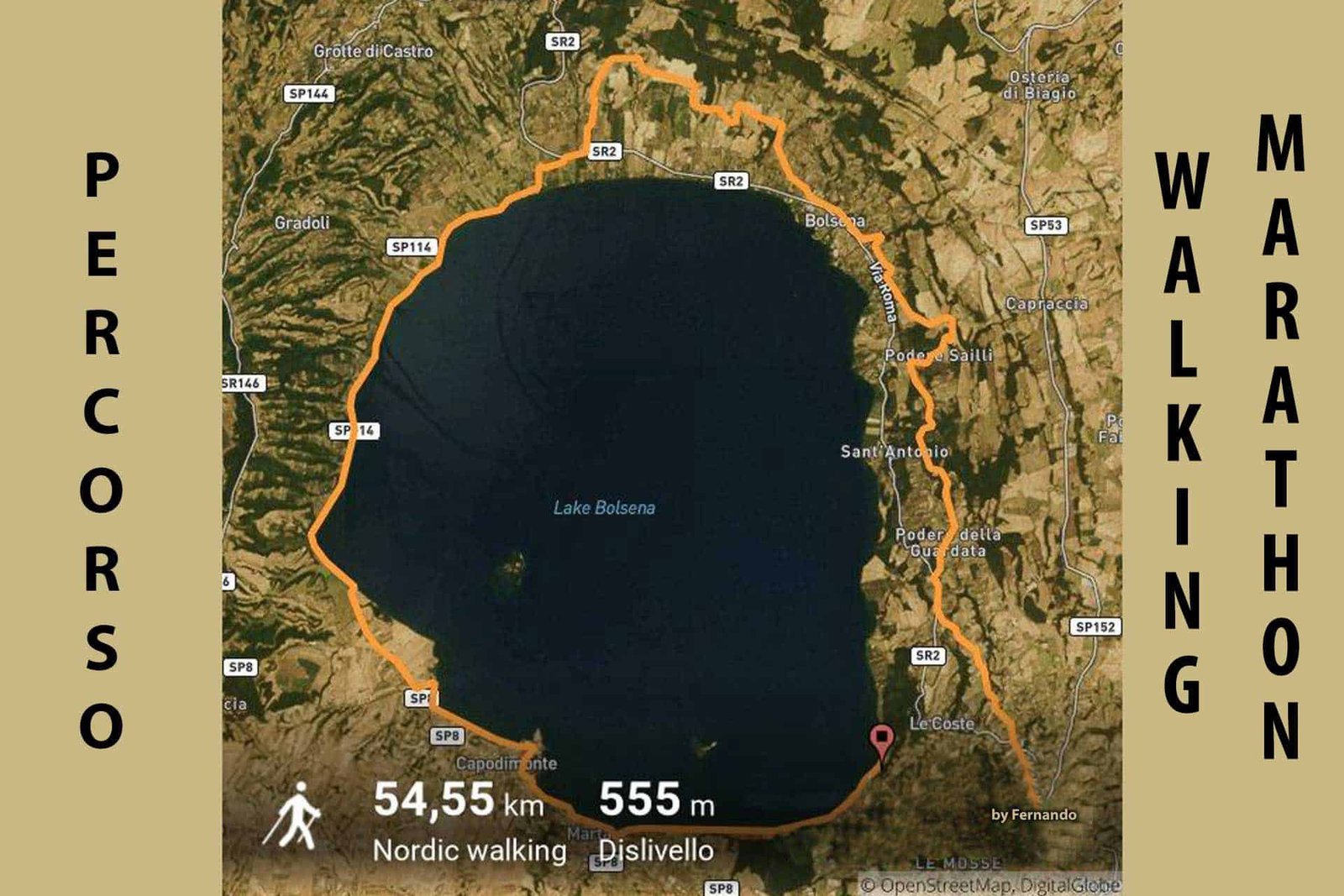
From the church of the Santo Sepolcro in Acquapendente to the basilica of Santa Cristina in Bolsena, about 22 kilometers and five and a half hours of walking. The first stage in Lazio noted in the diary of the Archbishop of Canterbury is Acquapendente itself, where the shrine imitating the Holy Sepulchre of Jerusalem is found: the crypt of the basilica holds the rock-cut aedicule that pilgrims visited as a substitute for the tomb of Christ. Along comfortable dirt roads, among olive groves and white roads, after a stretch on the plain you arrive at San Lorenzo Nuovo, and from there Lake Bolsena shows itself for the first time in all its breadth: it's the moment of the stage. The medieval village of Bolsena, on the shores of the lake, appears imposing with the Monaldeschi fortress dominating the town, and the winding alleys wind among old houses. The basilica of Santa Cristina, with its catacombs and the chapel of the Eucharistic miracle of 1263, is the pilgrim's obligatory stop, and the stamp on the Credential is obtained in the basilica itself or at the tourist office. Bolsena is also the gateway to the lake towns: Capodimonte, Marta and Gradoli are worth a rest day.
Stage 39 of Via Francigena: Bolsena to Montefiascone
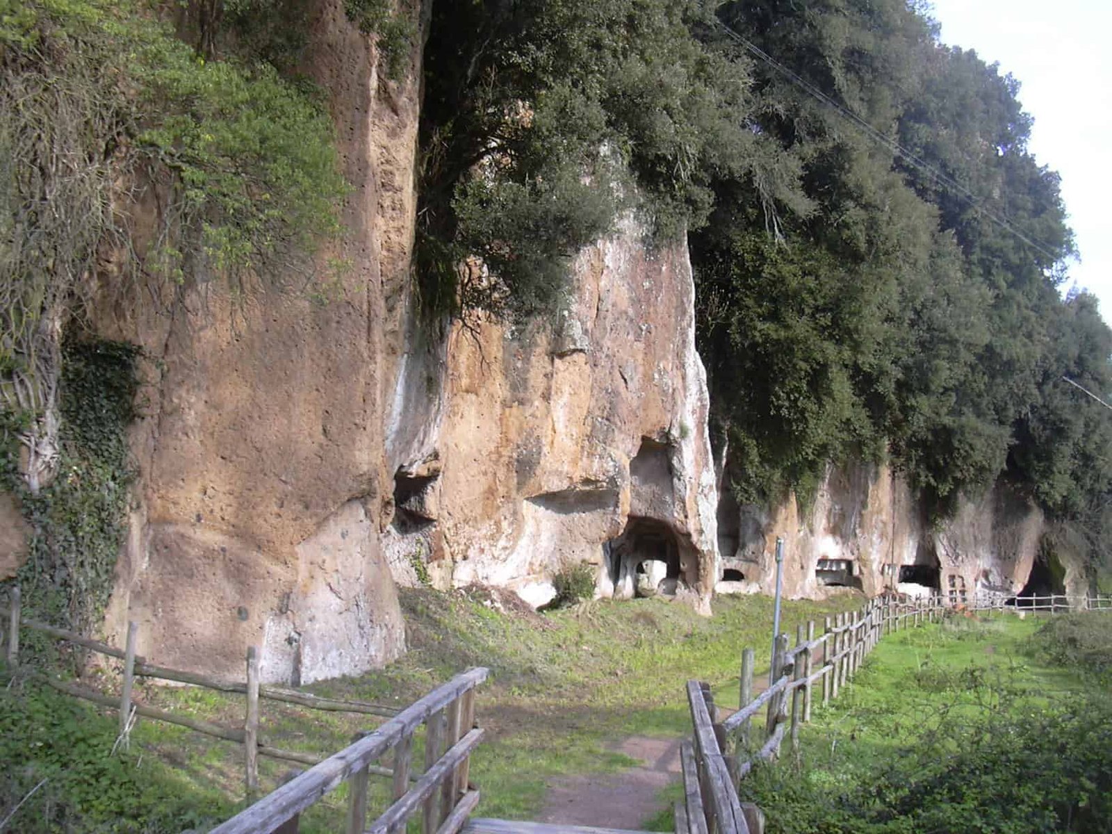
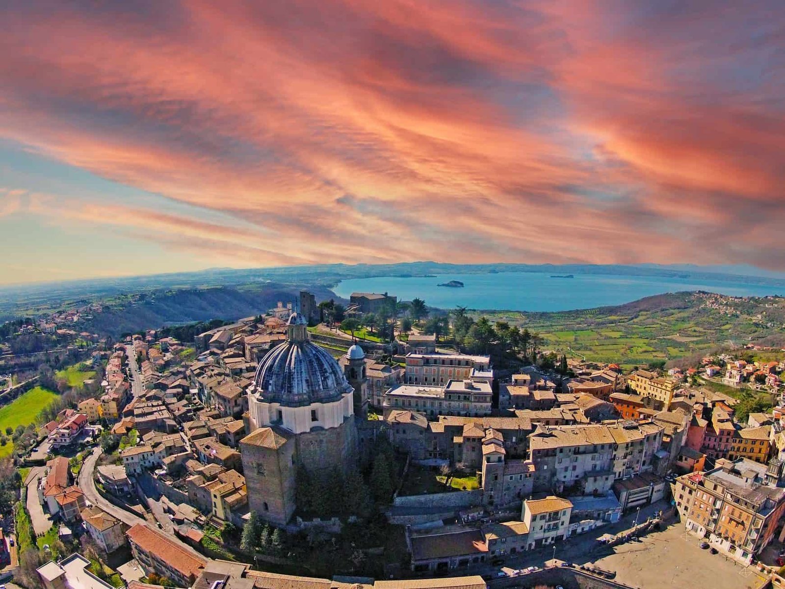
From the basilica of Santa Cristina to the Rocca dei Papi in Montefiascone, about 17-18 kilometers and four and a half hours. The route becomes engaging and invites you to take on the spirit of the wayfarer. You climb toward the Monti Volsini, among woods, fords and magnificent views of the lake with the Bisentina and Martana islands. The Roman paving of the Cassia emerges unexpectedly from the vegetation and accompanies hikers for long stretches, the most beautiful of the entire Lazio walk, recalling the Italic peoples who for centuries walked along Via Francigena. On the final climb you come across the marker stone for the 100 kilometers from Rome: from here on every step counts toward the Testimonium. Montefiascone welcomes you at the end of the climb and dominates all the surrounding landscape. From the viewpoint below the fortress the gaze ranges from the lake to a large part of the province of Viterbo, as far as Umbria and Monte Amiata. On days of tramontana you may be lucky enough to see the sea too. The church of San Flaviano, Sigeric's Sce Flaviane, is lower down along the Cassia, and whoever enters finds the tomb of the German prelate to whom legend ties the wine Est! Est!! Est!!!.
Stage 40 of Via Francigena: Montefiascone to Viterbo
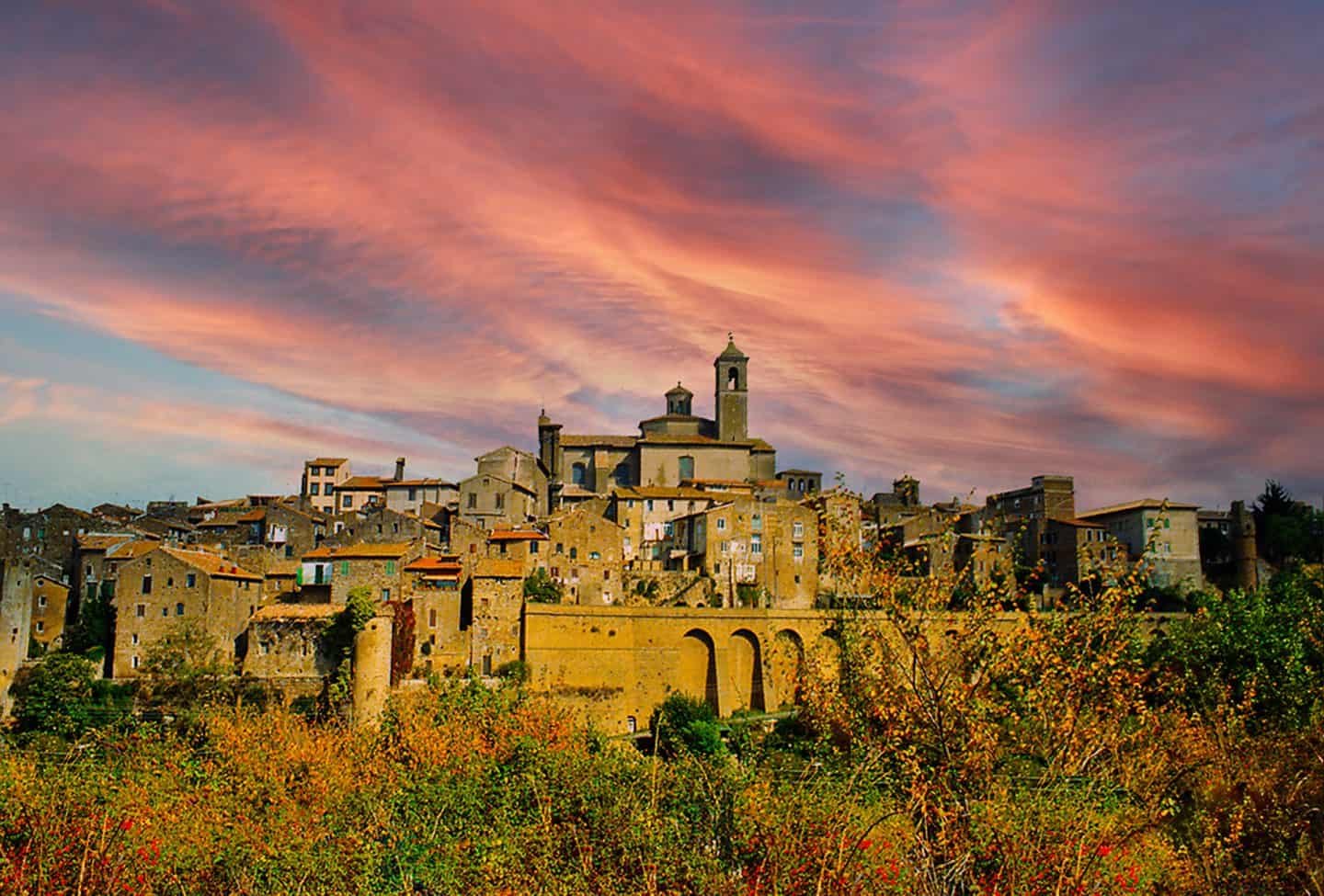
From the Rocca dei Papi to Piazza del Plebiscito in Viterbo, about 18 kilometers and four and a half hours. From Montefiascone you descend toward the Viterbo valley along the ancient paving that runs among woods of centuries-old oaks and olive groves, where the wide spaces of the countryside open out as far as the Maremma. The thermal waters of the Bagnaccio, free pools a few meters from the route, are a special relief for tired pilgrims, and anyone who skips them to arrive sooner is making a mistake. Turreted Viterbo, the city of the Popes, a fundamental stage of Via Francigena since always, welcomes you with the 17th-century Porta Fiorentina with its three arches. The stone streets, the fountains, the noble palaces, the Palazzo dei Papi with its loggia and the extraordinary medieval neighborhood of San Pellegrino, which carries its function in its name, let you discover a city still little known even to Romans themselves. From the Palazzo dei Papi a short walk leads to the cathedral of San Lorenzo, on the hill where Sigeric's San Valentino stood.

Stage 41 of Via Francigena: Viterbo to Vetralla
From Piazza del Plebiscito to the Duomo of Vetralla, about 17-22 kilometers depending on the variant chosen, in four and a quarter hours. After leaving Viterbo, the route continues following the ancient sunken roads of Etruscan origin, roads cut into the tuff with walls rising meters above your head: the sacred roads of the people of mystery go into the earth to emerge suddenly into the light, in an intact countryside. You skirt the Monti Cimini and pass the ruins of the Ponte Camillario. Vetralla, a town of tuff, a junction of ancient routes and surrounded by the woods of the Cimini, tells you the direction is right. The Duomo is the point of arrival, but the Romanesque church of San Francesco deserves the extra 10 minutes.
Stage 42 of Via Francigena: Vetralla to Sutri
From the Duomo of Vetralla to the Roman amphitheater of Sutri, about 24 kilometers and six hours: a long stage. The walk leads toward more shady woods and endless hazelnut groves, the forests that medieval pilgrims feared. The Querce di Orlando, with their great restorative shade, take their name from the paladin of the epic deeds. Roman mausoleums and ruins of medieval temples tell the stories of the peoples who lived here. Capranica, with its ancient "hospice," a place of refreshment for wayfarers, is ideal for a stop at the mineral water springs that flow perennially beside Via Cassia. And finally the very ancient city of Sutri, Etruscan and then Roman, with its admirable amphitheater carved into the tuff, the rock tombs, the mithraeum turned into the church of the Madonna del Parto, the monuments and the silent hospitality of the nuns, welcomes the walker with an atmosphere of another age. From Sutri the FL3 railway (Capranica-Sutri station) takes you back to Rome in a little over an hour: it's the most convenient stopping point for those who split the walk into two weekends.

Stage 43 of Via Francigena: Sutri to Campagnano di Roma
From the Roman amphitheater of Sutri to the church of the Gonfalone in Campagnano di Roma, about 24 kilometers and six hours or a little more. Skirting the Monti Sabatini, Lake Bracciano appears in the distance and the green Tuscia gives way to the Roman Campagna. The town of Monterosi rises above the valleys. A bakery-café on the main street offers discounts to pilgrims who refresh themselves with local products. Shortly after, you enter the Parco della Valle del Treja, with the Monte Gelato waterfalls, the place where Italian cinema shot the most films with a pastoral setting. Campagnano, a sunny farming town, waits on the hill from which you sense the closeness of Rome: you are still in the countryside, but the breath of the eternal city begins to be felt. It's a stage that divides opinion. Those who love the Tuscia find it flat compared to Sutri, but it's the most authentic of the eight, because it's the one in which Via Francigena stops being an outing and becomes an approach.
Stage 44 of Via Francigena: Campagnano di Roma to La Storta
From the church of the Gonfalone to the parish church of La Storta, about 22-23 kilometers and six hours. Passing centuries-old abbeys, more woods and fords, the pilgrim is tested even in the final stretch. You cross the Veio Park, climb to the sanctuary of the Madonna del Sorbo, one of the images most dear to the devotion of the Roman Campagna, and descend toward Formello. Isola Farnese, a true Etruscan center that has survived through time, emerges after yet another ford, with the ruins of Veii, the city Rome besieged for 10 years, a few hundred meters away. And here we are at La Storta, the gateway to Rome: until a few years ago here you could venture along the busy Via Trionfale or, more wisely, take the train to San Pietro station and walk the last stretch to the Vatican. Today it's no longer necessary.

Stage 45 of Via Francigena: La Storta to Rome, Piazza San Pietro
From the parish church of La Storta to Piazza San Pietro, about 19 kilometers and four and a half hours. The Roman stretch of Via Francigena has been redrawn: the last portion now coincides with the path that crosses the Insugherata Nature Reserve, 730 hectares of cork oaks and gorges behind Via Cassia and Via Trionfale, and with the park of Monte Mario. The route touches La Giustiniana, the Inviolatella Borghese, the Insugherata and finally the climb of Monte Mario, emerging at the Zodiaco viewpoint. Only the last hour is urban, along Via Trionfale and the rioni Prati and Borgo. The urban route that until a few years ago forced the pilgrim onto the sidewalk of the Cassia has thus become a country outing inside Rome, walked by the faithful, by hikers and by anyone who wants a journey in contact with nature up to the last kilometer. The Monte Mario Reserve sometimes closes access for works or for the summer fire risk: the notice appears on the Association's website, and in that case the descent is made along Via Trionfale. The Testimonium is picked up at the Vatican at the end of the stage. The office hours are limited, usually in the morning, and should be checked before arriving.

Arriving in Rome on Via Francigena: Mons Gaudii and the Two Tombs
The pilgrim who climbs Monte Mario repeats a gesture a thousand years old: from the height, the ancient Mons Gaudii, you see the basilica of San Pietro for the first time, and the name of the hill, the mountain of joy, recalls the happiness of those who arrived in the presence of the Eternal City after an endless and dangerous walk. The stretch now includes the kilometers of the Insugherata Reserve and the following ones of Monte Mario, with the astronomical observatory marking the summit.
The medieval destination was not the square, but the tomb of the apostle, and for many it was not the only one. In Sigeric's list San Paolo, San Lorenzo, Sant'Agnese and San Sebastiano appear: the basilicas of the martyrs outside the walls. Those who want to close the walk the way it was closed then follow, from the Vatican, the old itinerary of the seven churches, or at least reach San Paolo fuori le mura. In Rome there is a hostel designed expressly for those who arrive with the Credential: the Spedale della Provvidenza di San Giacomo e San Benedetto Labre, run by the Confraternita di San Jacopo di Compostella of Perugia, which opened a first location in Testaccio and today is hosted in Trastevere, at a religious community, halfway between the basilica of San Pietro and that of San Paolo, on a donation basis and for a few days. The same Confraternita runs in Radicofani, in Tuscany, the hospital of San Pietro e Giacomo. Thanks to the collaboration with the Daughters of Divine Providence, the possibility arose of lodging those who arrive in Rome according to the canons of true pilgrimage: it is the most authentic survival of the medieval hospitale in the city.
Another Well-Known Fact, Yet Rarely Mentioned
That Via Francigena has been rediscovered is well known. Less often said is how recent the rediscovery is and how much it owes to the Camino de Santiago. After the revival of the Spanish route in the 1970s, people realized that Italy too had a similar pilgrimage route. As had happened for Santiago, the route of the Francigena also lay partly under the asphalt of the highways and state roads that, over time, had followed the course of what had been the main roads of the Middle Ages and of the Roman age. The interest, at first limited to scholars (Renato Stopani above all), extended to many who, after Santiago, wished to reach Rome on foot and then Jerusalem, and gave rise to a network of "lovers of the Francigena" who, with paint and brush, began to mark paths and routes. Where possible an effort was made to recover the original route. At times it was decided to deviate from the historic route in favor of less trafficked paths and roads. Today's pilgrim therefore walks on a road that is partly medieval, partly from 1995, and that's fine, as long as he knows it.
The regions have moved in scattered order. Lazio has been among the most active: since 2016 it has invested in the Francigena in resources and promotion, reactivating the routes that have Rome as their fulcrum, to the north from Tuscany and to the south on the Prenestina route. The province of Lucca has recovered the stretch that arrived in the city, a place of passage but also of arrival. In 2017 Campania created the Viaticus tourist district for religious tourism, Puglia drew up a "Plan for the enhancement of Via Francigena del Sud" and, also in 2017, the seven regions touched by the route signed a memorandum of understanding to nominate the itinerary as a UNESCO World Heritage site. In August 2013, by contrast, Emilia-Romagna had changed the rules on the use of paths, allowing motorcycles and quads on the Emilian stretch: a choice that the walker can judge for himself. In the meantime media attention has grown, with a Rai Radio Tre radio series, documentaries and guides, as has the number of parishes and religious institutions that host pilgrims with the Credential. The real problems remain: making some road stretches safe, the shortage of inexpensive beds at regular distances, agreements for services and assistance. On this the Tuscia is ahead of many stages in the North.

The Right Photo to Take on Via Francigena
The photo of Via Francigena in Lazio is just one, and it's taken on the last day: the dome of San Pietro seen from the Monte Mario viewpoint, with the city opening below and the Tiber glittering on the left. You get there at the end of the morning, when the light comes from the south-east and doesn't flatten the dome against the sky. With the tramontana, in autumn, you can make out the Colli Albani behind the city. Anyone who wants the photo without the walk can go up by bus, but the photo that counts is the one with the backpack on the ground and the legs trembling.
The other two I recommend are on the stage from Bolsena to Montefiascone. The first is the paving of the Cassia in the woods, backlit, early in the morning, with the wet stones drawing the road like a ribbon: shoot low, at ground level, to convey the texture of the blocks. The second is from the viewpoint below the Rocca dei Papi, with Lake Bolsena and the Bisentina and Martana islands. The right moment is sunset, when the lake goes from silver to orange, but in that case you have to sleep in Montefiascone. From Sutri, finally, the amphitheater carved into the tuff is photographed from the top of the tiers, with the low sun sculpting the seating: midday photos turn it into a hole.
Some Important Events That Happened Here in History
In 876 a parchment drawn up in the countryside of Chiusi names a "via Francigena" for the first time: it is the birth certificate of the name, for a road that the Lombards had already been walking for two centuries under the name of Monte Bardone. In 990 Sigeric receives the pallium in Rome and notes down the 79 stops of the return: without that diary, the modern Via Francigena would have no reference route. In 1024 the name appears at Troia, in Puglia, and attests that the road continues south of Rome. Between 1152 and 1153 the Icelandic abbot Nikulás travels the road toward Jerusalem and describes it in Old Norse. In 1253 Archbishop Odo Rigaud enters Rome from Civita Castellana and leaves it by way of Sutri.
In 1263 at Bolsena, on stage 38, the Eucharistic miracle takes place that leads to the institution of the feast of Corpus Domini and, in the following decades, to the construction of the Duomo of Orvieto: an event that redraws devotion along Via Francigena and makes Santa Cristina a destination, not a stop. In 1994 the Council of Europe declares Via Francigena a Cultural Route and recognizes the Transitus Padi. On April 7, 2001 the European Association of the Vie Francigene is born. In 2009 two Italian ministries recognize the crossing of the Po. In 2017 seven regions sign the protocol for the UNESCO nomination. On October 18, 2019, in Bari, Via Francigena del Sud as far as Santa Maria di Leuca is ratified, and the road goes back to being what it was for Nikulás, a walk toward the sea and Jerusalem. In the same years the Roman stretch is moved into the Insugherata Reserve and onto Monte Mario: the most recent history of Via Francigena was written in Rome, where the road has stopped ending on a sidewalk.
Who Has Passed Through Via Francigena
Sigeric, Archbishop of Canterbury, in 990, with the pallium in his satchel and a diary that still decides today where the signs are placed. Nikulás Bergsson, Icelandic Benedictine abbot, between 1152 and 1153, the man who saw the greatest number of pilgrims of different languages in a single place, at Vevey, and wrote it down. Eudes Rigaud, Franciscan archbishop of Rouen, in 1253, with his entourage and his Regestum, who leaves Rome by way of Sutri and Viterbo. Matthew Paris, monk of St Albans, who drew the road in a guide for those leaving from London, mid-13th century. Philip Augustus, king of France, appears in the history of the road as the sovereign under whom Mont Cenis became "the true road of France," according to Stopani. Pope John XV is the pontiff who, by tradition, handed the pallium to Sigeric. The Lombards, from whom the Cisa pass took the name Monte Bardone, and the pilgrims from Ireland and Scotland who left in Forlì a church dedicated to San Pietro in Scotto.
Then the nameless, who are the true protagonists: the Italian merchants headed to the fairs of Champagne, the Hospitaller knights of Crepacuore, the friars of the Tau of Altopascio, the Spaniards who at San Lazzaro di Luni swapped roads with the Italians headed to Santiago, the Scandinavians who left from Stade and the Flemings who came down the road of Flanders. And the moderns: Saint Benedict Joseph Labre, the French pilgrim of the 18th century after whom the Roman hospice is named, is the last of the great wayfarers whose name the walk preserves. After him, from the 1990s, thousands of walkers with the Credential in their pockets, whom the Testimonium records every day at the Vatican.
Via Francigena Today: Credential, Testimonium, Hostels
The pilgrim's Credential, in accordion format, is bought online on the website of the European Association of the Vie Francigene at the suggested price of 8 euros, or at the distribution points along the walk (tourist offices, museums, parishes, local associations). It has two sections: one with personal data, the other for the stage stamps, issued by religious, lay or municipal facilities. It is needed to access religious and convent hostels, for discounts at partner facilities and to obtain the Testimonium, the official certification issued in Rome to those who have walked at least 100 kilometers on foot or 200 by bicycle. The Testimonium is picked up at the Vatican at the end of the walk. The procedures and the office are indicated on the Association's website and change over time, so they should be checked the week of departure.
The signage in Lazio is the stylized white pilgrim on a blue background and the yellow arrows, with regional panels at the starting points. The official GPX tracks and the Association's app replace the paper map. Hospitality is religious (convents, parishes), municipal (hostels), private (bed and breakfasts and farm stays with a pilgrim rate). The walk can be done by bicycle on most of the Lazio route, with variants on asphalt where the paths are impassable. Wheelchair accessibility is limited to the stretches on white roads and the historic centers. The Insugherata reserve and Monte Mario are not accessible with a wheelchair. Those who prefer English will find on the ItalyPlanner guide to Italian pilgrimage routes Via Francigena told for those arriving from abroad, with directions for the Testimonium.
What to Eat Along Via Francigena in Lazio
The cooking of the Tuscia is the cooking of lake, woods and vegetable garden. In Bolsena the dish is the whitefish, the lake fish that is cooked grilled or with tomato, together with the eel that Dante put in the mouth of a pope. In Montefiascone the wine is the Est! Est!! Est!!! DOC, a white from Trebbiano and Malvasia grapes, whose legend tells of a servant who marked with "Est" the inns with good wine and who here wrote the word three times. On the Cimini, between Vetralla and Sutri, the hazelnut groves you walk through for hours explain on their own the hazelnut tozzetti and the cream found in every bakery. In Viterbo look for acquacotta, a soup of stale bread, vegetables and egg, and chestnuts in autumn. In Sutri, in September, the local bean is celebrated with a festival. In Campagnano and Formello you return to Roman cooking, with pasta all'amatriciana and abbacchi. The pilgrim's rule still holds: a light lunch on the way, bread, pecorino and fruit, and the real dinner on arrival. The names of the restaurants change from year to year, and the bakery in Monterosi with the pilgrim discount is worth more than a reviewed restaurant.
Quick Questions About Via Francigena
How long is Via Francigena?
From Canterbury to Rome about 1,600 kilometers according to Sigeric's account, who covered it in 79 stages. The Italian stretch from the Great St. Bernard to Rome is about a thousand kilometers, the Lazio one from Acquapendente to San Pietro about 180. Via Francigena del Sud, from Rome to Santa Maria di Leuca, adds about 900 kilometers.
How many stages does Via Francigena have in Lazio?
Eight, numbered 38 to 45: Acquapendente, Bolsena, Montefiascone, Viterbo, Vetralla, Sutri, Campagnano di Roma, La Storta, Roma. Between 17 and 24 kilometers each, with the longest from Vetralla to Sutri and from Sutri to Campagnano.
How much does it cost to walk Via Francigena?
The walk is free. The Credential has a suggested price of 8 euros. Religious hostels are donation-based or at a pilgrim rate. The paid monuments along the Lazio stretch (Rocca dei Papi, Palazzo dei Papi, the amphitheater of Sutri) have their own tickets, to be checked on their respective websites.
How many days does Via Francigena from Acquapendente to Rome take?
Eight days of walking, nine with a rest day in Viterbo or Sutri. Those who have exactly one week start from Bolsena and walk seven days.
How do you get to Acquapendente from Rome to start Via Francigena?
By train to Orvieto on the Rome-Florence line and from there by bus. Alternatively with the Cotral buses that connect Rome to the Tuscia, changing at Viterbo. By car, Via Cassia or A1 to Orvieto, but the car then stays far away for eight days.
Do you need the Credential on Via Francigena?
Yes, if you want to sleep in the religious hostels and obtain the Testimonium. It's bought online on the website of the European Association of the Vie Francigene before departure.
What is the Testimonium of Via Francigena?
The official certificate of completion of the pilgrimage, issued in Rome to those who show with the stamps of the Credential that they have walked at least the last 100 kilometers on foot or 200 by bicycle. It is picked up at the Vatican at the end of the walk, during the hours indicated by the Association.
Where do you have to start to get the Testimonium?
At least from Bolsena, just over 100 kilometers. Better from Acquapendente, so you don't have to count every kilometer. The marker stone for 100 kilometers from Rome is met while climbing toward Montefiascone.
What is the most beautiful stage of Via Francigena in Lazio?
For the landscape, Bolsena to Montefiascone, with the Roman paving and the lake. For the emotion, the last one, from La Storta to San Pietro through the Insugherata and Monte Mario. For archaeology, the arrival at Sutri.
Can you do Via Francigena by bicycle?
Yes. The Testimonium by bicycle requires 200 kilometers, so you have to start at least from Siena or San Quirico d'Orcia. In Lazio most of the route can be cycled, with variants on asphalt on the steepest stretches.
Can you do Via Francigena with children?
Yes, from age 10, choosing the shortest stages (Bolsena-Montefiascone, Montefiascone-Viterbo) and using the FL3 and the Cotral buses to skip the long ones. The Roman stage, from Monte Mario to San Pietro, is suitable even for little ones.
Is Via Francigena wheelchair accessible?
Only in part: the historic centers, some white roads and the final urban stretch yes. The paths of the Cimini, the fords, the Insugherata and Monte Mario no. Those with accessibility needs plan alternative road stages with the Association.
Where do you sleep along Via Francigena in Lazio?
In parish and convent hostels with the Credential, in municipal hostels, in partner bed and breakfasts and farm stays. In Rome there is a donation-based hospice for pilgrims holding the Credential, run by the Confraternita di San Jacopo di Compostella.
What is the best time for Via Francigena?
From April to early June and from mid-September to late October. In July and August the heat of the Tuscia and the fire risk discourage the walk. In winter the stages are doable but the fords become difficult.
What is the difference between Via Francigena and Via di Francesco?
Via Francigena arrives in Rome from the north along the Cassia, through the Tuscia. Via di Francesco arrives from Umbria and the Sabina, through Rieti and the Tiber valley, that is, along the variant that Matthew Paris already described in the 13th century. They are two distinct walks with distinct Credentials.
What is the difference between Via Francigena and Via Francigena del Sud?
The first ends in Rome. The second begins in Rome and descends, by the Appia or the Latina, to the ports of Puglia and Santa Maria di Leuca, retracing the road of pilgrims bound for the Holy Land. It was ratified in 2019.
Can you do Via Francigena in stages, on weekends, starting from Rome?
Yes, and it's how many Romans do it: the FL3 stops at La Storta, Capranica-Sutri and Viterbo, and the Cotral buses cover Bolsena and Montefiascone. You go home in the evening and set out again from the same stop.
Where do you park to do a stage of Via Francigena?
At the foot of the historic centers of Bolsena, Montefiascone, Viterbo (parking outside the walls), Sutri (near the amphitheater) and Campagnano, returning by bus or train to the starting point. In Rome the start at La Storta is served by the FL3 station.
What is there to see in Rome at the end of Via Francigena?
The basilica of San Pietro, obviously, but then the basilicas that Sigeric lists in his diary: San Paolo fuori le mura, San Lorenzo, Sant'Agnese, San Sebastiano on the Appia. The medieval walk did not end in the square.
Is there an English guide to Via Francigena?
Yes, the ItalyPlanner guide to Italian pilgrimage routes describes Via Francigena, Via di Francesco and the other walks for those arriving from abroad, and the guide to Etruscan sites explains Veii, which stage 44 crosses. For a private or corporate tour organized by professionals, with the logistics taken care of, TourLeaderPro offers experiences for groups also outside Rome.
The last word: Via Francigena is not a path, it is a way of arriving in Rome, and anyone who walks it even just for the last three days no longer looks at the city the same way. Don't do it in a rush, don't skip the Bagnaccio, don't sleep in a hotel where a hostel with a stamp exists. And when from the Monte Mario viewpoint you see the dome, stop for a minute without taking pictures: it is for that minute that a thousand years of wayfarers called that hill the mountain of joy.
Article written by the editorial team of TourLeaderPro, contact them for Private/Corporate/V.I.P. Tours and Experiences.
Planning a trip to Rome? The English-language guides for visiting the city are on ItalyPlanner.com.