Bracciano Martignano Regional Natural Park
In short. Bracciano Martignano Regional Natural Park is the protected area that holds together the two volcanic lakes north of Rome, the hills around them and about 10 municipalities between the province of Rome and that of Viterbo.
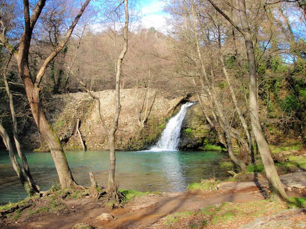
Bracciano Martignano Regional Natural Park is the protected area that holds together the two volcanic lakes north of Rome, the hills around them and about 10 municipalities between the province of Rome and that of Viterbo. Those who come here for the first time almost always make the same mistake: they think they're going to see a lake. In reality you're entering a system, and the system includes extinct craters, beech woods growing at absurdly low altitudes, a sulfur spring boiling in the middle of a forest, chestnut groves, pastures, a castle dominating the shore and a network of secondary roads that, if you have the patience to drive them slowly, tell you more than any information panel.
The park was established by the Lazio Region with regional law no. 36 of November 25, 1999, which brought under a single management a territory already partly protected by earlier measures. The total area of the protected zone is around 16,600 hectares, and the municipalities involved are 10: Anguillara Sabazia, Bassano Romano, Bracciano, Campagnano di Roma, Manziana, Monterosi, Oriolo Romano, Rome, Sutri and Trevignano Romano. The presence of Rome in the list always surprises those who read it for the first time, and yet it has a precise explanation that we'll see further on. The management is entrusted to a regional park authority with its administrative seat in the Lake Bracciano area.
Two thirds of the natural interest revolves around water. Lake Bracciano and Lake Martignano together cover about 40 percent of the entire protected area: 6,000 hectares of water surface, which for a regional park in central Italy is an out-of-scale proportion. Everything else, woods, farmland, natural monuments, villages, lives in relation to those two basins. Once you understand this, you also understand why a badly organized visit here disappoints, and a well-organized visit stays in your mind for years.

Where Bracciano Martignano Regional Natural Park Is and How You Really Get There
The park occupies the portion of Lazio between Via Cassia to the east and Via Braccianese to the west, with the northern edge touching Sutri and Monterosi and the southern one descending toward the Roman countryside of Olgiata and Osteria Nuova. As the crow flies, the center of Lake Bracciano is a little over 30 kilometers from the Grande Raccordo Anulare, which in theory means half an hour by car and in practice means anything between 40 minutes and two hours, depending on the day and the hour.
Those arriving by car have essentially three gateways. The first is Via Braccianese, which branches off Aurelia at Cerveteri and climbs toward Bracciano through the Manziana area: a convenient route, but one that clogs up in the final stretch on summer weekends. The second is Via Claudia Braccianese, which rises from northern Rome through La Storta and Osteria Nuova and reaches Anguillara Sabazia: it's the road the Romans use and for that reason it's also the one that jams first. The third is Cassia bis to Campagnano di Roma and then the descent toward Trevignano through the countryside of Sacrofano and Formello: longer, much more beautiful, and almost always faster on days of heavy traffic. The practical advice is to enter from one side and leave from the other, because the park is better understood if you cross it instead of just reaching it.
The train is a serious and underrated option. The regional rail line departing from Roma Ostiense and Roma Valle Aurelia serves the stations of Anguillara, Bracciano and Manziana with a frequency of about half an hour on weekdays that thins out on holidays. The Anguillara Sabazia station is a few kilometers from the historic center, with an elevation gain to tackle on foot or by local bus. The Bracciano one, on the other hand, is relatively close to the town and lets you reach the castle by walking uphill for about 20 minutes. Those who want to see the lake without a car have to keep in mind that the shores aren't served by continuous circular public transport: there are connections between the towns, but not a line that goes around the lake with the frequency you'd imagine.
Lake Martignano is a case apart and deserves to be mentioned right away, because it's the main source of misunderstandings. You can't drive to the shore. The paved road ends in a paid parking area on the plateau, and from there you walk down a dirt track for about a kilometer and a half, with an elevation change that on the way back up, in the three o'clock sun, makes itself felt indeed. In the busiest periods a shuttle service run by local operators is active. Those who arrive with swimsuit, beach umbrella, cooler and two small children, not knowing this, spend the rest of the day regretting the choice. Those who know it set out light and find one of the most beautiful places in Lazio.
What Bracciano Martignano Regional Natural Park Really Is: 10 Municipalities, Two Craters, One System
The first thing to clarify concerns the word park. In the minds of many Italian visitors a natural park is an enclosure with a gate, a ticket and a marked trail. Here it doesn't work that way. Bracciano Martignano Regional Natural Park is a protected area under regional management that sits on a territory that is inhabited, farmed, crossed by provincial roads and populated by tens of thousands of residents. You don't pay an entrance fee to the park, because the park includes whole towns, wheat fields, vineyards, private villas, campgrounds, restaurants and farms. If anything, you pay for parking in some parking areas, or for access to certain private beach establishments and services on the shore, which is a completely different thing.
The territory was born from a volcanic complex that geologists call the Sabatini district, active between about 600,000 and 40,000 years ago. The eruptions, mostly explosive, emptied the magma chambers and caused the collapse of the surface: from these collapses came the depressions that now contain the two lakes. Lake Bracciano occupies the main caldera, with an almost circular shape about nine kilometers in diameter and a maximum depth of over 160 meters. Lake Martignano, much smaller, occupies a secondary crater and is about 60 meters deep. Between the two runs a short ridge that, from above, shows the whole thing clearly: two holes in the ground, one large and one small, filled with rainwater and groundwater.
Everything else is arranged around these two depressions. To the west, toward Manziana and Canale Monterano, the most interesting woods open up along with the manifestations of secondary volcanism: fumaroles, sulfur springs, ground that gives off a smell of rotten eggs recognizable from dozens of meters away. To the north, toward Oriolo Romano and Sutri, the landscape becomes that of the southern Tuscia, with the low-altitude beech woods and the cuts in the tuff. To the east, between Campagnano and Formello, the park fades into the Roman countryside and borders the Veio Park. To the south you descend toward the plain of the Arrone, the outflow stream that carries the water from Lake Bracciano to the sea, near Fregene.

The Two Lakes: What You Can Do and What You Should Know First
Lake Bracciano isn't a lake like the others, and the reason is administrative even before it is natural. It constitutes a strategic water reserve for the city of Rome, to which it is connected through an intake structure and a dedicated aqueduct. This function, which dates back to the late 19th century with the construction of the Paolo Tosi Nuovo aqueduct, has conditioned the whole recent history of the basin and continues to condition its management. Rome appears among the park's municipalities for this reason too: a portion of the capital's municipal territory extends all the way here, into the area that includes Lake Martignano and the surrounding land.
The practical consequence is that the rules on the use of the water are stricter than most visitors expect. Swimming in Lake Bracciano is regulated: it's allowed in the stretches identified and monitored by the health authorities, with periodic checks on water quality, while in other sectors of the shore it's prohibited. Every season the Region and the municipalities publish the suitable stretches, and they don't necessarily coincide from one year to the next. To claim that you can swim anywhere in Lake Bracciano is false, and to claim that you can't swim anywhere is equally false. Those organizing a day here would do well to check the current situation with the municipality of the shore they intend to visit, because the ordinances change and the signs on site are the only reference that really counts.
The chapter on the water level deserves measured words. Over the years Lake Bracciano has gone through phases of significant lowering of the level, with a particularly acute crisis in the summer of 2017, when the combination of a prolonged drought and withdrawals for the capital's water supply made the water visibly retreat from the shores. On that occasion the Lazio Region intervened with measures limiting withdrawals, and the matter made the front pages of the national newspapers. Since then the level has seen recoveries and new dips, in relation to rainfall and management choices. I'm not giving a figure here, because it would be a number destined to be wrong within a few weeks: those who want the exact number will find it in the regional hydrological bulletins. What can be said with certainty is that the attentive visitor recognizes on the shores the strip of land exposed in the low-water years, recognizable by the pioneer vegetation colonizing it and by the different color of the pebbles.
On permitted activities, the picture is this. Navigation with internal combustion engines is subject to severe limits on Lake Bracciano, with the aim of protecting the quality of the water intended for human consumption: sailboats, canoes, kayaks, stand-up paddleboards, electric boats and small authorized craft are on the water. This is the reason the lake has become one of the centers of Roman sailing, with historic clubs spread among Bracciano, Anguillara and Trevignano, and for which in summer its waters remain extraordinarily quiet compared to any other body of water at a similar distance from a large city. Fishing is regulated by licenses and calendars that set periods, gear and minimum sizes. Scuba diving is practiced, with visibility that varies a great deal depending on the season and the area.
Lake Martignano, being much smaller and almost entirely free of buildings on its shores, has a different physiognomy. The shore is largely occupied by meadows that go straight down into the water, without construction, and this has given it a reputation as a wild lake. The reputation is partly deserved and partly not: on days of heavy summer crowds the main meadow fills up to the point that it's hard to find a spot, and the kiosks on the shore provide a fully commercial service. The difference from the larger lake is that here, if you walk 20 minutes along the shore away from the shuttle arrival point, you find silence almost everywhere. For Martignano too, the principle of checking signs and ordinances on swimming before going into the water applies.
Finally there's the chapter on land activities. The perimeter of Lake Bracciano is traced by a cycling and walking ring that over the years has been the subject of completion projects. Some stretches are equipped and signposted, others force you to travel short portions of provincial road. Horseback riding has an established tradition, with riding stables spread across the whole area and routes that climb toward the Sabatini. Birdwatching, in the park's wetlands and in particular in the Pantane di Trevignano sector, is a serious pursuit that brings ornithologists here from all over Italy in the winter months.
A Curiosity About Bracciano Martignano Regional Natural Park
The curiosity concerns a tree that shouldn't exist here. In the Caldara di Manziana, inside the park's perimeter, a birch wood grows. The birch is a northern species, which in Italy is normally found in the Alps and at a few high-altitude Apennine sites. Finding it at a little over 300 meters above sea level, an hour from Rome, in an area where summer temperatures exceed 35 degrees, is an apparent contradiction.
The explanation combines the glaciation and the volcano. During the last glacial phase the birch occupied vast portions of the peninsula, including Lazio. With postglacial warming the species retreated north and uphill, and disappeared from almost all of central Italy. In some spots, though, local conditions allowed it to hold on, and the Caldara is one of those spots: the acidic soil, saturated with sulfur compounds emitted by the fumaroles, is toxic to the Mediterranean species that would otherwise have supplanted the birch. In practice the gas coming out of the ground keeps competitors away, and the birch, which tolerates those conditions better than others, survives in an ecological island of a few dozen hectares. It's a glacial relic kept alive by a dormant volcano: two opposing forces that have balanced each other for 10,000 years.
Walking in the Caldara requires attention. The gas that surfaces is heavier than air and tends to stagnate in the hollows of the ground, so the indications of the managing authority are clear about the points not to approach and about the ban on lying on the ground or letting dogs stick their noses into the pools. No alarmism, but it's one of the few places in Lazio where the rules of behavior have a chemical basis and not an aesthetic one. The forest floor, in spring, fills with wild orchids, and the contrast between the delicacy of the flowers and the white bottom of the sulfurous water is what visitors remember most.
The Villages of the Park: Bracciano, Anguillara Sabazia, Trevignano Romano
Three towns face the larger lake directly, and they have three different characters, to the point that choosing one means choosing a completely different day.
Bracciano is the largest center and the one with the most famous monument. The town sits on a terrace about 100 meters above the lake level, which gives it a magnificent view and takes away its direct relationship with the water: from the historic center to the shore at Marmorata it's three kilometers downhill. Castello Odescalchi dominates the town with its five cylindrical towers and is one of the best-preserved Renaissance castles in Italy, still privately owned and open to visit with a guided tour. Built by the Orsini between the middle and the end of the 15th century, it passed in 1696 to the Odescalchi, a family of Como origin that had given the Church Pope Innocent XI. The rooms hold frescoes by the Zuccari, armor, tapestries and a decorative apparatus that conveys the idea of a residence both fortified and stately. The sentry walkway at the top offers the highest vantage point over the lake open to the public.
Anguillara Sabazia has the most theatrical position of the three. The old village occupies a promontory that juts into the lake, and seen from the water or from the road arriving from the south it looks like a moored ship. You enter through a gate with a clock, climb narrow alleys to the collegiate church of Santa Maria Assunta and come out on a terrace looking north toward Trevignano. The lower part, along the shore, is the one with the restaurants and the evening stroll. Anguillara also has the practical advantage of being the center closest to Rome and the easiest to reach by train, which is why on summer evenings it fills up with Romans who arrive for dinner and leave at night.
Trevignano Romano is the quietest and for many the most beautiful. The town stretches along the northern shore below the remains of the Orsini fortress, with a pedestrian lakefront that in summer becomes the living room of the whole area and a series of places that have raised the level of lakeside dining in recent years. The church of the Assunta keeps a frescoed apse of the Raphaelesque school that almost nobody expects to find in a town of 5,000 inhabitants. Behind Trevignano you climb toward the ridge separating the two lakes and toward the Pantane, the wetland that hosts the greatest concentration of birdlife in the park.
Outside the lake ring are the other municipalities, less visited and often more interesting for those looking for substance. Canale Monterano, on the western edge, holds the ruins of ancient Monterano, a village abandoned in the 19th century where you can recognize a fountain and a church designed by Gian Lorenzo Bernini, and where dozens of films have been shot. Sutri, to the north, preserves the amphitheater carved into the tuff, the mithraeum and the Etruscan necropolis, united in the Regional Natural Park of the Ancient City of Sutri. Nepi and Calcata lie just outside the perimeter but belong to the same world of ravines and tuff. Oriolo Romano has an Altieri palace with a gallery of papal portraits and, behind it, the beech wood that made it famous, as well as the Mola di Oriolo Romano complex.

Something Nobody Tells You About Bracciano Martignano Regional Natural Park
Almost all the guides describe the park as a summer destination. It's the most widespread mistake and the most costly in terms of experience. From mid-June to the end of August this territory shows its worst: the access roads clog up, parking lots fill by 10 in the morning on weekends, the meadows of Martignano fill up, the lakefront restaurants work under pressure and the quality of service suffers, the heat on the lake is humid and sticky because the water evaporates and the air stagnates in the basin. Those who come in August see a worsened version of what the park can offer, and often go home convinced it's an overrated place.
The real season here runs from October to May, and the best month of all is November. The reason is the light. The lake basin, surrounded by low reliefs, generates in fall and winter an optical phenomenon that regulars know well: on cold mornings after a clear night a thin mist forms and stays suspended half a meter above the water, and when the sun pierces it from the east the lake becomes a surface of white metal with the outlines of the towns emerging like islands. It lasts an hour, maybe two, and then it's over. Nobody photographs it because nobody is there at that hour in that month.
Third thing, more technical. The park's perimeter includes portions of territory belonging to large private properties, historic estates covering hundreds of hectares that are not freely accessible. The most debated is the Vicarello estate, on the western shore of the lake, a complex with thermal springs known since Roman times, which in past years has seen changes of ownership that fueled a local public debate on the fate of the large lakeside estates. Visitors who consult a map and see a road that seems to lead to the shore must allow for the possibility of finding a closed gate: being inside a protected area doesn't mean having a right of way everywhere, and this is one of the main differences between an Italian park and a US national park.
The Advice I Give You for Visiting Bracciano Martignano Regional Natural Park
There is only one piece of advice and it goes against everyone's instinct: don't spend the day on the shore. The lake is better seen from above than from within, and the park is only understood by climbing.
The day I recommend starts early, around eight, from Trevignano Romano. You leave the car in the upper parking lot of the town and walk up to the ruins of the fortress: half an hour of climbing, with a full panorama of the lake from the north, Bracciano and the castle on the right and Anguillara at the far end. From there you continue along the ridge eastward toward Martignano, following the dirt track that crosses the fields. In an hour and a half of walking you reach the point where you can see both lakes at the same time, one on each side, and that is the moment when the landscape explains itself: the large caldera and the small crater, separated by a strip of land a few hundred meters wide.
For those with two days, the second should be spent entirely in the western sector: Macchia Grande di Manziana in the morning, Caldara in late morning, lunch in Canale Monterano, afternoon among the ruins of ancient Monterano and the Diosilla waterfall. It's a day without a lake and without even a famous viewpoint, and it's the day you remember longest.
Flora and Fauna of Bracciano Martignano Regional Natural Park
The belt of hills surrounding the shores enriches the variety of the park in a way the distracted observer doesn't notice. Pastures and farmland draw a countryside still on a human scale, particularly in some sectors of the protected area such as the Vicarello estate zone, and this alternation between open and closed environments is exactly what multiplies the number of species. A continuous forest hosts less life than a mosaic of woods, meadow, hedgerow and water, because every edge is one more habitat.
The simultaneous presence of lakes, woods, pastures and farmland makes the park's fauna particularly rich, and the fact that stands out most concerns the birds.
The park's territory is the second wetland in Lazio for the number of wintering waterfowl, after Circeo National Park. 162 bird species have been identified, 79 of them nesting, a number that is very high for a regional protected area of this size. Among the most significant species is the red-crested pochard, Netta rufina, a rare diving duck of eastern origin, present above all in Lake Martignano with high values even at the national level: it's a showy duck, with a reddish head and a coral-red bill in the male, easily observed with binoculars from the shores in the cold months. Alongside it are the ferruginous duck, Aythya nyroca, a species of European conservation interest, and the black-throated loon, Gavia arctica, which winters on the larger lake and is recognized by its low silhouette and its habit of disappearing underwater for long stretches.
On the mammal side, the population is particularly significant for the presence of the wildcat, Felis sylvestris, and the Italian hare, Lepus corsicanus, two native species of great interest and very difficult to observe: the wildcat is nocturnal and shy, and the Italian hare is told apart from the European one by features that require an expert eye. Also notable is the presence of introduced species, such as the fallow deer, Dama dama, the mouflon, Ovis musimon, and above all the wild boar, Sus scrofa, all three possible prey of the wolf, Canis lupus, for which a stable population has been reported several times in the areas bordering the park's territory in the municipalities of Vejano, Barbarano Romano and Civitella Cesi. The return of the wolf to the Tyrrhenian area north of Rome is one of the most significant faunal phenomena of recent decades and directly concerns the ecological link between the Sabatini, the Tolfa mountains and the Cimini.

Another Well-Known Fact, Yet Rarely Cited
The well-known fact is that Rome drinks the water of Lake Bracciano. Almost all Romans know it, at least vaguely. What almost nobody connects to this information is the political and landscape consequence: half of the rules that govern this territory exist to protect a water conduit, not to protect biodiversity.
The story begins in 1870, when the city, newly made capital, finds itself with an insufficient water network. In 1885 an aqueduct goes into operation that draws water from Lake Bracciano and carries it to Rome: since then that reserve has been the emergency tank the capital draws on when the Apennine springs aren't enough. The ban on navigation with internal combustion engines, the limits on discharges, the controls on wastewater treatment in the lakeside municipalities, the severity of the swimming regulations, the difficulty of obtaining concessions on the shores: all of this descends from there. A lake that feeds an aqueduct is an infrastructure, and infrastructures have different rules from places of leisure.
The flip side is that this restriction has saved the lake. Just compare the Bracciano shore with that of other Italian bodies of water at a similar distance from a large city to realize what would have happened without it. Here there are no motorboats, no jet skis, no continuous curtain of tourist construction that elsewhere has erased the shore. The silence of Lake Bracciano in summer, when you move 200 meters away from the access points, is a rare condition, and it isn't due to an environmentalist choice: it's due to a pipe.
The second side of the fact is the less comforting one. A lake that serves as a water reserve is a lake under pressure, and the 2017 crisis made it visible to everyone. When the level drops, the capacity to dilute nutrients drops, the concentration of the substances present increases, the reed belts that filter the water shorten, the lake bed emerges and the riparian vegetation retreats. The debate between those who ask to guarantee the capital's supply and those who ask to guarantee the balance of the basin has been open for decades and has no simple solution, because both needs are legitimate. The visitor who walks on the shore and sees a strip of white pebbles a few meters wide is looking at the physical trace of that discussion.
The Right Photo to Take at Bracciano Martignano Regional Natural Park
The photograph everyone takes is the castle of Bracciano with the lake behind it, shot from the town's viewpoint. It's a beautiful image and also the most overused in all of northern Lazio. The right photograph is another one and requires two hours of walking.
It's the framing from the ridge between the two lakes, at the point where the trail from Trevignano toward Martignano reaches its maximum elevation. From there you see Lake Bracciano filling the whole left half of the field of view and Lake Martignano filling a corner of the right half, with the cultivated plateau in the middle. The good light arrives in early morning, when the low sun from the east lights up the surface of the larger lake and leaves the Martignano basin in shadow, or in the last hour of the day, with the situation reversed. You need a wide-angle lens to keep both inside, or the smarter choice, which is to give up the wide angle and take two separate shots with a normal lens: the panoramic photo flattens distances and removes exactly the thing that makes the spot interesting, namely the difference in scale between the two craters.
Some Important Events That Happened Here in History
The history of this territory begins long before the Romans, and it begins underwater. During work on the lake bed of the southern shore of Lake Bracciano, at La Marmotta, in the municipality of Anguillara Sabazia, the remains of a submerged Neolithic village dating to around the middle of the 6th millennium BC were identified. The site, preserved by water and sediment, yielded wooden structures, tools, seeds, textiles and above all dugout canoes made from single oak trunks, among the oldest known boats of the Mediterranean. One of these canoes is on display in a museum in Rome. The find changed the understanding of the spread of agriculture on the Italian peninsula and showed that these shores were permanently inhabited 8,000 years ago.
In the Augustan age the Aqua Alsietina was built, the aqueduct that drew from Lake Martignano and fed Augustus's naumachia in Trastevere. In 109 AD the emperor Trajan inaugurated the Aqua Traiana, which drew from the springs of the western basin of Lake Bracciano: a large-scale hydraulic engineering work, with tunnels and shafts still partly passable today, which supplied Rome for centuries. In the same era the baths of Vicarello, the Aquae Apollinares, were in operation, frequented for their thermal waters and known for an exceptional votive deposit: thousands of coins, from the oldest of pre-Roman date to imperial ones, thrown into the spring by generations of visitors.
The Middle Ages brought incastellamento. Between the 10th and 12th centuries the villages perched on the promontories and ridges, and the cores of Anguillara, Trevignano and Bracciano were born in the form we recognize. The Anguillara family and then the Orsini contended for and finally divided up control of the shores. Between 1470 and 1485 Napoleone Orsini and his son Gentil Virginio had the castle of Bracciano built, designed to withstand firearms and at the same time to serve as a stately residence.
In 1496 the castle was besieged by the troops of Pope Alexander VI, at war with the Orsini: the fortress held, and the episode consolidated the building's fame as one of the strongest fortifications of the Papal State. In the 16th century the castle hosted the passage of leading figures and was the stage, in 1576, of an affair that has fed popular literature for centuries: the death of Isabella de Medici, wife of Paolo Giordano Orsini, which took place in the villa of Cerreto Guidi in Tuscany but was told in many later versions that tied it to the castle of Bracciano and to the figure of her husband. The legend of Isabella's ghost in the castle comes from this intertwining of chronicle and narrative.
In 1696 the Orsini, in debt, ceded the fief and the castle to the Odescalchi, a Lombard family enriched by trade and risen to the top of the Church with Innocent XI. The property, with a 19th-century parenthesis, has remained with the same family to this day, which is the reason the castle has been preserved as a unified complex instead of being broken up.
The 19th century brought two transformations. The first was the arrival of the modern aqueduct, drawing from the lake to supply Rome as capital. The second was the railway: the Rome-Viterbo line, opened in the last quarter of the century, connected the lake towns to the city and started the phenomenon of lakeside holidays, with the construction of villas and hotels along the shores.
The 20th century left heavy marks. During World War II the area was affected by the passage of the front in June 1944, with bombing of rail junctions and bridges and with the German retreat to the north. The airfield of Vigna di Valle, on the southern shore, had a military role. That field has a history that begins much earlier: in 1908 the first Italian aeronautical yard for airships was set up there, and the lake served as a body of water for seaplane trials. Today Vigna di Valle hosts the historical museum of the Italian Air Force, with a collection of aircraft among the most important in Europe, facing directly onto the water.
In the postwar period, with mass motorization, the lake became the Sunday destination of the Romans, with all the consequences: scattered building, second homes, pressure on the shores. The institutional reaction matured slowly and led to the creation of the protected area with the regional law of 1999, preceded by measures of partial protection. In 2017 the water crisis brought the lake back to the center of the national debate. In the following years the issue of managing withdrawals, wastewater treatment in the lakeside municipalities and limiting land consumption has remained the main knot of local politics.
Who Has Passed Through Bracciano Martignano Regional Natural Park
The list is long and curiously tilted toward cinema.
Among historical figures, the castle of Bracciano records leading guests: Charles VIII of France during the descent into Italy in 1494, according to local tradition. Popes, cardinals and condottieri over the course of the 16th century. Queen Christina of Sweden, who in the 17th century frequented the Roman milieu and its fiefs. Paolo Giordano Orsini and Isabella de Medici remain the two figures that popular storytelling has tied most closely to the walls.
The richest chapter, though, is the 20th-century one. The park's territory has been one of the favorite sets of Italian and international cinema. The ruins of ancient Monterano, in the municipality of Canale Monterano, have hosted dozens of productions among spaghetti westerns, historical films and auteur films: the landscape of ruins and vegetation has served in turn as Mexico, as the Holy Land, as a ghost town. Among the titles most cited by local memory are genre films of the 1960s and 1970s and later productions that made use of the ruined church and the aqueduct.
Castello Odescalchi has hosted film and television shoots, and has entered the international society pages for the weddings celebrated in its halls and gardens: the best known is that of Tom Cruise and Katie Holmes in November 2006, which brought Bracciano an unprecedented amount of international press for a town of that size. Other weddings of show business and sports figures followed in the following years, consolidating the castle's fame as a luxury location.
Finally there is a category of passage worth mentioning, which concerns pilgrims. Via Francigena, the route that leads from northern Europe to Rome, crosses the northern sector of the park passing through Sutri and descending toward Campagnano di Roma and La Storta. Thousands of walkers a year cover these stages, and in the spring and fall months the towns along the route see a steady flow of wayfarers with backpack and staff, exactly as 1,000 years ago.
When to Go to Bracciano Martignano Regional Natural Park and When to Avoid It
The ideal calendar has a precise shape.
From mid-March to the end of May is the best period for walkers. The woods fill with blooms, the wild orchids of the ridges peak in April, the temperatures allow long routes and visibility is excellent because the air is still washed by the rains. Grebes perform their courtship display on the larger lake and bird activity is intense. The only drawback is the mud on the trails after rain, which in the western sector, where the soil is clayey, can make some stretches impassable.
July and August are the months to avoid, unless you come exclusively for a swim and are willing to arrive early and leave late. On weekends in these months the Martignano parking area is full by mid-morning, traffic on the Braccianese and the Claudia jams up, the lakefronts of Trevignano and Anguillara become impassable and restaurants require reservations days in advance. The heat, as mentioned, is humid and heavy. Those who absolutely must come in August should choose a Tuesday or a Wednesday and focus on the inland sectors, where the shade of the woods makes everything bearable.
October and November are the season of the woods and the food festivals. Chestnuts, mushrooms, hazelnuts, late grape harvest: the park's agricultural economy is at work and on show. Macchia Grande in this period is a different place from summer, and the Caldara in the cold air produces the maximum visibility of the exhalations. November brings the morning mist over the lake, which as mentioned is the most beautiful thing this territory offers.
December, January and February are the months of birdwatching. Wintering birds are present in maximum numbers, the red-crested pochard at Martignano is easy to observe, the larger lake hosts loons and diving ducks. The days are short and many tourist activities reduce their hours or close, but those who come for the wildlife find the best condition of the year. The cold in the basin is noticeable, with frequent night frosts and high humidity.
What Is Around Bracciano Martignano Regional Natural Park
The park works well as a base for a much wider area, because it sits at the center of a rich and little-trodden quadrant.
To the north you enter the Tuscia. Sutri with its amphitheater in the tuff is reached in 20 minutes from Monterosi. Nepi with its ravines and its waters is just beyond. Calcata, perched on a spur above the Treja valley, is one of the most photographed villages in Lazio. Continuing on you reach Viterbo with the medieval quarter of San Pellegrino and the Palace of the Popes, and farther north Lake Vico, the other great crater lake of Lazio, protected by the Lake Vico Nature Reserve, and Lake Bolsena.
To the west you descend to the sea in 40 minutes. Cerveteri with the Banditaccia necropolis is the obligatory stop for those interested in the Etruscans. Ladispoli and the Santa Severa beach with the Santa Severa castle offer the seaside alternative. The Bosco di Palo preserves a strip of coastal plain forest that was the original vegetation of the whole coast. Climbing into the Tolfa mountains you find Tolfa and Allumiere, with the Allumiere Beech Forest and a mining history tied to alum that shaped the economy of the Papal State for centuries.
To the east and south the park borders the Veio Park, which protects the ravines of the northern sector of Rome and the archaeological area of the Etruscan city, and farther down the Roman countryside and the Castel di Guido Oasis. In the area immediately adjoining the perimeter, toward Cerveteri, the Cascatelle di Fosso del Norcino are worth the detour, and toward Bassano Romano the territory of Barbarano Romano with the Marturanum park.
Those who want to stay inside the park but away from the lakes have three destinations worth the day: the Macchia Grande Woods of Manziana, the Caldara di Manziana and Monte Lagusiello, to which is added, toward the north, the Beech Wood of Oriolo Romano with the Mola di Oriolo Romano complex.
Quick Questions About Bracciano Martignano Regional Natural Park
Do You Pay a Ticket to Enter the Park?
No. The protected area includes towns, public roads and countryside, and access is free. What you may pay for is parking in some parking areas, private beach establishments on the shore, shuttle services and admission to monuments like the castle of Bracciano or the Air Force museum.
Can You Swim in Lake Bracciano?
Swimming is regulated: it's allowed in the stretches identified and monitored by the competent authorities and prohibited elsewhere. The suitable stretches are set seasonally and may vary from one year to the next, so checking with the municipality of the shore concerned and reading the signs on site are indispensable before going into the water.
How Big Are the Two Lakes?
Lake Bracciano is almost circular in shape, with a diameter on the order of 9 kilometers and a maximum depth of more than 160 meters. Lake Martignano is much smaller, with a maximum depth of around 60 meters. Together they cover about 40 percent of the park's surface.
Can You Drive to Lake Martignano?
No. The paved road ends in a parking area on the plateau and you walk down to the shore along a dirt track of about a kilometer and a half, with an elevation change. In the busiest periods a shuttle service is active. It's best to arrive light.
Are There Marked Trails?
Yes, there is a network of hiking routes managed by the park authority, with loops around the larger lake, ridge routes between the two basins and trails in the woods of the western sector. Maintenance of the signage is not at the same level everywhere, so a track downloaded in advance to your phone remains useful, also because network coverage is patchy.
How Many Municipalities Does the Park Include?
10: Anguillara Sabazia, Bassano Romano, Bracciano, Campagnano di Roma, Manziana, Monterosi, Oriolo Romano, Rome, Sutri and Trevignano Romano, spread between the province of Rome and that of Viterbo. The total area is around 16,600 hectares.
When Was It Established?
With Lazio regional law no. 36 of November 25, 1999, which brought under a single management a territory already covered by earlier forms of protection.
In our judgment Bracciano Martignano Regional Natural Park is the protected area in Lazio that pays the highest price for its proximity to Rome. It gets consumed as a freshwater beach by people with a free afternoon, and almost never read as a system. Those who make the effort to climb the ridge, to enter the Manziana woods in November, to go down into the Caldara with the calm needed to understand why birches grow there, find a territory of rare density: volcanology, Neolithic archaeology, imperial aqueducts, Renaissance castles, wintering birdlife and an open water question, all within 16,000 hectares. It's not a place to look at for an hour from the viewpoint. It's a place that asks for time and gives back in proportion.
Frequently Asked Questions About Bracciano Martignano Regional Natural Park
Do You Pay a Ticket to Enter Bracciano Martignano Regional Natural Park?
No, Bracciano Martignano Regional Natural Park has no entrance ticket: the protected area includes towns, public roads and countryside, and access is free. What you may pay for is parking in some parking areas, private beach establishments on the shore, shuttle services and admission to monuments like the castle of Bracciano or the Air Force museum.
Can You Swim in Lake Bracciano?
Swimming in Lake Bracciano, within Bracciano Martignano Regional Natural Park, is generally allowed, but the lake is also a strategic water reserve for Rome, connected through the Paolo Tosi Nuovo aqueduct since the late 19th century. This function has conditioned many of the rules governing the surrounding territory.
How Far Is Bracciano Martignano Regional Natural Park From Rome?
The center of Lake Bracciano is a little over 30 kilometers from the Grande Raccordo Anulare, which in theory means half an hour by car from the capital. The park occupies the portion of Lazio between Via Cassia to the east and Via Braccianese to the west.
Which Village Should You Choose for Visiting Bracciano Martignano Regional Natural Park?
Three villages face the larger lake of Bracciano Martignano Regional Natural Park, each with a different character: Bracciano is the largest center, with the most famous monument, the castle, but on a terrace that takes away the direct relationship with the water. Anguillara Sabazia and Trevignano Romano offer different experiences, more tied to the lakefront.
What Is the Best Time to Visit Bracciano Martignano Regional Natural Park?
From mid-March to the end of May is the best period for walkers in Bracciano Martignano Regional Natural Park: the woods fill with blooms, the wild orchids of the ridges peak in April and the temperatures allow long routes. From mid-June to the end of August, on the other hand, the territory shows its worst, with roads and parking lots congested on weekends.
What Botanical Curiosity Is Found in Bracciano Martignano Regional Natural Park?
In the Caldara di Manziana, inside the perimeter of Bracciano Martignano Regional Natural Park, a birch wood grows, a species normally found in Italy in the Alps or at a few high-altitude Apennine sites. Finding it at a little over 300 meters above sea level, an hour from Rome, is an unusual fact that deserves a stop.
What to See Near Bracciano Martignano Regional Natural Park?
To the north, from Bracciano Martignano Regional Natural Park you enter the Tuscia: Sutri with its amphitheater in the tuff is reached in 20 minutes from Monterosi, Nepi with its ravines is just beyond, and Calcata, perched on a spur above the Treja valley, is one of the most photographed villages in Lazio.
Article written by the editorial team of TourLeaderPro, contact them for Private/Corporate/V.I.P. Tours and Experiences. For an organized day on the lakes north of Rome, with a licensed tour guide, start from the TourLeaderPro contact page. Tour operators building itineraries in inland Lazio will instead find the consulting service in the section dedicated to tour operators.
Planning a trip to Rome? The English guides to visiting the city are on ItalyPlanner.com. For those thinking in terms of days out of the city there is the guide to the best day trips from Rome.