Park and Baths of Mola di Oriolo Romano
In short. First a clarification, because it is the source of almost all the misunderstandings: the Park and Baths of Mola di Oriolo Romano is not a spa.
What the Park and Baths of Mola di Oriolo Romano really are
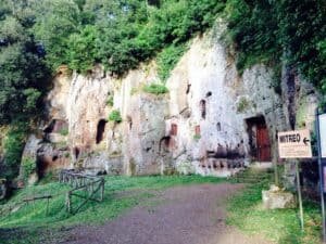
First a clarification, because it is the source of almost all the misunderstandings: the Park and Baths of Mola di Oriolo Romano is not a spa. There is no ticket booth with a turnstile, no reception with bathrobes hanging up, nobody to walk you to the changing cabin. It is a wooded valley floor about five kilometers from the town center of Oriolo Romano, in the province of Viterbo, where a stream drops between tuff walls, forms a waterfall, widens into a small pond and continues toward the Mignone. Next to that drop of water stands the ruin of a 16th-century mill, the Mola itself, and a little farther on, two shallow pools fed by a lukewarm sulfurous spring. That's all. And precisely because that's all, it is one of the most beautiful and most misunderstood places in northern Lazio.
The word "terme" in the name is therefore a linguistic inheritance, not a commercial promise. It points to the presence of thermomineral waters, that is, springs that come out of the ground at a temperature higher than that of the air and loaded with dissolved salts, and that presence is documented and verifiable: you smell the sulfurous emissions long before you see them. The main spring of the Mola gives water between 25 and 28 degrees Celsius, which means that in summer it will feel cool and in winter lukewarm, and that in no case will you find a steaming jet like those of the Bullicame in Viterbo. If someone told you otherwise, they told you something that isn't there. There is no up-to-date official information on the current state of the pools, on their actual accessibility or on any bans or ordinances: better to know that before you leave.
That said, with the misunderstanding cleared away, one remarkable thing remains. The Park and Baths of Mola di Oriolo Romano is a piece of landscape in which, within a few hundred meters, you find layered a Renaissance hydraulic system, a geothermal phenomenon tied to the volcanism of the Sabatini Mountains, a watercourse that appears in the Aeneid, a beech forest recognized by UNESCO that grows at an elevation where beeches normally don't grow, and a planned town founded on the drawing board in the 1500s. I don't know many valley floors in Italy that manage to bring together five such different things in a space you can walk in half an hour.
Why they call it a Mola and not a mill
"Mola" is the term that in Lazio, in Umbria and in a good part of central Italy indicates a water-powered milling plant. It comes directly from the Latin mola, the millstone, and by metonymy came to designate the whole building. In Lazio place names you find dozens of them: Mola di Bagni, Mola di Formello, Mola di Monte Gelato, Mola della Corte, and this one, the Mola di Oriolo, which the old-timers of the area prefer to call Mola del Biscione after the name of the stream that fed it. Every time you meet a place name beginning with Mola on a map of Istituto Geografico Militare, you can bet that water flows underneath and that someone, at some point, built on it.
The name is a guide to reading the landscape: it says that the place was not chosen for beauty but for water flow, and that the beauty came later, when the plant was abandoned and the vegetation took it back. It is a story that repeats across the whole of southern Tuscia, and knowing it changes the way you look at a tuff wall eaten by moss.
Where exactly the Park and Baths of Mola di Oriolo Romano are
The coordinates are roughly 42.17 north latitude and 12.09 east longitude. Administratively we are in the municipality of Oriolo Romano, province of Viterbo, postal code 01010, but real geography counts more than administrative geography. We are on the northern slope of the Sabatini Mountains, the volcanic complex that produced Lake Bracciano, in a transition belt where the tuff plateau begins to slope down toward the Mignone basin and toward the Lazio Maremma. It is a border, and geographic borders are always the most interesting places, because that is where things mix.
To the south and east you have the crater of Bracciano with its lake, to the north the volcanic complex of Vico with its own, to the west the descent toward the sea at Civitavecchia and Tarquinia. Oriolo sits in the middle, on a shelf a little under 400 meters above sea level, and the park of the Mola sits lower, in the valley floor cut by the stream. This difference in elevation, which sounds like a surveyor's detail, is actually the key to everything: it is the drop that made the mill work, it is the basin that holds the humidity and lets the beech live where it shouldn't, and it is the reason why at the bottom of the valley it is always a few degrees cooler than in town.
The relationship with Rome
From Rome it is about 60 kilometers as the crow flies, which become a good hour by car via the Cassia bis and then the provincial road that climbs toward Bracciano and Manziana. It is not a trip you improvise in the late afternoon, but it is comfortably a day. What always surprises first-timers is how quickly the landscape changes: once you are past Cesano, past the ring around the lake, the tuff takes over, the houses thin out, the woods close over the road, and in 20 minutes you are in a place that has nothing more to do with the Roman metropolitan area. It is the structural advantage of Tuscia: it is very close and feels very far.
Oriolo Romano, a town born from nothing in 1560
Here the story gets really interesting, and I ask you for a minute of attention because it is the thing that makes Oriolo different from all the other villages in the area. The vast majority of towns in Lazio have an origin that is lost: an early medieval castle, a fortified settlement of the 10th or 11th century, a resettled Etruscan nucleus, a parish church around which people gathered. Not Oriolo Romano. Oriolo Romano was founded from scratch, on land that had been woods and pasture, by the decision of a private individual, in 1560. It has a birth certificate, a plan and a patron. That makes it a late Renaissance planned town, and in Lazio you can count very few of them.
The patron was called Giorgio Santacroce, he belonged to a family of the Roman nobility long familiar on the Capitoline, and he owned in that area a wooded estate that earned little because there was nobody to work it. His idea was simple and ruthlessly modern: if there is no population, you import one. He granted favorable terms to those who agreed to move, had a regular urban layout traced, and had row houses built along parallel axes, so that each family unit had its own dwelling with a vegetable garden at the back. It was not philanthropy: it was an economic operation, and like all successful economic operations it left a lasting mark on the territory.
The fact that the town was born this way explains why walking through Oriolo you get a strange, almost unreal feeling: the streets are straight, they cross at right angles, the facades have a regularity that doesn't exist in villages that grew spontaneously. There is no alley that turns back on itself, no staircase that ends against a wall, no maze. There is a plan. And the Park and Baths of Mola di Oriolo Romano is, in this design, the productive infrastructure: the place where they ground the grain that this brand-new community had to eat.
What "planned town" means
In the history of urban planning, planned towns are settlements designed and built in a defined time, following a unified design, instead of growing by stratification. The Italian Renaissance produced some famous ones, from Pienza to Sabbioneta to Palmanova, almost always tied to the ambition of a lord. The ones in Lazio are more modest, more practical, more tied to agrarian land reclamation than to architectural theory, and for that very reason they better show how the economy of the Papal States really worked: a Roman noble with unproductive lands, capital to invest, peasants to attract, a mill to build because without a mill there is no bread and without bread there is no town.
If you keep this chain of logic in mind, the visit to the Park and Baths of Mola di Oriolo Romano changes meaning completely. You are not looking at a scenic ruin in the middle of the woods. You are looking at the engine of a successful demographic experiment.
Giorgio Santacroce and the family that bet on a forest
The Santacroce are one of those Roman houses that left more traces in place names than in textbooks. Their name survives in a small square in the historic center of Rome, in a few coats of arms over doorways, in a couple of family chapels. They were a baronial family of middling power, of the kind that in 16th-century Rome lived in the orbit of the great papal dynasties without ever becoming one: they never had a pope in the family, which was the decisive leap, and this kept them in a position of solid but limited importance.
Giorgio Santacroce therefore did what second-rank Roman nobles did: he invested outside the city, where land was cheap and where a well-managed fief could pay. The fact that in 1560 he decided to found a town instead of just renting out the pastures says something about the man: it took a certain amount of ambition, and also a certain amount of capital tied up for years before seeing a return. In 1573, 13 years after the founding, he had the mill built on the stream. That is the date you find in local memoirs, and it is the official birth date of the Mola.
13 years between the town and its mill is an interval worth a reflection. It means that in the early years the grain of Oriolo was taken elsewhere to be ground, with transport costs and dependence on someone else's plant. It means that the community first had to reach a critical mass large enough to justify the investment. And it means that when the Mola went into operation, the town had passed the critical phase and become a stable reality. The mill is not the beginning of the story of Oriolo: it is proof that the story of Oriolo was working.
The coat of arms and memory
Baronial coats of arms, on doorways and keystones, are the way families signed the territory. Anyone in the habit of looking up while walking through the villages of Lazio learns to recognize them and to date changes of ownership: a coat of arms chiseled off and replaced tells of a sale, a marriage or a confiscation. In Oriolo the overlap of different insignia is the most immediate trace of the passage from the Santacroce to the Altieri, and it is worth looking for it unhurriedly before going down to the Mola, because it is the quickest way to get the chronology of the place into your head.
The grid layout: how to read Oriolo Romano from above
The urban design of Oriolo is the thing I recommend you look at first, before the palace and well before the Mola, because it is the interpretive key to everything else. The town is organized on three parallel longitudinal axes, cut by orthogonal cross streets, in a grid scheme that any Roman recognizes immediately because it is the same principle as the castrum and the centuriation. It is not an erudite quotation: it is the most economical solution for dividing up flat land and distributing identical houses to identical families.
The three axes are not equivalent. The central one is the street of representation, the one that leads to the square and the baronial palace and works as the civic and ceremonial backbone. The two side ones are more workaday, more tied to labor, vegetable gardens, storerooms. Walking along them you clearly sense the drop in architectural dignity: the center has the best-kept facades, the most worked doorways, the most regular windows. The sides have the look of the farmhouse put in a line. It is a social hierarchy written in stone, and four and a half centuries later it still reads very well.
Then there is a detail worth pointing out. In a village that grew spontaneously, houses adapt to the terrain and streets follow the contour lines. Here the opposite happened: the terrain was adapted to the design. Where the natural ground was not regular enough, it was leveled. Where an alignment was needed, it was imposed. It is exactly the mental attitude that in the same years produced the great street straightenings in Rome, and seeing that logic applied to a little town of a few hundred souls in the middle of the Tuscia woods is a small free lesson in the history of urban planning.
Why the grid invites you down to the Mola
A regular layout also produces a precise psychological effect: it gives the feeling that the town ends. In medieval villages the built-up area fades into the vegetable garden, the garden fades into the field, and you never quite understand where the limit is. In Oriolo the limit exists, sharp, and beyond that limit the forest begins. That is why the relationship between the town and the Park and Baths of Mola di Oriolo Romano is so clean in the perception of those who live there: on this side geometric order, on that side the valley. Two worlds separated by a border you cross in five kilometers.
Palazzo Altieri, the backdrop of Oriolo Romano
At the end of the central axis, closing the perspective, stands the baronial palace. It was built by the Santacroce as the noble residence of the newly founded fief and then passed, with the fief, to the Altieri, who gave it the name we know today. It is a building that plays exactly the role the urban design assigns to it: it stands at the end of the main street, dominates it, and the street exists to lead to it.
Anyone arriving expecting a royal palace will be thrown off, and is right to be. It is not a palace that relies on exterior monumentality. Its quality is inside, in the frescoed rooms, in the decorative apparatus and above all in a collection that is the real reason scholars know Oriolo Romano: the gallery of portraits of the popes. It is one of those cases in which a peripheral building keeps something that in a big city would be buried among a thousand other things and that here, instead, stands at the center of attention.
The palace also looks out toward the territory, and this is another element of the plan: the baronial residence doesn't only look at the town the baron created, it also looks at the woods the baron owns. It is a double gaze, toward built order and toward natural resource, and it perfectly sums up the economy of a fief of this type. The Mola, down in the valley, is the point where those two gazes meet: infrastructure built inside the natural resource.
A practical note on access
Opening hours, days and fares are not given because they can't be reliably verified, and in this matter wrong information is worse than none: it makes you travel kilometers for nothing. The rule for the minor museums of Lazio is to treat them as not guaranteed until you have had direct confirmation, and to build the day so that a possible closed door doesn't ruin the trip. In the case of Oriolo it is easy, because the Park and Baths of Mola di Oriolo Romano doesn't close, has no ticket booth and has no hours.
The gallery of papal portraits: a series worth the trip
The collection of papal portraits kept in the palace of Oriolo is the most singular thing in town, and it deserves a pause. It is a series of effigies of the popes arranged in chronological order, an iconographic genre that in Rome in the 16th and 17th centuries spread enormously and that today strikes us as a little exotic. The underlying idea was to demonstrate the unbroken continuity of the apostolic succession: a chain of faces, one after another, as visual proof that the line had never been broken.
The problem, of course, is that nobody knew what the ancient popes looked like. The portraitists made do with what they had: conventional physiognomic types for the first centuries, established iconographies for saints already depicted elsewhere, and true portraits, often derived from famous originals, for the popes of the modern age. The result is a kind of stratigraphy of verisimilitude: going through the series you pass from pure invention to documentary portrait, and the point of transition tells more about the history of visual culture than many treatises do.
Then there is the political dimension, perhaps the most interesting. A series of popes in a palace owned by the Altieri is not a decorative whim: the Altieri gave the Church Emilio Altieri, elected pontiff in 1670 with the name Clement X. Having in the house the gallery of the predecessors, and therefore of one's own too, meant displaying one's belonging to the history of the universal Church. It is dynastic self-promotion done with the means of art, and it is a language that everyone in Baroque Rome understood perfectly.
How to look at them without getting bored
The risk of a long series is saturation: after 30 portraits the eye switches off. The remedy I recommend is to give yourself a criterion for reading instead of going in order. Look for changes in headgear, for example: the three-crown tiara, its shape lengthening and stiffening over the centuries, the moment the red camauro trimmed with fur appears. Or follow the hands: blessing, resting on the armrest, holding a document. Every choice of gesture is a message. Looked at this way, the gallery becomes a lesson in the semiotics of power that lasts 40 minutes and never tires.
From the Santacroce to the Altieri: how a fief changes owner
The passage of the fief of Oriolo from the Santacroce to the Altieri is the hinge between two eras of the town. On the precise dates of this transfer the local sources don't always agree, and I don't want to give you a year that you then find contradicted by a plaque or a book. What is certain is that in the course of the 1600s Oriolo enters the orbit of the Altieri and stays there for a long time, so much so that it gave its name to the palace and marked the later landscape. Anyone who wants absolute precision on the transactions should look for it in the notarial archives, which for this kind of operation are the only truly solid source.
What can be said with certainty, instead, is the economic meaning of the operation. Fiefs were bought and sold the way stock packages are bought and sold today, and for a rising family acquiring a territorial lordship meant three things at once: an agrarian income, a noble title tied to the place, and a power base outside Rome where the rules were less crowded with competitors. The Altieri, who in 1670 would put one of their own on the papal throne, were building exactly this kind of estate.
For the Park and Baths of Mola di Oriolo Romano the change of ownership meant continuity more than rupture. A mill is an infrastructure that pays as long as there are grain and water, and no new owner has any interest in dismantling it. The Mola kept working, and kept being what it had always been: a banal right, that is, a lordly monopoly. The baron owns the mill, the subjects are obliged to grind there and to pay a share in kind, called molenda or molitura. It is one of the pillars of the feudal economy, and it will remain so until the reforms that, between the 1700s and 1800s, dismantle the system of exclusive rights piece by piece.
The bread monopoly
It is worth understanding how powerful this instrument was. Grain alone can't be eaten: it has to be ground. Whoever controls the only milling plant in the area effectively controls access to bread, and therefore controls the community. It is no surprise that mills were for centuries the object of lawsuits, of disputes over weights, of accusations of fraud over the share withheld. The court documentation on these quarrels, across all of central Italy, is endless and gripping: you discover that the microhistory of bread is the microhistory of power.
When you go down to the Mola and see those tuff walls eaten by ivy, try to imagine in front of them the line of donkeys loaded with sacks, the miller weighing, the peasant protesting and the baron's steward keeping the accounts. The ruin is not silent: you just have to know what to listen for.
The mill of 1573, heart of the Park and Baths of Mola di Oriolo Romano
The Mola was built in 1573 and is owed, like the founding of the town, to Giorgio Santacroce. 13 years after setting up Oriolo, the feudal lord gave his community the plant it needed to be self-sufficient. The choice of site was dictated by a single criterion: the drop of water. Where the stream plunges, there you build, because the difference in height is free and perpetual energy.
Today what remains of the Mola are the perimeter tuff walls, the remains of the channeling works and the footprint of the building, immersed in greenery. Don't expect working millstones or visible gears: time, humidity and abandonment have done their work. But the hydraulic remains are the most readable part, and also the most interesting, because that is where you understand the engineering. Look for the diversion channel, that is, the conduit that took the water upstream and brought it to the plant while keeping a minimal slope. Look for the point where the channel narrows to speed up the flow. Look for the traces of the final drop.
The tuff the Mola is built of doesn't come from far away: it comes from the walls of the valley itself. It is the advantage of building in volcanic territory. The stone is quarried on the spot, cuts easily because it is soft, hardens in the air and holds up very well. Almost all the rural architecture of Tuscia works on this principle, and the result is that extraordinary color continuity between buildings and landscape that makes the villages of Viterbo instantly recognizable: the houses seem to emerge from the ground because they are literally made of the ground.
Why a mill ends up abandoned
The end of water mills was not due to a dramatic event but to a slow obsolescence. Between the 1800s and 1900s roller mills arrive, driven first by steam and then by electricity, able to produce finer and whiter flours at lower cost and without depending on the seasonal flow of the stream. At the same time the system of feudal rights is dismantled, the grain trade is liberalized, and the valley plant becomes a piece of industrial archaeology before anyone invents that expression.
At that point two roads: either the building is converted, and then it survives as a farmhouse or storehouse, or it is simply left, and the valley takes it back. At the Mola di Oriolo it went the second way, and that is why today the Park and Baths of Mola di Oriolo Romano has that air of romantic ruin that 19th-century travelers would have loved to paint.
How a plant like the Mola really worked
Let me take it apart piece by piece, because once you understand the mechanism you will never look at a mill ruin the same way. It all starts upstream, with a weir or a small dam that raises the level of the stream just enough to let water into a side channel. That channel, called the gora or diversion channel, runs for tens or hundreds of meters with a minimal, constant slope: it must lose much less elevation than the stream, so that at the end of its run it finds itself much higher than the natural bed. All the energy of the plant lies in that accumulated difference in height.
At the end of the gora, the water is channeled into a vertical or steeply inclined conduit, in many plants of central Italy a cylindrical tower called the hydraulic tower or carcerario, and from there it exits under pressure through a narrow opening. The jet strikes the blades of a horizontal wheel, the ritrecine, which turns on a vertical axis connected directly to the upper millstone. No transfer gear, no complicated transmission: the water pushes, the wheel turns, the millstone turns with it. It is the extreme elegance of preindustrial engineering.
Above, in the grinding room, is the pair of millstones. The lower one is fixed, the upper one rotates. The grain comes down from a hopper through the central hole of the upper millstone, is caught between the two stones, and the rotation pushes it outward while progressively crushing it. The distance between the two stones, adjustable by fractions of a millimeter, determines the fineness of the flour: it is the real craft of the miller, and it is learned only with years of ear and hand. A good miller could tell from the sound whether the grinding was going well.
The dressing of the millstones
A detail almost nobody mentions: the faces of the millstones are not smooth. They are cut with grooves laid out in a radial pattern, which have three simultaneous functions. They cut the grain like scissors, they create the spaces in which the product moves outward, and they circulate air that cools the flour, keeping it from heating up and going rancid. Those grooves wear down and have to be recut periodically with a chisel, an extremely delicate operation called dressing. Millers had hands dotted with dark specks, steel splinters lodged in the skin: it was the mark of the trade, and in the villages you recognized a miller by shaking his hand.
At the Mola these details can no longer be seen, but knowing they were there makes the ruin a lot less mute. And that, at bottom, is the service a guide can render: giving back depth to what looks like just a wall.
The Biscione stream, the Mignone and the water that made it all
The water that drove the Mola comes from the Biscione stream, a minor watercourse that runs down into the Mignone network. That is why in oral memory the plant is the Mola del Biscione, and the name is worth keeping because it is more precise and more affectionate than any official place name. The Mignone, in turn, is one of the most interesting and least celebrated rivers of Lazio: it rises in the Sabatini Mountains, crosses Tuscia heading west and flows into the Tyrrhenian between Civitavecchia and Tarquinia, carving along the way a series of gorges sunk into the tuff that are among the wildest landscapes of the region.
The drainage network of the area has a characteristic that explains a lot. In volcanic territory, watercourses cut into the soft rock with surprising speed, digging narrow, deep valleys with almost vertical walls. The result is the gorges, shady, damp corridors that work as ecological refuges: species live inside them that wouldn't survive in the warmer, drier surrounding landscape. The valley of the Park and Baths of Mola di Oriolo Romano is exactly one of these corridors, and that is why you feel the air change as soon as you go down.
The flow of these streams is strongly seasonal. In winter and spring the water is abundant and the waterfall is spectacular. In late summer it can drop a great deal, and anyone arriving in August hoping for an imposing jet risks disappointment. It is the same constraint that conditioned the mill: in the dry months they ground less or not at all, and the work calendar followed the rains. It is worth taking this into account today as well, when choosing the date of the trip.
Virgil's Mignone
There is a scholarly tradition that identifies the Mignone with a watercourse named in the Aeneid, in connection with Aeneas's journey to the Etruscans of Cerveteri and Tarquinia in search of allies against the Rutulians. Geographic identifications of Virgil's place names are slippery matter, debated for centuries, and this is not the place to settle them. What matters, for the visitor, is that this tradition exists and that it is felt locally. It is a classic case of how ancient literature has colonized the landscape: a river becomes more important because a poet perhaps named it, and that attributed importance then produces real effects on the way the territory is perceived and told.
Aeneas may or may not have passed that way. The true archaeological fact is another one and needs no Virgil: that valley was frequented by the Etruscans, lies in the hinterland of two of the most powerful Etruscan cities, and for centuries was a natural corridor between the Tyrrhenian coast and the interior.
The waterfall and the pond of the Park and Baths of Mola di Oriolo Romano
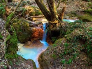
The point where the stream drops is, without argument, the emotional center of the visit. The water falls between the tuff walls and gathers in a small pond at the foot of the waterfall, edged with marsh and riverside vegetation: duckweed carpeting the still surface, reeds, willows, alders, the whole band of plants that live with their feet wet. It is a sight that doesn't come across in photographs, because a photograph conveys neither the humidity of the air nor the noise, which are half the experience.
The pond has that characteristic green opacity of waters rich in nutrients and organic matter, and it changes color with the light: early in the morning it is almost black, around midday it turns emerald where the sun comes in through the fronds, and in the late afternoon it takes on dark tones again. If you have the patience to stay still for a few minutes, the fauna comes back: dragonflies, in season, patrolling the surface with that jerky flight that seems impossible, a few frogs starting to sing again, the plunge of a merlin or a kingfisher if you are very lucky.
The basin of the waterfall is also a thermal trap in reverse: evaporation and shade keep it several degrees cooler than the plateau above. On a July day the difference is striking and immediately noticeable, and it is the reason why the Romans and the people of Viterbo who know the place go there in summer. It is geological air conditioning, free and without a compressor.
The noise, which is half of the place
A piece of advice that sounds strange and isn't: at some point, close your eyes. The sound of a waterfall inside a gorge is not uniform, it is layered. There is the deep thud of the falling mass, the sharp crackle of the drops on the leaves, the gurgle of the runoff downstream, and over everything a kind of breathing of the air moving through the damp corridor. 30 seconds with your eyes closed are worth more than 10 photographs, and it is also the best way to notice that in the Park and Baths of Mola di Oriolo Romano there is no traffic noise. That is a rarity, an hour from Rome.
The thermal springs of the Mola: what is known and what I don't promise
Let's get to the delicate point, and I'll treat it with the greatest honesty possible. In the area of the park, on the initiative of the local Università Agraria, a rest area has been set up with tables and two small, shallow pools that collect the waters of a nearby sulfurous thermal spring. This is the documented basis in fact, and it is also the origin of the word "terme" in the name of the locality. The main spring of the Mola gives water at a temperature between 25 and 28 degrees Celsius, accompanied by abundant gas emissions.
25 to 28 degrees must be interpreted correctly. It is a lukewarm temperature in absolute terms, very pleasant on a summer day, but noticeably below the 37 degrees of the human body: it means that when you get in you feel cool, not warm. It is not the steaming pool of the baths of northern Lazio, it is not the Bullicame of Viterbo that touches 60 degrees, it is not Saturnia. It is a lukewarm spring in the middle of the woods, which in summer is a blessing and in winter is frankly a questionable idea.
On the current state of these pools there are no up-to-date checks, and it is better to say so explicitly instead of filling the gap with promises. I don't know whether they are accessible today, whether they have been closed, whether municipal ordinances or prohibition signs exist, whether the hygiene conditions have been inspected, or whether bathing is permitted. Anyone who assures you of the opposite with confidence, without a recent institutional source, is improvising. The sound rule is this: go for the landscape, for the waterfall, for the woods and for the ruin of the mill. If the pools are there and usable, it will be a bonus. If they are not, the trip is still full.
The other side of the coin: the gases
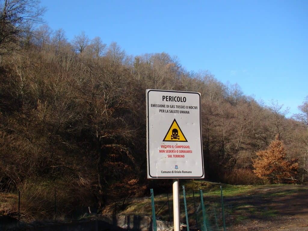
There is a safety element that has to be said clearly because it is not intuitive. The sulfurous manifestations of the area are accompanied by gas emissions, and gases of volcanic origin, in particular carbon dioxide and hydrogen sulfide, are heavier than air. This means they tend to stagnate in depressions in the ground, in holes, in ditches and generally in all low points, where they can reach dangerous concentrations in the absence of ventilation. It is exactly for this reason that camping in the area is discouraged: sleeping at ground level in an emission zone is the worst possible risk condition, because during the night the air stratifies and the gas accumulates.
It is not theoretical alarmism: in central Italy there have been accidents, even serious ones, in similar situations, almost always involving people who had crouched down in a depression in the ground or domestic animals, which are lower to the ground and therefore more exposed. The practical rule is very simple: stay on your feet, stay in the open, don't get into holes or tunnels, and if you smell an intense odor of rotten eggs that suddenly becomes less noticeable, move away immediately uphill, because the fading of the odor at high concentrations is a known and treacherous effect.
Travertine: how water builds stone
One of the most fascinating phenomena tied to the waters of the area is the deposition of travertine, and it is worth explaining because once you understand it you recognize it everywhere in Lazio. Water circulating in the subsoil of a volcanic area is enriched with carbon dioxide. This makes it slightly acidic and lets it dissolve the calcium carbonate of the rocks it passes through. When the water resurfaces, the pressure suddenly drops, the carbon dioxide is released into the air, the water loses acidity and can no longer hold all that calcium in solution: it deposits it.
The deposit forms preferentially where there is turbulence, that is, precisely at the drops in the water, and where there are surfaces to cling to, that is, mosses, algae, leaves, twigs. The result is a porous, light rock full of plant imprints: travertine. In some cases the growth is so fast that it encloses modern objects within a few years, and in geological museums you find samples with coins or bottles inside. It is one of the few rocks you can literally watch being born.
Lazio has a very deep historical relationship with travertine: it is the stone of Tivoli, the one the Colosseum's facing is built of, the one of countless Roman facades, the one Bernini and Borromini used with both hands. Finding its incipient forms in a stream of Tuscia, behind a waterfall, means seeing at work the same process that supplied the building material of Roman urbanism. It is one of those connections that suddenly make the landscape of Lazio coherent, from the capital to the remotest wood.
The forms of the deposit
On wet surfaces look for whitish or yellowish encrustations, crusts that cover the stones, small stepped terraces that the water has built on its own, and above all those spongy structures in which you can recognize the hollow imprints of mosses now decomposed. They are the unmistakable signature of travertine in formation. If you then find a surface where the water runs in a thin veil over a wavy crust, you are looking at a micro version of the same processes that at Pamukkale, in Turkey, built terraces as big as squares.
Underfoot: the volcanism of the Sabatini Mountains
Everything described so far (the tuff, the gorges, the lukewarm springs, the gases, the travertine) descends from a single fact: we are on an extinct volcano. The Sabatini volcanic district is one of the systems that make up the magmatic province of central Italy, the same chain of eruptive centers that runs from the Vulsini around Bolsena, to the Cimini and Vico farther north, to the Sabatini of Bracciano, down to the Alban Hills south of Rome. They are volcanoes tied to the dynamics of the Apennines and the extension of the Tyrrhenian coast, whose activity falls for the most part between hundreds of thousands and tens of thousands of years ago.
Lake Bracciano occupies a large depression of volcano-tectonic origin, a caldera formed by the collapse of the roof of the magma chambers emptied by the eruptions. Around it, the plateau is made of thick beds of pyroclastic products: tuffs, pozzolanas, ignimbrites, that is, material erupted and then consolidated. They are soft, permeable rocks, easily cut by watercourses and easily dug by people. Half of Etruscan civilization is founded on this property of tuff: without a rock that can be cut with an ax there would be no chamber tombs, no sunken roads, no drainage tunnels.
An extinct volcano, however, is not a dead volcano in thermal terms. The residual heat at depth continues to warm the circulating waters, and the fractures continue to let gases rise from the deep zones. The thermomineral springs and gas emissions of the Park and Baths of Mola di Oriolo Romano are precisely this: the slow and now very faint breathing of a system that has finished erupting but has not finished cooling. Walking there means walking above a geological heating system still on at the lowest setting.
Why so many different springs in so little space
In the area, very different waters are recorded within a few hundred meters of each other: some sulfurous and lukewarm, others very cold, one ferruginous. The explanation lies in the complexity of the subsoil. Each spring has its own circulation history: depth reached, residence time, rocks crossed, temperature met, gases incorporated. Water that descends little and rises quickly comes out cold and poor in salts. Water that descends a lot and stays a long time comes out hot and mineralized. Water that crosses iron-rich levels comes out with that characteristic metallic taste and leaves reddish deposits.
That the Romans knew and exploited several thermal localities in this area is consistent with everything we know of their water culture: no ancient people mapped the waters of Lazio with as much system, and practically every notable spring of southern Etruria has left traces of Roman use.
The Beech Forest of Oriolo Romano, World Heritage
A short distance from the valley floor of the Mola, on the plateau, is the reason Oriolo Romano appears on a list that includes the Pyramids and the Great Wall. The beech forest of Monte Raschio, in the municipal territory, is part of the transnational serial site of the ancient and primeval beech forests of Europe, inscribed on the UNESCO World Heritage list in 2017 with the extension that included several Italian beech forests. It is not a convenient tourist plaque: it is a scientific recognition based on precise naturalistic criteria.
The serial site gathers dozens of components scattered across a dozen European countries, from the Carpathians to the Balkans, from Germany to Spain, and documents the extraordinary way the beech recolonized the continent after the last glaciation, starting from southern refuges and reconquering an immense area in a few thousand years. The Italian components, all in the Apennines and the volcanic area of Lazio, represent the southern extreme of this expansion and preserve populations of exceptional genetic and ecological value.
What makes the beech forest of Oriolo especially remarkable, and the technical reason for its inclusion, is the elevation. The beech, in central Italy, normally occupies the mountain belt between 900 and 1,800 meters: it is the tree of the Mainarde, of Terminillo, of the Abruzzi. Here instead it grows at drastically lower elevations, a little over 400 meters, in a situation that ecologists call a depressed beech forest or low-elevation eutrophic beech forest. It is a biogeographic anomaly, and it is exactly the kind of anomaly UNESCO protects.
Why the beech manages to come down so low
There are at least three reasons and they work together. The first is climatic: the Sabatini area receives abundant rainfall and has high atmospheric humidity, with frequent fog that reduces summer water stress, which is precisely the factor that normally keeps the beech from living low. The second is morphological: the basin shape and the presence of sunken ravines create thermal inversion, with cold air stagnating in the bottoms and lowering average temperatures well below what the elevation would suggest. The third is edaphic: the volcanic soils, deep, cool, rich and well drained, are an ideal substrate.
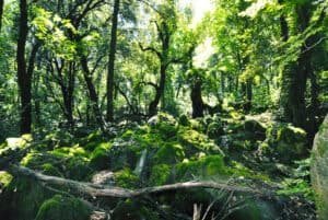
The result is an ecosystem that works like a mountain in miniature without being one: you enter a cathedral beech forest, with gray, smooth trunks, a closed canopy, an understory almost absent for lack of light, the carpet of dry leaves cushioning your steps, and that characteristic silence that beech forests have and oak woods don't. And you are 40 minutes from Lake Bracciano, in a landscape that until a few kilometers earlier was olive trees and Mediterranean scrub. The contrast is almost comic.
Anyone visiting the Park and Baths of Mola di Oriolo Romano who has time for only one addition should make it this: climb up into the beech forest. They are two faces of the same geological phenomenon, the water below and the forest above, and seen together they tell the complete story of the territory.
The beech as a species: a portrait
It is worth spending a few lines on the protagonist. The European beech is a tree that can exceed 30 meters and live for centuries, with a smooth, silvery-gray bark that stays that way all its life, which is rare among broadleaf trees, and a very dense crown that intercepts almost all the light. It is precisely this greed for light that determines the look of mature beech forests: under a closed canopy almost nothing grows, and the understory is reduced to a few species that complete their cycle in spring, before the leaves open.
The consequence is one of the most beautiful phenomena of the forest calendar: the spring flowering of the ground. For a few weeks, between March and April, the floor of the beech forest is covered with anemones, squills, toothworts and corydalis, which exploit the window of light before the canopy closes. Then everything switches off and for six months there is only green half-light. Going to the beech forest in April or in July means seeing two completely different places.
Beech forests also have a particular dynamic tied to the death of trees. When a big beech falls, it opens a window of light in the canopy that triggers a race among the young plants in the understory, which have grown very slowly for years waiting for that chance. The first one to reach the canopy closes the gap and the others stop. It is a patchy renewal mechanism that gives old-growth beech forests a mosaic structure of different ages: it is precisely this structure, with its abundance of dead wood and monumental trees, that the UNESCO criteria look for and protect.
How to behave in a protected beech forest
Simple, non-negotiable rules: you stay on the marked trails, you collect nothing, you light no fires, you take away no dead wood or mushrooms without authorization, you carve nothing into the bark, and dogs stay on a leash. Dead wood in particular, which to the untrained eye looks like disorder to be removed, is the living heart of the ecosystem: it hosts wood-eating insects, fungi, cavity-nesting birds, bats. A too-clean beech forest is an ecologically poor beech forest, and the old-growth beech forests of UNESCO are protected precisely because they are messy.
Via Clodia and the Etruscan territory around the Mola
Long before the Santacroce, this territory was crossed by one of the great road routes of southern Etruria: Via Clodia. It is a less famous road than its bigger sisters, the Aurelia on the coast and the Cassia toward the north, and that is exactly what makes it interesting, because it is the road of the interior, the one that served the Etruscan hinterland between the lakes and the cities of the Maremma. It started from the Roman area, climbed toward Blera, Norchia, Tuscania, and connected a world of rock-cut centers that today are among the most evocative and least visited archaeological places in Lazio.
Like almost all the Roman roads of Etruria, the Clodia was not invented by the Romans: it followed and regularized pre-existing Etruscan routes. The territory between the Sabatini and the Mignone was an area of transit and control between Cerveteri and Tarquinia, the two great maritime cities, and their respective hinterlands. Names like Blera, Norchia, San Giuliano evoke necropolises dug into the tuff, cube tombs, rock-cut facades, sunken roads tens of meters deep: an archaeological landscape that resembles nothing else in Italy.
The Park and Baths of Mola di Oriolo Romano lies within this territorial mesh, and that explains the chronological depth of its use. A valley with perennial water, thermomineral waters, easily worked tuff and woods rich in game and acorns is exactly the kind of place that no preindustrial population ignores. The mill of 1573 is, from this perspective, a very recent episode in a very long story.
The sunken roads, if you have time for a detour
If the trip to Oriolo leaves you wanting more, rock-cut Tuscia is within reach and well worth a second day. The sunken roads are corridors dug into the tuff, a few meters wide and as much as 20 or 30 deep, of a function debated between the practical and the ritual, which today you walk in a green half-light of ferns and mosses. They are one of the few settings in which you can physically walk inside an Etruscan work. The relationship with the Mola is closer than it seems: same rock, same logic of digging instead of building, same dependence on water.
The Università Agraria: the collective property that saved the woods
There is a typically Lazio institution, and in general of central Italy, that explains why around Oriolo there are still woods instead of warehouses: the Università Agraria. Although the name misleads anyone who thinks of universities, it has nothing to do with higher education. It is a body for managing collective lands, direct heir of the ancient civic uses, that is, of the rights that local communities had exercised for centuries over common goods: wood gathering, grazing, sowing, harvesting.
The logic of civic uses is the opposite of modern private property. The asset does not belong to an individual but to the community of inhabitants, and it can be neither sold nor divided: it passes intact from generation to generation, and the body administers it, guaranteeing its conservation and use. This model, which for a long time was considered an archaic remnant to be overcome, has proved in recent decades to be an extraordinarily effective tool of landscape protection, because it makes land speculation very difficult.
That it was the Università Agraria of Oriolo that equipped the park's rest area, with the tables for refreshment and the pools that collect the water of the spring, is perfectly consistent with this history. A civic-use body manages a common good for the community, and equipping it for use is exactly its job. It is worth knowing because it changes the visitor's attitude: you are not using a commercial service, you are using a collective good that someone maintains for you without asking for a ticket. The least you can do is take your own trash away, and maybe also what was left by those who didn't have the same upbringing.
The forest as an economy
The woods of the Sabatini are not virgin forest: they are woods worked for centuries, coppices managed in rotation, chestnut groves for fruit, oak woods for acorns for the pigs. The chestnut in particular had an enormous food role in this part of Lazio, so much so that it earned the name of bread tree: chestnut flour fed the Apennine and pre-volcanic communities in the months when the grain ran out. It is a tasty irony that, a short distance from a grain mill, the real winter bread often came from a tree.
Recognizing this productive history changes the way you look. The multiple stumps, the shoots grown in clusters from the same stump, the dry-stone walls that surface among the leaves, the paths too wide to be spontaneous: they are all traces of labor. The woods around the Park and Baths of Mola di Oriolo Romano are a cultural landscape, not a remnant of untouched nature, and that makes them more interesting, not less.
Fauna and flora of the Park and Baths of Mola di Oriolo Romano
The combination of damp gorge, perennial water, mature forest and plateau creates an environmental variety that concentrates many different species in little space. Along the stream riverside vegetation dominates: black alder, willows, poplars, elder, with an understory of ferns that in the shadiest spots becomes lush. On the dripping tuff walls grow mosses and liverworts, and in some recesses the maidenhair fern, that very delicate fern with fan-shaped fronds that is the indicator par excellence of constant dripping.
Climbing, you pass to mixed woods of Turkey oak and downy oak, with hornbeams and manna ash, to arrive at the beech forest elevation. It is an altitudinal sequence compressed into a few tens of meters of difference in height, made possible by thermal inversions: in 10 minutes you cross vegetation belts that in the Apennines are separated by hundreds of meters of elevation.
As for fauna, the big protagonists are seen rarely but the traces are everywhere. The wild boar is extremely abundant and leaves rootings, mud wallows and unmistakable footprints. The porcupine, nocturnal, leaves fallen quills that children pick up with enthusiasm. Foxes, badgers, stone martens and pine martens complete the picture of the mammals. Among birds, the beech forest hosts several species of woodpeckers, and the presence of woodpeckers is in turn a good indicator of abundant dead wood. On the water, in season, dragonflies and damselflies. Under the stones of the stream, caddisfly larvae that build cases from sand and debris, one of the most underrated spectacles of freshwater microfauna.
Amphibians, the real indicators
The pools and calm stretches of the stream are amphibian habitat, and their presence is the best certificate of environmental quality a watercourse can show, because amphibians have permeable skin and are extremely sensitive to pollution. Toads, frogs, newts and the spectacled salamander, if the valley hosts them, are all animals to look at and not to touch: human skin, with its oils and residues, is harsh on them. Watching them in silence, without moving stones and without stirring up the bottom, is the highest form of respect.
Lake Bracciano and Lake Vico, a stone's throw away
Oriolo sits halfway between two very different volcanic lakes, and the choice of which to pair with the Mola depends on the kind of day you want. Lake Bracciano is the biggest, the best equipped, the most inhabited: it has its ring of towns looking onto it, Bracciano with the castle, Anguillara with the promontory, Trevignano with the lakefront, restaurants, beaches, considerable summer traffic. It is also a lake with a strategic water function for Rome, and this story of withdrawals and levels has caused quite a lot of discussion in recent years.
Lake Vico is something else entirely: smaller, more enclosed, set in a perfect caldera and surrounded by a nature reserve, with Monte Venere rising like a cone inside the crater. It is a much wilder place, with less built up on the shores, and it has one of those landscapes that seem conceived to be painted. Anyone looking for the atmosphere closest to that of the Park and Baths of Mola di Oriolo Romano should head toward Vico. Anyone looking for lunch with a view and gelato on the lakefront should head toward Bracciano.
It is worth understanding that both lakes are close relatives of the Mola. Same volcanism, same geological history, same deep waters. The lukewarm springs of Oriolo, the minor fumaroles of the area, the sparkling mineral waters of Tuscia and the two lakes are different manifestations of a single system. Looking at Lake Vico knowing you are inside a collapsed crater is a mentally dizzying experience, and prepares you very well for understanding the valley of the Mola.
Manziana and the Macchia Grande wood
Between Bracciano and Oriolo is Manziana, with its wood of centuries-old Turkey oaks under collective ownership, and with another well-known hydrothermal manifestation of the area. They are all pieces of the same mosaic, and anyone with a full day can easily chain two or three of these places without driving more than 20 kilometers in total. The density of interesting things per square kilometer, in this corner of Lazio, is embarrassing compared to the scarcity of visitors.
How to get to the Park and Baths of Mola di Oriolo Romano
By car from Rome you leave toward the northwest and aim for the Lake Bracciano area, then continue toward Manziana and Oriolo Romano. The travel time, with normal traffic, is around an hour and a quarter. The final stretch is on narrow, wooded provincial roads: it isn't complicated, but it is the kind of route where it pays not to be in a hurry, because the roadway is winding and wildlife crossings are frequent, especially at dawn and dusk. An adult wild boar on the provincial road is an encounter nobody wants to have at 70 kilometers an hour.
Access to the park is then from Oriolo going down toward the valley, with the last kilometers on a surface that may be unpaved or at any rate not paved to a good standard. You don't need an off-road vehicle, but after days of rain you need caution and a bit of ground clearance. In difficult conditions, the sensible solution is to leave the car higher up and do the last stretch on foot: it is also the best way to arrive, because the walk down into the gorge is half the pleasure.
By train, which is the option I prefer
Oriolo Romano has a railway station on the line that connects Rome to Viterbo via Cesano and Bracciano, the same one that serves the whole northern arc of the lake. It is one of the few places in inland Tuscia reachable by train from the capital without complicated changes, and it is an enormous advantage: you avoid the traffic, you avoid the parking problem, and the trip itself is pleasant, with the train running along the lake and then slipping into the woods.
I don't give times or frequencies because they vary and because giving you a figure that then changes would be a terrible service: check the updated timetable before leaving, and above all verify the last evening returns, which on these lines tend to be early. Keep in mind that from the station to the valley floor of the Mola there is a stretch to cover, and that on foot it is not a five-minute stroll: if you arrive by train, make a realistic count of the times or arrange the last stretch differently.
What to put in your backpack
It is not a demanding trip, but it is a trip to a damp valley floor, and the wrong equipment ruins it. Closed shoes with a lugged sole: wet tuff covered with algae is extremely slippery, and smooth soles on that surface are the equivalent of skates. One more layer than you would wear in town, because the gorge is noticeably cooler. Drinking water brought from home, because however full of springs the valley is, no unchecked water should be drunk lightly, and the sulfurous ones in particular have a taste that will take away your desire right away.
Then: a towel and a change of clothes, if you intend to wet your feet. A bag to take your trash home. Insect repellent in the warm season, because with still water and shade mosquitoes are guaranteed. A headlamp if you expect to linger, because in the gorge darkness arrives earlier than elsewhere. And, if you are interested in the natural side, a pocket magnifying glass, which is the object with the best ratio of bulk to fun that you can put in a backpack: mosses, travertine encrustations and water insects change appearance completely at 10x.
What to leave at home
The expectations of a spa, first of all. Then the Bluetooth speaker, for reasons I hope need no explanation: in a closed valley sound bounces and you can be heard 300 meters away, and you are playing music inside someone else's living room, where by someone else I mean an ecosystem. And the idea of lighting a fire, which in a protected wood is forbidden, dangerous and stupid in roughly equal proportions.
The seasons at the Park and Baths of Mola di Oriolo Romano
If I had to rank the seasons by payoff, I would put spring in first place without hesitation. Between April and early June the stream still has abundant flow from the winter rains, the waterfall is full, the understory of the beech forest is in its flowering moment, the amphibians are breeding, temperatures are ideal for walking and the mosquitoes have not yet taken possession of the valley. It is the period in which the place gives everything it has.
Summer is the season of coolness. In July and August the valley becomes a thermal refuge and the contrast with the heat of the plain is violent, which explains why it is precisely in these months that the Park and Baths of Mola di Oriolo Romano receives the most visitors. The flip side is the reduced flow: in a dry late summer the waterfall can shrink a lot. It is the classic compromise: you gain in comfort what you lose in water spectacle.
Autumn is the photographically richest season. The beech forest turns in October and November to tones ranging from yellow to copper to brown, the light lowers and becomes raking, the morning fog fills the valley with visible volumes, and the first autumn rains give water back to the stream. It is also the period when the woods smell the most: that smell of mushroom, wet earth and decomposing leaf that is one of the finest olfactory experiences of the year.
Winter is for loners. It is cold, the ground is muddy, the days end early and the lukewarm pools are more an idea than a usable reality. On the other hand the flow is at its maximum, the bare vegetation lets you read the geology and the structures of the mill much better than in summer, and the probability of meeting anyone is statistically close to zero. Anyone who loves uninhabited places will find winter perfect, as long as they are seriously equipped.
The time of day
In a gorge light is everything and it doesn't last. The sun enters the valley floor through a limited window of hours, typically in the middle of the day, and at other hours the valley is in full shade. This means that if you want the waterfall lit you have to go at midday. If you want the dark tones, the saturated greens and the calm long exposures, go in the early morning or the late afternoon. The two versions are so different that they look like different places.
Safety: the three things not to underestimate
The first is the slippery ground. Damp tuff covered with algae and moss has a very low friction coefficient, and the stones around a waterfall are the ideal setting for a fall with consequences. The rule is to always proceed with three points of contact when going down toward the water, to avoid smooth boulders exposed to spray and never to trust a foothold that looks dry among wet surfaces: it is often dry only on the surface.
The second is the gases, already mentioned, and it is worth repeating because it is the least intuitive thing. Don't get into dips, holes, tunnels or cavities near emissions. Keep children on their feet and dogs under control, remembering that both have their heads closer to the ground than an adult and therefore breathe the air of the most dangerous layer. Don't spend the night in a tent in the area, for the precise reason that at night the air stratifies and heavy gases accumulate at ground level.
The third is hydraulic variability. Streams in volcanic territory respond extremely quickly to intense precipitation, because the basins are small and the slopes steep. A storm upstream can raise the flow in a very short time even if it isn't raining where you are. The rule is trivial but it saves lives: with storms under way or forecast, you don't stay in the stream bed and you don't wade across, period.
Phone coverage and common sense
At the bottom of a gorge cell coverage is often absent or intermittent. It is worth downloading the map offline before going down, telling someone where you are going and what time you expect to be back, and not counting on the phone as a safety plan. These are the precautions of a serious hike applied to an easy trip, but it is exactly on easy trips that people get hurt, because they don't prepare.
What to eat around here
The cooking of Viterbo's Tuscia is a cuisine of land, woods and lake, and it has a very marked personality that doesn't resemble the Roman one. The dominant chapter is legumes and cereals: thick soups, legume stews with short pasta or stale bread, and the whole family of preparations based on humble flours. The local bread, wood-fired and in some variants of the area made without salt, is the star of leftover dishes like acquacotta, which in its extreme simplicity is one of the smartest dishes of Italian cooking: water, wild greens, dry bread, oil, and an egg if there was one.
Then there is the chapter of the woods. Mushrooms in autumn, chestnuts, and the wild herbs for which Tuscia has a very deep foraging tradition: chicories, borage, bladder campion, wild asparagus in spring. Every family has its mental map of the good spots and nobody reveals it. It is knowledge that is being lost and that is worth respecting when you meet someone who still practices it.
The pig deserves a paragraph of its own. In a territory of oak woods and chestnut groves, pig farming has always had a central role, and the cured meats of the area are of excellent quality. Add the sheep cheeses, the extra virgin oil of the hills, and the white wines of the surrounding volcanic territories, which take from the tuff that savory minerality and that freshness that make them excellent companions to fried dishes and lake dishes. No indications on specific venues or on prices: they change too fast and can't be verified.
The picnic, which here is the right choice
Since the park's rest area is equipped with tables for refreshment, the picnic is the natural formula for the day at the Mola. Buy in town, carry it down and eat in the shade with the sound of water in the background: it is better than any restaurant, and it has the advantage of cutting dead time. The only recommendation, which is also the only duty, is to take everything away again. A wooded valley floor has no collection service, and every piece of paper left there stays there for years.
A full day built around the Mola
Here is one possible organization, with the premise that specific times are left to you because they depend on variables that can't be verified. Early morning: arrival in Oriolo Romano and breakfast in town. Then a good half hour walking the three axes of the grid layout, going as far as the baronial palace and trying to read the differences between the central street and the side ones. It is a short walk that prepares you mentally for everything else.
Mid-morning: the beech forest. Climbing into the woods when the light is still oblique and any fog has not yet dissolved is the best moment, and it also serves to understand the altitudinal logic of the territory before going down to the valley floor. An hour or two, depending on pace, with no distance goals: beech forests are enjoyed standing still more than walking.
Midday and early afternoon: descent to the Park and Baths of Mola di Oriolo Romano. Waterfall, pond, remains of the mill, channeling, rest area, springs. It is the heart of the day and deserves at least two or three hours, because the temptation to dispose of it in 20 minutes is strong and wrong. The place opens up slowly: after the first half hour you start to notice the travertine, after an hour you start to hear the noise differently, after two hours you become aware of things that were invisible on arrival.
Late afternoon: climb back up and, if energy remains, a stop toward Lake Vico or toward Bracciano to close with the big water after the small water. It is an ending that gives the day a satisfying symmetry: the collapsed crater, the stream that drains it, the mill that exploits the stream. The whole causal chain in one afternoon.
If you only have half a day
Give up the lake and the beech forest, keep the town and the Mola. The town because without understanding the urban plan the mill remains just another ruin. The Mola because it is the reason you came. Two hours in town and three in the valley make a full, coherent half day, and don't leave that feeling of having run without seeing that ruins most day trips out of town.
Typical mistakes of those who visit the Park and Baths of Mola di Oriolo Romano
The first, by far the most common, is arriving thinking of spa baths and leaving disappointed. It is a mistake of expectations, not of place, and it is prevented by reading first. Whoever arrives knowing they will find a valley floor with a waterfall, a ruin and two lukewarm pools of collective management goes home enthusiastic. Whoever arrives thinking of a wellness center goes home unhappy. Same place, opposite experiences.
The second is hurry. The Mola is not a monument you visit: it is an environment you spend time in. There is no climax to reach, no treasure room, no masterpiece to stop in front of for three minutes and then move on. The value accumulates by sedimentation, and whoever gives it 40 minutes can't understand what those who spent half a day there are talking about.
The third is visiting only the valley and ignoring the town, or vice versa. They are two halves of the same story: a 16th-century agrarian colonization project and its productive infrastructure. Taken separately they are two pleasant things. Taken together they are a case study. It costs five kilometers of road, and it is the best investment of the day.
And a mistake that isn't a mistake
Going without a plan. This place tolerates improvisation very well, as long as you have the right shoes and have read something beforehand. There are no reservations to make, time slots to respect, lines to anticipate. It is one of the last destinations in Lazio where you can still decide the same morning, and it is a freedom that in contemporary tourism has become so rare as to be a luxury.
With children at the Park and Baths of Mola di Oriolo Romano
It works very well, with some precautions. The strong points are evident: water to watch and touch, stones to turn over, a ruin to explore, a real forest and not an urban park in disguise. For a city child, half a day in a valley floor like this is worth a month of documentaries, and the physical experience of the air changing as you go down into the gorge is one of those that stay with you.
The precautions are three and you already know them: the slippery ground near the water, which with children requires continuous, undistracted supervision. The gases in depressions, remembering that a six-year-old breathes much lower than an adult. And the temptation to pick up and take away, which in a protected area should be discouraged by turning it into something else, for example the game of photographing instead of taking.
One suggestion that always works: give them a task. Counting how many different kinds of leaves they find, looking for the traces of the mill channel, trying to work out where the water came in and where it went out, spotting the white travertine encrustations. A child with a mission walks twice as far and complains half as much, and in the end has learned something without noticing. The Park and Baths of Mola di Oriolo Romano lends itself especially well because every question has a visible answer on the spot.
The Park and Baths of Mola di Oriolo Romano for walkers
For hikers, the valley of the Mola is more a notable point than a destination in itself: the elevation gain is modest and the distance short. The right way to use it is to fit it into a wider loop that includes the Monte Raschio beech forest, the collective woods and perhaps the link toward the trails of the Sabatini district. At that scale, the descent to the waterfall becomes the moment of rest and refreshment of a day of walking, which is exactly the role springs and mills have always had for those traveling on foot.
The territory is crossed by long-distance routes and by local trail networks of varying quality: some stretches are well marked, others much less, and in season the vegetation can close the less-traveled passages. A navigation app with tracks downloaded offline is the practical solution, remembering that in the gorge the satellite signal can degrade because of the walls. The golden rule stays the usual one: if the trail disappears, go back to the last sure point, don't improvise downhill inside a ditch.
Cyclists will find in the Sabatini area excellent terrain for gravel and mountain biking, with forest dirt roads and white roads with very little traffic. The final descent toward the Mola does require attention, though, and the stretch around the waterfall is best done on foot, pushing the bike: wet stones under cleats are a combination that always ends the same way.
A curiosity about the Park and Baths of Mola di Oriolo Romano
The curiosity I like best concerns the 13-year gap. Oriolo Romano was born in 1560, the Mola was built in 1573: 13 years in which a town exists without having its own mill. Put like that it sounds like an accounting detail, but try turning it around and it becomes a small epic. For 13 years every sack of grain produced on the lands of the fief had to be loaded up, taken to be ground somewhere else, and brought back in the form of flour, paying the milling fee to a miller who worked for another master. 13 years of logistical and economic dependence on the outside, for a community that had been founded precisely so as not to depend on anyone.
Which means that when the wheel of the Mola finally began to turn, that day was for Oriolo something like an inauguration of independence. The town stopped being an experiment and became a self-sufficient organism: it had the houses, it had the families, it had the church, it had the lord's palace, and now it also had the means to turn grain into bread without asking anyone's permission. We don't know the names of the people who were there that day, and I won't invent them, but I know for certain that they were there and that they knew perfectly well what was happening.
I'll add a second linguistic curiosity, minor but tasty. The popular name of the plant is Mola del Biscione, from the stream that fed it. Biscione is an augmentative that in the place names of watercourses almost always indicates the sinuous, serpentine course of the bed between the walls of the gorge: the stream is a water snake crawling through the tuff. It is a peasant metaphor, precise and not at all naive, of the kind worth more than a technical description. When you go down into the valley and look at the course from above, you understand immediately why they called it that.
Something nobody tells you about the Park and Baths of Mola di Oriolo Romano
What nobody tells you is that the danger, in this place, is not the water: it is the air. Everyone looks at the waterfall and thinks the risk is slipping or drowning, and in part that is true, but the least intuitive and most serious risk is the gas emissions that accompany the sulfurous manifestations of the area. Carbon dioxide and hydrogen sulfide are heavier than air: they don't rise, they sink. They accumulate in holes, in blind ditches, in depressions without ventilation, and in those microenvironments they can reach concentrations that the air at 1.70 meters above the ground gives no hint of.
It is for this reason, and not out of bureaucratic whim, that camping in the area is discouraged. At night the air stratifies, the wind drops, the heavy gas accumulates on the ground, and whoever sleeps in a tent sleeps in exactly the worst layer. The same goes for dogs, which have their noses 30 centimeters off the ground, and for small children. In the history of Italian volcanism there are documented episodes of poisoning in similar conditions, almost always with the same dynamic: someone bends down into a depression, loses consciousness, and whoever rushes to help bends down in turn.
There is an even more insidious detail, and it is the one that truly nobody tells: hydrogen sulfide has a very strong smell of rotten eggs at low concentrations, but at high concentrations it paralyzes the olfactory nerve and stops being perceived. This means that the sudden disappearance of the smell is not a good sign, it is the worst. The rule that follows is counterintuitive but must be learned by heart: if you smell strong sulfur, you are informed. If the smell vanishes suddenly while you are in a low spot, get out upward immediately without asking yourself why.
None of this should frighten anyone going for a walk outdoors in a ventilated valley: in the open air and on your feet there is no problem at all. But it is exactly the kind of information no brochure writes and an honest guide has the duty to give you.
The advice I give you for visiting the Park and Baths of Mola di Oriolo Romano
The advice is only one and I condense it into a sentence: do the town before the valley, and do the valley slowly. The first part is a matter of narrative sequence. If you go down to the Mola without having walked the three axes of Oriolo Romano, without having seen the grid and without having understood that the town was planned on the drawing board in 1560, the mill will look to you like a pretty ruin in the middle of the woods, one of many. If instead you arrive knowing it is the infrastructure that made an experiment in agrarian colonization possible, you will look at it with completely different eyes. A 40-minute walk in town multiplies by three the value of three hours in the valley. It is the best exchange I know.
The second point is about pace. The valley of the Mola is not a place with a high point: it is a place of progressive revelation. In the first half hour you see the obvious, that is, the waterfall and the pond. In the second you begin to distinguish the white travertine encrustations on the wet surfaces and to understand that this rock is forming right in front of you. In the third you notice the channeling, the footprint of the diversion channel, the hydraulic logic of the plant. And at some point in the fourth you realize that the sound of the water has stopped being a background and has become the thing you are listening to. Whoever stops for 40 minutes takes home only the first layer.
A practical corollary, because advice without practical corollaries is chatter: go in the morning on a spring weekday, with closed hiking shoes, one extra layer on, water in your pack and no appointment in the afternoon. If you have time left over, climb up to the beech forest before going home. There is no better version of this day.
Another well-known fact, yet rarely cited
It is well known that the beech forest of Oriolo Romano is a World Heritage site. The signs say so, the websites say so, the municipality says so with justified pride. What is almost never cited is why, and the why is far more interesting than the title. The recognition doesn't reward the beauty of the wood: it rewards a biogeographic anomaly. The beech, in central Italy, is a mountain tree that stands between 900 and 1,800 meters. Here it grows a little over 400. It is like finding an ibex on a beach.
The mechanism that makes the anomaly possible is the combination of three factors already described and summarized here: high rainfall and atmospheric humidity that eliminate summer water stress, thermal inversions in the volcanic basins that lower average temperatures far below what the elevation would suggest, and deep, cool, fertile volcanic soils. The beech, which is a demanding species but not a stupid one, exploits the ecological window that this combination opens for it and settles where on paper it shouldn't be.
The second little-cited fact is that this beech forest is not an isolated case but a piece of a serial site that extends across a dozen European countries, from the Carpathians to the Pyrenees. The Italian inscription of 2017 added some Apennine and Lazio beech forests to a network that documents the postglacial recolonization of the continent by a single species. Put another way: the wood above the Park and Baths of Mola di Oriolo Romano is a chapter of a book that reads from Naples to Kyiv, and its page tells the southern extreme of the story.
The third, which is almost an anecdote but is perfectly true, is that the ecological value of these beech forests lies in their disorder too. Dead wood on the ground, hollow trees, rotting stumps, irregular crowns: everything that to an eye used to urban parks looks like neglect is in fact the technical condition of old growth. A too-tidy beech forest would lose the requirements that won it the recognition. It is one of the rare cases in which apparent neglect is a protection policy.
The right photo to take at the Park and Baths of Mola di Oriolo Romano
The right photo is not the frontal waterfall, which is the first one everyone takes and also the most disappointing, because in a waterfall photographed head-on with the wrong light you lose both the depth of the gorge and the scale. The right photo is taken by going down a few meters from the obvious viewpoint and standing off to the side, so as to have in the foreground a portion of tuff wall with moss and encrustations, the falling water in the middle ground and the pond in the third. This way the image tells three things at once: the rock, the drop, the calm of the water below. It is the honest portrait of the place.
Technically, in a gorge you always work in low light, and that is a piece of luck disguised as a problem. Long exposures, on the order of half a second and up, turn the water to silk and give back that sense of continuous motion that the instant photo kills. You need a stable support: a light tripod, or failing that a flat rock and the self-timer. If you have a polarizing filter, put it on: it removes the white reflections from wet rocks and leaves and brings out the true greens, which without a polarizer stay milky. In a damp environment like this the polarizer is not an accessory, it is the difference between a faded photo and a saturated one.
The second photo worth taking home, and the one almost nobody takes, is of the remains of the mill, cropped the right way. Not the frontal shot of the ruin, which flattens everything into an anonymous wall, but a detail that holds together the tuff masonry, the trace of a channeling and a plant element that says how many years have passed: a root that has split a joint, ivy on a corner, a fern grown in a crack. It is a photograph about abandonment and time, and it is much more eloquent than the overall view.
The third, for those with patience, is the beech forest backlit. You position yourself with the low sun in front of you, expose for the highlights letting the trunks become silhouettes, and wait for a wisp of fog to pass or for the light to cross the foliage. It is the photograph that says better than any caption why that wood is on a UNESCO list.
The photo not to take
The posed portrait inside the pools with a spa face. First because there is no official confirmation of the current state of those pools and it is not right to encourage anyone to use them improperly. Second because it is the photograph that feeds exactly the misunderstanding this entry started from, namely that the Park and Baths of Mola di Oriolo Romano is a spa. It is not, and continuing to photograph it as if it were is the most effective way to ruin it, filling it with people who arrived there for the wrong reason.
Some important events that happened here in history
The first event, in chronological order and in order of importance, is the founding of the town in 1560 on the initiative of Giorgio Santacroce. It is not a spectacular event to tell, there are no battles or sieges, but it is the decision that created out of nothing a community where before there were woods and pasture. In the history of Lazio there are very few comparable episodes, and the fact that this founding succeeded, that is, that the town still exists and is inhabited, makes it even more remarkable: many similar experiments, elsewhere, failed within a generation.
The second is the construction of the Mola in 1573, again at the wish of Giorgio Santacroce. With the milling plant on the stream going into operation, Oriolo reaches basic food self-sufficiency and closes the productive cycle of the fief: you sow, you harvest, you grind and you eat within the same territory. It is the act that turns a successful land division into a real town.
The third is the passage of the fief from the Santacroce to the Altieri, which took place in the course of the 1600s. On the exact dates of the transaction the local sources don't agree and I don't want to hand you a year that might turn out to be wrong, but the fact itself is certain and its consequences are visible: the baronial palace still bears the name of the Altieri, and the presence in that house of Emilio Altieri, who rose to the papal throne in 1670 as Clement X, suddenly places this little town of Tuscia inside the geometries of Roman power at the highest level. A fief belonging to the family of the reigning pope is no longer just any fief.
The fourth event has no date but a century: the decommissioning of the Mola, between the 1800s and the 1900s, swept away like all traditional hydraulic plants by industrial roller mills and the end of feudal monopolies. It is a slow death, with no chronicle, and for that very reason rarely told. Yet it changed the landscape more than many wars: from that moment the valley stops being a place of work and becomes a place of nature.
The fifth, the most recent, is the inscription of the beech forest of Oriolo Romano on the UNESCO World Heritage list with the 2017 extension of the serial site of the ancient beech forests of Europe. In terms of international visibility it is the most important event of recent centuries for this municipality, and it brought attention back to a territory that for generations had been considered marginal. That the recognition concerns a wood and not a monument is a very encouraging sign of the times.
Who passed through the Park and Baths of Mola di Oriolo Romano
I'll head off any doubt with a rule I consider non-negotiable: I don't attribute to this place visits by famous figures that I can't document. Italian cultural tourism is full of plaques declaring stays that never happened, and there is no need to add another. The people who really passed through the Park and Baths of Mola di Oriolo Romano, and who determined its history, are others and are more interesting.
The first is Giorgio Santacroce, who owned that valley, knew it and chose it. Whoever decides where to build a mill has walked the stream, assessed the drop, measured the flow in the lean seasons. The patron of 1573 didn't just sign a contract: he made an inspection, and that inspection is the first documentable human presence that we can attribute with certainty to the site in the modern age.
The second category is the millers, who dedicated their lives to that mill for generations. We don't know their names but we know their trade very well: hands marked by the steel splinters from dressing the millstones, the ear trained to tell from the sound whether the grinding was right, the ambiguous reputation millers had all over Europe, suspended between an indispensable role and a permanent suspicion of keeping more flour than was due. In medieval and modern literature the miller is almost always a cunning figure, and it is no accident: whoever controls the bread is always looked at with mistrust.
The third is the anonymous line of the peasants of Oriolo, who for three centuries went down into that valley with donkeys loaded with sacks, waited their turn, argued over the share withheld and climbed back up with the flour. They are thousands of people, and each one walked that path dozens of times in a lifetime. If a place can be worn away by footsteps, that path is.
Then there are the Altieri, and through them, by dynastic route and not by documented physical presence, the long shadow of Clement X and Baroque Rome. And there is, in the background, the scholarly tradition that links the Mignone to Aeneas's journey to the Etruscans of Cerveteri and Tarquinia, as Virgil tells it: a geographic identification debated for centuries, which isn't mine to resolve and which I report for what it is, a literary suggestion rooted locally, not an archaeological fact.
Finally there are the Etruscans, who left no plaques but who inhabited and crossed this territory along the route later regularized by the Romans as Via Clodia. A valley with perennial water, thermomineral springs and workable tuff, in the hinterland between two of the most powerful Etruscan cities, was never an empty place. The mill of 1573 is the latest arrival in a very long series of people who understood, looking at that stream, that there was something there worth using.
Quick questions
Where is the Park and Baths of Mola di Oriolo Romano
It is in a wooded valley floor about five kilometers from the center of Oriolo Romano, in the province of Viterbo, on the northern slope of the Sabatini Mountains. The town sits on a shelf a little under 400 meters above sea level, the park lower down, along the Biscione stream. There you find a waterfall, a small pond, the ruin of the mill of 1573 and two shallow pools fed by a lukewarm sulfurous spring.
How do you get to the Park and Baths of Mola di Oriolo Romano
By car from Rome you head toward Lake Bracciano, then Manziana and Oriolo Romano: with normal traffic it is about an hour and a quarter. From town you go down toward the valley, with the last kilometers on a surface that may be unpaved. After days of rain leave the car higher up and walk down. Oriolo also has a station on the Rome-Viterbo line, but from the station to the valley floor there is still a long stretch.
Do you pay to get in and are there opening hours
No, access to the public areas is free, with no ticket booth and no hours. It is not a spa: it is a Natural Monument of the Lazio Region, with the Municipality of Oriolo Romano as managing body and a rest area with tables. To enter there are no reservations or time slots, while the guided visits on Saturday and Sunday and the barbecues are booked through the website monumentonaturalelamola.com. The rules require dogs on a leash, ban fires outside the barbecue area and close the area under an orange or red weather alert. There is no collection service either, so you take your trash back with you. For the Altieri palace in town, on the other hand, hours and fares can't be verified.
Can you swim in the thermal pools
There is no certain answer. The two small pools collect sulfurous water between 25 and 28 degrees Celsius, so lukewarm and not hot. On their current state there is no up-to-date official information: it isn't known whether they are accessible, whether there are bans or ordinances and whether bathing is permitted. You are better off going for the waterfall, the woods and the mill, and treating the pools as a possible bonus.
When is the best time to go to the Park and Baths of Mola di Oriolo Romano
The best season is spring, between April and early June, when the stream has abundant flow and the waterfall is full. In July and August the valley is cool, but in late summer the waterfall can shrink a lot. Autumn is the richest period for photographs. The sun enters the valley floor only in the middle hours of the day. For the visit allow at least two or three hours.
Is it suitable for children and what should you watch out for
It works well with children, but three precautions are needed. Wet tuff near the water is very slippery, so closed shoes with a lugged sole and continuous supervision. The sulfurous emissions bring gases heavier than air, which stagnate in holes and dips: keep children and dogs on their feet and out of depressions. That is why camping is discouraged. With storms under way or forecast, don't stay in the stream bed.
Article written by the editorial team of TourLeaderPro, contact them for Private/Corporate/V.I.P. Tours and Experiences.
Planning a trip to Rome? The English-language guides for visiting the city are on ItalyPlanner.com.