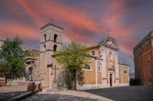
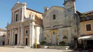
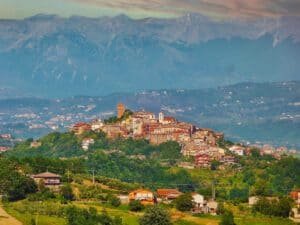
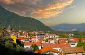
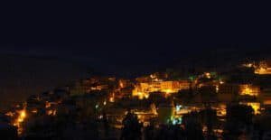
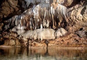
Ciociaria what to see: the province of Frosinone offers medieval towns, hill villages, Montecassino Abbey, the spa town of Fiuggi and a few natural areas, almost all 75-135 kilometers (about 47-84 miles) from Rome. Nearly every historic center can be explored on foot and for free. Drivers usually take the A1 toward Naples. This guide gathers 25 places with the essential details; for current opening hours, always check each place’s own page. More destinations are on our day trips near Rome page.
Ciociaria what to see: historic towns and villages
This first group brings together the larger, easier-to-reach centers, almost all close to the A1 or the Rome-Cassino railway line.
Sora
Sora has about 26,000 residents and is split in two by the Liri river. You can visit on foot, without a ticket, along its bridges and riverfront. From Rome, exit at Ferentino and continue on the expressway: a little over an hour and a half. By train, get off at Sora station and it is about ten minutes to Corso Volsci. Check museum and church hours on the page for the town.
Anagni
Anagni sits at 424 meters (about 1,390 feet) above the middle Sacco valley, a little over an hour from Rome via the Anagni-Fiuggi exit. The medieval town is explored on foot, and cars stay in the parking lots along the walls. Churches, sacred art, museums and the memory of the popes are the themes of its page. The train station is in the valley below; a local bus climbs to the center.
Fiuggi
Fiuggi has two centers. Fiuggi Città is the medieval town at 747 meters; Fiuggi Fonte, at 621 meters, is the twentieth-century spa district among chestnut trees. From Rome, exit at Anagni-Fiuggi and drive up about twenty kilometers. In summer, the page notes it is five or six degrees cooler than in the valley. Cotral buses connect the town to Rome.
Cassino
Cassino has about 35,000 residents and lies at the foot of the mountain topped by Montecassino Abbey. It is 135-140 kilometers from Rome, a good hour and a half by car or by train from Termini. SR 149 climbs 8 kilometers to the abbey. The Mastrantoni bus line runs only a few trips a day, so confirm departures and returns beforehand, as the page suggests.
Piglio
Piglio has about 4,300 residents and stands at 620 meters on Monte Scalambra, in the Monti Ernici. It is 74 kilometers from Rome, an hour and a quarter by car via the Anagni-Fiuggi exit. Its page links it to the castle, the Middle Ages, food and wine. Cotral runs few buses in the middle of the day and rarely on Sundays; check times at cotralspa.it.
Ferentino
Ferentino overlooks the Sacco Valley from a hill about 75 kilometers from Rome. Its Cyclopean walls, lanes, ancient gates and the Mercato Romano area are outdoors and free to walk. Churches follow service times; the covered Mercato Romano and a few monuments open on request. Ferentino-Supino station is in the valley and needs a bus connection.
Arpino
Arpino is at 447 meters on the left side of the Liri valley, about 110 kilometers from Rome. You get there in a little over an hour and a half by taking the Frosinone exit and the expressway toward Sora. The town is explored on foot and for free. Some museums and the foundation in the castle charge admission. The train does not reach the town.
Alatri
Alatri sits on a hill above the Sacco valley, about 100 kilometers from Rome. By car, exit at Frosinone and follow SS 155. Cotral leaves from Anagnina and reaches Alatri Quaraticciolo in 100 minutes; it does not run on Sundays, so check the trip first. The page highlights archaeology and churches, with free outdoor visits.
Veroli
Veroli is at 594 meters on a ridge of the Monti Ernici, about 90 kilometers from Rome. Driving is not allowed inside the walls: leave the car on the ring road. The center is free and always open. The Museo Civico Archeologico, at Piazza Giuseppe Mazzoli 2 (phone 0775 238929), is open Friday through Sunday, 10 a.m.-1 p.m. and 3-6 p.m.; check the page for other days.
Boville Ernica
Boville Ernica is at 487 meters on an isolated hill, 15 kilometers from Frosinone and about 90 from Rome. By car it takes a little over an hour and a quarter. By public transport, take the train to Frosinone and then Cotral to the viewpoint north of the historic center, on Via Cesare Battisti. The page mentions the views over the Sacco valley.
Ceccano
Ceccano has about 22,000 residents and stands on a limestone ridge over the middle Sacco Valley. This is the one place where the train makes sense: the station is on the Rome-Naples line via Cassino, with about forty regional trains a day and a trip from Termini of a little over an hour. The ticket costs a few euros; check the exact fare on Trenitalia.
Supino
Supino has about 4,600 residents and lies at the foot of Monte Gemma, on the eastern slope of the Monti Lepini. It is about 75 kilometers from Rome, via the Frosinone exit and SR 156. The page points to an archaeological area and ancient baths. Ferentino-Supino station is on the valley floor, a few kilometers below the town. Town hall: Via Guglielmo Marconi, phone 0775 226001.
Castro dei Volsci
Castro dei Volsci is at 384 meters on the last spur of the Monti Ausoni, about 100 kilometers from Rome. Leave the car at Porta della Valle or on the panoramic square. The historic center, churches and viewpoints are free and always accessible. Access to the Torre dell’Orologio and its permanent exhibition should be checked on the page. The railway stop is on the valley floor.
Roccasecca
Roccasecca is about 130 kilometers from Rome, an hour and a half on the A1 (Cassino exit). The medieval center spreads over the slopes of Monte Asprano, at 553 meters, and looks over the Liri Valley. Streets, churches and the castle remains are free to visit. For the Monte Asprano Archaeological Park, the page asks you to check directly. By train from Termini it takes about 1 hour 45 minutes.
Isola del Liri
Isola del Liri has about 10,500 residents and is about 110 kilometers from Rome. You can see its two waterfalls for free from the streets and bridges of the center. By train the trip takes more than two hours, so the page names the car as the more convenient option. For Castello Boncompagni-Viscogliosi and its museum, check opening and admission on the page.
Valle di Comino and Monti Ernici: mountain villages
Here the roads climb and you almost always need a car. Public transport is limited, with infrequent buses that vary by season.
Vico nel Lazio
Vico nel Lazio is at 721 meters on a limestone hill, about ninety kilometers from Rome. Leave the car outside the walls: inside, the streets are narrow, steep and stepped. By public transport you need a train, Cotral and a change at the Pitocco junction, on a weekday. Check the museum and the rest on the page.
Vicalvi
Vicalvi is in Valle di Comino, with a little over seven hundred residents spread over ten hamlets. At the top of the hill, at about 590 meters, the castle is recognizable by the large red cross on its facade. The village is open and free; the castle can only be visited with a guide. The Pro Loco organizes openings at 10:30 a.m. with required reservations by WhatsApp at 380 4750704, messages only.
San Donato Val di Comino
San Donato Val di Comino is at 721 meters, on the Lazio side of Abruzzo, Lazio and Molise National Park, at the foot of the Forca d’Acero pass. It is about 130 kilometers from Rome, a good hour and a half via the Ferentino exit. By public transport, take Cotral from Cassino or Sora, with a stop on Piazza IV Novembre. Check times on the Cotral website.
Alvito
Alvito has about 2,500 residents and stands at 738 meters on Monte Morrone. The town hall is in Palazzo Gallio, at Piazza Marconi 3 (phone 0776 510101). The historic rooms can be visited by reservation Monday through Saturday, 8:30 a.m.-1:30 p.m., through palazzogallio.it. Castello Cantelmo is municipal property: ask at the town hall about the interiors. Churches open during services or on request.
Collepardo
Collepardo is at 674 meters in the Monti Ernici, about 100 kilometers from Rome, an hour and twenty minutes in normal traffic. There is no train station and local buses do not match visiting hours: you need a car. Parking is free. The village has held the Orange Flag of the Touring Club Italiano since 2003. Hours for Certosa di Trisulti are on the page.
Guarcino
Guarcino has about fifteen hundred residents and stands on a ridge of the Monti Ernici, at 625 meters according to the municipality. It is about ninety kilometers from Rome, an hour and a quarter on a weekday. The information point is at Via Alfonso Milani 1, phone 0775 46007. From Frosinone it is about twenty-five kilometers through Alatri.
Pico
Pico has about 2,600 residents and stands at 192 meters on a limestone spur, inside Monti Aurunci Natural Park. It is about 110 kilometers from Rome: take the Ceprano or Pontecorvo exit and provincial roads. Ceprano-Falvaterra station is about 12 kilometers away. Park for free in the lower part and walk up.
Filettino
Filettino is the highest town in Lazio: the center is at 1,063 meters, on the border with Abruzzo, with a little over five hundred residents. Walking around is free. From Rome, take the A24 to Vicovaro-Mandela and then the Sublacense road, or Via Casilina through Fiuggi and Trevi. In winter the page advises keeping snow chains handy.
Ciociaria what to see in nature
If you want Ciociaria what to see outside the towns, two pages cover protected areas. One of them is just outside the region’s borders.
Falvaterra Caves and Rio Obaco
The natural monument covers 133 hectares in the municipality of Falvaterra, in the Monti Ausoni, a few kilometers from the Ceprano toll booth. Visits are booked by writing to mngrottedifalvaterra@gmail.com. Hours, fees and the calendar are on grottedifalvaterra.it and change with the season and with the hydrological conditions of the cave.
Monte Soratte
Monte Soratte stands alone in the Tiber valley, in the municipality of Sant’Oreste, about 45 kilometers north of Rome. It is not in Ciociaria but in Sabina, and it can be combined with a day trip out of the city. You get there on Via Flaminia in a little under an hour. The reserve and trails are free, including the Hermitage of San Silvestro.
How to choose among Ciociaria destinations
- Without a car: Ceccano has a direct train from Termini; Cassino, Sora and Anagni have a station. Collepardo and Vico nel Lazio require a car.
- Abbeys: Cassino for Montecassino and Collepardo for Certosa di Trisulti.
- Archaeology: Ferentino, Alatri, Supino and Castro dei Volsci.
- Cool in summer: Fiuggi and Filettino, higher up.
- By reservation: Vicalvi, Alvito and Falvaterra Caves.
Many villages have parking outside the walls and centers on a slope: comfortable shoes and extra time matter more than the kilometers. For every place, the rule on its page applies: check museum and church hours before you leave. More itineraries are in Hill Towns in Lazio: Where They Are and How to Get There; for another day out of the city there is Tivoli Day Trip from Rome: Hot Springs, Villa d’Este and Hadrian’s Villa. For water, see Lakes Near Rome for Swimming, and for higher altitude, Mountains Near Rome.
FAQ: Ciociaria what to see
How far is Ciociaria from Rome?
It depends on the place. Anagni and Fiuggi are a little over an hour away, Ferentino is about 75 kilometers, Cassino is 135-140 and San Donato Val di Comino is about 130, a good hour and a half.
Which village is easiest to reach by train?
Ceccano: the station is on the Rome-Naples line via Cassino, and it takes a little over an hour from Termini. Cassino and Sora also have a station.
Where can you see an abbey?
In Cassino, where Montecassino Abbey is an 8-kilometer climb on SR 149, and in Collepardo, for Certosa di Trisulti. Check hours on the pages.
Which places are free to visit?
Many historic centers, including Sora, Arpino, Veroli, Roccasecca and Filettino, can be walked without a ticket. Museums, castles and some openings may have fees or require a reservation.
Where do you need to book?
At Vicalvi for the castle, by WhatsApp message to the Pro Loco; at Alvito for the rooms of Palazzo Gallio; at Falvaterra Caves by email. Schedules can change, so check the pages.
All the places in this guide (25)
 Sora (FR)Sora (FR)Sora is a town of about 26,000 inhabitants in the province of Frosinone, in southern Lazio, lying on both banks of the Liri River where the plain o…
- Anagni (FR)Anagni (FR)Anagni (FR) -
- Fiuggi (FR)Fiuggi (FR)Fiuggi (FR) is reached from Rome in just over an hour. Take the Autostrada A1 heading south, exit at Anagni-Fiuggi, and climb along regional road 1…
- Cassino (FR)Cassino (FR)Cassino (FR) -
- Piglio (FR)Piglio (FR)Piglio is a town of about 4,300 inhabitants in the province of Frosinone, at an elevation of 620 meters on the flank of Monte Scalambra, in the Mon…
- Ferentino (FR)Ferentino (FR)Ferentino rises on a hill of the Monti Ernici about 75 kilometers from Rome, in the province of Frosinone, and overlooks the Valle del Sacco from a…
- Arpino (FR)Arpino (FR)Arpino (FR) -
- Alatri (FR)Alatri (FR)Alatri (FR) - Via del Duomo, 31, 03011 Alatri FR
- Veroli (FR)Veroli (FR)Veroli (FR) is in the province of Frosinone, on a ridge of the Ernici Mountains at 594 meters above sea level, with Rocca di San Leucio reaching 67…
- Boville Ernica (FR)Boville Ernica (FR)Boville Ernica is a comune in the province of Frosinone of about 8,300 inhabitants (a few hundred inside the walls), at 487 meters above sea level…
- Ceccano (FR)Ceccano (FR)Ceccano (FR) is a municipality of about 22,000 inhabitants in the province of Frosinone, set on a limestone ridge that overlooks the middle Sacco V…
- Supino (FR)Supino (FR)Supino (FR) is a town of about 4,600 inhabitants on the eastern slope of the Monti Lepini, at the foot of Monte Gemma (1,457 meters), overlooking t…
- Castro dei Volsci (FR)Castro dei Volsci (FR)Castro dei Volsci is a municipality of about 4,300 inhabitants in the province of Frosinone, at an elevation of 384 meters, on the last spur of the…
- Roccasecca (FR)Roccasecca (FR)Roccasecca is in the province of Frosinone, in Ciociaria, about 130 km from Rome, which can be covered in an hour and a half on the A1 motorway (Ca…
- Isola del Liri (FR)Isola del Liri (FR)Isola del Liri (FR) -
- Vico nel Lazio (FR)Vico nel Lazio (FR)Vico nel Lazio is reached in a little over an hour and a half from Rome: about 90 kilometers, the A1 to the Anagni-Fiuggi exit, then the expressway…
- Vicalvi (FR)Vicalvi (FR)Vicalvi is a scattered comune in the province of Frosinone, in the Valle di Comino, on the Lazio side of the Abruzzo, Lazio and Molise National Par…
- San Donato Val di Comino (FR)San Donato Val di Comino (FR)San Donato Val di Comino (FR) is in Frosinone Province, at 721 meters above sea level, on the Lazio side of the Abruzzo, Lazio and Molise National…
- Alvito (FR)Alvito (FR)Alvito (FR) is a municipality of about 2,500 inhabitants in the Val di Comino, in the province of Frosinone, at 738 meters above sea level on the s…
- Collepardo (FR)Collepardo (FR)Collepardo is in Frosinone Province, in southern Lazio, at 674 meters of altitude on the slopes of the Ernici Mountains. The distance from Rome is…
- Guarcino (FR)Guarcino (FR)Guarcino (FR) is a town of about 1,500 inhabitants in the province of Frosinone, resting on a ridge of the Ernici Mountains at a little over 600 me…
- Pico (FR)Pico (FR)Pico is a town of about 2,600 inhabitants in the province of Frosinone, at 192 meters above sea level, perched on a limestone spur right up against…
- Filettino (FR)Filettino (FR)Filettino (FR) is the highest municipality in Lazio: the town center is at 1,063 meters above sea level, in the province of Frosinone, at the easte…
- Falvaterra Caves and Rio ObacoFalvaterra (FR)Falvaterra Caves and Rio Obaco - Via Mazzorile, 03020 Falvaterra FR, Italy
- Monte Soratte (RM)Sant'Oreste (RM)Monte Soratte is the Sacred Mountain sung by Pliny, Virgil and Horace: “Vides ut alta stet nive candidum/ Soracte, nec iam sustineant onus/ siluae…