Sabina what to see near Rome: the short answer is Farfa and the village of Fara in Sabina, the Museo dell’Olio in Castelnuovo di Farfa, Lake Turano and Lake Salto, the villages of Castel di Tora and Collalto Sabino, and Rieti as the provincial capital. The closest stops are 30 to 60 minutes from Rome, while the upper Rieti area takes two to two and a half hours. This guide sorts them by area and uses only the data from the listings in the day trips near Rome section.
Sabina What to See Near Rome: Tiber Valley and Lower Sabina
These stops are less than an hour and a half from Rome’s ring road (the Raccordo). They suit a half-day trip best.
Monterotondo
A town of about 41,000 people on a hill at 165 meters (541 ft), 30 km (19 miles) northeast of Rome. By train, take the FL1: from Tiburtina to Monterotondo-Mentana is 35 to 40 minutes. The station is in the lower part of town, and the historic center sits on the hill.
Civitella San Paolo
A walled village of just over 2,000 people on the right bank of the Tiber, about 40 km (25 miles) from Rome. The castle, the parish church and the historic archive face Piazza Santa Maria. Allow about 30 minutes from the Raccordo, longer on Friday afternoons.
Arca dei Camaleonti
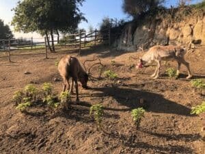
A wildlife park in the Pacciano area, within the territory of Civitella San Paolo. It is open year-round, but you need to book at 375.504.36.94. The price list shows €12 for adults, €8 for children aged 2 to 10, and free entry under 24 months. Packages that include food must be requested from the park.
Monte Soratte
An isolated ridge in the middle Tiber valley, in the municipality of Sant’Oreste, about 45 km (28 miles) from Rome. You get there on the Flaminia road in a little under an hour. The reserve and trails are free and open to all, including the hermitage of San Silvestro. For the tunnels and bunkers, see the listing.
Torri in Sabina
A village at 275 meters (902 ft) on a ridge of the Montagnola, with a little over 1,200 residents. It is about 40 minutes from the Raccordo. By train, the useful station is Stimigliano on the FL1; you cover the last stretch by bus or car.
Poggio Catino
A municipality of just under 1,300 people, at 387 meters (1,270 ft). It takes about an hour by car from Rome. The village, the Catino tower and the viewpoint are public spaces that are always open. The churches keep their own hours, so check on site.
Bocchignano
A hamlet of Montopoli di Sabina, 55 to 60 km (34 to 37 miles) from Rome. It is a lived-in village: you enter on foot, free, at any hour. From central Rome it takes an hour and a quarter without traffic, up to two hours at peak times.
Sabina What to See Near Rome: Abbeys and Olive Oil Around Fara and Farfa
This is the historic heart of Sabina. It deserves a full day.
Fara in Sabina
A medieval village at 482 meters (1,581 ft), on a ridge overlooking the Tiber valley. From Rome it takes a little under an hour: A1 to Fiano Romano, then the Salaria road. By train, get off at Passo Corese and continue with Cotral.
Farfa Abbey
The abbey is at via del Monastero 1, at the foot of Monte Acuziano. You can visit only with authorized staff, at fixed times: 10 a.m., 11 a.m. and noon in the morning; 3 p.m. and 4 p.m. on standard time; 3:30 p.m. and 4:30 p.m. on daylight saving time. It is closed to visitors on Mondays. The individual ticket is €6.50. The phone number is 0765 277065.
Castelnuovo di Farfa and the Museo dell’Olio
The reason to come up here is the Museo dell’Olio della Sabina, which opened in 2001 at Palazzo Perelli. A full ticket costs €6, a reduced ticket €3. It is open on weekends and holidays from 10 a.m. to 6 p.m.; on weekdays you enter by appointment for groups. Call ahead, because hours change with the season.
Farfa Gorges
A natural monument of 64.48 hectares (159 acres) in the municipality of Mompeo, carved by the Farfa river. Entry is free, with no ticket office and no set hours. The marked trail goes down into the gorge from a point given with coordinates in the listing.
Around Rieti: Villages and Sanctuaries
Rieti is the base for this part of Lazio. Roads to the villages of the basin and the mountains start from there.
Rieti
A provincial capital at about 400 meters (1,312 ft), on the Velino river. It is 80 km (50 miles) from Rome, about an hour and a quarter by car. The Cotral bus from Tiburtina takes about an hour and forty minutes; the train takes between an hour forty and two and a half hours. The station is a ten-minute walk from the center.
Contigliano
A municipality of about 3,600 people, 7 km (4 miles) west of Rieti. The center is the square of the collegiate church of San Michele Arcangelo. From Rome it is about 90 km (56 miles), a good hour and a half. By train, you change at Terni.
Cantalice
Visiting the center is free; the churches open during services. From Rieti there is a Cotral line to Cantalice Castello.
Rivodutri
A little over 1,000 people, at about 560 meters (1,837 ft), on the lower slopes of Terminillo. You can walk the center in a couple of hours. The churches and the alchemical door are free to enter, and the Santa Susanna springs are also freely accessible. From Rome it takes just under an hour and a half.
Poggio Bustone
A village of just under 2,000 people at 754 meters (2,474 ft), about 100 km (62 miles) from Rome. The Franciscan Sanctuary of San Giacomo, just above the village, opens in summer from 8 a.m. to 1 p.m. and from 3 p.m. to 7 p.m. Hours for other seasons are in the listing.
Greccio Sanctuary
A convent clinging to a rock face above the Rieti basin. According to Tommaso da Celano, the nativity scene was born here on the night of December 25, 1223. It is the right stop for anyone looking for a place tied to St. Francis.
Lake Turano, Lake Salto and the Border Villages
East of Rieti, Sabina becomes a landscape of reservoirs and villages in the hills. These are the coolest stops in summer.
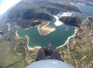
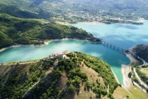
Lake Turano
A reservoir at 536 meters (1,759 ft), about 10 km (6 miles) long, with four lakeside municipalities: Castel di Tora, Colle di Tora, Ascrea and Paganico Sabino. You get there in just under an hour and forty minutes on the A24 to Carsoli. Access is free; you pay for sun loungers and rental canoes.
Castel di Tora
A village at 607 meters (1,991 ft) on the northeastern shore of Turano. You can enter freely at any hour. By car from Rome it takes a little over an hour. Cotral buses run from Rieti, with few departures, so check the schedule before you leave.
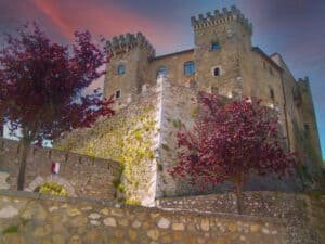
Collalto Sabino
A village at 980 meters (3,215 ft) on the border with Abruzzo, inside the Monte Navegna and Monte Cervia Reserve. From Rome it takes a little under an hour from the Carsoli-Oricola exit of the A24. The village is free; the baronial castle is listed as closed to tourist visits.
Lake Salto
Reach it from the SS578 Salto Cicolana road, leaving the A24 at the Valle del Salto exit. The reference point is Petrella Salto, about 115 km (71 miles) from Rome. The lake itself is free to access; you pay only for umbrellas, canoes and similar. Swimming is allowed in designated areas.
Rieti Mountains: Leonessa, Terminillo, Amatrice and Accumoli
These are the farthest stops. You need a car and a full day.
Leonessa
You get there by car: A24 to Borgorose, then the SS578, about 110 km (68 miles) and an hour and forty minutes. It has held the Touring Club Orange Flag since 2003. There is no railway station.
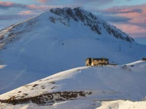
Terminillo
At 2,217 meters (7,274 ft), it is the highest peak of the Monti Reatini. From Rome it takes about two hours: Salaria road to Rieti, then the Terminillese road to Pian de’ Valli. Without a car, a city bus runs from Rieti, about fifty-five minutes, with few departures.
Amatrice
There is no station, and buses have few departures. There is no entrance fee: you walk in and park for free.
Accumoli
Since August 24, 2016, the historic center has been a red zone, fenced off and closed to walking. You see the village from outside; you can visit the hamlets, the trails of the Monti della Laga and the monumental cemetery, partly reopened in August 2025. From Rome it is about 150 km (93 miles).
Practical Tips for Planning Your Trip
- Distances: Monterotondo, Civitella San Paolo and Monte Soratte are the closest; Amatrice and Accumoli are the farthest.
- Public transport: almost everywhere, Cotral buses run only a few times a day. Check the schedule on the operator’s website before you leave.
- Reservations: required for Arca dei Camaleonti and for groups at Farfa. Call ahead for the Museo dell’Olio.
- Costs: villages, reserves and lakes are free. You pay for Farfa, the museum, the wildlife park and services at the lakes.
To combine other stops, also read Lakes Near Rome for Swimming, Mountains Near Rome and Hill Towns in Lazio: Where They Are and How to Get There. For a trip in a different direction, see Tivoli Day Trip from Rome: Hot Springs, Villa d’Este and Hadrian’s Villa.
How to Choose Among the Stops in Sabina
With half a day, Monterotondo, Civitella San Paolo or Torri in Sabina are enough. With a full day, the most coherent itinerary combines Fara in Sabina, Farfa Abbey and the Museo dell’Olio. Lakes work best in summer, villages in autumn. The key to Sabina what to see near Rome is to start from how far you are willing to drive.
FAQ: Sabina What to See Near Rome
What is the closest stop to Rome?
Monterotondo, about 30 km (19 miles) away: from the Raccordo it takes 25 to 30 minutes without traffic. Civitella San Paolo and Monte Soratte are also close, both 40 to 45 km (25 to 28 miles) away.
Where can you see Sabina olive oil?
At the Museo dell’Olio della Sabina in Castelnuovo di Farfa, at Palazzo Perelli. A full ticket costs €6. It is open on weekends and holidays from 10 a.m. to 6 p.m.
How do you visit Farfa Abbey?
Only on a guided visit, at fixed times, never on Mondays. The individual ticket is €6.50. Groups must book through the abbey’s tourist office.
Which places are free?
Villages such as Castel di Tora, Collalto Sabino and Bocchignano are free, as are Lake Turano, Lake Salto, the Farfa Gorges and Monte Soratte. You pay for extra services, such as sun loungers and canoes.
Can you go without a car?
In part. Monterotondo is on the FL1, you reach Fara in Sabina from Passo Corese, and Rieti has trains and buses from Tiburtina. Amatrice and Leonessa have no railway station. Check Cotral schedules before you leave.
All the places in this guide (24)
 Monterotondo (RM)Monterotondo (RM)Monterotondo is a city of about 41,000 inhabitants in the Metropolitan City of Rome, at 165 meters above sea level, on a hill overlooking the Tiber…
- Civitella San Paolo (RM)Civitella San Paolo (RM)Civitella San Paolo is a walled village of just over 2000 inhabitants in the province of Rome, on the right bank of the Tiber, about 40 kilometers…
- Arca dei Camaleonti – Civitella San PaoloCivitella San Paolo (RM)Arca dei Camaleonti - Civitella San Paolo - Località Pacciano, 00060 Civitella San Paolo RM, Italy
- Monte Soratte (RM)Sant'Oreste (RM)Monte Soratte is the Sacred Mountain sung by Pliny, Virgil and Horace: “Vides ut alta stet nive candidum/ Soracte, nec iam sustineant onus/ siluae…
- Torri in Sabina (RI)Torri in Sabina (RI)Torri in Sabina is in the province of Rieti, at 275 meters above sea level, on a ridge of the Montagnola that overlooks the valley of the Aia strea…
- Poggio Catino (RI)Poggio Catino (RI)Poggio Catino is a municipality of just under 1,300 inhabitants in the province of Rieti, in Sabina, at an elevation of 387 meters, with an area of…
- Bocchignano (RI)Bocchignano (RI)Bocchignano is a hamlet of the municipality of Montopoli di Sabina, in the province of Rieti, about 55-60 kilometers from Rome. The village is an i…
- Fara in Sabina (RI)Fara in Sabina (RI)Fara in Sabina is a medieval village in the province of Rieti, in Lazio, perched at 482 meters above sea level on a ridge that looks over the Tiber…
- Farfa Abbey (RI)Fara in Sabina (RI)Farfa Abbey is at Via del Monastero 1, in Fara in Sabina, province of Rieti, at the foot of Monte Acuziano and about a hundred meters from the stre…
- Castelnuovo di Farfa (RI)Castelnuovo di Farfa (RI)Castelnuovo di Farfa can be reached in a little over an hour from Rome: the town hall and municipal offices occupy Palazzo Perelli, on Viale Regina…
- Farfa GorgesMompeo (RI)Farfa Gorges - Strada delle mole, 02040 Near Rome>Villages and Small Towns>Mompeo (RI) RI, Italy
- Rieti (RI)Rieti (RI)Rieti is the capital of the northernmost province of Lazio and stands at about 400 meters above sea level in the Rieti basin, on the banks of the V…
- Contigliano (RI)Contigliano (RI)Contigliano is a municipality of about 3,600 inhabitants in the province of Rieti, seven kilometers west of the provincial capital, on the southwes…
- Cantalice (RI)Cantalice (RI)Cantalice is a municipality of a little over 2,400 residents in the province of Rieti, perched on the southwestern slopes of the Reatini Mountains…
- Rivodutri (RI)Rivodutri (RI)Rivodutri is a municipality of a little over 1,000 inhabitants in the province of Rieti, lying at about 560 meters above sea level on the western s…
- Poggio Bustone (RI)Poggio Bustone (RI)Poggio Bustone (RI) is a village of just under 2,000 inhabitants in the province of Rieti, at 754 meters above sea level on the flank of Monte Rosa…
- Greccio Sanctuary (RI)Greccio (RI)Some places tell their own story and some ask to be explained. The Greccio sanctuary belongs to the second kind: if you come up here without knowin…
- Lake Turano (RI)Lake TuranoLake Turano is an artificial reservoir in the province of Rieti, in eastern Sabina, with the water surface at an elevation of 536 meters above sea…
- Castel di Tora (RI)Castel di Tora (RI)Castel di Tora is one of the wonders of Lazio, set in an evocative scenery of woods, gorges, streams and lakes. About an hour from Rome, it is cons…
- Collalto Sabino (RI)Collalto Sabino (RI)Collalto Sabino is a municipality in the province of Rieti, perched at 980 meters on the border between Lazio and Abruzzo, inside the boundaries of…
- Lake Salto (RI)Lake SaltoLake Salto is the largest artificial lake in Lazio, located in the province of Rieti, created in 1940 by damming the Salto River with the Salto Dam…
- Terminillo (RI)TerminilloTerminillo (2217 meters) is the highest peak of the Reatini Mountains and closes the Rieti basin to the east, the basin of Rieti. You reach it from…
- Amatrice (RI)Amatrice (RI)Amatrice stands at 955 meters above sea level in the province of Rieti, at the far northeast of Lazio, where the region touches Umbria, Marche and…
- Accumoli (RI)Accumoli (RI)You reach Accumoli from State Road 4 Salaria, at around kilometer 142, at an elevation of 855 meters, in the province of Rieti. The town hall is at…