Salabrone Waterfalls (VT)
In short. The Salabrone Waterfalls (VT) are a drop of the Olpeta river, in the territory of the Comune of Farnese, province of Viterbo, close to the border with Tuscany and a short distance from the southern edge of the Selva del Lamone Regional Nature Reserve.
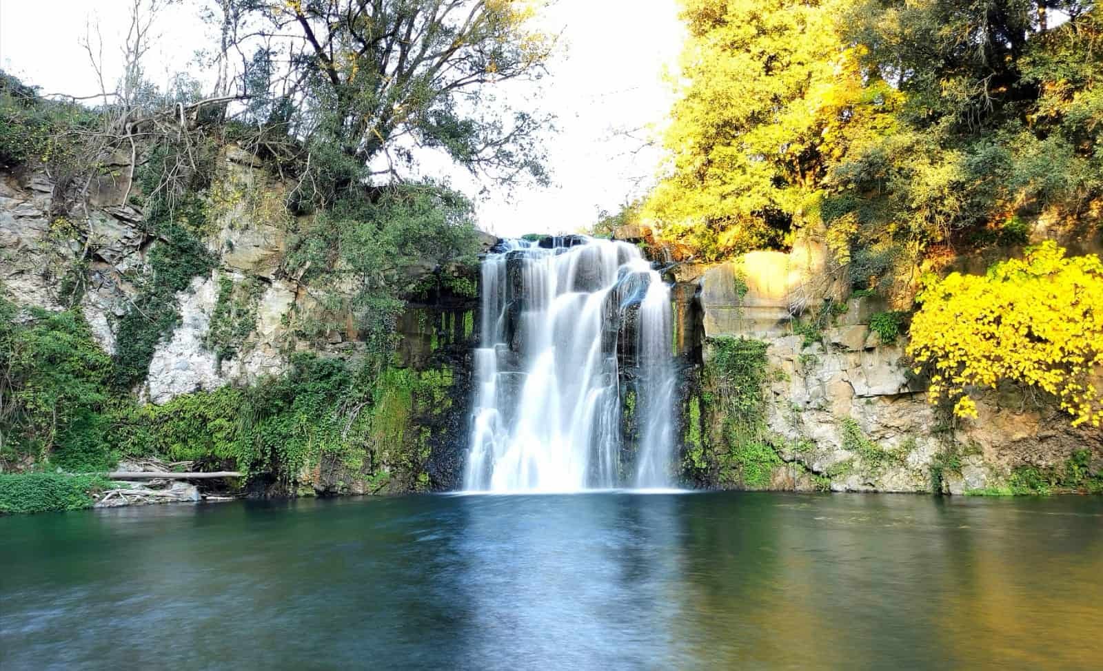
The Salabrone Waterfalls (VT) are a drop of the Olpeta river, in the territory of the Comune of Farnese, province of Viterbo, close to the border with Tuscany and a short distance from the southern edge of the Selva del Lamone Regional Nature Reserve. You reach them from the provincial road that goes down from Farnese toward Pitigliano and Manciano, leaving the car along the roadway and continuing on foot on a track that goes down toward the river. Access is free and you pay nothing. The spot is one of the few, in the whole Tuscia, where you really see water fall: the Olpeta runs sunk into the tuff and the lava flows of the Vulsini volcanic district, and the Salabrone drop opens into a basin closed by walls of dark rock, with thick riparian vegetation on both banks. The flow, however, depends entirely on the rains. Whoever arrives at the end of July risks finding a trickle on a damp wall. Whoever arrives in March, after a week of rain, finds a front you can hear from far away. Here is what to expect, how to get there without losing an hour wandering white roads, what is worth seeing within 20 kilometers and which claims, among those that circulate, are better taken with a grain of salt.
Where Are the Salabrone Waterfalls (VT) and How to Really Get There
The geography of this corner of Lazio is simpler than the cartography suggests, but it has to be understood once and for all, because here the GPS alone isn't enough. Farnese is a town of a little over 1,300 inhabitants perched on a tuff spur at 343 meters above sea level, west of Lake Bolsena, in that strip of territory that geographers call the Lazio Maremma and that Romans, when they get there, struggle to recognize as Lazio. The Olpeta river passes south of the town. The waterfalls lie along that watercourse, in the direction of Tuscany, along the provincial road that leads toward Pitigliano.
By Car: The Roads That Matter
From Rome the most direct route goes along the Cassia to Viterbo, then through Tuscania and Canino, or you take the Aurelia up to Montalto di Castro and go back up inland. In both cases it's about two and a half hours of driving, with the last half hour on narrow, winding provincial roads, with a surface that changes character every few kilometers. Whoever arrives from the north, from Tuscany, comes down from Pitigliano toward Farnese and meets the waterfall area before the town.
The traditional reference is the 12th kilometer of the provincial road between Farnese and Pitigliano, where on the left a track branches off down toward the river. I report the figure because it's the one that has circulated for years on the area's tourist pages, not as a measurement taken with an odometer: the numbering of the kilometer markers on the Viterbo provincial roads is not always legible and the signs, when there are any, are not new. The concrete thing to know is that the stopping point is a dirt pull-off at the roadside, which in winter turns to mud and on a sunny spring day can fill up fast. There is no equipped parking lot, no services, no kiosk. Whoever expects the logistics of the Monte Gelato Waterfalls, with lawn, picnic area and crowds, here finds exactly the opposite.
A warning on white roads. Around Farnese and along the whole Olpeta basin dirt roads branch off that the GPS happily proposes as shortcuts. Some are farm roads, some are inside protected areas and reserved for authorized vehicles, some end at a gate. Driving them in a low compact car means at best ruining a wheel rim, at worst getting stuck at a point where the phone has no signal. The rule I always apply in this area is trivial: you stay on the asphalt up to the indicated stopping point, and the rest you do on foot.
By Train and Bus: The Uncomfortable Truth
There is no comfortable way to get here without a car, and it's right to say so before someone buys a ticket. The nearest useful station, in a very relative sense, is Montalto di Castro on the Tyrrhenian line, or Viterbo on the line from Roma Ostiense and from Orte. From both you then need a bus and a change, and the intercity transport schedules in the inner Tuscia are built around the needs of students and commuters, not of those who want to take an outing: runs concentrated early in the morning and in the early afternoon, very long gaps in between, service reduced to a minimum on Sunday and holidays. Adding up waits and changes you easily reach four hours each way.
What You Need to Wear
Shoes with a lugged sole, not sandals and not city shoes. The descent to the water is short but the ground is the typical kind of tuff streams: packed earth that becomes slippery with moisture, outcropping roots, stretches of smooth rock. On the rocks at the water's edge a patina of algae forms that is treacherous even in the sun, and most trivial accidents in places like this happen in the last 10 meters, when you're looking for the right framing walking backward.
What the Salabrone Waterfalls (VT) Really Are: A Drop on the Olpeta River
Before talking about the drop it's worth talking about the river, because the Salabrone can't be understood without the Olpeta. It is a watercourse of about 32 kilometers that rises from Lake Mezzano, in the municipal territory of Valentano, and is the only outlet of that small circular body of water set in an explosion crater of the Latera volcanic complex. From the lake the Olpeta describes a large arc inside the caldera, crosses the territories of Valentano, Latera, Ischia di Castro and Farnese, bounds the southern slope of the Selva del Lamone, passes next to the remains of the ancient city of Castro and finally flows into the Fiora near the old bridge of San Pietro, a crossing that for centuries marked the border between the Republic of Siena and the Papal State.
32 kilometers is not much, but it's 32 kilometers that drop from an altitude of 452 meters, where Lake Mezzano rests its surface, almost to the level of the coastal plain. The elevation difference, spread over a course sunk into soft volcanic materials, produces exactly what you'd expect: a succession of gorges, narrow canyons, potholes and drops. The geographic documentation speaks of many waterfalls along the course while the river runs through the tuff, and the Salabrone is the best known of these.
Why the Drop Exists: Geology in a Few Words
This whole area is a child of Vulsini volcanism, the same that carved out the basin of Lake Bolsena and produced the Latera caldera. The rocks you see along the Olpeta belong to two different families: on one side the tuffs, that is deposits of cemented pyroclastic material, soft, easily cut by water. On the other the lava flows, compact, which resist. When a river running over tuff meets a bar of harder rock, erosion slows at that point and accelerates downstream: the result, over geological time, is a step. The Olpeta waterfalls are steps of this kind, and the dark, compact wall you see behind the drop tells the same story as the Selva del Lamone, grown on a flow dated between 150,000 and 50,000 years ago.
How Many Waterfalls, and with What Names
In the area, next to the reserve, the Olpeta forms two recognized drops cited in the documentation of the protected area: the Pelicotonno waterfall and the Salabrone waterfall. The name of the second also appears in the plural, Cascate del Salabrone, and the reason is that the water front, in flood periods, splits into several branches that fall side by side. It's a point that generates confusion: whoever looks for information finds both the singular and the plural, and sometimes becomes convinced they are two different places. They are not.
On the height of the drop there are no certain data: figures that differ from each other circulate online, none of which appears in an official source of the managing body, and a wrong figure repeated for years becomes harder to correct than to avoid. What can be said honestly is that the drop is not as high as the great Apennine waterfalls, and that its strength lies in the relationship between the water front and the closed space of the gorge: in a narrow environment, with vertical walls a few meters away, even a drop of contained size produces a disproportionate acoustic and visual effect. Whoever arrives with the Marmore Waterfall in mind will be disappointed. Whoever arrives with no expectations will find in front of them something that in Lazio is not at all common.
The Vegetation Inside the Gorge
The change of environment you cross going down toward the water is sharp. On the flat you walk through Mediterranean and agricultural vegetation, among olive trees, fields and scrub. Go 20 meters lower, inside the gorge, and the vegetation becomes riparian: willows, black alders, poplars, which on the Olpeta form continuous galleries above the riverbed. On the damp walls mosses, ferns and maidenhair settle, and the effect is that of a microclimate detached from the rest of the territory. On a July day the perceived temperature difference between the parking pull-off and the bottom of the stream is considerable.
The Fiora-Olpeta river system is recognized as a site of community interest, and among the species cited is the otter, one of the few populations recorded in Italy. It must be said right away: the probability of seeing one on a daytime outing with other people around is close to zero. It is a nocturnal, shy animal, that leaves traces more than presences. But knowing it's there changes the sense of what you're looking at, and also changes how you behave: less noise, less time spent inside the riverbed, no dog let loose.
The Water of the Salabrone Waterfalls (VT): What Is Accessible and What Is Not
This is the chapter on which it pays to be most precise, because it's where tourist pages tend to promise more than they can deliver.
The Descent
From the stopping point on the provincial road a track goes down toward the river. The indications that circulate speak of a route of a little over 500 meters, covered in about 20 minutes, and defined as suitable for everyone. These indications should be taken as found: they are measurements that don't appear in an official publication of the managing body, and the formula suitable for everyone, applied to a tuff stream with a final stretch on wet rock, is one of those that in the mountains has done damage. Common sense says otherwise: it is a short route, without technical difficulties, which however requires a steady foot, suitable footwear and the willingness to give up if conditions aren't convincing.
Signage is a chapter of its own. Some sources speak of a marked trail, others describe an informal track beaten by passage. The difference is substantial, and there appears to be no codified and maintained official marking for this specific access. Whoever goes should assume the worst: a track to recognize, no signs to count on, an offline map downloaded before leaving because phone coverage in this part of the Tuscia is patchy.
Swimming: The Honest Answer
The pools at the base of the drop are frequented. That is an observable fact. That they are swimmable is another question, and the correct answer is that no water-quality monitoring for bathing use appears to exist on this stretch of the Olpeta, nor a classification of bathing waters like the one covering sea and lakes. In the absence of that data, recommending a swim means recommending something nobody has measured.
There are then two safety reasons that hold regardless of water quality. The first is the variability of flow: a rain-fed river can change regime in a few hours, and a narrow gorge is the worst place to be when it happens. The second is that the bottom of a pool under a drop is never readable from above: irregular depth, boulders, wedged branches, undertow currents. No diving, ever, in any watercourse of this type.
The Rules Worth Knowing
The context is that of a strongly protected area. The Selva del Lamone Regional Nature Reserve, established in 1994 by regional law, covers 2,002 hectares and is managed by the Comune of Farnese. The territory includes three Natura 2000 network sites, two sites of community importance and a special protection zone. Even where you walk outside the strictly protected perimeter the common-sense rules apply that in a similar context are almost always also written rules: no fire, no collecting plants, no moving stones from the riverbed, no bivouacking, trash goes back in the backpack, the dog stays on a leash. For the specific prescriptions, including any temporary closures of routes, the reference is the managing body.
The Right Contact and Whom to Ask
The Selva del Lamone Regional Nature Reserve has its seat in località Bottino, in Farnese. The contacts published on the regional portal of Lazio's protected areas are the landline 0761 458861, the mobile number 331 2346429 and the e-mail address rnselvalamone@regione.lazio.it. The reference page is parchilazio.it/selvadellamone. The Comune of Farnese answers at 0761 458381 and at the address segreteria@comune.farnese.vt.it, with its seat at Corso Vittorio Emanuele III 395.
A phone call before leaving is the most useful gesture of the whole organization, for three concrete reasons. First: knowing if an access is closed for works, for hydrogeological risk or for nesting season. Second: knowing what the flow is like at that moment, information that no website provides in real time and that the people who work there know. Third: checking if guided excursions are scheduled, which in the Selva del Lamone and surroundings are organized with archaeologists and volunteers at certain times of the year.

A Curiosity About the Salabrone Waterfalls (VT)
The curiosity concerns the name, and it's the kind nobody tells because it requires admitting an uncertainty. Salabrone has no ascertained and shared etymology. It appears in local place names tied to this stretch of river and to the surrounding lands, but there is no documented explanation that gets the sources to agree. The hypotheses that circulate in the area are at least three, and it's worth knowing them all precisely because none is certified.
The first hypothesis ties the name to the root of salt, and would be consistent with a territory crossed for millennia by transhumance and trade routes between the Tyrrhenian coast and the interior: the salt of the coastal salt pans went up toward the pastures of the hinterland, and the salt roads left names along the whole peninsula. The second hypothesis looks to the dialects of upper Lazio and the Maremma, where there are terms tied to the hornet and to insects that nest in tuff walls: a gorge full of natural cavities is exactly the kind of place that takes its name from its noisiest inhabitants. The third points to a pre-Latin base, Etruscan or pre-Etruscan, as happens for very many hydronyms of central Italy, whose semantic transparency has been lost for 2,500 years.
The interesting part isn't choosing, but understanding why the choice is impossible. In this strip of territory Bronze Age peoples, Etruscans, Romans, Lombards, Cistercian monks, feudal lords, transhumant shepherds and brigands followed one another without interruption. Each layer left names, and each following layer reinterpreted them in its own language. A place name like Salabrone is a linguistic sediment, exactly as the wall behind the drop is a geological sediment: it can be read, it can't be dated with precision.
The Ruins of the Powder Mill and the Hydroelectric Plant on the Olpeta
Near the waterfall are the remains of a powder mill that local tradition dates to the 1700s, and a little farther downstream those of a small hydroelectric plant. They are two ruins that say much more than their size would suggest, because they tell the only two things that human beings ever seriously asked of this river.
The Powder Mill
A powder mill along a watercourse is not an oddity: it's the rule. The production of black powder required grinding and mixing saltpeter, sulfur and charcoal, operations entrusted to millstones and mortars driven by water wheels. It also required isolation, for obvious reasons: workshops of this kind were placed away from towns, at the bottom of narrow valleys, where an eventual explosion would do less damage. A gorge like that of the Olpeta, with constant water, an exploitable drop and containing walls, was the perfect place.
Then there is the historical context, which explains why right here. This territory was for more than a century the heart of the Duchy of Castro, the feudal state created in 1537 by Pope Paul III Farnese for his son Pier Luigi, formally subject to the Holy See and in fact autonomous. After the destruction of Castro in 1649 the area returned to the Patrimony of Saint Peter, and for the Papal State remained a border zone with the Grand Duchy of Tuscany: land of customs posts, smuggling and garrisons. A powder manufactory in a position like this had a military logic as well as an industrial one.
Of that structure today there remain masonry, openings and traces of channeling, in conditions that do not allow organized visits. On the ruins the recommendation that holds for all unconsolidated ruins applies: you look from outside. The masonry of a building abandoned for generations, in a constantly damp environment overrun by vegetation, offers no guarantee of stability, and the idea of climbing for a better photograph is the worst you can have in a place where rescue takes a long time to arrive.
The Hydroelectric Plant
Farther downstream you meet the remains of a small hydroelectric plant. This too is a story repeated all over Italy between the end of the 1800s and the first decades of the 1900s: every exploitable drop of water became a small power station, every small power station lit a town. Before the unification of the national grid, electricity was a local matter, and a village of a few hundred inhabitants with a river two kilometers away had what it took to switch on its own light bulbs 50 years before larger towns without water on a slope.
Something Nobody Tells You About the Salabrone Waterfalls (VT)
What is not said is that this is a seasonal waterfall, and that the kind of trip it entails is therefore different from that of any other attraction in the Tuscia. A museum opens at fixed hours, an Etruscan necropolis is there all year, a village on a tuff spur doesn't change. A rain-fed waterfall changes every week, and the difference between the successful visit and the useless one is played on a factor you don't control.
The mechanism is simple to understand. The Olpeta has no glacier upstream nor an artificial reservoir to regulate its flow: it has a small crater lake as its source and for the rest lives on rainfall and local springs. In July and August, after weeks without rain, the flow can shrink to the point of turning the drop into a veil. The photographs that circulate, almost all taken between November and May, don't lie but tell only half the year.
The practical consequence is that the previous day's rule counts more than the season. A dry October can give less water than a rainy June. Whoever wants to be reasonably sure should look at the previous week's precipitation over the area between Valentano, Latera and Farnese, and not limit themselves to choosing the month on the calendar. And whoever arrives anyway in a lean phase should reorganize the day on another axis: the village, the museum, the forest, the remains of Castro. The territory holds up even without the water, if you know in advance that the water won't be there.
The second aspect nobody mentions concerns the opposite effect. After very intense rains the place becomes dangerous, not spectacular. Muddy water, an invisible bottom, eroded banks, branches carried by the current and the impossibility of judging depth turn a quiet outing into a serious risk, and the gorge leaves no quick escape routes. The good window is the intermediate one: a few days after the rain, not during and not immediately after. Whoever lives in the area knows it and organizes accordingly. Whoever arrives from outside tends to think more water is always better, and it isn't true.
Frequently Asked Questions About the Salabrone Waterfalls (VT)
What Are the Salabrone Waterfalls?
The Salabrone Waterfalls are a drop on the Olpeta river, a watercourse of about 32 kilometers that rises from Lake Mezzano, in the municipal territory of Valentano, in Viterbo Province. They lie in the territory of Farnese and are a seasonal waterfall, fed by the rains, not an attraction active all year with the same flow.
In Which Comune Are the Salabrone Waterfalls?
The Salabrone Waterfalls are in the territory of Farnese, in Viterbo Province, along the Olpeta river, near the border with Tuscany. Farnese is a town of a little over 1,300 inhabitants perched on a tuff spur at 343 meters above sea level, west of Lake Bolsena.
Do You Pay a Ticket to See the Salabrone Waterfalls?
No, access to the Salabrone Waterfalls is free and no tickets or tolls appear to exist. There are also no services, refreshment points or equipped parking lots on site, so it's best to get organized in advance with water and sun protection.
Do the Salabrone Waterfalls Always Have Water?
No, the Salabrone Waterfalls are a seasonal waterfall, fed by the rains, and their flow changes every week unlike a museum or a village that stay identical all year. The difference between a successful visit and a useless one therefore depends a lot on the period and on recent rains.
Are the Salabrone Waterfalls Inside the Selva del Lamone Reserve?
The Salabrone Waterfalls are on the Olpeta river, which bounds the southern slope of the Selva del Lamone Regional Nature Reserve. The reserve covers 2,002 hectares, about 90 percent covered by forest, grown on a lava flow that made the ground unusable for agriculture.
What Is the Best Time to Go to the Salabrone Waterfalls?
The best time to visit the Salabrone Waterfalls is spring, in particular between the second half of March and the end of May, when the Olpeta still has the flow accumulated during the winter and the riparian vegetation is green but not too thick. If you have to choose just one week, the second half of April is the recommended one.
What Is Near the Salabrone Waterfalls?
Near the Salabrone Waterfalls is Farnese, a medieval town on a tuff cliff, with the Museo Civico Ferrante Rittatore Vonwiller, which holds the finds from excavations in the territory from the Bronze Age to the Etruscan age, the monumental fountain inaugurated in 1887 and the Poor Clares monastery.
The Advice I Give You for Visiting the Salabrone Waterfalls (VT)
The first piece of advice is not to build the day on the waterfall. Build it on the territory and put the waterfall inside it, as one of the three or four moments. The reason is the one just given: if the flow disappoints, a day built on a single objective is a lost day, while a day built on Farnese, the forest, the river and a second village holds up anyway. In the inner Tuscia the density of things to see per square kilometer is high, and it would be absurd to drive two and a half hours for 20 minutes of water.
The second piece of advice is about timing. Early morning, no discussion. In the gorge the light enters for a few hours, and in early morning it arrives raking, producing the contrast that makes the scene readable. At noon it falls straight down and flattens everything. In the afternoon the basin is already in full shade. Added to the light is the question of numbers: whoever arrives by eight has a good chance of having the place to themselves, whoever arrives at 11 on an April Sunday finds a line on the track.
The fourth concerns guiding. In a territory like this the difference between seeing a waterfall and understanding a landscape is made by someone who can read a tuff wall, tell an alder from a poplar and explain why a powder mill was at the bottom of a ditch. Guided excursions in the Selva del Lamone are also organized with archaeologists and volunteers. For a day built to measure, with a licensed tour leader, the reference is TourLeaderPro. It isn't an enthusiast's detail: it's the difference between an outing and something that lasts.
The sixth and last: give up without regret if conditions aren't convincing. High, muddy water, rain in progress, an impassable track, darkness coming. The place stays where it is and in two months it will be better. No photograph is worth a broken ankle at the bottom of a ditch with the phone not picking up signal.
The Green, the Selva del Lamone and the Trails Around
The waterfall is the point, but the context is one of the most distinctive wooded areas of central Italy. The Selva del Lamone Regional Nature Reserve covers 2,002 hectares, about 90 percent covered by forest and the remaining 10 by agricultural areas, and it grew on a lava flow that made the ground unusable for agriculture. That is the simple, material reason why the forest survived while everything around was cleared: not because someone protected it, but because nobody could plow those blocks.
The Murce and the Craters
The local term for accumulations of lava blocks is murce. They are chaotic heaps of stone, partly covered with moss and vegetation, that make walking off-trail tiring and disorienting. The second characteristic formation is the collapse craters, inverted-cone depressions inside which cold air stagnates and a vegetation of Apennine hill forest settles, different from the Mediterranean one that grows 10 meters higher on the boulders. Passing from one environment to the other in a few minutes of walking is the experience described by everyone who has been there.
The Trails You Hear About
The hiking network of the reserve counts over 20 trails and mountain bike itineraries, including CAI-marked routes. The names that recur in the indications and in local tradition are those of the Strompia trail, which touches the rock formation of the same name and crosses clearings of charcoal burners and shepherds' huts, and that of Rosa Crepante, tied to the most cited of the collapse craters. They are routes described as simple, but the simplicity here concerns elevation and not orientation: visual landmarks are very few and false tracks are many.
I don't list lengths, times and elevation gain route by route, and the reason is practical: numbering and routes are updated by the managing body, and a wrong list on a page consulted by thousands of people does more damage than an absent list. The valid map is picked up at the reserve office or on the regional portal of protected areas before leaving, and whoever enters the forest without a map and without a compass makes a choice that in the Selva del Lamone is paid for more than elsewhere.
The Sentiero dei Briganti
The Sentiero dei Briganti is a CAI-marked itinerary that connects the Selva del Lamone to the Monte Rufeno Nature Reserve, in the upper Viterbo area toward Acquapendente, also passing through Tuscan territory. It can be done on foot, by mountain bike and on horseback, and it is a multi-day trek: planned stages, booked stopover places, water calculated. Whoever does it by bicycle must allow for sections to be pushed, because the ground on the murce is not rideable in any optimistic reading of the term.
The Other Waterfall of the Olpeta
The Pelicotonno is the second drop of the river in the same area. It is less frequented and less photographed than the Salabrone, and for whoever seeks a place with nobody around it is often the better choice. The very same warnings apply: flow dependent on rains, slippery rocks on the final stretch, no services. Whoever has time for both should do them in the same morning, because they are close and because the comparison shows the character of the river better than any description.

Another Well-Known Fact, Yet Rarely Cited
That this is brigand land everybody knows, and the story of Domenico Tiburzi is told at every festival in the upper Viterbo area. What is cited much less is the reason why brigandage here could last for decades, and the answer is not the forest.
The romantic version says the brigands hid in the impenetrable forest and nobody could flush them out. It is true only in part. The forest helped, certainly, because it was unreadable for those who had not grown up in it and perfectly readable for those who knew it block by block: the same geology that today disorients hikers then guaranteed an enormous advantage to those who knew where to pass. But a fugitive doesn't live on trees. He lives on bread, on information and on silence, and those were given to him by people.
The band that operated between the upper Viterbo area and the lower Grosseto area worked in fact as a private police of the large landowners, and financed itself with what the sources call the brigandage tax, a tribute paid in money or in kind. It wasn't a band at war with the territory: it was a piece of the local economic system, tolerated and partly wanted by those who had an interest in a parallel order in the countryside, in a phase when the unified State reached this periphery with difficulty. The trial held in Viterbo in 1893 had national resonance, drew observers including foreigners and gave material to the first modern journalistic reportage.
There is a second well-known fact worth putting in relation with the first: the relationship between water and power in this territory. Whoever controlled the Olpeta controlled the mills, the fulling mills, the powder mills and later the turbines. In a territory with no other energy, a drop of water was an industrial plant, and the boundaries between properties often ran along the river precisely because the river was worth something. The bridge of San Pietro, where the Olpeta flows into the Fiora, marked for centuries the border between the Republic of Siena and the Papal State: a river that today is looked at for its waterfalls was for generations a political line, a source of income and a reason for dispute.
The Right Photo to Take at the Salabrone Waterfalls (VT)
The wrong one first, because it's the one almost everyone takes: the waterfall framed head-on, in the center, at full midday, with the sky blown out in the upper part of the frame. In a narrow gorge this image never works, for a technical reason: the brightness range between the shaded rock and the sky exceeds what a sensor can record, and the result is a black wall under a white blotch.
The Light
The good window is early morning, when the light enters raking and draws the walls instead of crushing them, or a day of uniformly overcast sky, which is the ideal condition for photographing water and vegetation because it eliminates contrast and saturates the greens. Direct overhead sun is the worst condition of all. On clear April days the basin goes from shade to light in a few tens of minutes, and it's worth arriving early and waiting rather than arriving late and regretting.
Exposure Times
On moving water the choice of shutter speed completely changes the result, and there is no rule right for everyone. A time around half a second or one second makes the thread of water soft while keeping the structure of the jet: it's the compromise that works almost always. Going to 10 or 15 seconds gives the milky surface that social media like and that erases all information: the drop becomes a uniform white blotch and the photograph stops saying anything about the place. On the other side, a fast time, around a thousandth of a second, freezes the droplets and conveys the violence of the impact, which in periods of full flow is a far more honest image than silk.
Framings That Work
The first is lateral and low, with the wall on the diagonal and the drop shifted toward a third of the frame: the gorge gains depth and you understand how narrow it is. The second uses the riparian vegetation as a frame, with willow or alder branches in the foreground and the water in the background: it's the image that conveys the microclimate better than any panorama. The third is detail: the moss on the dripping rock, the maidenhair growing on the damp wall, the surface of the pool with bubbles rotating. The fourth, which almost nobody takes, is the ruin of the plant or the powder mill with the greenery wrapping it, and on a photo page about the territory it is often the strongest image of all.
What Not to Do
Don't move stones and branches to improve the composition: you are altering the bed of a watercourse inside a site of community interest. Don't enter the water to get the perfect angle when the flow is strong. Don't use the drone without having checked the rules applicable to the protected area, because in contexts like this there are precise limitations and disturbance to nesting wildlife is a real problem. And don't leave anything, not even a peel: in a closed gorge trash stays for seasons.

Some Important Events That Happened Here in History
The river and its basin have never been a natural void. Here are the passages that have left marks still readable today within a few kilometers of the waterfall.
The Bronze Age and the Pile Dwellings of Mezzano
At the source of the Olpeta, in Lake Mezzano, underwater explorations carried out starting in 1973 have identified submerged pile-dwelling villages. The recovered materials document an occupation running from the Copper Age, in the third millennium BC, through the Apennine culture of the Bronze Age, up to the Final Bronze Age in the 12th century BC. In the same chronological horizon lies the settlement of the Sorgenti della Nova, not far away. Put differently, the Olpeta basin was permanently inhabited 3,000 years ago.
The Etruscans and Rome
In the Etruscan age this strip of territory gravitated toward Vulci, one of the great cities of the dodecapolis, whose settlement lies on the Fiora downstream of the confluence with the Olpeta. In the Selva del Lamone the remains of the late Etruscan fortress of Rofalco and the chamber tomb called del Gottimo are preserved. The Roman conquest of Vulci in the third century BC changed the balance of the whole area, which became agricultural and transit territory: traces of farms and roads remain.
The Lombards and the Cistercians
In the forest stands the church of Santa Maria di Sala, founded in the Lombard period and rebuilt in the 12th century by the Cistercians, the object of a restoration between 2013 and 2014. It is the sign of the passage from military garrison to monastic garrison, which in central Italy meant for centuries land reclamation, cultivation and control of the territory.
The Duchy of Castro, 1537 and 1649
This is the story that weighs most on this landscape. On October 31, 1537, with the bull Videlicet immeriti, Pope Paul III Farnese created the Duchy of Castro for his son Pier Luigi: a feudal state formally subject to the Holy See and in fact autonomous, extending over a strip between the Tyrrhenian and Lake Bolsena, from the Marta river to the Fiora. It included Castro, Montalto di Castro, Canino, Valentano, Gradoli and Ischia di Castro, in addition to Farnese.
In the 1600s the papacy tried to retake the enclave and from this came the two Wars of Castro, between 1641 and 1644 and between 1646 and 1649. On September 2, 1649 the troops of Innocent X took the city after the siege. Castro was razed to the ground, salt was sown on the ruins and a column was erected there in memory of the destruction. On December 19 of the same year the duchy passed formally to the Papal State. The ruins of Castro lie a little south of Farnese, along the Olpeta, and they are the reason this valley has a history out of proportion to its size. Careful not to confuse: the family that gave its name to the duchy is the same as the great Renaissance palaces, including the Palazzo Farnese in Caprarola, but the town of Farnese is a comune in Viterbo Province and is a different thing from the palace.
The Garibaldian 1867
In 1867, during the Agro Romano campaign, the territory of Farnese was the scene of a clash tied to Garibaldi's attempt on Rome. It is a minor episode in national history and central in local memory, as almost always happens in these towns.
Brigandage and the 1893 Trial
Between the 1870s and 1890s the Lamone forest was the operating territory of the best-known band of post-unification brigandage in upper Lazio. The Viterbo trial of 1893 formally closed that season and handed it to the national news.
The 1900s: The Small Power Station and the Reserve
Between the end of the 1800s and the first decades of the last century the Olpeta was exploited for electricity production on a local scale. In 1994, with regional law number 45, the Selva del Lamone Regional Nature Reserve was born, entrusted to the Comune of Farnese: the passage from productive use to protection, which took place in exactly a century.
Who Has Passed Through the Salabrone Waterfalls (VT)
The question of who has passed through here deserves a sincere answer: there is not, for this specific point of the river, a documented list of illustrious visitors, and inventing one would be as easy as it would be useless. What can be reconstructed is who has passed through this valley, and it is not little.
The first are the Bronze Age communities who lived at the Sorgenti della Nova and on the shores of Lake Mezzano, along the same watercourse. Then the Etruscans of Vulci and the garrison of Rofalco, who defended the fortress against Roman expansion. Then the Romans, with their farms and their roads. Then the Cistercian monks of Santa Maria di Sala, who brought to this valley an agricultural technique and an idea of landscape.
From the 1500s the valley belongs to the history of the Farnese, the family that from here rose to the papal throne with Paul III and that built, with the proceeds and the prestige of this piece of Maremma, some of the most important buildings of the Italian Renaissance. Pier Luigi Farnese, first Duke of Castro, walked these countrysides. A century later the armies of the Wars of Castro passed through, with their military engineers and their sieges.
In the 1800s the brigands passed through and the carabinieri who chased them, and with the 1893 trial came the chroniclers, among them the first reporters of modern Italian journalism, who wrote about this territory for the readers of the big cities. In 1867 the Garibaldians passed through.
When to Go to the Salabrone Waterfalls (VT) and When to Avoid Them
The right season is spring, and by a good margin. Between the second half of March and the end of May the Olpeta still has the flow accumulated during the winter, the riparian vegetation is green but not yet so thick as to close off every view, the undergrowth of the nearby forest is covered with flowers and the temperatures allow walking for hours. If you have to choose just one week, it's a week of April, possibly a few days after a rain.
Autumn is the second choice and is quieter. From mid-October onward, when the rains have resumed, the river is back in shape and the forest changes color. Winter gives the best flows of all, but the days are short, the ground is muddy and the cold inside the gorge is biting: it's the season for those who know what they are doing and have the right gear.
Full summer, July and August, is the period to avoid, for two reasons that add up. The first is the flow, which in dry years shrinks to little. The second is that the heat of the inner Maremma in those months makes even the drive tiring, and the reward is not proportionate. Whoever finds themselves in the area in August anyway should treat the waterfall as a secondary stop and build the day on Lake Bolsena or on the villages.
Ticks, Vipers and Other Concrete Things
From April to October ticks are a real presence throughout the scrub of upper Lazio. Long pants, socks over the pants in stretches through tall grass, a body check the same evening. The asp viper is cited among the reptiles of the reserve: don't put your hands in the crevices between boulders and don't walk barefoot. On damp days the rock is slippery everywhere. And in the evening hours, in a closed valley floor, darkness arrives much earlier than on the flat: the return must be calculated with a wide margin.
What Is Around the Salabrone Waterfalls (VT)
The advantage of this area is that in half an hour by car the scenery changes completely. The natural starting point is Farnese, a medieval town on a tuff cliff, with the Museo Civico Ferrante Rittatore Vonwiller that holds the finds from excavations in the territory, from the Bronze Age to the Etruscan age, the monumental fountain inaugurated in 1887 and the Poor Clares monastery with the church of Santa Maria delle Grazie. It's a small village and should be taken for what it is: half a day, no more, but well spent.
To the south, along the Olpeta, are the ruins of Castro, the city erased in 1649. To the west, on the Fiora, you reach Vulci, with the archaeological park, the Abbadia castle and the Devil's Bridge: it is the visit that more than any other gives historical depth to the day. Toward the coast you go down to Montalto di Castro and, a little farther north in Tuscany, to Pitigliano, the tuff town that is probably the most photographed image of this whole border.
To the east opens Lake Bolsena, the largest volcanic lake in Europe, with Bolsena, Capodimonte, Marta, Montefiascone and, on the western side, Valentano and Grotte di Castro. Toward the interior are Tuscania, with its Romanesque churches, and Tarquinia, with the painted tombs recognized by UNESCO. Farther away, but within an hour, Viterbo with the medieval quarter and the Palazzo dei Papi, Civita di Bagnoregio and, across the regional border, Orvieto.
Whoever wanted to build an itinerary on the waterfalls of Lazio finds material for more than a weekend: besides the Monte Gelato Waterfalls and the Diosilla Waterfalls in the Monterano area, there are the Acquarossa Waterfalls and the Inferno Waterfall in the Veio Park.
Quick Questions About the Salabrone Waterfalls (VT)
Is There an Entrance Fee?
No. Access is free and no tickets or tolls appear to exist. There are also no services, refreshment points or equipped parking lots.
In Which Comune Are They?
In the territory of Farnese, in Viterbo Province, along the Olpeta river, near the border with Tuscany.
Are They Inside the Selva del Lamone Reserve?
They are on the river that bounds the southern slope of the reserve, right next to its perimeter. The reference body for information is in any case the reserve, managed by the Comune of Farnese.
How Long Does the Walk Down Take?
The indications that circulate speak of a little over 500 meters and about 20 minutes. They are data from tourist tradition and not from an official source: it's best to allow more time and check on site.
Can You Swim in the Pools?
No monitoring of water quality for bathing appears to exist on this stretch of river, and the depth under a drop can't be assessed from above. I don't recommend swimming and I absolutely advise against diving.
How High Are They?
There is no figure published by an official source. The figures that circulate don't agree, and I prefer not to report any.
When Is There More Water?
Between November and May, and in any case in the days after a rain. In July and August the flow can shrink enormously.
Are There Other Waterfalls Nearby?
Yes, the Pelicotonno, on the same river and in the same area, less frequented.
Can You Get There by Train?
Not in a practical way. You need your own car, a rental or a tour leader with a vehicle.
Is It Suitable for Kids?
The route is short, but the final stretch on wet rock requires constant supervision. With small children it's best to judge on site and give up without hesitation if the ground is slippery.
Are Dogs Allowed?
In reserve contexts the leash applies, both for wildlife and for the dog's safety on wet rock. The specific prescriptions should be asked of the managing body.
Is There Phone Signal?
Coverage in the inner Tuscia and inside the valley floors is patchy. Maps should be downloaded offline before leaving.
Can You Use a Drone?
On protected areas there are limitations. It should be asked in advance of the managing body and the competent authorities.
What Is the Contact for the Reserve?
Seat in località Bottino, Farnese (VT). The contacts published by the regional portal of protected areas are the phone 0761 458861, the mobile number 331 2346429 and the address rnselvalamone@regione.lazio.it.
What Not to Expect
Services, signs, organized safety and guaranteed water. This is a ditch in a territory with little infrastructure, and its beauty depends exactly on that.
In our judgment the Salabrone Waterfalls (VT) deserve the trip on one condition only: that they be the backbone of a day and not its only purpose. The waterfall is beautiful in the right season and modest in the wrong one, but the valley around, with the forest grown on lava, the ruins of an erased duchy and the workshops eaten by vegetation, is interesting all year. Whoever comes for the photograph will return with a photograph. Whoever comes to understand a piece of inner Italy will return with something that lasts longer.
Article written by the editorial team of TourLeaderPro, contact them for Private/Corporate/V.I.P. Tours and Experiences. For a day organized in the Tuscia, with a licensed tour leader, start from the TourLeaderPro contacts page. Tour operators building itineraries between the Lazio Maremma and the upper Viterbo area find the consulting service in the section dedicated to tour operators.
Planning a trip to Italy? The English guides to visiting Rome and Lazio are on ItalyPlanner.com. For those thinking in terms of days out of the city there is the guide to the best day trips from Rome.