Tenuta di Acquafredda Nature Reserve
In short. The Tenuta di Acquafredda Nature Reserve is a protected natural area entirely within the territory of the Municipality of Rome, in the western sector of the city, leaning against the Grande Raccordo Anulare and closed to the south by Via Aurelia.
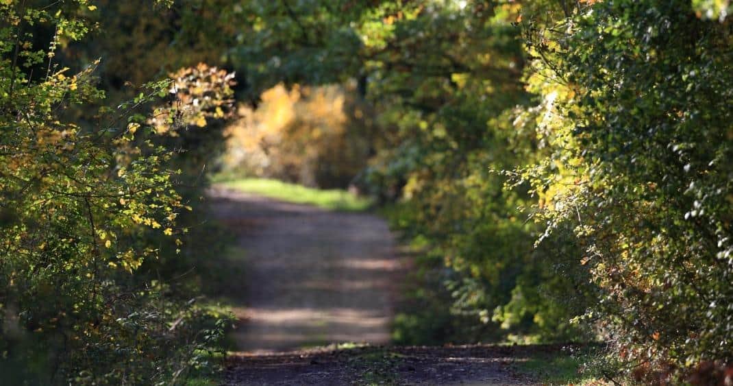
The Tenuta di Acquafredda Nature Reserve is a protected natural area entirely within the territory of the Municipality of Rome, in the western sector of the city, leaning against the Grande Raccordo Anulare and closed to the south by Via Aurelia. It is managed by RomaNatura, the regional body that administers the system of protected natural areas inside the Municipality of Rome, and it was established by Lazio regional law number 29 of October 6, 1997, the same law that on the same day gave legal form to almost all the Roman reserves. On its size the official figures differ slightly: the identity card published by RomaNatura gives 249 hectares, the descriptive sheet of the same reserve speaks of 250 hectares, while the figure of 254 hectares has long circulated in local outreach. The difference depends on successive perimeter definitions and on how the margins along the Raccordo and along Via di Acquafredda are counted. In any case we are talking about a little less than two and a half square kilometers of Roman countryside that survived inside the city, wedged between the densely built neighborhoods of Boccea, Primavalle, Montespaccato and Casalotti.
From an environmental point of view the estate belongs to the Ponte Galeria Arrone system, the large complex of river and marsh environments that occupies the northwest quadrant of Roman territory and descends toward the coastal plain. From an administrative point of view the RomaNatura identity card still reports Municipio XVIII, a numbering that belongs to the season before the reform of the districts: with resolution of the Capitoline Assembly number 11 of March 11, 2013 that municipio became Municipio XIII Aurelio, which is the current administrative reference for anyone looking for an office, a school or a department competent for the area. The urban zones bordering the reserve bear names that find their origin in the estate: Val Cannuta, Fogaccia, Casalotti di Boccea, Aurelio Nord.
The reserve takes its name from the coolness of the waters of the ditches that cross it, and the place name is ancient. It appears for the first time in a papal bull of Alexander III of 1176, with the Latin formula terras et vineas in Acqua frigida, when these lands were granted to the religious linked to the church of San Pancrazio on the Janiculum. Since then the name has never changed, and the road that crosses the estate still bears it today. Whoever arrives here expecting to find an equipped urban park, with gates, kiosks and big signs, is thrown off: the Tenuta di Acquafredda is a real agricultural area, cultivated, largely private, protected by a restriction that regulates its uses but has not turned it into a public garden. To understand how the protected green of this quadrant works it's worth reading also the pages of the Tenuta dei Massimi Nature Reserve, the Valle dei Casali Nature Reserve and the Insugherata Nature Reserve, which together with Acquafredda make up the green belt to the west and northwest of the city.

Where the Tenuta di Acquafredda Nature Reserve is and how you really get there
The geography of this reserve is better understood with a map than with a walk, because the estate is a wide, unspectacular plateau, with no high point from which to take it all in at a glance. The quadrilateral is clear: to the south Via Aurelia, to the north Via di Boccea, to the west the Grande Raccordo Anulare, to the east the built fabric of Montespaccato and Primavalle. In the middle runs Via di Acquafredda, which enters the estate from the Aurelia side and crosses it going up the valley floor, and which is in fact the only road from which an ordinary visitor sees anything.
The access indicated by the managing body is at Via dell'Acquafredda 88, where the access signs are also found and where the Torre dell'Acquafredda marks the starting point of the nature trail. There is no monumental entrance, there is no ticket office, there is no visitor center open with continuous hours. There is a country road that branches off the Aurelia, a couple of signs and some fields.
By public transport to the Tenuta di Acquafredda
The connection indicated by RomaNatura is line 906, which starts from Valle Aurelia station, an interchange between metro line A and the regional railway, and runs along Via dell'Acquafredda and Via Nazareth. It is the simplest way to arrive without a car and without parking problems, and it has the advantage of leaving the passenger right at the edge of the estate instead of a kilometer away. The Battistini terminus of metro line A is the other useful reference, because from there several surface lines start toward the Boccea and Casalotti quadrant.
By car: the interchange, Via di Acquafredda and the parking question
Whoever arrives by car leaves the Grande Raccordo Anulare at the Aurelia interchange and takes the consular road toward the center, or at the Boccea interchange coming down from the opposite side. In both cases the reference point is the junction of Via di Acquafredda. The problem is not arriving: it is stopping. Via di Acquafredda is narrow, without a continuous sidewalk, with irregular shoulders and with stretches where two cars passing each other must slow down. There is no parking dedicated to the reserve. Cars that stop along the shoulder narrow the roadway further, and on a road also used by farm vehicles this is not a detail.
The reasonable solution is to leave the car in the residential streets of Montespaccato or Casalotti, where parking is regular and less contested, and allow for a walk of 10 or 15 minutes on asphalt before entering the atmosphere of the countryside. It is an apparent waste of time that avoids the concrete risk of finding your car moved or of getting in the way of those who work on that road every day.
On foot and by bicycle from the neighboring districts
For those who live in Montespaccato, Val Cannuta, Primavalle, Casalotti or along lower Boccea, the Tenuta di Acquafredda works as the green back room of the neighborhood. You leave home and in a quarter of an hour you go from concrete to fields. This explains why the population that frequents the reserve is almost entirely local: people walking dogs, morning runners, Saturday families, a few cyclists going up the valley floor. Foreign tourists almost never get there, and the reason is simple: the reserve appears in no international guide to Rome, has no monument recognizable from afar and does not offer the kind of service a passing visitor expects.
What the Tenuta di Acquafredda Nature Reserve really is: a farming estate under protection
Here lies the understanding of everything else, and it is the point where generic descriptions most often go wrong. The Tenuta di Acquafredda was not born as a park designed for leisure. It was born as a tool for protecting a piece of the Agro Romano that the restriction stopped while everything around was being built. The formula found in the official documents is precise: the reserve represents the ecological link between the agricultural areas of Casal del Marmo, the Tenuta dei Massimi and the Valle dei Casali. Translated into practice, this green serves first of all animals and plants to move from north to south without having to cross built-up land. The benefit for those who walk is a side effect.
The second thing to keep firmly in mind is ownership. The RomaNatura documentation states that the surface of the reserve falls entirely within the property of the Vatican Chapter, and inside the perimeter several small and medium-sized farms operate, growing vegetables, fruit, figs and fava romanesca and selling directly or at the Trionfale neighborhood market. This means the reserve is not public land that you enter the way you enter a municipal garden. The official nature trail, the one marked by the body, develops declaredly on private property, and the valley-floor dirt track that continues beyond the loop runs among the crops and on private land. Whoever walks it does so with the discretion of someone passing through another person's workplace, not with the ease of someone crossing a public meadow.
The fourth thing is the state of health. The same official sources, and this is a merit of their honesty, report that the ditches today show conditions of degradation tied to the heavy human development of the surrounding areas and to the invasion of exotic species such as black locust and ailanthus. Anyone who arrives here expecting untouched nature is disappointed. Anyone who arrives knowing they are looking at a fragment of countryside under pressure, which holds out thanks to a legal restriction and to the stubbornness of those who work here, understands what is in front of them.
The Fosso di Acquafredda, the water that gives its name to everything
The name of the estate comes from water, and water is still the element that organizes everything else. The Fosso di Acquafredda collects the waters of the small streams and trickles that come down from the slopes and runs lengthwise through the whole protected area, flowing farther downstream into the Fosso della Magliana, which in turn reaches the Tiber at the height of the neighborhood of the same name. Working alongside the Fosso di Acquafredda are the Fosso di Valcannuta and the Fosso di Montespaccato, and it is these three furrows that draw the pattern of the territory.
The coolness of these waters is what produced the place name in the 12th century and still justifies the name today. On scorching July days, going down into the valley floor from the fields in full sun, the difference in temperature is clearly felt: the riparian vegetation holds the humidity, the reed bed stops the hot wind, and the microclimate changes within a few meters of elevation change. It is an ordinary experience from a scientific point of view and a surprising one from a physical point of view, especially for anyone coming from the asphalt of the Boccea.
The ecological role of the riparian environment is what specialists call a corridor: the damp strip along the ditch works like a road for animals, which travel along it while staying covered by the vegetation. In the plant formations along the banks you can see the green frog and the grass snake, and many birds tied to wetland environments. In the pools that form in spring after the rains you find the tadpoles of the common toad, and in the system of pools and temporary ponds still present in some areas of the reserve lives a certain number of dytiscid beetles, aquatic insects that are among the best indicators of the quality of these still waters.
A curiosity about the Tenuta di Acquafredda Nature reserve
The most solid curiosity of this reserve is hidden inside a Latin formula eight centuries old. In 1176 Pope Alexander III issued a bull confirming to the religious tied to the church of San Pancrazio the possession of terras et vineas in Acqua frigida, that is, lands and vineyards at Acquafredda. That line is the first written attestation of the place name, and it contains two pieces of information that today's landscape no longer tells.
The first concerns the vineyards. In the 12th century this plateau was planted with grapevines, and not by chance: hills of sand and gravel with open exposure and fast drainage are exactly the terrain that the medieval viticulture of the Roman suburb was looking for. The wine produced on the estates around Via Aurelia supplied the city and the religious bodies that owned the land. Today the estate grows vegetables, fruit, figs and Roman fava beans, and the vine has disappeared from the productive landscape: the passage from vineyard to vegetable garden tells in a single line the evolution of Rome's peri-urban agriculture, which in the 1900s specialized in supplying fresh vegetables to the neighborhood markets of the expanding city.
There is also a note on the continuity of this ownership. The official documentation reports that the entire surface of the reserve falls within the property of the Vatican Chapter. This means that the thread linking the 12th-century estate to the contemporary land situation has never completely broken: the bodies change, the legal forms change, the farm contracts change, but this piece of countryside has remained in the orbit of the same large ecclesiastical owners for a number of centuries that makes the idea of the long term, applied to the real estate market, ridiculous. And it is probably this continuity of ownership, even more than the environmental restriction of 1997, that is the reason why 800 years later you still see fields here instead of apartment buildings.
The Torre dell'Acquafredda and the cutting of the ancient Via Cornelia
The most evident historical testimony of the estate is the Torre dell'Acquafredda, which stands along the road of the same name, at number 88, right where the managing body places the entrance to the reserve. It is a square-plan tower of medieval origin, built on the ruins of a Roman villa. The masonry tells this story better than any sign: in the lower part you see flint chips mixed with reused marble material, evidently coming from the Roman structures that preceded it on the site, while the upper part is in brick and belongs to a later building phase. On the walls you can still recognize marble inserts and pieces of basolato, that is the basalt slabs with which the Romans paved the consular roads, reused as building stone.
The function of the tower was strategic and visual. Together with Torre Spaccata and Torre Vecchia it put the suburban stretch of Via Aurelia in optical communication with Via Cassia and Via Trionfale, in turn controlled by the Torre della Castelluccia. This system of watchtowers is the characteristic feature of the medieval landscape of the Agro Romano: a network of high points that made it possible to transmit a signal, to monitor movements along the roads and to offer a fortified refuge to the farm estates. The fact that almost all of them are built over Roman ruins is no accident: the ancient foundations were solid and the material was already there, ready to be reused.
The second archaeological element of the estate is harder to see but more interesting to understand: the tagliata of the ancient Via Cornelia, along Via Nazareth. Little is known about Via Cornelia. It is not clear which Cornelius it was named after and the archaeological finds along its route are scarce. It is known, however, that it was part of the road network linking Rome across the Tiber with Etruria, administered by a single figure, the Curator Viae Aureliae veteris novae Corneliae et Triumphalis, whose title lists in sequence the four roads of the quadrant. The Cornelia came from the Pons Aelius, that is from Ponte Sant'Angelo, probably branching off from Via Triumphalis, skirted the Circus of Caligula before the Constantinian basilica of St. Peter was built, and continued along today's Via dei Monti di Creta, Via di Boccea and Tragliata, in the direction of Cerveteri.
The word tagliata indicates an artificial cut into the tuff bank or compact ground, made to ease the slopes and carry the road at a constant elevation. It is a technique of Etruscan origin, adopted systematically in northern Lazio, and it leaves deep trenches in the ground with vertical walls that survive for millennia. From this practice derives the place name Montespaccato, the split mountain: the neighborhood that today borders the reserve carries in its name the memory of a work of ancient road engineering. During the Middle Ages Via Cornelia declined and was replaced by Via di Boccea, which partly follows its route, and this is the reason why a Roman road of some importance is today almost invisible.

Something nobody tells you about the Tenuta di Acquafredda Nature Reserve
The thing that almost no description makes clear is that this reserve is not a free-access area in the sense that Villa Pamphilj or the Parco degli Acquedotti are. The restriction of 1997 imposed an environmental protection on an estate that was and remains agricultural and private. In the official documentation of the managing body, under the entry for the hiking route, it is written verbatim that the route runs on private property. It is not a footnote: it is the fundamental condition of the whole visit.
This produces a situation that throws off those who arrive with the habits of the public park. There are no gates with hours, but there is also no right to go where you like. There are no tickets, but there is no staff to ask. The fields you see from the path are someone's fields, the henhouses you walk past are someone's henhouses, the orchards you cross are the income of families who work three, four or seven hectares. The farms recorded by the managing body inside the perimeter grow vegetables, fruit, figs, plums, apricots and fava romanesca, and sell directly at the farm or at the stalls of the Trionfale neighborhood market. Some set up seasonal stands along Via dell'Acquafredda.
The practical consequence is twofold. On one hand, whoever visits the estate must behave as a guest: stay on the evident tracks, not enter the cultivated fields, not pick fruit, keep the dog on a leash, close the gates found closed. On the other hand, the best way to really come into contact with this place is not the walk but the purchase: stopping to buy vegetables from the people who grow them 200 meters from where they sell them is the gesture that concretely supports the agriculture that keeps the landscape standing. A protected agricultural area lives if agriculture holds up, and peri-urban agriculture holds up only if it finds a market.
The second element that is almost never said concerns the fauna. The same official documentation writes, with a frankness that deserves to be reported, that the mammal species present are few. Among those reported are the bat Myotis myotis and the crested porcupine, alongside badger, fox, European hedgehog, hazel dormouse and wild boar. The bird species recorded are 39, of which 36 breeding. They are honest numbers, describing an environment squeezed between high-traffic roads and dense neighborhoods, not a sanctuary of biodiversity. Whoever comes here for birdwatching finds interesting material, but whoever is looking for the abundance of species of the Marcigliana or of Decima Malafede will do better to go elsewhere.
The advice I give you for visiting the Tenuta di Acquafredda Nature Reserve
The advice is to treat this estate as a short, targeted visit, not as a day trip, and to build it around the official route instead of around the vague idea of a walk in nature.
The route the managing body describes is called Sentiero Natura La Torre. It starts from Via di Acquafredda, near the tower of the same name and the access signs, it is a loop, measures one kilometer, has a 30-meter elevation change and is walked in about 20 minutes. Along the route are placed four information boards. There are no water points, and this should be kept in mind in summer. The environment crossed is made of fields, vegetable gardens, packed-earth paths and riparian vegetation of poplars, willows and reed bed. The body indicates it as walkable all year and bikeable with caution, and recommends comfortable shoes, better if light hiking boots.
The description of the route is precise and it's best to have it in mind before setting out. From the Torre dell'Acquafredda you have an overview of the valley the path covers. You go down along an evident track and after a few meters you meet a fork, recognizable by a pile of lava rocks, where the loop begins. You turn left, skirting outcrops of volcanic cinerites and some henhouses, and you meet the first board among the fields and the vegetable gardens. You go straight down, pass a strip of reed bed and arrive at a picnic table near a water cistern. You turn right before a grove of willows and poplars and cross the valley-floor dirt track, which follows the ditch for a few kilometers. That track is evocative and scenic, but it runs among the crops and on private land, so it requires attention. To close the loop you climb back up to the right, passing the reed bed again in the direction of the tower, to the starting fork.
20 minutes of walking is little, and precisely for that reason the real advice is another: don't come here only for the path. Come with the idea of half a day that puts together three things. The first is the loop route, done calmly, stopping at the four boards and really looking at what grows at the edges of the fields. The second is reading the tower from outside, with your nose on the masonry, looking for the fragments of marble and the pieces of reused basolato. The third is shopping: find out in advance which farms of the estate do direct sales and at what hours, and go home with something that grew inside a protected area eight kilometers from the Vatican.
I'll add a word of caution that applies to all the Roman agricultural reserves. The conditions of access to private properties change over time: a route open one spring may be fenced the next year, because the owner changed crops or had problems with visitors. Before setting out it's best to contact the managing body, which is based at Villa Mazzanti in Via Gomenizza 81, in the Monte Mario Nature Reserve, with telephone number 06.35405350, and ask whether the Sentiero Natura La Torre is walkable and whether accompanied outings are planned. It's a two-minute phone call that avoids a wasted trip.
Flora and fauna of the Tenuta di Acquafredda
The natural picture of the estate is read by bands, and each band has its species. The logic is simple: where the ground is steep and not arable the wood survives, where it is flat and fertile there is the field, where there is water there is riparian vegetation. These three bands alternate within a few hundred meters, and it is this alternation, more than the absolute quality of each environment, that produces the biological variety of the place.
The groves and the banks
The groves of the reserve are limited and develop along the steepest slopes and the banks, that is those terraces and embankments the plow cannot reach. They are formed mainly of oaks: downy oaks, holm oaks and cork oaks. The cork oak, Quercus suber, deserves a note: it is the oak that gives cork, a Mediterranean species tied to acidic, sandy soils, and its presence here is the sign of an ancient plant landscape that in most of coastal Lazio was wiped out by cutting and land reclamation. The official documentation points out that especially in the southernmost zone of the reserve, along some banks, the cork oak dominates the surviving patches of tree vegetation, accompanied by shrubs such as rockrose, broom and mock privet.
Among the shrubs reported there is also the French rose, Rosa gallica, described as rare in the Roman area. It is the kind of presence that justifies a restriction: a species that has disappeared elsewhere and survives here because a few hectares were neither built on nor plowed. At the edges of the cultivated fields you find instead Judas trees, hop hornbeams and field maples, dotted with dog rose, Spanish broom, elder, blackthorn and hawthorn: the classic field hedge of the Agro Romano, which besides marking the property lines works as a refuge and a pantry for birds.
The wild orchids
The most notable presence of the herbaceous flora is the blooms of orchids that in spring adorn the fallow fields. The species cited by the managing body are the Italian orchid, the butterfly orchid and the purple orchid. They are European wild orchids, small, with spike inflorescences, nothing to do with the tropical orchids of nurseries. They have a short and capricious cycle: they bloom in April and May, and their presence from one year to the next depends on the winter rains and above all on whether that meadow was not mowed at the wrong moment.
The wet strip along the ditches
Along the Fosso dell'Acquafredda and the Fosso di Montespaccato you find the species tied to wetlands: white willows, black poplars, alders and marsh reeds. The white willow, Salix alba, is the main component of the riparian vegetation, recognizable by the silvery reflections of the leaves when the wind turns them over. In the areas managed by RomaNatura you also find the purple willow, the basket willow and the goat willow.
The birds
The bird species recorded in the reserve are 39, of which 36 breeding. Among those reported as significant are the common whitethroat, the wood warbler and the European pied flycatcher. Along the ditches you see the gray heron, the coot, the moorhen and the penduline tit, and from the dense riparian vegetation you often hear the loud call of Cetti's warbler.
The penduline tit, Remiz pendulinus, is the bird worth learning to look for. It builds a soft pouch nest hanging from the young branches of willows over the water, with a shape that recalls an upside-down flask: once you have seen it you don't confuse it with anything else, and it is visible mainly in winter when the leaves have fallen. In the summer months over the fields you see swallows, house martins, swifts and bee-eaters, the latter recognizable by their multicolored plumage and by the gurgling call that always precedes the sighting.
There are then two presences that divide observers: the rose-ringed parakeets and the monk parakeets, green parrots settled for years in the Roman urban area and constantly expanding. You see them in fast, straight flight over the fields or while feeding on fruit trees. They are spectacular and they are non-native, that is they do not belong to the original fauna: their spread is one of the most visible phenomena of the ecological change of the city, and in agricultural areas it also causes damage to fruit crops. Whoever photographs them here is documenting a transformation in progress, not a piece of original nature.
Mammals, reptiles and amphibians
The mammal species, as the official documentation points out, are few. Among those present are the badger, the fox, the European hedgehog, the hazel dormouse and the wild boar, as well as the bat Myotis myotis and the crested porcupine. The latter, Hystrix cristata, is the largest Italian rodent after the beaver: between 50 and 70 centimeters long, weighing between 10 and 15 kilos, with its back covered in black and white quills up to 30 or 40 centimeters long. Contrary to popular belief, the porcupine does not throw its quills: it loses them easily because they are weakly set in the skin, and whoever walks early in the morning along a country path often finds one on the ground. It has nocturnal habits, digs deep burrows or adapts those of badger and fox, feeds on roots, bulbs and bark, and is protected by law 157 of 1992 as well as being included in the Habitats Directive.
Among the reptiles are reported the Moorish gecko, the common wall lizard, the western whip snake, the three-toed skink and the grass snake. Among the amphibians are the green frog, the common toad, the green toad and the Italian tree frog. The tree frog, Hyla intermedia, has become rare in the Roman urban area and survives in a few isolated populations: small, bright green, with adhesive toe pads that let it climb the vegetation, it is heard far more than it is seen, especially on the damp evenings of April and May.
Another well-known fact, yet rarely mentioned
The fact is this: the reserve was born together with eight sisters, with a single legislative act, and on its own it can't be understood.
Lazio regional law number 29 of October 6, 1997, titled to the rules on regional protected natural areas, is the measure that reorganized the whole system of protected green space of Lazio and that established the Roman urban reserves in one block. On the same day, with the same signature, the Tenuta di Acquafredda, the Tenuta dei Massimi, the Valle dei Casali, the Insugherata, Monte Mario, the Marcigliana, the Valle dell'Aniene, Decima Malafede and the Laurentino Acqua Acetosa became protected areas, along with the regional urban parks of Aguzzano and Pineto. It is the operation that gave substance to RomaNatura as the single managing body.
The reason this should be remembered is that it explains the shape of Acquafredda. It is not a park chosen for its beauty or for its recreational vocation: it is a piece of a wider design, that of the so-called Roman ecological network, which aims to keep the surviving fragments of countryside within the municipal perimeter connected to each other. Acquafredda, in that design, has a precise task: to act as a junction between the agricultural areas of Casal del Marmo to the north, the Tenuta dei Massimi to the south and the Valle dei Casali toward the east. It is a link in a chain. If it breaks, the areas it connects become islands, and ecological islands lose species with a regularity that scholars have measured in dozens of cases.
There is a second implication, less reassuring. A reserve that is born as a corridor is a long, narrow reserve, that is with an unfavorable ratio between perimeter and surface. Everything that happens just outside the boundary comes in: the noise of the Grande Raccordo Anulare, stray dogs, domestic cats, the seeds of invasive exotic plants such as black locust and tree of heaven which the official documentation reports as a confirmed problem, discharges into the ditches, the dumping of materials along the dirt tracks. 250 hectares seem like a lot until you consider that almost every point of the reserve is a few hundred meters from a road or a house.
The third implication concerns the way you read the map of Roman green space. Whoever wants to understand this quadrant should look at Acquafredda together with the Mazzalupetto Natural Monument, Galeria Antica, the Parco della Cellulosa and the Castel di Guido Oasis: they are all pieces of the same western system, all small or medium, all separated by roads, and all destined to work only if considered together.
The right photo to take at the Tenuta di Acquafredda Nature Reserve
The right photo here is not a panorama, because there is no panorama. It is a portrait of masonry.
The subject is the Torre dell'Acquafredda seen up close, with a tight framing on the lower part of the building, the part built with flint chips mixed with salvaged marble material. What you photograph is not a tower: it is a stratigraphy. In a single frame a meter and a half wide you see the white marble of a Roman villa, the dark basalt of the basolato of a consular road, the chipped flint of a local quarry and, a little higher, the red brick of a more recent building phase. Four eras, four materials, a single wall. It is the most direct way to make the viewer of the photo understand how people built in the medieval Agro Romano: by taking what was already there.
To do it well you need two tips. The first concerns the light: the masonry looks its best in raking light, that is in the first hour after dawn or the last before sunset, when the side shadows bring out the relief of the stones. At noon the same wall becomes flat and unreadable. The second concerns scale: it's best to include in the frame an element of dimensional reference, a hand, a hat set down, a tuft of grass at the base, because otherwise the viewer can't tell whether the blocks are as big as a fist or as a head.
The second photo to take home is completely different and is the one that in summer tells the story of the reserve best: the contrast between the field in full sun and the dark strip of reed bed in the valley floor. You stand on the high edge of the path, keep the golden field in the lower half of the frame and the dark green line of the willows and reeds in the upper half, with the apartment blocks of Boccea barely visible in the background. In a single image are the three elements that define this place: agriculture, water and the city pressing in.
Some important events that happened here in history
The history of this plateau is read by thresholds, and each has left a mark that can still be seen or at least located.
Totila's camp in 547
The second event is the most cited and also the most delicate to handle. In the year 547, during the Gothic War, the king of the Goths Totila arrived outside Rome. Procopius of Caesarea, in the Gothic War, reports a camp by a watercourse that he calls Algidon. According to some historiographical hypotheses that river would be identified with the Fosso dell'Acquafredda, and the area would therefore be the place where the Goths stopped before the capture of the city. Local tradition did the rest, permanently tying the name of Totila to this plateau.
It's best to be clear about the level of certainty: the ancient source speaks of a watercourse with a Greek name, the identification with the local ditch is a hypothesis of scholars, not a fact established by excavation. It is in any case a reasonable hypothesis, because an army besieging Rome from the west needs fresh water in quantity, flat ground for the camp and a position controlling the consular roads: and this plateau, with its perennial ditches between the Aurelia and the Boccea, meets all three needs better than any other point of the sector.
The twelfth century and the birth of the name
The third step is documentary. In 1176 the bull of Alexander III with the formula terras et vineas in Acqua frigida fixes the place name in writing, and in the same century another papal bull confirms the property of the Fundus Aque frigule to the Basilica of St. Peter. From this moment on the landholding identity of the place is stable: an agricultural estate with its own name, part of the patrimony of Roman ecclesiastical institutions, cultivated with vineyards and arable crops. It is the arrangement that, with all the transformations involved, reaches the present, given that the managing body's documentation reports that the surface of the reserve falls within the property of the Vatican Chapter.
The early twentieth century, the land reclamation and the borgata
The fifth step is the one that drew the present landscape. In the first years of the twentieth century a vast territory owned by the Ospedale Santo Spirito was bought by the counts Piero, Marietta and Giulia Fogaccia, a family originally from Clusone, in the province of Bergamo. The Fogaccia launched an intense work of land reclamation and agricultural modernization that led to the birth of a settlement called borgata Fogaccia, which is the origin of today's Montespaccato. The urban zone of Municipio XIII still officially bears the name Fogaccia. It is an almost textbook example of how capitalist agriculture at the beginning of the century transformed the Agro: reclamation, farmhouses, estate roads, stable labor, and finally borgata.
1924 and Piacentini's villa
The sixth step is architectural. In 1924 the Fogaccia sisters commissioned from their friend, the architect Marcello Piacentini, a building recalling the family palace in Clusone. The result was Villa Fogaccia, at Via Nazareth 35, in the northernmost part of the reserve: a construction that brings together the features of the tower, the palace, the villa and the manor, with the front articulated in different volumes and the facade in rustic tuff stone, a rusticated portal topped by a cartouche with the coat of arms and the family motto, Ni ma tarme ni spantarme, which in Bergamo dialect means neither kill me nor scare me. The interiors are richly decorated, with inserts of reused classical architectural elements, heraldic floor elements in Vietri and Deruta ceramics, faucets reproducing the animals of the Roman countryside and family portraits. The villa is immersed in a park of eight hectares with Mediterranean plants, tree-lined avenues radiating from the building and joining a ring avenue, the galoppatoio.
The Second World War
The seventh event is wartime. During the Second World War Villa Fogaccia was occupied by the Germans and suffered bombings: for a few days it was exactly on the line of fire between the retreating Germans and the advancing Allies firing from the positions of Pineta Sacchetti. It is a detail that places this quiet corner of countryside within the days of the liberation of Rome in June 1944, when the front crossed the western quadrants of the city.
1997 and the protection
The eighth and last step is regulatory. With regional law number 29 of October 6, 1997 the plateau becomes the Tenuta di Acquafredda Nature Reserve, with a surface that official sources give as between 249 and 250 hectares, entrusted to the management of RomaNatura. It is the threshold that stopped building expansion on these fields at the moment when the neighborhoods around were completing their saturation. Without that measure, in all likelihood, today you would see apartment blocks from Via di Acquafredda.
Who has passed through the Tenuta di Acquafredda Nature Reserve
The list of people tied to this piece of countryside is short, but not trivial.
Totila, king of the Goths, is the name that tradition ties most closely to the place. He reigned from 541 to 552 and was the protagonist of the Gothic phase of the war against the Eastern empire, leading an offensive that allowed him to retake most of Italy. In 546 he entered Rome for the first time, and in 547 he returned to the walls. If the identification of Procopius's river Algidon with the Fosso dell'Acquafredda holds, his camp was right here. The official RomaNatura documentation reports this tradition in the introductory text of the reserve.
Pope Alexander III, born Rolando Bandinelli, pontiff from 1159 to 1181, is the author of the 1176 bull that names Acqua frigida for the first time. His pontificate is the one of the clash with Frederick Barbarossa, of the Lombard League and of the Peace of Venice of 1177: in the midst of that political season, the ordinary administration of the Roman landed patrimony went on anyway, and one of those documents gave the name to this estate.
The Fogaccia counts, Piero, Marietta and Giulia, who arrived from Clusone at the beginning of the twentieth century, are the people who physically remade this landscape. They bought the land from the Ospedale Santo Spirito, reclaimed it, put it under cultivation, built houses and roads, and ended up giving their name to a borgata and an urban zone. Their imprint on the territory is deeper than that of any other figure on this list.
Marcello Piacentini, a Roman architect among the most influential and most debated of twentieth-century Italy, designed Villa Fogaccia in 1924 as a favor to a friendship. He is the man of the Città Universitaria of the Sapienza, of Via della Conciliazione, of the plan for the Universal Exposition that produced EUR: finding a minor, private work of his at the end of a country road in the western quadrant is one of those surprises that make the edge of Rome interesting.
Finally there are the nameless people, and they are the ones who matter most for understanding what you see today: the farming families who have worked these fields for generations and who still run the farms recorded inside the perimeter of the reserve, with extents of three, four or seven hectares, producing vegetables, fruit, figs and fava romanesca. The landscape the restriction protects is their work, not nature's.
When to go to the Tenuta di Acquafredda and when to avoid it
The best period by far is spring, between mid March and the end of May. It is the window when the countryside is green, the ditches still have water, the nesting birds are active and noisy, and above all it's the moment of the orchid blooms in the fallow fields. April is the fullest month. The flip side is mud: after a week of rain the packed-earth paths become heavy, and without light hiking boots you go home with shoes to throw away.
The second good period is autumn, from mid October to the end of November. The light is low and warm all day, which helps a lot with photographing the tower's masonry, the colors of the poplars and willows along the ditch turn to yellow, and temperatures make walking pleasant even at noon. It is also the season when the farms of the estate have the most produce on the stands.
Summer is the period to avoid, and not as a figure of speech. From mid June to the end of August the fields in full sun are impassable in the middle hours, there are no water points along the route, shade is limited to the riparian strip and the mosquitoes of the valley floor in the evening hours are aggressive. Whoever insists on going in summer should set out at dawn, bring at least a liter and a half of water each and be out by 9:30 in the morning.
What's around the Tenuta di Acquafredda
The reserve alone takes up barely half a day, so it's good to know what to put next to it. The quadrant is rich in protected green space and poor in classic attractions, which makes it interesting for those who have already seen the center of Rome.
To the south, beyond Via Aurelia, you quickly reach the Tenuta dei Massimi Nature Reserve, which shares with Acquafredda its regulatory origin, its agricultural character and its access problems, and which descends toward the Magliana valley. Continuing east you enter the Valle dei Casali Nature Reserve, where the park ranger service that also covers Acquafredda has its operational base, and from there the step to Villa Doria Pamphilj is short: it is the largest public park in Rome and the obvious alternative for those who found a closed gate at Acquafredda.
To the north, past Via di Boccea and the Grande Raccordo Anulare, you find the Tenuta di Mazzalupetto Natural Monument and, farther away, Galeria Antica, the abandoned village above the Arrone valley that is the most evocative visit of the whole sector. Still to the north, the Parco della Cellulosa offers a real equipped area, with services, suited to those traveling with children. Farther west, toward the sea, is the Castel di Guido Oasis, with its municipal farm.
To the northeast, past the Trionfale, you enter the territory of the Insugherata Nature Reserve, crossed by the route of Via Francigena, and from there you descend toward the Monte Mario Nature Reserve, where Villa Mazzanti, seat of the managing body, is found, and where the viewpoint over the city repays all the flat walks of the quadrant. The Pineto Regional Urban Park closes the circle toward the center, with its valley of pines between Balduina and Aurelio.
For those who want a strong contrast, from the countryside of Acquafredda to St. Peter's Basilica there are less than eight kilometers as the crow flies: the same institution that has owned these fields for 800 years has its monumental seat a little farther on, and doing the two places on the same day is an exercise in perspective that I recommend.
Quick questions about the Tenuta di Acquafredda Nature Reserve
Can you enter the Tenuta di Acquafredda freely?
No, not in the sense in which you enter a public park. Much of the estate is private property in agricultural use, and the nature trail indicated by the managing body itself runs on private property. You follow the marked route, you don't leave the evident paths and it's best to get information first from RomaNatura.
How large is the reserve?
The official sources indicate 249 hectares in the identity card and about 250 hectares in the descriptive sheets. The figure of 254 hectares circulates in local outreach but finds no confirmation in the managing body's documents.
Which municipio is it in?
The RomaNatura identity card gives Municipio XVIII, a numbering prior to the 2013 reform. Today the territory corresponds to Municipio XIII Aurelio, established by resolution of the Capitoline Assembly number 11 of March 11, 2013.
How do you get there by public transport?
By bus 906 from Valle Aurelia station, on metro line A: it runs along Via dell'Acquafredda and Via Nazareth. The Battistini terminus of line A is the other useful reference.
Is there a marked trail?
Yes, the Sentiero Natura La Torre: a one-kilometer loop, 30 meters of elevation change, about 20 minutes, four information boards, no water points. It starts from Via di Acquafredda near the tower and runs on private property.
Can you buy farm products inside the reserve?
Yes, some farms of the estate do direct sales at the farm and some set up seasonal stands along Via dell'Acquafredda. Others sell at the Trionfale neighborhood market. Methods and hours vary, so it's best to ask directly.
Can Villa Fogaccia be visited?
It is at Via Nazareth 35 and the official documentation indicates it as visible from the outside. It is used as a venue for events, weddings and conferences, so access depends on the owner.
The Tenuta di Acquafredda is not the most beautiful reserve in Rome and doesn't even try to be. It is, however, one of the most instructive, because it shows clearly what it means to protect a landscape that is at once agricultural, private and urban. You don't come here for wild nature, which isn't there: you come to understand how half a dozen farming families, a regional law of 1997 and an eight-century-old ecclesiastical property have held together 250 hectares of countryside while everything around became city. Whoever arrives with this expectation goes home satisfied. Whoever arrives looking for an equipped park will do better to get off at the next stop.
Frequently asked questions about the Tenuta di Acquafredda Nature Reserve
What is the Tenuta di Acquafredda Nature Reserve?
The Tenuta di Acquafredda Nature Reserve is a protected area of Rome that safeguards a plateau of Agro Romano that stayed agricultural while everything around was being built, between Via Aurelia to the south, Via di Boccea to the north, the Grande Raccordo Anulare to the west and the built fabric of Montespaccato and Primavalle to the east. The reserve represents the ecological link between these two road axes.
Where exactly is the Tenuta di Acquafredda?
The Tenuta di Acquafredda is in Rome, in a quadrilateral bounded by Via Aurelia to the south, by Via di Boccea to the north, by the Grande Raccordo Anulare to the west and by the neighborhoods of Montespaccato and Primavalle to the east. Via di Acquafredda runs through it, and the access to the hiking route is at number 88, by the Torre dell'Acquafredda.
Can you enter the Tenuta di Acquafredda freely?
No, not in the sense in which you enter a public park. Much of the Tenuta di Acquafredda is private property in agricultural use, and the nature trail indicated by the managing body also runs on private property. You follow the marked route, you don't leave the evident paths and it's best to get information first from RomaNatura.
What route can you take in the reserve?
The official route of the Tenuta di Acquafredda is called Sentiero Natura La Torre. It starts from Via di Acquafredda, near the tower of the same name and the access signs, and is a loop of a little over a kilometer, suited to a short, targeted visit more than to a full-day outing.
What is the Torre dell'Acquafredda?
The Torre dell'Acquafredda is a square-plan tower of medieval origin, built on the ruins of a Roman villa, which stands along the road of the same name at number 88, right where the managing body places the entrance to the reserve. Its masonry shows in the lower part flint chips mixed with salvaged marble material.
When is it best to visit the Tenuta di Acquafredda?
The best period to visit the Tenuta di Acquafredda is spring, between mid March and the end of May, when the countryside is green, the ditches still have water and the nesting birds are active. April is the fullest month. After a week of rain, however, the packed-earth paths become heavy going.
What is near the Tenuta di Acquafredda?
Near the Tenuta di Acquafredda, beyond Via Aurelia to the south, you quickly reach the Tenuta dei Massimi Nature Reserve, which shares with Acquafredda its regulatory origin, its agricultural character and some similar management problems.
Article written by the editorial team of TourLeaderPro, contact them for Private/Corporate/V.I.P. Tours and Experiences. For an organized day in the nature reserves of the western quadrant of Rome, with a licensed tour guide, start from the TourLeaderPro contact page. Tour operators who build slow-tourism itineraries in the Agro Romano will find the consulting service in the section dedicated to tour operators.
Planning a trip to Rome? The English-language guides for visiting the city are on ItalyPlanner.com. For those thinking in terms of days outside the center there is the guide to the best day trips from Rome, while those who want to understand how to get around the city without a car will find practical information in the guide to public transport in Rome.