Tenuta di Mazzalupetto – Quarto degli Ebrei
In short. The natural monument named for the Tenuta di Mazzalupetto and the Quarto degli Ebrei is one of the least-known protected areas in Rome, and it is for a reason worth making clear right away: it isn't an urban park with gates, a ticket…
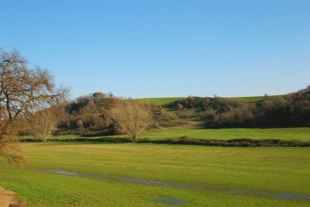
The natural monument named for the Tenuta di Mazzalupetto and the Quarto degli Ebrei is one of the least-known protected areas in Rome, and it is for a reason worth making clear right away: it isn't an urban park with gates, a ticket office and marked trails, but a piece of the Agro romano that has remained cultivated countryside inside the belt of the northwestern neighborhoods. It lies in the quadrant outside the Grande Raccordo Anulare between Via Cassia, Via della Storta and the Fosso dell’Acqua Santa, and its particularity is that it isn't a single block of land: it's two distinct estates, separated by a couple of kilometers of houses built in recent decades, protected by a single measure. The larger one, Mazzalupetto, covers about 140 hectares between the settlements of Via della Storta and the Palmarola neighborhood. The smaller one, the Quarto degli Ebrei, covers about 40 hectares in a quadrilateral between the Raccordo and the extraurban stretch of Via Trionfale, and it practically borders the northern tip of the Insugherata Nature Reserve, at the height of Monte Arsiccio. The measure that placed them under protection is decree number 54 of the President of the Lazio Regional Government of January 28, 2000, published in the Bollettino Ufficiale della Regione Lazio number 7 of March 10, 2000, and management is entrusted to RomaNatura. The land is publicly owned, registered to Arsial, the Regional Agency for the Development and Innovation of Agriculture in Lazio, and this alone explains why the area stayed agricultural instead of becoming a housing development. Anyone arriving here expecting a woodland for strolling has the wrong address. Anyone arriving knowing they'll find fallow fields, pastures, strips of oaks along the ridges and an anomalous quiet a few steps from the Raccordo leaves satisfied.
Where the natural monument is and how to really get there
Geography, in this case, is half the problem and half the charm. The natural monument sits in the peri-urban belt of Rome's northwestern sector, just outside the Grande Raccordo Anulare, in that strip that descends from the Cassia toward Boccea and that Romans cross every day without looking at it. The cartographic reference RomaNatura uses on its pages is the triangle between Via Cassia, Via della Storta and the Fosso dell’Acqua Santa. The free encyclopedia entry instead places the protected area in the Casalotti zone, the 48th zone of the Agro romano, and the difference isn't an error by either one: it's the consequence of the fact that the two estates fall on the edges of several adjoining urban zones, in an area where administrative boundaries and perceived boundaries almost never coincide.
By car, which is the realistic way to get there
The access point indicated by the managing body is on Via della Storta, at the height of Via Montagnana. Coming from the center, take Via Cassia and follow it past the Raccordo, or take the Raccordo itself and exit at the Cassia bis junction or the Boccea one, depending on where you are. From there the network of local roads becomes dense and not particularly well signposted: Via della Storta, Via di Santa Cornelia, Via di Casal Selce, Via Trionfale in its extraurban stretch. The practical advice is to set your navigation to the intersection of Via della Storta and Via Montagnana and not to the name of the protected area, because the official name appears in several variants and the result the maps return isn't always the same point.
Parking is on local streets, with no equipped areas. This is one of the things that has to be said clearly: the natural monument has no dedicated parking lot, no visitor center open to the public with fixed hours, no ticket office. The operational base of the park rangers who patrol the area, according to the listing published by RomaNatura, is in Monte Mario, several kilometers away, at the Monte Mario Nature Reserve. The telephone number published by the body for the natural monument is 06.35491587.
By public transportation
The official listing indicates line 031, an ultra-peripheral line that starts from Via Bassano and runs along Via della Storta. Via Bassano is next to the Giustiniana station, on the Rome-Viterbo railway, the one the old timetables called FM3 and which today carries the code FL3. The RomaNatura listing still gives the old wording, as it still gives Municipio XIX, a numbering superseded by the reform that reduced Rome's municipi from 19 to 15: the territory that was then the XIX now falls largely in Municipio XIV. These are bureaucratic details, but they help you see that the public documentation on this protected area is stuck several years in the past and has to be read with that awareness.
By bicycle and on foot
On foot, things change. The distances between one patch and the other are such that a walking excursion makes sense only within one of the two estates at a time. And here comes the point that generates the most misunderstandings: these are agricultural lands, partly run by farms, and passage isn't free everywhere as in a public park. The decree bans the opening of new roads and drivable tracks and the passage of motor vehicles except for service exceptions, but it doesn't turn agricultural properties into undifferentiated open space. Anyone who wants to enter in an orderly way does well to move along public roads and to ask RomaNatura about organized visiting activities, which the managing body is expressly authorized to carry out by the text of the decree itself.

What this natural monument really is: two separate estates, not a single park
The official name of the protected area, the one written in the decree, is the Quarto degli Ebrei and Tenuta di Mazzalupetto natural monument. In current place naming the two parts are often swapped, and the result is that the same protected area is cited in at least three different ways, which complicates the search for information and contributes to the place's low profile. With the name cleared up, the substance remains: these are two public agricultural properties, not contiguous, brought together under a single act of protection because they share the same character and perform the same ecological function.
The Mazzalupetto estate
This is the large part, about 140 hectares. The dominant landscape is that of cultivated fields that carpet much of the territory, with extensive crops and pasture meadows, and with wooded strips running along the ridges. In those bands of woodland, oaks dominate: Turkey oak, holm oak, downy oak and cork oak. The estate is wedged between the settlements that developed along Via della Storta and the Palmarola neighborhood, which rises right up against the Raccordo. This position tells the recent story better than any description: what is protected today is what remained after construction took over the rest.
The Quarto degli Ebrei
This is the small part, about 40 hectares, and its natural characteristics are very similar to the previous one. It occupies a quadrant of land between the Grande Raccordo Anulare and the extraurban stretch of Via Trionfale, and it inevitably suffers the heavy influence of both infrastructures, to use the words of the managing body's listing. The most interesting fact is the continuity: this patch borders the northernmost part of the Insugherata Nature Reserve at the height of Monte Arsiccio, which means that on paper the two protected areas form a single body interrupted only by the ribbon of road.
Why two separate pieces under a single protection
The decree itself explains the reason. Regional Law of Lazio number 29 of October 6, 1997, at article 6, provides for the establishment of natural monuments to protect habitats or environments of limited extent, subjecting them to protection rules aimed at conservation. It's a tool designed exactly for situations like this: surfaces too small and too fragmented to become reserves or parks, but too significant to be left to chance. The decree justifies the choice by observing that in the territory of the Municipality of Rome there are two areas next to the Grande Raccordo Anulare, owned by Arsial, which present the typical appearance of the Roman countryside with a good degree of preservation of the natural landscape, characterized by the alternation of plateaus and hollows, on which agricultural activity and livestock raising have taken place. It then adds that in the same areas there are patches of tree vegetation made up largely of cork oak and downy oak plants, which serve as a biological corridor for the shelter and movement of wild animals.
Put plainly: the value of Mazzalupetto and the Quarto degli Ebrei lies not in the rarity of a single element, but in the function of connection. They are nodes in a network. Within the city's ecological network they are functionally connected to the environmental district of the city's northern sector, made up mainly of the agricultural areas of Casal del Marmo, the Insugherata Nature Reserve and the Veio Park. Anyone who thinks of Rome as a green system and not as a sum of gardens understands at once why a 40-hectare fragment can count as much as a park 10 times larger.
The surface area: a number that wobbles
Here an inconsistency has to be pointed out that anyone looking for the figure runs into. The official list of Italian protected areas and the encyclopedia entry give 186 hectares. The identity card published by RomaNatura on its pages gives 180 hectares. The sum of the two estates as the managing body itself describes them, 140 plus about 40, gives roughly the same figure, and the six-hectare difference most likely depends on how the perimeter was measured against the cartography attached to the decree. The decree, for its part, contains no figure: it refers to the attached cartography as an integral part of the measure. Anyone who needs the precise figure, for a thesis or for technical work, has to ask the managing body for the cartography, not trust the round number found online.
The 2000 decree and the rules that apply inside the protected area
Few Roman protected areas have a founding act this readable. Decree number 54 of the President of the Regional Government of January 28, 2000 takes up a little more than a page of the Bollettino Ufficiale and is written in a way that's understandable even to someone who doesn't chew on environmental law. It's worth going through it, because it contains everything you need to know before setting foot in these fields.
Who signed it and by what procedure
The measure originates from a proposal by the Regional Councillor for the use, protection and enhancement of environmental resources, passes through the favorable opinion of the competent permanent Council Committee expressed in the session of January 24, 2000, and is signed four days later by the President of the Regional Government of Lazio, at the time Piero Badaloni. The text specifies that the decree is not subject to review under law number 127 of 1997 and that it is published in the Bollettino Ufficiale. Publication comes on March 10, 2000, in number 7, part one.
What is prohibited
The list of prohibitions is blunt and worth knowing, because it applies to everyone, visitors included. Inside the natural monument the following are prohibited. Carrying out any building work, with the exception of ordinary maintenance, extraordinary maintenance and conservative restoration of the existing building stock. Tampering with and altering the natural characteristics. The collection and damaging of spontaneous flora, the collection of mushrooms and forest-floor products, except what is done for research and study purposes in compliance with current regulations. The opening of new roads or drivable tracks and the passage of motor vehicles, except for service and rescue vehicles, vehicles for agricultural and pastoral activities and those strictly necessary for conservation works and management of the area. The construction of works that entail permanent modification of the water regime. The carrying out of any excavation or earthmoving, with the exception of archaeological excavation. The opening of quarries and landfills.
Two prohibitions deserve a comment. The first is the one on collecting: anyone imagining coming here for mushrooms or wild asparagus should know that the decree rules it out, and rules it out explicitly, admitting only collection for research purposes. The second is the one on the water regime: the ban on works that permanently modify the flow protects the ditches, and it's the rule that in practice saves the isolated pedunculate oaks along the watercourses, the ones that escaped the straightening and bank cleaning carried out in the past. Without that clause, a hydraulic maintenance operation done with a bulldozer would wipe out in a week trees that took a century to become what they are.
What is allowed
The decree leaves a door open: the managing body is allowed to carry out works for public use. It's the legal basis on which the guided visits, trail network and educational activities that RomaNatura organizes on its areas rest. Management of the natural monument is entrusted to the public-law body provided for by article 40, paragraph 1, of Regional Law number 29 of 1997, that is, to RomaNatura, which must also adopt the regulation provided for by article 27 of the same law. Finally, the managing body receives a precise task: to notify the decree to Arsial and to record the restriction in the property registers. It's the operation that makes the restriction enforceable against anyone and that ties it materially to the land, not to the will of an administration.
A curiosity about the Tenuta di Mazzalupetto - Quarto degli Ebrei
The curiosity concerns the name, and in particular the less conspicuous of its two words: quarto. In the vocabulary of the Agro romano, the quarto is not a generic numeral adjective but a technical term of land management: it indicates a portion of an estate, one of the parts into which a large agricultural property was divided to organize the rotation between sowing, fallow and pasture. The Agro romano is full of place names built this way, with the term quarto followed by the name of an owner, a tenant farmer or a family. They aren't colorful names: they're fossilized cadastral labels, survivors of the agrarian system that produced them.
The second element of the name refers to the Roman Jewish community, and this is where maximum sobriety is needed, because it's exactly the point on which invented reconstructions circulate online. The documented facts are these. The Jewish community of Rome is the oldest in Europe and for centuries had a complicated relationship with landed property: the bull Cum nimis absurdum, issued in 1555 by Pope Paul IV, established the ghetto and, among other prescriptions, forbade Roman Jews from owning real estate, limiting their trade to that of rags and used clothing. A place name that associates an estate quarto with the Jewish community must therefore be read within this frame: it may refer to a situation prior to 1555, to a lease or emphyteusis arrangement, to a credit, to an established use, or to a popular designation that took hold for reasons the accessible documents don't clarify.
The honest position is this: the precise origin of the place name is not established by the public documentation available on the protected area, which limits itself to recording the name without explaining it. Anyone who wants to dig deeper has to go to the historical cadastres, and in particular to the Catasto Alessandrino of 1660, which lists 380 estates for the Agro romano, and to the Topografia geometrica dell’Agro Romano of 1692, which counts 411. These are the sources where the quarti appear with their names and where a serious attribution can be built. Until then, the correct thing to say is that the place name ties a technical term of papal agriculture to a reference to the Roman Jewish community, and that this association is a fragment of social history that deserves archival research and not tour-guide anecdotes.
I'll add a note that usually surprises: the name Quarto degli Ebrei doesn't live only in the papers of protected areas. It has entered the city's infrastructure place naming. On the Grande Raccordo Anulare, in the stretch of the northwestern quadrant upgraded with the third-lane works, there are structures that carry this name. The fact that a 21st-century road work inherited the label of an agricultural estate quarto is, in its way, proof that the place name was rooted and recognized in local cartography long before it became the name of an environmental restriction.
The volcanic landscape, the tuff plateaus and the network of the Fosso di Galeria
To understand why this countryside has the shape it has, you have to look underneath. The morphology of the territory is made up of fairly wide tuff plateaus, produced by the volcanic activity of the Sabatino complex, interrupted by low flat-bottomed valleys. It's a technical description that becomes immediately visual as soon as you climb a ridge: nearly horizontal surfaces, cut by shallow incisions with flat floors, short slopes more or less steep depending on the coherence of the volcanic rocks that make them up.
Sabatino volcanism
The Sabatino volcanic district is the apparatus that generated, among other things, the basin of Lake Bracciano and that of Martignano. Its eruptions covered the whole sector northwest of Rome with pyroclastic deposits that, compacting, gave rise to the tuffs on which half the city is built. Here those tuffs outcrop on the slopes of the ditches and determine the vegetation: where the rock is more coherent the slope is steep and the woodland holds, where it's more friable the slope softens and the plow reaches the edge. Anyone with an eye for landscape reads the geology simply by looking at where the fields end and the trees begin.
The waters
The two estates belong to the basin of the Rio di Galeria and its tributary ditches, a network that collects the waters of the northwestern sector and carries them toward the Tiber. The most elegant hydrographic fact concerns the boundary: the Galeria basin is separated from the adjoining Acqua Traversa basin by the watershed that runs along Via Trionfale. It means the consular road is not only a historic axis, but the dividing line between two water systems. Ancient roads, in this part of Lazio, almost always follow the ridges, and this is one of the cases where the rule can be seen with the naked eye on the map.
The ditches and their maintenance
The ditches that cut the plateaus are the most fragile element of the system. In the past many of these watercourses were straightened and their banks cleared with heavy mechanical work, a type of maintenance that eliminates riparian vegetation and turns a natural watercourse into a canal. The isolated pedunculate oak specimens that dot the ditches of the two estates, often imposing, are described by the managing body as having miraculously escaped those operations. The 2000 decree, by banning works that permanently modify the water regime, put a legal barrier against the repetition of those interventions. It's probably the most concrete legacy of the protection.
A thing nobody tells you about the Tenuta di Mazzalupetto - Quarto degli Ebrei
What is almost never said is that this is not a protected area wrested from a building project by a neighborhood battle, as often happens in Rome. It's a protected area built on top of an already existing public agricultural property. The land was and remains Arsial's, the regional agency that deals with development and innovation in agriculture. The decree, in its last operative paragraph, charges RomaNatura with notifying the measure to Arsial itself and recording the restriction in the property registers. Put differently: the Region placed an environmental restriction on land belonging to one of its own agencies, entrusting its oversight to another of its own bodies.
This origin explains many things that look incomprehensible to the visitor. It explains why the area doesn't look like a park: because it wasn't born as a park, it was born as a public farm. It explains why agricultural activity continues instead of being suspended: because the decree doesn't ban it, in fact it presupposes it, expressly excluding from the ban on passage the vehicles needed for agricultural and pastoral activities. It explains why the most-cited enhancement project is an agri-food workshop and not a nature visitor center: because the vocation of the place, in the minds of those who protected it, is productive countryside, not a sanctuary of nature.
And it explains, finally, the most delicate point: the protection of an area like this depends on the continuity of agricultural management far more than on patrolling. A fallow field that stops being worked doesn't become woodland in three years, it becomes an uncultivated tract overrun by bramble, and with the uncultivated land come illegal dumping, fires and landfills. The decree explicitly bans the opening of landfills, a sign that whoever wrote it was well aware of the real risk in that quadrant of the city. The difference between a living natural monument and an abandoned plot with a sign on it is decided by the farmers who keep sowing, not by the bans.
I'll add a second thing that usually isn't read anywhere. The physical proximity to the Raccordo, which would seem a sentence, is also the reason these two fragments count so much in the ecological network. A road infrastructure is a barrier for land fauna: it interrupts movements, kills animals that try to cross, fragments populations. Having seminatural areas attached to the barrier, on both sides, means maintaining the possibility that a population survives right up against the obstacle and that, where underpasses or gaps exist, crossing remains feasible. The decree uses exactly this expression, biological corridor, speaking of the patches of cork oak and downy oak. It's not environmentalist rhetoric: it's the technical function that justifies the protection.
The advice I give you for visiting the Tenuta di Mazzalupetto - Quarto degli Ebrei
There's only one piece of advice and it has to be said bluntly: don't come here thinking of a visit, come thinking of a reconnaissance. This isn't a place you use up in an hour and file away. It's a place you understand if you fit it into a wider line of thinking about Rome's green space, and it will disappoint anyone who approaches it expecting a marked trail, a drinking fountain and a picnic area.
How to set up the day
The way I recommend is to pair the natural monument with a properly equipped area, and to use the two estates as a context stop. The best combination, for geographic contiguity and ecological continuity, is with the Insugherata Nature Reserve, which begins practically where the Quarto degli Ebrei ends. You give the morning to the Insugherata, which has recognizable routes and a visitor structure, and in the afternoon you head back up toward Via Trionfale and look at the Quarto degli Ebrei quadrant from the public road, understanding how the two patches hold together. If you have more time, add the third piece, Mazzalupetto, by moving toward Via della Storta.
What not to do
Don't collect anything: the ban is in the decree and applies to spontaneous flora, to mushrooms and to forest-floor products. Don't enter the cultivated fields: they're surfaces in production and passing through damages the sowing, besides being discourteous to the people who work there. Don't take a motor vehicle off the public roads: the ban on passage is explicit and the exceptions concern only service, rescue, agriculture and management. Don't light fires, ever, and especially from June to September, when stubble fields catch from a spark and the wind in this quadrant pushes the flames toward the houses.
The advice nobody will give you
If you can choose, come after a spring rain, in mid-morning, with a lively sky. It's the moment when this landscape is at its best: the green of the crops is saturated, the ditches have water, the isolated oaks on the ridges stand out against the clouds and the side light reveals the undulation of the plateaus that in high summer, with the sun overhead and the fields scorched, simply can't be seen. The same countryside, in August at two in the afternoon, looks like any plot waiting to be built on. It's the same place, but you'd never say so.
Flora, fauna and the agro-environmental workshop
The biological richness of these two estates is residual, and precisely for that reason important. It's concentrated on the short slopes that connect the plateaus to the valleys, where the plow doesn't reach. It's a general principle of the Roman countryside: biodiversity survives in the corners that mechanized agriculture can't reach.
The residual woodlands
On the slopes there are patches of woodland dominated by Turkey oak, accompanied by downy oak or elm depending on exposure, or else, where human exploitation has been heavier, degraded stages of those same formations. On the ridges of Mazzalupetto oaks in the broad sense dominate: Turkey oak, holm oak, downy oak and cork oak. Cork oak, in particular, is the species the decree cites explicitly together with downy oak when it describes the tree patches serving as a biological corridor. Some of these oaks reach significant size and host, in dead wood and in cavities, beetle larvae, including those of the rare oak longhorn beetle. It's a detail that seems minor and is actually decisive: the longhorn beetle is a species tied to old trees of large diameter, and its presence certifies that mature oaks exist here, not young resprouts.
The species worth noting
Among the vegetation, the most significant presence according to the managing body is the ash, by now very rare in the district, together with the isolated and often imposing specimens of pedunculate oak that dot the course of the ditches. The pedunculate oak is an oak that asks for cool, deep soils, and in coastal Lazio it has become rare: coming across it standing alone in the middle of a crop field, with a wide crown and an enormous trunk, is one of the thrills this landscape holds for those who know what they're looking at.
At the edges of the cultivated fields you find rosemary, Scotch broom and the evergreen mastic tree, with sporadic fruit trees: the fig, the apple, the apricot with white flowers that open at the end of winter. In the meadows and at the edges of the fields you meet common and beautiful herbaceous plants: meadow clover, wild carrot, dandelion, poppy, borage, a medicinal plant traditionally used to calm a dry cough. It's a flora no one would call rare, and yet it forms the food base for pollinators and, as a result, for everything above them in the chain.
The fauna
The faunal fact that makes this natural monument special isn't about a large mammal or a spectacular raptor, but about two animals almost nobody will ever see. Besides a substantial presence of raptors and of the more common mammals, the official documentation reports the existence of populations of the Apennine shrew, Sorex samniticus, and the bank vole, Clethrionomys glareolus, extremely localized in the Roman area. The comment that accompanies the fact is the interesting part: although inconspicuous, these two species are indicators of fairly cool climatic conditions and of ecological processes not yet compromised by the expansion of human activities.
The decree added an element that changes the life of the fauna more than any other rule: the area is removed from poaching. In a peri-urban quadrant where illegal hunting was long a reality, formal protection and the presence of park rangers have a measurable effect on the animals' tameness and on their density.
The agro-environmental workshop
The most-cited enhancement project for this protected area is the idea of an agri-food and agro-environmental workshop that would give the nearby neighborhoods a place to learn how food production works. The approach is to offer citizens, children and adults, knowledge of farm life and of conscious food consumption, through educational activities, guided excursions and workshops. It makes sense right here, for the reason stated earlier: the property is public, agricultural and already equipped, and the distance from the residential neighborhoods is measured in hundreds of meters, not kilometers.
It has to be said honestly that the actual availability of these activities varies over time and depends on the managing body's programming. Anyone who wants to take part must contact RomaNatura directly and check the current calendar, without assuming that a permanent service exists that can be booked on any day.

Another well-known fact, yet rarely mentioned
The well-known fact is that the Grande Raccordo Anulare, in its northwestern quadrant, was entirely rebuilt between 2002 and the end of the decade. What is cited far less is how much that work had to do with protecting the landscape of this part of the city, and how much the name Quarto degli Ebrei appears in the papers of that construction site.
The works for the third lane in the northwest quadrant began in 2002, between the Aurelia and Castel Giubileo interchanges, over a length of 18.5 kilometers. They were among the most complex interventions of the whole modernization of the Raccordo: about 3 kilometers out of 18.5 were built on a rerouted alignment, with many elevation changes, stretches in artificial or natural tunnels and viaducts. Among the most significant works, the new Selva Candida tunnel, about a kilometer long, was built to stitch back together the Selva Candida and Palmarola neighborhoods, which the old surface alignment had separated.
The passage that directly concerns this story is another. Between the Volusia tunnel and the Trionfale interchange, a rerouted alignment was built that was more northerly and about 20 meters lower than the previous one, with two stated goals: to restore the scenic continuity of the Insugherata Nature Reserve and to eliminate a stretch made treacherous by an abrupt change in elevation on a curve. Among the new structures of that variant are the Cassia tunnel, whose road section of 18.50 meters is the widest among Italian tunnels, and the Quarto degli Ebrei viaduct. The old viaduct of the same name was demolished in 2006. On January 23, 2007 the ceremony for the opening of two of the four ramps of the Trionfale interchange was held at kilometer 10 of the Raccordo, at the height of the Quarto degli Ebrei tunnel, in the presence of the then Minister of Infrastructure Antonio Di Pietro, the Mayor of Rome Walter Veltroni and the president of Anas Pietro Ciucci.
The little-cited fact, then, is this: at the point where the Raccordo grazes the protected patch of the Quarto degli Ebrei and the northern tip of the Insugherata, the design of the third lane explicitly pursued a scenic goal, lowering and shifting the alignment to reduce the fracture. It's rare for an Italian road work to put such a motivation in black and white, and it's worth knowing when you look at that portion of countryside from the edge of Via Trionfale. A methodological clarification must be added, though: that the road structure and the agricultural estate share the name is a documented fact, while the exact correspondence between the boundaries of the historic quarto and the point where the viaduct stands is not established by the sources that can be consulted. It's a place-name indication, not a cadastral measurement.
The right photo to take at the Tenuta di Mazzalupetto - Quarto degli Ebrei
This is an area that's hard to photograph well, and it's best to know it before setting out with a postcard in mind. There are no scenic ruins, no view of the sea, no monument. There's a rolling agricultural landscape with a few remarkable trees, which is exactly the kind of subject that in a mediocre photo looks like any field and in a successful photo becomes memorable.
The subject
The right subject is the isolated oak in the middle of the crop field, or the pedunculate oak along the ditch. You need a single, large tree with an open crown, and a context of worked soil to serve as its carpet. It's the classic iconography of the Roman countryside, the one the Grand Tour painters built in the 19th century and that survives here by chance, inside the Municipality of Rome, five minutes from traffic. The second subject is the wooded strip running along the ridge: a dark, sinuous line cutting through the green or yellow of the fields, and which, photographed from a raised spot, draws the morphology of the plateau better than a topographic map.
Light and season
The light to look for is the raking light of early morning or the hour before sunset, because a landscape of low undulations needs long shadows to exist. At noon the same scene flattens out and becomes unreadable. The best season is late spring, between the end of March and the first days of May, when the crops are green and poppies light up the edges of the fields. The second choice is the end of June, when the stubble gives a warm yellow that works beautifully with a lively sky. In August and late September the landscape is arid and monotone, and you need an exceptional sky to save the shot.
Some important events that took place here over the years
The history of this piece of countryside isn't made of battles and memorable dates, but of administrative acts, cadastres and planning decisions. It's a less spectacular and more instructive story, because it explains why the landscape has this shape.
The passage of the pilgrims
The historical reference the managing body puts on its front page concerns the Middle Ages: this is the same landscape the Jubilee pilgrims crossed coming from the Cassia and the Aurelia, the two routes that led to Saint Peter's from the north and northwest. Via Francigena, in its final stretch, came down along the Cassia right in this sector, and those arriving saw the basilica appear after the last undulation. The alternation of cultivated plateaus and small valleys we see today is the same structure as then, with different crops and without the background noise.
The cadastres and the birth of the quarto
The land structure of the Agro romano consolidates in the modern era. The Catasto Alessandrino of 1660 lists 380 estates. The Topografia geometrica dell’Agro Romano of 1692 counts 411. It's in this system that the names of the quarti, meaning the portions into which the large estates were subdivided, are born and fixed. With the Catasto Gregoriano, starting in 1835, the Agro romano also takes on a precise legal and administrative significance, with exactly determined boundaries. The reformed cadastre of Rome of 1870 counts 357 agricultural estates for a total extent of 197,840 hectares. The estates, spanning hundreds of rubbia, remain nearly the same until the middle of the 20th century: it's that system, which survived almost intact for three centuries, that the urban expansion of the post-war period dismantles in 30 years.
1997 and the regional law
On October 6, 1997 the Lazio Region approves law number 29, which reorganizes the entire system of regional protected natural areas. Article 5 regulates parks and reserves, article 6 introduces natural monuments for habitats or environments of limited extent, article 40 establishes the public-law body that will manage the protected areas in the Municipality of Rome, that is, RomaNatura. Without that law the restriction on Mazzalupetto and the Quarto degli Ebrei wouldn't have existed: both the tool and the managing body were missing.
January 28, 2000
This is the date that counts. The President of the Regional Government signs decree number 54 and establishes the natural monument, four days after the favorable opinion of the permanent Council Committee of January 24. Publication in the Bollettino Ufficiale comes on March 10 of the same year. From that moment the two patches of Arsial countryside become a protected area, with a list of prohibitions, a managing body and the obligation to record the restriction in the property registers.
The construction site for the Raccordo's third lane in the northwestern quadrant opens in 2002 and permanently alters the eastern edge of this territory, with the rerouted alignment between the Volusia tunnel and the Trionfale interchange and with the structures that carry the name Quarto degli Ebrei. On January 23, 2007 the partial opening of the Trionfale interchange is celebrated right there, at kilometer 10. It is the last major event that changed the look of this area's edge.
Who has passed through the Tenuta di Mazzalupetto - Quarto degli Ebrei
It has to be said right away, in fairness: this is not a place with a register of illustrious visitors, and anyone who tells it as such is building an attraction that doesn't exist. The names tied to these two estates are tied through documents, not through anecdotes, and that's exactly why they're worth listing.
The farmers and shepherds of the Agro
The second category is the one that made the landscape. The 2000 decree describes a territory on which agricultural activity and livestock raising have taken place, and the managing body's listing specifies that extensive agricultural use is dominated by fallow-based cultivation and by grazing, both sheep and cattle. These are generations of nameless workers who drew the boundaries between field and woodland, opened the cart tracks and left standing the oaks that gave shade to the animals. The isolated pedunculate oaks along the ditches and the large specimens in the wooded bands exist because someone, deciding where to run the plow, chose to spare them.
Piero Badaloni
The television journalist who became President of the Lazio Region is the signature affixed at the foot of the founding decree of January 28, 2000. The link to the place is documentary and not biographical, but it's the most solid link this natural monument has with an identifiable person.
Antonio Di Pietro, Walter Veltroni and Pietro Ciucci
On January 23, 2007 the then Minister of Infrastructure, the then Mayor of Rome and the then president of Anas were physically at kilometer 10 of the Grande Raccordo Anulare, at the height of the Quarto degli Ebrei tunnel, for the opening of two ramps of the Trionfale interchange. It's not a visit to the protected area, it's a road ceremony a few dozen meters from its edge: I cite it because it's the only documented public event that carried the name of this place onto all the national newscasts.
Arsial's agronomists and RomaNatura's park rangers
These are the people who really frequent these fields today. The regional agency owns the land, the managing body has the park rangers' operational base in Monte Mario and patrols the area. If you meet someone with a service vehicle in the middle of the crops, they most likely belong to one of these two organizations.
When to go and when to avoid the area
Seasonality here is sharp and worth respecting, because the difference between the right period and the wrong one isn't about comfort but about meaning: in the wrong period you see almost nothing of what makes this place worth a detour.
Spring, the right season
From mid-March to mid-May the crops are green, the ditches have water, poppies and borage light up the edges of the fields, the apricot trees bloom white and raptors are active above the arable land. Temperatures allow long walks and the light, with the season's weather systems, gives the skies this landscape requires. It's the moment I recommend coming, without hesitation.
From mid-October to the end of November the landscape recovers after summer, plowing sets the color of the earth in motion again and the low light works beautifully. The days are short and the mud on the cart tracks becomes a factor, so you need serious footwear.
Summer, to avoid
From the end of June to September the countryside is scorched, shade is scarce and concentrated only on the wooded strips, the heat on the open plateaus is heavy and the risk of fire on the stubble is real. Anyone who comes anyway should leave at dawn, carry plenty of water and skip the central hours. Don't light anything and report any start of a fire immediately.
Winter is the loneliest season and has its austere charm, with bare oaks on the ridges and morning mists in the small valleys. The limit is the ground: after rains the cart tracks become impassable and the edges of the fields turn into deep mud. From January, though, the almonds and then the apricot trees begin to bloom, and it's a preview of spring that few expect to find inside the Municipality of Rome.
What's around
The real reason to come to this area is that the natural monument works as a tile in a mosaic. Here are the other tiles, in order of proximity.
The Insugherata Nature Reserve
It's the direct neighbor: the northern tip of the reserve, at the height of Monte Arsiccio, touches the patch of the Quarto degli Ebrei. The Insugherata is bigger, more wooded and much better equipped for visiting, and it's the natural completion of a day in this area. The listing dedicated to the Insugherata explains how to organize the excursion.
The Veio Park
To the north, beyond the Cassia, begins the Veio Park, which the official documentation indicates as one of the nodes to which these two estates are functionally connected in the city's ecological network. It's the wider natural and archaeological context in which to place the whole quadrant, with its tuff gorges, waterfalls and Etruscan area.
The Parco della Cellulosa and Galeria Antica
To the west, on the left bank of the Arrone river, is the natural monument of the Parco della Cellulosa, another protected area of this sector with a completely different history, tied to experimental research on poplar growing. Farther northwest, above the ditch that gives its name to the whole hydrographic basin of this area, you reach Galeria Antica, the abandoned village that is perhaps the most evocative place in the whole quadrant.
The Castel di Guido Oasis
Heading down the Aurelia you reach the Castel di Guido Oasis, the largest public farm in the municipal territory, where the same model of worked countryside and residual woodland can be read on a much larger scale.
The rest of the system
Anyone who wants to understand how Rome has put together its system of protected areas can round out the tour with the Monte Mario Nature Reserve, where the patrol service that also watches over this area has its operational base, with the Pineto Regional Urban Park, which brings greenery right into the built-up city, with the Valle dei Casali Nature Reserve on the southern side of Aurelio, and on the coast with the Litorale Romano State Nature Reserve, which closes the western quadrant's green network toward the sea.
Quick questions about the natural monument
What is the official name of this protected area?
The founding decree names it the Quarto degli Ebrei and Tenuta di Mazzalupetto natural monument. In current place naming and in lists of protected areas it also appears with the two names swapped.
When was it established and by what act?
By decree number 54 of the President of the Lazio Regional Government of January 28, 2000, adopted under article 6 of regional law number 29 of October 6, 1997 and published in the Bollettino Ufficiale della Regione Lazio number 7 of March 10, 2000.
How big is it?
National lists of protected areas give 186 hectares. The managing body's listing gives 180. The two estates that make it up measure about 140 hectares, Mazzalupetto, and about 40 hectares, the Quarto degli Ebrei. The decree gives no figures and refers to the attached cartography.
What is the indicated access?
The official listing indicates Via della Storta, at the height of Via Montagnana, and the connection with bus line 031 coming from Via Bassano, near the Giustiniana station on the Rome-Viterbo railway. No opening hours are published, because this isn't a fenced area with timed entrances.
Can you pick mushrooms or asparagus?
No. The decree expressly bans the collection and damaging of spontaneous flora, the collection of mushrooms and forest-floor products, except what is done for research and study purposes in compliance with current regulations.
Can you enter by car or motorcycle?
No. The passage of motor vehicles is banned, with the exception of service and rescue vehicles, those used in agricultural and pastoral activities and those needed for conservation works and management of the area.
Why is it called Quarto degli Ebrei?
The term quarto indicates, in the historical vocabulary of the Agro romano, a portion of an estate. The reference to the Roman Jewish community is recorded by the place name, but its precise origin is not established by the public documentation available on the protected area and should be sought in the historical cadastres.
Is it suitable for children?
As a walk, yes, because the elevation changes are modest, but with no services, no water and no equipped areas. For a day designed for the little ones, it's best to rely on the educational activities scheduled by RomaNatura or to choose a protected area with visitor facilities, like the Insugherata or the Castel di Guido Oasis.
The final verdict is that Mazzalupetto and the Quarto degli Ebrei are a place for people who have already seen the rest. Anyone arriving in Rome for three days shouldn't come here: they have other things to do, and they'd do well to do them. Anyone who lives in the city, who studies landscape, who has understood that the Agro romano is the capital's truly underrated heritage, finds here a two-hour lesson in how the historic countryside works and in what it takes, legally and practically, to keep it standing. It's 40 hectares on one side and 140 on the other, protected by a page of the Bollettino Ufficiale signed in January 2000, and the fact that they still exist is anything but a given.
Frequently asked questions about the Tenuta di Mazzalupetto, Quarto degli Ebrei
What is the Tenuta di Mazzalupetto, Quarto degli Ebrei natural monument?
The Tenuta di Mazzalupetto, Quarto degli Ebrei natural monument is a protected area in the northwestern peri-urban belt of Rome, built on top of an already existing public agricultural property. The land was and remains Arsial's, the regional agency that deals with development and innovation in agriculture, and it continues to be cultivated.
When was the natural monument established?
The Tenuta di Mazzalupetto, Quarto degli Ebrei natural monument was established by decree number 54 of the President of the Lazio Regional Government of January 28, 2000. It's a short, readable founding act that takes up a little more than a page of the regional Bollettino Ufficiale.
Is there a marked trail for visiting the Tenuta di Mazzalupetto?
No, anyone visiting the Tenuta di Mazzalupetto, Quarto degli Ebrei natural monument shouldn't expect a marked trail, a drinking fountain or a picnic area. It's an agricultural landscape best understood when placed in a wider line of thinking about Rome's green space, not a destination to be used up in an hour.
What is the best time to visit the Tenuta di Mazzalupetto?
The best period for the Tenuta di Mazzalupetto, Quarto degli Ebrei natural monument runs from mid-March to mid-May, when the crops are green, the ditches have water and poppies and borage light up the edges of the fields, making the countryside decidedly more photogenic.
Where exactly is the natural monument?
The Tenuta di Mazzalupetto, Quarto degli Ebrei natural monument sits just outside the Grande Raccordo Anulare, in the northwestern sector of Rome, in a belt of countryside between Via Cassia and the Boccea area, crossed every day by people driving the Raccordo without looking at it.
What landscape will you find at the Tenuta di Mazzalupetto?
The landscape of the Tenuta di Mazzalupetto, Quarto degli Ebrei natural monument is made up of wide tuff plateaus, produced by the volcanic activity of the Sabatino complex, interrupted by low flat-bottomed valleys. On the short slopes that connect the plateaus to the valleys there are patches of woodland dominated by Turkey oak.
What is near the Tenuta di Mazzalupetto natural monument?
The direct neighbor of the Tenuta di Mazzalupetto, Quarto degli Ebrei natural monument is the Insugherata Nature Reserve, whose northern tip, at the height of Monte Arsiccio, touches the patch of the Quarto degli Ebrei. The Insugherata is bigger, more wooded and much better equipped for visiting.
Article written by the editorial team of TourLeaderPro, contact them for Private/Corporate/V.I.P. Tours and Experiences. For a day dedicated to the Agro romano and the protected areas of the northwestern quadrant, with a licensed tour guide, start from the TourLeaderPro contact page. Tour operators who build nature itineraries around Rome will find the consulting service in the section dedicated to tour operators.
Planning a trip to Rome? The English guides to visiting the city are on ItalyPlanner.com. If you think in terms of days outside the center, you'll find the guide to the best day trips from Rome, while if you want to work out how many days to devote to the city before splitting your time between the center and the green outskirts, start from the guide on how many days you need in Rome.