Laurentino – Acqua Acetosa Nature Reserve
In short. The Laurentino Acqua Acetosa Nature Reserve occupies the valley floor south of the Laurentino neighborhood, in Municipio IX, and the operational office given by the managing body is at Via Carlo Emilio Gadda 187, 00143 Roma, phone 06 5082 9723.
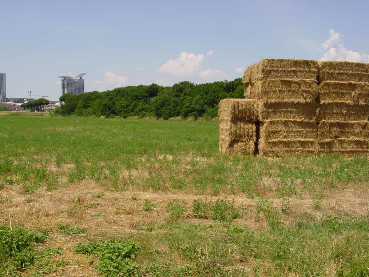
The Laurentino Acqua Acetosa Nature Reserve occupies the valley floor south of the Laurentino neighborhood, in Municipio IX, and the operational office given by the managing body is at Via Carlo Emilio Gadda 187, 00143 Roma, phone 06 5082 9723. Administrative coordination belongs to the Regional Body RomaNatura, with offices at Via Gomenizza 81, 00195 Roma, phone 06 35405310. There is no ticket office: it is a regional protected area with free access, no turnstiles and no declared closing time, and passage depends on daylight more than on a gate. The nearest metro stop is Laurentina, the southern terminus of line B, from which you continue toward the Laurentina and Vallerano neighborhoods. Surface lines change with the timetables and it's best to check them on the transit company's website before setting out. By car you arrive from Via Laurentina and from the internal roads of the Laurentino, with free street parking. The archaeological area of Acqua Acetosa, which falls in the same district, is instead closed to the public and remains the responsibility of the Soprintendenza: you see it from outside, you don't visit it.
If you are looking for the other protected areas of the city and the walking itineraries within Rome, the complete map starts from the Decima Malafede page, the sister reserve that borders this one to the south beyond the Grande Raccordo Anulare.

What the Laurentino Acqua Acetosa Nature Reserve really is
Whoever arrives here expecting an urban park with paved paths is thrown off, and rightly so. This is residual countryside, squeezed between the public housing of the 1970s and the ring road, with streams that descend toward the Tiber and farmhouses that still hold up the memory of an agricultural economy ended half a century ago. The surface given by the regional body's sheet is 152 hectares. The perimeter has been the subject of proposals for expansion and the updated figure should be checked on the body's official website, because the figures in circulation don't match. In any case we are looking at one of the smallest protected areas of the Roman system, and also one of the most fragile.
The establishment came with the Lazio regional law of October 6, 1997, number 29, published in the official bulletin of November 10, 1997. That law was born as an overall reorganization of the regional protected areas and brought into the RomaNatura system a piece of territory that until then had a very different destination: intensive urbanization, public and private residential building. The point deserves to be said clearly, because it explains everything else: the Laurentino Acqua Acetosa Nature Reserve exists not because someone preserved it, but because someone stopped building on it.
The numbers of the Laurentino Acqua Acetosa Nature Reserve
Managing body: RomaNatura, the regional body that administers the protected areas within the territory of Roma Capitale. Municipality: Rome. Type: regional nature reserve. Extent declared by the regional sheet: 152 hectares. Boundaries: to the north the buildings of the Laurentino, to the south the Grande Raccordo Anulare, to the east Via Laurentina, to the west the Acqua Acetosa Ostiense district. Inside this irregular quadrilateral three minor watercourses run, three valleys open, there are a few historic farmhouses and a plateau that archaeologists excavated for four seasons. It is not much, in hectares. It is a great deal, in stratigraphy.
Why the reserve was born where a neighborhood was supposed to be
In the 1970s this valley floor was destined to become yet another zone of economic and public housing in the southern belt. The surveys preliminary to urbanization, the ones done before opening construction sites, turned up in 1976 a protohistoric settlement and its necropolis. From then on the area's fate changes direction: first the archaeological restriction of 1976 on the village and the necropolis, then, 20 years later, the regional law that establishes the reserve. It is a sequence that repeats often in Rome, but rarely so cleanly. In our judgment the Laurentino Acqua Acetosa Nature Reserve is the most honest case study you can show to anyone who wants to understand how protection really works on the outskirts: you protect what you discover, and you discover what you are about to destroy.
The three valleys of the Laurentino Acqua Acetosa Nature Reserve
The backbone of the landscape is hydraulic. Three streams cut the tuff and draw three parallel little valleys converging westward, toward the Tiber. Whoever walks here does not follow panoramic paths: they follow the water, and water tells the terrain better than any sign.
The Fosso dell'Acqua Acetosa
It is the central valley, the one that gives the whole reserve its name. The stream collects the waters of the slope and passes by the mineral spring that made this stretch of the Laurentina famous. The bed is modest, often reduced to a trickle in August, swollen and muddy after the October storms. Along the banks the vegetation thickens and becomes a continuous band of willows and poplars that, seen from the top of the plateau, draws a dark green ribbon within the yellow of the fields.
The Fosso di Vallerano
The Vallerano is the main collector of the sector, and the Fosso dell'Acqua Acetosa brings it its tribute before the whole reaches the left bank of the Tiber. The place name has generated over the years some confusion with homonymous localities of northern Lazio: here we are talking about the Roman stream, not the town of the Tuscia. The Vallerano valley is the most open of the three and the most marked by recent agriculture, with plots that until a few decades ago were still sown.
The Fosso del Ciuccio
The third stream has the most Roman name of the three and the most interesting fauna. In its waters, and in the pools that form in the old basalt quarries near the San Sisto farmhouses, populations of newts and green frogs survive. They are the animals ecologists use as a warning sign of water quality, because the skin of amphibians does not forgive pollution. Finding them a few hundred meters from the Grande Raccordo Anulare is the best news this reserve can give.
The spring that gives its name to everything
Around kilometer 8 of Via Laurentina a spring of slightly acidic, ferruginous mineral water with a sulfurous component emerges. Its sharp taste earned it the popular name of acqua acetosa, which in Rome indicates more than one source: the one in the Parioli, known to Grand Tour travelers, and this one, distinguished by the ancient toponymists as Acqua Acetosa Ostiense precisely to avoid the confusion. Whoever mixes up the two gets the neighborhood wrong by 11 kilometers.
The acqua acetosa of the ancients and the acquacetosari
The spring was known in Roman times and a therapeutic use was attributed to it, as happened with many mineral waters of the suburbium. Local tradition says the water was brought into the city by itinerant sellers, the acquacetosari, who loaded it in terracotta containers and distributed it in the rioni. It is a vanished trade, like the street sweeper and the coachman, and it survives only in a few photographs and in street names. It's worth remembering when you look at the ruin of the plant: before industrial bottling, the distribution of mineral water was a job done on foot.
The Fonte San Paolo and the 1937 plant
In 1937 the spring was tapped and industrialized with a collection and marketing plant named Fonte San Paolo, after the Ostiense basilica that marks this whole urban sector. The water entered the circuit of Roman mineral waters and for decades appeared on the city's tables. The plant is closed today, and the closure has no reopening date: the declared cause is the pollution of the water table. The building remains inside the perimeter, abandoned, and passersby easily mistake it for just any warehouse.
Why the spring is not drunk today
I'll say it straight: the water of this spring should not be drunk. It is not a formal precaution, it is the reason the plant is closed. The water table of this sector has suffered decades of urban pressure, illegal dumps and spills, and the cleanup of the area is one of the matters still open among the Municipio, Roma Capitale and the managing body. If you bring children, this is the only truly non-negotiable rule of the day.
The eucalyptus trees of the Laurentino Acqua Acetosa Nature Reserve
Among the rows you meet going up the central valley there are some eucalyptus alignments, planted at the end of the 19th century. They are not a landscape whim: they belong to the great season of the fight against malaria in the Agro Romano, when it was thought that the Australian tree, with its formidable thirst and its balsamic leaves, could drain the stagnant waters and purify the air. Science later clarified that the vector was the mosquito and not the miasma, but the eucalyptus trees remained, and today they are involuntary botanical monuments to a generous scientific error. You recognize them at first glance by the bark that peels in strips and by the smell that stays on your fingers after crushing a leaf. You also find them along Via Appia and in the reclaimed lands of the coast, and they tell the same story: whoever walks in the Appia Antica Park meets the same rows with the same origin.
The vegetation of the Laurentino Acqua Acetosa Nature Reserve
The forest cover is modest and fragmented, and it would be dishonest to describe it as a woodland. Intensive agricultural use and urbanization at the edges have reduced the tree formations to isolated groves. But those groves are real, and they have a composition worth reading plant by plant.
The oak groves
You recognize Turkey oaks, downy oaks, English oaks, holm oaks and cork oaks, with field maple as the second layer. It is the typical ensemble of the mixed low-altitude Lazio woodland, the one that in coastal Lazio coexists with Mediterranean scrub. The holm oak is evergreen and keeps its color even in January. The downy oak loses its leaves but often keeps them attached, dry, all winter, and it is the simplest way to tell them apart at a distance. The presence of the cork oak, in such an urbanized context, is the sign of acidic soils and an ancient forest continuity that the plow did not entirely erase.
The banks of the streams
Along the water the vegetation changes completely: willows and poplars form the riparian gallery, with brambles and hawthorn closing the understory in a barrier that in summer becomes impassable. In the water appear water speedwell and watercress, two plants that have had a long career in the kitchen and that here indicate running, oxygenated water. Whoever wants to understand the difference between a living stream and a drainage ditch doesn't need a laboratory: look for the watercress.
Wild herbs and orchids
In the meadows and fallow land you find borage, mallow, wild carrot, milk thistle and poppies, the ruderal flora that colonizes abandoned farmland. The real surprise comes in spring, and it is the reason April is the right month: inside the reserve wild orchids of the genera Ophrys, Serapias and Orchis are reported. The ophrys are those that imitate the abdomen of an insect to attract pollinating males, one of the most elegant deceptions of the plant kingdom. You don't pick them, you don't dig them up, you photograph them standing on the path: they are protected species and the bulb doesn't survive transplanting.
The fauna of the Laurentino Acqua Acetosa Nature Reserve
The biodiversity is that of a small, surrounded protected area, so with many anthropophilic species and few demanding ones. That said, the list is longer than you would imagine coming down from the Raccordo.
Amphibians and river crabs
In the freshwater streams live the river crab, the green frog, the common toad and the newt. The river crab deserves an extra line: it is a freshwater crustacean that does not tolerate dirty water and that in Rome survives in very few minor watercourses. Finding it here means that at least some stretches of the streams still have decent quality. The crested newt, reported in the pools of the old basalt quarries, is the most delicate species of the whole list.
Reptiles
The grass snake frequents the banks and dives in when you disturb it: it is harmless and hunts amphibians. The western whip snake is the black, fast snake you will see crossing the paths in June, equally harmless and wrongly feared. The common lizards and the common gecko complete the picture, the latter appearing at day's end on the walls of the farmhouses.
Mammals
The fox is there, and moves at dusk along the edges of the fields. The porcupine leaves its quills on the paths and digs deep burrows in the tuff banks. The hedgehog and the mole complete the picture of the small mammals, together with the rodents of the meadows and the colonies of pipistrelle bats that at sunset come out of the cracks of the farmhouses. Whoever wants to see something alive must come in the last hour of light, not at noon.
Birds and raptors
On the streams you see the gray heron, the kingfisher and the white wagtail. Over the open fields the buzzard and the kestrel, which hunts hovering above the tall grass. In the farmhouses the little owl and the barn owl nest, and the peregrine falcon is reported as a hunting presence. Among the passerines you count nightingale, hoopoe, redstart, blackbirds, sparrows, starlings and swallows. The common pheasant circulates in the fields as a legacy of the old hunting releases. The hoopoe, with its fan-shaped crest and three-note song, is the bird that groups remember best.
Insects
Bumblebees, wild bees and butterflies populate the flowering meadows: orange tip, swallowtail and scarce swallowtail are the three most recognizable, and the swallowtail, with its rear tails, is the butterfly everyone photographs badly because it won't stay still. If you want to take home a decent shot, look for it early in the morning, when the low temperature keeps it motionless on the flowers.

The protohistoric settlement of Acqua Acetosa Laurentina
Here the reserve stops being a matter of trees and becomes a matter of centuries. In 1976, during the preliminary works for the urbanization of the Laurentino neighborhood, a protohistoric settlement was identified on the plateau overlooking the stream and the spring. The excavation campaigns, directed by Alessandro Bedini, took place between 1976 and 1980 and brought to light a fortified settlement at the 8th kilometer of Via Laurentina, south of Rome.
The ditch and the agger
The defensive system is the part that most strikes anyone who knows Lazio archaeology. On the northern side, the most exposed, a deep ditch about 200 meters long was dug into the tuff. The earth and the chunks of tuff removed were piled up inside to form an embankment, an agger, which still survives today with an 11-meter drop. On the southern side the plateau defended itself, with steep tuff walls. The accesses were reduced to narrow passages at the two ends, easy to block. The digging of the ditch is dated to the beginning of the 8th century BC: it means that here, while Rome was just being born as an aggregate of villages, a Latin community already had the organizational capacity and the labor to fortify a plateau.
The phases of the settlement
The oldest pottery fragments, collected in secondary deposition, date to the Final Bronze Age, between the 12th and 10th centuries BC. The full phase is that of the early Iron Age and the Orientalizing period, between the 8th and 7th centuries. The investigated area covers about two hectares, with huts of modest size, the usual type of ancient Lazio, and it is probable that in the later phases the settlement extended beyond the fortified hill. A road cut into the tuff linked the valley floor to the necropolis area, to the northeast. Toward the end of the 7th century the settlement goes into decline, and life on the plateau continues in much more modest forms until more recent times.
Why that plateau
The position is not random. The site controls the Acqua Acetosa valley and the passages toward the Tiber, the Colli Albani and the coastal cities of Laurentum, Lavinium and Ardea. It is a node of traffic, not a refuge: the grave goods prove it with objects that come from far away. Whoever wants to grasp by eye the geography of these relationships can travel the coast to Ardea, the ancient capital of the Rutuli, and then go back up toward Ostia Antica: they are the two ends of the same trade network that passed through here.
The necropolis and the princely grave goods
From the settlement we move to its dead, and the dead of this site made history. The excavation campaigns brought to light about 175 burials, a rare statistical sample for protohistoric Lazio, which made it possible to read the community's social development the way you read a graph.
From modest tombs to tumuli
The burials of the 8th century contain sober, almost uniform pottery grave goods: a society still little differentiated. During the 7th century, in the full Orientalizing age, the picture changes abruptly. Aristocratic families appear who have tumuli built over 30 meters in diameter, with pseudo-chamber tombs exceeding four meters by three, wooden or stone supports and a tumulus covering. It is the moment when wealth stops being hidden and becomes funerary architecture visible from kilometers away.
The bronze chariot and the luxury objects
The top tombs contain up to about 100 vessels, bronze vessels such as basins and tripods, iron weapons, amber beads, gold fibulae and decorated bronze shields, all indicators of particularly high rank. Among the recovered materials the managing body's documentation reports a bronze chariot, the object that more than any other defines the owner as a member of a warrior and ceremonial elite. The amber arrives from the Baltic through the continental routes, the gold passes through the workshops of southern Etruria: inside a tomb of the Laurentina there is half of Iron Age Europe.
Where the grave goods can be seen today
The materials of the necropolis are kept in the collections of the Museo Nazionale Romano. Whoever wants to see them, or to see the Lazio context they belong to, has to head for the museum's sites in the center: the protohistoric section and the archaeological collections are distributed among Palazzo Massimo alle Terme, the Octagonal Hall of the Baths of Diocletian and the Crypta Balbi. It's best to check on the museum's website which site displays the Laurentina materials during the period you go, because the displays rotate.
Tellenae, Politorium and the question of the name
What was this place called? We don't know. The position south of Rome, between Ficana and Castel di Decima, has led scholars to propose the identification with Politorium or with Tellenae, two Latin centers that the annalistic tradition remembers as destroyed during the Roman territorial expansion of the regal age, with the population deported to the Aventine. It is a hypothesis, not a fact: no inscription found on the plateau pronounces a name. Whoever tells it to you as certainty is selling you a suggestion.
The interesting thing is another. Even if the identification were wrong, the structural fact would remain: here was an autonomous, fortified center, with a rich aristocracy, eight kilometers from the Roman Forum, and toward the end of the 7th century it stopped counting. The story of the formation of the Roman state is also the story of these neighbors who disappear. The Laurentino Acqua Acetosa Nature Reserve keeps, under the grass, one of the losers of that game.
The farmhouses and historic buildings of the Laurentino Acqua Acetosa Nature Reserve
The built heritage is the third soul of the reserve, and the most neglected by visitors. They are rural and industrial buildings that tell four centuries of land use.
The San Sisto farmhouse
The San Sisto complex, of 17th-century layout, stands near the protohistoric settlement. The destination foreseen by the managing body's programs is that of a museum-workshop and visitor center of the archaeological area: it would be the presence that this reserve has always lacked. At the time of your visit it's best to check on the body's website if the center is actually open, because the timing of Roman restorations is what it is. Next to the farmhouse open the old basalt quarries, today pools of water that host newts and green frogs.
The Castellaccio and the cowshed
On the hill of the Castellaccio an old cowshed is preserved whose large basilica-like hall, with the arches that marked the stalls of the animals, is destined to become an exhibition and museum center. The cowsheds of the Agro Romano are a chapter of rural architecture that almost nobody tells: imposing buildings, built for stabling livestock in the malarial countryside, often of surprising construction quality. This one deserves the small effort of climbing up there even just to see it from outside.
The spring plant and the judicial depot
Within the perimeter also fall the old Fonte San Paolo bottling plant, closed because of the pollution of the water table, and the judicial depot of seized vehicles, an expanse of sheet metal that is perhaps the most jarring neighbor a nature reserve can have. These are the two knots to be untied for a coherent development of the area: as long as they stay as they are, any talk of redevelopment remains theoretical. I say it without diplomacy: the day the depot finds another location, this reserve doubles in value.
The Laurentino, the cumbersome neighbor
To the north, the backdrop is that of the Laurentino neighborhood, the public housing project designed by Pietro Barucci and built starting in the second half of the 1970s, which became famous for the elevated connecting structures that Romans simply call the bridges. The neighborhood has gone through decades of difficult news coverage and a long season of renewal work, and today its public image is very different from that of the 1980s. For whoever walks in the reserve, the Laurentino is above all a backdrop: a wing of concrete that closes the valley and makes the boundary between the built-up city and the surviving countryside immediately legible. It is also, it must be said, one of the strongest photographic contrasts that Rome offers to anyone looking for the urban landscape rather than the postcard.
A curiosity about the Laurentino - Acqua Acetosa Nature Reserve
The loveliest curiosity of this reserve doesn't concern a tree or a ruin: it concerns a chronology. The defensive ditch of the protohistoric settlement was dug at the beginning of the 8th century BC. Take that date and put it next to the traditional date of the founding of Rome, 753 BC: we are in the same half-century. While on the Palatine and the Capitoline the hut villages were just beginning to think of themselves as one thing, here, eight kilometers away, a community already had the capacity to organize a collective construction site, cut 200 meters of ditch into the tuff and pile up an embankment 11 meters high. It is not little: fortifying a settlement means having an authority that decides, labor that obeys and a food surplus that lets dozens of people work on defense instead of in the fields.
The second part of the curiosity is the one that closes the circle. That embankment is still there. It is not a reconstruction, not a drawing on a panel: it is a rise of earth and chunks of tuff that you cross on foot, and that from an 11-meter drop can still be read perfectly in the morphology of the plateau. In a city that displays its monuments inside cases, the Laurentino Acqua Acetosa Nature Reserve preserves an Iron Age fortification in the open air, without a ticket office and without signs. The fact that almost no Roman knows it is, in its way, the curiosity inside the curiosity.
Something nobody tells you about the Laurentino - Acqua Acetosa Nature Reserve
That the archaeological area can't be visited. It is the most important piece of information and the one most absent from the pages that talk about this place, and it produces dozens of wrong outings every year. The protohistoric village and its necropolis were protected in 1976 with the establishment of the Acqua Acetosa archaeological zone, which is a distinct perimeter and is not part of the nature reserve. The site is closed to the public and remains the exclusive responsibility of the archaeological Soprintendenza: you can walk in the reserve, you can walk around the plateau, you can read the shapes of the terrain, but you don't enter the excavation area and you don't see the structures brought to light.
Whoever arrives convinced of finding a visitable archaeological park, with routes and panels, goes home disappointed and says there is nothing here. It is the opposite: there is a great deal, but it is protected and not set up. The distinction between archaeological restriction and public access is something that in Italy is little explained and much endured. The project to open a visitor center in the San Sisto farmhouse goes exactly in this direction, and when it is operational it will change the perception of the whole reserve. Until then, the practical advice is simple: come for the valley, for the streams, for the eucalyptus trees and for reading the landscape, and consider the archaeology a level of knowledge you carry with you, not a guided visit someone will give you.
Second point nobody mentions: the reserve does not have rich signage or a system of numbered trails like the larger protected areas. The tracks are there, they are well trodden, but they must be read with common sense. An offline mapping app and closed shoes are worth more than any brochure.
The advice I give you for visiting the Laurentino - Acqua Acetosa Nature Reserve
Come in April, early in the morning, and give the reserve two and a half hours, no more. April is the month when the wild orchids are in flower, the meadows are still green, the streams have water, the butterflies are out and the mosquitoes have not yet taken possession of the valley floor. Early morning serves two reasons: wildlife moves in the first and last hours of light, and the raking light draws the relief of the protohistoric embankment, which at noon becomes unreadable.
Practical organization. Bring water, because inside the reserve there are no reliable drinking fountains and the spring is not drunk. Closed shoes with a lugged sole: the paths along the streams stay muddy for days after rain and wet tuff is slippery. Long pants, for the brambles and the ticks, which in an area with foxes and porcupines are a concrete possibility between May and September. No road bike: the surface won't take it. A light pair of binoculars completely changes the day, because wildlife here is observed from a distance.
The advice on method is to build the visit as a descent and a climb back: you start from the urban edge, descend into the valley of the Fosso dell'Acqua Acetosa, climb back up to the plateau of the protohistoric settlement and finish by looking at the Laurentino from above. In that sequence of 40 minutes you cross 3000 years and two opposite ways of living in the same valley. If instead you have only one hour, skip the upper part and stay along the stream: water is the most alive thing this reserve has.
Last warning, and it isn't rhetorical: this is not an equipped area. There are no restrooms, no kiosk, no always-open information point. Whoever expects the services of an urban park will do well to choose the Caffarella Park or the Pineta di Castel Fusano. Whoever instead looks for a real, little-visited landscape is in the right place.
Another well-known fact, yet rarely cited
That in Rome there are two acque acetose, and that mixing them up is the most common mistake of anyone looking for this place. The Acqua Acetosa that everyone knows is the one in the Parioli, on the left bank of the Tiber north of the center, with the fountain attributed to Bernini's circle and the tram terminus that bears its name. The other, the one we are talking about here, is the Acqua Acetosa Ostiense, to the south, on Via Laurentina, and to distinguish it the toponymists had to add the neighborhood's surname. Whoever types the name into the navigator and sets out without checking risks ending up 11 kilometers further north, in front of another spring and another story.
The fact is well known among Romans of the southern quadrant, and almost ignored elsewhere, with curious consequences: photographs of the Parioli fountain attributed to the Laurentino reserve circulate online, and vice versa. The reason for the double name is the same in both cases, that is the presence of acidic and ferruginous mineral waters, frequent in the volcanic subsoil of Lazio. Rome is built on tuffs and pozzolanas that release carbon dioxide and iron salts: acidic springs are the normal geological result of that subsoil, not a rarity. What is rare is that one of these springs gave its name to a protected area and to an Iron Age necropolis. It's worth adding that in the southern quadrant the toponymy of waters is very dense: from the Acqua Santa to the springs of the Appia, the entire sector is mapped on the points where water emerges, and the Parco degli Acquedotti is its monumental translation.
The right photo to take at the Laurentino - Acqua Acetosa Nature Reserve
The photograph worth the trip is just one, and it is not the one of the flowers. Climb to the edge of the plateau of the protohistoric settlement in the early morning, position yourself so that you have the valley of the Fosso dell'Acqua Acetosa in front and the blocks of the Laurentino in the background, and frame keeping the horizon line low. What enters the frame is a leap of 3000 years: in the foreground the embankment of earth and tuff of the 8th century BC, in the middle the rows of eucalyptus planted against malaria at the end of the 19th century, in the back the concrete of the public housing of the 1970s. Three ways of occupying the same valley, three eras, a single shot. I don't know many places in Rome where the urban stratigraphy reads so well without needing captions.
Technical advice, because the photo is difficult. The right light is the raking light of the morning, within the first hour and a half after dawn: it serves to sculpt the drop of the agger, which with high sun disappears and becomes just any meadow. Use a moderately long focal length, between 50 and 90 millimeters equivalent, to compress the planes and bring the Laurentino closer: with a wide angle the neighborhood becomes an insignificant strip and the photo loses its meaning. Close the aperture to keep both the foreground and the background in focus. If there is haze, wait: haze in this valley is frequent on October and November mornings and flattens everything.
The second photo, for those with patience, is the stream: running water, watercress, brambles closing overhead. You need a long exposure and a stable support, and you need to accept getting your shoes dirty. The third, the hardest, is the kingfisher: a blue flash that crosses the stream and disappears. If you get it, you've made your day.
Some important events that happened here in history
The first event is the fortification of the plateau at the beginning of the 8th century BC. It is not a battle and it has no name, but it is the founding act of this place: a community decides to dig 200 meters of ditch into the tuff and raise an 11-meter agger, and in doing so declares itself a city. From that moment the site controls the roads toward the Tiber, the Colli Albani and the coastal cities.
The second event is the aristocratic explosion of the 7th century. Over the span of two or three generations the necropolis goes from the uniform burials of the 8th century to tumuli over 30 meters in diameter, to pseudo-chamber tombs, to grave goods with about 100 vessels, bronzes, iron weapons, Baltic amber and gold. It is the moment when the commercial wealth of this valley becomes visible and ostentatious.
The third event is the decline, toward the end of the 7th century. The settlement loses weight and the necropolis dies out. The Roman annalistic tradition places in these decades the destruction of the neighboring Latin centers and the deportation of their populations to Rome: if the identification with Politorium or Tellenae were well founded, what we read in the ground would be the archaeological face of a conquest told by the literary sources. It remains a hypothesis, but it is a hypothesis that holds.
The fourth event belongs to the 19th century and has the form of some rows of trees: the planting of the eucalyptus in the malarial countryside, a therapeutic and agronomic choice of a season that believed in bad air more than in the mosquito. The fifth is from 1937, when the spring is tapped and the Fonte San Paolo plant is born, which brings the acidic water of the Laurentina to Roman tables until its closure for pollution of the water table.
The sixth event is from 1976: the preliminary surveys for urbanization identify the settlement and the necropolis, the excavation campaigns directed by Alessandro Bedini begin and the Acqua Acetosa archaeological zone is established. The seventh is from October 6, 1997, when regional law number 29 establishes the nature reserve and entrusts management to RomaNatura. In 21 years, a valley floor destined for concrete becomes a protected area twice over: first for what it hides below, then for what it carries above.
Who passed through the Laurentino - Acqua Acetosa Nature Reserve
The first to have a name are anonymous but not generic: the aristocratic families of the 7th century BC buried in the tumuli of the necropolis, men and women who had themselves accompanied into the tomb by a bronze chariot, decorated shields, gold fibulae and amber come from the Baltic. We don't know their names because no inscription from the plateau gives them back to us, but we know their rank, their trade and their taste, which is more than we know about many people with a name.
Then there is the literary tradition, and it must be taken for what it is. The Roman annalists tell that the kings of the early age, and in particular Ancus Marcius, destroyed the Latin centers south of Rome, among them Politorium and Tellenae, deporting their inhabitants to the Aventine. If the identification of the plateau with one of those centers were correct, then a Roman army of the regal age would have passed over this hill. It is a tradition, not an ascertained fact: I write it like that, and that is how it should be read.
From the 19th century onward there pass through here the agronomists and technicians of the reclamation of the Agro Romano, the ones who planted the eucalyptus convinced they were fighting malaria, and the acquacetosari, the itinerant sellers who carried the spring's water into the city. In the 20th century come the mineral water industrialists who in 1937 set up the Fonte San Paolo.
The most important modern name is that of Alessandro Bedini, the archaeologist who between 1976 and 1980 directed the excavations of the settlement and the necropolis and who published the results in the Archeologia Laziale series: without his work this valley would today be a building zone and nothing more. Beside him, the architect Pietro Barucci, author of the design of the Laurentino neighborhood that closes the reserve to the north: two men who worked in the same years on the same piece of city, one digging into the past and one building the future, and who today look at each other from one side of the valley to the other.
How to really visit the Laurentino Acqua Acetosa Nature Reserve
The visit is built on your own, and this is at once the difficulty and the merit of the place.
How long the visit lasts
Two and a half hours for the full loop with the climb back to the plateau. One hour if you stay along the Fosso dell'Acqua Acetosa. Four hours if you also link the Fosso del Ciuccio sector and the farmhouses. It is not a vast area, but the elevation changes and the uneven surface slow you down more than the map suggests.
The Laurentino Acqua Acetosa Nature Reserve with children
It works very well from age six up, provided you build the day around water and animals: river crabs, frogs, newts in the quarry pools, porcupine quills on the paths. Under age six the uneven surface and the lack of services make it tiring. The stroller is out of the question. Iron rule, repeated twice to the youngest: you don't drink the spring water and you don't go into the streams.
Accessibility
The area is not equipped for visiting in a wheelchair: the routes are on packed earth, with slopes and muddy stretches, and there are no walkways. Whoever has mobility difficulties can still look over the edges from the urban side and read the valley from above, which is already a good overall picture. For an accessible nature experience in the same city, better to head toward the Laghetto dell'EUR.
With the dog
It is a protected area with amphibians, reptiles and ground nesting: the dog must be kept on a leash, always, and kept out of the streams. It's not a bureaucratic formality, it's the difference between a walk and damage.
When to go and when to avoid it
The best period runs from mid-March to late May, with April at the head for the flowerings. October is also good, with the colors of the riparian woodland and the water back in the streams. Avoid July and August: the valley floor is muggy, the grass is dry, the animals hide and the mosquitoes get the upper hand. Also avoid the two days after a heavy rain, when the paths become impassable.
What's around the Laurentino Acqua Acetosa Nature Reserve
The southern quadrant is the richest in protected green of all Rome, and from here you build whole days. To the south, beyond the Grande Raccordo Anulare, opens the vast Decima Malafede, the largest of the RomaNatura reserves, with real woods and farmhouses. Toward the center, Via Ostiense leads to the Basilica of San Paolo fuori le Mura and to the Museo della Via Ostiense, which explains the ancient topography of this sector better than any map. A short distance away, the Abbey of Tre Fontane preserves another piece of countryside inside the city, with the eucalyptus that here is even a monastic product.
On the modern side there is the EUR district, a few minutes by road, with its monumental axes and the little lake. Whoever wants to continue along the thread of protohistoric and funerary archaeology finds the most instructive comparison in the Necropolis of Banditaccia at Cerveteri, where the Orientalizing tumuli can be seen standing and at full size: it is the best way to imagine how the necropolis of the Laurentina must have looked before the plow leveled it. For those staying in the city, the Valle dei Casali Nature Reserve and the Monte Mario Reserve complete the round of urban protected areas, and the Parco del Pineto offers the same reading of valley and stream on the opposite side of the city.
Frequently asked questions about the Laurentino, Acqua Acetosa Nature Reserve
How much does it cost to enter the Laurentino Acqua Acetosa Nature Reserve
Entrance to the Laurentino Acqua Acetosa Nature Reserve is free. It is a regional protected area with free access, no ticket office and no turnstiles, in the southern sector of Rome.
Where exactly is the Laurentino Acqua Acetosa Nature Reserve
The Laurentino Acqua Acetosa Nature Reserve is in the southern sector of Rome, between the Laurentino neighborhood to the north, the Grande Raccordo Anulare to the south and Via Laurentina to the east, over an area of 152 hectares given by the regional body's sheet.
Can you visit the protohistoric archaeological area of the reserve
No, the archaeological area can't be visited. The protohistoric village and its necropolis were protected in 1976 with the establishment of the Acqua Acetosa archaeological zone, a distinct perimeter that is not part of the nature reserve and remains closed to the public, under the responsibility of archaeological protection.
How much time do you need to visit the Laurentino Acqua Acetosa Nature Reserve
The full loop with the climb back to the plateau takes about two and a half hours. One hour is enough if you stay along the Fosso dell'Acqua Acetosa, while whoever also links the Fosso del Ciuccio sector and the farmhouses can reach four hours. The area is not vast, but the elevation changes and the uneven surface slow the walk more than the map suggests.
Why is it called Acqua Acetosa and how is it distinguished from the other Acqua Acetosa of Rome
The name of the Laurentino Acqua Acetosa Nature Reserve comes from a spring of slightly acidic mineral water, ferruginous and with a sulfurous component, at kilometer 8 of Via Laurentina. In Rome there is another Acqua Acetosa, the one in the Parioli on the left bank of the Tiber: to distinguish them, this one is called by the ancient toponymists Acqua Acetosa Ostiense.
What is the best time to go to the Laurentino Acqua Acetosa Nature Reserve
The recommended period is April, early in the morning, devoting about two and a half hours to the reserve. April is the month when the wild orchids are in flower, the meadows are still green, the streams have water and the mosquitoes have not yet taken possession of the valley floor.
What can you see of the protohistoric necropolis discovered in the reserve
The necropolis identified in 1976 near the Laurentino Acqua Acetosa Nature Reserve yielded about 175 burials, a rare sample for protohistoric Lazio, with grave goods ranging from sober 8th-century pottery to princely tombs with bronze chariots, decorated shields, gold fibulae and amber from the Baltic. The area cannot however be visited, being an archaeological site closed to the public.
If you want to build an organized, not improvised, day in this quadrant, the network of escorts and guides of TourLeaderPro in Rome routinely works on the less-trodden routes of the suburbium, and the tourist escort service is designed for groups who want a professional to manage timing and logistics. For those traveling in English and putting together a broader itinerary, the guide best things to do in Rome and the page dedicated to Lazio give the regional picture, while whoever looks for nature and walking routes finds the Italian panorama in mountains and nature in Italy.
Quick questions about the Laurentino Acqua Acetosa Nature Reserve
How much does it cost to enter the Laurentino Acqua Acetosa Nature Reserve
Nothing. It is a regional protected area with free access, no ticket office and no turnstiles.
Where exactly is the Laurentino Acqua Acetosa Nature Reserve
In the southern sector of Rome, between the Laurentino neighborhood to the north, the Grande Raccordo Anulare to the south and Via Laurentina to the east. The reference given by the managing body is Via Carlo Emilio Gadda 187, 00143 Roma.
What is the phone number of the reserve
The contact given for the reserve is 06 5082 9723. The RomaNatura headquarters, at Via Gomenizza 81, answers at 06 35405310.
How big is the Laurentino Acqua Acetosa Nature Reserve
The regional body's sheet gives 152 hectares. The perimeter has been the subject of expansion proposals and different figures circulate online: for the updated figure it's best to refer to the managing body's website.
When was the reserve established
With the Lazio regional law of October 6, 1997, number 29, published in the official bulletin of November 10, 1997.
Who manages the Laurentino Acqua Acetosa Nature Reserve
The Regional Body RomaNatura, which administers the system of protected natural areas in the territory of Roma Capitale.
Can you visit the archaeological area
No. The Acqua Acetosa archaeological zone, established in 1976, is closed to the public and the exclusive responsibility of the Soprintendenza. You walk in the reserve, not in the excavation.
Can you drink the spring water
No. The bottling plant is closed because of pollution of the water table and the water is not potable. Bring your own water bottle.
How long does a visit to the Laurentino Acqua Acetosa Nature Reserve last
One hour staying along the stream, two and a half hours for the loop with the climb back to the plateau, up to four hours if you also link the farmhouses and the Fosso del Ciuccio.
What is the best time to go
From mid-March to late May, with April at the head for wild orchids and butterflies. October is the second choice. July and August are to be avoided.
Is it suitable for children
Yes from age six up, building the visit around water and wildlife. Under age six the uneven surface and the lack of services make it tiring, and the stroller won't get through.
Is it wheelchair accessible
No. The routes are on packed earth, with slopes and muddy stretches, and there are no equipped walkways.
Can you bring the dog
Yes, on a leash and away from the streams, because the area hosts amphibians and ground nesting.
Are there restrooms, kiosks or information points
There are no permanent services. A visitor center is planned in the San Sisto farmhouse: before leaving it's best to check on the managing body's website if it is active.
How do you get there by public transport
The reference metro station is Laurentina, the southern terminus of line B, from which surface lines continue toward the Laurentina neighborhoods. Bus routes and schedules should be checked on the public transport company's website.
Can you arrive by car and where do you park
You arrive from Via Laurentina and from the internal roads of the Laurentino neighborhood. Parking is free on the street, with no dedicated areas.
What animals do you see in the Laurentino Acqua Acetosa Nature Reserve
Fox, porcupine, hedgehog, mole and bats among the mammals. Grass snake, western whip snake, lizards and gecko among the reptiles. Green frog, toad and newt among the amphibians. Gray heron, kingfisher, buzzard, kestrel, little owl, barn owl, hoopoe, nightingale and pheasant among the birds. In the streams the river crab survives.
What is the difference with the Acqua Acetosa of the Parioli
They are two different and distant places. The one in the Parioli is on the left bank of the Tiber north of the center, with its monumental fountain. This one is the Acqua Acetosa Ostiense, to the south, on Via Laurentina, inside the nature reserve.
Where are the finds from the necropolis kept
In the collections of the Museo Nazionale Romano. Which site displays them depends on the displays of the moment and should be checked on the museum's website.
Can you take photos and use a drone
Photographs are free. For drones, national rules and the restrictions of Rome's airspace apply, with the aggravating factor of proximity to the Grande Raccordo Anulare: it must be checked case by case with the managing body and the competent authority.
Are there marked trails
The reserve has no network of numbered trails like the larger protected areas. There are trodden tracks along the streams, recognizable but not signposted thoroughly: offline mapping on your phone is recommended.
Can you go birdwatching
Yes, and it is perhaps the activity that pays off best. The right hours are the first and the last of light, the best spots are the banks of the streams and the edges of the open fields where buzzard and kestrel hunt.
Why is it called Acqua Acetosa
For the slightly acidic taste of the spring's mineral water, due to the ferruginous and sulfurous component typical of the waters of the volcanic subsoil of Lazio.
Is it worth going if you have little time in Rome
If you have two or three days, no: stay in the center. If you live in Rome or come back often and want to understand how the city is made beyond the ring, then yes, and it is worth double.
To close, a judgment: the Laurentino Acqua Acetosa Nature Reserve is not a beautiful place, it is an important place, and the difference must be said honestly. Whoever looks for landscape to photograph will find better elsewhere. Whoever wants to understand how Rome was formed, how an Iron Age community defended itself, how people tried to cure malaria with trees and how at a certain point in the 1970s it was decided to stop building on a valley, here has an open book in front of them that no museum can replace. Go in April, early, with the right shoes, and take the time to climb to the plateau: that 11-meter embankment is worth the trip by itself.
Article written by the editorial team of TourLeaderPro, contact them for Private/Corporate/V.I.P. Tours and Experiences.
Planning a trip to Rome? The English-language guides to visiting the city are on ItalyPlanner.com.