Snodo Mandrione
In short. For a few years Snodo Mandrione had one of the most recognizable addresses in southeastern Rome: Via del Mandrione 63, that is a street number that reads quickly but corresponds to a precise point in the Roman landscape, the one where…
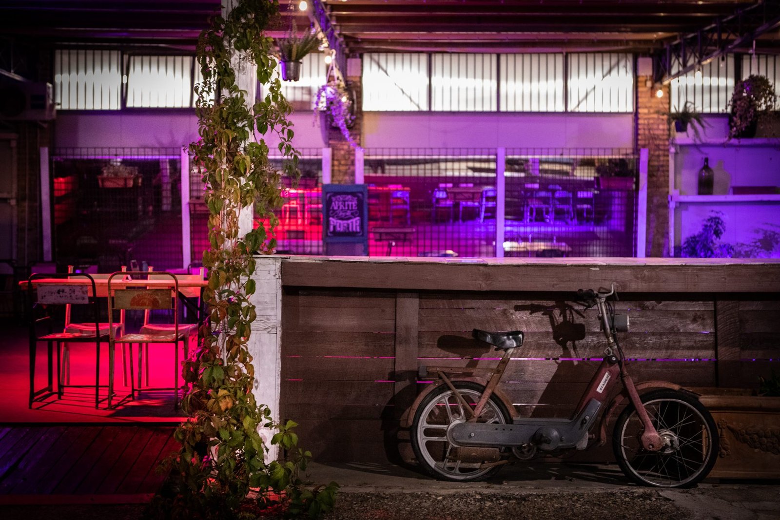
For a few years Snodo Mandrione had one of the most recognizable addresses in southeastern Rome: Via del Mandrione 63, that is a street number that reads quickly but corresponds to a precise point in the Roman landscape, the one where the road runs narrow between the arches of the aqueduct and the railway tracks. It was a large space right next to the Mandrione aqueduct, held together by music, theater, comedy and social activities, with an outdoor part designed expressly for summer, when in Rome everything with a courtyard suddenly becomes more interesting than any indoor hall. Those who went there know it: it was not an elegant place, it was a place with an unrepeatable location.
It's worth being clear right away on one thing, because in Rome the venues of independent culture open and close at a speed that confuses anyone: the listing of the publication that catalogued the venue, Zero, now shows the space as permanently closed. There are no elements to say when this happened or to tell the reasons, and it is better to say so explicitly rather than describe a calendar that may no longer exist. What remains instead, and it remains quite a lot, is the piece of city where that street number is located: Via del Mandrione is one of the most photographed, most written about and most misunderstood urban stretches of Rome's historic periphery, and deserves to be described with precision regardless of the fate of a single venue.
The coordinates of the point, as recorded by the original listing, are around 41.8803 latitude and 12.5331 longitude: we are in the quadrant between Pigneto and Quadraro, with the Casilina to the north and the Tuscolana to the south, in that band of the city that for decades was considered only a margin and that today, for real estate reasons before cultural ones, has become a very hot front. The rest of these lines serves to tell what you see on arriving there, what is above the heads of those who walk that street, who passed through before and why a walk in that area is worth more than many visits in the center.
Where Snodo Mandrione Is and How to Get There
The Address and the Stretch of Road
Via del Mandrione is a long, narrow and surprisingly straight road that connects the area of Porta Furba, on the Tuscolana, with the zone of Porta Maggiore and Pigneto, running for almost the entire route parallel to the railway tracks and leaning against the arches of an aqueduct. Number 63 sits in the central part of the route, the one where the arches are seen best and where the roadway narrows until it becomes a narrow one-way passage for long stretches. Anyone arriving for the first time is generally thrown off: there are no shop windows, no porticoes, no continuous street front. There are walls, gates, low sheds, workshops, a few vegetable gardens, and above all this the row of arches.
The road has a characteristic that makes it hard to explain to someone who hasn't seen it: it changes character every 200 meters. At one point it opens onto a clearing with cars parked diagonally, 200 meters farther on it narrows between two walls and becomes almost a corridor, then widens again and the aqueduct moves away for a few tens of meters leaving room for a patch of uncultivated green. This irregular rhythm is exactly the reason why photographers have been going there for 70 years and why, still today, anyone looking for a Rome that doesn't resemble postcards ends up sooner or later in these parts.
By Public Transport
The simplest way to approach is Metro A, getting off at Porta Furba Quadraro: from there you go up toward the start of Via del Mandrione and continue on foot along the road, with the aqueduct on the right or on the left depending on direction of travel. The walk is not short and not especially comfortable, because the sidewalks are discontinuous and in some places simply don't exist, but it is precisely that walk that makes the place understandable: you immediately grasp that the road was born as a service, not as a promenade.
Alternatively you can use Roma Casilina station or the Malatesta stop of Line C, or the trams and buses that serve Pigneto, then walking south. The regional railway leaving Termini toward Ciampino and Castelli passes right alongside: from the windows you see the arches in sequence, and it is one of the few cases in which the train ride gives a Roman view better than the one you get by stopping.
By Car, Scooter, Bicycle
Going by car is possible but not advisable: the one-way systems change, the parking is improvised and the passage of heavy vehicles headed to the workshops makes the roadway uncomfortable. The scooter remains the most Roman and most effective means, while the bicycle works well on weekends, when traffic thins out and the stretch among the arches becomes almost silent. Anyone arriving by pedaling from Pigneto finds an almost flat route, with a single flaw: the road surface, which in several places still keeps the irregular basalt paving stones and the patches of asphalt layered over the years.
A practical detail that always applies: the road is poorly lit. In the evening, and especially in the months when dark comes early, walking along the Mandrione requires a minimum of attention, not so much for reasons of perceived safety as for the plain absence of regular streetlights and the fact that cars come from behind without much warning. A light-colored jacket, a light on the bike, the phone flashlight: small precautions that avoid annoyances.
What Snodo Mandrione Was: Music, Theater, Comedy and an Outdoor Space
The description that circulated in the guides was essential and fairly precise: a large space right next to the aqueduct, devoted to music, theater, comedy and social activities, with an outdoor part to make use of during the summer. Put like that it can seem a generic formula, but anyone who knows the Roman fabric knows that behind those four words there is a well-defined model, that of the multifunctional container that holds together cultural programming and a neighborhood presence.
The name itself, Snodo, declared the intention: a junction is a point where different things meet and change direction. In a zone that for decades was crossed without being culturally inhabited, calling itself that meant offering oneself as a gathering point rather than as a simple concert hall. The social activities mentioned in the original description must be read in this key: not a sideline, but the reason why a space of this kind opens on a stretch of road where the public doesn't pass by chance.
The outdoor part was the element that made the difference. In Rome the useful season for outdoor spaces is very long, and a large courtyard next to the arches means being able to program from April to October without depending on a hall. This is also the reason why venues with a garden survive longer than those without, and why the Roman summer, as a collective phenomenon even before being a series of events, has always leaned on this kind of container.
On the music side the typical format of similar spaces puts together small and medium-capacity concerts, evenings with music selections, record presentations, open rehearsals. On the theater side it ranges from residencies for independent companies to civic theater series and workshops. Comedy, in particular live comedy with short formats and multi-voice evenings, has been in recent years one of the things that brought new audiences to Rome's peripheral spaces, often more than concerts have. There are no documented elements to list names, dates and lineups of this specific place, and building plausible ones would make no sense.
What can be said honestly is that a place like this, at that point, had an urban value that went beyond the week's program. It brought people to a road that is deserted in the evening, kept a light on in a stretch where lights are few, and obliged anyone arriving to cross on foot a piece of city that is otherwise known only from the window.
A Curiosity About Snodo Mandrione
The best curiosity concerns the wall that serves as backdrop to everything: the arches seen from Via del Mandrione don't belong to one aqueduct, but to two superimposed ones. Below is the Roman structure of the Aqua Claudia, started under Caligula and completed under Claudius in the first half of the first century AD. Above, in many stretches, runs the specus of the Acqua Felice, the aqueduct commissioned by Pope Sixtus V at the end of the 16th century, which reused the ancient arches instead of building new ones for the whole route. The result is an architectural object that lines up 1,500 years of hydraulic history in a single glance, and almost none of those who pass in front of it notices.
The detail that makes this evident, once you know it, is the difference in wall texture. The ancient part shows the facing in tuff blocks and the massive piers. The 16th-century part looks finer, with different brick and mortar, often with later repairs clearly visible. If you walk slowly along a 100-meter stretch you can read the joint between the two eras almost like a horizontal line crossing the whole structure. It is a free archaeology lesson, outdoors, available every day of the year and without any explanatory sign.
Then there is the question of the name, which is less trivial than it seems. Mandrione recalls the herds (mandrie): for centuries this band outside the walls was grazing land, with flocks and herds moving along fixed routes between the countryside and the city markets. The place name keeps that function even now that in place of pastures there are workshops and sheds, and it is one of the many Roman cases in which the name of a street is the last witness of a vanished landscape.
A curiosity within the curiosity: the aqueduct here is not an isolated ruin in a park, as at the Parco degli Acquedotti, but an element fully absorbed into the built city. There are gates leaning against the arches, shelters hooked onto the piers, modern walls closing the openings of the arches. This rough coexistence, which to a restorer's eyes can look like a disaster, is actually the way Rome has always treated its ruins: by using them.
Via del Mandrione, the Felice Aqueduct and the Aqua Claudia
The Aqua Claudia, the First Layer
The Aqua Claudia was one of the major aqueducts of imperial Rome, fed by springs in the upper Aniene valley and characterized by a final run on monumental arches that crossed the countryside southeast of the city until reaching the walls at Porta Maggiore. Ancient sources attribute it to the initiative of Caligula and its completion under Claudius, around the middle of the first century, and tell of its considerable flow and the maintenance problems that accompanied the work from its first decades.
What you see today along the Mandrione is the terminal part of that route: arches in series, several meters high, that originally crossed an open agricultural landscape. The monumentality was intended, because an aqueduct on arches was also a political statement, but the technical reason was simple: maintaining the constant slope needed to make water flow by gravity meant, on undulating terrain, raising the channel on continuous supports.
The Acqua Felice, the Second Layer
At the end of the 16th century Rome had a water supply problem in the upper districts, those that today correspond to Monti, Esquilino and Quirinale. The solution was a new aqueduct, called Felice from the given name of the pontiff who wanted it, and designed to exploit where possible the already existing ancient structures. The construction site engaged workers and engineers in a work of stitching between old and new that can still be read in the masonry today, and ended with the construction of the great terminal fountain known as the Moses Fountain, in Piazza San Bernardo.
For the stretch that concerns us, the point is that the 16th-century aqueduct runs in part above the Roman one. This explains why the structure appears taller and more continuous than you'd expect from an ancient ruin, and why in some points you notice buttresses and reinforcements made in different eras. Anyone walking along the road therefore has above them a work that was in operation for centuries and a ruin, at the same time.
The Railway, the Third Layer
The third element that defines the landscape of the Mandrione is the railway. With the arrival of the 19th-century lines toward the south, the band between the aqueduct and the tracks became a remnant: a long and narrow space, difficult to build on in an orderly way, suited to warehouses, depots, small productive activities. The road we know today was born precisely from this condition of margin, and that is why it has such a particular shape, almost like a service corridor.
Anyone arriving with the idea of finding a protected archaeological site is surprised by the simultaneous presence of trains, trucks, guard dogs and hanging laundry. Anyone who instead arrives knowing what to expect finds one of the few places where Roman stratification is visible without mediation, without a ticket office, without mandatory routes. It's a difference in expectations that completely changes the day.
Something Nobody Tells You About Snodo Mandrione
The thing nobody puts in black and white is that the difficulty of getting there was part of the project, not a flaw. A cultural space on a stretch like that deliberately chooses an audience willing to walk 15 minutes in the dark along a wall. This filters, and by filtering builds a community: whoever takes that road once takes it again, whoever doesn't, never does. It is the reason why similar spaces in far more convenient areas stay anonymous for years, while those in awkward positions become recognized reference points within a season.
The second thing little said concerns noise. Right next to the railway the passage of trains is frequent and marks the evenings like an irregular metronome. For a concert this can seem a problem, and in part it is, but it also becomes an identity trait: anyone who has attended shows in similar spaces knows that the train passing during a moment of silence is one of those things the audience remembers years later, much more than the setlist.
The third is the most concrete and concerns anyone planning to go looking for the place today. An address on Via del Mandrione almost never corresponds to an evident entrance. The street numbers are discontinuous, some gates are blind, others lead to courtyards shared by several businesses. Even when the space was fully operating, in the evening you would see small groups of people stopped checking their phones trying to work out if the right gate was the one in front or the one 50 meters farther on. If you go now, without certainty that the place is operating, this effort of orientation should be factored in from the start.
There is finally a fourth thing, less practical and more honest: the fascination with urban decay is a feeling that must be handled with care. Via del Mandrione is beautiful to photograph and very hard to live in. The families who live there, the workshops that operate there and the people who pass through every day do not have the same aesthetic relationship with those arches as a visitor looking for shots. Keeping this in mind changes the way you move, look and photograph.
The Shanties, the Evictions and the Memory of the Postwar Period
To truly understand the Mandrione you have to go back to the years immediately after World War II. Rome emerged from the conflict with a damaged building stock, massive internal immigration and a housing demand that no public policy managed to satisfy. Thousands of families from the countryside of Lazio, from Abruzzo, Molise, Ciociaria and the South settled wherever they found free space: the embankments, disused quarries, railway areas and, in a particularly evident way, the arches of the aqueducts.
The openings of the arches became walls. Three brick walls, a sheet-metal roof and a tarp were enough to make an enclosed room using the ancient structure as a load-bearing side. Along the Mandrione and along the Felice Aqueduct there thus formed one of the best-known concentrations of precarious housing in the city, with hundreds of family units, an absence of adequate sanitation, water at the fountains and improvised electrical connections. It was not a hidden phenomenon: it was visible from the train, and anyone arriving in Rome from the south saw it even before getting off at Termini.
In the 1950s the question of the shanties became a central political issue, fed by journalistic investigations, social surveys and a cinema that had made the periphery its subject. The figures circulating at the time on the overall number of Roman shanty dwellers vary greatly depending on sources and counting criteria, which is why I prefer not to hand over one as if it were definitive. The order of magnitude, in any case, was tens of thousands of people on a citywide scale.
The 1960s brought the season of evictions and transfers to new public-housing districts built farther from the center. It was a long, contradictory process that never truly ended on a single date: some areas were cleared quickly, others held out much longer, and the memory of the families involved tells as much of the relief at a real home as of the uprooting caused by distance from workplaces and neighborhood networks. The arches remained, stripped of dwellings, with the traces of floors and plaster still legible in several points.
Those traces are still there. Walking along the road with a minimum of attention you can distinguish the beam holes, the repairs in modern brick, the differences in plaster level that marked the height of a floor. They are the remains of houses that no longer exist, leaning against an aqueduct that has existed for 2,000 years, on a road that carries the name of the herds. It's hard to find in Rome a more compact synthesis of how this city works.
The Advice I Give You for Visiting Snodo Mandrione
The most useful advice is to treat the visit as a walk along the road, not as the search for a single doorway. Given that the venue's status is listed as closed according to the source that catalogued it, going all the way there just to find an open gate risks being a wasted trip. Setting up the afternoon instead as a walk between Porta Furba and Pigneto, with the aqueduct as the thread, guarantees a full day even if no gate opens.
The route I recommend is this: start from the metro at Porta Furba Quadraro, take a look at the 18th-century fountain commissioned by Clement XII at the aqueduct arch on the Tuscolana, turn into Via del Mandrione and walk it northwest up to the Casilina, then climb up to Pigneto for lunch or an aperitivo. It's about three kilometers overall, with negligible slopes, which take an hour and a half of relaxed walking and become three hours if you stop to look and photograph.
For timing, the best choice is the side light of late afternoon, which carves the arches and gives back the relief of the masonry. Summer midday here is merciless: there is no continuous shade, the asphalt gives back heat and colors flatten. Early morning works very well in winter, when the low haze between the tracks and the arches gives atmospheres that no filter can imitate.
On shoes there's not much to discuss: you need sturdy soles. The surface alternates uneven asphalt, paving stones, gravel and packed earth, and in several points you walk on the edge of the roadway. Anyone bringing small children should think twice, because there are many passages without a sidewalk and the cars, though few, travel faster than the road would suggest.
One last tip, one of those that seem obvious until you need them: bring water. Along the central stretch of the road there are no bars, no drinking fountains at regular intervals and nothing open at certain times. For a neighborhood that owes its existence to an aqueduct, it's a small irony worth telling while you walk.
The Quadraro, Tor Fiscale and the Parco degli Acquedotti Around
The Quadraro
South of the road, beyond the Tuscolana, begins the Quadraro, one of the neighborhoods with the densest history in this part of the city. Born as a spontaneous settlement between the wars and then grown in a more orderly way, the Quadraro keeps a low-scale fabric, with small villas, courtyards and narrow streets, and in recent years has also become known for the amount of street art that has repainted its walls. You get there from the Mandrione in a few minutes on foot, and it is the natural complement to the walk along the arches.
The event that indelibly marks the neighborhood's memory is the roundup of April 17, 1944, when the German occupation forces surrounded the area at dawn and deported hundreds of men of working age, in a punitive operation motivated by the fact that the area was considered a refuge for partisans and draft evaders. Estimates of the number of deportees vary depending on the sources and later reconstructions, which is why I don't give a flat figure. What is certain is that the episode was one of the gravest suffered by a Roman neighborhood during the occupation and that it left a deep mark on the collective identity of the Quadraro.
Tor Fiscale
A little farther southeast, on the other side of the Tuscolana, opens the park of Tor Fiscale, dominated by a medieval tower built astride the arches of the aqueducts. The place is famous for a precise historical reason: during the Gothic siege of the mid-sixth century, the area enclosed by the crossing of the two aqueducts formed a sort of natural enclosure that was used as a camp by the besieging troops, and that is why in scholarly sources the area appears under the name of Campo Barbarico.
Anyone with time can link the two places in a single longer walk, passing from the Mandrione to the Tuscolana and then to the park: it's a matter of seeing the same aqueduct in three completely different conditions, absorbed into the city, isolated in a park and topped by a tower. Few Roman walks offer a comparison as clear.
The Parco degli Acquedotti
The next chapter, and the best known, is the Aqueducts Park, a few kilometers farther south and part of the system of the Appia Antica Park. There the arches run free in the meadow, with no buildings leaning against them, and the view is the one everyone knows from photographs. It is the place where you understand what the original look of the Roman countryside crossed by the conduits was, and therefore the term of comparison that makes the urban stretch of the Mandrione more understandable.
The park is also one of the most used summer venues in the city for series of events and open-air arenas, and anyone planning a day around here can easily combine the afternoon walk along the arches with an evening devoted to cinema or music not far away. The open-air cinema series hosted in the park is one of the events that every year fill that meadow with chairs and people.
Pigneto and the Casilino
Toward the north, the other end of the road leads straight into the Pigneto zone and the Casilina area, with its pedestrian island, its markets and a density of venues that grows season after season. Here too the urban structure tells the same story: neighborhoods born to house railway workers, laborers and immigrant families, with low houses and courtyards, now at the center of intense transformation dynamics. The urban festival that animates the Casilino quadrant and the screenings on the roof of the urban park at Casilino are two recent examples of how that part of the city continues to produce cultural programming on its own.
The point where Via del Mandrione approaches Porta Maggiore deserves a separate mention, because there the concentration of ancient infrastructure reaches an almost comic level: the Aurelian Walls, the monumental gate with the overlapping of conduits, the baker's tomb, the tram tracks and, just below street level, the underground basilica of Porta Maggiore. Anyone who walks the whole Mandrione from south to north ends up inside this node almost without noticing, and it is the best way to get there.
Another Well-Known Fact, and Yet Seldom Mentioned
The well-known fact is that Via del Mandrione has been a movie set. Everyone knows it, it's read everywhere, and yet almost no one lingers on why. The reason is not about scenery: that stretch offered, in the 1950s and 1960s, exactly the landscape that Italian cinema was looking for to tell a reality the rest of the production ignored. Ancient arches, precarious dwellings, dirt roads, trains passing and a still-open urban horizon. It was a ready-made backdrop, with no need for set design.
Pier Paolo Pasolini is the name that recurs most often when talking about this area, and rightly. In his films and writings of the 1960s the borgate of the southeastern band, the Quadraro, the Pigneto, the aqueduct zone and their inhabitants are constant presences, not ornaments. In Mamma Roma, the 1962 film starring Anna Magnani, the public-housing periphery facing the arches of the aqueduct is one of the strongest visual elements of the whole work, to the point that those shots became a standard way of representing the Rome of those years.
Alongside cinema there is photography, which in this area has produced an enormous archive. The reportage on the shanties, made between the 1950s and 1960s for illustrated magazines and social investigations, fixed images that were then reused countless times in exhibitions, books and documentaries. Some of those photographs have become better known than the places they portrayed, and still today you happen to see an image of the Mandrione used as a generic synonym for Italian postwar urban poverty.
The part that is rarely cited is the consequence of all this: the area has been told far more than it has been listened to. For decades the Mandrione has been a backdrop, a subject, a metaphor. The cultural spaces born here in recent years, Snodo Mandrione among them, have tried to reverse that direction, that is to have the neighborhood produce culture instead of just being the theme of a film shot by someone else. It's a difference you don't see in a photograph, but one that changes everything in the way a place lives.
A second little-cited fact concerns water. The Acqua Felice, the one running above the Roman arches, fed for centuries fountains, wash houses and watering troughs across the whole upper part of the city, and its route is still legible in a series of fountain displays and troughs scattered between the Tuscolana and the center. Walking along the Mandrione therefore means walking along an infrastructure that worked, not along an artifact: a distinction that in Rome counts far more than it seems.
The Right Photo to Take at Snodo Mandrione
The right photo is not the one of the single arch. Everyone, on arriving, points the lens at an isolated arch and gets a correct and forgettable image. The photograph that truly gives back the character of the place is the one that puts together at least three levels: the ancient arches above, the contemporary buildings leaning against them below and an element of daily life in the foreground, be it a parked car, a dog, a scooter propped against the wall or hanging laundry.
Technically the most effective way is to stand at a point where the road is straight and the arches align in perspective, letting the sequence of arches shrink toward the back. A moderate focal length, around 35 or 50 millimeters equivalent, works better than the extreme wide angle, which tends to spread too much and lose the sense of compression of the street. The phone is perfectly fine, as long as you avoid digital zoom and get closer with your feet.
The best light is that of the first hour after dawn or the last before sunset, for a precise reason: the low sun enters under the arches and draws on the ground a succession of light and dark patches that is, in itself, the subject. In the middle hours the arches flatten and the image loses depth. In winter, with overcast sky, black and white works far better than color, because the natural palette of the area tends toward gray, ocher and dirty green.
A second subject I recommend is the detail of the masonry. By getting close to a pier and framing the joint between the ancient part and the later repairs you get an image that explains, without a caption, the layered history of the place. It also works well to photograph the beam holes of the old shanties: they are small, often go unnoticed, and in a close-up they tell more than an information panel.
The third subject is the train. With a bit of patience you can frame the passage of a train with the arches in the background, getting a contrast between speed and permanence that is the most effective visual synthesis of this road. You need an exposure time long enough if you want the trail, short enough if you want the train sharp. In both cases it's best to identify the framing first and then wait.
Two warnings, though. The first is that you are photographing an inhabited street: courtyards, windows, gates and interiors are private spaces, and asking before framing someone is not pedantry, it's good manners. The second is that some stretches are adjacent to railway areas and fenced properties, where entering is not permitted. The best images, in any case, are obtained from the road.
Some Important Events That Took Place Here in History
The First Century: Water Arrives in Rome
The first event that directly concerns this piece of ground is the construction of the Aqua Claudia, started under Caligula and completed under Claudius around the middle of the first century. It was an enormous construction site, which forever changed the landscape of the countryside southeast of Rome and which determined the line along which, 2,000 years later, roads, shanties, workshops and venues would arrange themselves. Everything you see today along Via del Mandrione descends, in a direct line, from that hydraulic decision.
The Sixth Century: The Siege
During the Greek-Gothic war, in the mid-sixth century, Rome was besieged and the aqueducts became military targets and defensive structures at once. The arches were cut to deprive the city of water and in some points reused as fortified enclosures, in particular in the area still remembered today as Campo Barbarico, a little farther south. The end of the regular functioning of the great ancient aqueducts essentially coincides with that season, and marks the passage of the Roman countryside to a long period of abandonment.
The Middle Ages: Towers and Herds
In the following centuries the band outside the walls becomes land of pasture, of farmsteads and of watchtowers, often built leaning on the ruins of the aqueducts, as the case of Tor Fiscale shows. It is the period in which that pastoral economy consolidates from which, in all probability, the place name Mandrione itself derives. For centuries, then, this stretch was countryside to all effects, traveled by flocks and not by cars.
The 16th Century: The Water Returns
At the end of the 16th century the opening of the Acqua Felice gives this line an active hydraulic function again, reusing the ancient arches and putting a Roman building principle back into service after a thousand years of interruption. It is one of the few cases in which an ancient infrastructure is not simply plundered for building material, but put back to work.
The 19th Century: The Railway
With the arrival of the railway lines toward the south and east, in the second half of the 19th century, the landscape changes again. The corridor between aqueduct and tracks defines itself as a residual space, and begins to fill with depots and activities tied to the movement of goods. The road takes on the long and narrow shape it still keeps today.
The 20th Century: The Borgate, the War, the Shanties
Between the wars the urban policy of the period moves entire population nuclei to the margins of the city, giving rise to the borgate. During World War II the quadrant suffers bombings tied to the presence of the railway yard, and in 1944 the Quadraro zone is the scene of the great roundup of April of that year. In the immediate postwar period the arches fill with precarious dwellings, and for about 20 years the Mandrione is one of the national symbols of the Italian housing question.
The 1960s and 1970s: The Evictions
The season of evictions and transfers to the new public districts radically changes the physiognomy of the road. The shanties disappear, the population disperses, the arches remain with the scars of the grafts. In place of dwellings come workshops, body shops, depots, small sheds: the road takes on the productive and semi-industrial connotation that it keeps in large part even now.
Recent Decades: The Cultural Rediscovery
From the 1990s on, the band between Pigneto, Casilino and Quadraro progressively becomes one of the city's cultural laboratories, with self-managed spaces, galleries, rehearsal rooms, independent theaters and street art interventions. In this wake also falls the opening of a space like Snodo Mandrione, which brought musical and theater programming exactly to the point where, 70 years earlier, the shanties were being photographed. The symbolic value of that overlap is hard to overstate.
Who Passed Through Snodo Mandrione
Answering this question with a list of names would be convenient and dishonest, because the lineups of an independent Roman space are not documented in an accessible and verifiable way after the fact, and inventing artists, companies or comedians who supposedly played or performed there would be the fastest way to ruin a page. What I can tell, instead, is who really did pass through this stretch of road, because on that the sources exist and are abundant.
Passing through, first of all, were the workers and slaves of the imperial construction sites who raised the arches, and then the curatores aquarum in charge of maintaining a water system that required continuous oversight. The armies of the sixth century passed through, who made a wall of those arches. For well over a millennium the shepherds with the herds who left their name to the road passed through, and the farmers of the farmsteads of the Roman countryside.
Passing through were the engineers and workers of the 16th-century Acqua Felice construction site, who had to work out where the ancient structure still held and where it needed reinforcing, in a diagnostic job we would today call structural restoration. Passing through were the railway workers of the 19th and 20th centuries, who made of this band a part of their daily workplace.
Passing through, above all, were tens of thousands of ordinary people: the families who arrived in Rome from the countryside between the 1940s and 1960s, who here built a home with what they had, raised children under a Roman aqueduct and were then transferred elsewhere. They are the true protagonists of the story of this road, even if their names appear on no lineup.
Passing through were the directors and photographers of the postwar period, who built in this quadrant a fundamental part of the Italian imagination. Pier Paolo Pasolini remains the most evident reference, both for the film work of the 1960s, in which the periphery of the aqueducts is a visual protagonist, and for the journalistic and narrative writing devoted to the borgate. Alongside him a whole generation of photojournalists who documented the housing conditions of the area for magazines and investigations.
Passing through, in recent decades, were the street artists who turned the walls of the Quadraro and the Casilina area into an open-air gallery, the activists of neighborhood committees, festival organizers, the managers of spaces like Snodo Mandrione. And the audience passed through: students, musicians, theater companies, comedians just starting out, neighborhood families, people who got off the metro and walked 15 minutes in the dark to go hear something.
This is, honestly, the list I can vouch for. If one day a searchable archive of this space's lineups should emerge, a more precise page can be written. In the meantime I prefer a true and somewhat less brilliant list to a brilliant and invented one.
How a Space Like This Worked and What Is Left to See
The Model of the Roman Hybrid Space
Snodo Mandrione belonged to a family of places that has consolidated in Rome over the last 15 years: sheds, former depots or disused industrial areas transformed into cultural containers with a hall for concerts, a zone for theater, a courtyard for summer and a part devoted to social activities, courses, workshops or neighborhood help desks. The model works because it spreads fixed costs over different uses, and because it lets you fill a whole day instead of a single evening.
The social component, in particular, is the one most often underestimated by those who look only at the music program. In neighborhoods with few public facilities, a space that opens in the afternoon for activities open to everyone performs a function that no commercial venue could perform, and builds a relationship with the neighbors that then translates into mutual tolerance in the evening, when the audience and the noise arrive.
The Relationship with the Roman Summer
The mention of the outdoor space to make use of during the summer is not a detail. The Roman summer season, with its network of arenas, temporary stages and open courtyards, has for decades been the main engine of the city's widespread cultural programming, and peripheral spaces with a large courtyard are the ones that manage to fit best into that circuit. A courtyard next to the arches, with the possibility of setting up a stage and chairs, is exactly the kind of light infrastructure on which a good part of Roman summers rests.
What You Can See Today
Even assuming the gate stays closed, the stretch of road offers quite a lot: the sequence of arches, the remains of the dwellings leaning against them, the improvised vegetable gardens, the murals on the boundary walls, the passages under the railway, the glimpses toward Pigneto and toward the Tuscolana. Adding the park of Tor Fiscale and the Aqueducts Park you get a full day, which costs only the metro ticket.
Anyone who wants to stretch it further can go down toward the Caffarella and then toward the Appia Antica, closing a loop that crosses 2,000 years of landscape without ever entering the historic center. It's one of the best ways to understand Rome, and one of the least frequented by visitors.
Frequently Asked Questions About Via del Mandrione
Is Snodo Mandrione open?
The source that catalogued the venue lists it as permanently closed. I don't have an official communication that confirms or contradicts that indication, so the advice is to consider the space inactive and to check the direct channels before organizing an evening. The stretch of road, in any case, remains freely visitable as a public street.
Can you walk along the whole Mandrione?
Yes, the road is entirely public and can be walked without restrictions. There are no continuous sidewalks, though, so you need to pay attention to traffic. The railway areas and the private courtyards facing the road are not accessible.
Is it a safe area?
It is a peripheral road, poorly lit and little frequented in the evening, with the typical feeling of isolation that comes from the absence of shop windows and passersby. By day it presents no particular problems and is regularly traveled by residents, workers and photographers. As everywhere, the rule applies of not displaying expensive equipment and of preferring company when it gets dark.
How much time do you need?
For the walk along the arches alone, 45 minutes are enough. For an itinerary that includes Porta Furba, the Mandrione, the Quadraro and a look at Tor Fiscale, allow half a day. Adding the Parco degli Acquedotti you comfortably reach a full day.
Are there guided tours?
Cultural associations and neighborhood groups organize with some regularity walks devoted to the aqueducts, to the memory of the shanties and to the street art of the Quadraro. There is no fixed and continuous service on this stretch, though, so it's best to look for one-off initiatives season by season.
Can you go with children?
You can, but the route best suited to families is that of the Parco degli Acquedotti, where you walk on grass and without cars. The urban stretch of the Mandrione is more interesting for those who already have some historical curiosity and less suited to strollers and children's bicycles.
Why This Place Matters, Even Now
Rome tends to concentrate attention on a radius of three kilometers around the Pantheon, and everything else becomes background. Via del Mandrione shows how much this habit makes you miss: here there are an imperial aqueduct, a Renaissance aqueduct, a 19th-century railway line, the memory of one of Italy's greatest housing emergencies of the 20th century, a first-rate photographic and film archive and, in recent years, a cultural life that has tried to build itself from below. All this on a road that many guides don't even name.
A space like Snodo Mandrione, in this picture, was not just a venue. It was an attempt to give a contemporary use to a place that for 70 years has been told in the past tense. That it now appears closed does not cancel that attempt, and does not cancel the fact that it was possible: which, in a city where opening a cultural space on the periphery requires an amount of energy disproportionate to the result, has value all the same.
The invitation, then, is simple: go on foot, on an afternoon of low sun, with no expectation of finding an open gate. Look at the arches, count the beam holes, follow the line that separates the ancient tuff from the 16th-century brick, wait for a train to pass. Then climb up to Pigneto or go down to the Quadraro and stop to eat something. No Roman museum manages to explain this city better than that.
How to Read the Road as You Walk It
A walk along the Mandrione becomes much more interesting if you know what to look for, because here nothing is signposted and everything must be recognized. The first clue to watch for is the change of material in the arches: where squared tuff in regular blocks appears we are in front of the imperial structure, where the facing becomes fine and irregular we are looking at later interventions, ranging from the 16th-century construction site to 20th-century repairs. Often the three moments coexist in the same pier, one above the other.
The second clue concerns the square holes that open at mid-height on many arches. They are not all the same: some belong to the ancient construction phase and served for scaffolding, others are the seating of the floor beams of the dwellings leaning against them in the postwar period. The former follow a regular and aligned rhythm, the latter appear scattered and adapted to the needs of whoever was building a room. Learning to tell them apart, which takes about 10 minutes of observation, turns a row of arches into a readable document.
The third element is ground level. In several points the road level is higher than the original, from accumulation of materials and modern interventions, and the arches therefore appear lower than they were. Where instead the ground has stayed closer to the ancient level the structure suddenly seems enormous. This alternation explains why the same row of arches appears, within a few hundred meters, now imposing and now almost domestic.
The fourth element concerns vegetation. Capers, wild figs and weeds grow on the masonry and speed its decay, but they also draw the visual character of the place. Weeding and consolidation interventions follow one another over the years in a discontinuous way, and the result is a structure that in certain stretches looks cared for and in others completely abandoned to its own plant life.
The fifth and last element is the signs. Mechanic workshops, body shops, tire shops, material depots: the activities that occupy the road today tell of the productive vocation taken on after the clearing of the shanties, and many of those hand-painted signs are by now a few decades old. They are a piece of recent archaeology that disappears much faster than the arches, and that nobody photographs.
Frequently Asked Questions About Snodo Mandrione
Where was Snodo Mandrione?
Snodo Mandrione was at number 63 of Via del Mandrione, in Rome, in a central stretch of the road where the arches of the aqueduct are best seen, between Porta Furba and the zone of Porta Maggiore and Pigneto.
Is Snodo Mandrione open?
The source that catalogued Snodo Mandrione lists it as permanently closed, but there is no official communication confirming or contradicting this indication. The advice is to consider the space inactive and to check the direct channels before organizing any evening.
What did Snodo Mandrione offer when it was active?
Snodo Mandrione was described as a large space right next to the aqueduct, devoted to music, theater, comedy and social activities, with an outdoor part used during the summer, following the model of the multifunctional container typical of some Roman spaces.
Can you still walk on Via del Mandrione?
Yes, the stretch of road remains freely visitable as a public street, even though the Snodo Mandrione space at number 63 appears closed. You can walk along the aqueduct and observe the arches even without the venue being active.
What can you see along Via del Mandrione?
Along Via del Mandrione you see the arches of two superimposed aqueducts: below the Roman structure of the Aqua Claudia, started under Caligula and completed under Claudius in the first century AD, and above, in many stretches, the specus of the Acqua Felice, the Renaissance aqueduct commissioned by Pope Sixtus V.
How do you get to Via del Mandrione by public transport?
Via del Mandrione connects the area of Porta Furba, on the Tuscolana, with the zone of Porta Maggiore and Pigneto, and is a long, narrow road parallel to the railway tracks, leaning against the arches of the aqueduct for most of the route.
Why was Via del Mandrione chosen as a movie set?
Via del Mandrione was a movie set in the 1950s and 1960s because it offered exactly the landscape that Italian cinema of the time was looking for: ancient arches, precarious dwellings and dirt roads, useful for telling a reality the rest of the production ignored.
If You're Planning the Trip
Anyone lining up a Roman day around this itinerary usually needs two different things. The first is the practical fit: how much time it really takes, how metro, walks and breaks chain together, what to see before and what after, how not to find yourself at two in the afternoon on a road with no shade. For this kind of planning, itineraries built day by day and calibrated on real distances, it's useful to take a look at Italy Planner, which thinks in exactly these terms instead of in lists of monuments.
The second need concerns groups. Guides, tour leaders and organizers who want to bring people outside the historic center, to places like the Mandrione or the Parco degli Acquedotti, need management tools, prepared materials and a network of reliable contacts: on this front the reference point is Tour Leader Pro, designed for those who do this work for a living and can't afford to improvise the logistics of a half day on the periphery.
For the rest, what always holds in Rome holds: comfortable shoes, water, a plan B for rain and the willingness to change the program if a gate stays closed. This part of the city rewards those who walk and those who look up.
Address: Via del Mandrione, 63, Roma
Contact Information
Via del Mandrione, 63
Roma Roma Città, Roma Città