Forte Antenne
In short. There are places in Rome you visit because the guidebook says so, and places you visit because, once you have understood what they are, you can no longer pretend otherwise.
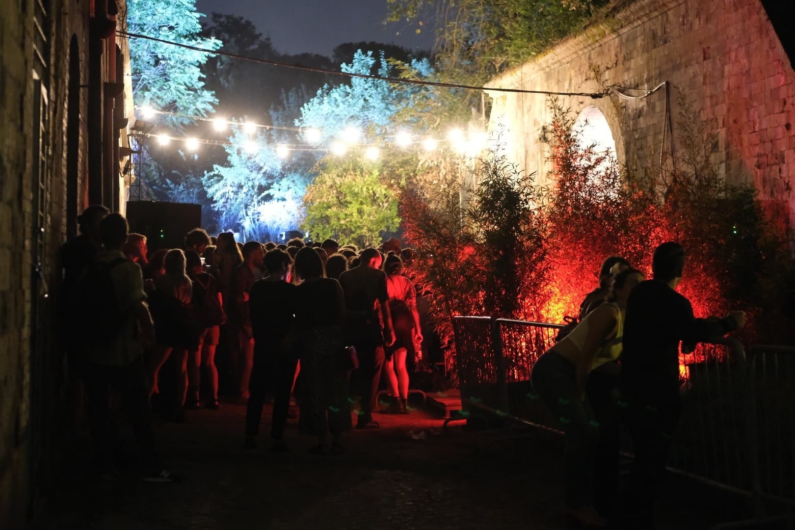
There are places in Rome you visit because the guidebook says so, and places you visit because, once you have understood what they are, you can no longer pretend otherwise. Forte Antenne belongs to the second category. It is a 19th-century fortress built over the ruins of a city that the Romans wiped out when Rome itself was little more than a village of huts, inside a park where families bring their dogs and kids play soccer, a quarter of an hour by bus from Piazza Fiume. No billboard announces it, no turnstile regulates access, and for that very reason most Romans walk past it without knowing what they are looking at.
Everything you need to know is here: the hill and the two rivers that define it, the Sabine city of Antemnae and its cappellaccio walls, the Rape of the Sabine Women and Romulus's second triumph, the 19th-century excavations that confirmed a scholarly hunch and at the same moment destroyed it, the Royal Decree that in 1877 set in motion the largest military building project of post-unification Rome, the anatomy of the fort with its moat and its caponiers, the lightning obsolescence that made it useless before it was even finished, the 20th century of barracks and depots, September 1943 with the royal bunker a few hundred meters away, the families who lived inside it until a few years ago, and exactly what you can see today by walking up from the park. By the end you'll also know what photo to take and from where.
Forte Antenne: What It Really Is, in Two Minutes
Forte Antenne is one of the 15 forts of the so-called Campo Trincerato di Roma, the belt of fortifications that the newborn Kingdom of Italy built around its new capital between 1877 and 1891. It covers an area of about 2.5 hectares, the smallest of the whole series, and stands on the summit of Monte Antenne, a hill 60 meters high that overlooks the point where the Aniene flows into the Tiber. Administratively we are in the Parioli district, Q. II, within the territory of Municipio Roma II. Geographically we are inside the park of Villa Ada Savoia, 160 hectares of public green space in the northern part of the city.
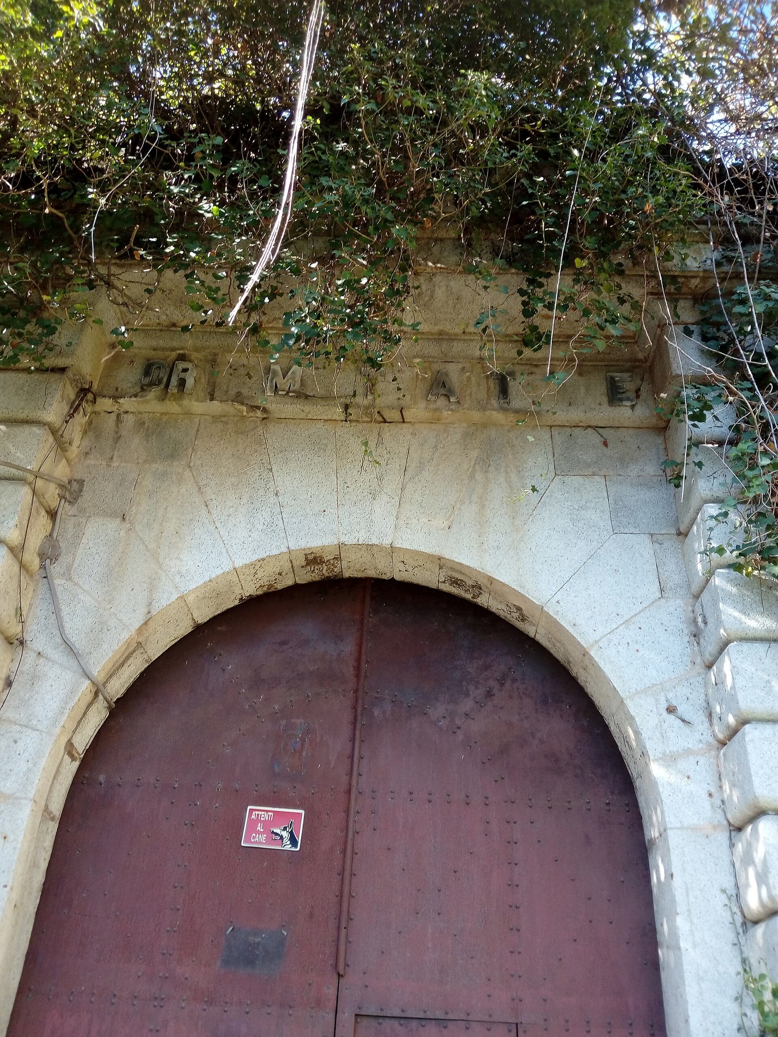
Put like that it sounds like a land registry entry, and in fact it is. But the interesting thing about Forte Antenne is not the fort itself: it is the stratigraphy. Under the 19th-century masonry lie the remains of Antemnae, an oppidum of Latium vetus inhabited from the mid-8th century BC, that is from before Rome was Rome in the full sense. The hill is the same. The strategic position is the same. The Savoy military engineers who opened the building site in 1882 chose that spot for the same reasons the Antemnati had chosen it 26 centuries earlier: from up there you control the valley floor, you control Via Salaria, you control who arrives from the north. The weapons change, the geography doesn't.
The Name Forte Antenne, Explained Once and for All
The fort takes its name from the hill, the hill takes its name from the ancient city, and the ancient city took its name from its own position. Antemnae, in Latin, most probably comes from ante amnes, that is "in front of the rivers". Varro, in the De lingua Latina, says so with a clarity that leaves little room for imagination, and the pseudo-Festus source goes in the same direction. It has nothing to do, then, with radio antennas, even though, and here is a twist I'll tell you about better later, in the 20th century the fort did end up housing the depot of a regiment of radiotelegraphists. A toponymic coincidence so perfect it seems invented, and yet it is true.
My advice from the start is to keep this etymological chain in mind as you climb: hill, rivers, city, fort. You need it to read the landscape. If you stop at the north edge and look down, what you see is not "a piece of Rome with traffic": it is the reason everything that happened here happened.
Where Forte Antenne Is: the Geography That Explains Everything
Put your finger on a map of Rome at the point where the Aniene ends up in the Tiber. Now move it 300 meters to the southeast and you are on the summit of Monte Antenne. That confluence, today half hidden among the ring road, the Salario neighborhood and the warehouses, was for centuries one of the decisive nodes of central Italy: whoever went up the Aniene valley reached Tivoli and then the Apennine passes. Whoever went up the Tiber reached Sabina and Umbria. Whoever came down the Salaria carried salt from the Adriatic toward the Tyrrhenian coast. Three routes at a single point. Forte Antenne sits exactly on top of it.
Via Salaria, it must be said, is the oldest of the great consular roads and began as a salt track, long before the Romans paved it and gave it an official name. It passes at the foot of the hill. Ponte Salario, a little farther north, is the point where the road crosses the Aniene: a bridge rebuilt and destroyed and rebuilt so many times, from the Goths to Narses to the Garibaldians, that telling its history would take a separate entry. From Monte Antenne you control that bridge with your eyes. In antiquity it meant controlling it with weapons.
60 Meters That Are Worth More Than 200
Monte Antenne measures 60 meters in height, and the fort's foundation level sits at around 65 meters above sea level. These are modest numbers: the Janiculum reaches 88, Monte Mario exceeds 140. But absolute altitude matters less than relative elevation, and here the elevation above the Aniene valley floor is sharp, with steep slopes on three sides. It is a naturally defensible position, which explains why it was fortified twice 25 centuries apart.
There is also a detail that the 19th-century military engineers considered far from secondary: from up there the railway to L'Aquila and Pescara, the line that crossed the Apennines toward the Adriatic, was also kept under fire. In the strategic calculation of 1880 a railway was worth as much as a consular road, maybe more. Forte Antenne, put differently, was not a scenic whim: it guarded the northern front of the city, the Salaria and the tracks.
Why the Geography Is Less Readable Today
I'll warn you: the landscape you see today is not what either the Antemnati or the Savoy engineers saw. The confluence has been regulated, the Aniene boxed in between embankments and vegetation, the valley floor taken up by infrastructure, and the Villa Ada woodland has grown a lot compared with the sparse countryside of the 19th century. From some points on the hill you can't see the rivers at all. My advice is to go in winter, with the trees bare: your reading of the site improves considerably and suddenly you understand why someone, in the 8th century BC, decided to build a city on top of it.
Antemnae, the City That Stood Here Before Forte Antenne
Before the fort there was a city, and not just any city. Antemnae was an oppidum of Latium vetus, that is a fortified settlement in that mosaic of Latin, Sabine and Italic communities that occupied the lower Tiber when Rome was one of many and not yet the strongest. The archaeological record attests a settled center from the mid-8th century BC, particularly flourishing until the first decades of the 5th. In practical terms: people lived here continuously for at least two and a half centuries before the Roman Republic existed.
The ancient authors don't agree on its origins, which in itself is news. Plutarch, in the Life of Romulus, takes it as Sabine. Dionysius of Halicarnassus wants it founded by the Sicels and then conquered by the Aborigines, in one of those ethnic genealogies in which the Greeks were masters. Virgil, in book seven of the Aeneid, lists it among the cities that took up arms against the Trojans. Silius Italicus, in the Punica, declares it older than Crustumerium. Four authors, four versions. What they all agree on is that Antemnae existed, was old, and was important enough to deserve a mention.
13 Hectares of City Under and Around Forte Antenne
The ancient circuit wall enclosed an area of about 13 hectares. To give you a yardstick: the 19th-century fort occupies 2.5. That means the ancient settlement extended well beyond the perimeter of the military works, onto the slopes and side plateaus of the hill. Not everything was destroyed, but everything was heavily compromised, and what remains is mostly underground or reduced to fragments that are hard to read for anyone without a plan in hand.
13 hectares, for an Iron Age community in Latium, is a lot. We are not at the level of Veii or of archaic Rome itself, but we are looking at a first-rank center in its local context. The Capitoline Superintendency, which is in charge of the site, defines it bluntly as the center of the Sabine-Latin countryside closest to Rome. Closest also means: the first to be crushed when Rome began to push.
What They Ate, What They Traded
On this, caution is called for, because the 19th-century excavation was not exactly a model of stratigraphic method and many contexts have been lost. What we know with reasonable certainty is that the position on the salt road, the Salaria, precisely, places Antemnae on a trade axis of very long duration. Salt from the Adriatic toward the Tyrrhenian and the pastures of the Apennine transhumance passed through there. A community that controls a ford and a salt road is not a poor community.
Then there are the architectural terracottas, which I'll talk about shortly, and they are a precious clue: whoever decorates a temple with antefixes of that quality has craftsmen, patrons and money. Antemnae was not a village of shepherds. It was a city, with a sanctuary, walls and a ruling class. The fact that almost none of this can be seen today is precisely the reason it is worth telling the story while you are up there, standing on the spot.
The Rape of the Sabine Women and the First Siege of the Hill of Forte Antenne
Here we enter the zone where history and myth hold hands, and it is best to say so openly instead of pretending that the Roman annalistic tradition is a police report. The story is very well known in its literary form. Romulus, short of women for the new community, organizes games in honor of Consus, invites the neighbors, and in the middle of the festival the Romans seize the guests' daughters. The offended cities react one by one instead of all together: first the Caeninenses, then the Antemnati, then the Crustumini, finally the Sabines of Titus Tatius.
The people of Antemnae, Livy tells us in the first book of the Ab Urbe condita, took advantage of the absence of the Roman army, busy against Caenina, to raid Roman territory. It was a terrible calculation. Romulus came back, faced them, beat them, took the city and celebrated his second triumph. Then, following the pattern that would become the trademark of Roman politics, he razed nothing: he sent colonists there and absorbed the population. Dionysius of Halicarnassus confirms this in substance, adding details.
How Many of the Women Were from Antemnae
The ancient sources insist on a detail worth reporting: among the abducted women there were many from this very center. It is a detail that served the Roman narrative to justify the Antemnati's fury, but it also says something about the closeness and mutual contact between Rome and Antemnae. They were not distant foreigners: they were neighbors, an hour's walk away, who took part in the same festivals.
My advice, when you are up there, is to look south. As the crow flies, from the hill to the Capitoline there are a little more than four kilometers. The distance between the city that survived and the one that vanished is all here. It is not a geographical distance: it is a distance of outcome.
History or Legend?
Legitimate question and honest answer: the Roman regal chronology is a late reconstruction, and no serious historian takes the Rape of the Sabine Women as a chronicle. But the core of the story, a small neighboring center, quarrelsome, soon subdued and then absorbed, is perfectly compatible with what archaeology shows: a flourishing settlement until the 5th century, then scaled down, then reduced to an outpost, then abandoned. Legend and stratigraphy, in this case, tell the same arc in different words.
Titus Tatius and the Kings: the Sabine Chapter of Forte Antenne
In the account handed down by Pliny the Elder, and reported through Dionysius of Halicarnassus, the submission of Antemnae passes through the defeat of its king, identified as Titus Tatius, the Sabine ruler who according to tradition ended up associated with the throne of Rome next to Romulus. The more widespread version makes Titus Tatius the king of Cures. This one instead ties him to Antemnae. The traditions overlap, contradict each other, contaminate each other. And this is normal for material that was put in writing centuries after the events it claims to narrate.
What matters, for someone standing on the hill, is the concept of associated kingship: Rome, instead of annihilating its adversary, took its king and put him on its own throne. It is the prototype of a policy of integration that in the 1,000 years that followed would turn a city-state of Latium into the largest empire of the Mediterranean. The fact that this prototype, in ancient memory, is linked to this hill is no small curiosity.
Antemnae Against Rome, Again
There is a second, lesser-known episode. Tradition recalls that Antemnae supported the attempt by Tarquin the Proud, allied for the occasion with Porsenna, to regain control of Rome after the expulsion of the kings. Put differently: at the first useful opportunity, the subdued center took sides against. It is the sign of an autonomy never truly extinguished, and it explains why later Rome preferred to fortify the hill as its own outpost rather than leave it to itself.
From outpost to ruin the step, historically speaking, was long but inexorable. And it is exactly the kind of arc that Forte Antenne, 26 centuries later, would repeat on a smaller scale: built to defend, declared useless, abandoned, forgotten.
The Cappellaccio Walls: What Was Under Forte Antenne
Between the end of the 6th and the beginning of the 5th century BC, Antemnae, by then a Roman outpost, was given a fortified circuit of considerable quality. It was made of blocks of cappellaccio, the gray-ash tuff, the oldest used in archaic Latian building, laid in the opus quadratum technique: squared blocks, arranged in regular courses, without mortar. Measurements taken before the construction of the 19th-century fort recorded stretches preserved up to seven meters high.
Seven meters. Pause for a moment on this number, because it is what makes the site of Forte Antenne archaeologically painful. An archaic curtain wall seven meters high, in cappellaccio, four kilometers from the Capitoline, would today be one of the most important monuments for understanding the defensive architecture of pre-Republican Latium. The Servian Wall, in Rome, survives in scattered and debated stretches. The walls of Ardea, Lavinium and Gabii are studied intensively precisely because they are rare. Here there was a first-rate point of comparison, and it was largely dismantled.
Cappellaccio, Properly Explained
It is worth spending a couple of words on this material, because in Rome you come across it everywhere and almost nobody explains it to you. Cappellaccio is the oldest tuff outcropping in the urban area, of volcanic origin, soft, porous, dark gray, not very resistant in the open air. The archaic builders used it because it was what they had under their feet: it was quarried on the spot, squared with simple tools, laid dry. In time the Romans moved on to better tuffs, the Grotta Oscura tuff after the capture of Veii, then peperino, then travertine, but cappellaccio remains the unmistakable signature of the oldest structures.
If during a walk inside Villa Ada you happen to recognize gray blocks, chipped, coarse-grained and with that air of stone that crumbles, they are not construction scraps: they are probably the oldest material you will see all day. My advice is not to touch them and not to move them. A block out of context is a mute block, and here enough context has already been lost.
What Remains to See of the Walls
Little, and badly distributed. The works of the military building site, between 1877 and 1891, removed or incorporated most of the circuit. An ancient cistern was destroyed during those same works. The later archaeological investigations, in 1978 and 1986, made it possible to document tuff foundations and tile roofing of the settlement, to reconstruct the course of the perimeter and to refine the chronology, but they did not give the public a visitable monument in the sense that, say, the Roman Forum is.
Be realistic when you climb up to Forte Antenne: you are not going to see the walls of Antemnae, because they no longer exist in readable form. You are going to see the place where they stood, and the 19th-century monument that replaced them. It is a visit of informed imagination, not of contemplation. Knowing what to look for, the shape of the plateau, the steepness of the slopes, the position relative to the rivers, is what turns a walk into an experience.
Juno Sospita and the Sanctuary on the Hill of Forte Antenne
Among the few elements that came through the 19th-century destruction unscathed is a group of architectural terracottas, and among these a piece that deserves a trip of its own. It is an antefix, that is one of those decorative terracotta elements that closed the ends of the roof tiles along the slope of the roof, with a depiction of the head of Juno wearing a helmet made of bovine elements, in particular horns. It is dated to the early 5th century BC and is now kept in the Museo Nazionale Romano.
That horned helmet is a precise iconographic signature: it points to Juno Sospita, or Juno of Lanuvium, the great deity of Lanuvium, depicted with the goatskin and the goat headdress. That her cult is attested at Antemnae tells us that this community took part in the Latin religious system in its most characteristic form, and that the sanctuary on the hill was not a little chapel but a temple building with a decorative program of high standard.
A Temple of the 7th Century BC
A cult building datable to the 7th century, with consistent votive finds, precedes the late archaic phase of the temple. It means that on the summit of the hill an organized cult was practiced from at least the century after the foundation of the settlement, and that this cult continued throughout the Republican age even when the civil city was by then in decline. It is a common pattern in Latium: sanctuaries outlive settlements, because the holiness of a place wears out more slowly than its usefulness.
My advice, if the subject grabs you, is to pair the climb to Forte Antenne with a visit to the Museo Nazionale Romano: seeing the antefix after walking on the hill it comes from completely changes your perception of the object. It is no longer a terracotta in a display case: it is the roof of a temple that stood exactly where you had your feet a little while ago.
Why the Terracottas Matter More Than the Walls
It sounds like a paradox and it isn't. The walls tell you that a community had fear and resources. The architectural terracottas tell you who frequented that community, where the craftsmen came from, which iconographic models circulated, with which centers there were exchanges. They are, in essence, a document of international relations in fired clay. And in a devastated site like this one, where the stratigraphy is compromised, movable objects become the main source.
Antonio Nibby and the Rediscovery of the Site of Forte Antenne
The first modern identification of the site of Antemnae is owed to Antonio Nibby, in 1834. Nibby, a Roman, archaeologist and topographer, professor at Sapienza, is one of those figures who are little cited today and to whom we nevertheless owe a substantial slice of what we know about the surroundings of Rome. His Analisi storico-topografico-antiquaria della carta de' Dintorni di Roma is still a working tool today, and not out of nostalgia: because it describes a landscape that was later wiped out by urban expansion.
Nibby arrived at Monte Antenne by a literary route. Strabo and Plutarch placed Antemnae just outside Porta Collina. Geography, the surviving place names and the visible remains did the rest. It was no small intuition: identifying a vanished city on the basis of ancient citations and a survey of the terrain requires a competence built by walking for years in the Roman countryside. In the same years William Gell too, in his Topography of Rome and Its Vicinity of 1834, devoted specific pages to Antemnae.
Why Nibby's Proposal Was Not Accepted Right Away
Because it was, precisely, a proposal. In the absence of excavations, 19th-century historical topography proceeded by argued conjecture, and conjectures were fought with citations. The location proposed by Nibby obtained general consensus only with the excavations of 1878, those opened for the construction of the fort, which brought the ancient structures to light and closed the discussion. 44 years between hypothesis and confirmation: research works like that, even when it is right.
It is worth noting the irony of the situation, and I point it out because it is the heart of the story of Forte Antenne: the building site that confirmed the existence of Antemnae is the same one that wiped out its traces. The proof and the destruction arrived together, with the same shovels.
The 1878 Excavations and the Archaeological Paradox of Forte Antenne
In 1878 the hill opened up. Not out of scientific will but out of the necessity of the building site: they had to cut, level, dig moats, lay masonry foundations, and in doing so the structures of the ancient city emerged. These were years in which Rome was being dug up everywhere and in a hurry, because the new capital was building whole neighborhoods and every foundation intercepted something. The Municipal Archaeological Commission, established in that very decade, did what it could. On military building sites, however, the hand of archaeology was shorter.
The balance sheet, today, is merciless: the works for the construction of the late 19th-century fort destroyed a large part of the archaeological site. The formula is the Capitoline Superintendency's and allows no nuance. The walls were largely dismantled. An ancient cistern was demolished. The city's walking surface was reworked to make room for the embankments and the masonry works. The measurements of the curtain walls, fortunately, were taken before the excavation, and that is why we know today about those seven meters of height.
The Investigations of 1978 and 1986
A century later people went back to look at the hill with different eyes. In 1978 Lorenzo Quilici and Stefania Quilici Gigli published for the Consiglio Nazionale delle Ricerche the volume Latium vetus. I. Antemnae: a monograph entirely devoted to the site, which collects the 19th-century documentation, the topographical data and the surviving evidence. It is the kind of work that saves a site from oblivion even when the site physically no longer exists. A second campaign of investigations followed in 1986.
Thanks to these studies, the chronology of the settlement is today reasonably solid: inhabited from the mid-8th century, flourishing until the first decades of the 5th, fortified between the end of the 6th and the beginning of the 5th, in decline from the 3rd century, replaced toward the end of the 1st century BC by an imposing private villa. Pliny the Elder, in the Naturalis historia, includes it in the list of the cities of Latium by then vanished: a list of ghosts that is perhaps the most melancholy document of Roman antiquarianism.
The Roman Villa That Closed the Circle
That late Republican villa deserves one more line. The passage from city to private villa is a typical phenomenon of the Roman countryside between the 1st century BC and the 1st century AD: the old autonomous communities, depopulated and stripped of political function, become property of senatorial families who exploit their land and reuse their structures. The hill of Forte Antenne, with its view of the confluence and its closeness to the Salaria, was exactly the kind of place a rich Roman wanted for his suburban residence.
So the complete sequence is this: village of the 8th century, archaic fortified city, Roman outpost, declining center, suburban villa, countryside, military fortress, depot, makeshift housing, public park. Nine lives on the same hectare of land. Few places in Rome condense as much into so little space.
The Battle of Porta Collina Ended Right Under Forte Antenne
There is an episode of Roman Republican history that played out literally at the foot of this hill, and that almost no guide tells. In November of 82 BC the Battle of Porta Collina was fought, the last great clash of the civil war between the supporters of Sulla and the coalition of the populares with the Italic militias. On one side the legions of the aristocratic faction led by Lucius Cornelius Sulla. On the other an army commanded by the Samnite leader Pontius Telesinus, who was marching on Rome with the declared intention of finishing it once and for all.
The main clash took place in front of the northeast gate of the Servian walls, in an afternoon and a night of confused and extremely bloody fighting. But the concluding episode, the one in which the Samnite and Marian resistance was definitively broken, played out in front of Antemnae. The ancient sources agree in placing the end of the battle here. On the hill of Forte Antenne, in short, it was decided who would govern Rome and by what method.
What Happened Next
What followed is one of the darkest chapters of Republican history. The survivors who surrendered were rounded up and, according to tradition, massacred. Sulla established the dictatorship and the proscriptions. Pontius Telesinus died in the fighting. The Social War and the civil wars had bled Italy dry, and the battle fought down here is conventionally the point where that season ended and another began, no less violent but more orderly.
Of all the things that can be told about this hill, this is the most striking. Nothing marks it. No plaque, no panel. You walk on a dirt path in a public park, with dogs running and joggers puffing, and below you is a battlefield where tens of thousands of people died and where the Roman Republic changed shape.
The Link with the Vanished Gate
A small topographical note you need to get your bearings: Porta Collina opened in the Servian walls in the area of today's Piazza Sallustio, between Termini and Via Veneto. From there Via Salaria Vetus began. Antemnae stood along that route, a little farther north. It is exactly the same line on which, 29 centuries later, the Italian army would place Forte Antenne and the Batteria Nomentana. The military geography of Rome is surprisingly stable across the millennia.
Why Rome as Capital Built 15 Forts Like Forte Antenne
Let's jump ahead 19 centuries. On September 20, 1870 the bersaglieri enter through Porta Pia. In 1871 Rome becomes the capital of the Kingdom of Italy. Within a few months the city finds itself with an enormous political role and a ridiculous defensive apparatus: the Aurelian Walls, a work of the 3rd century AD, reworked in the Renaissance and essentially useless against the rifled artillery of the 19th century. 1870 itself had proved it: a few hours of cannon fire were enough to open a breach.
The international context did not help one to rest easy. The Franco-Prussian War of 1870-71 had shown what a modern army could do, and the siege of Paris with its belt of detached forts had become the obligatory case study for every European general staff. The doctrine of the moment said: urban walls are no longer of use, what you need are autonomous forts arranged in a crown a few kilometers from the built-up area, able to hit the surrounding terrain with their own artillery and to support one another.
The Royal Decree of August 12, 1877
After years of controversy over the designs, and the controversies were bitter, because there were those who considered the whole undertaking a waste, the forts were commissioned with Royal Decree no. 4007 of August 12, 1877. The plan called for 15 forts of the "Prussian" type and four batteries with a hexagonal plan, placed at a distance of about four to five kilometers from the Aurelian Walls and two to three kilometers from one another, for an overall development of about 40 kilometers.
40 kilometers of fortifications. It is a figure worth repeating, because it conveys the scale of the effort: the Campo Trincerato di Roma was, by far, the largest military public work of post-unification Italy and one of the most imposing building sites in Europe of its kind. Forte Antenne is one piece of it, the smallest by area, and occupies the northern vertex of the crown on the left bank of the Tiber.
The First Seven and the Other Eight
Construction took place in two stages. The first seven forts, Monte Mario, Braschi, Boccea, Aurelia Antica, Bravetta, Portuense and Appia Antica, started in the same year, 1877, and, with the sole exception of Appia Antica, all stand on the right bank of the Tiber: the dominant worry was a landing on the Tyrrhenian coast and an advance toward the city from the west. The second tranche of eight, Antenne, Ardeatina, Casilina, Ostiense, Pietralata, Prenestina, Tiburtina and Trionfale, was started in 1880 thanks to new appropriations.
With Royal Decree of November 1, 1882 the forts officially took the names of the roads they stood on. And it is here that ours is an exception, in an instructive way: there is no consular "Via Antenne". The fort took the name of the hill, which in turn had it from the vanished city. Among all 15, Forte Antenne is the only one named after an archaeological site instead of a road.
Forte Antenne in the System: Numbers, Distances and Neighbors
To really understand Forte Antenne you have to see it within the series. Here are its identifying data: construction between 1882 and 1891, area 2.5 hectares, Municipio Roma II, location on Monte Antenne at the confluence of the Tiber and the Aniene, distance from the next fort along the crown equal to four kilometers. It is the smallest fort of the whole belt, tied with Portuense, and one of the last to be completed.
The comparison with the others is illuminating. Forte Pietralata covers 25.4 hectares, Forte Tiburtina 23.8, Forte Trionfale 21, Forte Appia Antica 16.5, Forte Prenestina 13.4. Ours, with its 2.5, is 10 times smaller than the largest. It is not a matter of importance: it is orography. On the summit of a narrow and steep hill there was no room for anything else. The very shape of the work, as we will see, is dictated by the profile of the terrain more than by the manuals.
The Complete Crown, Fort by Fort
It is worth listing them all, because it is the kind of information nobody ever has at hand. Clockwise starting from the west: Aurelia Antica (1877-81, 5.7 ha), Boccea (1877-81, 7.3 ha), Braschi (1877-81, 8.2 ha), Monte Mario (1877-82, 8.4 ha), Trionfale (1882-88, 21 ha), Antenne (1882-91, 2.5 ha), Pietralata (1881-85, 25.4 ha), Tiburtina (1880-84, 23.8 ha), Prenestina (1880-84, 13.4 ha), Casilina (1881-82, 3.8 ha), Appia Antica (1877-80, 16.5 ha), Ardeatina (1879-82, 11.2 ha), Ostiense (1882-84, 8.8 ha), Portuense (1877-81, 2.5 ha), Bravetta (1877-83, 10.6 ha).
To these are added the four batteries, built in an intermediate and rearward position relative to the forts: Tevere, on the right bank below Monte Mario. Appia Pignatelli (1877-81). Porta Furba (1883-86). Nomentana (1884-90). The last of these, on Via Nomentana at number 274, is the closest neighbor of Forte Antenne and with it closes the garrison of the northeast quadrant.
The Military Road That Was Never Finished
The original plan called for the forts to be connected to one another by a "military road", flanked by a service railway, so as to be able to move men and guns quickly from one point of the crown to another. The link was built only in part, from Via Tiburtina to Via Appia Antica, intersecting Prenestina, Casilina, Tuscolana and Appia Nuova. It was later demilitarized, and today its semicircular course can still be recognized in the layout of the present Via di Portonaccio, Via dell'Acqua Bullicante, Via di Porta Furba, Via dell'Arco di Travertino, Via dell'Almone and Via di Cecilia Metella.
It is one of those things that, once you know it, change the way you drive around Rome: that absurd big curve you take every day coming home from work is a remnant of the military logistics of 1880. The northern quadrant, however, stayed out of the link. Forte Antenne, on its isolated hill beyond the Aniene, was always the hardest point to reach of the whole belt, and this relative marginality explains a good part of its later history.
How Forte Antenne Is Built: Anatomy of a Prussian-Style Fort
The technical definition says "fort of the Prussian type", and it is good to understand what that means, because the formula recurs everywhere and almost nobody explains it. The Prussian model, established in Europe after 1860 and canonized by the experience of 1870-71, calls for a polygonal work with a compact plan, protected by a dry moat, with the main volume buried or covered by embankments, the artillery placed en barbette on the upper embankment, and the close defense of the moat entrusted to caponiers, that is small projecting structures from which the bottom of the moat itself is raked with fire.
In practice: no towers, no Italian-style bastions, no visible curtain walls. A Prussian fort seen from outside looks like an artificial hill with a few walls. And that is exactly the point: the rifled artillery of the second half of the 19th century demolished any exposed masonry, so the masonry hides under the earth and only what lies inside the moat is left in view, where enemy projectiles do not reach by trajectory.
The Plan of Forte Antenne, Dictated by the Hill
The plan of our fort is described as a trapezoidal quadrilateral, with the two straight fronts not parallel and with asymmetrical flanks because of the orography of the hill. Translation: it is not regular, and it is not because it could not be. In the manuals the standard fort is a symmetrical pentagon or hexagon. Here the available summit was narrow and irregular, and the designers adapted the scheme to the terrain. The result is a work that, for those who know how to read it, tells its own site in its very shape.
The perimeter is encircled by a moat with side caponiers. On the gorge front, that is the rear side, the one facing the city, by definition the least exposed and the most delicate, runs a Carnot wall. On the main front there is a defensive drum with a ravelin. Two ramps lead from the inner courtyard to the upper rampart, the one on which the position of the guns was planned. A drawbridge, today preserved but deteriorated, regulated access.
Why the Word "Gorge" and Why "Carnot"
Two terms worth having in your pocket. The "gorge" of a fortified work is its rear side, the one through which supplies and the garrison enter: it is the soft underbelly, and for that reason it is protected in a special way. The "Carnot wall" takes its name from Lazare Carnot, the French mathematician and minister of war who theorized its use at the beginning of the 19th century. It is a detached wall, placed at the bottom of the moat and not leaning against the embankment, with loopholes for rifle fire, so that the defenders can sweep the moat without being exposed to the direct fire of the besieging artillery. The wall sits in shadow with respect to the trajectory, and that saves it.
The "ravelin" is instead a triangular or almond-shaped advanced work placed in front of the main front to protect its access, a concept that comes straight from Renaissance bastioned fortification and that in the 19th-century fort survives in reduced form. Seeing these elements all together in such a small work is, for a military architecture enthusiast, reason enough to make the climb.
The Powder Magazine, the Well and the Cistern of Forte Antenne
A fort is not just walls and cannons: it is an organism that has to hold out in isolation for weeks. That means water, ammunition, food, quarters, latrines, an infirmary. Forte Antenne had a powder magazine with a double entrance, a standard solution to guarantee ventilation and to prevent a single blocked access from trapping the men, a spring-water well and a cistern.
The well deserves attention. A fort with its own water is a fort that can withstand a siege. A fort that depends on outside supplies is a fort that surrenders. The fact that there was spring water here is, in historical perspective, almost funny: it is probably the same reason the inhabitants of Antemnae, 26 centuries earlier, had chosen that summit. Ancient cities are founded where there is water, not where there is a view.
The Underground Rooms
The most interesting part of the complex, and the best preserved, is the buried one. The underground volumes and the original ramparts have remained substantially intact, and this makes Forte Antenne a case study: many of the other forts have been heavily reworked by decades of military or civilian use, while here the structure, though without maintenance, has kept its configuration.
The barrel-vaulted rooms, the connecting corridors, the service rooms, the storerooms: it is the anonymous and functional architecture of the 19th-century military engineers, made of solid brick and measurements repeated with obsessive precision. It is not beautiful in the way a Baroque church is beautiful. It is beautiful in the way a well-designed machine is beautiful, where every element answers a specific problem.
The State of Preservation, Without Sugarcoating
It must be said clearly, because it is the premise of any visit: the fort has gone without ordinary maintenance for decades. There are partial collapses, modern additions made over the course of the 20th century, invasive vegetation, structural failures. The drawbridge still exists but is deteriorated. It is not a romantic ruin tended by a landscape gardener: it is a disused building that is aging badly and that in recent years has begun, laboriously, to be brought back to life by cultural activities.
I tell you this because disappointment, in this trade, always comes from the wrong expectations. If you climb up thinking you will find a restored fort with a museum route and audio guides, you will be disappointed. If you climb up knowing you are going to see authentic military architecture, not cleaned up, inside an urban woodland, on top of a buried city, it will be one of the most interesting mornings you spend in Rome.
Lightning Obsolescence: Why Forte Antenne Was Born Already Old
Here is the central paradox of this whole story. Forte Antenne was completed around 1891. Within a very few years it was already militarily useless. Not "superseded after a generation": useless almost immediately. And the reason is not the incompetence of those who designed it, but a technological leap that caught all the European armies by surprise at the same moment.
The leap has a name: the "torpedo-shell crisis". Between 1885 and 1890, the introduction of high-power explosives, melinite in France, then the variants adopted everywhere, and of steel shells with a steep fall suddenly made vulnerable the masonry-and-earth fortifications that until a moment before had been considered impregnable. A fort designed in 1877 to withstand black powder found itself, 15 years later, having to withstand devices with a destructive capacity an order of magnitude greater. It could not withstand them.
And Then the City Arrived at the Forts
The second factor was urban. The logic of the entrenched camp presupposes that between the forts and the built-up area there is open countryside, where the fort's artillery can freely hit the terrain and where the enemy has no cover. But Rome, between 1880 and 1920, exploded. The neighborhoods ate up the countryside in which the forts had been planted, the cleared fields filled with houses, and the military easements became an unbearable obstacle for real estate speculation. A fort with a neighborhood in front of it is not a fort: it is a bulky building.
Add the evolution of military strategy, since the First World War was fought on continuous fronts, not on isolated fortresses, and the picture is complete. The fortified belt of Rome never fired a shot to defend the city. Not one. It is the largest military investment of liberal Italy, and it was entirely wasted, which takes nothing away from its historical interest, indeed adds to it.
A Fate Shared Across Europe
In fairness it must be said that it was not only an Italian embarrassment. The belts of forts built in the same years around Brussels, Antwerp, Liège, Bucharest, Paris and Vienna lived through the same arc, and some of them even had to face combat, with disastrous results: the forts of Liège, in August 1914, were pulverized by the German heavy mortars in a few days. Rome, at least, was spared the practical demonstration. Forte Antenne never had the misfortune of being put to the test.
1919 and the Decommissioning: the Second Life of Forte Antenne
The official acknowledgment came with Royal Decree no. 2179 of October 9, 1919. With that measure all the works of the Campo Trincerato were struck from the roll of the State's fortifications. Not demolished: downgraded. From fortresses they became ordinary military properties, to be used as barracks, warehouses and depots. It is a bureaucratic step worth a novel scene: 42 years after the decree that had called for them, another decree erased them.
From that moment the history of the 15 forts diverges. Some ended up with State bodies and are still there: Forte Braschi today houses the AISE and the Raggruppamento Unità Difesa. Forte Pietralata is the seat of the Command of the "Granatieri di Sardegna" Brigade and of the 1st Regiment. Forte Tiburtina is annexed to the structure of the Reparto Comando e Supporti Tattici of the Granatieri. Forte Appia Antica and the Batteria Appia Pignatelli belong to the Air Force. Forte Ostiense belongs to the State Police. Forte Aurelia Antica and the Batteria Porta Furba to the Guardia di Finanza. The Batteria Nomentana to the Army.
Those Handed Over to the City
Others were handed over to Roma Capitale, with very different outcomes. Forte Prenestino has been since 1986 the best-known self-managed social center in Italy, and paradoxically it is also one of the best-known and most frequented forts precisely thanks to that occupation. Forte Portuense, Forte Ardeatina and Forte Bravetta remained abandoned for a long time. Forte Boccea and Forte Trionfale followed paths of their own. Forte Antenne belongs to this second group: property of Roma Capitale, unused for a long time, today entrusted to Municipio Roma II for institutional and cultural uses.
My advice, if the subject of forts fascinates you, is not to stop at this one: build an itinerary. Seeing Antenne, Prenestino and Pietralata in sequence means seeing three completely different answers to the same question, what does a city do with a military architecture that is no longer needed, and none of the three is trivial.
The Radiotelegraphists: Forte Antenne Between the Wars
Until the 1940s the fort was used as a depot of the Radiotelegraphists Regiment. It is the detail that gives the entry its loveliest coincidence: a fort called Antenne because it stands on a hill called that because there was a city there called "in front of the rivers", and which ends up housing the military of radio transmissions. Nobody did it on purpose. Place names, every now and then, have a sense of humor.
The Radiotelegraphists Regiment, heir of the first engineer specialties devoted to transmissions, was a significant structure in the Italian Army between the wars. Radio communications were, in the 1920s and 1930s, the fastest-evolving military technology, and Rome was its nerve center. A depot means material storerooms, workshops, storage of equipment. The fort's underground rooms, dry and at constant temperature, were perfect for the purpose.
What "Depot" Means for a Historic Building
It means, generally, salvation and decay together. Salvation because a building in use is a building that doesn't collapse: there is a caretaker, there is minimal maintenance, roofs get repaired. Decay because use as a warehouse brings partitions, new openings, makeshift utilities, removal of elements deemed to be in the way. Many of the later additions you notice today inside Forte Antenne date back to this phase and to those immediately after it.
It is the fate of all disused military architecture, and not only in Italy. Those who work on fort restoration know that the main enemy is not time but continuous adaptation: 50 years of small jobs done on the cheap turn a coherent work into a collage. Recognizing what is original and what is added, in a building like this, is the eye's first job.
Villa Ada Around Forte Antenne: How the Park Came to Be
Today the fort cannot be understood without the park that surrounds it, and the park has a history of its own, much less military and much more aristocratic. Villa Ada Savoia occupies 160 hectares in the northern part of Rome, northwest of Via Salaria, between Parioli, Pinciano and Trieste-Salario. It is the fourth-largest public park in the city, after the Parco dell'Appia Antica, the Parco del Pineto and Villa Doria Pamphilj.
In the 17th century the area was the seat of the Irish College, and functioned more as a farm estate than as an urban villa. Passed to the Pallavicini princes, it was reorganized at the end of the 18th century according to the taste for the "landscape garden", with paths, vistas and small buildings in the romantic landscape style: the Temple of Flora, the Belvedere, the Cafehaus. The rolling ground and the natural differences in elevation already supplied by themselves the romantic backdrops that elsewhere gardeners had to build artificially.
The Savoys, Count Telfener and Signora Ada
The turning point is 1872: the estate was bought by Victor Emmanuel II, who loved its park, bought neighboring land to bring it up to the present 160 hectares and had service buildings built there, including the stables. His son Umberto I, however, could not stand the countryside and preferred the Quirinale: in 1878 the villa was sold at a favorable price to Count Giuseppe Telfener, administrator of the royal family's property, who named it after his wife Ada. From that marital gesture comes the name by which all Romans still call it today.
In 1904 Victor Emmanuel III bought it back and renamed it "Villa Savoia", making it a royal residence until 1946. It is in this phase that the relationship between the villa and Forte Antenne becomes curious: the residence of the king of Italy and a fortress of the Italian army shared the same hilly estate, separated by a few hundred meters of woodland. The park was, among other things, a hunting reserve of the royal family.
From Litigation to Public Park
With the fall of the monarchy the villa became the object of a long legal dispute. One part remained private property of the Savoys and was then sold off in different ways, and it is, paradoxically, the one that best preserves the layouts of the 18th-century garden, precisely thanks to the neglect in which it has been left. The part toward Via Salaria was acquired by the public state property in 1957 and equipped as a park, with reworkings and plantings not always of native species. The Royal Villa was donated by Umberto to Egypt in exchange for the hospitality his parents had received during their exile in Alexandria in 1946-47: today it houses the Embassy and the Consulate of the Arab Republic of Egypt.
The main entrances are on Via Salaria at numbers 267, 273 and 275, on Via di Ponte Salario, on Via di Monte Antenne and on Via Panama. The park is open every day from dawn to dusk. My advice is to enter from Via di Ponte Salario or from Via di Monte Antenne if your goal is the fort: from Via Panama and from lower Via Salaria you have to cross almost the whole park.
The Royal Bunker, Neighbor of Forte Antenne
A few hundred meters from the fort, inside the same park, is the second fortification of Villa Ada: the air-raid shelter of the royal family. It is a completely different structure in era, technique and purpose, and together with Forte Antenne it forms a diptych that tells two ways of being afraid, 60 years apart.
At the outbreak of the Second World War the Savoys used as shelter the cellars of the villa, reached by trapdoors and furnished like a little sitting room: a makeshift solution, and not even a very safe one. As the situation worsened it was decided to build a real bunker, dug into the tuff bank. The work was carried out by the firm of engineer Romeo Cametti between November 1942 and May 1943. The total cost was 705,929.40 lire, paid with eight checks from the Banca Commerciale Italiana on June 23, 1943.
How the Bunker Is Built
The structure uses a natural rise, the Colle delle Cavalle Madri, about 350 meters north of the royal residence, and is conceived with remarkable practical intelligence: the access is level, so that a car could reach it in two or three minutes from the villa along an internal road, with no stairs or ramps to climb on foot. The main entrance opens under a large arch of solid red brick, near the first stable.
Inside, the layout is a ring: a circular gallery of brick masonry, which uses the arch effect to resist compression, with an overpressure chamber equipped with air filters, a parking area able to hold up to three cars, two bathrooms, an antechamber and service rooms. The doors are iron, double-leaf, each leaf weighing about 1,800 kilograms and reinforced inside with concrete, with gas-tight rubber seals. A travertine spiral staircase of 40 steps leads to the secondary emergency exit. At the top of the hill a concrete shield, supported by masonry arches, was meant to absorb the impact of bombs. The whole was camouflaged with maritime pines and tuff gravel.
Abandonment and Recovery
King Victor Emmanuel III and Queen Elena left the shelter on September 8, 1943, after the announcement of the armistice, and never returned. Decades of total abandonment followed: the structure became a refuge for the homeless and a place without rules, and almost all the interior walls were covered in graffiti. Until the 1960s it still kept part of the original furnishings and remnants of armament.
The recovery is recent. The Roma Sotterranea association began the work in October 2015 and completed it on March 24, 2016, using more than 3,000 hours of volunteer labor. Since April 2016 the bunker has been restored and visitable thanks to an agreement with the city administration. It is the model, in miniature, of what has not yet happened at Forte Antenne on a full scale: a forgotten military structure becoming accessible again thanks to stubborn work by an association.
September 1943: What Happened Around Forte Antenne
We have to be precise, because a lot of confusion circulates on this subject and suggestions easily take the place of facts. In the days of the armistice, Villa Ada and the northern quadrant of Rome were at the center of decisive events, but not because of the fort itself.
The first episode is from July 25, 1943. After the approval of the Grandi motion at the Grand Council of Fascism, the king summoned Mussolini to Villa Savoia. On leaving the meeting Mussolini was arrested and taken away in an ambulance. The Fascist regime ended on a tree-lined avenue, a few hundred meters from the hill of Forte Antenne. It is one of the most famous facts of contemporary Italian history, and most of the people who use the park don't know it happened there.
The Night Between September 8 and 9
On September 8, 1943, at 22:10, fighting began in the area of the Magliana bridge. In the following hours the clash spread: to the south toward the Magliana, the Tre Fontane and Forte Ostiense. To the north toward La Storta, Manziana and Lake Bracciano. To the east along the Tiburtina. The Italian units deployed in defense of the capital included the "Granatieri di Sardegna" Division in the southern sector, the "Piacenza" in the southwest quadrant, the "Piave" between Via Trionfale and Via Salaria, the armored "Ariete II" around Bracciano, the "Centauro" along the Tiburtina, the "Sassari" and other units in the city.
The "Piave" Division garrisoned the sector that includes Via Salaria, that is the very route beneath Monte Antenne. Around 5:10 in the morning of September 9, Victor Emmanuel III with his family, the head of government Marshal Badoglio and the chiefs of staff Ambrosio and Roatta left Rome heading for the Adriatic and then Brindisi, abandoning the coordination of the defense. The resistance concentrated in the following days and culminated at Porta San Paolo on September 10. The surrender agreement was signed at 16:00, but the fighting continued until evening at several points.
What Cannot Be Said About Forte Antenne
A necessary clarification is due here. There is no documented fighting inside Forte Antenne, nor an independent role of the fort in the defense of Rome. In 1943 the work had been struck from the State's fortifications for 24 years and served as a depot. The stories that circulate about supposed heroic resistance in the fort should be taken for what they are: urban legends born from the closeness between a place with a martial look and a dramatic date.
What can be said, and it is more than enough, is that the hill was in the geographic heart of events: the fleeing king passes through these streets, the bunker the king abandons is in the same park, the division garrisoning the Salaria is deployed below the hill, and the end of Fascism was signed a kilometer from here. There is no need to invent anything.
1958, the Olympics and the Campground at the Foot of Forte Antenne
In 1958, in view of the 1960 Rome Olympics, the fort was transferred from the state property to the City of Rome with a precise destination: to be turned into a campground. Rome was expecting a wave of low-cost visitors and was looking for places to put them. A fenced compound of 2.5 hectares with its own water, inside a park, a few minutes from the center, seemed perfect.
It went differently. The campground was built only in the surrounding park, because private residences had already been built inside the fort. Translation without euphemisms: someone lived there. The administration found itself the owner of an occupied property and had to adapt the project to what existed. It is an episode that has repeated itself in Rome so many times that it is almost a literary genre.
The Olympics That Changed the City
It is worth recalling what the 1960 Games meant for Rome: the Palazzetto dello Sport at Nervi, the Palazzo dello Sport at EUR, the Stadio Flaminio, the Olympic Village built in the Campo Parioli area, Via Olimpica, the new Fiumicino airport. It was the greatest infrastructural transformation of the city since Fascism, and it concerned directly the northern quadrant, that of Forte Antenne: the Olympic Village and the Stadio Flaminio are a couple of kilometers away, and the marathon of Abebe Bikila, run barefoot in the night of September 10, 1960, passed through the streets of this part of the city before arriving at the Arch of Constantine.
The fort, in all this, stayed on the margins: a container assigned to a function, the function that doesn't get carried out, the structure that keeps aging. It is the typical fate of properties that nobody manages to fit into a clear administrative category.
The Families Inside Forte Antenne: a Fort Inhabited Until 2017
This is perhaps the most surprising chapter, and the one no guide tells. Forte Antenne was inhabited. Not in the 19th century by a garrison, but in the second half of the 20th century by family units, in spaces carved out inside and around the military structures, until 2017. It means that until a very few years ago, inside a 19th-century fortress built over an archaic city, inside a Roman public park, there were people hanging out their laundry.
How it happened is an exemplary Italian story: assignments of service housing, consolidated situations, successions, a state property transferred to the City with the people inside, decades of legal limbo. There is no villain in this story. There is a piece of historic heritage used as a home because nobody knew what else to do with it, and people who lived a life there.
What an Inhabited Fort Leaves as a Legacy
From the point of view of conservation, the consequences are ambivalent. On one side the additions: partitions, bathrooms, kitchens, lean-to roofs, false ceilings, utilities added over decades with no criterion of reversibility. On the other, again, the presence: an inhabited building is a watched building, where leaks get patched and broken panes get replaced. The fact that the underground volumes and the original ramparts have come down substantially intact to today is explained this way too.
After 2017 the complex was entrusted to Municipio Roma II for institutional and cultural uses. It is the beginning of a new phase, still under way, in which the fort tries to become what it has never been: a public place.
The 2008 Protection Order and the Plans for the Future of Forte Antenne
On August 6, 2008 the fort was declared of cultural interest under the Code of Cultural Heritage and Landscape. Concrete consequences follow from that ministerial decree: any intervention requires authorization, transformations are subject to review, and the property cannot be sold or freely altered. It is a protection that comes late with respect to the damage already done, but that at least prevents more from being done.
Over the years hypotheses for reuse of very different kinds have circulated. There was talk of turning it into a hotel. There was talk of a branch of the nearby LUISS Guido Carli university, whose main campus is a few hundred meters away on Viale Romania. None of these hypotheses has turned into a realized project, and this, it must be said, is not necessarily a bad thing: the reconversion of forts is a very delicate subject, on which a specific literature exists.
The Debate on Reconverting the Forts
Those who want to go deeper will find a reference in the collective volume Operare i forti. Per un progetto di riconversione dei forti militari di Roma, published by Gangemi in 2010, and in the earlier Il sistema dei forti militari a Roma, edited by Elvira Cajano for the same publisher in 2006. These are studies that tackle the question seriously: what can be put inside an architecture born not to be inhabited, how accessibility is reconciled with conservation, how to avoid recovery meaning distortion.
The historical bibliography then includes two titles of a different kind: I forti di Roma by Michele Carcani, printed in Rome in 1883 by the printer Voghera, that is a source contemporary with the building site and for that reason priceless. And I forti di Roma by Giorgio Giannini, published by Newton Compton in 1998, which is the most widely read popular synthesis. My advice, if the subject grabs you, is to look for them in a library before climbing up: they completely change the quality of what you see.
The Role of the Associations
In recent years the life of Forte Antenne has restarted from the bottom up, as happened with the Villa Ada bunker. Cultural activities, openings on the occasion of events, summer open-air cinema series with evening screenings, guided tours of the fort, workshops and installations: a presence built by associations with the support of the Municipio, which has the enormous merit of having brought back inside the walls people who would otherwise never have entered. It is not a restoration, and nobody passes it off as one. It is, however, the only way so far in which this place has come back to exist in the life of the city.
Forte Antenne Today: What You Can See and What You Can't
Let's get practical, which is the part where many entries on this place tell tall tales. Here is the real situation, without embellishment.
The hill of Monte Antenne is part of the Villa Ada park and can be walked freely during the park's opening hours, that is from dawn to dusk every day. You get there on foot from the inner avenues, climb along paths and tracks, and arrive at the slopes and the outer perimeter of the complex. From there you see the boundary walls, the stretches of scarp, the entrances, the wooded context. The view toward the Aniene and toward the Salario neighborhood can be reached from several points of the plateau.
The interior of the fort, instead, is not a museum. It has no ticket office, no fixed opening hours, no permanent visiting route. Openings take place on the occasion of events, series, special days and guided visits organized by associations and by the Municipio. If you go on any Tuesday in November, you will most likely find the gates closed and will only be able to walk around. If you go during the summer season, when the complex hosts cultural activities, the situation changes.
How to Check Before You Leave
My advice is simple and worth gold: always check the current year's program before going with the idea of getting in. Openings depend on association calendars and on authorizations that change from season to season. Also consider that, since it is an unrestored building, some portions may be off limits for safety reasons even during events: that is normal and has to be accepted.
Be wary of any source that promises you a "guided tour of the fort every day" or that lists fixed hours and standard prices. That is not how this place works. The right mental model is not that of the museum, but that of the place that opens when someone opens it.
The Other Things in Villa Ada You Can Always See
Fortunately the surroundings carry the day even if the fort is closed. Inside the park there are the Royal Lodge, today the seat of the Embassy of Egypt and therefore visible only from outside, the Royal Stables, the Temple of Flora, the Belvedere, the Gothic Tower, the Swiss Chalet, Villa Polissena, the little lake with its islet, and the ring path of about four kilometers equipped with information panels. The royal bunker can be visited by reservation through the association that runs it.
How to Get to Forte Antenne: Transit, Entrances, the Climb
The complex is on Via del Forte Antenne, inside Villa Ada, in Municipio Roma II. You can't get there by car all the way to the walls, and this is good news for the place and something for you to know.
By bus is the simplest solution: Via Salaria is served by several city lines that connect Piazza Fiume, the Policlinico and Termini station with the northern quadrant, and the stops along the Salaria at the park entrances leave you a few minutes' walk away. Those coming from the north-central area can also use the Rome-Viterbo regional railway, on which lie the stations of Campi Sportivi and Monte Antenne, the latter right next to the area.
The Climb, in Concrete Terms
From the valley floor to the plateau of the fort the elevation gain is modest but real: you climb a hill of 60 meters with the fort's level at around 65 meters above sea level. The paths are dirt, partly beaten, partly irregular, with roots and loose stones. You don't need equipment, you need a closed shoe with a decent sole. After rain the ground becomes slippery, and the sloping stretches under the holm oaks stay damp for a long time.
Allow, from the park entrance to the summit, 15 to 25 minutes of walking at an easy pace, depending on the gate you enter by. With a stroller it is doable only along the main avenues. The last stretch of the climb is awkward. With a wheelchair the upper part is in effect closed off: I tell you because it is better to know it beforehand than to find out on the spot.
Water, Shade and Facilities
Inside Villa Ada you find drinking fountains and refreshment points in the busiest areas, but not on the hill: the last stretch is woods and nothing else. In summer bring water. Shade is abundant thanks to the holm oaks and pines, which makes the climb bearable even in July at the right hours, but the summit plateau has open stretches and at midday in August it is an oven. My advice is to treat Forte Antenne as a small urban excursion and not as a stop between two museums.
What to See Around Forte Antenne in Half a Day
The fort alone doesn't fill a morning, but the quadrant it stands in is one of the richest and least trodden in Rome. I suggest three combinations, all on foot or with a very short stretch of public transport.
The Archaeological Combination
Beneath Villa Ada runs, for most of its extent, the complex of the Catacombs of Priscilla, one of the oldest and most important Christian cemeteries in Rome, whose entrance is on Via Salaria. The area belonged to the gens Acilia, whose memory is preserved by the place name Piazza Acilia, nearby, and which had a family hypogeum there. Particularly remembered is the consul Manius Acilius Glabrio, probably converted to Christianity, condemned in 95 by Domitian for plotting against him. A small basilica was later added to the original hypogeum under Pope Sylvester I.
Combining Forte Antenne and the catacombs means making in one morning the jump between the archaic Rome buried under the fort, the underground Christian Rome beneath the park and the Savoy Rome on top of the hill. Three cities stacked in one square kilometer.
The 20th-Century Combination
The royal bunker inside the park, the Royal Lodge where Mussolini was arrested, and then, leaving toward the west, the 1960 Olympic Village with the Palazzetto dello Sport by Pier Luigi Nervi and Annibale Vitellozzi, one of the absolute masterpieces of Italian postwar architecture. A little farther, the Stadio Flaminio by Antonio and Pier Luigi Nervi and the Auditorium Parco della Musica by Renzo Piano. It is an itinerary of contemporary architecture of European standing, and it begins at the gate of a 19th-century fort.
The Religious and Landscape Combination
At the foot of Monte Antenne stands the great Mosque of Rome, the complex of the Islamic Cultural Center of Italy designed by Paolo Portoghesi, Vittorio Gigliotti and Sami Mousawi and inaugurated in 1995. It is one of the largest Islamic places of worship in Europe, with a structure of branching pillars that is one of the most original spatial inventions of recent Italian architecture. From there, going back up toward the hill, you return to the woods. Within 20 minutes you go from a contemporary mosque to a Savoy fortress to a Sabine city: few places in the world offer a similar compression.
When to Go to Forte Antenne: Seasons, Light, Crowds
The season changes the experience radically, more than in almost any other Roman place, because here the protagonist is a woodland.
Winter: the Best Season
From November to March, with the deciduous trees bare, the topographical reading of the site improves enormously. You sense the differences in elevation, you perceive the shape of the hill, views open up that in summer the vegetation closes off completely. The clear days of north wind, the ones when from Rome you can see the Castelli and Terminillo, are the ideal occasion. The cold is never prohibitive and the park is less crowded. My advice is to aim for a January morning after a day of wind: it is the perfect condition.
Spring: the Best for Photography
April and May bring new greenery, flowering meadows and a soft light that enhances the brick masonry. It is also the period when Villa Ada is most used by Roman families, so the main avenues are crowded while the hill stays relatively quiet. Watch out for pollen if you are sensitive: here the concentration is high.
Summer: the Season of Events
Summer is the period when the Forte Antenne complex comes back to life thanks to cultural activities and evening open-air series. It is the best occasion to get in, but the central hours of the day should be avoided. If you go by day, go before 10 in the morning. If you go in the evening for an event, bring a light sweatshirt: the hill is breezy and after sunset the temperature drops more than in the center.
Autumn: the Best Light
October and November give the most beautiful raking light of the year and the woods change color. It is also the period when the ground on the paths starts to turn muddy after the first rains. Keep in mind that in autumn and winter the park closes early, because the hours follow sunset: in December that means being outside the gates by late afternoon.
Forte Antenne with Children, with the Dog, by Bicycle
Villa Ada is one of the parks most used by Romans for daily life, and this is reflected in the experience of the fort.
With Children
It works, as long as you tell the right story. A fort is a fort: moat, drawbridge, loopholes, powder magazine. These are words that with an eight-year-old do 90 percent of the work. Add that underneath there was a city wiped out by the Romans and that here they abducted the Sabine women, and the walk becomes an expedition. My advice is to prepare the visit at home with a plan and a couple of pictures of similar forts, so they know what they are looking for. The climb is within reach of a child who walks, not of a stroller on every stretch.
With the Dog
Villa Ada is traditionally one of the parks most frequented by dog owners in all of Rome, with dedicated areas and walkable avenues. The park's rules on leashes and dog areas must be respected, and on the hill, where wildlife is more present, common sense suggests keeping the dog under control anyway. In the park live squirrels, hedgehogs, moles, wild rabbits and porcupines, plus a very rich birdlife that also includes the famous colonies of parrots.
By Bicycle
The ring path of about four kilometers is comfortable and well kept, and the cross shortcuts let you vary the loop. The climb toward the fort, however, is another matter: steep dirt, roots, broken stretches. With a gravel bike or a mountain bike it can be done. With a city bike you push by hand. My advice is to leave the bike at the bottom and do the last stretch on foot, which is worth walking anyway.
Mistakes Not to Make at Forte Antenne
I list five, which are the ones I see made most often and which can all be avoided with 10 minutes of preparation.
First: Expecting a Museum
It is worth repeating, because it is the capital mistake. Forte Antenne is not a museum site with guaranteed opening. It is a historic compound inside a public park, with openings tied to events and initiatives. Those who arrive convinced they will buy a ticket go home angry, and they are wrong: the information was available.
Second: Looking for the Ruins of Antemnae
They are not there, not in visible and readable form. The cappellaccio circuit seven meters high was dismantled by the 19th-century building site. Those who climb hoping to find archaic walls in view come away empty-handed. The value of the place is conceptual and scenic, not monumental in the classical sense.
Third: Entering Off-Limits Areas
It is an unrestored building, with partial collapses and structural failures. The fences and the bans are there for serious reasons. Climbing over for a photograph is, besides being forbidden, stupid: inside an abandoned fort there are wells, tunnels, weakened floors and unmarked voids. No shot is worth a broken ankle 200 meters from the nearest path.
Fourth: Going at the Wrong Time
The park opens at dawn and closes at dusk, and in winter dusk comes early. Finding yourself on the hill in fading light, with dirt paths and no lighting, is an excellent way to ruin your day. Always allow a good hour of margin.
Fifth: Dispatching It in 20 Minutes
It is the subtlest mistake. Those who climb up, look at a wall, take a photo and go back down have seen nothing. This place is understood by staying in it: walking the perimeter, watching how the moat follows the terrain, looking for the points where the woods open onto the valley, imagining the seven meters of archaic walls where today there is a grassy slope. Give yourself at least an hour and a half on the hill.
A Curiosity About Forte Antenne
The curiosity I prefer concerns the name, and it has the perfect form of a coincidence nobody planned. Forte Antenne is called that because of a chain of derivations that begins in the 8th century BC: the city of Antemnae took its name from its position ante amnes, "in front of the rivers", because it stood above the confluence of the Aniene into the Tiber. The hill inherited the name from the city. The fort inherited the name from the hill. So far, ordinary philology.
The twist comes in the 20th century. The fort, decommissioned from its defensive function, was assigned as a depot of the Radiotelegraphists Regiment, and remained so until the 1940s. That is: a work called "Antenne" for Latin hydrographic reasons ended up housing the military of radio transmissions, the specialty that really did work with antennas. Nobody decided it as a pun, no engineer officer thought "what a nice coincidence". It simply happened, because that compound was empty, dry, fenced and close to the city.
There is a second toponymic oddity, less conspicuous but just as significant. With Royal Decree of November 1, 1882 the forts of the Campo Trincerato were named after the roads they stood on: Boccea, Portuense, Casilina, Prenestina, Tiburtina, Ardeatina, Ostiense, Trionfale, Appia Antica. All names of consular roads. Forte Antenne is the only one named after a vanished archaeological site instead of a road. In a list of 15, it is the one that breaks the rule, and it breaks it because up there once stood a city so ancient it left its name to the land even after disappearing completely.
I'll add a postscript of scale, for those who like numbers: with its 2.5 hectares it is the smallest of the 15 forts, 10 times smaller than Forte Pietralata, which counts 25.4. The smallest fort of the belt is the one that stands on the oldest site. The disproportion between the smallness of the work and the depth of the place is, in the end, the whole story of this place in one line.
Something Nobody Tells You About Forte Antenne
What nobody tells you is that Forte Antenne was a home. Not a barracks, not a warehouse: a home, with families living inside it, and not in a distant past but until 2017. When in 1958 the state property handed the fort over to the City of Rome to make a campground of it in view of the Olympics, the project ran aground for a reason that is written in the documents and is rarely told: private residences had already been built inside the fort. The campground was built only in the surrounding park. The fortress, quite simply, was occupied.
Try to picture it. A polygonal fortress of 1891, with moat, caponiers, Carnot wall, double-entrance powder magazine and drawbridge, built over the ruins of a Sabine city razed by Romulus, inside the former hunting reserve of the kings of Italy. And inside: kitchens, partitions, hanging laundry, bicycles leaning against the wall, children doing homework in a casemate. For almost 60 years. It is one of the most incredible overlaps Rome has produced, and there is not a sign that tells it.
This story has left physical traces that anyone who climbs up can notice, if they know what to look for: the modern additions leaning against the original structures, the openings made where they were not planned, the remains of utilities, the plaster that has nothing to do with the 19th-century masonry. A distracted eye reads them as generic decay. An informed eye reads in them 60 years of daily life inside a monument.
And there is a flip side that must be told honestly, because it is counterintuitive: that presence also protected the building. The underground volumes and the original ramparts have reached us substantially intact, while other forts of the belt were distorted by decades of military alterations. An inhabited building is a watched building. The fort survived because someone lived in it, and suffered damage because someone lived in it. Both things are true together, and whoever tells this story choosing only one of the two halves tells it badly.
The Advice I Give You for Visiting Forte Antenne
My advice is to completely reverse the order of priorities: don't go to see the fort, go to see the hill. If you climb with the goal of getting inside the walls, 90 percent of the time you will go home empty-handed, because the interior opens only for events and initiatives. If instead you climb with the goal of understanding why that hill was fought over for 26 centuries, there is no day of the year on which the visit can fail.
Operationally, here is how it is best organized. Enter from Via di Ponte Salario or from Via di Monte Antenne, which are the nearest gates, and take the time to walk up: 15 to 25 minutes, with closed shoes and a decent sole, because the ground is dirt and after rain it is slippery. Choose a winter morning with bare trees, better after a day of north wind. Arrive early, when the light is still low and the park belongs to those who walk and not to those who picnic.
Once at the top, walk around the outer perimeter before looking at anything else. Observe how the moat follows the course of the terrain, note that the plan is not regular (it is a trapezoidal quadrilateral with non-parallel fronts and asymmetrical flanks, because the summit of the hill allowed nothing else), and look for the point where the woods open toward the north. From there look down: below you are the Aniene ending in the Tiber, Via Salaria, the railway. It is everything that Forte Antenne had to control, and it is everything that Antemnae controlled 26 centuries earlier with the same eyes and from a meter higher up.
Last recommendation, the most important: don't climb over fences and don't enter the off-limits portions. It is a building without ordinary maintenance for decades, with partial collapses and unmarked voids, and the barriers are not there to discourage the curious but to avoid accidents. If you want to see the interior, wait for an official opening and check the current year's program: they are real occasions, and they are worth the wait far more than a clandestine raid done in a hurry.
Another Well-Known Fact, Yet Rarely Cited
It is well known that the Campo Trincerato of Rome never fired a shot. You read it everywhere, usually as a closing joke, in a tone between good-natured and sarcastic: 40 kilometers of fortifications, 15 forts, four batteries, and not a single shell in defense of the capital. End of story, we move on. What is cited much less often is how quickly and for what precise technical reasons all of this became useless, and the fact is far more interesting than the joke.
The belt was commissioned with Royal Decree no. 4007 of August 12, 1877. Forte Antenne, started in 1882, was completed around 1891. And already in those same years the technical premise of the whole work had collapsed. Between 1885 and 1890 European artillery adopted high-power explosives and steel shells with a steep fall, and within five years the masonry-and-earth fortifications designed to withstand black powder found themselves suddenly exposed. It isn't that the forts of Rome aged badly: they were born inside a ballistic revolution that overtook them while they were still under construction.
The second factor, just as rarely cited, is urban and has a very current moral. The entrenched camp works only if between the forts and the city there is open countryside, terrain swept by artillery and free of cover. Rome, between 1880 and 1920, ate that countryside with a voracity nobody had foreseen: the neighborhoods arrived right up to the forts, the military easements became an obstacle for construction, the cleared fields filled with houses. The bureaucratic conclusion came with Royal Decree no. 2179 of October 9, 1919, which struck all the works from the roll of the State's fortifications: 42 years after the decree that had called for them.
The thing I always add, and that is rarely said, is that it was not an Italian anomaly. The very same belts were built in the same years around Brussels, Antwerp, Liège, Bucharest and Vienna, with the same criteria and the same outcome. Indeed: some of them also had to be put to the test, and the result was worse than ours. The forts of Liège, in August 1914, were reduced to dust by the heavy mortars in a very few days. That Forte Antenne never fired is not a national shame: it is, all things considered, the best of all possible news.
The Right Photo to Take at Forte Antenne
The answer is blunt: the right photo is not the fort's wall. It is the moat that follows the curve of the hill, shot in raking light, with the woods entering from one side of the frame. It is the only image that tells in a single frame what this place is, that is a military architecture that bends to the shape of a hill instead of imposing itself on it.
Technically: go in winter, early in the morning or in the last hour before the park closes, when the sun is low and the light comes in from the side. Raking light is what brings out the texture of the brick and of the masonry scarps, which at midday become a flat surface without character. Use a normal focal length or a slight wide angle, not a telephoto: here you need the context, not the detail. And look for a point where you can put both the masonry and the natural terrain in the frame, because the real subject is the relationship between the two.
The Other Three Framings That Work
The second is from the top of the plateau toward the north, with the gap in the woods open onto the Aniene valley. It works only with bare branches, so from November to March, and it works very well on days of north wind when the air is clear and you can see the mountains. It is the photograph that explains the strategy: why here, why always here.
The third is the entrance, with what remains of the drawbridge. It is deteriorated, and for that very reason it is honest: photographing a preserved but run-down element is more truthful than looking for the angle that pretends a restoration that never happened. If you happen to be there during an opening, the reverse shot from the inside toward the entrance gap is the strongest image this place can give.
The fourth I call the paradox photograph, and it is the one I recommend to those who want to tell a story instead of collecting shots: a frame that holds together the 19th-century military masonry and a sign of ordinary park life (a beaten path, a dog, a bench, a jogger). Because the truth of Forte Antenne is exactly this: a forgotten fortress inside the place where Romans take their kids on Sunday. My advice is not to clean these elements out of the frame. They are the subject, not the disturbance.
Some Important Events That Happened Here in History
This hill has a density of events that almost no other peripheral place in Rome has. Here they are in a row, with dates, because seen in sequence they have an effect that the scattered narrative cannot give.
From the 8th Century BC to the Republican Age
Mid-8th century BC: on the hill there already exists a stable settled center, the one the sources call Antemnae, flourishing until the first decades of the 5th century. 7th century: a cult building is built, whose votive deposits point to the cult of Juno Sospita. Regal age: after the episode of the Rape of the Sabine Women, the Antemnati raid Roman territory taking advantage of the absence of the army engaged against the Caeninenses. Romulus beats them, takes the city, celebrates his second triumph and sends colonists there. End of the 6th to early 5th century: the city, by now a Roman outpost, is given a circuit wall of cappellaccio blocks up to seven meters high, enclosing about 13 hectares.
Then the downward arc. End of the 6th century: Antemnae backs the attempt by Tarquin the Proud, allied with Porsenna, to retake Rome. From the 3rd century BC decline is attested. November of 82 BC: the concluding episode of the Battle of Porta Collina is fought in front of Antemnae, with the victory of Lucius Cornelius Sulla over the Italic and populares militias of Pontius Telesinus. Toward the end of the 1st century BC: an imposing private villa rises in place of the city. Shortly after, Pliny the Elder includes Antemnae in the list of the cities of Latium by then vanished.
From the 19th Century to Today
1834: Antonio Nibby identifies the site of Antemnae on Monte Antenne. August 12, 1877: Royal Decree no. 4007 launches the construction of the Campo Trincerato. 1878: the excavations for the fort's building site confirm Nibby's identification and at the same time destroy a large part of the archaeological site. 1882: construction of Forte Antenne begins. On November 1 of the same year a Royal Decree assigns the forts the names of the roads. 1891: the work is completed. October 9, 1919: Royal Decree no. 2179 strikes all the fortifications of the entrenched camp from the roll.
Until the 1940s: the fort is the depot of the Radiotelegraphists Regiment. July 25, 1943: in nearby Villa Savoia, inside the same park, the king summons Mussolini, who on leaving is arrested and taken away in an ambulance. September 8, 1943: the sovereigns leave the Villa Ada bunker for good. At 22:10 the fighting for the defense of Rome begins. September 9, 1943, at about 5:10: the king, Badoglio, Ambrosio and Roatta leave the city. 1958: the fort passes from the state property to the City of Rome in view of the 1960 Olympics, but the campground is built only in the park because private residences already exist inside. 1978 and 1986: new archaeological investigations on the site. August 6, 2008: the fort is placed under protection under the Code of Cultural Heritage and Landscape. 2017: residential use ends. The complex is entrusted to Municipio Roma II for institutional and cultural uses.
Who Has Passed Through Forte Antenne
I'll put in a caveat on a point of method, because on this hill the temptation to exaggerate is strong: some of the names that follow belong to the literary tradition more than to documented chronicle, and others passed through the hill or the park around it, not necessarily inside the walls of the fort. I say it because the difference matters. That premise made, the list remains impressive.
The Ancient Names
In the tradition that flows into Livy, Dionysius of Halicarnassus and Plutarch, the first to climb up here with hostile intentions is Romulus, who takes the city of the Antemnati and celebrates his second triumph. With him appears Titus Tatius, the Sabine king who according to the version reported by Pliny the Elder ruled Antemnae and who, defeated, was associated with the kingship of Rome: one of the founding names of Roman memory. Virgil places the city among those that took up arms against the Trojans, Silius Italicus declares it older than Crustumerium, Strabo and Plutarch place it just outside Porta Collina.
Then there is documented history, and here the names are of the first rank. In November of 82 BC, in front of Antemnae, the Battle of Porta Collina ends: on one side Lucius Cornelius Sulla, on the other the Samnite leader Pontius Telesinus, who dies here. On this slope the outcome of the civil war was decided, a war that would lead to the Sullan dictatorship and the proscriptions. I don't think there are many public park hills, in Europe, with a résumé like this.
The Scholars
In 1834 comes Antonio Nibby, archaeologist and topographer, who identifies the site relying on ancient sources and on reading the terrain. In the same year William Gell devotes pages of his Topography of Rome and Its Vicinity to Antemnae. In 1883, while the building site is still open, Michele Carcani publishes I forti di Roma in Rome, which is the most precious contemporary testimony on the entire belt. In 1978 Lorenzo Quilici and Stefania Quilici Gigli sign for the Consiglio Nazionale delle Ricerche Latium vetus. I. Antemnae, the monograph that saves the site from bibliographic oblivion. In 1998 Giorgio Giannini gives its most widely read popular synthesis, and in 2006 and 2010 the two volumes that deal with the conservation and reconversion of the forts come out from Gangemi.
The Savoys, the Military, the Families
The park around the fort was for decades the home of the kings of Italy. Victor Emmanuel II buys the estate in 1872 and brings it up to the present 160 hectares. Umberto I, who detested the countryside, sells it in 1878 to Count Giuseppe Telfener, administrator of the royal family's property, who names it after his wife Ada and gives it the name by which we know it. Victor Emmanuel III buys it back in 1904 and makes it a royal residence until 1946, with Queen Elena. It is inside this perimeter that on July 25, 1943 the king summons Mussolini, whose arrest on leaving the meeting closes 21 years of regime. And it is a few hundred meters from the fort that the sovereigns, on September 8, 1943, leave for the last time the bunker dug into the tuff by the firm of engineer Romeo Cametti.
Then there are the nameless ones, who made daily use of this place: the soldiers of the Radiotelegraphists Regiment who until the 1940s kept the depot there, the technicians and storekeepers who passed through those underground rooms for decades, and the families who lived inside the complex until 2017. They are, in the end, the longest-standing inhabitants of Forte Antenne after the Antemnati. And today those who pass through are the association volunteers, the kids of the summer series, the joggers who come up to train on the slope and the families who on Sunday arrive all the way up here without knowing they are walking on a battlefield of the Roman Republic. My advice, when you go, is to think about it for a moment: 26 centuries of different people, on the same hectare and a half of land, for the very same reason, because from up there you see everything.
Article written by the TourLeaderPro editorial team, contact them for Private/Corporate/V.I.P. Tours and Experiences.
Planning a trip to Rome? The English guides for visiting the city are on ItalyPlanner.com.
Contact Information
Via del Forte Antenne, 12
Roma Roma Città, Roma Città